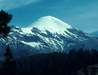
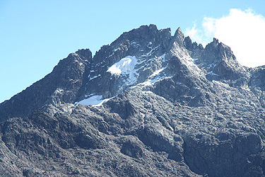
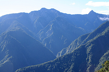
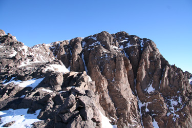
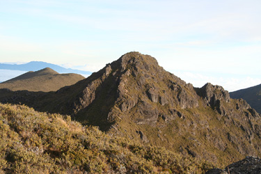
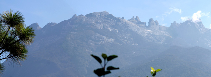
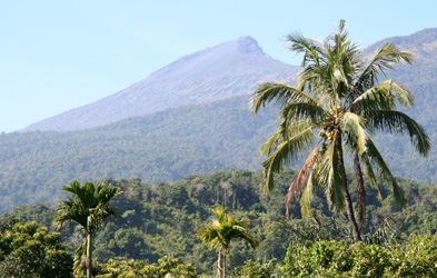
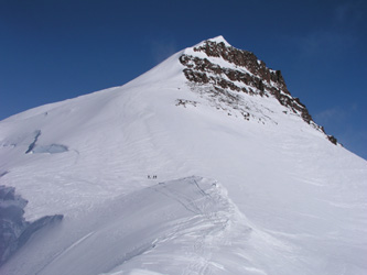
Info on the worlds most prominent mountains


Mount Everest

  • Mount Everest
  • Elevation: 8848 m
  • Primary factor 8848 m
  • Location: North 27:59:18, East 86:55:27
  • Saddle: Ocean
  • Base Camp:
  • Approach: Two standard routes, south col from Nepal, this was also the first ascent route. The North ridge is most popular among climbers on a more limited budget.
  • Difficulty: Very high, but technically not too bad.
  • Comment: Very commercialized and expensive.


Cerro Aconcagua

  • Cerro Aconcagua
  • Elevation: 6962 m
  • Primary factor 6962 m
  • Location: North , East
  • Saddle: Ocean
  • Base Camp: Plaza de Mulas, 4385 meter
  • Approach: Mendoza to Puente del Incas, then hike to base camp.
  • Difficulty: PD
  • Comment: The wind and the elevation are the main challenges
  • More info: (Access, routes and pictures)


Denali

  • Denali (Mount McKinley)
  • Elevation: 6194 m
  • Primary factor 6149 m
  • Location: Alaska
  • Location: North 63:04.153, West 151:00.402 (GPS at the summit)
  • Saddle: Nicaragua, definitely below 50 meter, with a 10 meter contour, we interpolate the saddle to 45 meter. The map is named Nicaragua 3050 III.
  • Difficulty: PD+
  • Comment: The weather is a main factor.
  • More info: (Access, routes and pictures)


Chimborazo

  • Chimborazo
  • Elevation: 6267 m
  • Primary factor 4122 m
  • Location: Ecuador
  • Location: South 01:28.125, West 078:49.055 (GPS at the summit)
  • Saddle: Near Olmos in Peru.
  • Difficulty: F+
  • Comment: This summit is the farthest point from the center of the Earth.
  • More info: (Access, routes and pictures)


Kilimanjaro

  • Kilimanjaro
  • Elevation: 5895 m
  • Primary factor 5885 m
  • Location: South 03:04:33, East 37:21:06
  • Saddle: Near the Suez canal,
  • Saddle location: North 30:33:21, East 32:07:04
  • Base Camp: Huts along the route
  • Approach: Via Arousha, then to the Nat. Park HQ.
  • Difficulty: F
  • Comment: The weather can change quickly
  • More info: (Access, routes and pictures)


Cristobal Colon

  • Cristobal Colon
  • Elevation: 5775 m
  • Primary factor 5584 m
  • Location: Colombia
  • Saddle: tbd
  • Saddle location: tbd
  • Base Camp: tbd
  • Approach: tbd
  • Difficulty: PD ??


Mount Logan

  • Mount Logan
  • Elevation: 5959 m
  • Primary factor 5250 m
  • Location: North 60:34.026, West 140:24.358
  • Location: Yukon, Canada
  • Saddle: Mentasta Pass
  • Approach: From Alaska
  • Difficulty: PD+
  • More info: (Access, routes and pictures)


Gora Elbrus

  • Gora Elbrus
  • Elevation: 5642 m
  • Primary factor 4741 m
  • Location: North 43:21.152, East 42:26.270 (GPS on the summit)
  • Saddle: 901 meter, near the border in west Pakistan
  • Saddle location: N26:33:39, E063:39:17
  • Base Camp: Baksan Valley
  • Approach: Mineral Vodye then to the Baksan valley
  • Difficulty: F+
  • Comment: The weather can change quickly
  • More info: (Access, routes and pictures)


Damavand

  • Damavand
  • Elevation: 5610 m
  • Primary factor 4667 m
  • Location: In Iran, between Tehran and the Caspian Sea.
  • Location: North 35:57.255, East 052:06.611 (GPS on the summit)
  • Saddle: 943 meter, south of Caucasus.
  • Saddle location: N42:01:27, E043:29:54
  • Base Camp: N35:54.099, E052:06.565, elevation 3030 meter.
  • Approach: Tehran, then north along the Haraz Rd. to Polour.
  • Difficulty: F, (YDS class 2)
  • More info: (Access, route, trip report and pictures)


Citaltépetl

  • Citaltépetl (Pico de Orizaba)
  • Elevation: 5611 m
  • Primary factor 4901 m
  • Location: Mexico HP
  • Saddle: 710 meter,
  • Saddle location:
  • Base Camp: Piedra Grande Hut
  • Approach: From the village of Tlachichuca
  • Difficulty: F+
  • Comment:
  • More info: (Access, routes and pictures)


Ritacuba Blanca

  • Ritacuba Blanca
  • Elevation: 5410 m
  • Primary factor 3646 m
  • Location: North 06:29:39, West 072:17:51
  • Saddle: 1765 m, near Morelia
  • Saddle location: N001:37:39, W075:58:48
  • Base Camp: tbd
  • Approach: tbd
  • Difficulty: tbd
  • Comment: The elevation is based on a report from John Biggar:
    Sent: Monday, January 30, 2006 1:39 PM
    On Ritacuba Blanco the readings were less consistent, I took three again and my +conclusion form them was that the height is 5410m, plus or minus maybe 10m or +15m. Interestingly this doesn't correspond to any regularly quoted height. The +most common height given abroad is 5493m, but looking at Colombian maps 5330m +was very common as a ' height'. The highest contour on the Colombian survey +sheet is 5350m, which given the shape of the summit is not inconsistent with my+readings. Incidentally we saw Bolivar from Blanco and vice versa, with a +distance according to the GPS of 278km!


Ararat

  • Ararat
  • Elevation: 5137 m
  • Primary factor 3611 m
  • Turkey HP
  • Location: North 39:42.113, East 044:17.899 (GPS on the summit)
  • Saddle: 1526 meter, south-west of Gardaneh-ye-Kuhin.
  • Saddle location: N36:18:36, E049:35:20
  • Base Camp: At about 3334 meter, about 1150 meter higher than the trailhead.
  • Approach: Get to the village of Dogubeyazit in East Turkey.
  • Difficulty: F, (YDS class 2)
  • More info: (Access, route, trip report and pictures)


Pico Bolivar

  • Pico Bolivar
  • Elevation: 4988 m
  • Primary factor 3964 m
  • Venezuela HP
  • Location: North 08:32.467, West 071:02.899 (GPS on the summit)
  • Saddle: (local) tbd.
  • Saddle location: tbd.
  • Base Camp: At about 4600 meter, a nice, flat area for tents.
  • Approach: Get to the city of Merida in Venezuela, then proceed.
  • Difficulty: AD-, (YDS class 5.4)
  • More info: (Access, route, trip report and pictures)


Mauna Kea

  • Mauna Kea
  • Elevation: 4205 m
  • Primary factor 4205 m
  • Location: Hawaii
  • Saddle: Ocean
  • Difficulty: F
  • Comment:
  • More info: (Access, routes)


Bogda Shan

  • Bogda Shan / Bogda Uia
  • Elevation: 5445 m/5448 m
  • Primary factor 4122 m
  • Location: China, N43:48.1, E088:19.9
  • Saddle: tbd
  • Difficulty: Hard
  • Comment: Easiest route is supposed to be NE ridge.


Rainier

  • Mount Rainier
  • Elevation: 4392 m
  • Primary factor 4034 m
  • Location: Washington, USA
  • Saddle: The saddle is below 366 meter. The uncertain interval is 15 meter, so we interpolate to 358 meter.
  • Saddle location: Map Vernon 82 L/6 BC
  • Approach:
  • Difficulty: PD
  • Comment:
  • More info: (Access, routes and pictures)


Mount Fairweather

  • Mount Fairweather
  • Elevation: 4671 m
  • Primary factor 3952 m
  • Location: Alaska/British Columbia, USA/Canada
  • Saddle: The saddle is below 732 meter. The uncertain interval is 24 meter, there are 3 competing saddles! We interpolate to 719 meter.
  • Saddle location: Map Vernon 82 L/6 BC
  • Approach: From Alaska, fly to glacier below peak.
  • Difficulty: PD+
  • Comment: The weather has a pretty bad reputation.


Mount Blackburn

  • Mount Blackburn
  • Elevation: 4996 m
  • Primary factor 3548 m
  • Location: Wrangell Mountains, Alaska, USA
  • Saddle: The saddle is below 1463 meter. Interpolation gives 1448 meter.
  • Saddle location: Map McCarthy C-3
  • Approach: From Alaska, fly to glacier below peak.
  • Difficulty: AD
  • More info: (Access, routes and pictures)


Jade Mountain (Yu Shan)

  • Jade Mountain (Yu Shan)
  • 3952 m
  • Primary factor 3952 m
  • Location: North 23:28.200, East 120:57.436.
  • Approach: Yu Shan National Park, 300 km from Taipei.
  • Difficulty: F.
  • More info: (Access, routes and pictures)


Mount Fuji


Jebel Toubkal

  • Jebel Toubkal
  • 4167 m
  • Primary factor 3757 m
  • Hut: Toubkal refuge (formerly called Nelter refuge), 3260m, 80 beds, about 4 hours from the trailhead.
  • Approach: From Marrakesch in Morrocco, continue to Imlil, about 1.5 hour by car/taxi.
  • Difficulty: F.
  • More info: (Access, routes and pictures)


Cerro Chirripo

  • Cerro Chirripo
  • 3820 m
  • Primary factor 3727 m
  • Costa Rica
  • Location: North 09:29.045, West 083:29.320.
  • Hut: Base Crestones, 5 kilometer from the summit.
  • Approach: From San Jose, via San Isidoro de El General to San Gerardo de Rivas.
  • Difficulty: F
  • More info: (Access, routes and pictures)


Kongur Shan

  • Kongur Shan
  • 7719 m
  • Primary factor 3655 m
  • Approach:
  • Difficulty:
  • Comments: The elevation may be a bit disputed. Previous maps has 7649 meter, the Chinese may overstate the correct elevation. We need a GPS reading to resolve this.


Tajumulco

  • Tajumulco
  • 4220 m
  • Primary factor 3990 m
  • Hut: tbd.
  • Approach: tbd.
  • Difficulty: Should be easy.
  • Contact: Should be easy.


Kinabalu

  • Kinabalu
  • 4095 m
  • Primary factor 4095 m
  • Location: In Sabah on North Borneo.
  • Hut: Laban Rata at 3272 m, advance reservations required.
  • Nearest airport: Kota Kinabalu with good connections from Singapore.
  • Approach: Kinabalu Park headquarter is located about 90 km from Kota Kinabalu.
  • Difficulty: F, a good trail.
  • More info: (Access, routes and pictures)


Gunung Kerinci

  • Gunung Kerinci
  • 3805 m
  • Primary factor 3805 m
  • Location: On Sumatra
  • Hut: None, it is normal to camp.
  • Nearest airport: Padang with connections to Jakarta and Singapore.
  • Nearest village: Kersik Tua.
  • Approach: It takes about 7 hours to drive from Padang to Kersik Tua.
  • Difficulty: F, a good trail.
  • More info: (Access, routes and pictures)


Gunung Rinjani

  • Gunung Rinjani
  • 3726 m
  • Primary factor 3726 m
  • Location: On Lombok island, Indonesia.
  • Hut: None, it is normal to camp.
  • Nearest airport: Mataram with connections to Jakarta and Singapore.
  • Nearest village: Senaru
  • Approach: Drive to Senaru, about 2-3 hours from Mataram.
  • Difficulty: F, a good trail.
  • More info: (Access, routes and pictures)


Teide

  • Teide
  • 3718 m
  • Primary factor 3718 m
  • Saddle: Ocean
  • Highest on Tenerife
  • Approach: From the highway
  • Difficulty: F
  • More info: (Access, routes and pictures)


Gunnbjørn Fjeld

  • Gunnbjørn Fjeld
  • 3694 m
  • Primary factor 3694 m
  • Saddle: Ocean
  • Highest north of the Arctic Circle
  • Approach: Twin Otter to glacier
  • Difficulty: F+
  • More info: (Access, routes and pictures)


Minya Konka

  • Minya Konka
  • 7556 m
  • Primary factor 3642 m
  • Saddle: Local, to the north
  • Note: Also called Gongga Shan ?
  • Approach: tbd.
  • Difficulty: tbd.


Return to Petter's mountain page

Maintained by: Petter E. Bjørstad, petter@ii.uib.no, © 1997-2012