Difficulty winter: Moderate snow, ice axe and crampons.
Information:
How to get there:
The natural starting point is the fascinating
city of Marrakech. There are direct flights from
many European cities to Marrakech.
See a more detailed trip report
with photo illustrations.
From Marrakech, one should go to the small village of Imlil, located
in the Mizane valley. Public transportation is possible, but perhaps
somewhat unpredictable. The most efficient way is just to hire a taxi
in Marrakech. The fare to Imlil is clearly negotiable, I paid 500 Dirham,
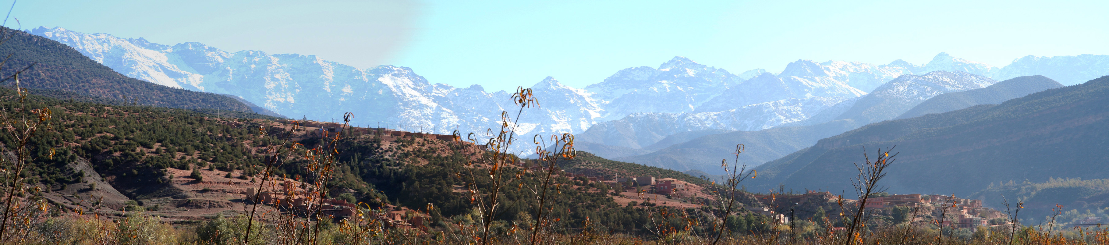
this is likely a bit more than needed. The road from Marrakech (Hwy. R203), first heads
towards the Atlas across flat, dry plains, then enters a pretty
interesting canyon before emerging in a larger fertile valley with the
village of Asni. The driving time from Marrakech to Asni is just slightly more than
one hour.
The road to Imlil forks left here and continues another 17 kilometer up
the lower part of the Mizane valley.
Total driving time from Marrakech to Imlil is about 1.5 hours. Imlil derives
quite some business from tourists that are headed for Jebel Toubkal. There are
shops and a hotel as well as other accommodation facilities. The elevation
of Imlil is about 1740 meter, since the village is on a slope, the precise
figure depends on where in the village you measure. Route description: From Imlil to the Toubkal Refuge:
The entire route from the village of Imlil to the Toubkal Refuge
follows the main Mizane valley, but often high above the river.
This valley forms a large left curving arc from Aroumd to Sidi
Chamharouch, then a sharper right bend followed by another left arc
before the last section up to the refuge.
From the village of Imlil, head up the main street of the
village as it curves uphill with various (tourist) stores on
either side. As you leave the shops behind, watch for a 180
degree right bend of the road. Leave the road here and follow a
nice path that continues straight ahead. This path climbs (some
stairs) up on the right side of the Mizane river gorge. You pass
another few buildings, then zig-zag up the hill and reconnect with
the road (dirt) that runs from Imlil to the village of Aroumd (Also
called Around).
Follow the road high above the river. You will see Aroumd across
on the opposite side. A bit further along, the road forks with
the left branch serving Aroumd, continue straight along the
right hand side of the valley.
The road is now quite level as it serves a few buildings and a
pretty large, flat valley ahead. Branch left and follow the tracks
that enters the valley floor. The valley floor consists only of
rocks, your tracks will gradually bring you to the left hand side
where a clear trail climbs the hillside.
The trail initially zig-zags uphill, crossing a small water supply
channel, then curves along the hillside. This trail is very easy to
follow, and is quite heavily used by trekkers, mules and local people.
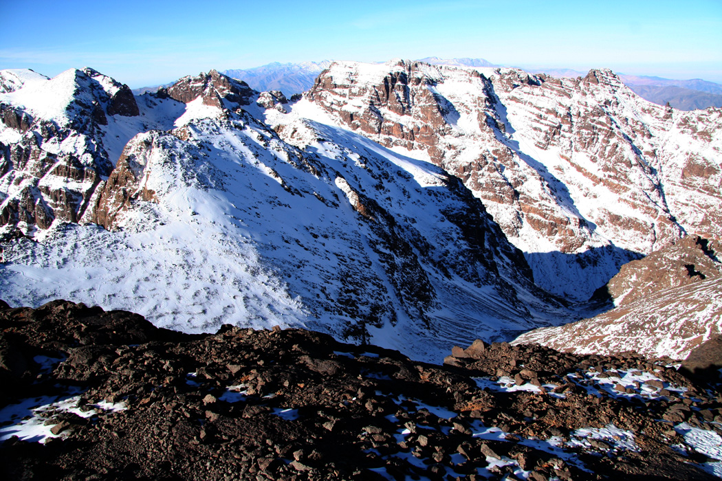
The steep faces of the Atlas mountains are a lot closer now as the trail
heads into the valley bend with the very tiny village named
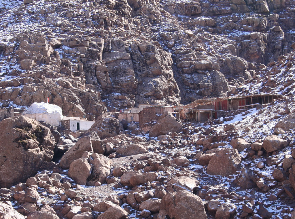
Sidi Chamharouch.
You cross the river and make your way up to the buildings among some
large boulders. Note that the trail continues right before you enter
the small passage between the buildings. The trail turns more narrow
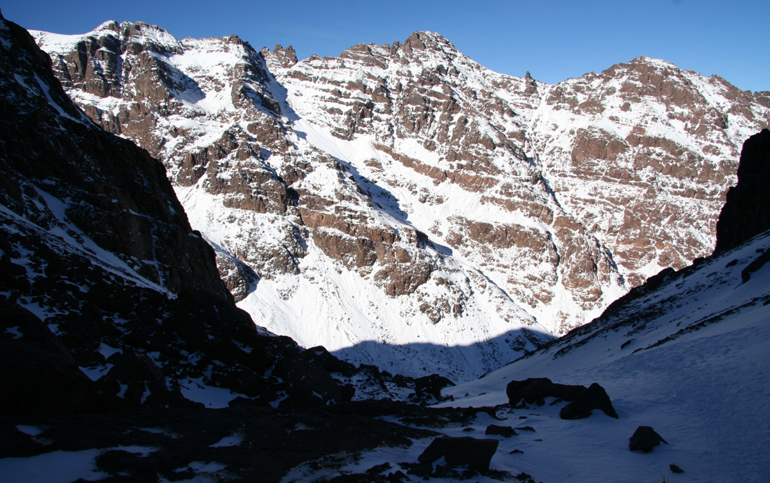
as it continues uphill in several zig-zags. Higher up, the trail
contours left high above the creek and eventually curves right below
a band of cliffs. There is a small shelter here. Further on,
the trail continues to climb gently until
the valley again curves left. The mountains are still considerably
higher than the valley floor as you head straight ahead and only slightly
uphill to reach the Toubkal Refuge at elevation 3207 meter. From the Toubkal Refuge to the summit:
In summer, there is a trail that hikers can follow to the summit.
The text that follows describes a winter ascent.
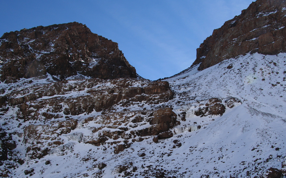
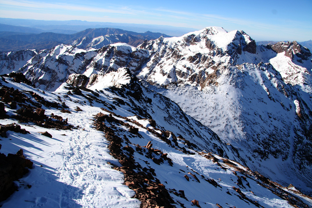
The first part of the climb is easily seen from the refuge. Looking straight
across the creek, there is a moderately steep slope that tops out at what looks
like a high col (it is a hanging valley). The slope appears steeper than it really is
as is often the case when viewing slopes head on.
The best way to cross the creek seemed to be going about 50 meter uphill, then across
and follow the creek downstream until almost opposite of the refuge. Looking uphill,
there are a couple of downsloping rock bands. Higher up you see more complex terrain
on the left. The best route of ascent is a climbing traverse going left, but staying
above the rocks that are visible. The slope is slightly steeper further right, but there
is room for variations.
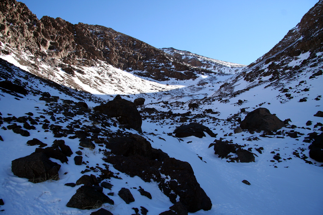
After this initial steep section, the route enters a distinct valley that continues uphill,
but at a considerably more gentle angle. The best route (more snow and fewer boulders) follows
the left side, then more in the center. You can now see the ridge leading to Jebel Toubkal
towards the sky, climbing left from a col further uphill. Continue up a short, slightly
steeper step, then across a short almost level section. The slope ahead will take you
onto the summit ridge. One may climb towards what appears to be the lowest col, or go a bit
further left and hit the ridge higher up. The slope is slightly steeper further left.
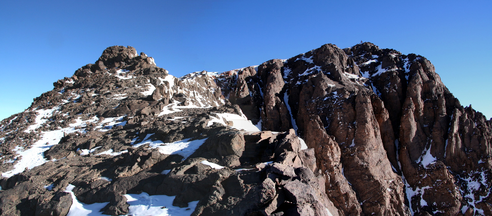
As you enter the broad, scree slopes of the ridge, ascend towards the horizon above you.
The ridge falls off steeply on the other side, as you get higher a few zig-zags may be needed
in order to reach the highest visible point. Alas, this is a false summit, but the good
news is that the true summit can be seen across from this point. The final summit ridge is
narrow and U-shaped, however, one can find a reasonable route by dropping off the ridge
on its left side. Traverse a couple of snow slopes near their upper end and gain the summit
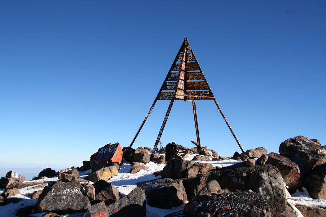
plateau. From here, a few easy steps to the summit marker. Comments:
I climbed this mountain solo. Many parties hire guides
and/or mules, but this is really not needed if your purpose
is to climb the mountain.
I started hiking in the village of Imlil at 1045 and arrived
at the Toubkal Refuge 4 hours later at 1445. This time included
numerous short stops for photography. The next morning, I started
up the steep slope at 0645 and reached the summit at 0900. The
weather was very nice and I spent 30 minutes taking pictures and
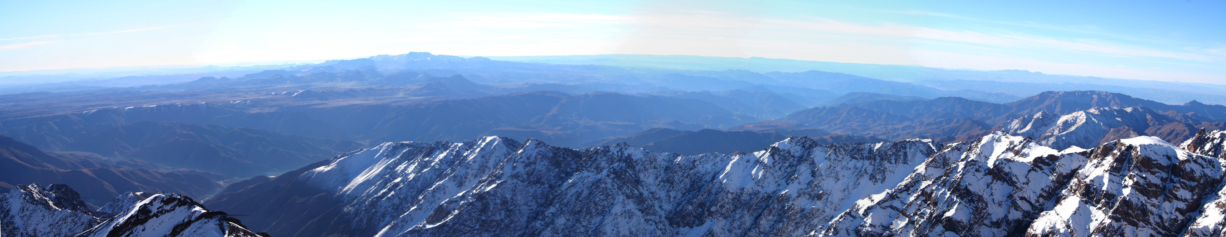
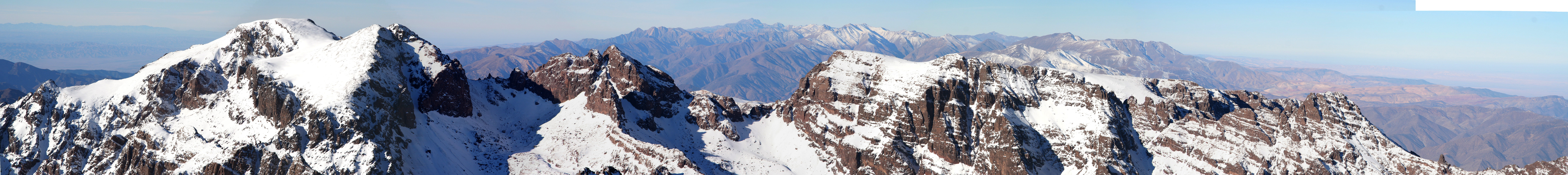
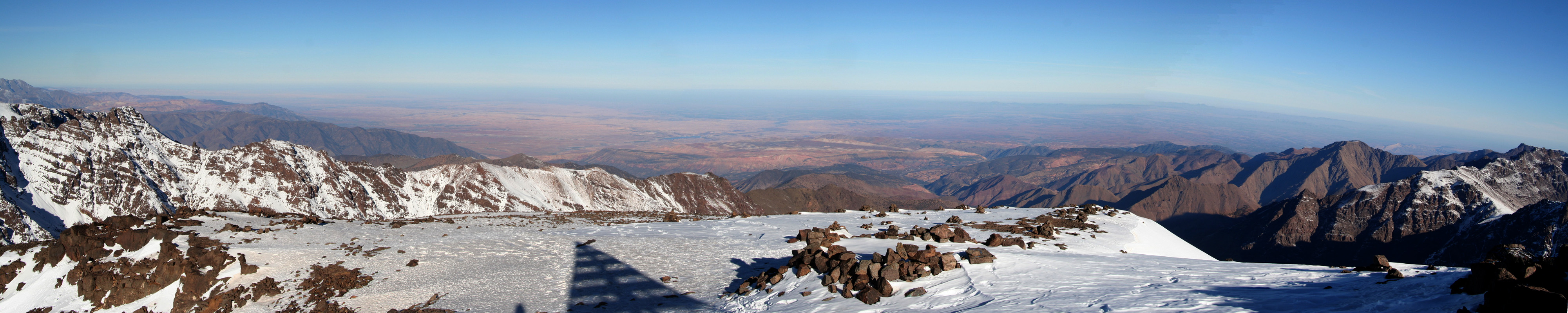
just looking around. The impressive Atlas mountains running
north-east to south-west. The Sahara starting on the south side and
the plains of Marrakech to the north. A single bird, the only
sign of life.
I left the summit at 0930 and was back at the refuge by 1030,
descending the snow slopes that were still in the shade. After
saying farewell to the friendly people at the refuge, I started the
return hike at 1100. I arrived at the uppermost village of
Sidi Chamharouch at 1215 and enjoyed the hospitality of Omar
whom I spoke to at the refuge the previous night. The last leg of
the hike took one hour, arriving back in Imlil at 1345, just
15 minutes before the 1400 hour when
the taxi had promised to start waiting for me.
I was back at my hotel in Marrakech shortly after 1500 with lots
of time before a nice "summit dinner" at 2000.
More detailed descriptions in my Trip report.
