Location: North 01.23986, East 036.61255 (GPS on the summit)
Difficulty: YDS class 1
Climbed February 3. 2020.
Information:
How to get there:
This peak is located directly off hwy. 77, about
20 kilometer north of Maralal.
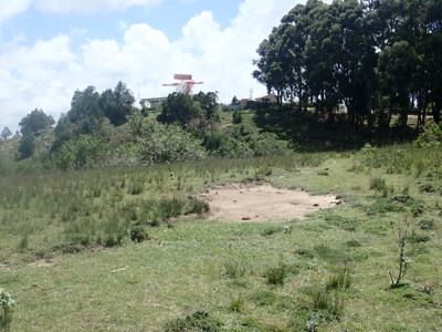
Route description:
Drive the summit access road that serves the radar station, stop at the
hill-top where the road turns right towards the radar installation.
Fortunately, this is not the high point. Park off the road and hike left (NW)
when facing the radar station. Go on the right side of the fence and then to
the summit.
Comments:
This trip report continues from Lesatima.
We took this very short side trip from Hwy. 77 when
driving north. We first drove to
the radar installation where a friendly
guard informed us that the hill nearby was actually the highest point.
We next went over there and
we agreed with the guard that this point is indeed
the highest. Our visit lasted about 30 minutes from 1230 to 1300.
Next in this trip report is Ng'iro.