Location: South 00.31123, East 036.61615 (GPS on the summit)
Difficulty: YDS class 2
Climbed February 2. 2020.
Information:
How to get there:
From Nairobi, travel north on Hwy. A-104, fork right on Hwy. C-68 and continue
to Njabini. From there, follow C-69 a bit west of north to the village called
Ndunyu Njeiru. There is a ranger station here, one should check here to get a ranger
for the hike. From here, a pretty bad road called D-389 connects to the Aberdare National Park.
As soon as you reach the park boundary, the road quality improves as you ascend to the
Matubio West Gate, located at 3200 meter of elevation, S0.525, E036.664.
Route description:
One may drive independently in the park, but walking on foot requires a ranger with a gun.
This is most easily organized back down in Ndunyu Njeiru. One will pay the park fees at
the gate. They do not accept cash, only credit cards. The charge is about 55 USD per person
for each 24 hour stay in the park. Additionally, one must pay a rather small fee for a vehicle
and about USD 20 for the ranger (2020 prices).
From the gate, one should continue with a car, a high clearance 4WD is recommended.
Continue on the main park road and keep left (main road) where there is a fork to
the Fishing Lodge. The road serving Lesatima forks sharply left at location
S0.409, E036.726. Expect this road to be considerably rougher than the main park road.
Follow this road to location S0.339, E036.684. Here, the final road serving a high
trailhead, forks sharply left. This road was not drivable due to heavy rain when we were
there. In the dry season, one should be able to drive to the trailhead located at a high
saddle on the main crest
at elevation near 3600m, location S00.33726, E036.65160.
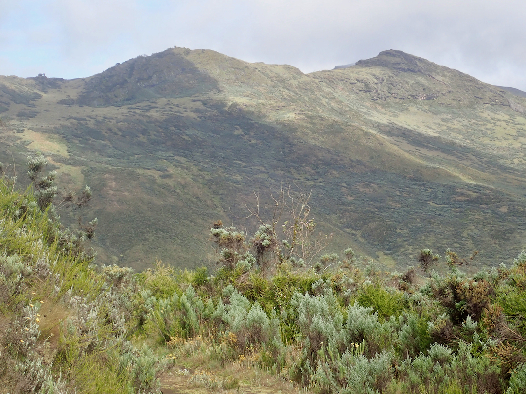
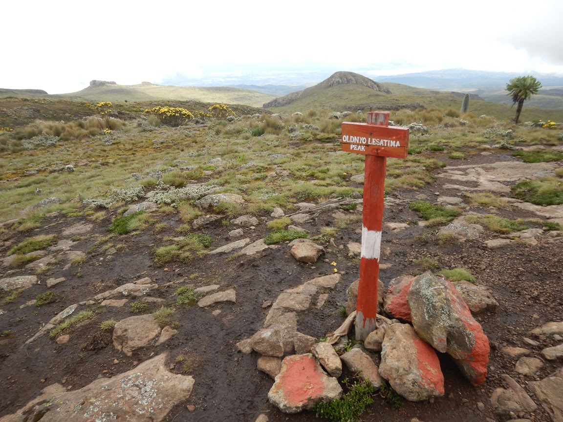
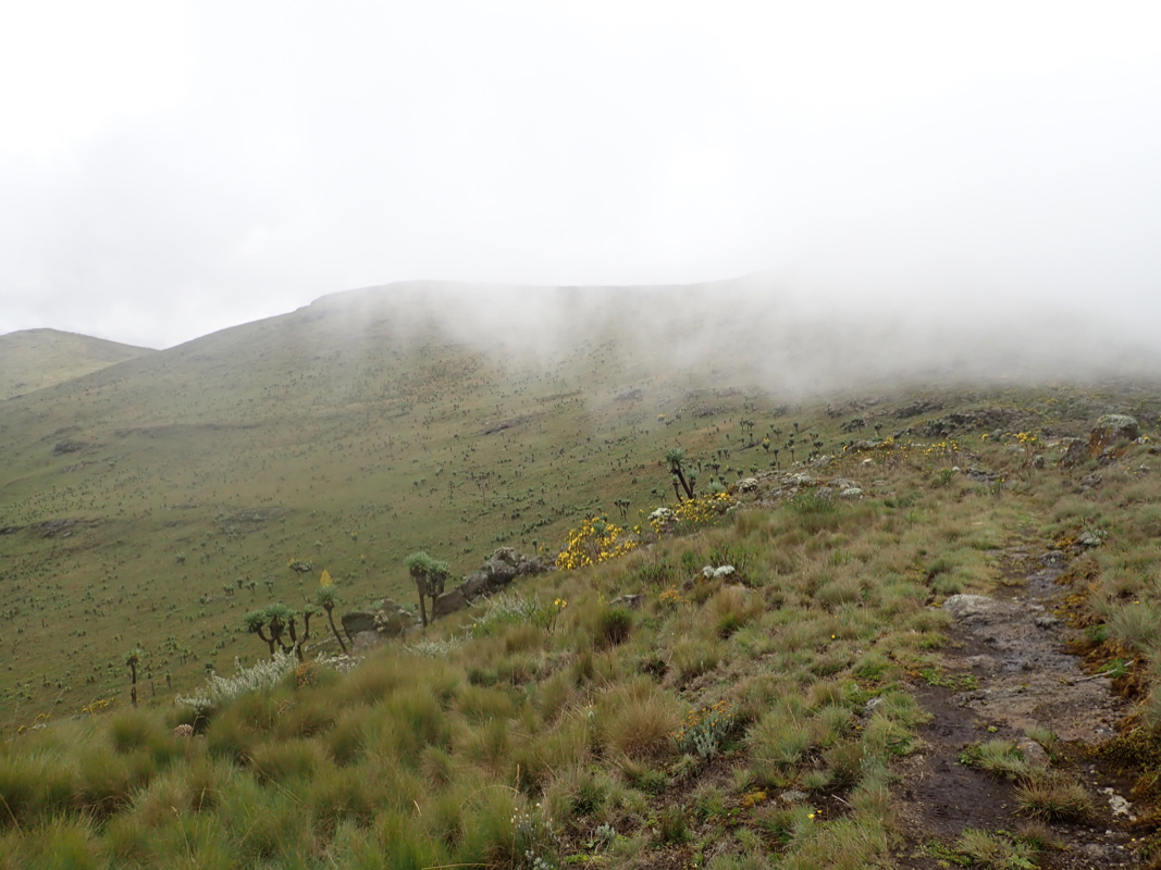
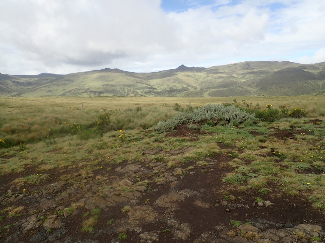
A good trail leads from here north, then more north-west
to a false summit with a sign
declaring that this is Lesamita.
Our ranger had taken tourists here many times, however, he had
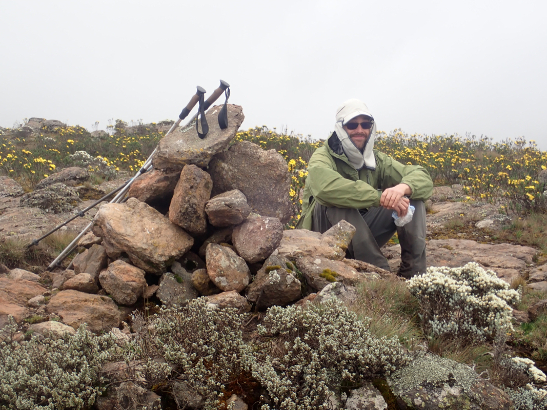
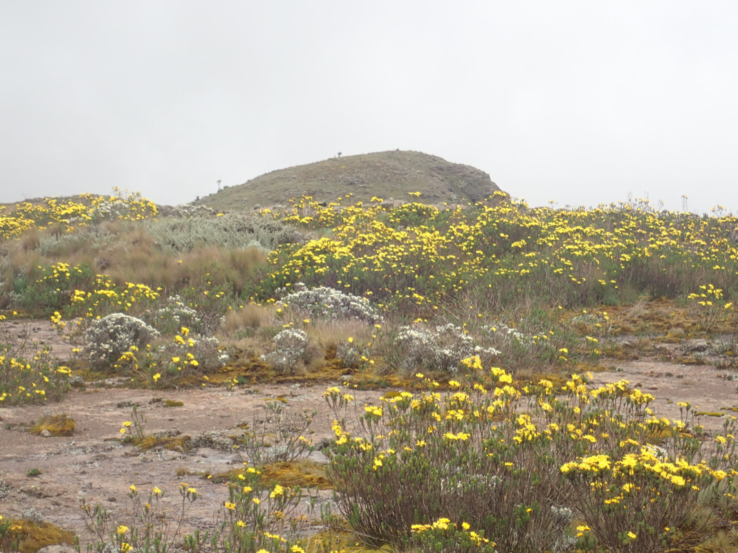
never visited the true summit, located about 600 meter slightly west of south. The summit is more
flat and rounded, while the false summit is a more pronounced hill. There is a small cairn
marking the true summit.
Comments / Trip Report East Africa February 2020.:
This report covers my trip to East Africa in February 2020. I went
to Tanzania and Ethiopia in 2019, both of those trips were organized by
a local tour company. This worked well, but it is an expensive option if
you have a small party. Such a trip will also easily run into problems
when unexpected events interfer with the original plan as flexibility is
often more of an issue. I therefore decided to try a new approach more similar
to touring in Europe, with no overall external assistance, but where we would
get local support for the mountains as needed.
See also the excellent report by Adam Walker.
Several pictures in this report are by Adam and copied from his report.
Preparations.
The key element of this trip would be a dependable, high clearance, 4x4 rental car.
A full size Toyaota Landcruiser would be best, but a somewhat scaled down
Toyota Prado Landcruiser would also do the job. I contacted Zak at Central Rental Car
in Nairobi. He was very responsive and organized the paperwork and insurance needed
in order to also drive the car in Unganda. At USD 116 per day, this would be the
dominating expense for the expedition. The team should ideally be 2 or 3. I contacted
a few peakbagging friends in Europe and in the USA to check if anybody were interested.
Adam Walker immediately signed on and we ended up with being a team of 2.
Next, a rough plan had to be drafted. Kenya has 6 ultra prominent mountains. Excluding
Mount Kenya (it is a technical climb), then adding 3 ultras in Uganda located near the
border to Kenya, made a list of 8 possible targets. Allocating two days per ultra, including
travel, seemed very optimistic. We added 2 extra days and agreed that succeeding to
climb at least 5 peaks should be our success criteria.
I did some additional research and identified (more or less) promising trailheads. I was able
to obtain a copy of a 30 year old book "The mountains of Kenya - A walker's guide" by Paul
Clarke. This book had a description of all 8 mountains, but many aspects concerning access
had changed.
Travel.
I left Bergen late evening on January 30th. as there was no direct flight that would allow me
to catch an early flight from Frankfurt to Nairobi on January 31st. Adam flew from Las Vegas via
San Francisico with a somewhat short connect in Frankfurt. I stayed one night in Copenhagen and
made it to Frankfurt the next morning, arriving well ahead of Adam. Everything worked well and
we touched down in Nairobi shortly after 2100. Adam had secured independet visa for Kenya and
Uganda online (E-visa) in advance, while I quickly obtained the East African Tourist visa valid
for Rwanda, Uganda and Kenya, upon arrival in the airport. Sammy from Central rent a car waited
for us at the airport, then quickly drove us to their downtown office in order to complete
what little paperwork remained. We then crashed at After40, a nearby hotel. In this way, we
could drive as early as we pleased the next morning, February 1st.
The climb of Lesatima.
The plan was to do Lesatima on our first day, then spend February 2nd. to travel north.
I had contacted a ranger from KWS (Kenya Wildlife Services) and he recommended that we drive
to the West Gate, texting him while driving. We left Nairobi early, it was still dark, in order to
accomplish our goal. The road was good until we reached the small town of Ndunyu Njeiru. From here,
we turned east on a bad road. The quality of the road improved (tarmac) as soon as we reached
the hillside. Thus, we arrived at the National Park gate on schedule, it was still morning.
However, all was not good. My contact at KWS had failed to respond, despite sending several
Whatsapp messages while I was still in Norway. The staff at the gate informed us that we needed
to go back to Ndunyuwa Njeiru in order to get a ranger, (the park requires that an armed ranger come
along on all foot excursions in the park.) This would take considerable time. On top of that, we had
a flat tire, a nail was clear evidence. While busy changing the tire, good news, the required ranger
had been able to get alternative transport and was now on his way.
We planned on camping after our hike and paid the fees for access, ranger escort, vehicle and camping,
almost USD 200, East African national parks are expensive.
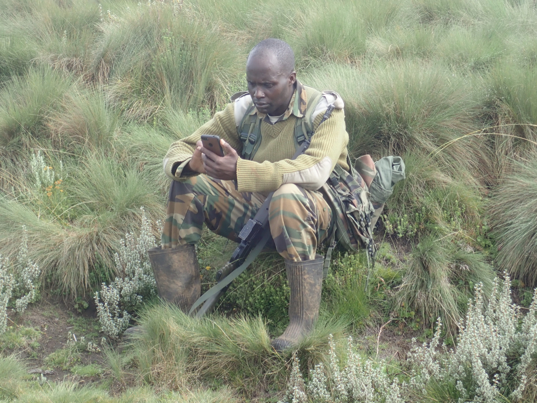
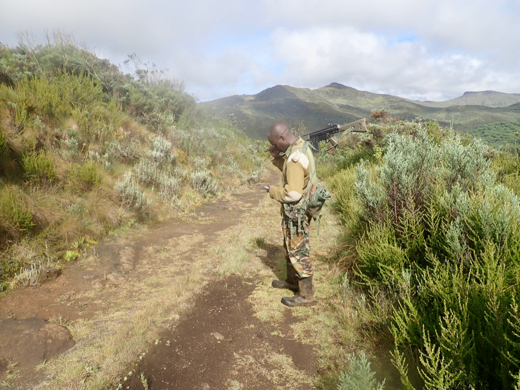
Our ranger, David, arrived
and we started driving. The drive from this gate to the trailhead is quite
long, about 40 kilometer on roads of variable quality. In fact, due to recent heavy rain, the road that
we needed, forking left from the main park road,
was an ocean of mud. Driving like on an unplowed (snow)
road in Norway, we soon caught up with a truck that had slided into the ditch. Adam and David went out
to push and we continued only to find the road blocked again by the same vehicle stuck in deep mud.
Fortunately, I was able to exit the road and bypass by driving off-road, then steeply descend back
down to the road. This road was absolutely non-trivial to drive even with my pretty good landcruiser.
Finally, we arrived at the last fork where we were going sharply left.
This is at location S00.33943, E036.68390, elevation about 3260 meter.
From here, the road climbs about 300 vertical meter to the trailhead located at a broad saddle on the
main crest. As it turned out, we ran into trouble already on the very first uphill. Steep and slippery,
the car refused to climb. We went back down to the fork, I then made a second attempt without Adam and
David in the car. Keeping good speed, I passed the critical point were we had stalled previously. Advancing
further uphill, I could see that the uphill slope became more gentle in another 20 meter, but then, unfortunately,
a wheel was forced into the left hand ditch, no way to avoid it. We then spent time getting the car back
down and out of the ditch, gravity helped and we were back down at the fork.
The time was now 1515 and it was clear that we could not complete this hike in daylight. The only decision
would be to drive back to our camping site, then make a new attempt tomorrow. The return drive was
equally difficult. A highlight was a big elephant that suddenly
came onto the road right in front of us. My first time breaking for an elephant when driving myself!
After 2 full hours of driving got us back to Aberdare Fishing lodge. In the meantime, torrential
rain had started, thunder and lightning. The camp site did not look inviting. Our ranger would stay in a small
building with a friend (staff at the Fishing lodge) and he offered us to stay indoors aswell.
The rain continued heavily into the night, I wondered if our mud road would be drivable at all the next
morning.
The next morning, we started at 0650. The road was perhaps slightly worse than the previous day, but
not by much (it really could not get much worse!). We were at the final road fork by 0840, so 1:50 driving
on horrible roads. By the time we were done, I had driven more than 8 hours on this road! We parked and
hiked up the road at 0850, keeping a good pace,
both Adam and I felt the thin air by heavy breathing. We got to
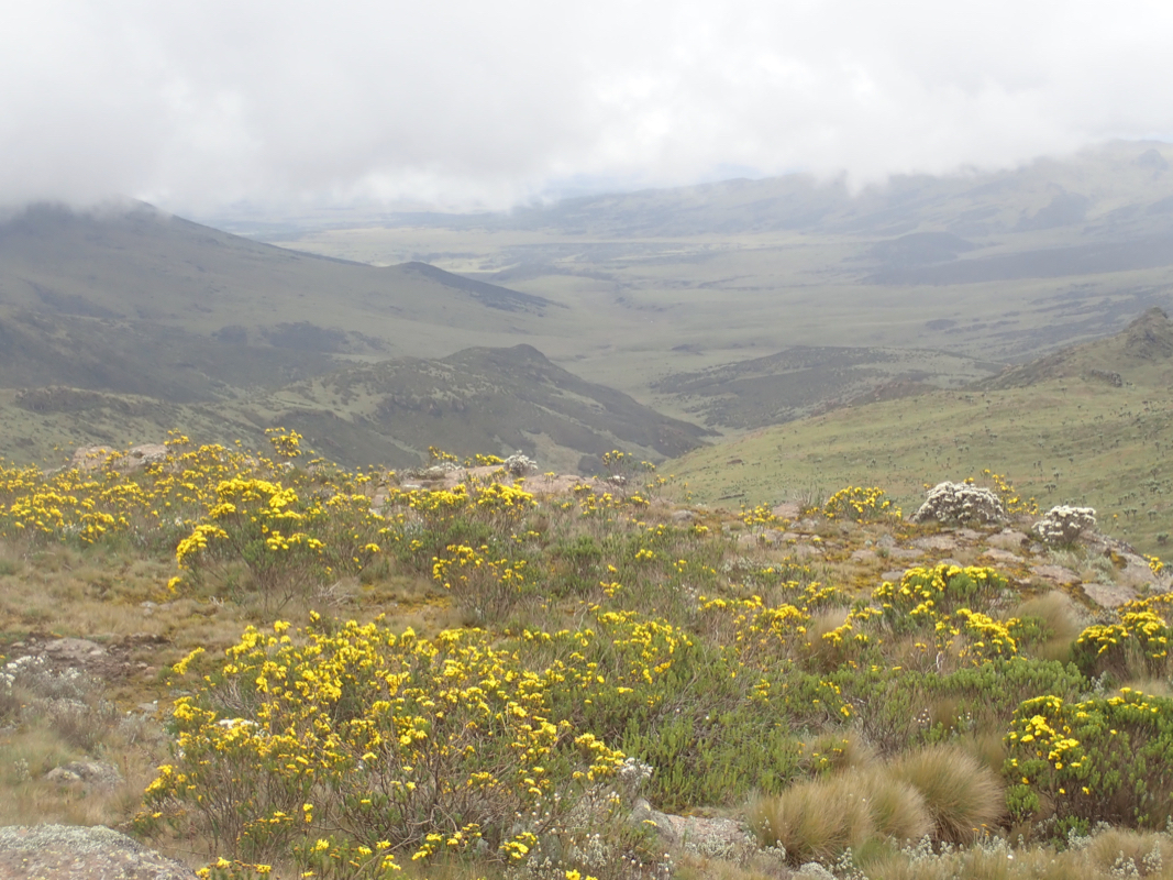
the saddle at 0950, exactly one hour. The weather was now quite good, a 10 minute break before we continued on
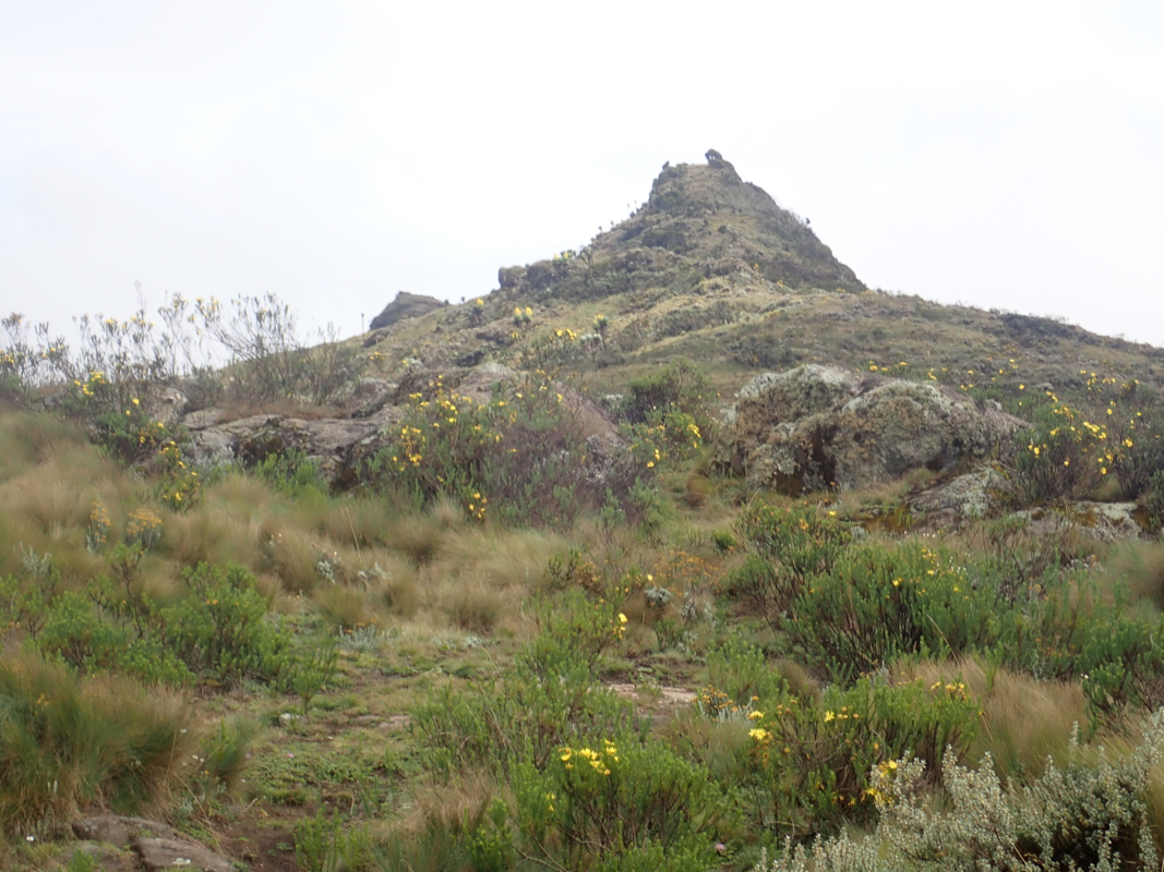
a good trail towards Lesatima. We got to a distinct peak with a summit sign on top
a bit before noon. However, this is not the summit. Our ranger David was surprised when we set off towards
the rounded top nearby. He told us, he had never been in any other place than the summit where the trail ended.
Somewhat reluctantly, he followed across, but his mood changed for
the better when he discovered the cairn
and noticed that we were indeed higher. We had arrived at 1200 sharp and
left at 1215. The hike back down went without
incidents of any kind and we arrived at the car by 1425.
Next, my final 2 hours of driving this terrible road. I even managed to reverse the bypass by climbing
steeply from the road up to the grass, not obvious at all. We returned to
Ndunyu Njeiru where David lived. He got us to a tire repair shop and they quickly fixed our flat tire,
replaced it and moved the spare back to its location, then checked the air pressure in all tires. The
asking price for this was about USD 3, he earned an extra dollar in a well deserved tip.
We said
goodbye to David, he had helped us well across 2 days.
It was getting late, David recommeded a local guesthouse named Amani, located at
S00.54207, E036.56623. The lady there took good care of us, 2 rooms as well as dinner in the evening.
The next morning, we started driving towards the ultra up in the north-east of Kenya. Our trip
report continues with a visit to Poror.
