Location: North 01.75945, East 034.70837 (GPS on the summit)
Difficulty: YDS class 3
Climbed February 10. 2020.
Information:
How to get there:
The town of Nakapiripirit is the starting point. It can be reached
directly from the south (Mbale) via the Muyembe Nakapirit road through Pian Upe game reserve.
From the north, the road (paved!) comes from the town Moroto.
There is a nice hotel called Panaora, recommended.
From Nakapiripirit, go south, fork left (east) onto a small, dirt track immediately when
leaving the paved road through town. Keep right at a fork and follow the track south
with tall grass on all sides. It may be most convenient to hire transport on motor bike
and leave your car at the hotel. Location N01.81049, E034.72652, elevation about 1625 meter
may be a good place from where to start walking.
Route description:
The route first continues south into a nice canyon then across the main creek, before
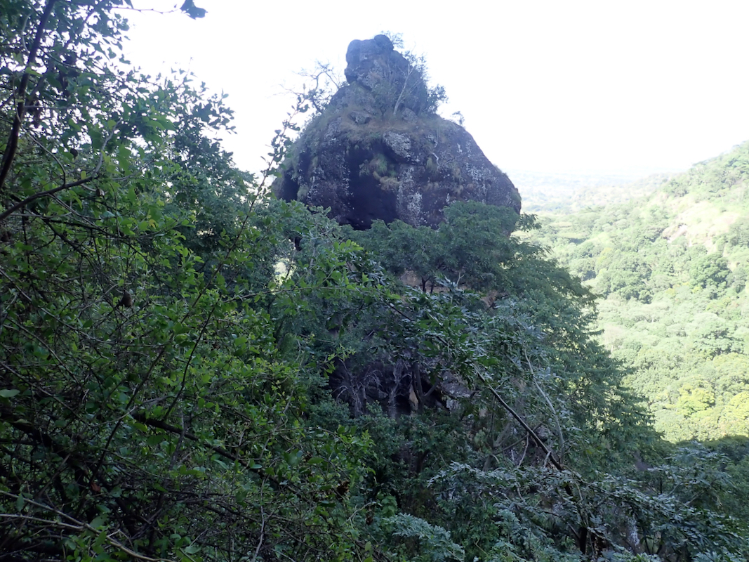
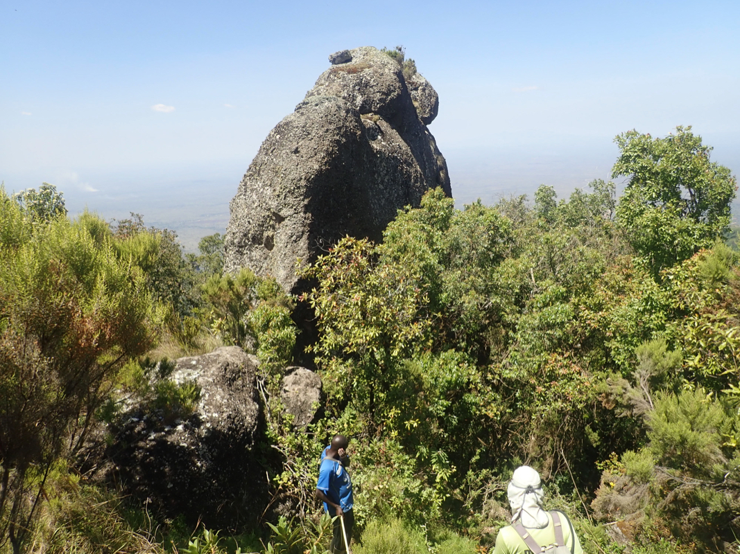
ascending steeply up to your right (east) just beyond a very characteristic
rock formation. The terrain becomes more level, another small creek is crossed, then
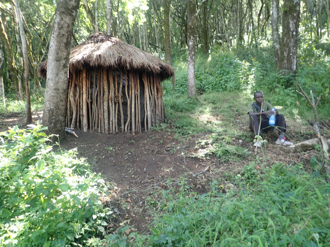
more uphill in the forest to reach an area
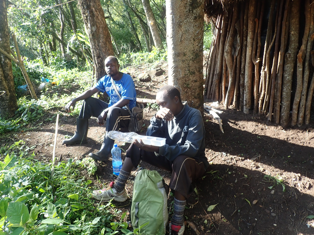
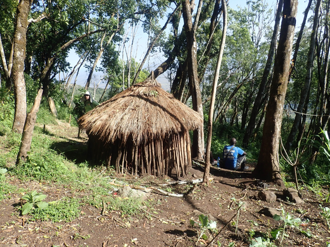
with many native huts and quite a few
families living a bit isolated up here.
The trail continues uphill,
then makes a turn more north in order to gain the main
ridge. There is a very nice ledge forming a ramp that completes this part.
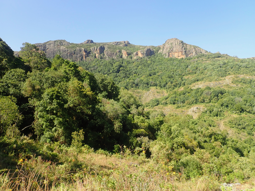
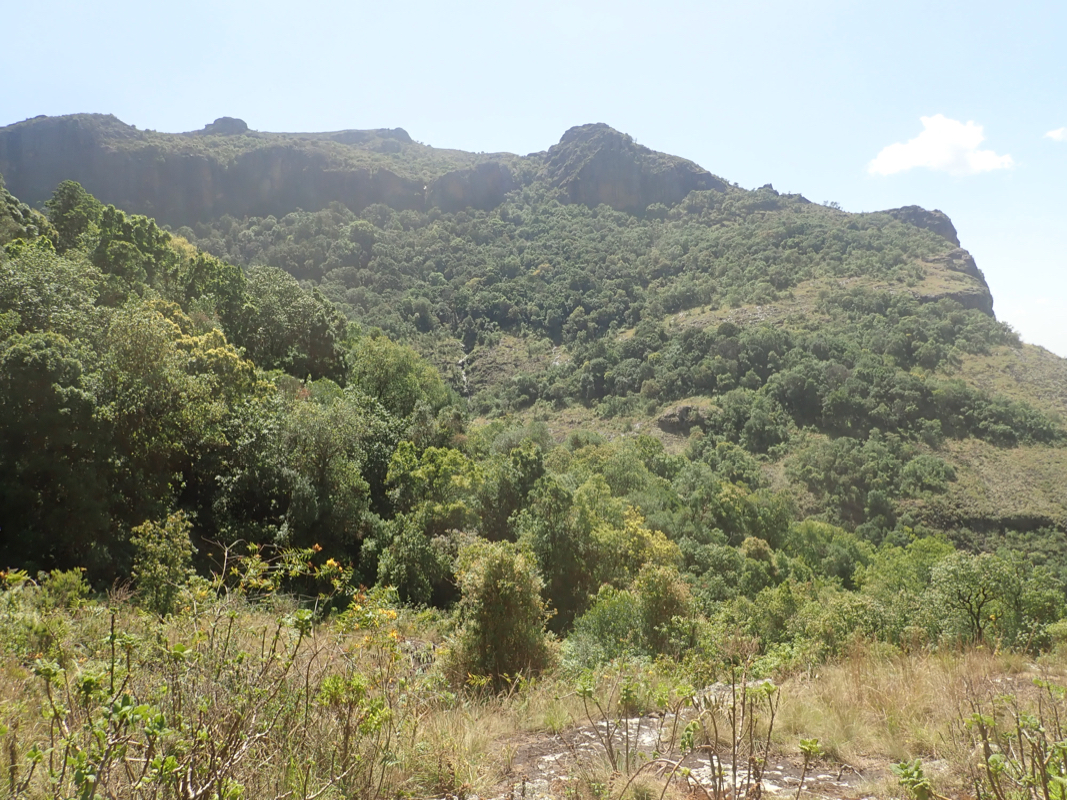
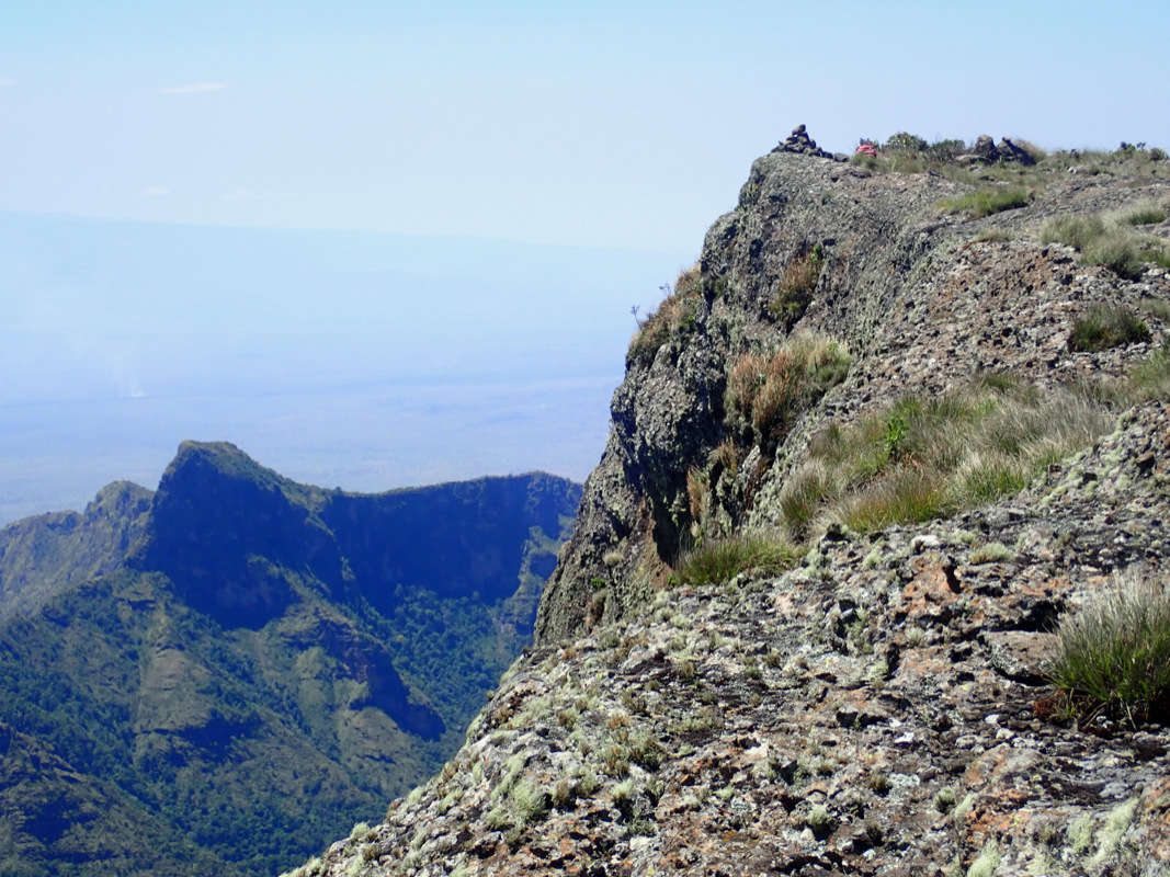
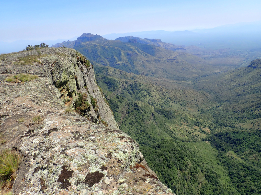
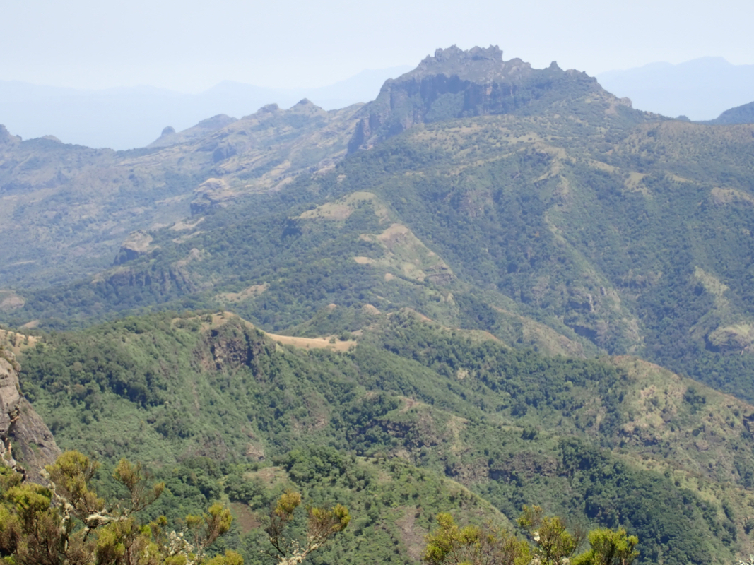
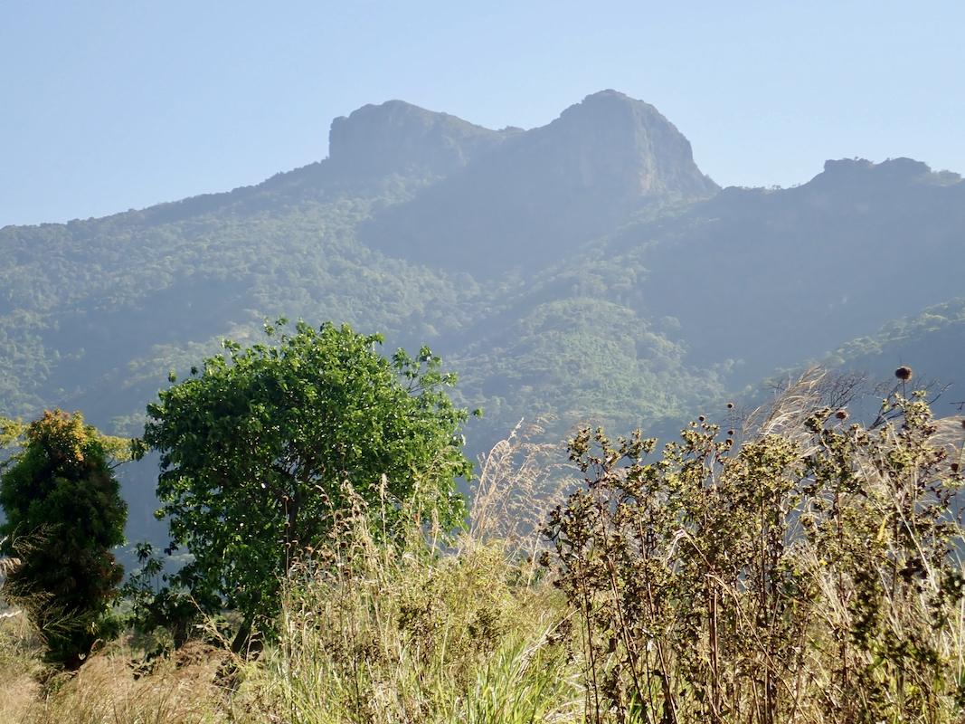
Follow the top ridge south towards the impressive cliff that blocks the way to
the Kadam summit located behind. After a very short stretch, the trail will
descend off the ridge (right) in order to make a fairly long traverse in the
hillside to bypass this big obstacle. The route runs in a pleasant forest with
almost no vegetation on the ground below the bigger trees. Gradually, the trail will
ascend while staying in the same general hillside and you will have a valley
on your right that cuts in between this hillside
and the main Kadam mountain.
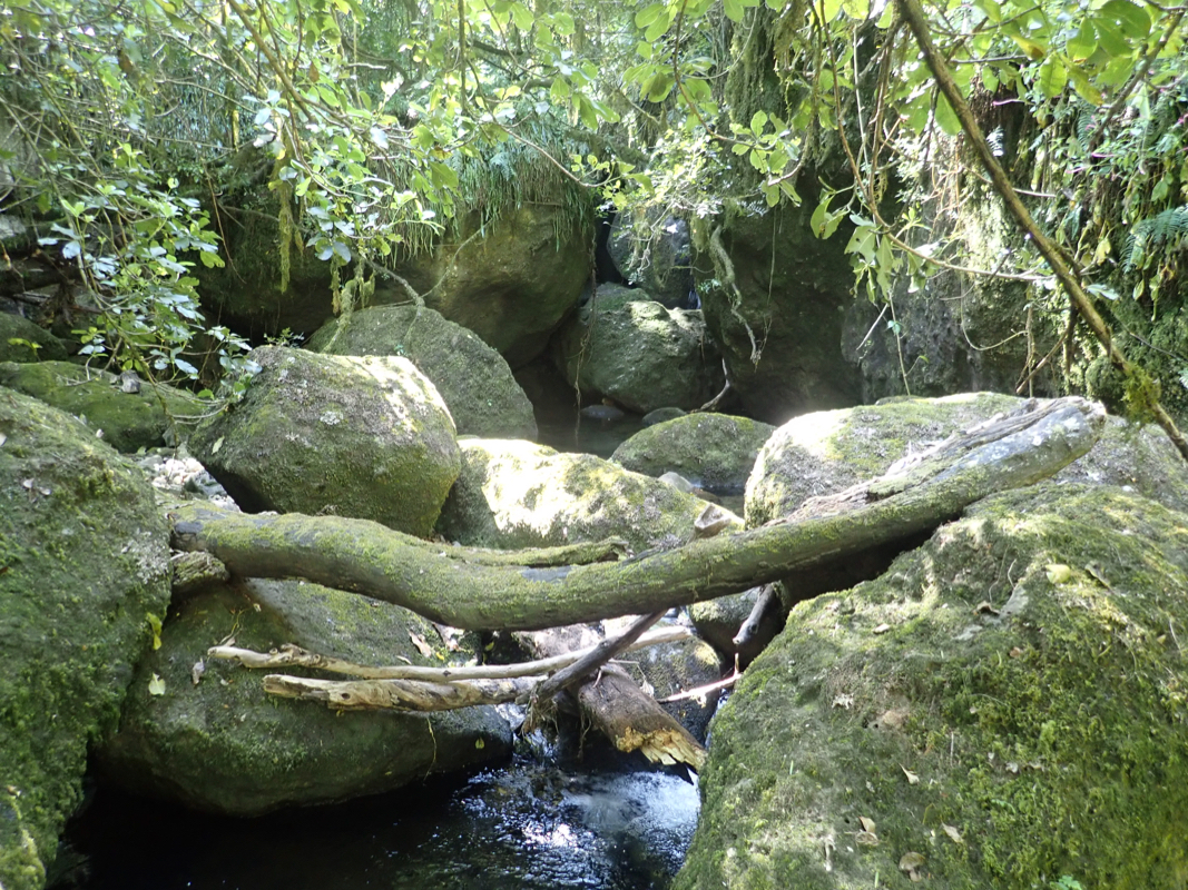
The trail levels out and reaches the main creek, very nice with a small waterfall
among large boulders.
Cold water that can be used to fill up water bottles.
Next, traverse more right (north) in order to gain the main ridge on
Kadam, gradually the trail will turn uphill, a short, steeper section
completes the task.
Follow the small, but clear trail as it runs up the ridge towards a steeper
rock formation that blocks the way. Traverse left of this initially, then
scramble up right, easy YDS class 3, only a few meter. This is the crux
of the route.
Continue along the ridge, cross a small ravine that runs aross the direction of
travel, then ascend through dense vegetation. The trail is narrow, but
essential in order to get across this section. Finally, the trail
emerges onto a flat plateau quite close to its righthand (north-east) side.
A small cairn has been placed here to mark this important entrance when
returning.
The summit is still about 1.5 kilometer away and unfortunately, there is no clear
trail across this largely flat area. The best route, avoiding most of the bad bushwack,
follows rock formations along your left side of the plateau. It is better to accept a few
ups and downs along the rock than fighting the bush on the more level plateau.
Finally, a gentle uphill will terminate with reaching the abrupt end of the plateau, a big
vertical cliff towards the south.
The summit is marked with a small cairn. The maps are
wrong and shows the summit differently.
Comments:
The previous part of this report describes the ascent of Mtelo.
After climbing Mtelo on February 8th., we wanted to find a hotel in Kitale, hopefully
with WIFI access. Our guide had wasted about 2 hours leading us astray when descending and
now the idea to reach Kitale before dark seemed impossible. We still wanted to try and
by the time it got dark, we were only 30-40 minutes from the center of town. I told Adam
to supplement my eyes and tell me about all hazards that he could see on the road. Oncoming
vehicles typically would shine their high-beams straight into my face, visibility was our
first priority. In a typical 2-3 minute period, I would hear Adam scream: "Cow on the left,
dark pedestrian to your right, bicycle without light in front, big hole in the road, left,
sheep in the road left, another big hole in the middle, etc. Pretty hard work to drive
here! We made it to the hotel and had a room with internet, first time since Nairobi.
On February 9th. our plan was to cross into Uganda and perhaps find a room near
Kadam. First task was to cross the border. A pretty bad dirt road got us there.
The border office was not busy, in fact they told us we were the second car to cross
in 2020. They had to call for the guy with the official stamps, obviously he was
not in his office every day when only one car per month would cross the border.
We were slightly delayed due to Adam's E-visa, they had no computers and it was Sunday.
My East-African visa obtained on arrival in Nairobi, worked well. In the meantime, I located
a local exchsnge office and changed all our Kenya money into Uganda currency.
We next continued driving north of Elgon on a reasonable dirt road, then turned north
on the road connecting to the town called Nakapiripirit.
This road was rough with many deep holes, still better than many roads we drove
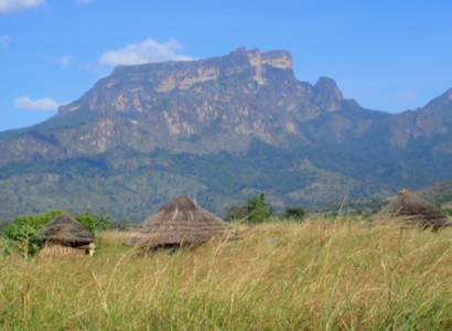
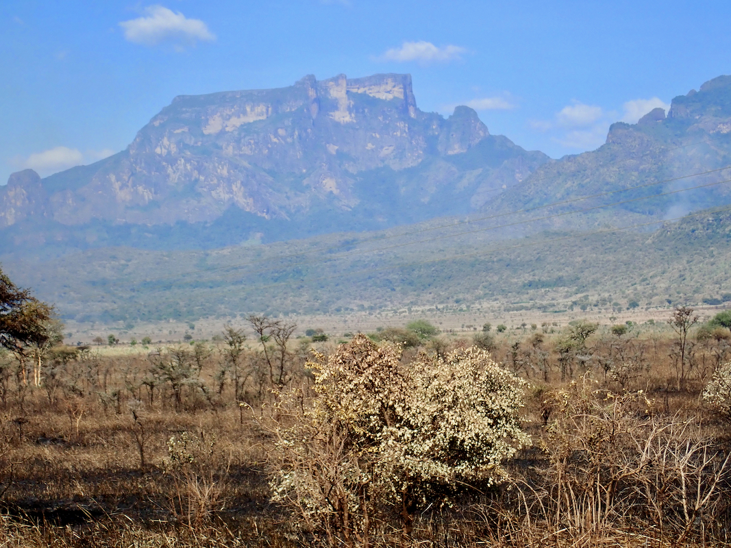
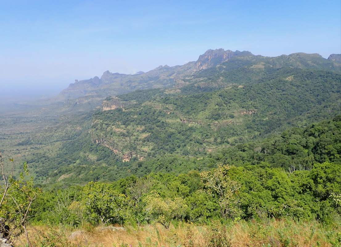
in Kenya. We got a really impressive view of Kadam from the south.
Suddenly, as we were about
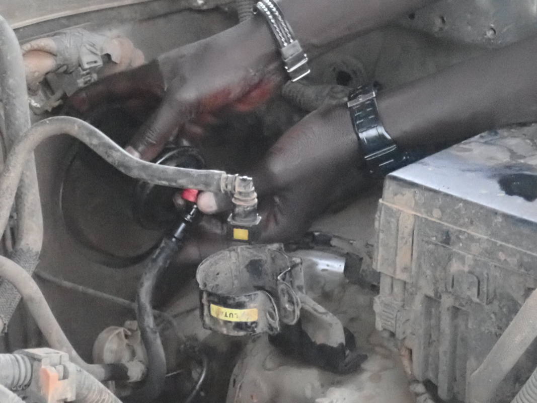
to cross the last hill before Nakapiripirit, the engine started to fail. It ran fine on
idle, but as soon as I tried to drive forward the engine stalls. Then it back-fires, but
the car is not going anywhere. To have a rental car from Kenya give up life in the middle
of nowhere in Uganda is just very bad news. I then figured out how to trick the car to
make progress. Shift down into the low range gear, put it in first and idle the engine.
Then carefully clutch out and the car moves slowly forward before stopping. Next, repeat this.
We slowly moved up the hill, then more or less rolled down into the town
of Nakapiripirit. We checked into the local hotel, then looked into fixing the car.
The fuel filter could be
taken out and rinsed. It looked like water in the gasoline.
We filled about 150 liter in Kitale, perhaps some water? The car should now rest
while we climbed Kadam.
We located 2 local guides. They first claimed
that the trip could not be done in a single day, but as we insisted, they eventually
agreed that we could try it.
The next morning, we set off on two hired motorbikes. Adam told me this was his first
time on a motorbike without a helmet and with 3 people on each bike. The bikes crossed
a fairly flat area with 2 meter tall grass.
We started walking at 0750, first into the canyon, then steeply up the side quite
close to an interesting rock formation.
Higher up, quite to our surprise, we came to
small settlements where families were living.
The trail climbed onto a main ridgeline,
then descended into a forest of big trees with welcome shade. We crossed the main
drainage, a nice river having a small waterfall among big boulders. This water is
good to drink, I filled up my drinking bottle on the return. Again, ascending to
a new, main ridgeline
that connected to the summit plateau. A short section
of (YDS) class 3 scrambling here. The final bushwack was pretty bad, we found a better
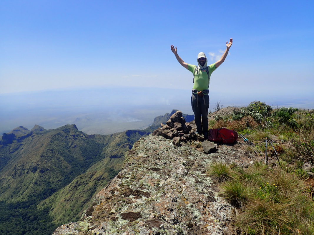
way when returning. We arrived at the edge of the big cliff at 1210. There is a small
heap of rocks serving as a summit cairn.
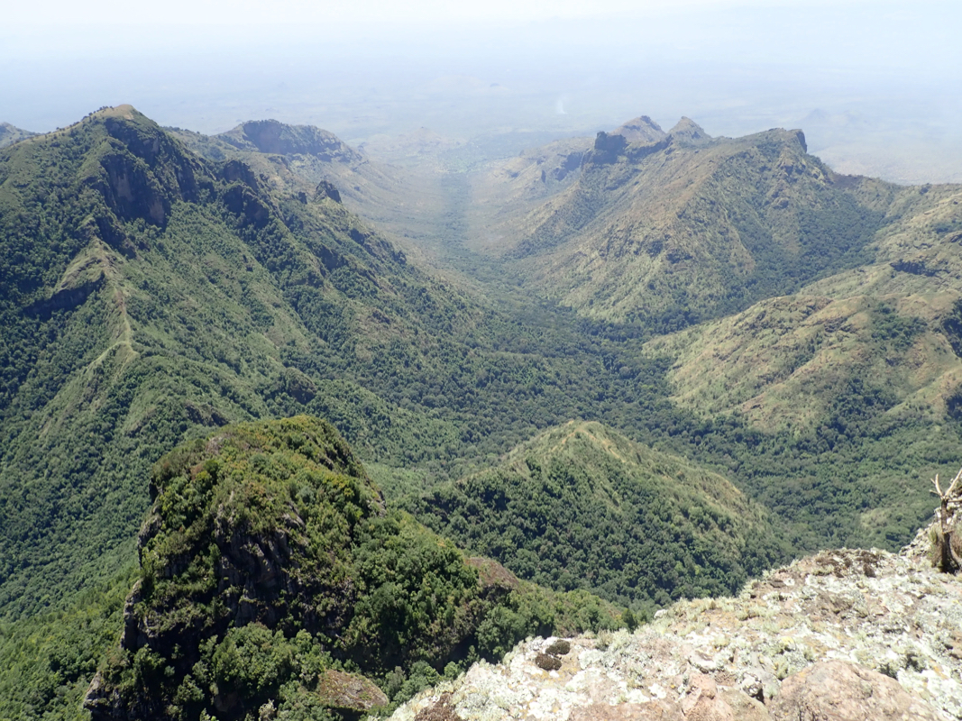
A very nice place to rest and enjoy the
view, there are more connecting mountains going east across to Kenya.
We left at 1240, this time keeping to the local rock sections on our right (east) side
of the plateau. Slightly longer and a bit more up and down, but still much better avoiding
most of the bush. The descent was nice,
we followed the same path
and reached the tall grass
where we had started at 1600. No phone coverage here, so we walked another
kilometer before getting to a pickup point. A final ride back to the hotel, arriving
there at 1640. This had been a very nice hike and I enjoyed a cold beer in the afternoon
sun outside the hotel before making plans for dinner.
This trip report continues with Moroto.
Resources:
Images
Kadam, as seen when driving north towards Nakapiripirit.