Background:
Taiwan has a large number (the claim is more than 200)
of mountains exceeding 3000 meter. In 1971, a list of the
"Top 100 Mountains" was selected and agreed on. These now constitute the most highly
prestiguous mountains to climb among Taiwan "peakbaggers". Unfortunately, this list
seems only available in Chinese.
The highest mountain, Jade Mountain, is 3952 meter, located in Yu Shan National Park.
The second highest mountain is called Syue Mountain (means Snow Mountain), this peak
is 3886 meter and is located in Shei-Pa National Park. These two peaks are the only two
in Taiwan with prominence exceeding 1500 meter.
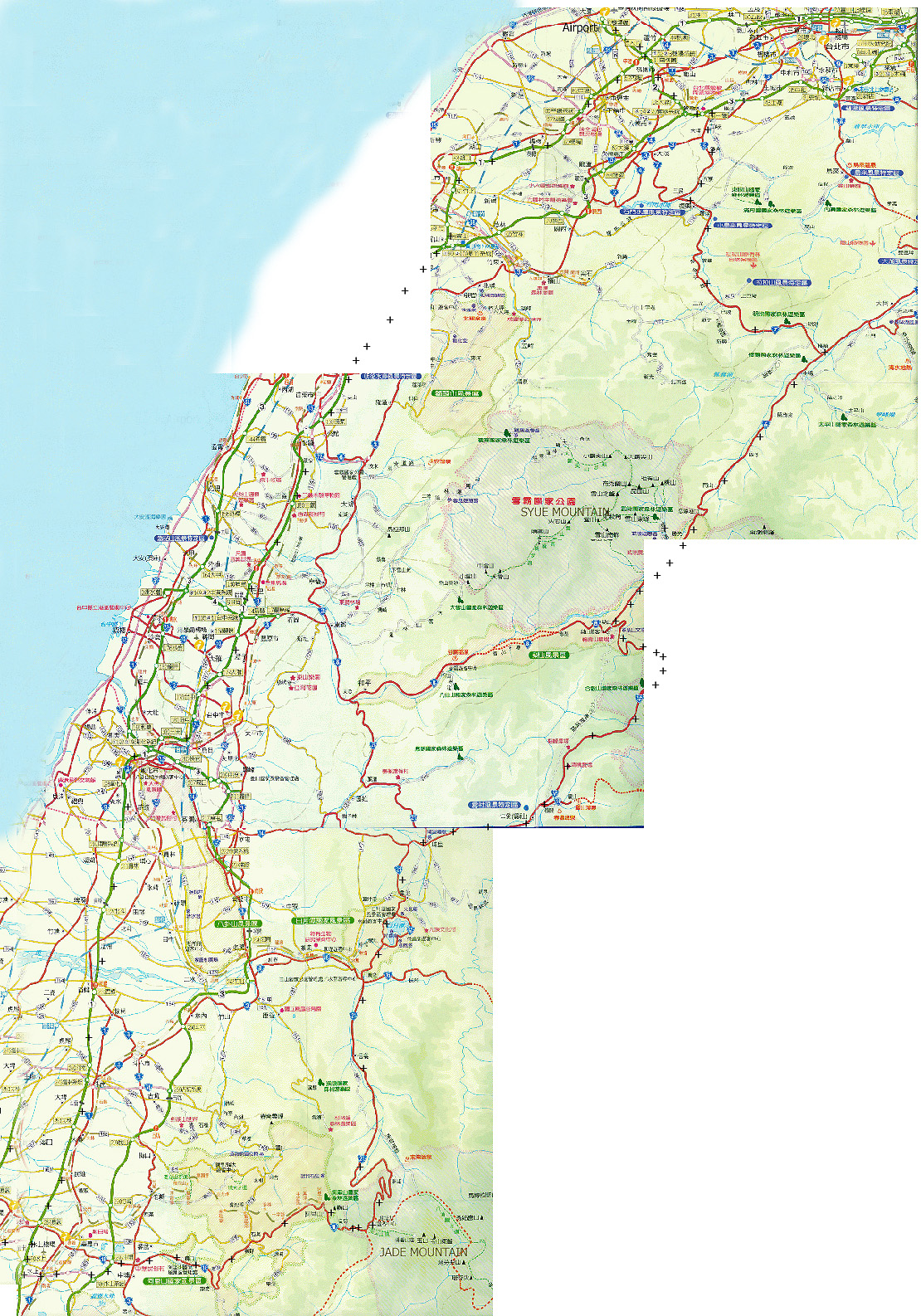
Here is a composite map showing my route of travel (indicated by
"+" on the map), the airport and the two national parks with the location of
Jade Mountain and Syue Mountain
indicated in the general area of the two parks.
The currency in Taiwan is called "Taiwan Dollar", abbrviated NT. 100 NT was
about 3 US Dollars at the time of my trip in June 2007.
The timezone in Taiwan is the same as in Shanghai, they are 6 hours ahead of Norway
(MET) in the summer.
How to obtain a permit:
The Taiwan authorities requires a mountain permit as well
as a National Park permit in order to climb these (and other) mountains.
As a principle, I strongly disagree with such bureaucracy (red tape). One should
take every opportunity to tell appropriate persons that they should help
convince the government to terminate these (stupid) rules.
On the positive side, these rules in Taiwan have appearently been relaxed somewhat in
recent times. There is a lot of outdated and partially wrong information posted on
the WEB not reflecting the regulations that are currently in place.
In particular, I had no problem in obtaining the necessary permits to travel around
in these mountains without anybody else, that is, there is no requirement that at
least one member of a party must come from Taiwan, neither any requirements for a
minimum party size.
I would recommend anybody contemplating a visit (that is, you come from outside
of Taiwan) to contact the 523 Mountaineering Association
Their WEB address is http://www.523.org.tw and
phone number is +886-(0)2-25557523. Their email address is 523@523.org.tw,
I had contact with a very helpful lady by name of
Doris Juan, you may try to ask for her assistance.
The climb of Jade Mountain (In Yu Shan National Park) is very popular and
in order to control/limit the number of hikers on a single day, there is a lottery
conducted one month before the actual day in question. The 523 Mountaineering Association
(in my case Doris) can handle all this. However, it seems advisable to contact them
about 6-8 weeks in advance, because of the procedure that is currently in place.
Here is what they (Doris) provided for me:
1. A class A mountain permit to climb Jade Mountain in Yu Shan National Park (two copies). This was a two-day pemit costing NT 1000.
2. A Yu Shan National Park pass, this included a permit to stay at the Paiyun Lodge if desired. This was a two-day pass costing NT 1000.
3. A two night reservation (pre-paid) for the Tongpu Lodge (near the road) in Yu Shan National Park, costing NT 1000.
4. A class A mountain permit to climb Syue Mountain in Shei-Pa National Park (two copies) This was a one day permit costing NT 500.
5. A Shei-Pa National Park pass, for one day, costing another NT 500.
6. Copies of hiking maps for Yu Shan and Shei-Pa as well as a map with driving directions from Yu Shan to Shei-Pa.
7. All this was sent by DHL to my address in Norway (3 days transit), at an additional cost of NT 1000.
In total, a cost of about US dollar 150, I basically made use of all of the above, except for staying
only one night at the Tongpu Lodge. The local park ranger at the trailhead would collect one copy of the
relevant mountain permit. At Shei-Pa, he also took the park pass. In Yu Shan, I carried the park pass
to the Paiyun Lodge where it was collected by the hut keeper.
How to rent a car:
Few (if any) international car rental agencies seem to provide service from the Taipei Inernational
Airport. However, a local agency was recommeded and they provided excellent service.
Their web address is http://www.easyrent.com.tw
However, since most information is in Chinese it is far better to communicate by email and/or
phone. Their email address is: x033@mail.hotaimotor.com.tw, and their phone number is +886-(0)3-3812277,
their fax number being: +886-(0)3-3811770.
They were located at the Dayuan Interchange of freeway 2, ie. very near the airport. They
will come very quickly and pick you up from the airport, you call them (local: 033812277) upon arrival.
Similarly, they provide you with swift transportation
to the airport on departure.
They confirmed the reservation by email before my departure. They accept normal credit cards, a standard
Norwegian drivers license and the cost for a 4 day rental of a Toyota Yaris ran at NT 8000 with
unlimited milage. Their service can be highly recommended.
Driving in Taiwan:
Coming from Western Europe, I had no particular difficulties wrt. driving in Taiwan. Many signs
are in Chinese,
so some extra care and defensive driving may be adviseable. The highways are marked
with numbers (that can be read!) and this makes navigation quite doable. Ask for a roadmap as you
check out the rental car. In the populated areas, traffic is quite heavy and the roads are pretty
good. In the mountains, the roads are narrow and with numerous sharp curves. Most curves have mirrors
posted in order for the driver to see if there is oncoming traffic. Many places the road is narrow to
the extent that you may not be able to meet a truck or bus. As can be seen from my access descriptions
for the two main peaks, one should plan conservatively wrt. estimated driving time. Along the freeway
sections a speed of 80-100 km/hour can be assumed, while in the interior an average speed of
30 km/hour is more realistic.
Day 1, Arrival in Taiwan and travel to Yu Shan
I left Suzhou in China around 0500, travelled by car to the International Airport outside
of Shanghai and left pretty
much on time around 0840 by Dragon Air to Hong Kong. There are
currently no direct flights between China and Taiwan, Hong Kong being an exceptional case.
After a smooth transfer in Hong Kong, I continued to Taipei, arriving there 1400 on June 25.
My cell phone handled a local call to the car rental agency without problems and within 5 minutes
they picked me up and drove me the short way to their office.
I made a GPS waypoint of their office location, just in case a return drive should run into
problems, then started out at 1500. Finding my way to Freeway 1 was trivial and soon I headed south
on 1. A short stop for gasoline (my car was delivered with about half a tank), then onwards. There
were several toll collection stations, passing through the first one, I paid with a NT 100 bill and
received a NT 50 coin in change. I was therefore somewhat surprised when receiving a NT 10 coin
in change as I paid the second toll station with my NT 50 coin. It turned out that I had used
a gate reserved for trucks on my first crossing. In all, a pretty small mistake given the lack of
anything but Chinese signs.
I exited on 82 and made my way across to Hwy. 18 without problems. There may be a slightly shorter
way, but it is likely to be somewhat more difficult to navigate. After a few more short stops
to secure water and some trail snack, I arrived at Yu Shan national park closer to 2000. It was dark,
and the Tongpu Lodge were nowhere to be seen. After looking around a bit, I did locate the lodge and
subsequently a small exit off the main road that I could drive to get there.
I entered the lodge, actually a pretty primitive hut with a mountain style room that could sleep more
than 20. A local party of perhaps 5 were already asleep. The hut seemed to have a staff (possibly
including local friends) of about 4-5 young adults sitting in a general room inside the main entrance.
They verified that a person by name of "Peter" was expected, so clearly I had found the correct
place. However, their English was rather poor, it seemed like one of the guys knew about 15
words. He pointed to my short sleeve skirt and indicated that I should be cold (The temperature was
perhap 14 Centigrades). When I answered no, he touched my lower arm and noticed the hair cover, telling
the rest that this most likely explained why the new arrival from Norway was not cold. (All in Chinese,
but it seemed pretty obvious that this was his message.) He subsequently pulled up his own
sleeve and showed me his clean arm, just to point out what seemed to be an important difference.
Now eager to pursue the topic he continued to open his jacket and unbuttoned his shirt to show his
chest, completely smooth. To really convince everybody present about this "new theory" about why
visitors from Norway did not feel cold, he pointed to my chest and nodded with anticipation. I was really
amused by this rather unexpected welcome and opened the three upper buttons in my skirt and showed a
chest that certainly has a somewhat denser cover than what can be seen between hand and elbow.
A mix of a gaze and an "ohhh" from everybody present, including the woman and seemingly all
"formal distance" evaporated. They came with a bowl and rice and chopsticks, then the real treat,
a rather large portion of peeled prawns prepared in a wok with red chili. This tasted rather great,
in fact, a dish I had been looking for the previous week in China without ever seeing anything close.
My hosts pointed to a big wall clock and made it very clear that a van would drive me from
this place and up to the trailhead at 0600 the next morning. It was equally clear to me that this
was in fact the procedure and that it might be difficult to start any earlier. The park ranger needed
to collect the mountaineering permit etc.
Satisfied with this and with having accomplished a rather long travel from Suzhou, China to Yu Shan, Taiwan,
I went to bed and slept reasonably well.
Day 2, The climb of Jade Mountain
I woke up at 0500, it was already daylight outside and I could see the sun hitting the highest
points in the surronding hills. There was, however, no sign of life anywhere. I had a packet
of biscuits for breakfast and some water purchased the day before. I went out to the car
and got all organized. The sun was now hitting more of the hills, the sky was all blue and it looked
like a nice day was about to begin.
No life around the hut, at 0600 sharp, a very tired face looked out from his bedroom. He walked
straight to the wall clock and told me (by pointing) that nothing would happen until 0630.
This turned out to be pretty accurate, at 0630 the van was ready, a driver had showed up and we drove
back up to the main parking area along Hwy. 18. More hikers, in fact surprisingly many were ready to
take the same lift to the trailhead. Our van stopped up by the ranger station and the guy there
collected my permit. Off we went, and soon everybody unloaded their packs at the saddle from where the
trail starts out.
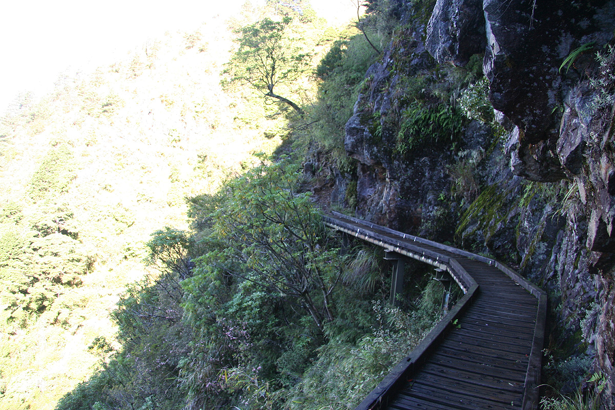
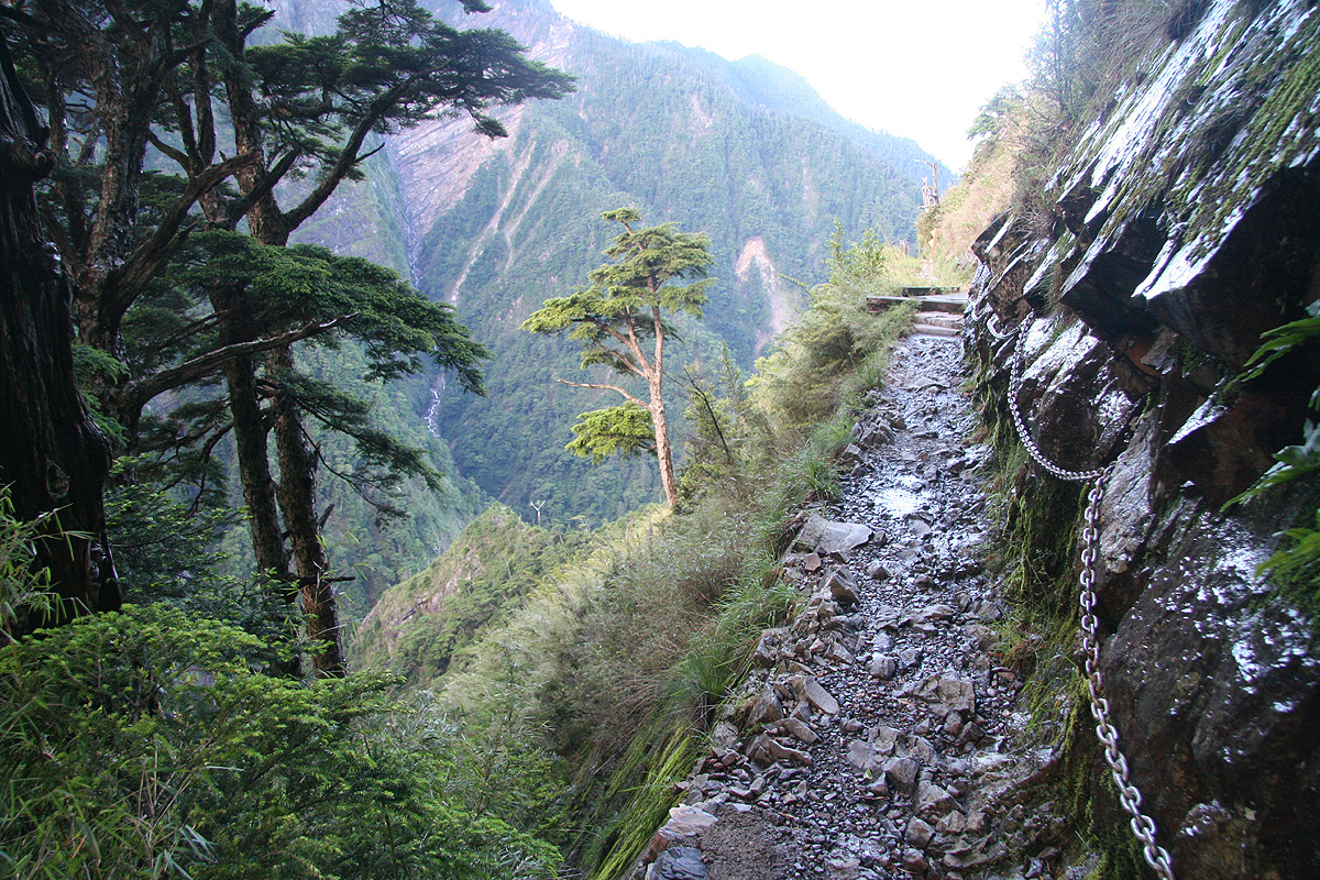
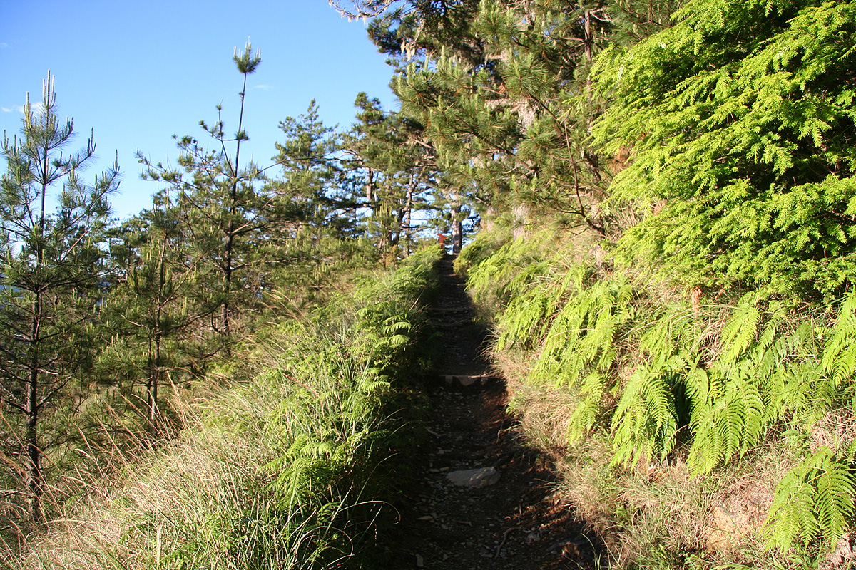
I set off along the trail. The trail was quite nice and obviously heavily used, but it
became clear to me almost immediately that this was a (YDS) class 1 trail with
exposure.
The hillside
was very steep indeed. It is interesting, but fairly typical that the vegetation is
so dense and the colors so strongly green, even when the slopes
are as steep as here. The trail
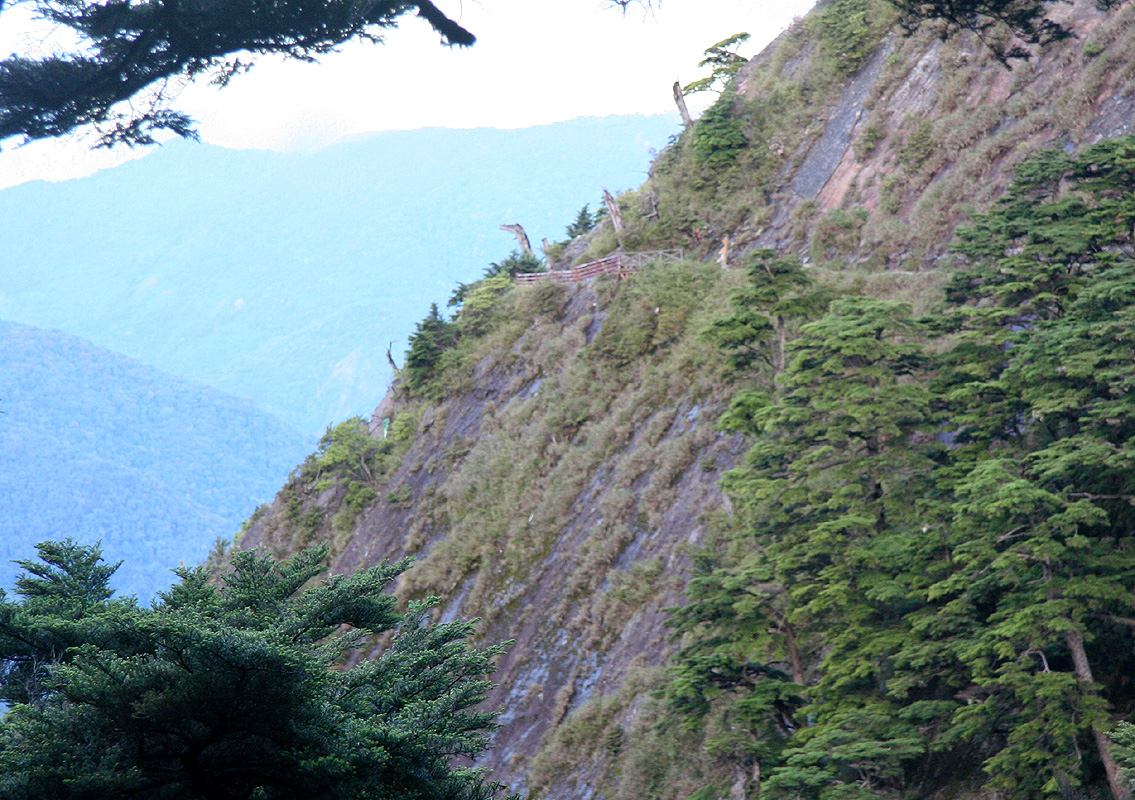
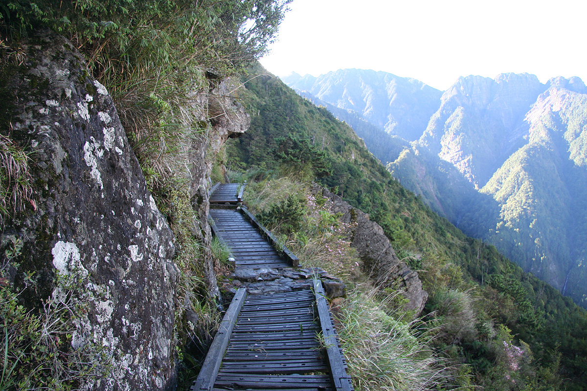
has more or less been cut out in the slope. In many places the trail has been improved by
actual construction of wooden bridges
that are used to further make the going easy and the surface
flat. On the inside, there is often a chain that hikers with a fear of heights may hold on to.
However, there is little logic in this use of such chains, most often it is placed on the inside
where a fall "off the trail" would be very bad indeed. However, there are also equally exposed
sections without the chain as well as some trivial sections where one would fall at most one meter that
still for somewhat mysterious reasons are protected by a chain.
The weather is very nice and the sun is gradually hitting sections of the trail. I soon (after about 2:15)
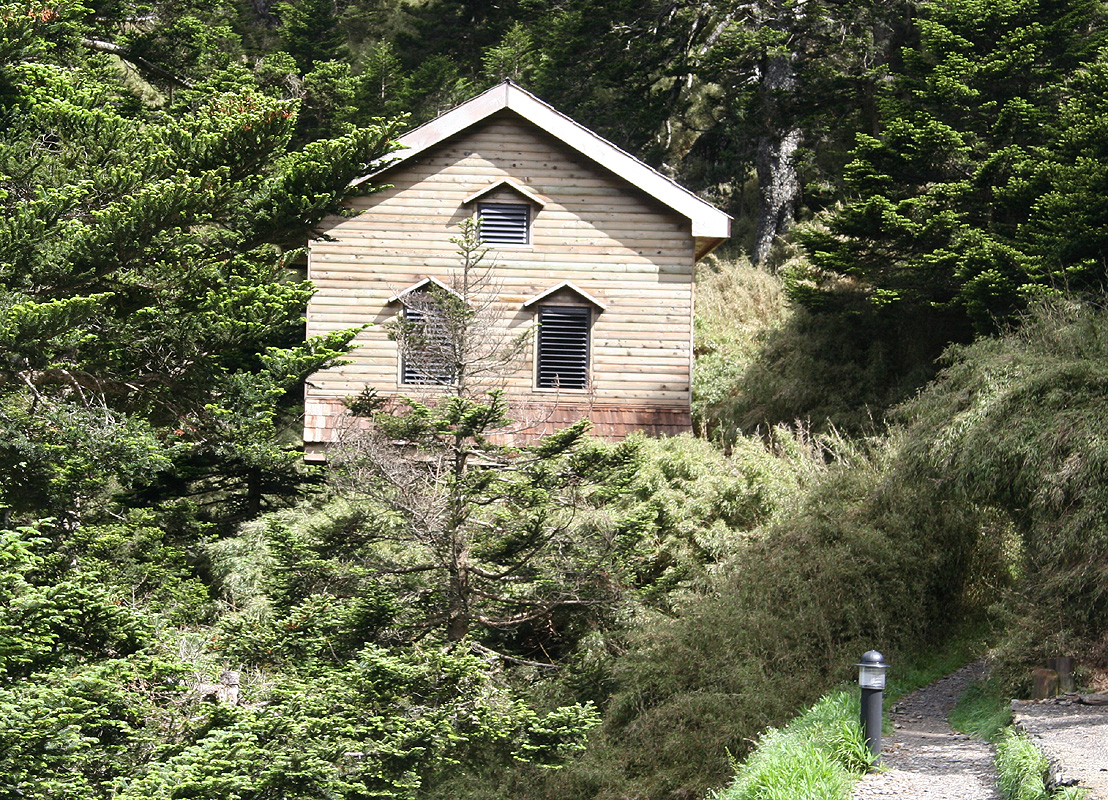
arrive at the Paiyun lodge.
The hut-keeper greets me warmly and collects my park pass (that specifies that
I may stay at the hut if I want to). However, since I have a long and unknown drive tomorrow, my idea is
to continue straight to the summit, then descend back down to the Tongpu lodge where I have prepaid for
a second night of accomodation. Thus, I proceed up the trail above the lodge. My description says that
this section should get considerably steeper, in fact turn into a (YDS) class 3 route. Well, at least
initially, there is no signs of this. The trail is as nice as it has ever been, zig-zag uphill, not along
any ridge, but really on the west facing slopes below the summit. Higher up, there is a long chain heading
straight up along the left side of a gully to what looks like a small col, while the trail crosses
right and then finds a nice way back up to the same destination. From here one sees the section above
where the wind gusts have been blowing climbers off the mountain in previous times. To prevent this,
there is now an enclosed section. The trail has been equipped with a roof as well as with a number
of parallel steel bars for "an outer wall". No way to fall off here anymore. Exit from this and you
find a signed trail fork. The left trail runs down a scree/talus gully parallel to the north ridge proper,
heading towards the north summit.
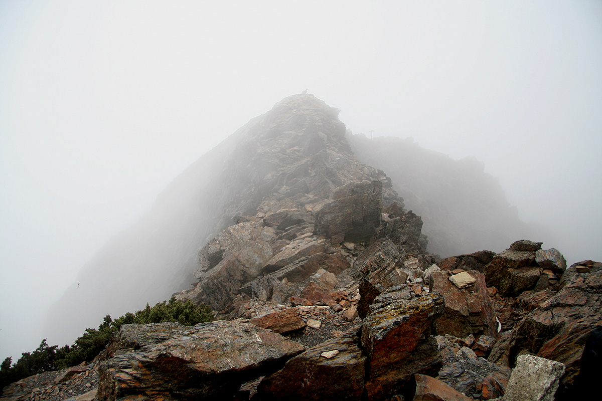
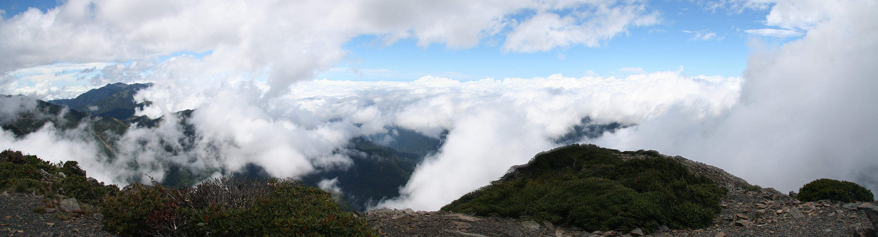
Bad news, right around here the clouds quickly close in and engulfs the summit above. So close to a good
summit view, then this! A slightly earlier start, that I had good reason to believe would have been
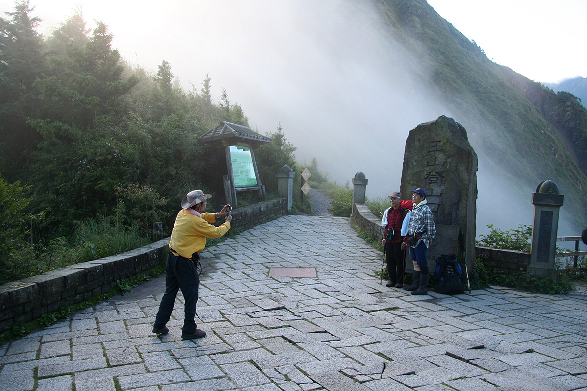
the case and I would have had good summit visibility. Well, I ascended the last 80-100 meter and arrived
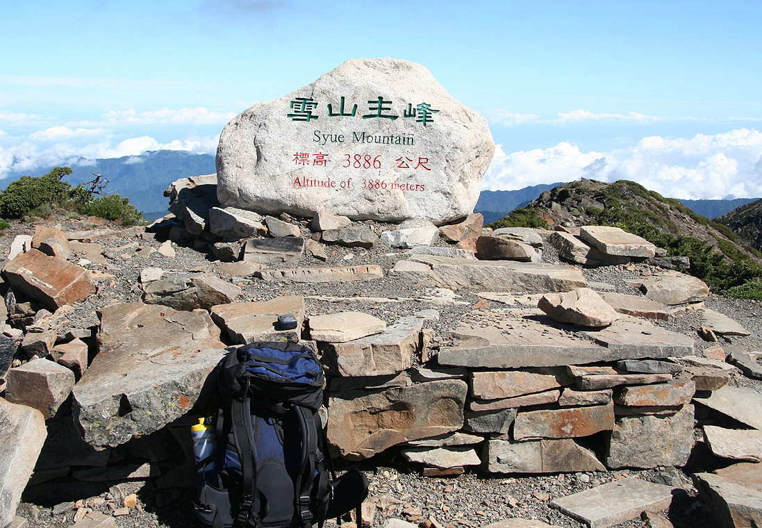
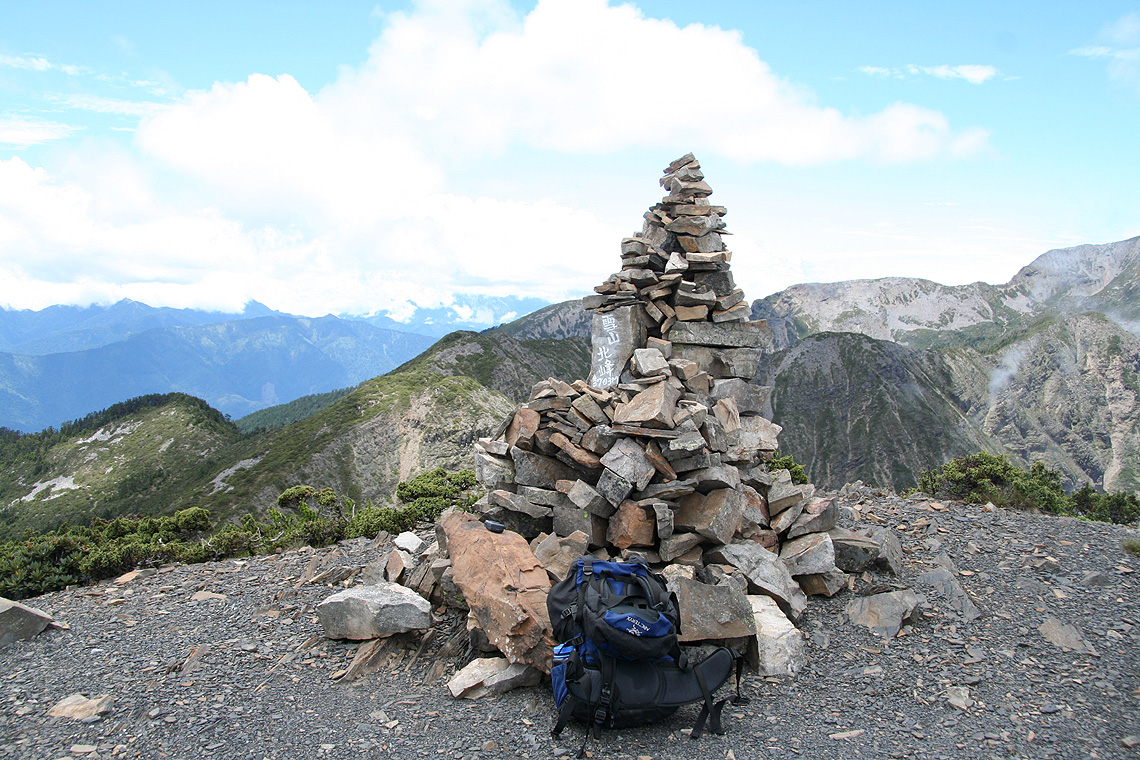
at the summit after about one hour from the Paiyun lodge. The summit has a pretty big and very carefully
made marker.
The name stated is Jade Mountain, then the elevation and also likely the name expressed in
Chinese. From this evidence it seems to me that one should start calling the mountain Jade Mountain, reserving
Yu Shan to mean the entire national park.
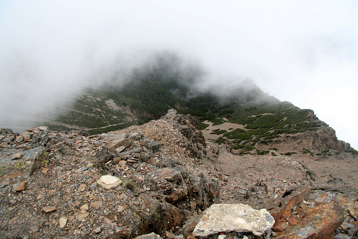
I waited around to see if there would be a break in the clouds, but no, one could barely see the start of
the south ridge and
not much more. A very limited break gave me a quick look down
in the direction of ascent, then the clouds
closed up again.
Coming this far and then missing a good view by such a slim margin.
I decided to just descend to the Paiyun lodge, then make a reascent tomorrow morning. After all, this
is just a matter of about one hour up an another little hour down. I could even consider leaving a few
things in the lodge to travel lighter. There would be plenty of time to descend back to the trailhead
and drive north to Shei-Pa. Having decided this, and observing that the time was still well before
noon, I subsequently decided to check out the north summit as well. Being up here, it made little sense
to descend to Paiyun already before lunch.
With a firm, but revised plan, I went back to the trailfork and descended the gully. In doing so, I
did reflect that one lost not a little, but indeed quite a lot of elevation that would need to be
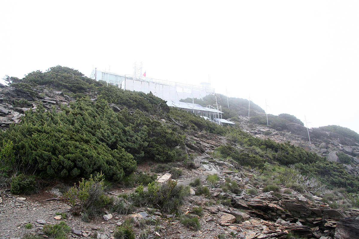
regained going back. Further down, the ridge turned more level with some intermediate humps and a nice
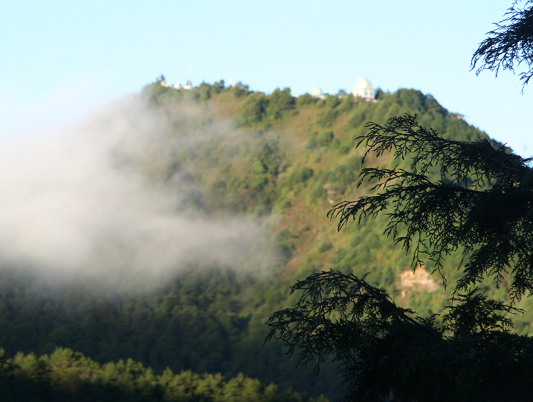
trail. I hiked along and had no trouble reaching the top. Seeing the building on top,
reminded me that
I had in fact read about the existence of a pemanently manned weather station being located here.
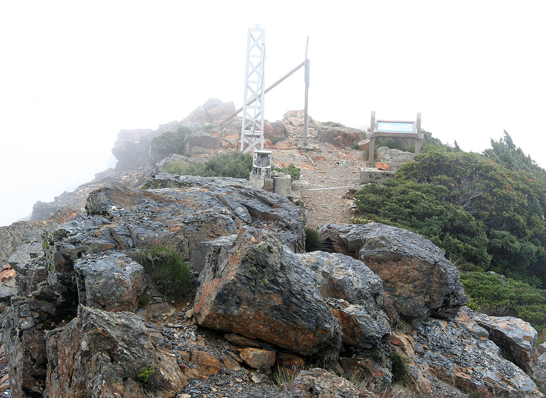
I saw nobody, but a barking dog. The highest point was a short ridge
on the east side of the building.
Upon returning, fatigue soon showed up as I started the reascent of the main peak. I needed several
short stops in the broad gully and felt happy about only going to Paiyun lodge. I was back
around 1400 and informed the hut keeper that I would indeed stay for the night. In the meantime,
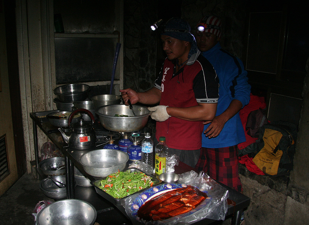
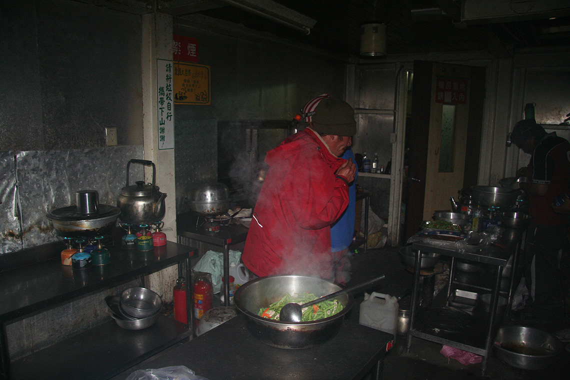
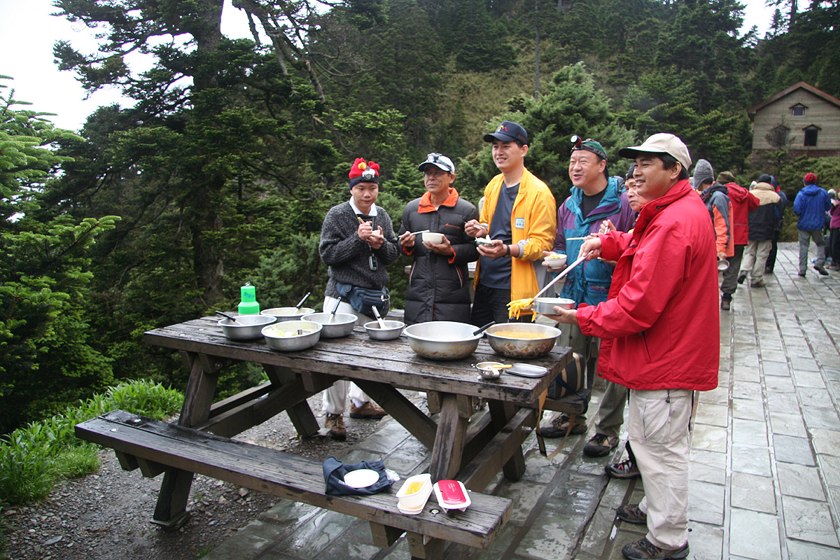
light rain had started and a seemingly endless stream of local climbers were arriving at the hut.
Boy, this was going to be a crowded place. Still, it was fun to just hang around and watch. The
arriving groups were .busy cooking food
(Chinese style), quite a sight in a dark kitchen with headlamps,
then large woks and 10-15 gas burning stoves. Friendly as everybody seems to be, they soon found a spare
cup and some chopsticks, I was invited
to join dinner with several groups
and thus had a choice. The dinner
was nice and just after dinner people started to crawl into their sleeping bags. There was immediate
concern (among the locals) that I did not have a sleeping bag. Again, more concern that it would be
bitterly cold at night, how should I survive? Well, the temperature dropped to around 10 Centigrade,
I had my Devold wool as well as fleece and a goretex layer (never needed). The hut keeper obviously had
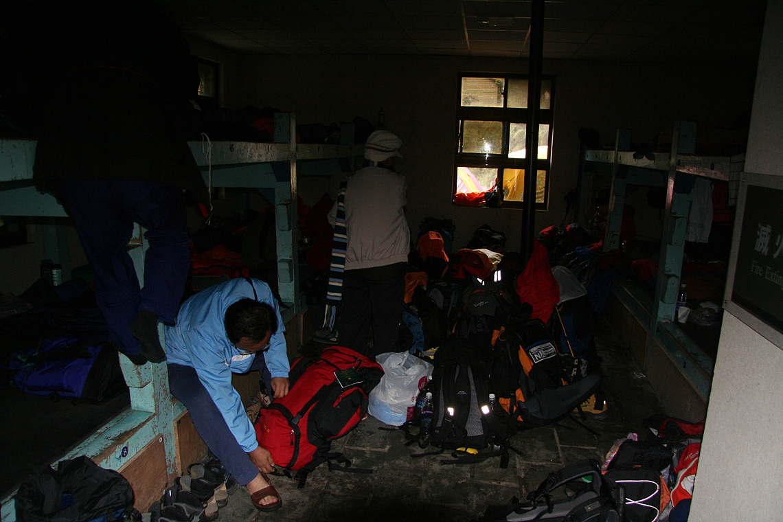
been alarmed about the situation, so he turned up with a spare sleeping bag.
The room could sleep about
60, but we were closer to 100, the beds did not have any matress, so pretty hard and crowded. I decided
to use the sleeping bag as a cushion in order to soften things a little. There was no need for anything
warm.
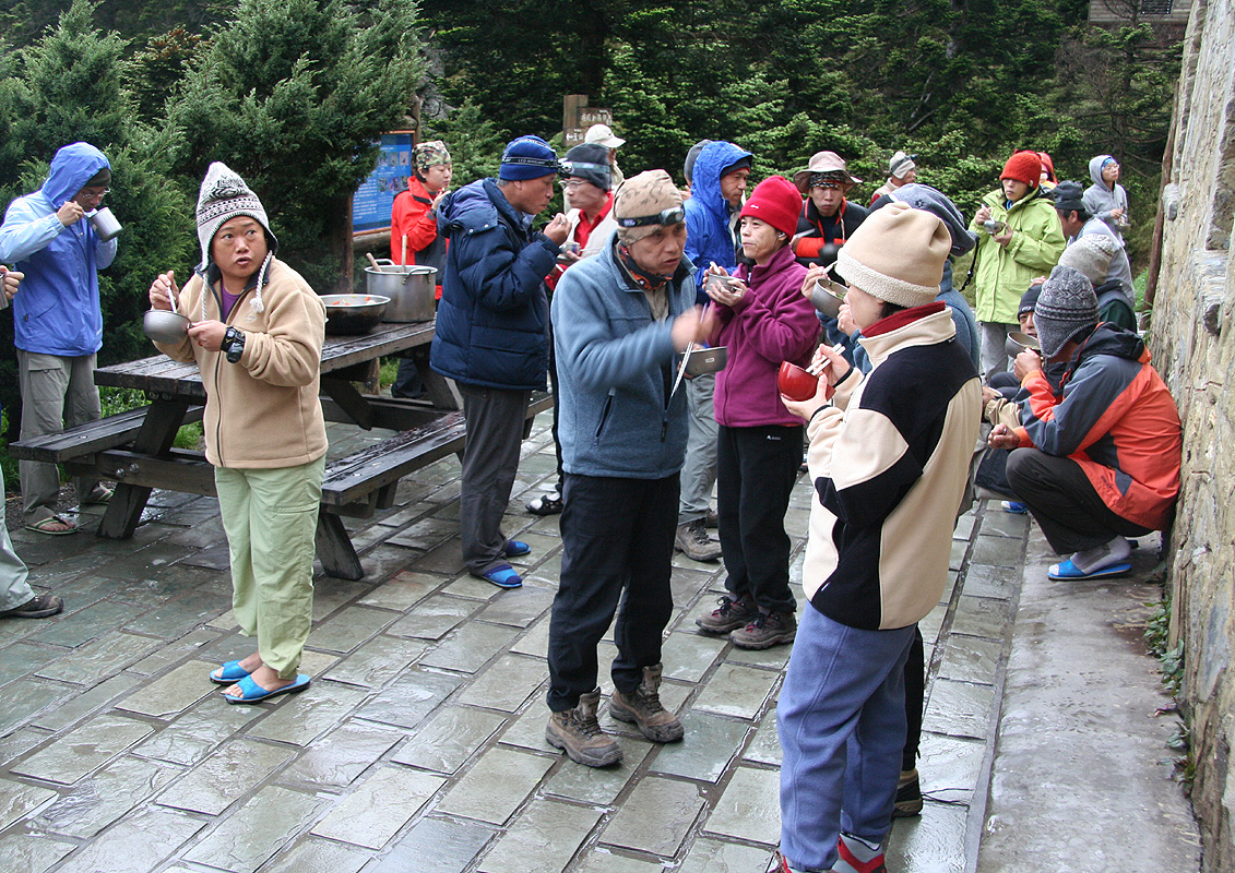
It seemed I had barely fallen asleep, when everybody started to get organized for the climb. It was
midnight! The general feeling was more like a major phase of preparations for Mont Blanc, even there the
start is about two hours later. Incredible chaos, that gradually sorted itself out. No sleep. Around
0230 the last person had left and I feel asleep. My plan was to get up with daylight around 0500, after all,
the hike to the summit was a one hour assignment.
Day 3, Travel to Shei-Pa National Park
At 0500, I looked out and to my considerable disappointment, observed clouds all around the summit.
Really no point to make a second ascent up there into clouds that were even thicker than yesterday.
I packed up my gear and started hiking back down to the trailhead. Still, reflecting on the events,
I was happy for having experienced the life at the Paiyun lodge, the many locals full of excitement
about climbing the highest point on their island etc.
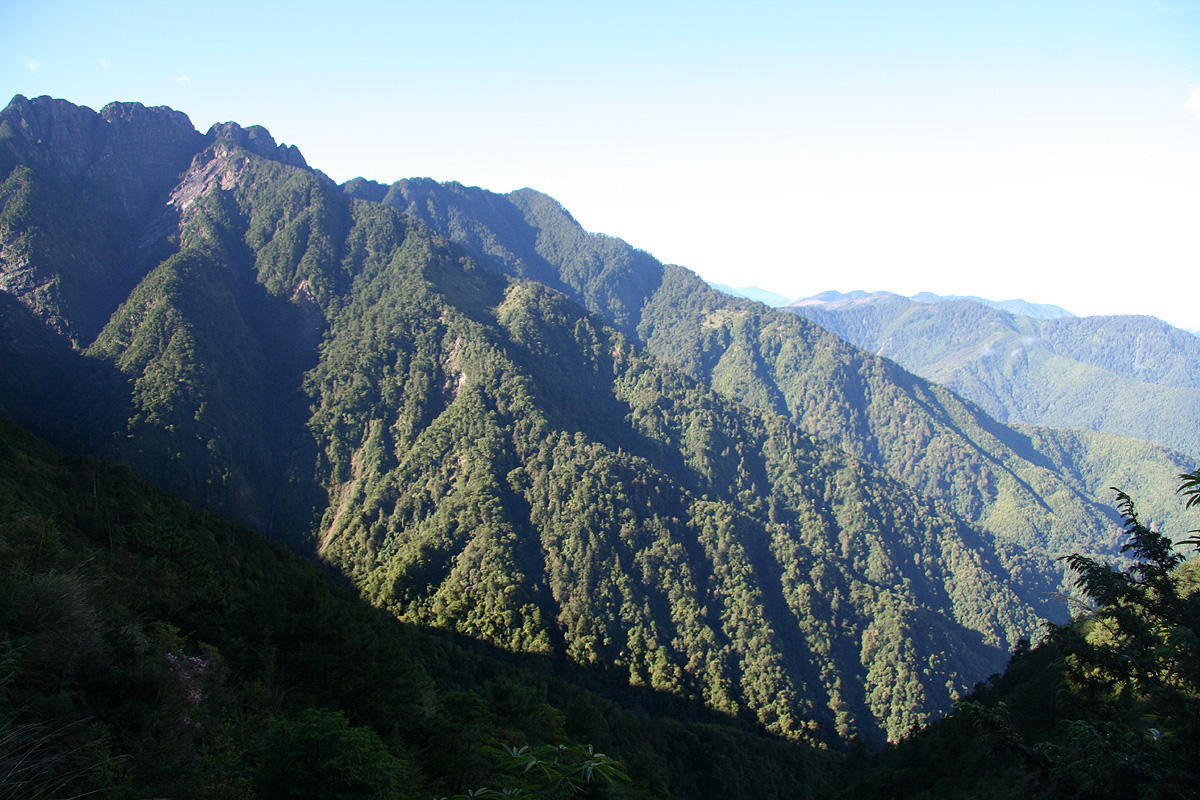
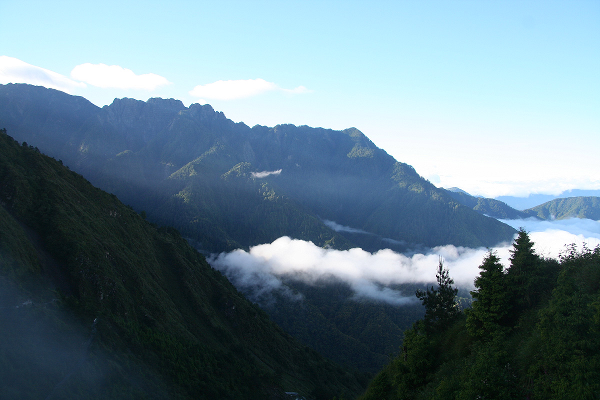
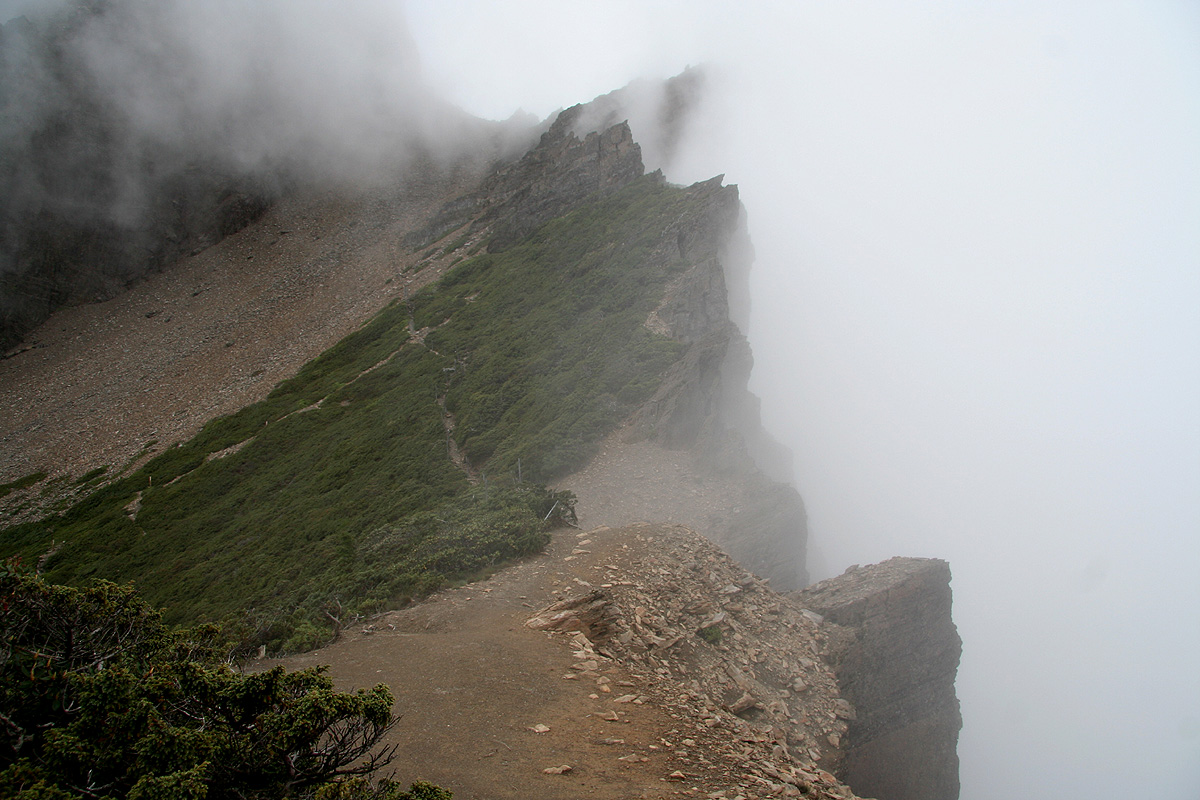
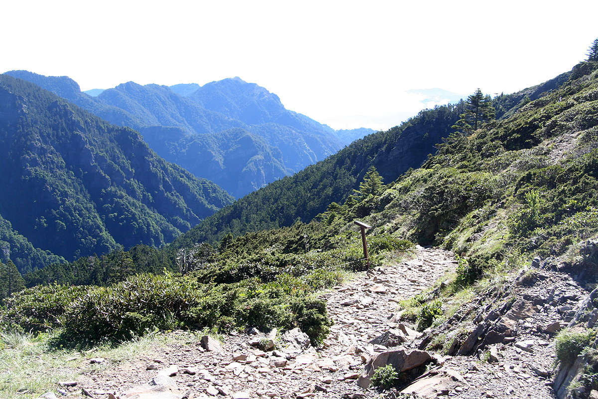
I reached the trailhead in about 1:45, including a few stops to capture a couple of
the steeper sections (exposed sections)
of the trail. The landscape is very special. I had good visibility
below the clouds that ruled higher up. Across the valley,
there is another ridge coming more
from the south, the terrain is rugged all over. One of the vans appeared with more hikers and
gave me a return ride back down to the Tongpu lodge. I said goodbye to everybody there, got organized
and started my drive north to Shei-Pa park.
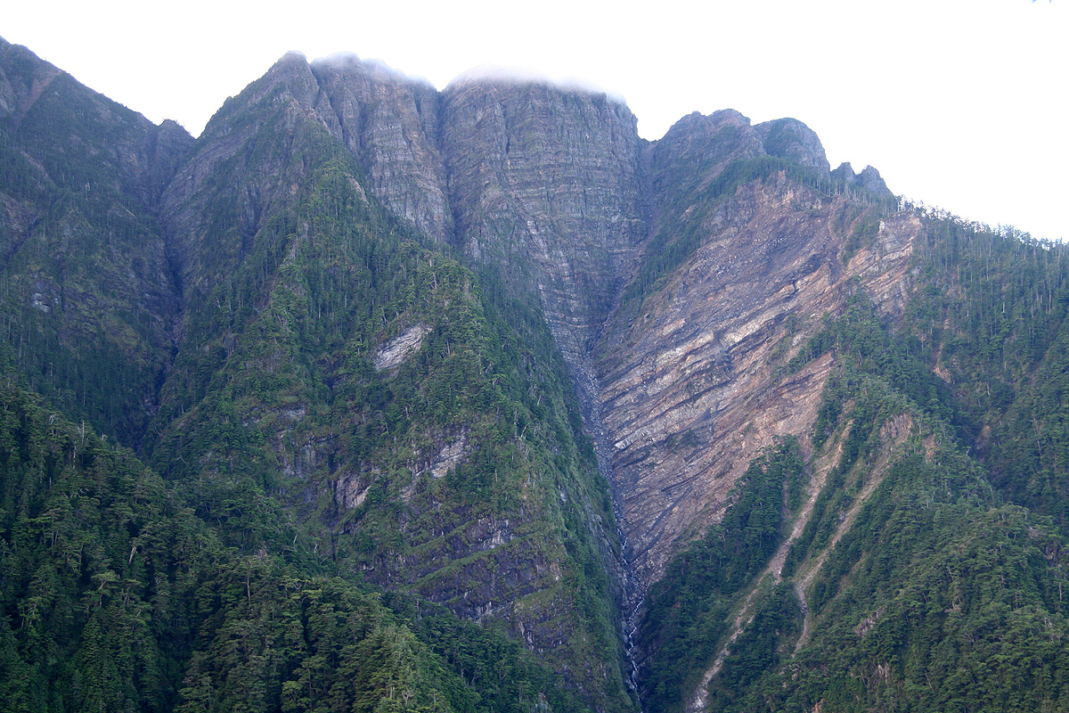
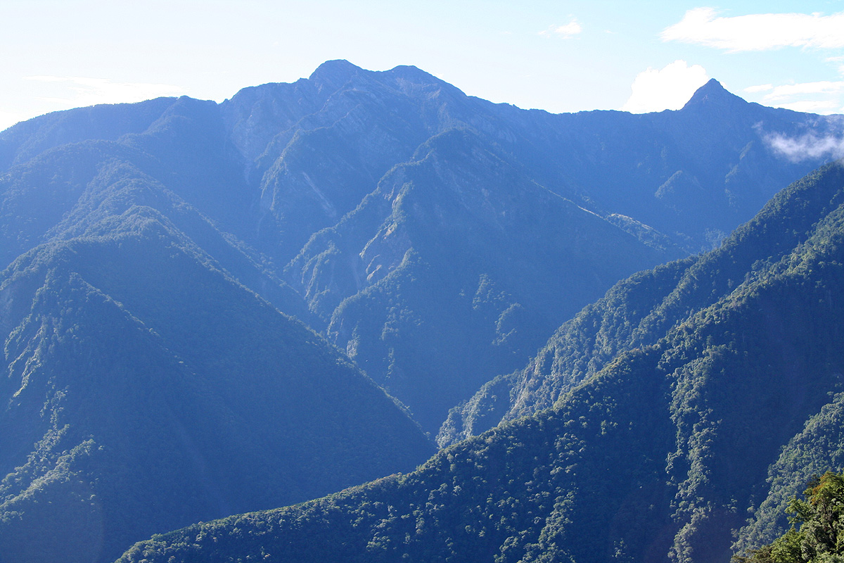
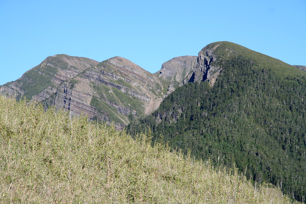
The drive was interesting indeed. What a dramatic landscape here on Taiwan! The first section of
Hwy. 21 descends steeply below the east side of Yu Shan. The weather took a completely different
pattern from yesterday, the clouds gradually cleared and by 0800,
the summit of Jade Mountain was
clear. Thus, a few hours extra waiting, then a second ascent had been the right choice. Well, to be
honest, a pretty impossible scenario to predict. The day before, it had been a crisp and crystal
clear morning, then gradually more clouds that stayed the rest of the day.
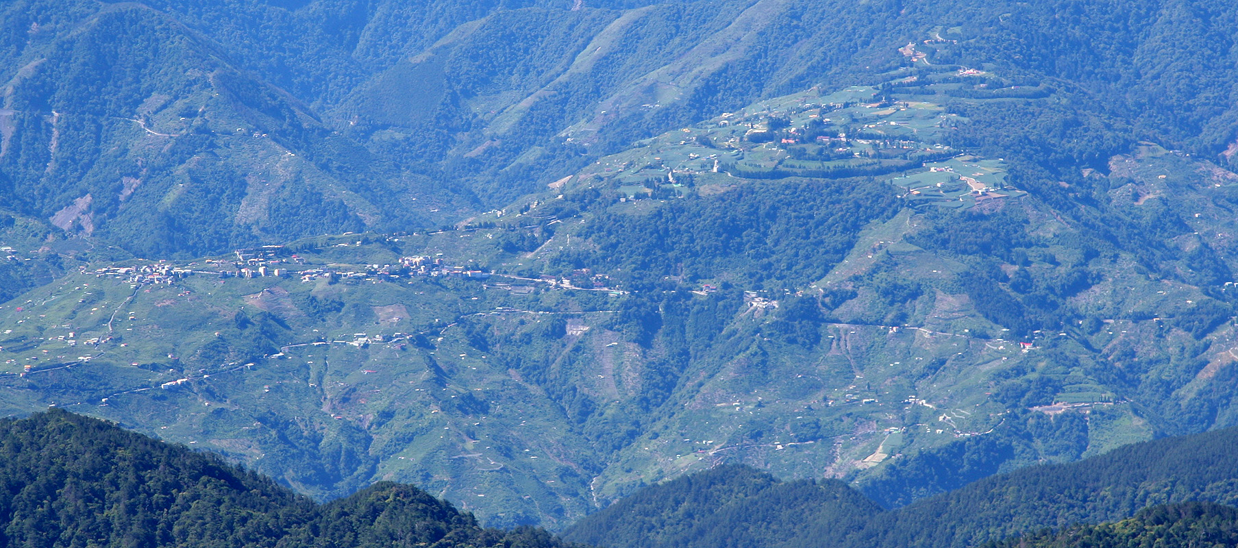
I drove without any difficulties and according to my map supplied by Doris, across to Shei-Pa National
Park further north. This drive takes you onto Hwy. 14 across some more facinating mountain landscape.
The scenery is great, the speed rather low. The roads have an incredible number of sharp curves, they
are narrow to the extent that you may need to stop or even back up in order to meet an oncoming
bus or truck. After about 6 hours of driving, passing through Lishan
as the last town,
I was in the new national park. The weather was cloudy and
a couple of pretty heavy, but of short duration, rain showers interfered. I located the trailhead and
was informed about where to drop my permit (in a designated box), for an early (before office hours)
departure. I had noticed a rather fancy looking hotel near the park entrance and decided to
book myself there for two nights.
The hotel, Hoya Resort Hotel Wuling, charged NT 7200 for two
nights including breakfast and dinner. It struck my mind that I still had no idea about the actual
value of the local currency. I knew that my rental car would be NT 8000, and figured that this rate
for a hotel of resort quality standard could not be too bad.
After two days of rather basic accommodation, this seemed well earned. A warm shower, then a multi-dish
Chinese dinner, then quickly to bed in preparation for an early start the next morning.
Day 4, The climb of Syue Mountain
I got up at 0400 and took some bread for breakfast as I drove back up the valley to
the trailhead. I decided to hike in shorts and just carry some warm clothing in my backpack.
I was ready to leave around 0435, just as the morning light
gave sufficient visibility that
a head lamp was not needed. The trail climbed distinctly for the first kilometer, then leveled off
to the shelter located near kilometer 2. From there, the trail again went uphill for a couple of
kilometer before sort of topping out at the end of the distinct ridge coming down from the
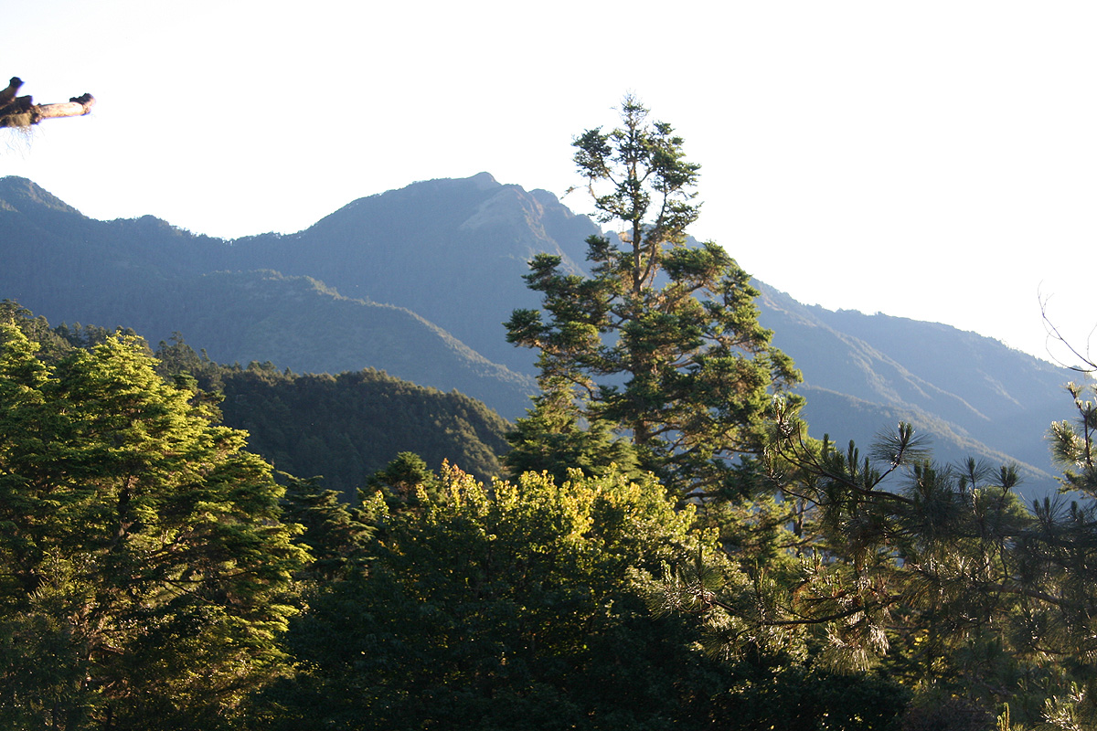
Syue Mountain itself. The sun was up, but the long range of mountains
across the main valley where still in the shade.
It was a quiet morning and I had a clear
feel for the difference between this trail and the trail to Jade Mountain. Whereas that trail
was nice with considerable exposure, this trail was also nice (perhaps slightly rougher), having
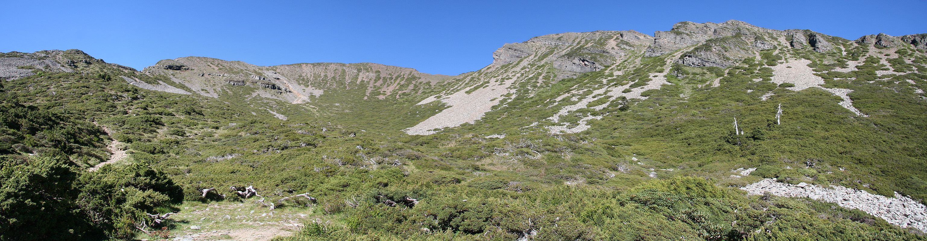
no exposure. From this ridge, one could now see the Syue itself for the first time.
The trail had a distance marker every 100 meter, so one could hardly avoid keeping track of
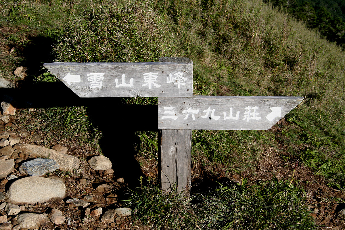
progress. A very small bump on the ridge is called the East Peak, however, it has very
little prominence. Just before coming there, the trail forks with the left branch heading
across the bump while the right branch contours around. This is not obvious when you see the
sign at the fork, however now
I can say with some confidence that the left pointing sign
directs you across the "East Peak" etc..
I was soon at the "369" lodge. The name is supposedly derived from a nearby peak with
elevation 3690 meter, however this elevation has long since been adjusted while the name on the
lodge stuck. This lodge was also without staff or people, I took a 10 minute rest on the steps right
in front of the main entrance.
It was a beautiful day and I knew I would get this summit without clouds. The trail continued
uphill across the open field of grass then back into pretty heavy forest before emerging
in a nice,
open basin
just below the Syue Mountain. From here, it was an easy hike to the summit. Class 1 all
the way and no exposure. Still, this hike felt like a bigger hill than Jade Mountain and it is since
the trailhead is located considerably lower.
The summit was made up of a rather large and gently sloping
ridge. The official summit marker
used a name consisten with what could be seen in the park and near the trailhead, "Syue Mountain",
syue means snow, so this explains why some people call it Snow Mountain. It seems to me that
the most proper name therefore should be Syue Mountain.
I met 2 hikers near the summit.
They had stayed in a shelter/lodge on the opposite side.
One of
them carried an enormous backpack, hardly needed under such nice conditions as here. I sat around
for a while and got my panorama pictures. Unfortunately, there were still clouds around the
horizon, so clear views as far as possible did not quite materialize.
However, views back down to the nearby valleys were excellent.
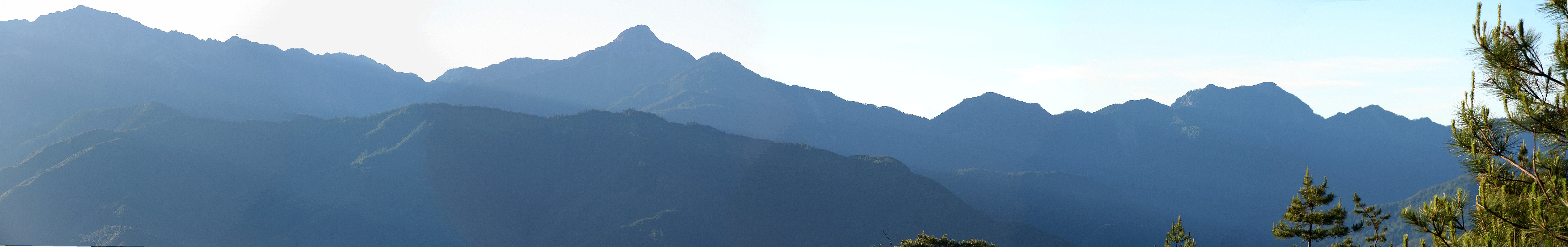
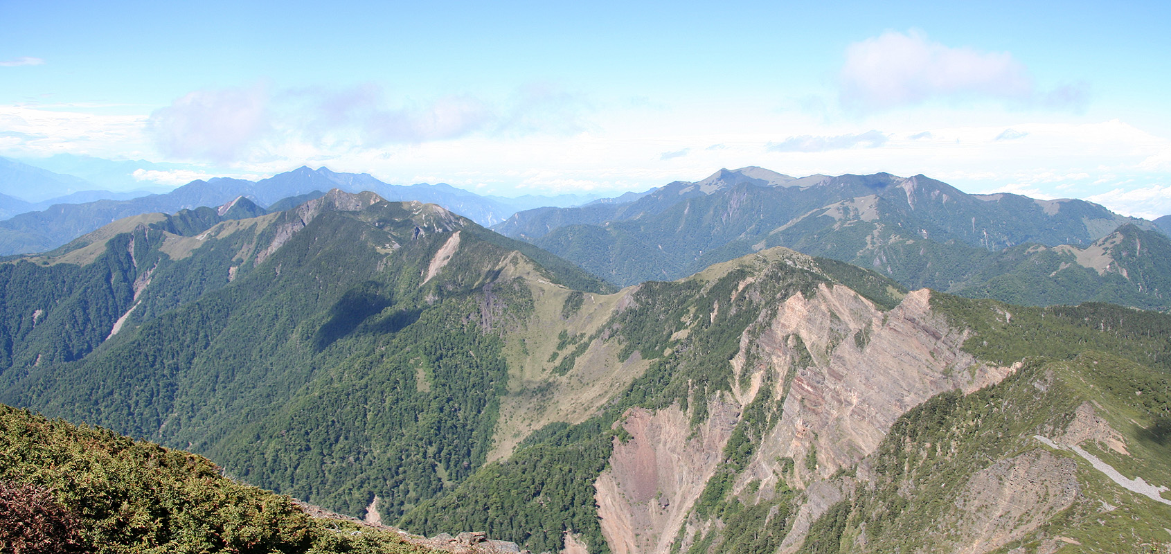
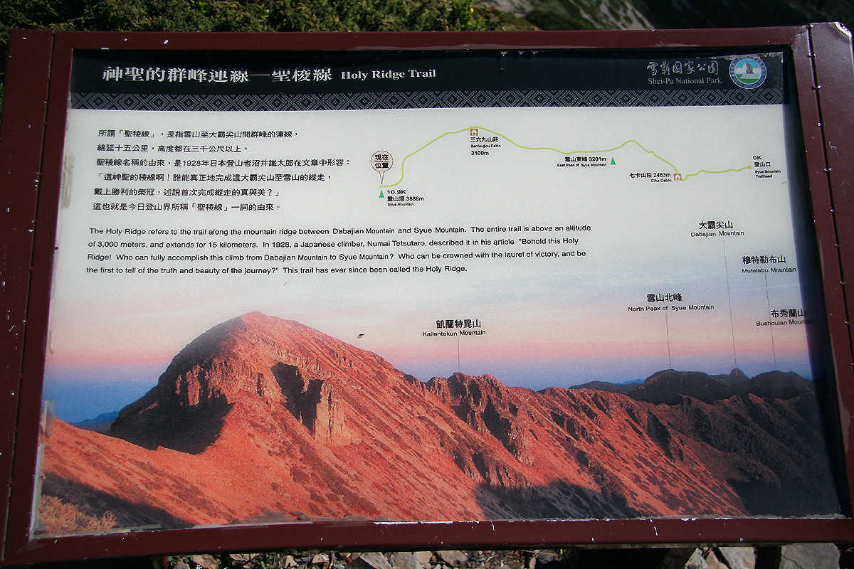
I read an information sign
about "The Holy Ridge" and spotted its opposite end,
a very characteristic peak with steep slopes, by
the name of Dabajian (3492m). Considerably before this peak, just left of Dabajian, the mountain named
the Syue North Mountain was
clearly visible. With a long day still, I decided to check out The Holy Ridge and see if I could
traverse it across to the North Summit. This would certainly be a quite long project also depending on
how complex this ridge turned out to be.
I set out and scrambled across to the neighbor summit at
3880 meter. There was actually a (YDS) class
3 move (but hardly more than a single move) needed in order to ascend this peak. Another party of
three hikers had left their packs in the saddle, then climbed up. I met them just after completing
the local "crux" point. They seemed somewhat surprised by meeting an "old guy" even carrying his
backpack coming up this route.
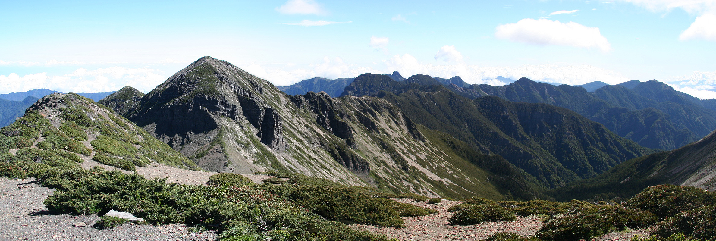
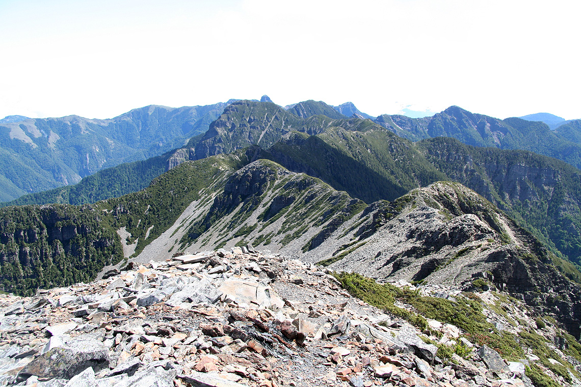
From this summit, the ridge stretching all the way to Dabajian,
was even more clearly laid out and
the bulky north summit, visibly right in front of Dabajian, still looked like a feasible goal.
I continued down slope towards the north and soon came to a trail forking
down right, off the ridge. This was the trail that had a sign saying "Syue North Summit" forking
right just shortly after the 369 Lodge. I decided to take that trail on my return hike.
The ridge continued with several ups and downs, sometimes with a slightly more narrow path and
some degree of exposure, but never difficult. In fact, the rest of the route from the 3880 peak to the
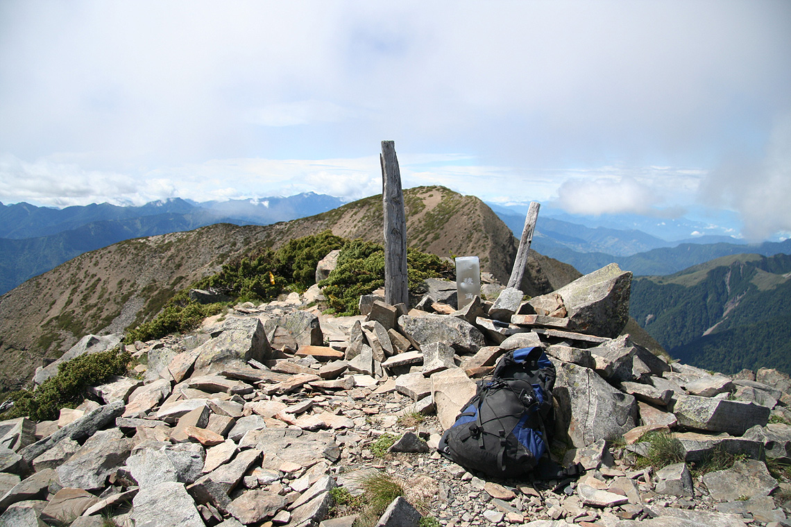
North Summit, stays at (YDS) class 2. In the last saddle before the peak, there was another A-framed
shelter, but no sign of other hikers. I climbed the final hill
and soon rested on the Syue North Summit.
By now, one could see how the clouds were building and attacking the ridge.
They formed a sea of
white to the west, while the east side was still largely clear. However, I realized that it would be a
matter of time before the clouds would succeed in crossing over.
Descending, I noticed that time was now running fast and that I started to feel the long hike.
Clearly, I was going to be pretty exhausted by the time I would reach the trailhead. However, this
was going to be my last hike in Taiwan, so it was only proper that this day was used and enjoyed to
its fullest possible extent. Reaching the trailhead after almost 11.5 hours of hiking, I was tired
and very happy.
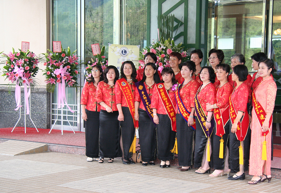
Just as should be expected after a day like this, a
group of nicely dressed ladies had lined
up to welcome me back at the hotel doorstep.
A shower, a nice dinner, a relaxed evening in the hotel, then a long return trip to Norway.
Day 5, Departure from Taiwan
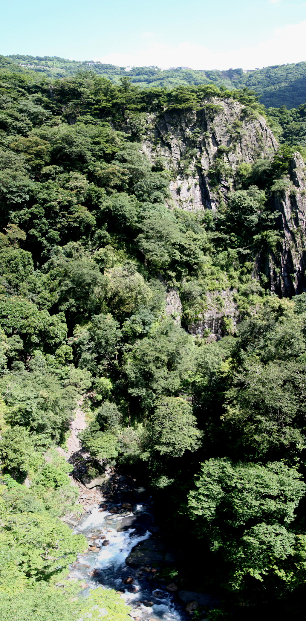
I had breakfast around 0700, then started out by driving Hwy. 7 further north.
Shortly, I arrived at a pass and could see a much deeper valley extending further
north. The road descended into this valley, then climbed west across a very facinating
landscape. Steep hillsides, deep gorges, the road balancing on precarious terrain at the
edge of steep drops into the intensely green far, far below.
The drive was extremely scenic, and took about 5 hours. The distance covered being only
slightly more than 150 kilometer says it all.
I delivered the car to my friendly car rental place. They took me swiftly to the
airport. Then successive flights to Seoul in Korea, Munich in Germany, Copenhagen in
Denmark and Bergen got me home around mid-day on Saturday.
Return to the Jade Mountain (Yu Shan) page.