Wedge Mountain
- Wedge Mountain
- 2892 m
- Primary factor 2249 m
- British Columbia, Canada.
- Location: North 50.13295, West 122.79327 (GPS on the summit.)
- Difficulty: YDS class 2
- Climbed September 2. 2018
Wedge Mountain
|
|
How to get there:
This mountain is located in Garibaldi Provincial Park. Drive Hwy. 99 from Vancouver to Whistler and
continue towards Pemberton. You should drive approximately 11 kilometer from the intersection between Hwy. 99
and Lorimer Road in Whistler. Turn right (across a bridge) at the smaller road signed with Wedge Mountain.
Drive about 2 kilometer on a reasonable dirt road to the trailhead and parking located at N50.17286, W122.86307,
elevation about 760 meter.
Route description:
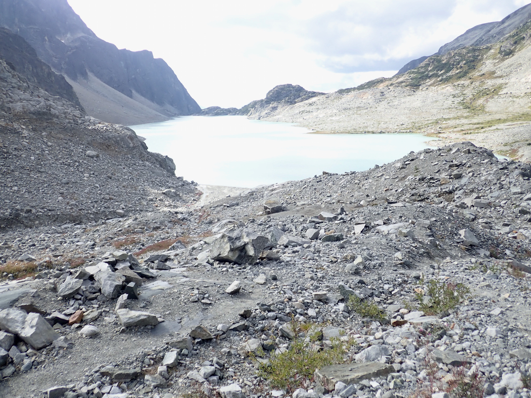
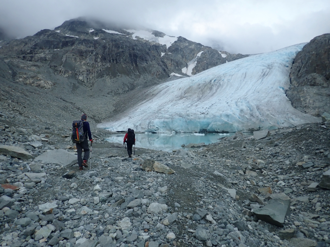
Climb to camp by the lake:
Follow the well developed trail from the trailhead/parking. After a gradual start
this trail soon climbs quite steeply in many zig-zag
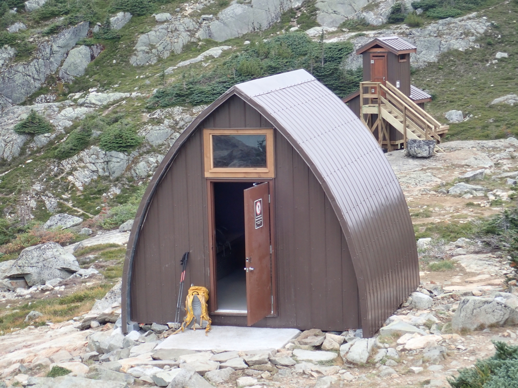
turns until it arrives at the small hut
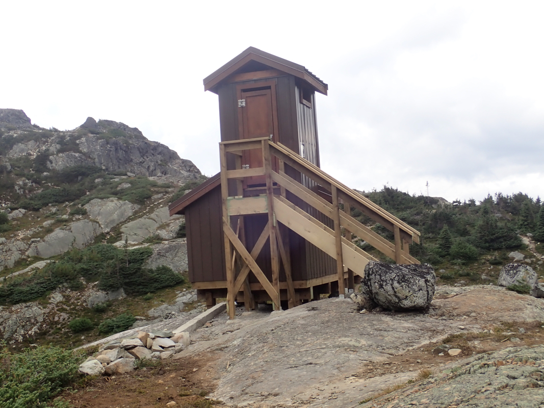
and a very strange looking WC
overlooking the lake. There are several additional
camp sites a bit further onwards, lower and closer
to the lake. You gain about 1150
vertical meter on this leg of the route.
Red tape:
One is supposed to reserve and pay for a camping slot. This is essentially impossible for people
that do not live in the Vancouver area. When we were there, no dates available in the next 5 weeks.
Route from the lake to the summit:
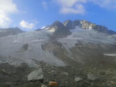
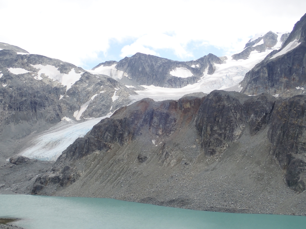
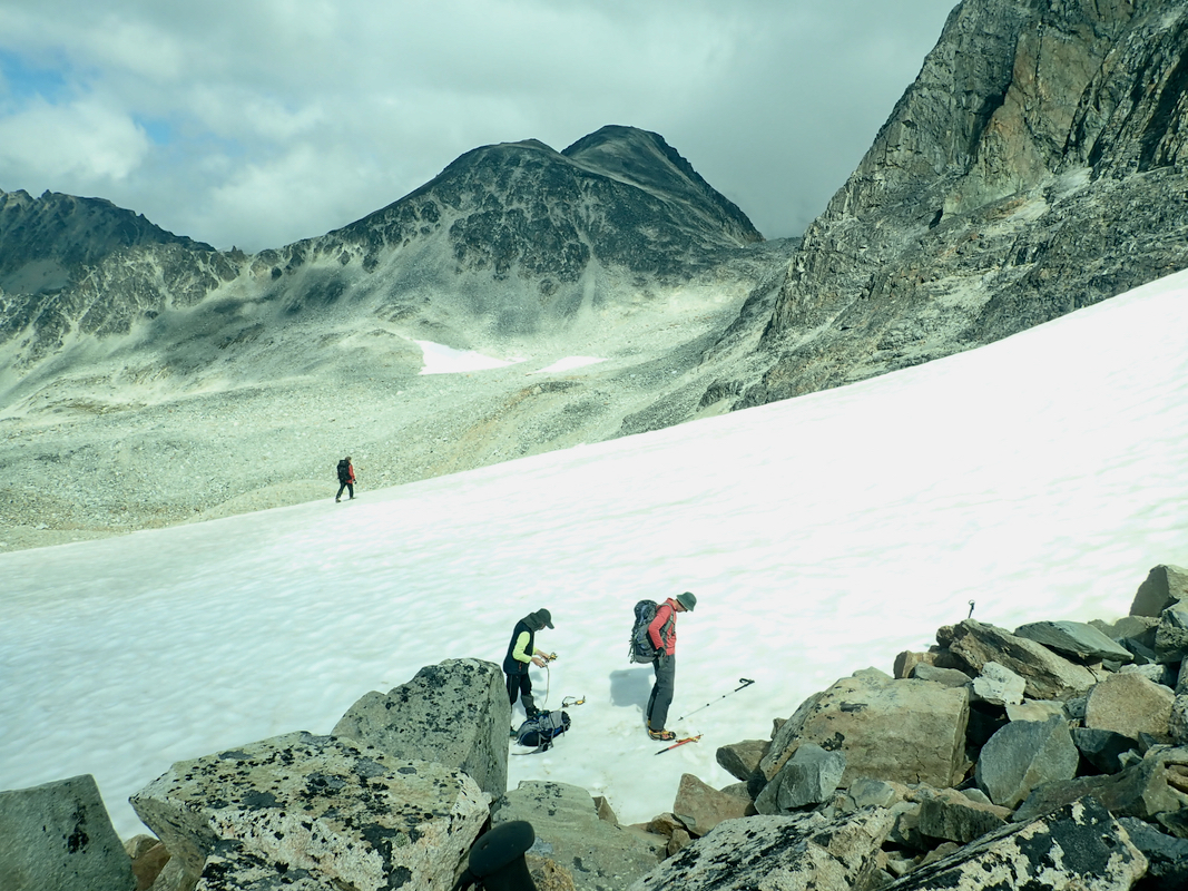
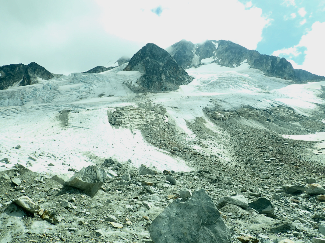
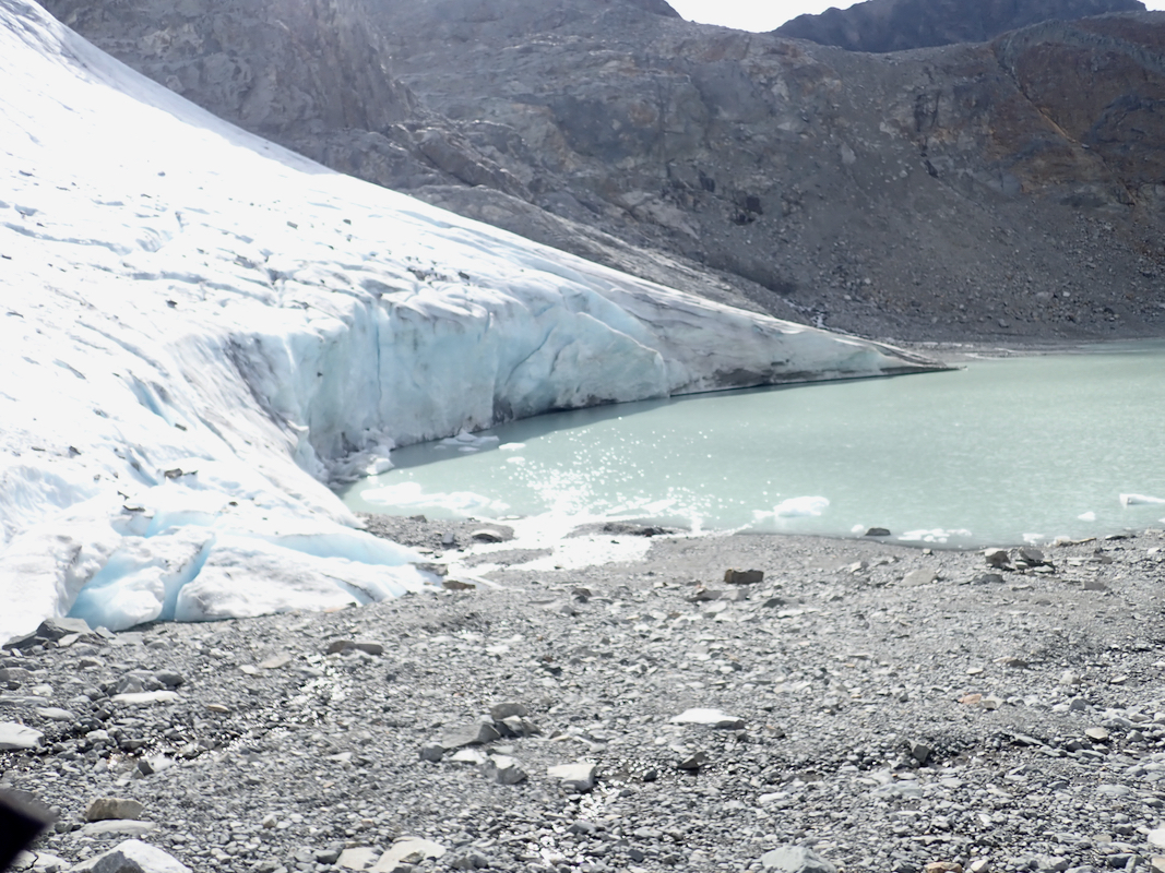
Hike on a trail to the lower end of the glacier.
Proceed a bit up along
the rocks and pick a convenient place to get
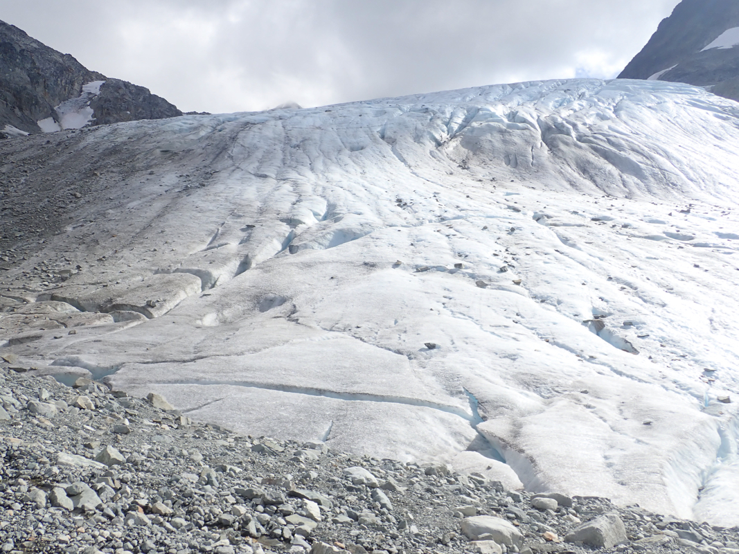
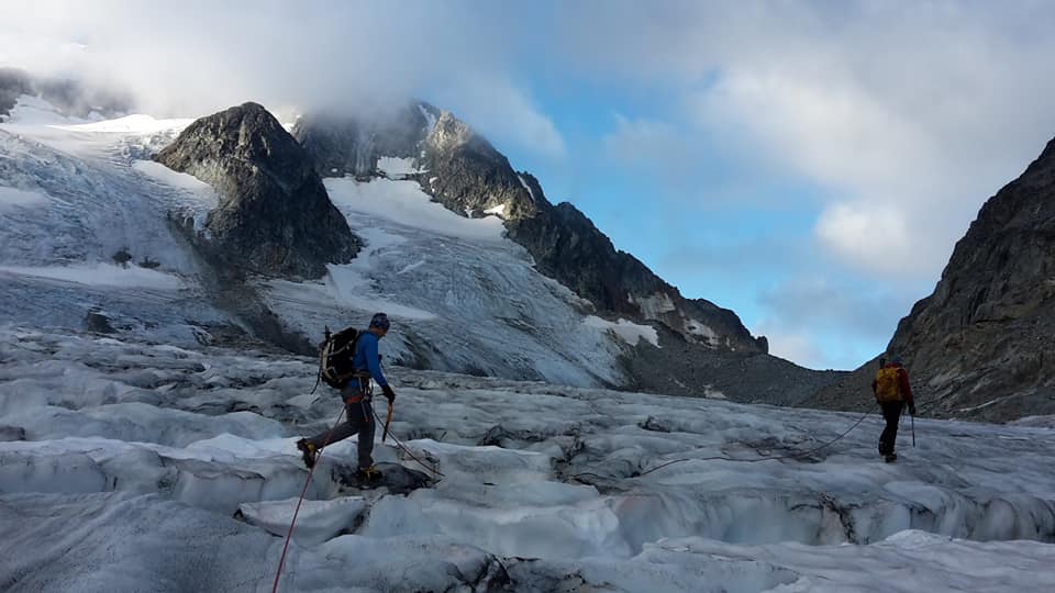
onto the glacier. This glacier
has crevasses, but it is not difficult to find a route
up and across the lower part
in order to gain the col between Parkhurst Mountain (north) and Wedge Mountain.
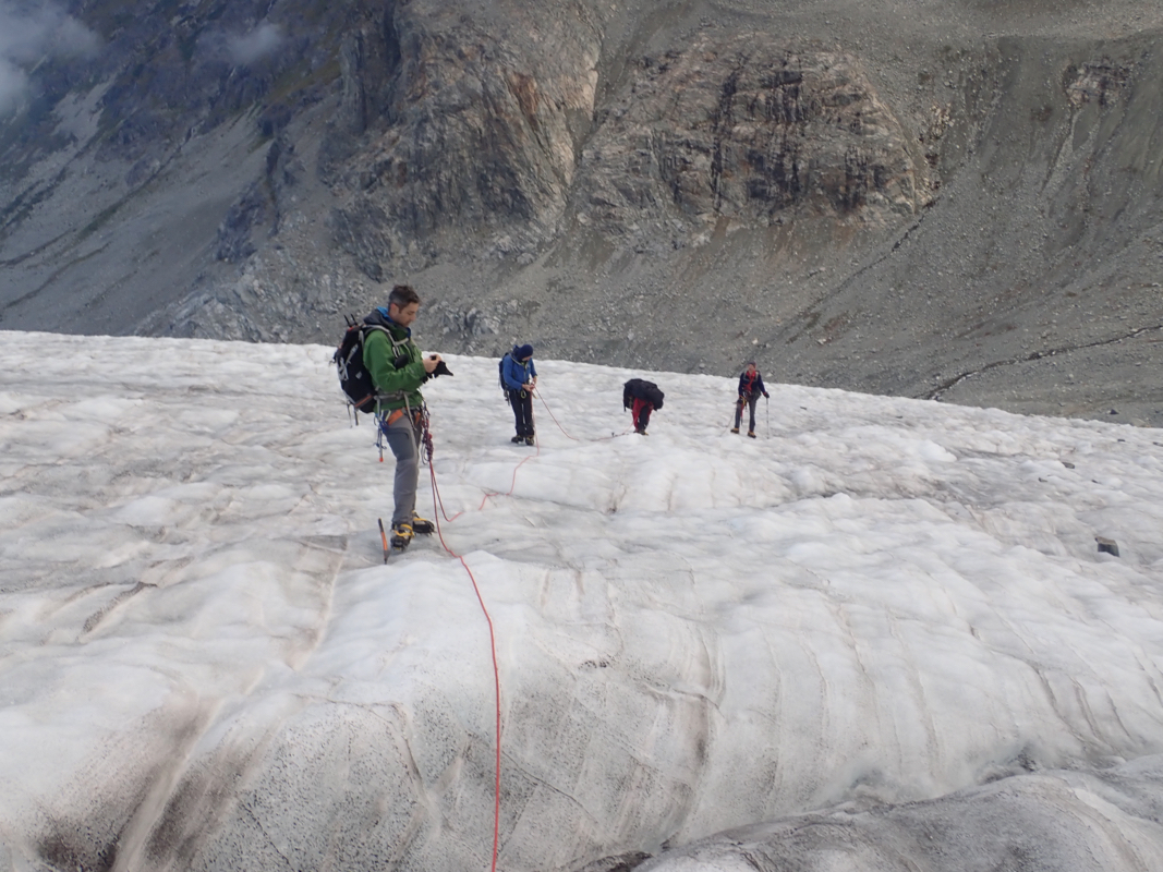
Obviously, any team should use a rope and have crampons and ice axe when crossing this
glacier.
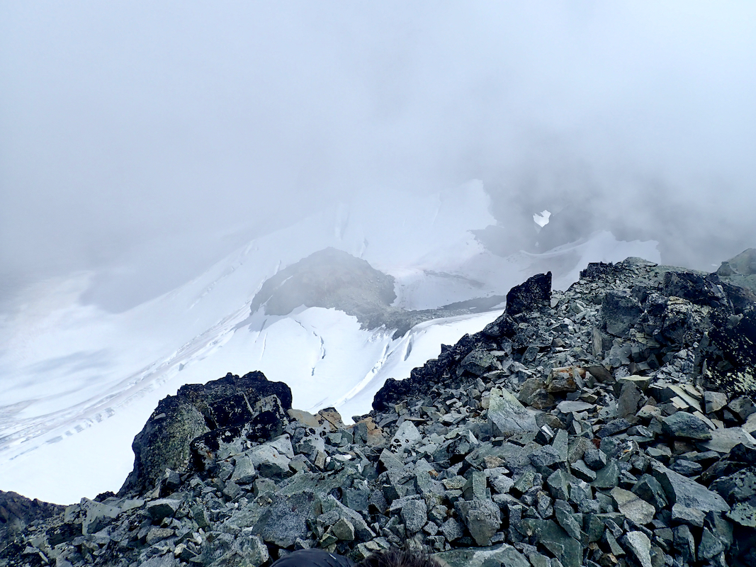
Next, ascend to the col a bit higher than 2300 meter and descend on the other (west) side.
Do not traverse in order to keep your elevation, it is best to just descend, aiming for a
very distinct snow ramp that gains a pretty distinct ridge as seen from the col. Ascend this
snow ramp and gain the ridge. Crampons and ice axe are needed. The snow is moderate, slightly
steeper as you curve right near the top.
This ridge now leads (pretty flat) directly to the broad west ridge of Wedge Mountain.
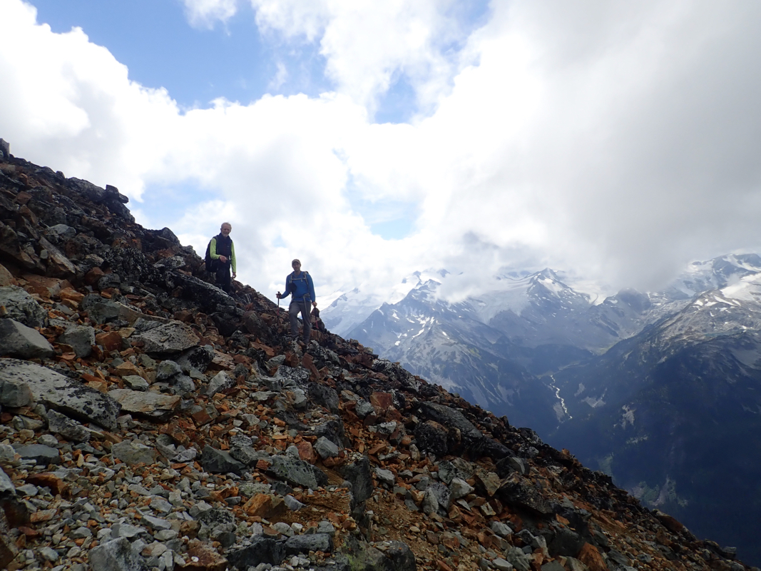
Ascend up across an initial section of talus, quite many rocks are a bit unstable and move
when stepåped on. Higher up, one may follow a rock rib or ascend on more scree, then more
talus near the top of the slope. The route finally gains a broad and fairly level north-west
ridge that may be easily followed to the summit.
Comments:
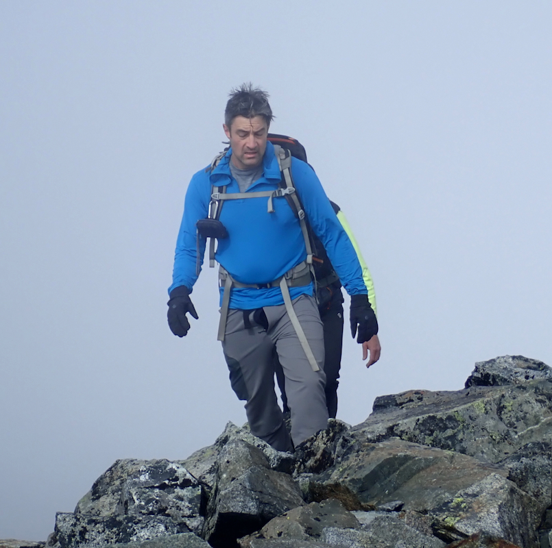
I did this climb with Åke Dahlen, James Barlow, Rob Woodall and Pete Ellis. After a motel
stay in Pemberton, we drove to the trailhead and started up the trail around 1000. The climb to the lake took
about 3 hours (with a rest along the way), arriving there around 1300. We had no prior information
about the red tape with advance reservation if one wanted to camp. We carried two tents, but in order
to avoid camping, since a permit was impossible to get, we stayed in the small hut.
The next morning, we started out already at 0600.
We knew it would be a long day. Åke and I were
near the end of our trip, having flights back to Norway already the following day.
I had no difficulties navigating across the glacier
and we made the col south of Parkhurst Mountain
around 0830.
The snow ramp provides a nice access to Wedge, however, the remaining route up to the
final ridge was a pretty long walk on and among unstable rocks.
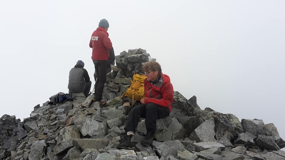
We arrived at the summit at 1130, so 5.5 hours up.
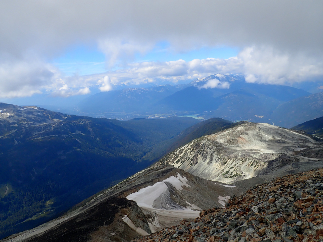
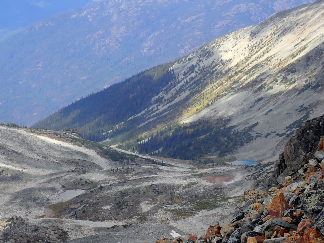
We had limited views due to clouds,
but still got good impressions of a pretty landscape.
The return hike took only
slightly more than 4 hours, back at the hut by the lake shortly
after 1600. After a short rest as well as reorganizing gear and backpacks, we started down
at 1640 and arrived at the parking at 1835. That is, an overall trip time slightly
exceeding 12 hours.
It was time to say farewell, James was returning home, while Rob and Pete intended
to head north for more ultra peaks. Åke and I drove to Squamish in order to
stay our last night a bit closer to Vancouver.
This ended my 2018 trip to British Columbia. Many thanks to my son Pål Jørgen for
good company the first 2 weeks and to my friend Åke Dahlen that participated in
the last 3 weeks. We had a nice trip
together on the Columbia Icefields.