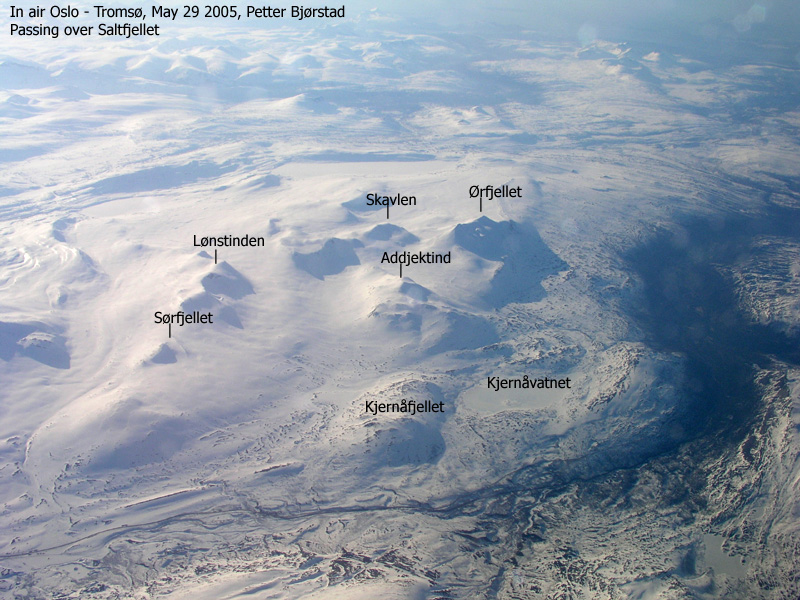
Ølfjellet
- Ølfjellet (Ørfjellet)
- 1751 m
- Primary factor 1073 m
- Location: North 66.78927 East 015.25210 (GPS on the summit)
- Saltfjellet, Nordland, Norway
- Climbed (almost) November 4, 2006
- Climbed November 10, 2012
- Difficulty: (YDS) class 2.

Ølfjellet
|
|
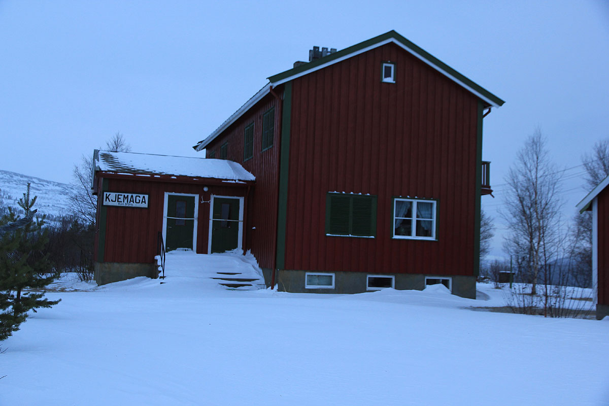
Scene: A desolated railroad station, it is completely dark, the wind is moderate and it snows.
In order to maximize my chances of success, I decided on an "alpine start", as I skied across the
railroad tracks already at 0415. With a good headlamp, I started out in the direction of a pretty
good sized lake, Kjemåvatnet (620m). I had decided to ski near the south end of this lake.
Almost immediately, I found myself in pretty bad terrain for skiing. Large (several cubic meter) boulders seemed
to be scattered everywhere. Either I discovered standing on top of such a huge rock with no easy way to
proceed, or I would be just between these rocks with snow above my knees and more big boulders blocking
further progress. Darkness made it difficult to navigate around these trouble zones. I could see the general
features of the hillside and my light was fine for local visibility. Intermediate range, which would help
finding a better route, was hidden in darkness.
I continued to struggle and the terrain got slightly better after a while. Progress was still hard, the wind
got stronger and at 06:05, I was finally approaching the lake, in the last 70 minutes I had gained 20 meter
of elevation and covered a horizontal distance of only 1.45 kilometer. "Go back" said the wind and the mountain,
"No" replied the small human in the large wilderness. I entered the lake and carefully probed the ice, it
seemed safe. The next stretch would be free of boulders, cut across the lake to a very pronounced penisula that
would serve as a good marker for where I should enter the shore. However, after only a few meter on the lake
I ran into a layer of water on top of the ice. This transformed instantly into 5-10 centimeter of frozen ice/snow
attaching to my skis. I carried a tool for this purpose. Take the skis off, clean them for snow and ice,
then reattach and continue skiing. Soon, another patch of water, forcing a repeat of the procedure. I got
closer to where I should get back on land and yet again more water, more ice and another stop to clean the
skis. My route headed gently uphill to a saddle at 728 meter, gradually daylight was coming and my headlamp
could be turned off. I had skied slightly more than 5 kilometer, the time was 07:39. Almost 3.5 hours of really
hard work to gain 5 kilometer is not impressive, however, I was 5 kilometer closer to the summit, it was still
early morning and the future looked brighter.
The next leg called for an ascending traverse across and up the broad valley going east between
Addjektind (1444m) and Ølfjellet. The terrain ahead was completely dominated by rocks, having smaller
patches of snow between them. The wind had picked up to gale force and yet again whispered: "Go back".
I did not much consider the proposal, it was still early in the day. The weather was not good, but I have
seen it worse.
I brought enough gear on this trip to spend a full night out if
the conditions should force me, a bivu-bag, extra socks and gloves, extra fleece, a snow shovel for digging a
shelter etc.
I sent a few thoughts to how I would manage an unplanned night, decided that that would not be
a very difficult situation, then pushed on.
Crossing the main creek coming down from above, I noticed it was partially open and made a mental note that I
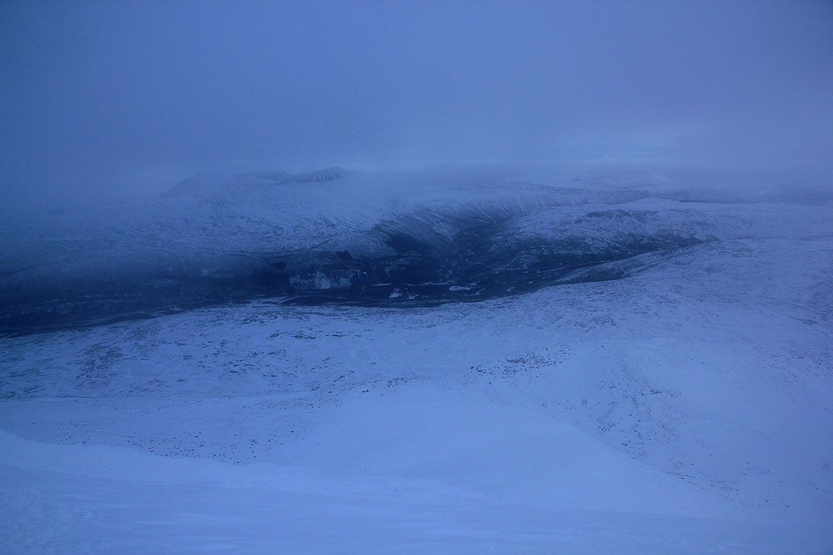
could count on filling up more water here on my return. The mountain was completely hidden in clouds/fog, this
was unfortunate, as I had no reliable information and needed to make some decisions about which ascent
route to follow. Suddenly, my ski felt loose. Open binding, no, the screws that attach the binding to the
ski had come loose. This is potentially serious. I carried a repair kit including spare screws as well
as screwdriver etc. A major repair stop was called. Again, there was "an inner voice" testing: "Go back",
after a few moments of reflection on questions that started with "what if?", I firmly continued my
traversing ascent, zig-zag-ing between all the rocks.
I arrived at the base of the mountain, skiing on its south slope improved considerably, the wind was weaker
and I felt confident that the trip would achieve its objectives. It was a grey and windy day, but I felt
fine and very much alive. An important decision was coming up: What route would be best in order to make the
climb all the way to the summit on skis? The mountain slope disappeared directly up into the low clouds preventing
me from any views of the possible routes with respect to skiing and steepness. I took a second careful look
at the map and a route that I had briefly discussed with Arnt the day before, seemed to present itself
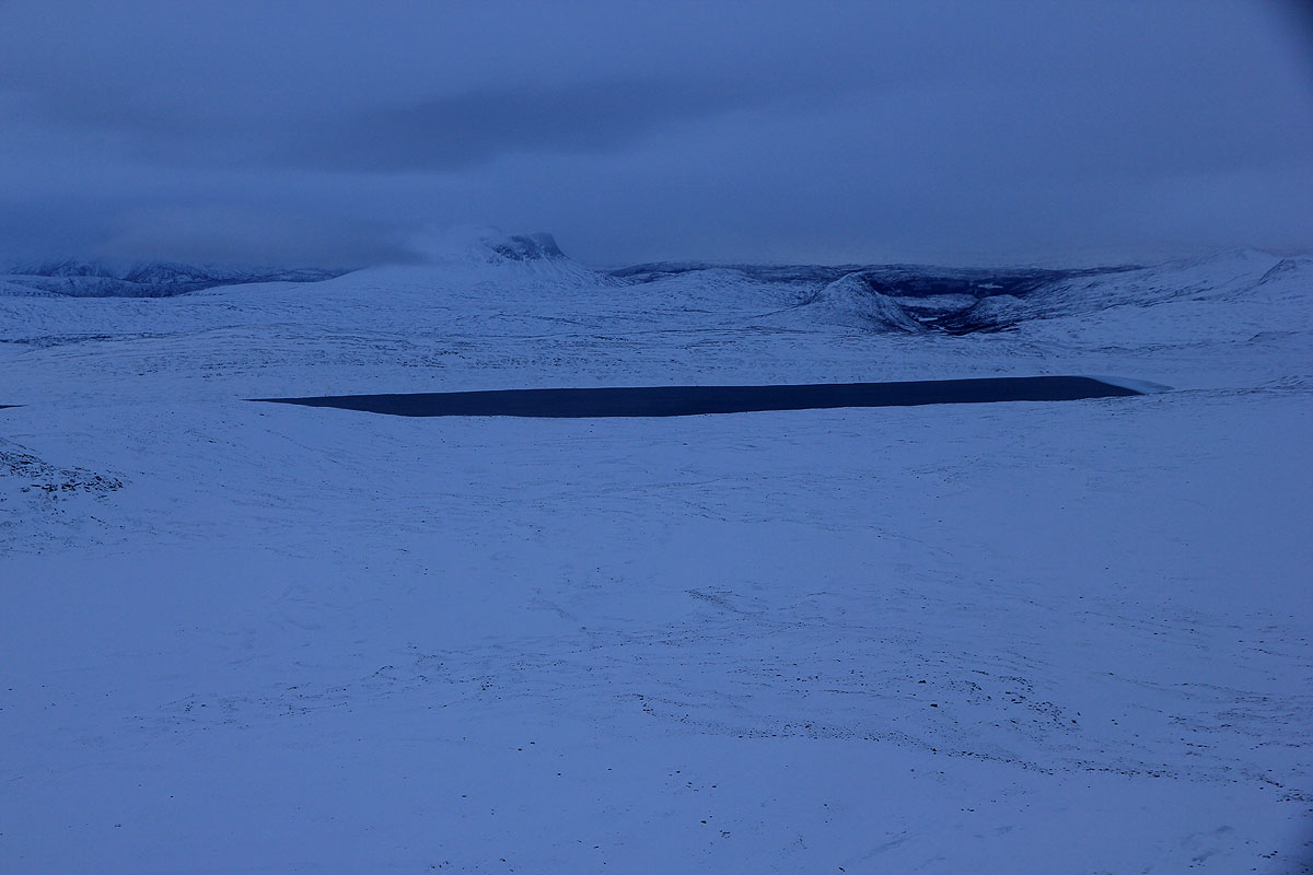
as the safest option. Ski around on the east side, through a local saddle and near a small lake, then climb
a more gentle slope to the top of the north ridge and follow this ridge to the summit. I had originally
planned to ascend from the south, then possibly move out to a high east shoulder, the steepness of this
route was unknown, however the north ridge looked safer. The north ridge would be quite a bit longer, but
with my early start, time was not really an issue.
With a firm plan, I quickly reached the small saddle and located the lake below. I tried to keep some
elevation by contouring in the slope west of the lake, however this was a pretty steep area with big boulders
and overall it would have been better to just loose these 40 meter of elevation. The weather now took
a turn for the worse. The wind increased to gale force and there was considerable snow drift in the air.
As I climbed higher on the east slope, I was engulfed in the clouds and visibility was limited to the nearest
rocks on my slope. Again, the wind whispered: "Go back, this is no place to be for a human today." Forced
to assess the situation, time, snow slope, physical condition, I concluded that there was no reason for
abort and that the summit now was within range.
I skied among giantic boulders, then hit a steeper snow slope that required a traverse and avalanche
considerations. There had been a recent snowfall, temperature change and wind, so steep snow slopes
without any signs of rock should be approached with respect. The current slope seemed OK, I could avoid the
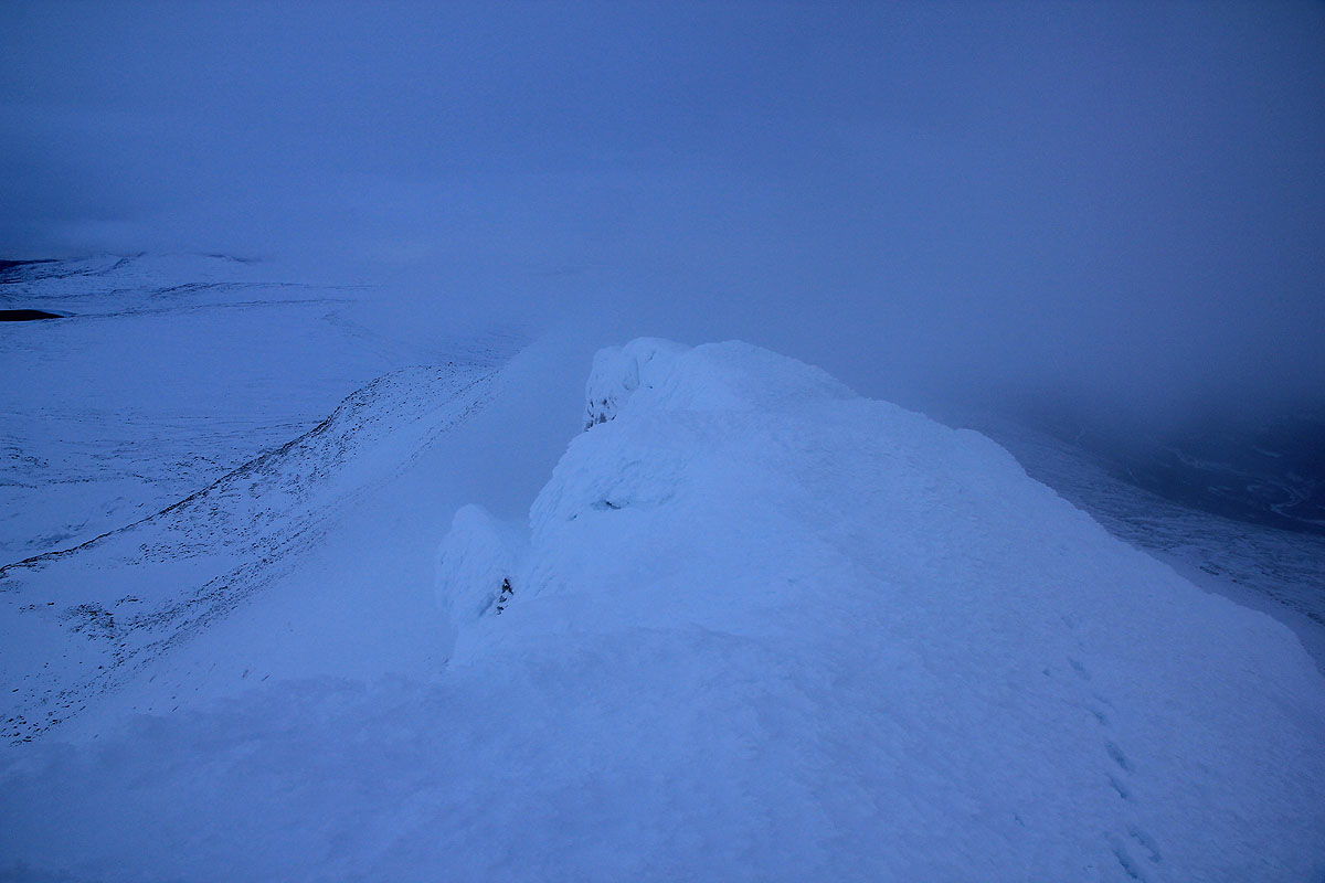
really steep part and in a few more minutes I topped out on the north ridge, a major milestone.
The ridge towards the south summit climbed gently, had a steep wall on its left and a more gentle slope
to the west. However, it was full of large boulders and skiing looked complicated. I decided to leave the
skis and continue on foot. Easier said than done, the snow between the boulders was very deep and progress
along the ridge became a struggle. After almost one hour, I had only advanced about 150 meter, the ridge
looked more agreeable, but covered by deep snow. I took the hard decision to return to my skis and ski
the ridge instead of walking. Bummer!, more than one hour and lots of energy wasted for no gain.
The skiing was just as hard as it originally looked, but clearly better than walking. I got back to
my "highest point" and continued beyond with somewhat easier skiing. Good, it seemed like the summit
would be mine in at most another 30 minutes.
The ridge turned more rocky and less suitable for skiing. Shortly, I had to leave my skis and continue
on foot. This time, there was really no choice. The snow was still difficult to cross on foot, but I made
steady progress and the distance remaining was indeed short. The fog was dense and the wind pretty strong.
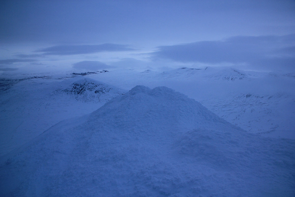
A few shades that gradually became clearer, slowly showed a significantly steeper ridge ahead. More signs
of trouble, a steep cliff also on the right hand side. I got all the way to the base of this steeper section,
to make things more complicated, the ridge also had a layer of ice as it rose ahead. "Go back", said the
mountain, it did not whisper any more, the message was loud and clear.
I considered my future; a steep and icy ridge, bad wind and snow drift.
It had taken me almost 9 hour (one way) to get here.
I carried crampons and ice axe, this would definitely be needed.
The terrain ahead would take time, my latest turn around time at
1400 would be exceeded. Of more concern, how safe would it be to solo this ridge under the prevailing
conditions? The steep and forbidding cliffs on the right were unexpected and unpleasant. A slip on the
section ahead would not be acceptable. My skis were further down on this ridge,
thus a safe, solo downclimb would also
be required. Any alternate route down would not connect with my skis.
My fingers were not very warm, but nothing to worry about right now.
My conclusion was about to change. "OK mountain, you are right" said the
small human and reluctantly turned around and started do retrace his foot steps
as he slowly descended the ridge.
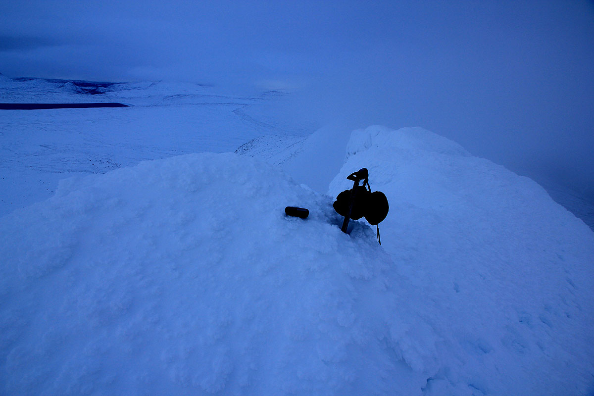
This was indeed unfortunate. I turned at 1690 meter elevation according to my GPS.
Thus, only 60 vertical meter remaining. With the steepness of that last section, this must
have been what was left. With somewhat less time in the early morning I would have tried
a more direct approach. This is appearently what one should do. Climb the slope on the south,
bear east as the slope steepens and reach the east shoulder. From here to the summit there
is no dangerous ridge, however the steepness of this east facing slope might carry an
avalanche hazard if (wind) loaded with snow. Most likely, that slope still had visible
rocks and a snow cover that would be safe.
I returned back down to the lake, traversed across to the 728 meter saddle along a somewhat
lower (and better) line than on my approach. A good rest with water as I crossed the open
creek was also welcome. It got dark as I arrived on the upper slopes of the large lake.
I decided to cross it more directly to an area with some cabins. This would be a slightly
shorter route, possibly I could find a ski track from the cabins. As I set out, the weather
now improved considerably. The wind died down, the moon came up and illuminated the landscape.
I succeeded getting onto the lake without running into water on the ice. In fact, the long stripes
of wet areas could be seen reflecting the moonlight. I set a course across and soon discovered
that there was light coming from the windows of a hut on the opposite side. This would mean
people and therefore also a track to follow back to the train station.
Three men had come up on Friday and planned to stay until tomorrow Sunday. They had been
out looking for ptarmigans, so far they had gotten three. They had seen my tracks near the
southern end of the lake.
I stopped by for 10 minutes drank some water, told them about my day as they told me
that the normal route indeed went up from the east shoulder. I said farewell and
skied their good track. (A 4th. member of their group had skied down just hours ago.)
Arriving back at the train station and my car at 1900, 14:45 hours, perhaps the longest
first ski trip of any sesaon I could remember.
I stopped by the hotel, paid for the DNT hut and ordered dinner. A call was made to Bodø
in order to reserve a hotel. The two hour drive back ended a long day. I booked an early
ferry for the next day, determined to make an attempt on Eidetinden
before flying south to Oslo and Bergen.
2012 climb.
The small human was back, he was 6 years older, but carried experience from the 2006 epic attempt.
It would only be fair to make a new attempt in November. The days are short and the snow is often
deep with no crust layer to prevent you from sinking in.
I arrived in Bodø almost 3 hours behind schedule. My taxi driver in Bergen ran out of fuel on his way
to the airport. I lost my flight and had to buy a 4000 NOK new ticket on the next and last possible flight to
Bodø.
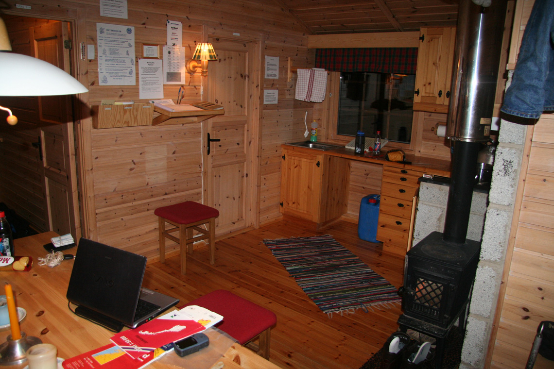
I stayed at the Storjordstua DNT self serve hut. Really only slept there, but it is very convenient
located for my new trailhead. I started out towards the small forest road that runs uphill to the railroad
around 0700,it was still dark.
I had breakfast in the car, then discovered that my ski bindings were set for another (longer) boot.
I carried the tools for adjustments, however, the time was already 0800 when I finally got started.
Unfortunately, this road was not plowed and I had to start quite a bit
lower than what my plan called for. It was heavy going uphill while breaking trail along this road.
I made the railroad at 0900, one hour after starting.
Above the railroad, the terrain was pretty messy, but the best route runs next to the telecommunication
tower that one may see from the railroad station. Higher up, skiing got easier and I made good progress up
towards the east shoulder of the summit. There was no sun and clouds were obscuring my view. I parked my
skis about 200 vertical meter below the summit, it looked like going on foot would be easier, in particular
downhill.
The last 200 vertical meter turned into a struggle. The snow was not in any way compact and I kept
falling into deep holes between boulders. I had left my backpack with the skis, so only camera, ice axe and
crampons. Finally, on the summit ridge. A steep drop on my right and what looked like the highest point on
the ridge straight ahead. I was there at 1320, so 5:20 up. I stayed around for 10 minutes. Interesting to look back
towards the valley where I started, a 1600 meter vertical climb.
The view west was pretty good,
but generally the drifting clouds obscured the view. The summit is located on a short, but fairly
horizontal part of the main ridge, the distance south is short,
while the ridge extends a bit further north.
My previous attempt was to arrive along this ridge from the north.
I was back at the railroad station
shortly before 1600, it was certainly getting dark. Someone had driven a 4WD vehicle up the road
while I was higher. Thus skiing was nice and I returned to my car by 1615.