How to get there:
The best starting point is the (old) powerplant at Hornaberg.
From Bergen, follow E-16 to Dale, then take the old road to Voss
that climbs steeply up Bergsdalen (exit right through the town of Dale).
Drive to the north-east end of the large lake Hamlagrøvatnet, then
turn right (small paved road) shortly after leaving the lake. Note that if
the lake is low (it is part of a hydro power storage basin), then this lake
is divided into two lakes. Follow the small road to the east side and park at a
large parking area next to the very easy to see, grey power plant building.
This is location N60.55819, E006.21080, elevation about 600 meter.
Note, that an alternative route is to continue on E-16 all the way to Bulken,
exit left there following the signed road to Hamlagrø. This road is about
the same distance, but of better quality to Bulken. The disadvantage is that
you pay toll before reaching Bulken.
Route description:
Follow the road that continues along the lake, south then south-west for
about 2 kilometer to Nedre Sveindalen. The road turns away from the lake here
and follows a small river, do not cross, but fork left on a big trail that
ascends gently to the cabins at Sveindalen, next to a small lake. Continue
to follow the trail until about elevation 750 meter. Leave the trail and head uphill
while traversing right. There are some gullies, you should be able to cross
above them. Continue an ascending traverse following the best line until near
elevation 900 meter. At this elevation, one may easily cross the very distinct
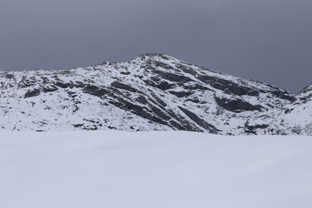
gully that separates Blå:koll from Sveindalsnuten. Next, continue ascending
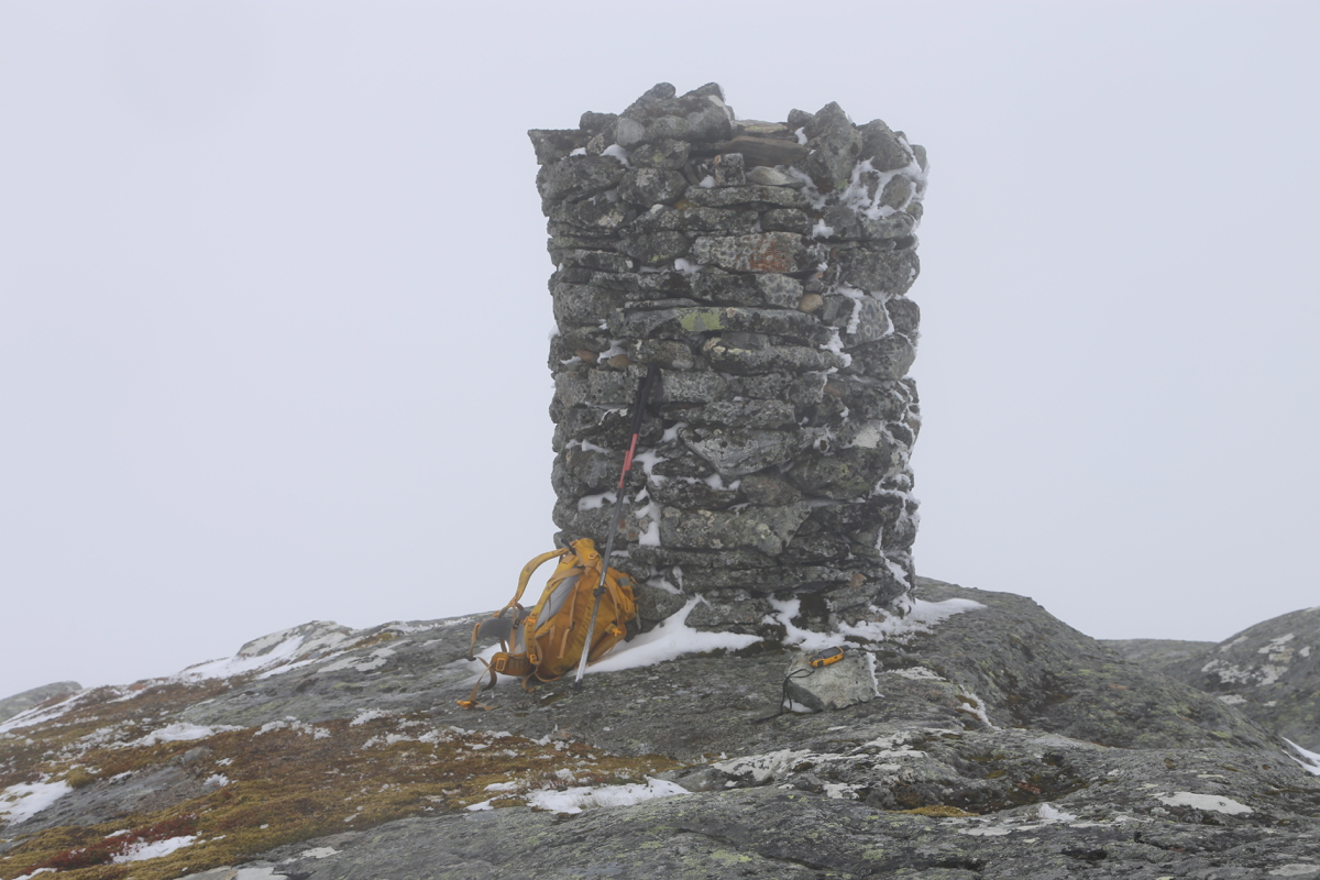
on easy terrain until you reach the summit with a very nicely built cairn. Comments:
This climb was part of a longer trip in deep snow. I had started the
day at Kiellandbu, then climbed Flatafjellet.
What remained was climbing the slope
above the Løkjesdal lake. There were
cliffs across the upper slope, I noticed a crack that looked quite promising.
It turned out that this crack extended quite a long way uphill to a small
plateau just below the final summit area.
I was on top at 1130. This mountain had a pretty tall and very well built cairn.
After about 10 minutes, I started down. The map indicated that the terrain lower
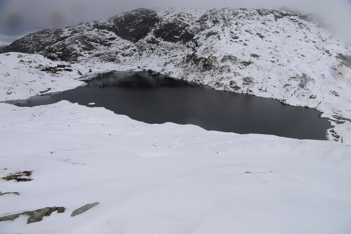
down could be steep. I therefore decided to descend into the small, narrow valley
that separates Blåkoll from Sveindalsnuten. The ideal place to cross is
very close to 900 meter of elevation. From here, a traverse onto the slope proper and
an easy way down revealed itself.
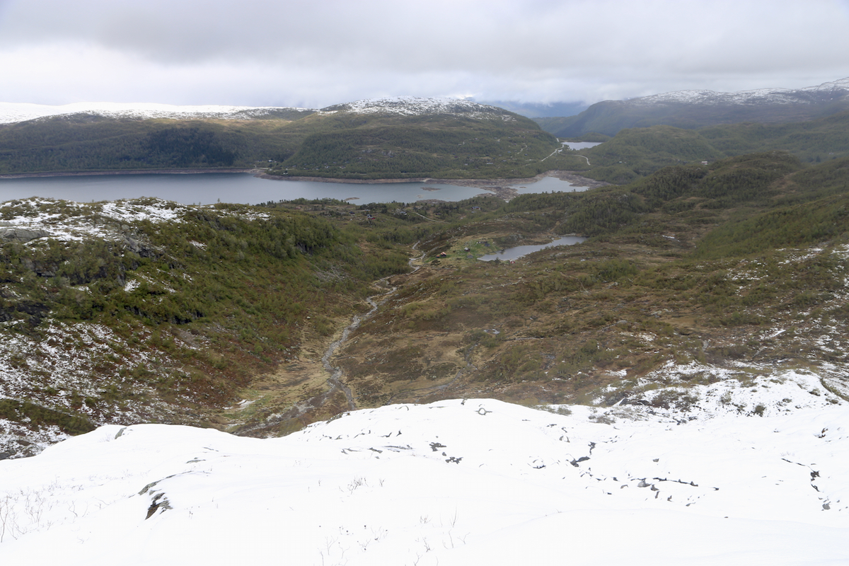
Nice to see land without snow after 2 days
of walking around in it.
I got down to the road, then followed it back to my car. Half way there, I met two
young ladies with backpacks coming opposite. They asked if I had stayed
at Kiellandbu. Upon confirming this, they were quite happy. I asked if they were
headed there. Yes, they replied. i then told them that they were now a bit lost
as the way they followed would not get them to Kiellandbu. Initially, they looked
bewildered, but quickly accepted my advice. I followed them back to the
roadfork where they should have gone left. It was indeed fortunate that they
met me before getting even more lost.
I was back at my car by 1330, a nice drive home followed. It had been two
good days, very different from what I had expected.