Travel.
If Etna was the only objective, then one would likely fly directly to the capital of Sicily,
Palermo, or even onwards to Catánia, situated on the coast near the base of Etna. However,
for me Etna was one stop on a more extensive visit to the big islands in the Mediterranean.
We had already been climbing in Corsica and on Sardina, thus arriving by overnight
ferry from Cágliari (Sardina) to Palermo on July 16. We checked out a rental car in Palermo and
drove across the island to Santa Tecla, just north of the city Acireale. This is on the coast
north of Catánia and about one hour by car from the south trailhead on Etna.
Here, we found a nice hotel,
Santa Tecla Palace, that would serve the dual purpose of a nice summer vacation resort for my wife (and
also for us in the afternoon), as well as "base camp" for climbing Etna.
Obviously, if Etna was the only objective, one could find many alternatives a bit closer. Still, the
largest selection of hotels are near the coast and the distance to Etna is not an issue if you have
a car at your disposal.
Local information.
I drove up to the south trailhead of Etna in the afternoon the day before our intended climb.
My initial purpose was to buy a good map for hiking, but once there I realized that I could
check out the legal issues as well as learning more about the volcano. Lastly, this trip
was also useful in order to find the right point of departure without wasting time on
the road the next morning.
Observations I (Is it legal to climb Etna?):
The mountain is dominated by commercial enterprises that have a very bad effect on
people that just want to climb Etna without interference. They have "guides" and they do
offer tours, however they claim (incorrectly!!) that it is illegal to climb without using
their service. Since almost every tourist that travels up to Etna will need assistance in the
form of cableway transport, and bus transport if they want to go as far as Terre del Filosofo,
the commercial enterprise would indeed not loose, but possibly gain overall if they changed
their attitude and started with providing helpful advice and facts instead of lies.
The CAI, section Catania (Club Alpino Italiano) did respond very well to my initial questions sent them by email
from Norway, confirming that no permit was needed. They could help further by removing the
official looking signs at the base of Etna south (the trailhead) that plainly states that
"anyone hiking without a guide will be prosecuted to the full extent of the law" etc. From these
signs, any visitor must believe that climbing the mountain unassisted is indeed illegal.
This may have been the case a few years ago when Etna last had more violent eruptions, but this is
no longer the case.
However, the day before my climb I looked into this matter. I first approached the hut
called "Information" (run by the guide service), then the guide office. The people there, "guides",
were consistently unfriendly and maintained that it was strictly forbidden and illegal
to climb without making (expensive) arrangements with them. Then they inevitably got themselves
into some complicated, but unconvincing talk about how dangerous it would be to hike without
a guide. I do agree that climbing Etna in the state she has right now may be dangerous indeed, but
I seriously doubt that these "guides" would make any substantial difference in this respect relative
to people that are used to making safety judgements related to mountaineering activities.
The Italian police maintains a small
but permanent presence at the trailhead. I asked if climbing Etna was indeed illegal, but after
some hectic talk with the CAI as well as with the commercial operator, he told me that I
could indeed go ahead and just climb it.
I did not understand much of the discussion between the police and the "guide", but clearly
he wanted factual proof/evidence presented that it was indeed illegal. The guide fumbled through
a pile of papers pretending to look for such a document, however without success.
It is interesting to note that the local police acted if
this was an issue they never had heard about before. With the OK from the local CAI as well as a
go ahead from the local police I had no concerns about breaking any laws, however I was prepared
to deal with more unfriendly guides on the mountain.
Observations II (Map and Elevations):
I purchased a scale 1:25.000 topo map at one of the tourist shops at the trailhead.
This map claimed to be a 2005 edition. Since Etna is an active volcano, the landscape
keeps changing and frequent updates may seem important. However, this map like many in
Southern Europe, is very hard to read as they leave out many contour lines and try to
picture the terrain instead. The added focus on craters and lava streams also destroyed
the usefulness of this map as a navigational aid when hiking. Still, one is better off
with such a map than without, any party climbing this mountain unassisted should buy one.
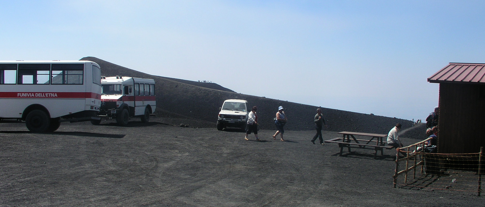
At the trailhead with at least ten stores selling Etna related
articles, as well as with the official guiding companies etc. I observed the
following elevations for Etna: 3340, 3345, 3346, and 3350 meter. Not a single
reference to the value 3323 meter that I had assumed beforehand. We accurately
measured the three summits we visited to 3326, 3324, and 3291 meter respectively.
The 3326 summit was clearly the highest summit of Etna, I tend to believe that
this is close to the actual value, that is, Etna is most likely 3325 meter high
as of summer 2005. It is perhaps typical that Etna being a tourist attraction that
normally is not climbed, the elevation is inflated by the commercial parties from
producers of post cards to the so called "guides". One should note that the "guides"
tow tourists around in the vicinity of Terre del Filosofo, however, I suspect they
almost never take anybody along to the summit. We saw extremely few footprints in the
lava sand near the summits.
The Ascent.
We left the hotel at 0415, and since I now knew the way, we arrived at the
Etna south trailhead after one hour, at 0515. The temperature at the trailhead
was 16 C. What had been a very busy tourist place yesterday was now completely quite and dark,
we did not see any other person in the area. We parked at a big parking lot with clear "P" signs located
parallel to the access road that we used. This was just east of the main tourist area.
We quickly got ready and started walking at 0520. This was near perfect, as daylight arrived and there
was no need to use our flash lights.
We started out with a good pace and quickly decided to hike up what serves as downhill ski slopes in the winter.
The service road climbed very gently in large curves and it would likely take more time to walk along the road.
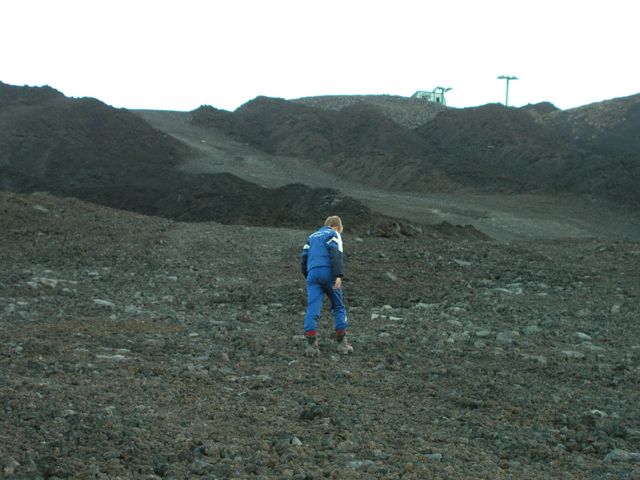
Soon, we could see the top station of the cable way. We reached it in one hour and
stopped nearby for a short break.
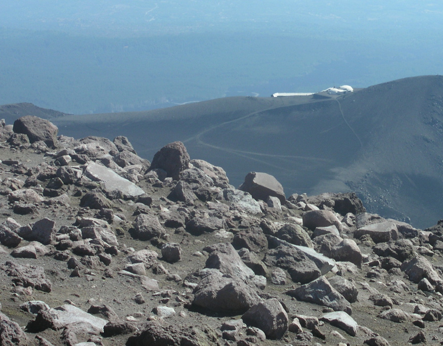
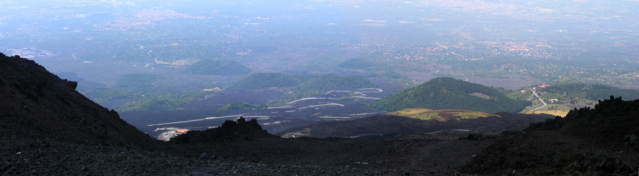
From here, a dirt road continues up through the desolate volcanic landscape in order to reach Terre del Filosofo,
the highest point on Etna that you can access without walking. In the day, the commercial operator runs a fairly
large number of 4WD buses in order to ferry tourists up to this location. For the first section, this road cuts
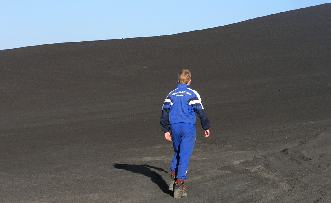
through a recent lava stream, higher up the landscape is dominated by fine grained volcanic sand. This creates
a lot of dust when the buses drive on the road. The sand is, however, easy to walk on
and in particular when
walking downhill, it pays to shortcut many of the switchback curves that the road makes.
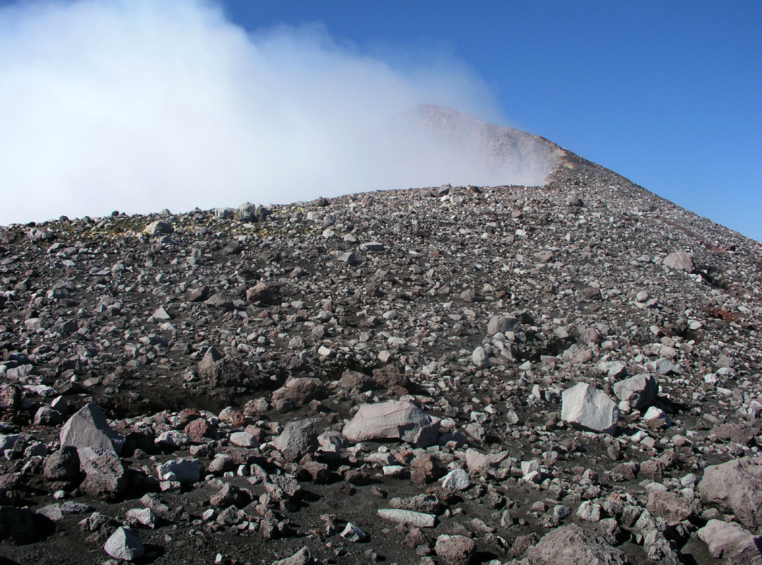
More real craters comes into view and a
sense of approaching a live volcano is definitely there.
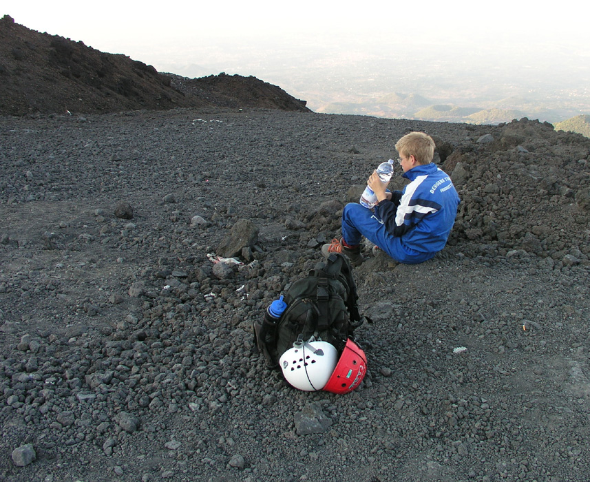
We reached Terre del Filosofo at 0730, 1.5 hours before the first tourists can start
taking the cableway from the trailhead. This place has a small hut that sells souvenirs to
the tourists. There is also a well prepared trail to a nearby ridge where tourists are
"guided" on a small walk from the bus. We rested and looked at the terrain ahead.
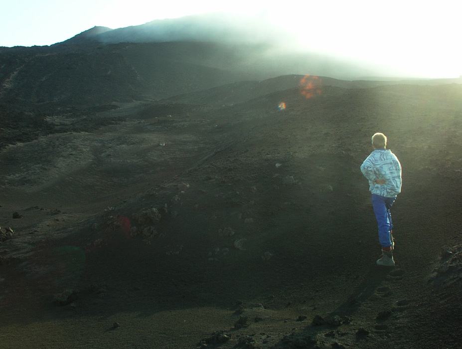
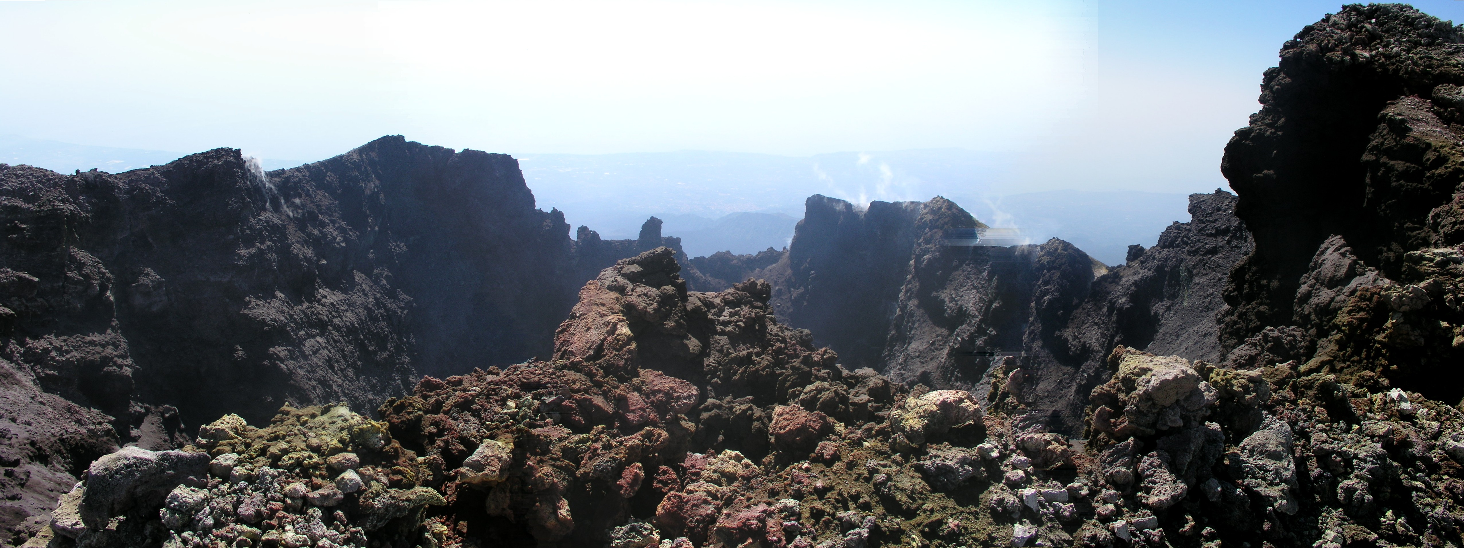
Things did not look completely straightforward, a huge plume of sulphur smoke is coming
from one of the higher craters and the wind is pushing this smoke down the west side of
the volcano. There seems to be two alternatives, either continue a traverse across the west
slope along a pretty distinct trail or climbing a small valley that gains elevation almost
immediately. The first choice involves crossing the smoke, while the second choice will
get us higher, but not necessarily to the summit. After considering this and consulting the map,
I decide that we shall at least try to complete the traverse that will bring us further
north. We start out and soon find ourselves inside the sulphur smoke. Coughing is
unavoidable, but we see that the air is clearer if we just continue a few hundred meter
further along. The thickest smoke is higher up, we "sneak under" the worst and after some
more coughing finally emerge into cleaner air on the opposite side. We rest after 3 hours, then
find a trail fork as indicated on the map at 0830.
From here, we head upwards.
The trail quickly vanishes, it is pretty obvious that very
few and infrequent visits take place on this upper part of Etna.
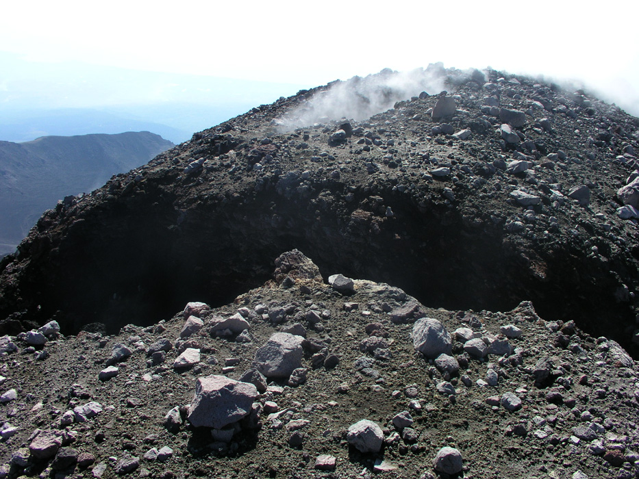
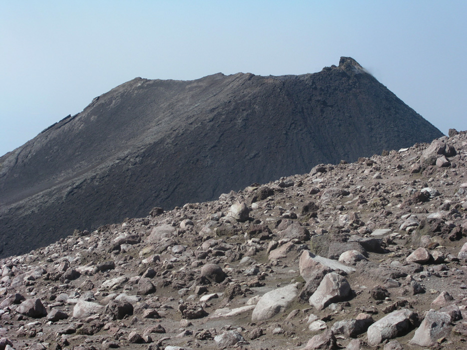
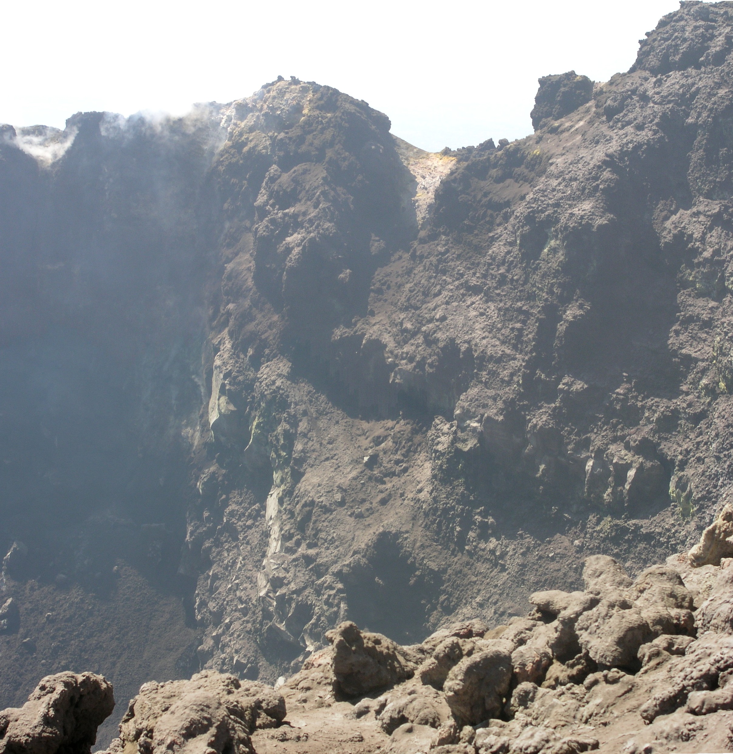
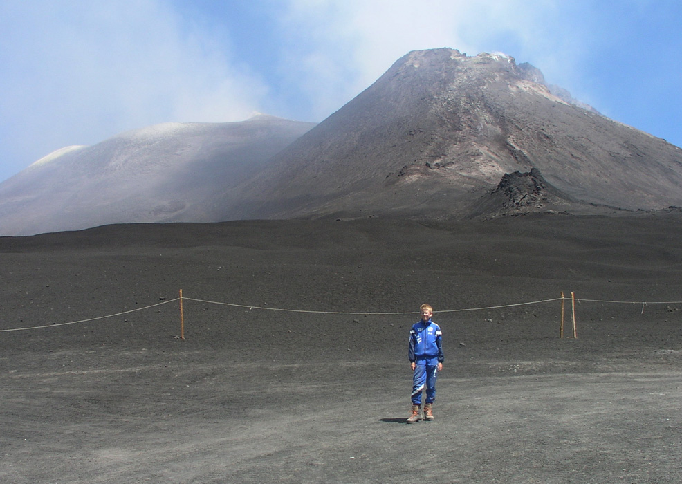
At 0900 we reach our first summit,
this is part of the North-East crater, the GPS reads
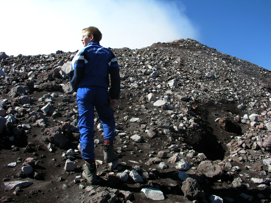
3324 meter. Smoke is coming up through cracks in the ground,
this is definitely not a friendly place. These cracks look like crevasses, warm instead of
cold, most likely at least as dangerous to fall into. We look around, it appears that we
are on top of Etna, the only possible higher point appears to be the oppsite side
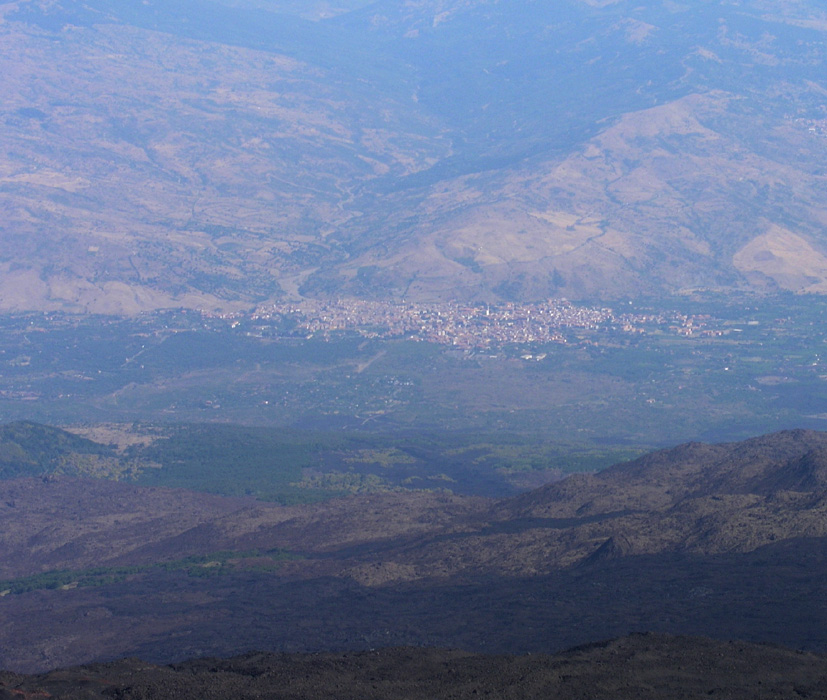
of this crater. There is a good view down north to a village,
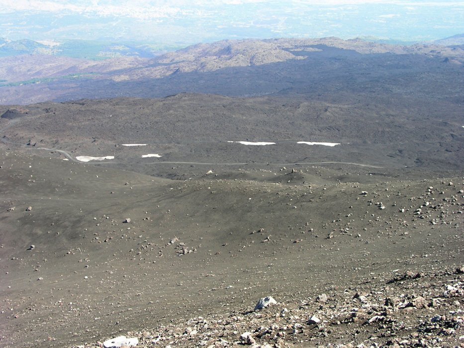
possibly Randazzo?. There are also patches of snow
on this north slope, most likely the
southernmost July snow in Europe.
The bad news is that it is this crater that produces all the sulphur
smoke. Smoke is pouring out of the crater
as from 1000 steam engines, the wind is pushing
it all towards the west. Most of the smoke clears the opposite high point on the rim by
going slightly on the south side. There are also huge quantities of smoke that rises well
above the rim before drifting west.
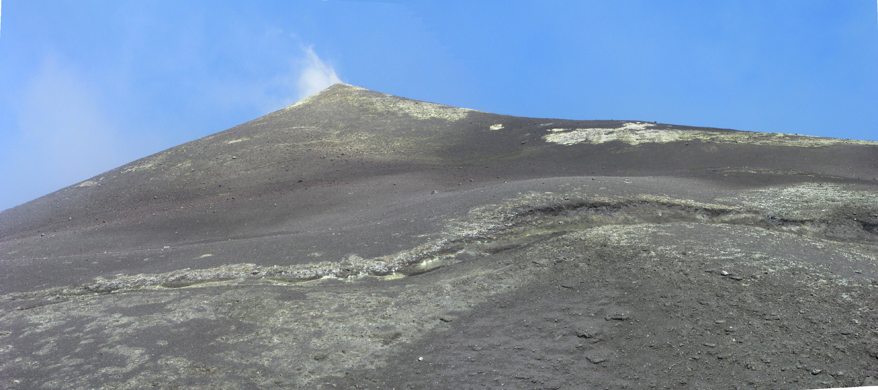
We descend from our first summit point and look ahead up along the rim
to what
looks like another candidate for being the highest point of Etna. We realized that a summit visit here
must be short and swift since the sulphur gas is engulfing this part of the rim regularly. We decided to
leave the backpack and most everything else lower on the rim, then watch the wind and the smoke and
make a dash for the summit point when the conditions looked ok. It turned out that this was easier
said than done. Although we only needed a net gain of about 20 meter, the distance along the rim was
long enough to require too much time. Each time we were between half and two thirds of the way to
the top, the sulphur gas would return and chase us back down the rim in order for us to catch some
clean air. After 3 or 4 unsuccessful tries we reconsidered the strategy. I suggested that we traverse the
steeper slope at about 3300 meter of elevation in order to position ourselves directly below the
highest point. The distance to the summit would be shorter, however, the slope much steeper, consisting of
loose volcanic rocks. From this location, the smoke would drift across above our heads, an escape back down
could be fast, more or less a local rockslide. In fact, rocks would roll all the way down this slope so
care was needed in order to not end up in a more unpleasant slide ourselves.
Initially, we did not have much more luck here. The two first attempts brought us closer to the summit
than ever before, but short. Tumbling down coughing with rocks rolling, the whole scene was pretty
unreal. My thoughts went to some form of new, crazy competition: A fast dash up a 35 degree slope with
only loose rocks at 3300 meter of elevation. As you got closer to the finish, increasingly denser
sulphurous gas would kill your breathing and throw you back down the slope, - what an insane activity
this was. On my third try, I got an early start, the sky stayed blue and suddenly I stood on top.
A brief look around, everything seemed clearly lower. In particular, the crater slightly west and between
me and the South-East crater was definitely lower. The gas returned, but I could now just stop
breathing for a little while. I took a GPS waypoint, then turned and stumbled down,
having held my breath for about the last minute. Pål Jørgen had been behind from the start
and did not make it up until the sulphur pushed him back down. On his fourth attempt, Pål Jørgen
again turned back about two thirds of the way up, however, watching his attempt from below, I saw that a new
clear period would arrive and shouted to him to turn around and head uphill again. This worked and he
successfully got a clear moment at the summit, somewhat longer than what I had experienced. The time
was 0930 and we had both successfully made the highest point.
We now returned to the lower col between the two crater high points and rested. The GPS reading at the summit
was 3326 meter, 2 meter higher than on our first top. Satisfied with this we considered traversing the high
plateau and possibly giving the South-East crater a visit, as it looked quite high, but lower when observed from our
current high point.
Traverse and further explorations.
There was a flat area of rocks between the two high points, nearer to our first summit, while the proper
deep crater with all the gas was closer to our last and highest summit. Thus, it looked feasible to walk between
the two summits and head in the direction of the South-East crater. An
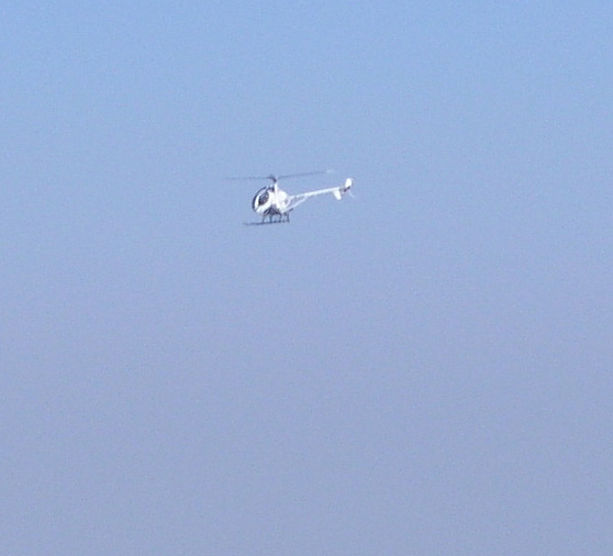
helicopter flew across nearby, it looked as if it carried tourists that probabely paid quite a bit
in order to see the volcano summit area. While hiking below our first summit
we had a very good view across the entire plateau. Soon, we also got the North slope
buildings in view. The South-East crater came into view and
we decided to try climbing it, then descending back down into the col between it and the rest of Etna and make our
return hike to Terre del Filosofo from that col, thus avoiding any more sulphurous gas. A traverse of a pretty large
slope, partially loose got us into the saddle a bit lower than its highest point, but in a place from which a good
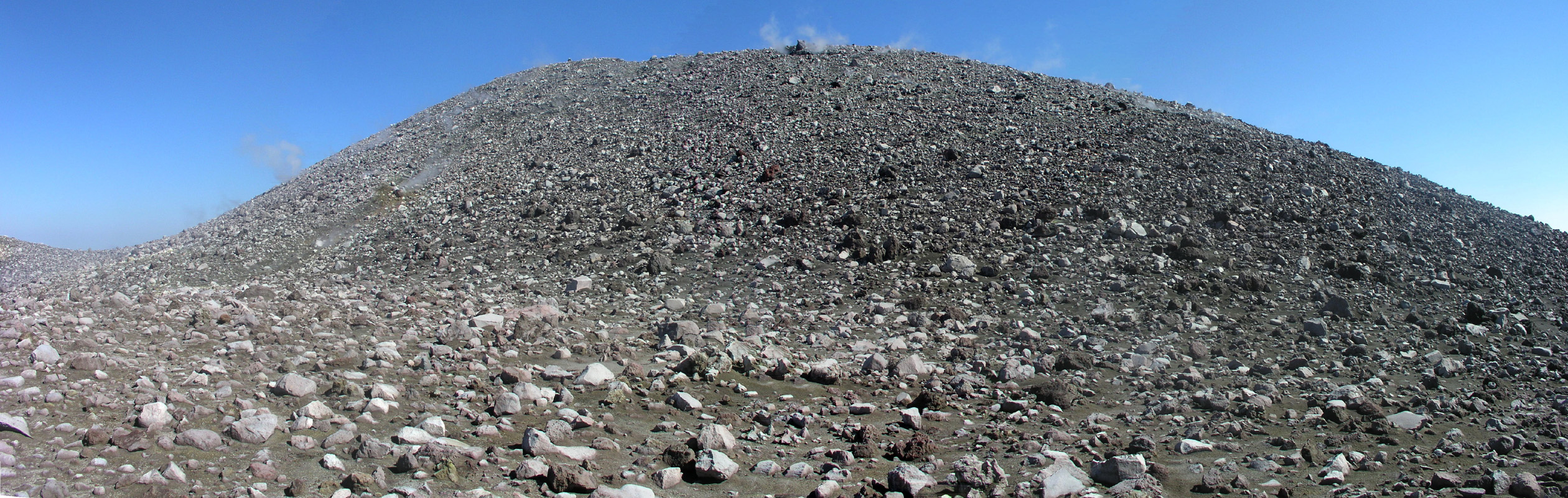
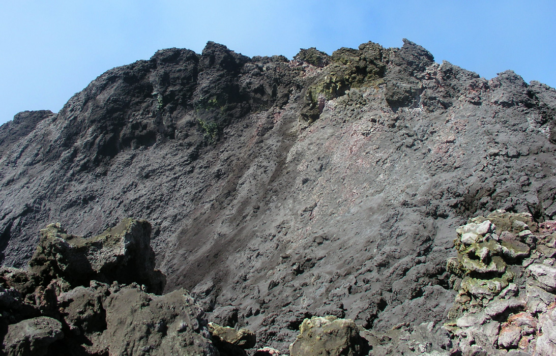
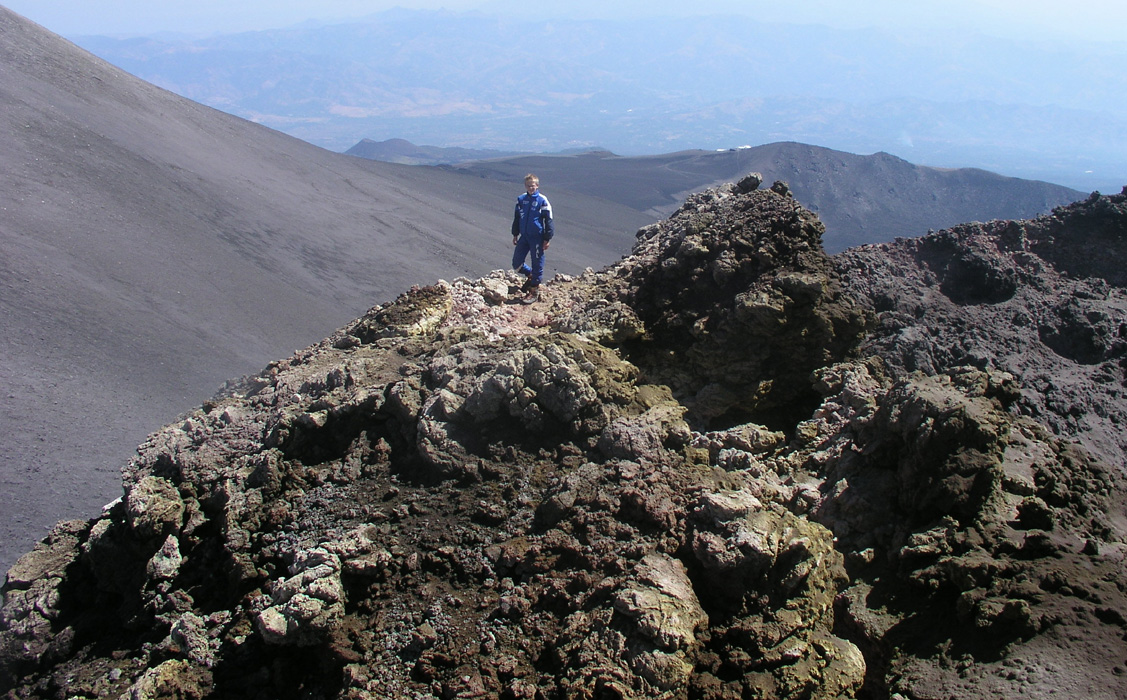
line of ascent to a ridge could be made. We advanced up this ridge and arrived at the crater rim.
It was easy to see
that this was an active crater. Sulphur gas, but in smaller qualtities. More cracks everywhere and more colors, we could
feel that the air temperature was higher here. Advancing towards the high point of the rim,
I descended into a small notch, then immediately realized that the rocks I stepped on was at least 100 Centigrade hot.
The smell and gas was also overwhelming so I quickly jumped up to higher ground on the other side.
Pål Jørgen noticed this and decided to remain on his (safe) side of this notch, we were very close to the
rim highpoint anyway and the GPS showed that this crater was not an independent (100 meter prominence) peak, despite
looking like it might be this from the North-East crater area. I got a good look at the entire
the crater standing right next to the crater high point. Subsequently also a scary
look into the crater as well. The highest point was essentially a single rock that looked teribly unstable. In fact,
a lot of attention was needed, partly to large cracks, partly to unstable blocks that easily could collapse
into the crater. I touched the high point and quickly returned to Pål Jørgen, stepping quickly across
the "sauna notch" in the rim. From here, we also had a pretty good view to the point that we did not visit,
an area near the Central crater. From here, it seemed pretty clear that this
was the third highest point, most likely slightly above 3300 meter.
The Descent.
We descended to the col between the South-East crater and the rest of Etna's highest area.
From here, hiking was easy.
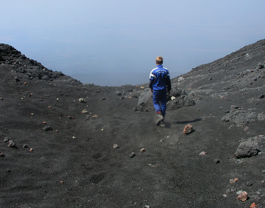
We quickly continued our descent, again in volcanic sand,
a welcome change after all the loose rocks we had been fighting the alst couple of hours.
We were back at the Terre del Filosofo at 1050 and took a well deserved lunch break until 1120.
Tourists kept arriving by bus and some started out on a well designed path that extended from this hut in the opposite
direction of the high Etna. Tourists in all sorts of shoes and clothing, yes they most likely do need a guide even
to walk on the short "designer-hike" nearby. We waved goodbye to Etna and headed downhill at 1120.
Soon, we could again look down to the trailhead with parking, tourists and souvenirs, all
in large quantities.
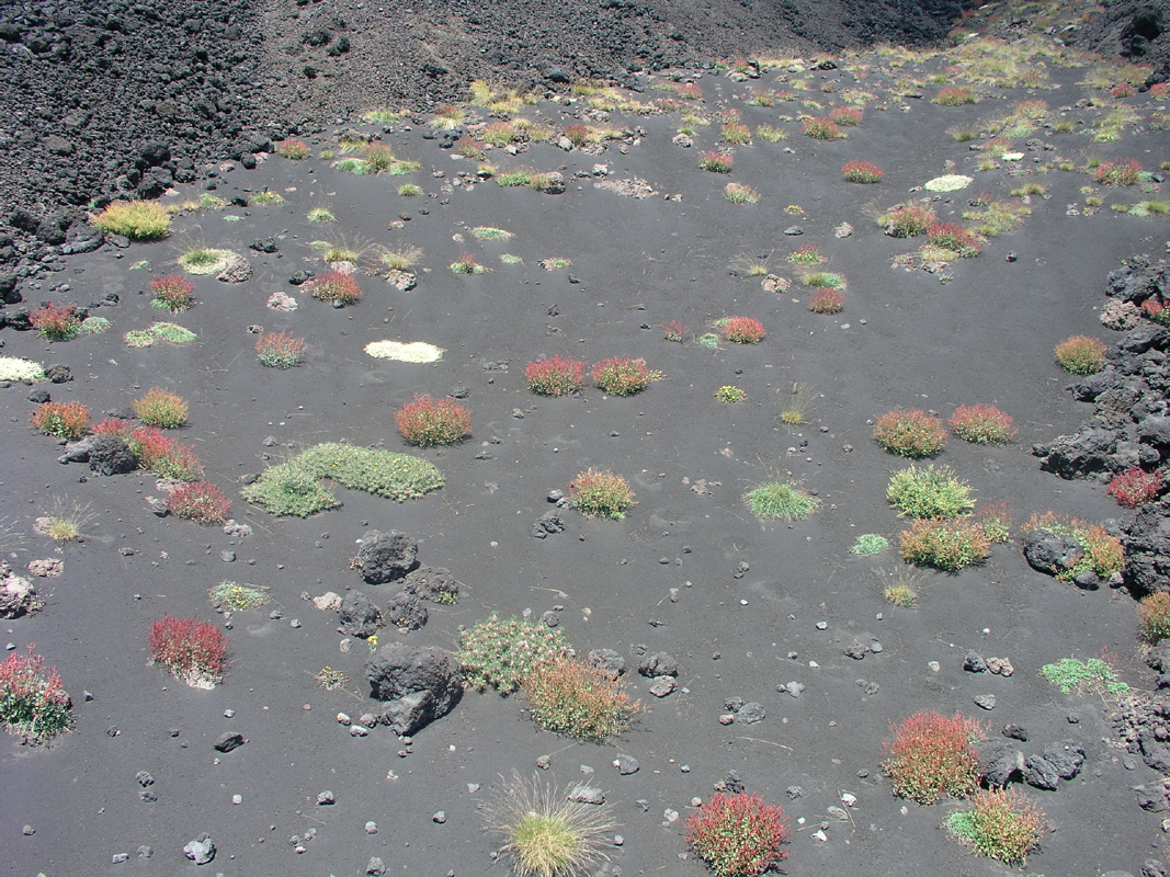
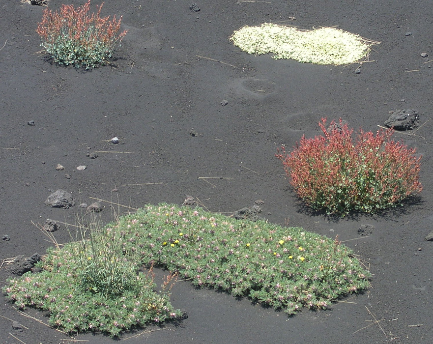
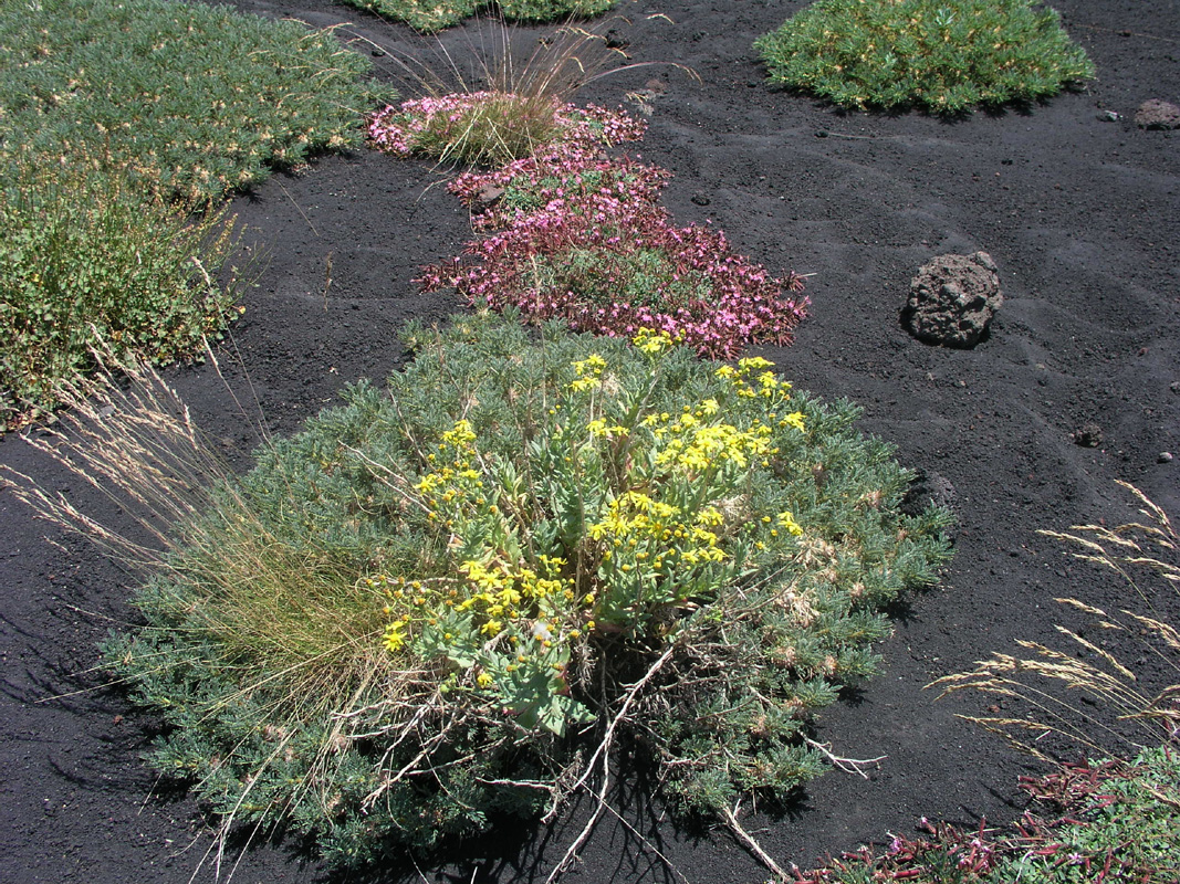
Volcanos are normally quite "dead-looking", so also Etna. However, it is fascinating to see how
colorful plants quickly find a new home shortly after the lava has been flowing nearby.
Here is a closer look at some of the plants.
In fact, it is well known that volcanic activity will result in good growing conditions, over millions
of years this has created good soil on Sicily.
We were back down at the car by 1220, the temperature was now 29 C. Among the first things that happened, was a parking
enforcement guy that quickly showed up and told us we owed one Euro in unpaid parking fees. Well, well, back to civilization
after a very different day in a very different environment. We left the trailhead at 1250 and arrived back at the
coast for a nice swim in the Mediterranean around 1400. Volcanic dust and sand were everywhere so a dip in the ocean was indeed
the best possible way to end a successful climb of Etna.
GPS Waypoints.
On our trip, we noted 4 high points on Etna. We did climb 3 of these. Summit number
2, called "Top B" was the highest of all, easily verified by looking from "Top B"
to "Top C" and comparing that line of sight with the top that we did not visit, but
which was near this line of sight. "Top A" and "Top B" are really two points on the
same crater of almost equal height, although the actual crater now is closer to "Top B"
making it possible to walk between the two tops as we did on our way to "Top C".
We recorded the following GPS waypoints:
| WP | Elevation | Location | Comments | |
| WP 1 | 1904 m | N37:41.959, E015:00.017 | 0.0 km, Trailhead, parking Etna south | |
| WP 2 | 2497 m | N37:43.099, E014:59.944 | 2.1 km, Top of cableway, 1 hour | |
| WP 3 | 2939 m | N37:44.279, E015:00.037 | 4.3 km, Top of Bus transport, 2 hours, 1.1km to WP 13 | |
| WP 4 | 3120 m | N37:45.202, E014:59.275 | 6.4 km, Rest after 3 hours. | |
| WP 5 | 3110 m | N37:45.323, E014:59.315 | 6.6 km, Trail fork on the north side, 588m to WP 10, 1.2km to WP 13 | |
| WP 6 | 3185 m | N37:45.371, E014:59.551 | 6.9 km, Up a gully | |
| WP 7 | 3244 m | N37:45.412, E014:59.715 | 7.2 km, Further on the way | |
| WP 8 | 3324 m | N37:45.391, E014:59.847 | 7.4 km, Top A, 937m to WP 13, top C. 791 m from WP 5. | |
| WP 9 | 3304 m | N37:45.353, E014:59.739 | 7.6 km, Leave backpack, a bit above saddle | |
| WP 10 | 3326 m | N37:45.304, E014:59.715 | 7.7 km, Top B, Top of Etna !! This 252 meter from Top A. | |
| WP 11 | 3172 m | N37:44.989, E014:59.960 | 8.5 km, On the traverse to Top C | |
| WP 12 | 3262 m | N37:44.916, E014:59.955 | 8.7 km, On the traverse to Top C | |
| WP 13 | 3294 m | N37:44.888, E014:59.905 | 8.7 km, Top C (waypoint taken 2 meter below the top), 821 m from WP 10. | |
| WP 14 | 3228 m | N37:44.927, E014:59.859 | 8.8 km, Saddle elevation for top C | |