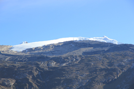
Ritacuba Blanco
- Ritacuba Blanco
- 5410 m
- Primary factor 3645 m
- Highest in Cordillera Oriental, Colombia.
- Location: North 06:29.675, West 72:17.791 (GPS on the summit)
- Difficulty: YDS class 2.
- Climbed January 12 2012.
|
|
Copyright Petter Bjørstad, 2009-2012.
Information:
The mountain range Cordillera Oriental is located about 280 km north-east of the capital Botoga in Colombia.
The highest peaks are all located in the national park El Cocuy. I climbed two peaks in this area in the
first half of January 2012. A full report from
the trip is available. A map that shows an outline of the
trip, may also be consulted.
How to get there:
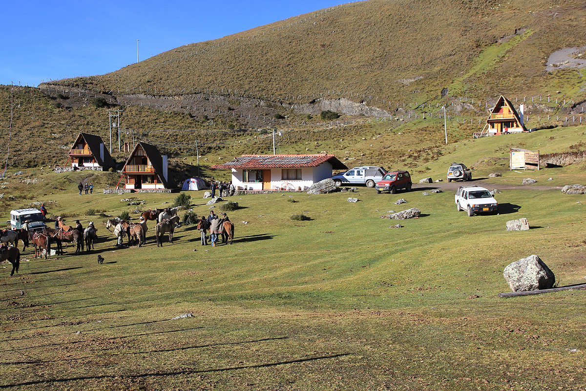
The starting point for this climb is Cabanas Kanwara or
the huts a bit lower (and a bit closer) to
the mountain, called Posada Sierra Nevada. This location, just inside the national park, is reached from
the village of El Cocuy (or from the village Guicán.) in about one hour. It is important to note that
one must register with the National Park Office in either of these two villages before travelling
to this trailhead. A visiting permit (unlimited length) was 35.000 peso for foreign nationals in 2012.
For more detailed information on the local travel, see the trip report.
This is the trailhead, location N06:28.346, W072:21.283, elevation about 3990 meter.
Route description:
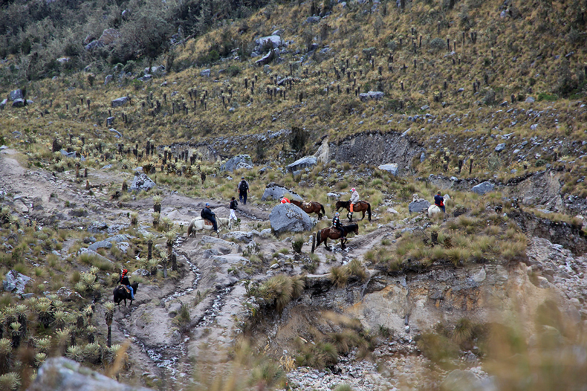
From the entrance to Cabanas Kanwara, the trail starts up with a small uphill, there is a sign saying Ritacuba.
Follow the very obvious trail and locate an old water channel after a short hike. Follow a smaller trail that
runs along this water channel. The main trail used by horses, decends a bit, then continues parallel, but somewhat
lower than the water channel. I much preferred the smaller water channel trail, follow it until you again merge
with the bigger trail, then cross a bit right as you cross a creek. The trail is obvious as it now starts a long
climb of the slope above. After roughly one hour, one should be near location
N06:28.829, W072:20.178, elevation about 4148 meter.
The trail continues uphill in many zig-zags. This trail sees heavy
use by horses and is therefore quite easy to follow.
Higher up, at location N06:29.144, W072:19.683, elevation 4531 meter, look for a trail that continues uphill along the
right side of the valley. The main trail crosses more left here, and eventually ascends along a very distinct moraine
marking the left side of the basin. The trail that heads up on the right side might be slightly more direct.
If you end up climbing the moraine, the trail will exit right off the moraine ridge around location
N06:29.679, W072:19.246, elevation as the top of Mount Blanc, 4810 meter.
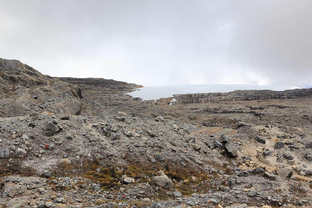
Either way, follow good tracks and cairned routes to the very lowest part of the
glacier. In 2012 (this glacier may
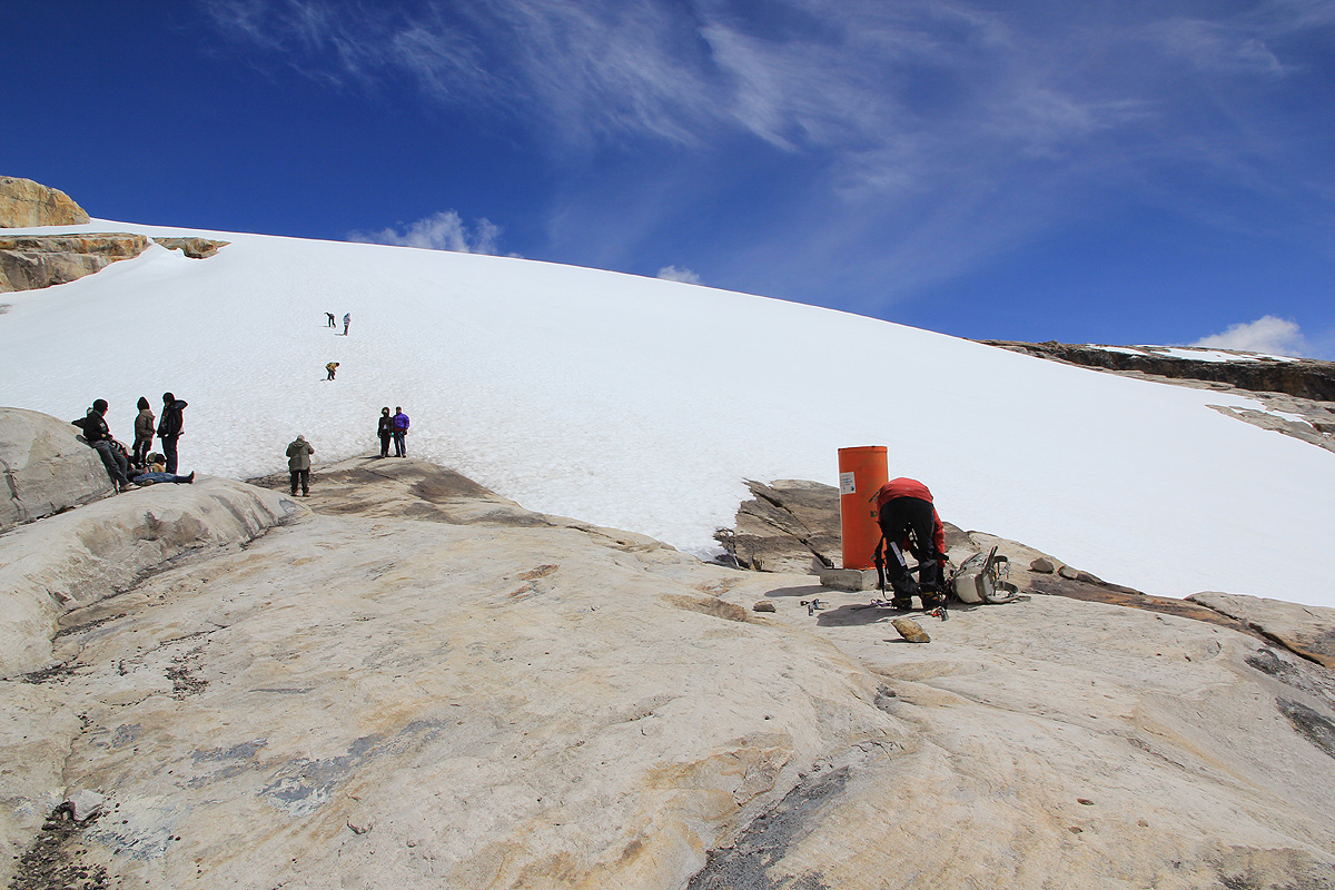
be melting fast!), this location was at N06:29.693, W072:19.112, elevation 4852 meter. There is a marker here.
Most tourists will travel here (most of the way on horseback),
in order to touch and play with the snow.
Ascend the moderate snow slope, crampons are needed when the snow is crusty (as in the morning). Continue uphill until
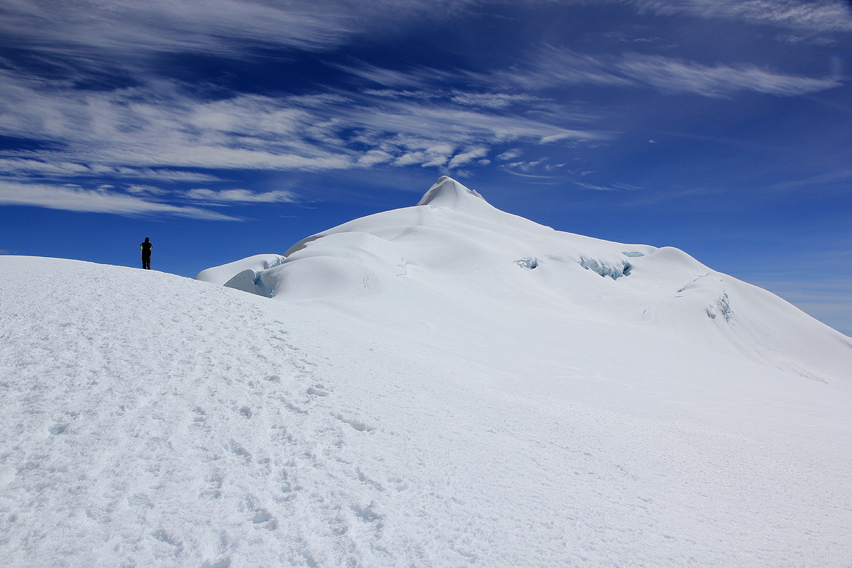
reaching the main ridge a bit above 4900 meter, then turn more right and follow the very broad and gentle snow, the remaining
distance is about 2 kilometer. Ritacuba Negro will dominate your view on the left,
while the final summit ridge gradually
will rise in front as you get closer. At about 5300 meter, the final and more distinct ridge stands 100 meter higher directly
in front. Continue uphill and finish the very last
and somewhat steeper pitch. This hill is short and there may be steps from
previous climbers. Once on top, continue along the final, gentle ridge (short) to reach a pretty well defined summit.
Comments:
We started out at 0310 with strong head lamps and a clear sky with many stars.
Higher up, the weather got quite windy and I needed to stop and put on my jacket near 4800 meter
of elevation. We traversed into the basin and accessed the glacier one rock shelf higher, on the left
side than the lowest point. There is really no need to do this. Daylight was coming and we made good progress
up the crusty snow with near ideal conditions for crampons. Somehow, we both felt the elevation and our
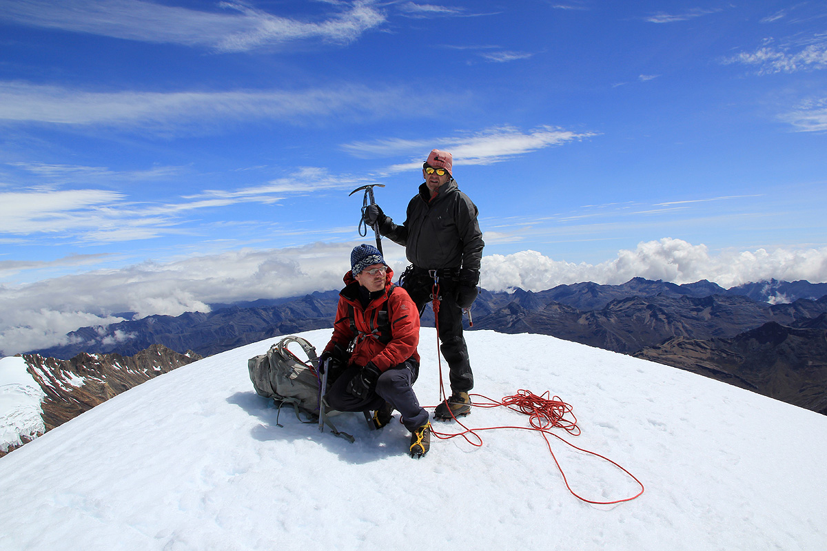
progress up the long and gentle snow ridge was embarassingly slow. We made the summit at 1020 in very good
weather, even the wind died down and thus we could enjoy the summit with its panorama views.
A single German joined us at the summit and
offered to take a summit picture. Since we had ascended an "unknown"
glacier, we had roped up. However, the route was crevasse free and we descended unroped.
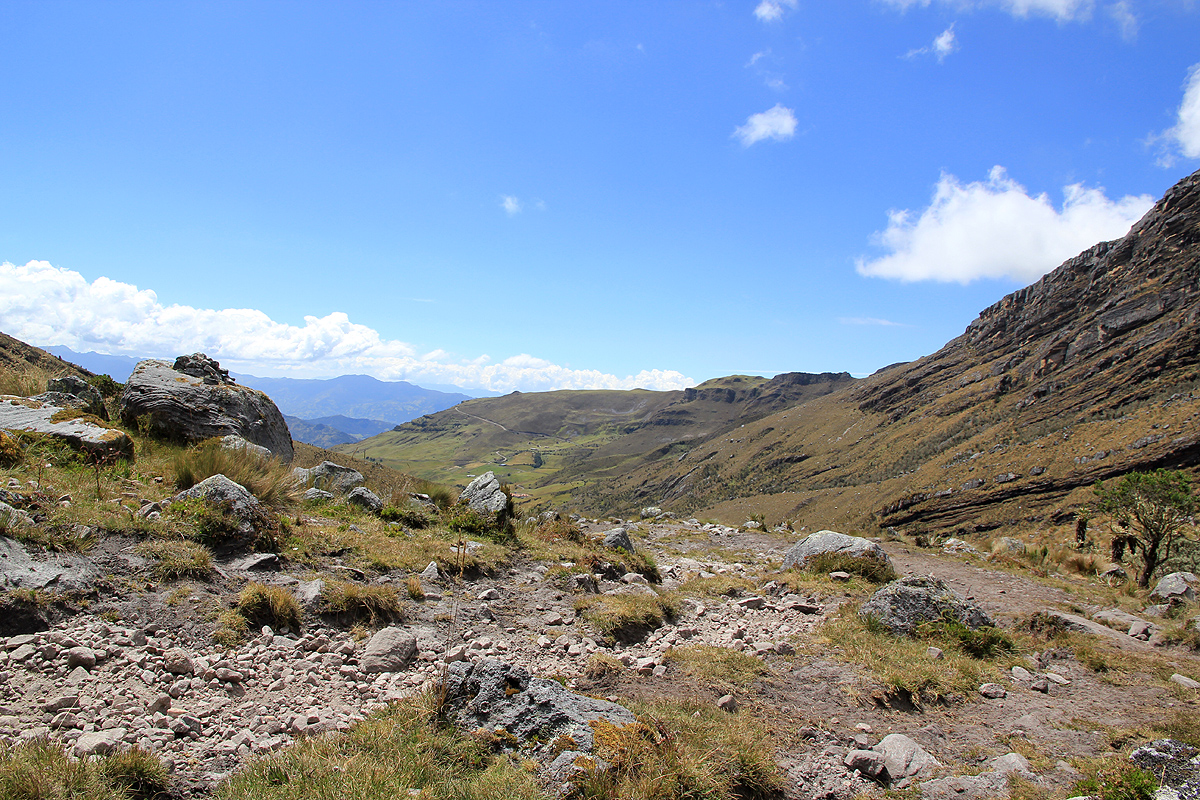
We had left the summit at 1100 and took another major rest at the bottom of the glacier shortly after 1200.
Heading down the trail (the lower part for the 3rd. time!), we arrived back at the Cabana Kanwara at 1500, a total
round trip of 12 hours.
Many people break this ascent into two parts, establishing a high tent camp above 4500 meter.
However, any reasonably
fit party can easily do this climb directly from the comforts of the nice hut at Kanwara.
Resources: