Ritacuba Blanco, Colombia, Trip Report,
January 8, 2012 - January 17, 2012.

Short overview.

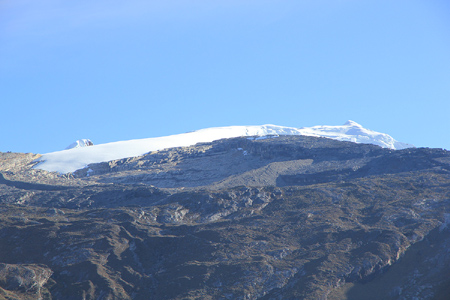
We started in Bogota and travelled one day north-east to the village of El Cocuy.
From there we entered the El Cocuy National Park and climbed Ritacuba Blanco (5410m)
followed by an ascent of Concavo (5173m).
We then returned to Bogota and flew home.
We did not use any local support nor any guides.

Here is an overview map of the route travelled and the peaks climbed.

Our team consisted of 2:
        Petter E. Bjørstad, age 61, Norway
        Geir Åke Dahlen, age 38, Norway

Before the Trip, Preparations.


I did some research before departure. December and January seem to offer the best chances of good weather. The security in this area is now totally ok, if the situation should change then the authorities in the national park will take necessary precautions. The only convenient way to travel between Bogota and El Cocuy seems to be by bus, however the bus conections are well developed. I decided to improvise all local arrangements after arrival, except for a hotel booking in Bogota. Our flight arrived late and I knew that the bus would leave early. Thus, it made sense to know in advance which hotel to stay in upon arrival in Bogota.
The currency in Colombia is Peso. At the time of our trip one could get a rough idea of the Norwegian krone equivalent by striking two zeros, then divide by three. In Euro, this meant that (very roughly) 50.000 peso corresponded to about 20 Euro.

Day 0, January 8th.  -  Travel and arrival in Bogota.


My flight was without any trouble. I left Bergen in the morning on January 8th., and travelled directly to Frankfurt. Åke travelled from Oslo and we hooked up in Frankfurt about one hour before our long (but direct) flight to Bogota.
The flight to Bogota was on time and very convenient. Somehow mysteriously Lufthansa had given us business class travel for economy price. On such occasions one normally just accept the unexpected luxury without asking too many questions.
I had booked a room at Hotel Capital in Bogota. This hotel was selected because its location was between the airport and the bus terminal. They also provided a complementary shuttle service between the hotel and the airport. Thus, we had a smooth arrival quickly being picked up by a hotel representative that guided us to the small shuttle van that subsequently took us directly to the hotel. I asked the reception at the hotel to help me find the correct bus company and departure time for the next morning. This went rather smooothly, the bus company was called Expreso Pas del Rio and their bus departed from Terminal 3 in the bus station the next morning at 0500. We set the alarm for 0300, booked a taxi for 0330 and went to bed.
The hotel worked out ok, so I decided to also book it for our last night in Colombia. We would return on the same flight, ie. the departure would be in the evening. To safeguard the travel, we planned to arrive in Bogota the evening before, spend one night, then sightseeing Bogota before going to the airport. A final observation with this hotel; unlike most hotels they had a standard check out time at 1800 in the evening, even later times could be arranged with the reception.

Day 1, January 9th.  -  Bus transport to El Cocuy.


Up, taxi, bus terminal. No issues. The Expreso Pas del Rio was quickly located at window 155, somewhat to the right when entering the terminal 3 (color code: red terminal), from the street. Two tickets cost 100.000 peso. We waited until the bus departed from Puerta 117 (gate 117) on time at 0500.
The air distance to El Cocuy is 280 kilometer. We arrived in Tunja at 0730, short stop before continuing to Duitama where we arrived at 0840 and had a major break until 0930. I bought a grilled chicken for 15.000, as travel food for the next several hours. The road to here was mostly a 4 lane, divided highway. From here, the road was mostly a two lane, paved road. The landscape was mainly rolling hills as we climbed across a divide that exceeded 3200 meter. For the first time, we got a brief view of snowy mountains, the goal of our trip. However, there were several spots along the road in need of repair where the bus would have to travel very slowly and carefully. We crossed the low point of the trip, a big valley with a river at the bottom, around 1230, our lowest elevation reading roughly 1390 meter. We made a 10 minute stop in the village of Boavita, around 1300. Every village in this area has a nice church. We continued and drove by some smaller villages on our way to the village of San Mateo (1415) before arriving in El Cocuy at 1545.
We checked in at the Hotel Casa Munoz, located near the upper corner of the main rectangular park in front of the church. The charge was 60.000 for a room with two beds, likely among the more expensive in the village. They would keep some gear that we did not want to carry in the mountains. Just as in Bogota, we also booked a night here before our scheduled return bus to the capital. Dinner at the seemingly only restaurant in town, up the street around the corner, that is the corner of the rectangle. No menu, no English, but quite ok food at a very, very low price.

Day 2, January 10th.  -  Arrival at Cabanas Kawara and acclimatization hike.


The plan was to hire transportation and move up to near 4000 meter of elevation today as soon as practical issues were completed in El Cocuy. Already the previous evening, we had visited the National Park office and received our permits. This office is up along a side street (going right) that is closer to the church. The procedure is trivial, they write down your name and collect 35.000 per person. This is for a multi-day visit. We also needed fuel for our stove. I was initially excited to locate a store (a bit behind the church, on the same main street that runs on the upper side of the rectangle), that carried Primus propane/buthane mix. Just what we needed for the multi-fuel burner I had taken along. Unfortunately, all the displayed cartridges were empty! The store owner had promised last night that he would have a new supply today, but no such thing. He still only carried empty boxes. Plan B would be needed, a visit to the local gas station and the purchase of one litre of regular gasoline for cars. It works, but does not burn very cleanly.
I had also made the unpleasant discovery that my SPOT had been left behind in the bus. The Spot had been attached to a string that ran across the window, recording our travel from Bogota to El Cocuy. We bought some water as well as some biscuits, then requested a car that could take us higher. Soon thereafter a jeep appeared. He informed us that transport to Cabanas Kawara would cost 140.000. Clearly one of the higher cost items, it takes a considerable time to drive on the rather primitive roads above the village. We were well aware that one can get less expensive transportation early every morning by travelling with the milk truck. However, with our schedule and the necessary tasks to do, this option was inconvenient for us.
On the way, we drove through the highest village, Guicán, I had read that this village had few services, but from what it looked like, this fact may be very outdated. There were hotels, shops and clearly better Internet services. Thus, I would advise new climbers to consider staying in Guicán rather than El Cocuy. (The bus from Bogota would have taken us all the way there.)
Along the way, we got an excellent view of the peak Pan de Azucar, sugar loaf, that we would see close up later on the trip. We arrived at the Cabanas Kawara before noon, and checked in to the highest cabana. One may stay on this property with a private tent for a smaller fee, however, we were too much tempted by the luxury of a cabin with beds and a fireplace. The price quoted was still quite affordable. From here, we had a good view across to Ritacuba Blanco as well as to the other peaks further south. We now had a very convenient base camp with all services. Even a restaurant serving breakfast, lunch and dinner.
The time was still 1200 - noon and the next task would be to explore the trail leading up the valley towards Ritacuba Blanco. We were now at elevation 4000 meter, but having spent 1.5 days above 2500 meter already, it was time to push acclimatization to the next level. We started out up the trail and made a first short break after one hour at elevation about 4150 meter. From here, the trail climbed more directly higher. We continued until we were half way up a big moraine at elevation 4670 meter. The time was now 1445 and we felt the effect of uphill walking already higher than Monte Rosa. From here, we could see the lower part of the glacier pretty close and not much higher. We took a good break and started back down at 1500, returning to the cabana by 1640.
It got dark shortly after 1800, a last look at Ritacuba and Pan de Azucar, then relax and wait for dinner. Dinner at 1930, first a soup then local trout fish, very nice! We were told that there had been some cabins here already 30 years ago, but that the Farc guerilla had destroyed this place about 10 years ago. Just as we arrived, the park authorities decided to close the eastern part of the very popular 6 day circuit trek, since there were reports of some guerilla activity further east. It seemed that the authorites were indeed very cautious.

Day 3, January 11th..  -  Acclimatization hike.


I had given some thought to a summit attempt already today. However, when trying to optimize our attempt, I concluded that one additional day in the 4000-4500 meter zone would most likely be of good use. We came from 2700 meter yesterday. To immediately push to 5400 meter would be quite agressive. Most people establish a camp high on the trail and push to the summit the next morning. I had already decided to do the summit climb directly from the hut, a long day, but not more than we should be able to carry out.
Thus, we went on a leisurely acclimatization hike. We decided to hike the road that climbs around and above the huts to its end. From there, we planned to follow a trail (that was drawn on the map) to get back across.
The day started with a healthy breakfast, soup with chunks of meat, then eggs and bread etc. We started walking at 0805. The road was quite long, it turned a corner, (by now we had a good view of our mountains,) and climbed very gently with a good view of the main valley below. After two hours we finally arrived at the end of the road and a hut that was located slightly below. We looked for the trail that should branch off to the right, but did not find any. We continued into the valley until we arrived at a major fork in the river where the trail crossed left, eventually connecting to the eastern side.
What to do? The map was plain terrible. Even the main path that is part of the famous circuit trip was wrong. Our trail back to the Kawara was clearly not here. A small trail went into what looked like a basin further in. We decided to follow it and then make decisions as we could see what the land looked like. The landscape was nice and as we climbed upwards, the impressive Ritacuba Negro came into view. It soon became clear that our trail led to the place where a creek came down a sloping rock. At this point, a water channel had been dug. The water was diverted was diverted from its natural route and quite amazingly, somebody had dug a channel that would lead this water in and out small side-valleys and eventually all the way across to a junction at the road that we had hiked along earlier in the day. From there, it is likely that this water serves some of the high level farms on the upper slopes, way higher than any of the two villages.
The GPS told us that we were not very far from where we turned around on the Ritacuba Blanco trail the day before. Thus, the only reasonable plan would be to traverse across in this direction and try to avoid gaining more elevation than strictly needed. We crossed the key saddle at 4638 meter and connected back to the standard trail. We were back by around 1500, 7 hours and definitely a bit tougher than planned for a day of acclimatization.
The evening light was good, then a big and filling dinner as we were going to start without breakfast tomorrow.

Day 4, January 12th.  -  We climb Ritacuba Blanco.


See here for a route description.
Summit day. We had set the alarm to 0245, I wanted to be on the trail by 0300. We were on the trail with strong headlamps beaming by xx. We had decided to carry only one backpack, thus saving the pretty heavy (empty) weight of Åkes pack. However, with 60 meter of climbing rope, jackets, first aid, crampons, ice screws as well as snow pickets, the pack was not exactly lightweight.
We still made good progress on a trail that we knew very well by now. The wind picked up as it often does before sunrise, however, it kept increasing. I needed a stop to put on my jacket. Progress was still good and we reached the elevation of Mont Blanc (4810m) well before 0700. At this point we left the moraine and headed directly for the glacier. Since slopes tend to look steep when viewed straight on, we advanced a bit further left along a rock structure that would get us to the glacier a bit higher, a place where the glacier also seemed to be less steep. We made a short stop at the edge of the glacier. The slope looked easy, in fact we might as well have started from the very lowest point where the tourists go to touch the snow. Anyway, we put on crampons since the crust was hard and I left my hiking poles behind, exchanging them for my ice axe. We quickly ascended to the main crest, with Negro rising across the crusty slope. Icy mountains near the equator takes on forms of elegance that are hard to match elsewhere. We roped up as we now had 2 kilometer of (to us) unknown glacier ahead.
We were both a bit slow along this long, but gentle slope, making frequent short stops for rest. The view of Ritacuba Negro on our left side continued to capture our attention. Gradually, we came across a false horizon and got the final ridge leading to the summit into clear view. Going higher, I could see the steep pitch, but it was still hard to judge how steep it really was. The summit part of this peak has a very nice profile as you approach it. In a brief moment, I worried that the highest point would be on a snow ridge that sort of went right, it looked more than scary. The mistake was soon obvious, this little ridge being substantially lower than what it first looked like. The final slope was not too hard, good steps from earlier climbers. Before long, we were both at the summit. A single guy from Germany had caught us up the last slope, he came from a tent pitched high on the mountain. We got a summit photo and stayed around for about 40 minutes. The wind had finally died down and the panorama view was pretty good.
The view across to Negro, to the only snowy peak across the valley as well as south to Pan de Azucar.
We decided to carry the rope as the route had been without any crevasse danger. A leisurely descent, the view connecting to Negro and, in particular, the nice looking ice clinging to the ridge. In a few years, the prediction is that this will all melt away. Our glacier descent ended with an unpleasant surprise as somebody had taken my hiking poles. This seemed rather unlikely since we left them pretty much out of sight at a place which was definitely not on any main route. After a long rest at the foot of the glacier, we took a very unhurried approach to the descent. I followed a cairned route back to the long moraine, while Åke found an alternate (and quicker!) route that avoided the moraine all together. This would be the third time we descended this trail and we were happy thinking about the fact that this would indeed be the very last time.
Back at the cabana by 1500, 12 hours and looking forward to a well deserved dinner!

Day 5, January 13th.  -  We hike to Laguna Grande, 4500 meter.


Having achieved our main objective completely according to plan, we could now plan what would be the best possible use of our remaining days. We quickly agreed that an attempt on the peak Concavo seemed like the best option. Various maps had different elevations, but this peak was certainly among the highest in the range and the route would involve a visit to the famous Laguna Grande, quite a big lake at elevation 4500 meter.
We booked transport (for US dollar 40) from Kawara to Esperanza, the trailhead for hiking to Laguna Grande. An urgent problem surfaced after breakfast. I had placed our fuel bottle (with regular gasoline) outside of our cabin on the side that would stay in the shade. Now it was gone! This was a critical item if we were to climb Concavo via a camp at Laguna Grande. I explained the problem to some of the staff. Of course nobody around that knew English, my explanation consisted of hand waving supplemented with words like gasolina, explosiva, peligro, desaparecer, campamento,... somehow I believed they understood, but nothing happened. After about 30 minutes, a man appeared and he handed me the missing bottle, no word said. Needless to say, I was quite relieved to get it back.
The hike from Esperanza to the Laguna Grande was a very nice, but also a tough effort. For the first time of this trip, we set out with packs that carried both camping and climbing gear. The trail was pretty much uphill, gaining about 900 vertical meter net. Pretty high up, and Åke discovered that he had lost his GPS since the last time we had a rest. He dropped his pack and went back to look for it. He did indeed find it (a bit lucky!), but this diversion took about 30 minutes and extra energy. The very special Pulpito, part of Pan de Azucar, came out of the mist on our right hand side and we could see our Concavo glacier far ahead. We passed the small cave on our right, I had read that it was near the laguna. A large moraine going across up front and having a big cairn with a wooden sign looked promising. I thought that the lake might be behind it. No such luck! A nice panorama, no lake, but yet another moraine parallel to this one. OK, one more, then the lake. Åke was visibly very tired and we had been hiking for alomost 6 hours. The next moraine revealed moraine number three. Is there never an end? At least we got a pretty nice view of our target, Concavo, except that the summit remained hidden in clouds. Finally, I struggled up to the cairn and sign on the third moraine and below it - the lake Laguna Grande. To please me even more, Concavo showed its pointed summit for a few seconds while I was waiting for Åke to make the last uphill of today.
We found a good site for our tent. This area has many nice and flat spots with only sand on the ground. The stove decided to be nice, however the local gasoline is far from perfect. More yellow flames initially and more black soot deposit on the pots. Dinner tasted well. We had a good night, decided to launch our summit attempt at daybreak around 0600. We had given the two possible routes a careful look. It comes down to how long we shall climb on the glacier. We decided to ascend the moraine on the left side all the way up, then traverse and access the glacier above the steep ice fall. To climb around the ice fall in a big arc, following the more gentle looking snow also looks very possible. We may perhaps explore that route on descent?
Another day here, and we should also have explored the Pan de Azucar, with its steep guard Pulpito. This characteristic rock cylinder looks equally steep from all sides. The last sunrays on the rock face across, then night with thousands of stars in the sky.

Day 6, January 14th.  -  We climb Concavo.


See here for a route description.
We got going by 0605, pretty much on schedule. The route we had decided to try turned out to be nicer than expected. The moraine had quite a bit of sand, we followed reasonable tracks between the rocks and gained elevation without any difficulties. Higher up, it was easy to traverse towards the glacier on a broad rock shelf. Crampons and rope came on. Another unknown glacier, this one certainly looks more impressive than the one on Ritacuba. It is draping the mountain and falls down the slope making terasses and basins with steeper and more crevassed sections in between. Again, the conditions were near perfect for crampons, good crust and a very shallow layer of top snow. We followed a pretty natural line into the basin, good ice scenery here, then up a steeper section. We crossed a few crevasses that showed up in areas of rapid glacier movement, just as expected. They were all easy to cross, nothing more than a focused long step. Soon, we were near the final crest, advancing on the summit without any real issues. The last pitch looked like it might pose a few challenges. To my delight, we arrived just below what was likely the summit and found a sheltered, flat area. Quite ideal, what remained was a short climb to reach the crest, once there, I saw a short, but somewhat narrow final ridge. I told Åke that care was in order. There could be overhanging cornices here and the drop on the far side was more than substantial. Unfortunately, a cloud had decided to rest on the very summit so our views were a bit limited. I made the few steps to the summit and verified that there was no ridge leading any higher. A great summit, very nicely rounded and with limited space. In fact, one should likely not be more than 2-3 people up here simultaneously. Small cracks in the snow carried a pretty clear message: Stay in the center part!
It had taken us about 3.5 hours to reach the summit. We waited and rested, hoping that the cloud should depart, for perhaps 30 minutes. No improvement, and we started our descent. No hurry, this was a real glacier 6 degrees shy of the equator. We decided to take the snow further down and exit the glacier below the ice fall. The route is scenic with its blue laguna just below. This route had perhaps 4-5 additional crevasses, but they were all easy to identify and cross. There were clear signs of ice falling from the steep glacier above us. Thus, this route may carry a somewhat larger objective danger. We quickly passed the danger zone and got back onto the rock before removing our crampons.
We were back at the tent around 1130, the weather was nice and even the trouble cloud at the summit of Concavo finally drifted away. Summer temperature at 4500 meter. Åke decided to try swimming in the lake. He did a very nice swim lasting perhaps a couple of minutes. It was cold, but nothing like a winter swim in Norway. We decided that there are few places on the planet where one can swim in a good sized lake in mid January. Perhaps Åke was the highest human being taking a swim on this day? Not at all unlikely! Lazy hours in a tent heated by the sun, our mountain, Concavo, in evening light, then dinner and a pretty early bed time. The stars were brillant but somewhat unfamiliar.

Day 7, January 15th.  -  We descend and return to El Cocuy.


The next day, after breakfast, we left at 0815 and had a rather pleasant walk back down to Esperanza. What a difference the trail sloping downhill makes! We were back down in 3:15, almost twice as fast as our ascent. The local owner offered chairs and a table in his courtyard, then two bottles of beer, it does not get much better. We had an agreement with our driver from El Cocuy to pick us up here at 1400, pleanty of time, but a nice place to look around while waiting.
Unfortunately, no jeep showed up at 1400. I called and heard a voice repeating "una hora", this sounded like 1500. I called again at 1430, and the message was still "une hora". Slightly concerned about our limited Spanish, I eventually got another guy that spoke English to make a third call and check into the matter. It seemed like they had trouble with the car, but that it was on its way. Our transport finally showed up around 1600, with several expressions of being sorry about what had happened. Ok, we started the drive back down. This route actually took us across a pretty high section, the driving time was about 70 minutes. Back in town, we checked out with the National Park authorities, then went for dinner at the same restaurant as we had visited before. No menu, but pretty good sized portions and a very inexpensive bill. We bought tickets for the bus to Bogota, it would depart already at 0400. The ticket cost 90.000 for two, so slightly less than our first ticket.

Day 8, January 16th.  -  We travel back to Bogota.


The bus to Bogota departed at 0400. Pitch dark. We got onboard at it soon was clear that this bus wanted to pick up business in some nearby Andes villages before shooting for Bogota. This involved driving on some rather narrow and scary dirt roads, typically half way between the river at the valley bottom and the top of steepish slopes. Not much solid rock, but loose dirt with big, scattered boulders. To drive here in the rainy season? I would not even like to think about it. Part of the road had avalanched down and the bus drove rather carefully. At 0900, after 5 hours of driving, I checked my GPS. The direct distance back to El Cocuy was now an impressive 25 kilometer!
Fortunately, the quality as well as direction of the road improved. We got back on the same road that we travelled a week ago. When I wanted to take a "goodbye picture", as we climbed out of the big valley, the bus driver stopped in order for my picture to be as good as possible. We finally arrived back in Bogota around 1800, 14 hours on a bus, at least this was a new record for me. We celebrated a very successful trip with a luxury dinner at the top floor of our hotel.

Day 9, January 17th.  -  Sightseeing in Bogota, then fly home.


After breakfast,m we took a taxi to the national center for topographical maps, the IGAC, Instituto Geografico Augustin Codazzi. We got to look at maps of the national park in scale 1:25.000, unfortunately, the maps had only 50 meter contours and they still seemed to be missing contours near the summits of the major peaks. We then set off to walk to the old historical center, but after a while, completed this quest by taxi. We quickly found the parliament as well as the president palace, including a music performance by the president's guard (military music). The shopping afrea was near by and this area is really busy and crowded. Lunch at a rather nice (upscale) place, the owner started trying to convince us to have Norwegian salmon, which i got fresh every morning from the airport. After lunch we took the gondola to the top of the local hill, Monserrate. Unfortunately, it started to rain, then thunder and our view of Bogota was limited. We returned back down and hired a taxi for the trip back to Capital Hotel.

After the Trip, Wrapping Up.

Our flight left in the evening from Bogota. We were able to pick up the "lost SPOT" at the bus station on our way to the airport. The flight left on time and Åke and I enjoyed the sleeping "seats/beds" provided on business class. Åke had a smooth travel back home to Gausdal and I had an equally good flight back to Bergen, where Pål Jørgen picked me up and drove me back home.
Many thanks to Åke for excellent company.
Heart rate and blood oxygen saturation as plotted here.

Return to Petter's mountain page