My wife Heidi wanted a trip south before Christmas, she preferred
a place with sun and warm weather. Easier said than done, unless you
travel very far, December is a month with somewhat unpredictable
weather even in Southern Europe.
We decided to try Marrakech in Morocco, and I immediately started
planning a trip to the Atlas and North Africa highpoint, Jebel Toubkal
at 4165 meter.
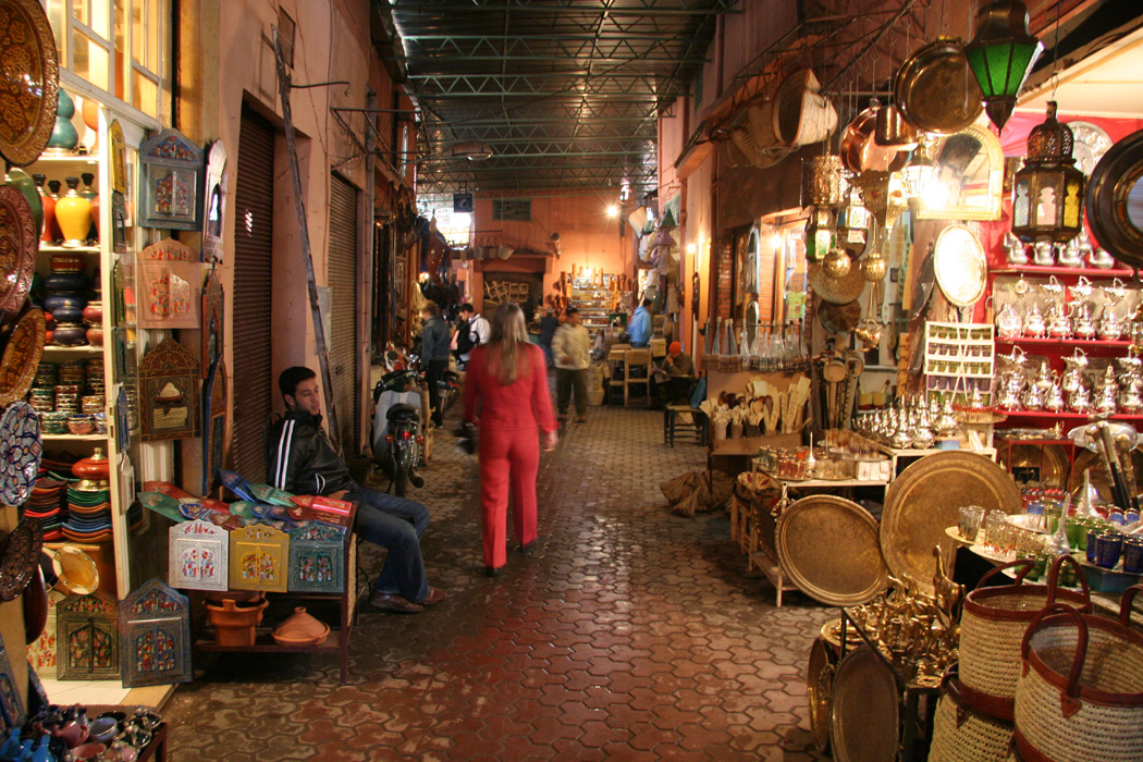
Our first day, December 2. was spent exploring the city and, in particular,
the famous Souk market next
to the unique and fascinating Djemaa el Fna, a city
square second to none.
I also made arrangement for my trip to start
the next morning.
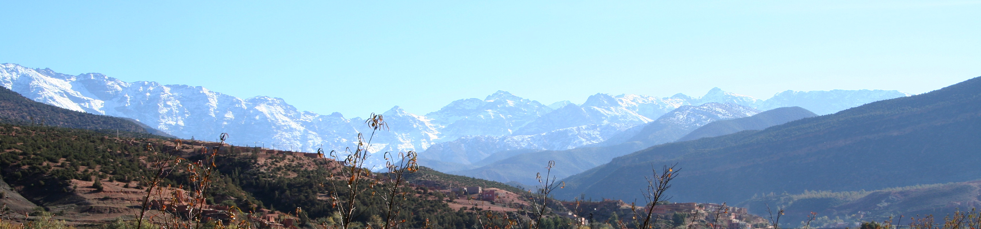
I started out from our hotel at 0900 with a taxi that had been booked
the day before. A very friendly taxi driver with a somewhat limited
English vocabulary. Immediately after leaving Marrakech, the snowcapped
Atlas mountains
became visible. The first part of the drive is across
very dry and very flat terrain.
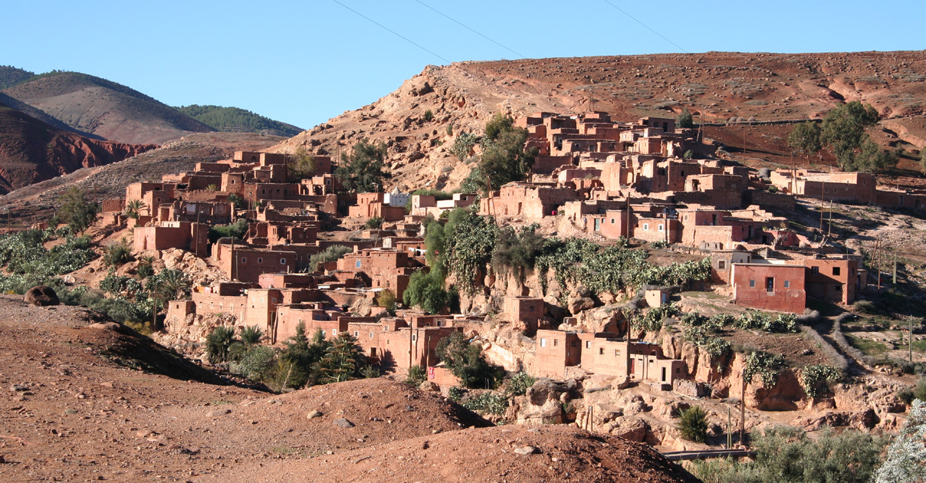
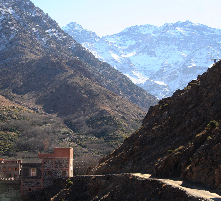
Gradually, we get into the foothills passing
a charming old village
(I think the name is Moulay Brahim)
on the opposite side of the river.
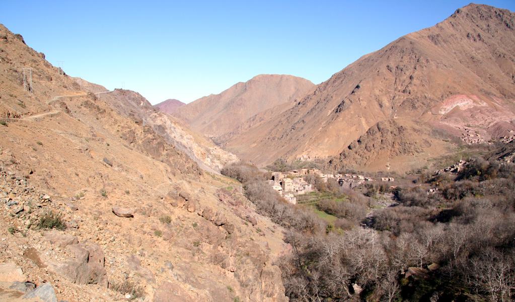
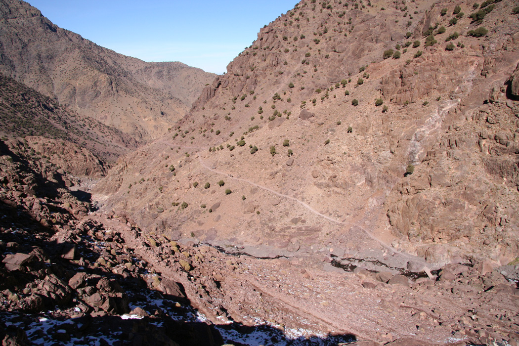
Next, the road enters a pretty wild
canyon in order to reach a more fertile and greener mountain valley
higher up. The road through this canyon runs high above the canyon floor.
Every curve is carefully marked by red and white barrier blocks and the
road is wide enough that most oncoming traffic can pass without trouble.
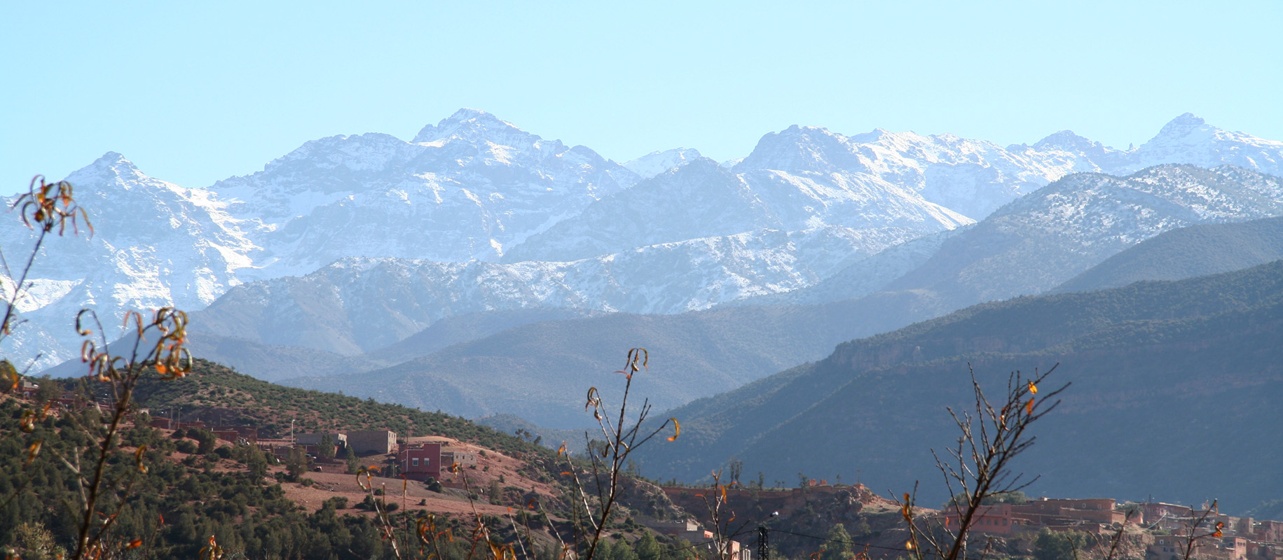
Asni is the main village above the canyon, from here the views of
the Atlas is
certainly more impressive than the more distant views
from Marrakech.
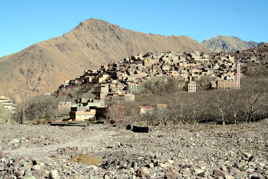
In Asni, we leave the main highway as we turn left onto the smaller road
that runs up the Mizane valley to the village of Imlil. We arrive there
around 1030 and I immediately set out to buy a topographic map of the
area. I looked for a map the day before in Marrakech, however, people I asked
there all said that the place to get this map was in Imlil.
After some initial confusion, a man with only one leg produces a
map in scale 1:50.000 that covered the area I need. Unfortunately, he asks
150 Dirham, a horrible price for such a poor quality map. I do not really
have time for a long session with bargaining and let him have the money
knowing that his hotel "Etoile Toubkal" shall not receive any
recommendations from this web-page.
The taxi driver wanted my return business quite badly, however I told him that
I had little idea on a realistic pickup time and that I therefore preferred to
take a local taxi back to Marrakech. He understood the logic, but refused
to accept the situation. Finally, he came up with a suggestion that his uncle
(also a taxi driver) would be waiting for me from 1400 the following day. The "one leg man"
interrupted and said that I could not possibly be back before 1800. I agreed that
a precise return time was difficult to estimate, but the taxi driver assured that
his uncle would be perfectly happy to wait 6 hours. Such statements remind you
that this is not Europe, that peoples time cost less here than most everywhere else.
The "one leg" wanted more business and claimed that it would be absolutely impossible
to buy any food/meals at the refuge. My response was certainly a disappointment, as I
walked across to the nearest store and bought two bread (relatively small, circular shaped,
Morocco style bread). Again, a reminder of where I was, this store did not sell bread,
however, the boy immediately ran across,
secured himself two breads and could then profitable sell
them to me for 3 Dirhams.
I now had one liter of water, 4 chocolate bars (from Norway) and 2 breads, certainly
enough to sustain a two day expedition.
I started hiking up the main street around 1045, quite a few onlookers, I guess
there are few hikers at this time of year. First, several shops lining the street
and the normal attempts from the locals to help out with a mule or a guide or
provisions etc. Higher up, the road made a 180 degree right
turn in order to ascend the hill
while a clear
trail continued straight ahead. The map was already hard to read, but I assumed rightly
that this would be a good direction. The trail quickly started climbing and eventually
connected back to the road that now connects Imlil with the village named Aroumd.
This road
traverses high above the gorge of the Mizane river and what certainly used to be a mule trail
can now be used by cars (careful driving required).
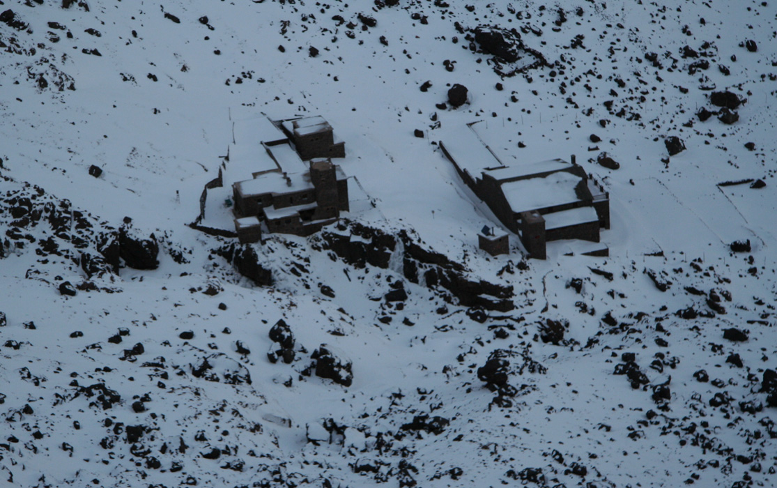
I emerged onto the end of a flat valley floor entirely covered by rocks.
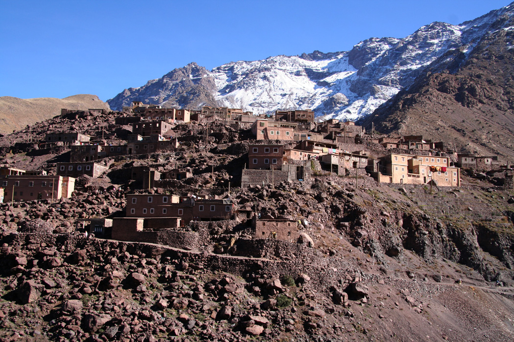
The village called Aroumd (also sometimes Around)
nicely on a moraine up to the left.
The Atlas mountains draped in white snow seemingly
blocking further access, rising steeply from the valley. I continued across the wasteland
and decided to make a GPS waypoint as I took a few pictures before continuing. The trail was
pretty obvious as it crossed the flat area diagonally and started climbing the hillside
on the left hand side of the valley. This all made sense since the valley itself was making an
arc left, thus this route would likely cut some distance as well as gaining elevation in a more
gradual fashion.
I hiked by a small hut that probabely serves hikers in the season, as well as a water channel
serving the village of Aroumd. No other hikers or local people on the trail today. I spotted a
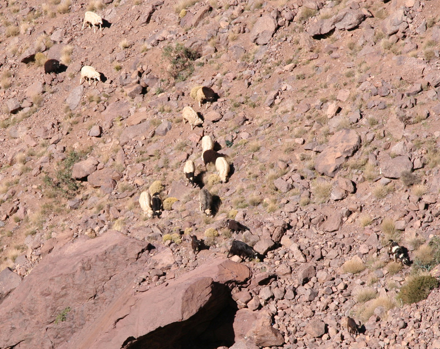
man with goats further downslope,
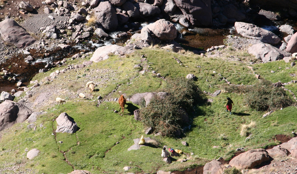
and a bit later I observed some local people with a horse
all the way down by the river.
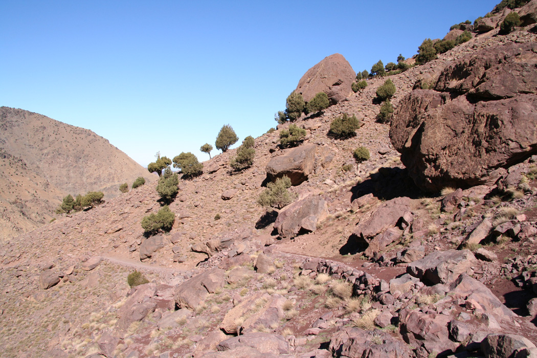
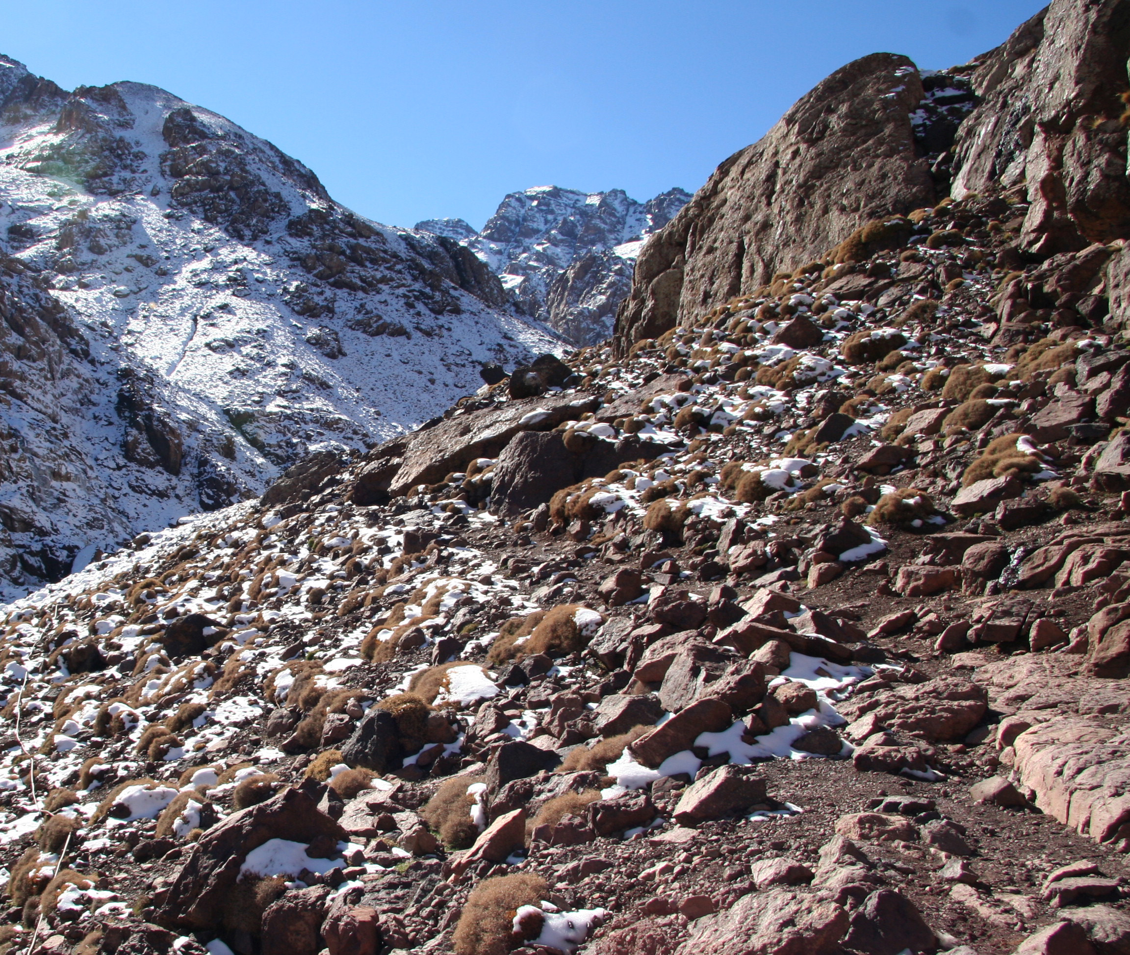
The trail cut nicely along the slope. The terrain is clearly
very dry, but a few trees
still dotted the landscape. In front the Atlas rise abruptly and
the trees vanish.
From a short distance I notice the
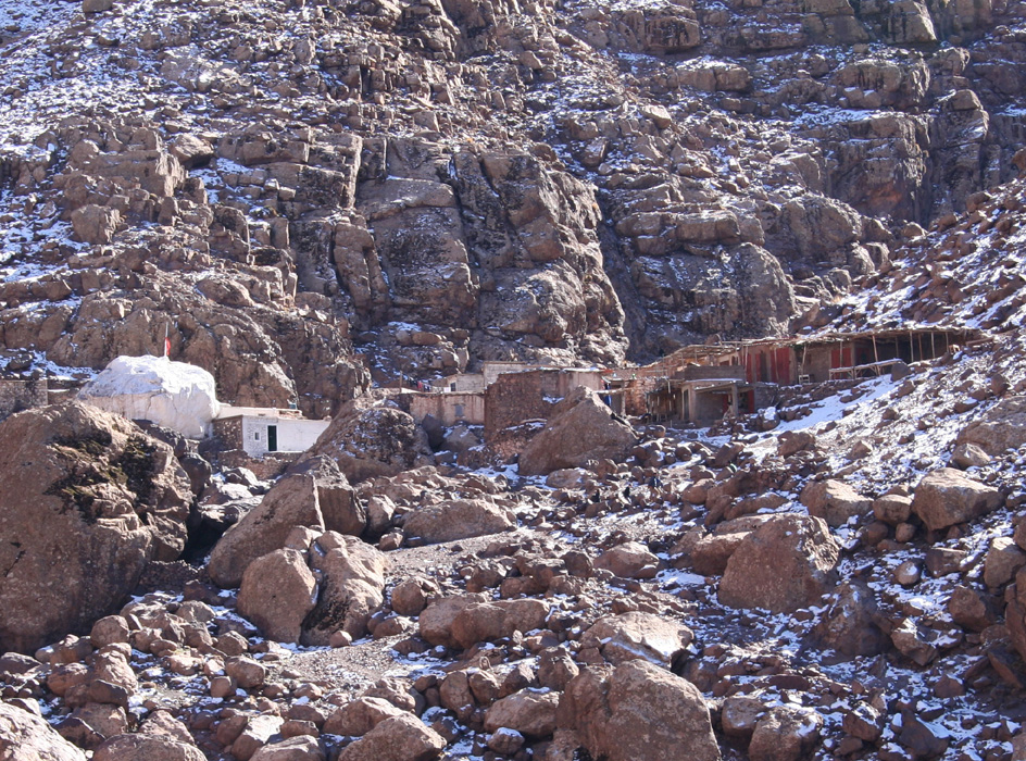
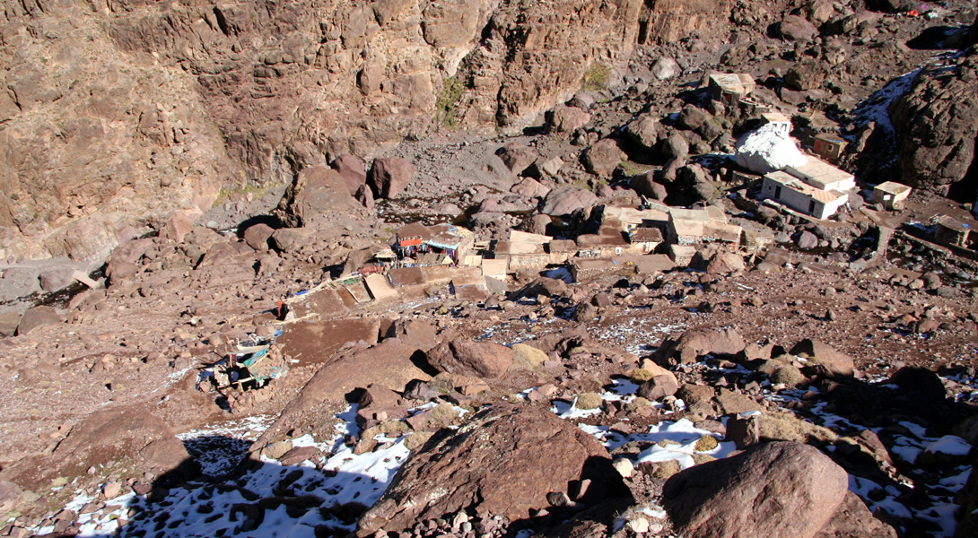
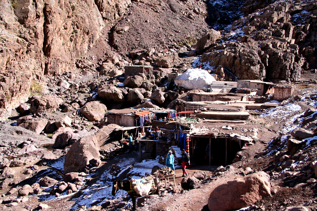
last village, Sidi Chamharouch,
hardly more than a bunch of primitive huts all built together
among rocks and boulders.
Besides people climbing and trekking in the Atlas, there are also pilgrims coming here to
Sidi Chamharouch and its marabout shrine, most likely with its origin dating back to
before Islam.
Obviously, there were people asking if I needed help of any kind, perhaps a cup of tea?
Politely, I told that these were all nice offers, however, I was just fine and really
should continue my hike. People are friendly, they try hard to earn a few more Dirhams, but
one cannot say that they are annoying. A few friendly words back and a smile showing that
you appreciate their offer seems to do the trick. I thought about how two very different
worlds more quickly than before meet and mix. These native Berber people are poor and until
recently lived their lifes quite isolated. Now, I observed that several owned a cell phone.
The rapid increase of tourism attracted by Jebel Toubkal will increasingly serve as a base
for the local economy in this valley that serves the main trail. What with Berber villages
that are located in a less attractive valley?
An unpleasant surprise, as I wanted to waypoint Sidi Chamharouch, I discovered that I had
lost my GPS. It seems like I just left it behind down on the rocky, flat valley floor just
beyond the village of Aroumd. Pretty stupid and costly, hopefully this will teach me a long lasting
lesson about how to keep track of my GPS.
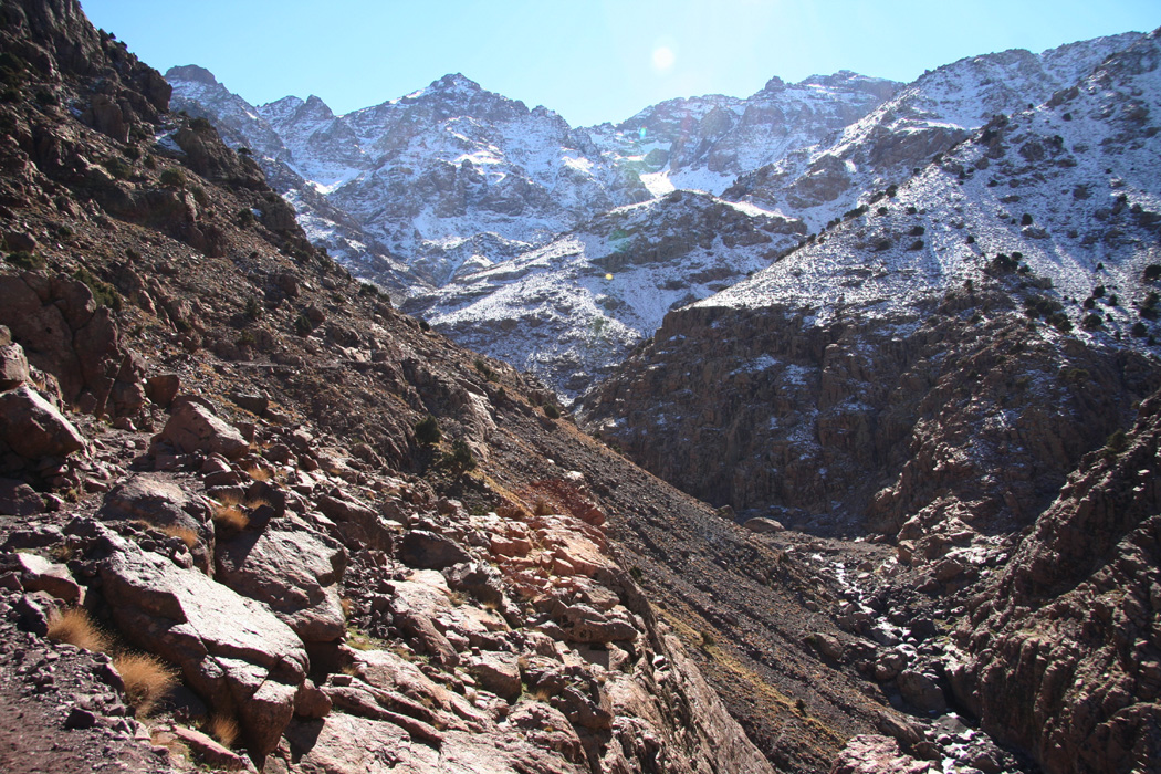
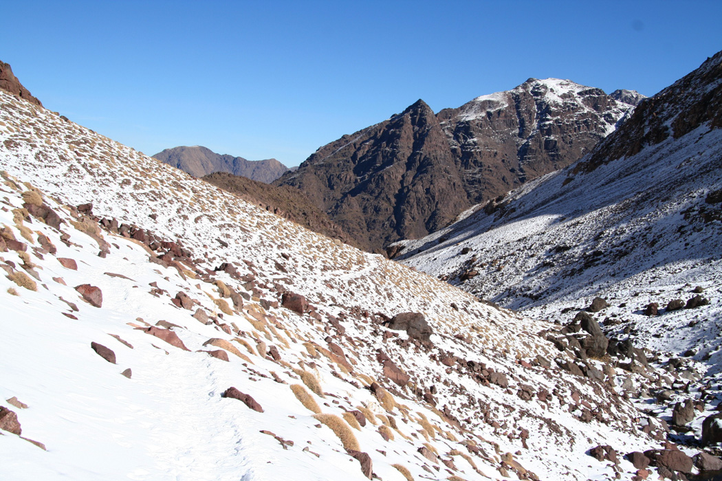
I continued my hike as the trail made its way up a broad ridge above the village before
contouring left into the valley higher up. Somewhat to my surprise, I realized that this
valley continued as a pretty big valley much higher than I had imagined. Slippery patches
of ice started already down in Sidi Chamharouch, but the snow did not increase much as
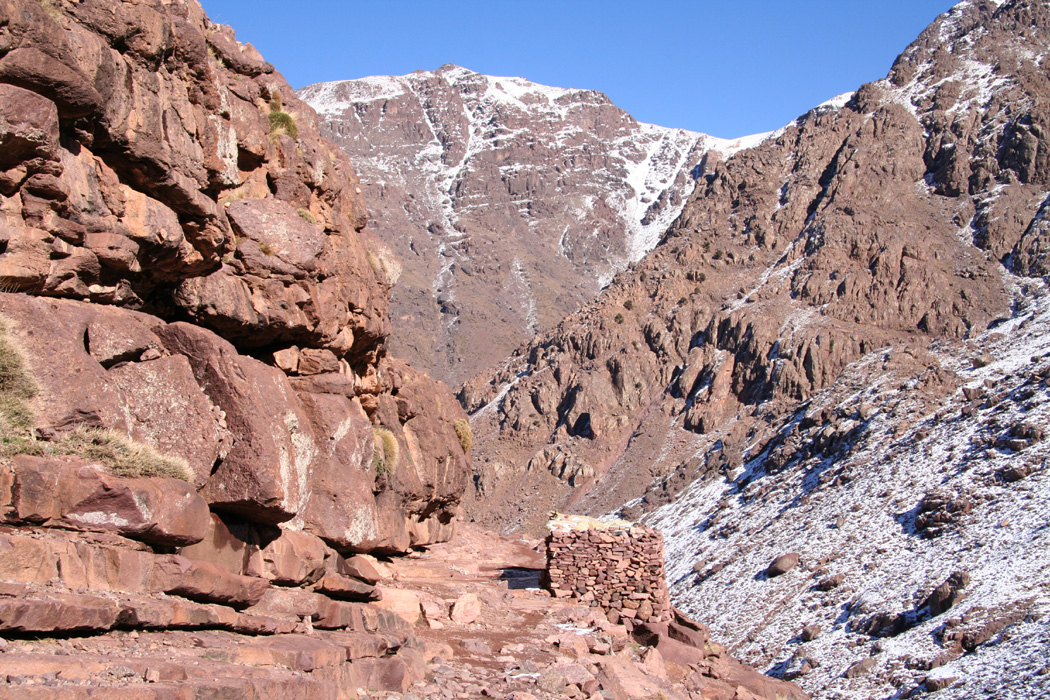
the trail curved around to the right and therefore faced more south. I noticed a
small shelter
built along the trail and the changing scenery
as the trail climbed higher.
Looking back, I realized that the trail steady gained more elevation.
Gradually, more snow but not a lot. It was fairly clear that the snow shoes I carried on my pack
would not be needed. I had not seen or met a single hiker since I left Imlil. I wondered
how many people would be at the refuge, only me? Most likley not, there were footprints
in the snow that seemed pretty new. The trail (and valley) made a new bend left and the
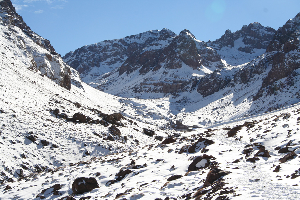
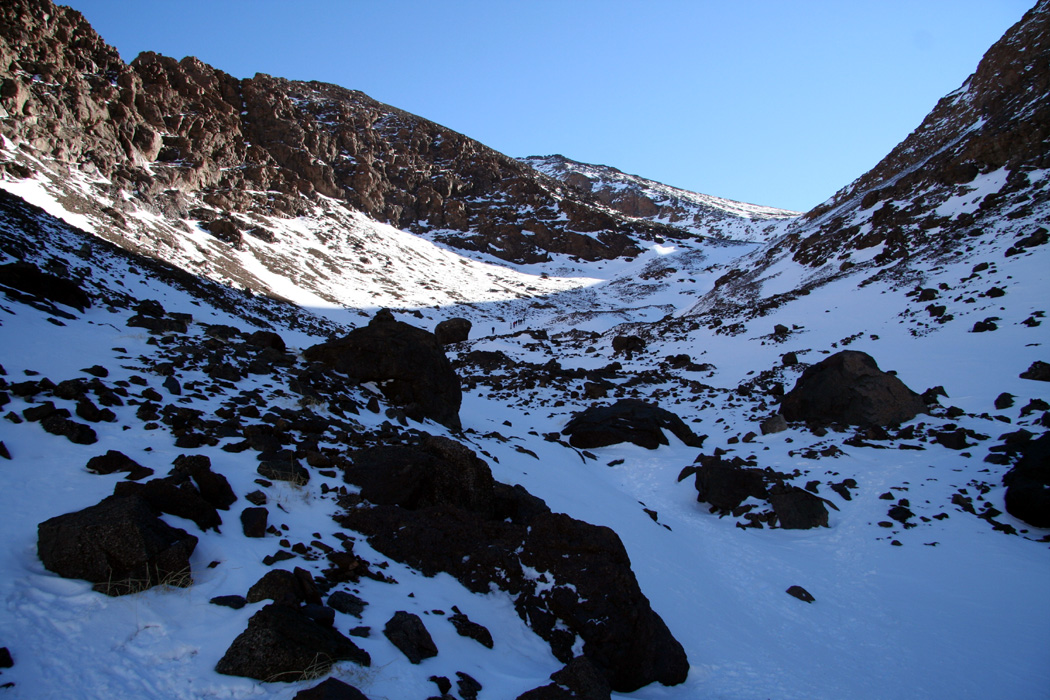
amount of snow increased somewhat. From here and higher the snow covered the landscape
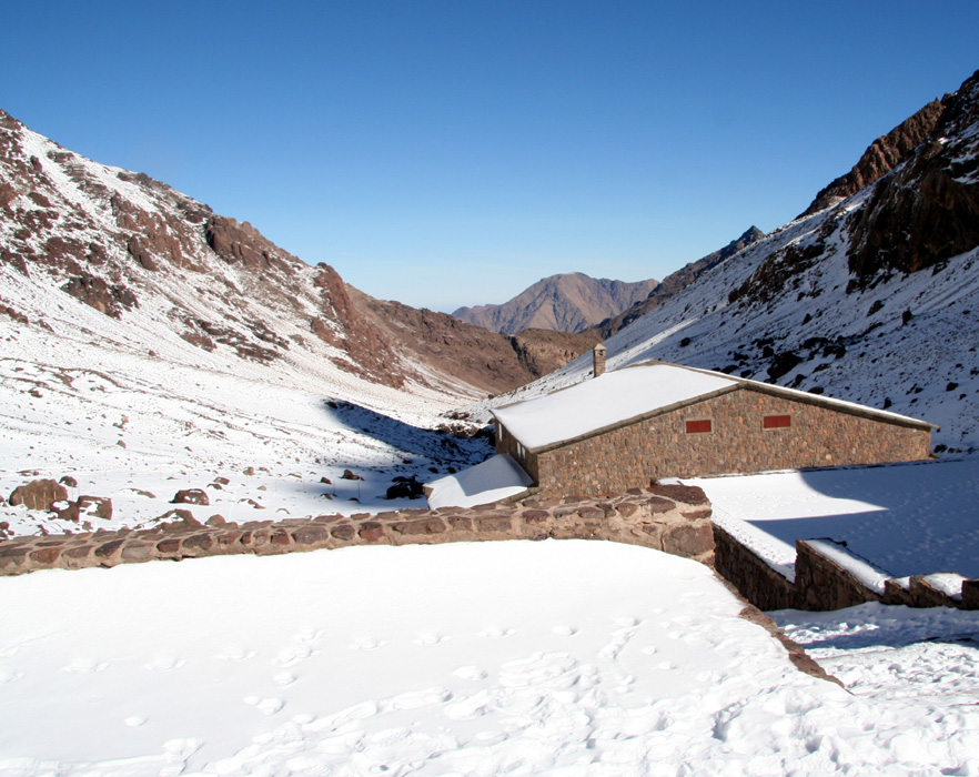
in a more continuous way. I noticed a structure
higher up, either some very large boulders
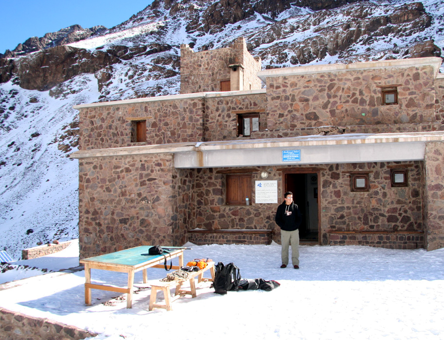
or the refuge. As I closed in,
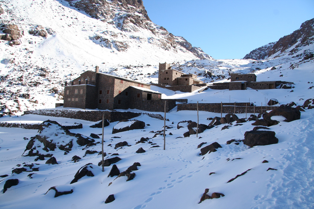
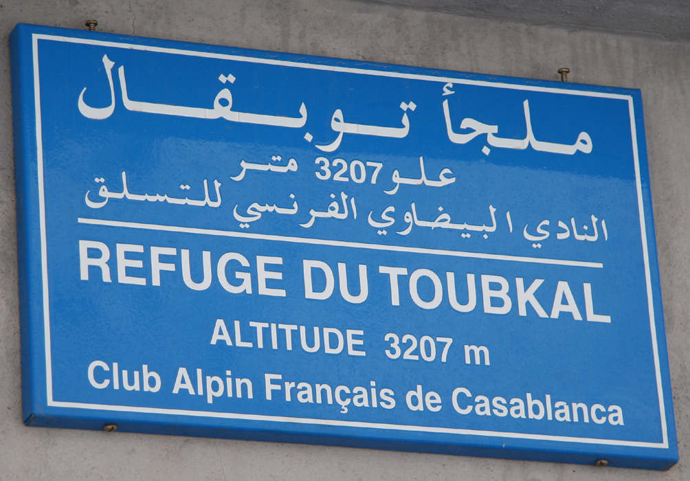
I saw more details of the Toubkal Refuge. Quite impressive,
two large buildings, the last one less than 10 years old.
The construction of this refuge
must have provided a local boom in employment. How many hundreds of mule loads have been
carried up?
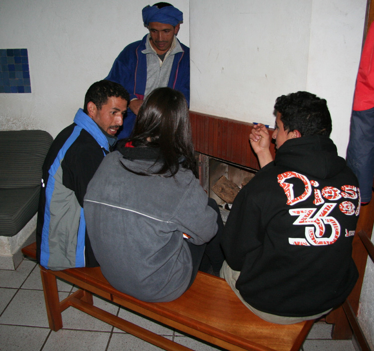
I checked in and talked briefly to a couple of Berbers that seemed to serve
as guardians of the hut. They showed me a bed upstairs, typical French refuge style.
The hut was cold, I needed more clothing indoors than what had been required while
walking. There were two other climbers, from Scotland, that just came down from a
successful ascent. We chatted briefly and their report was encouraging. Good snow
and crampon conditions all the way.
Later in the evening another 3 English climbers came down from the summit having spent
a full day on the ascent, lack of acclimatization seemed to have been an issue.
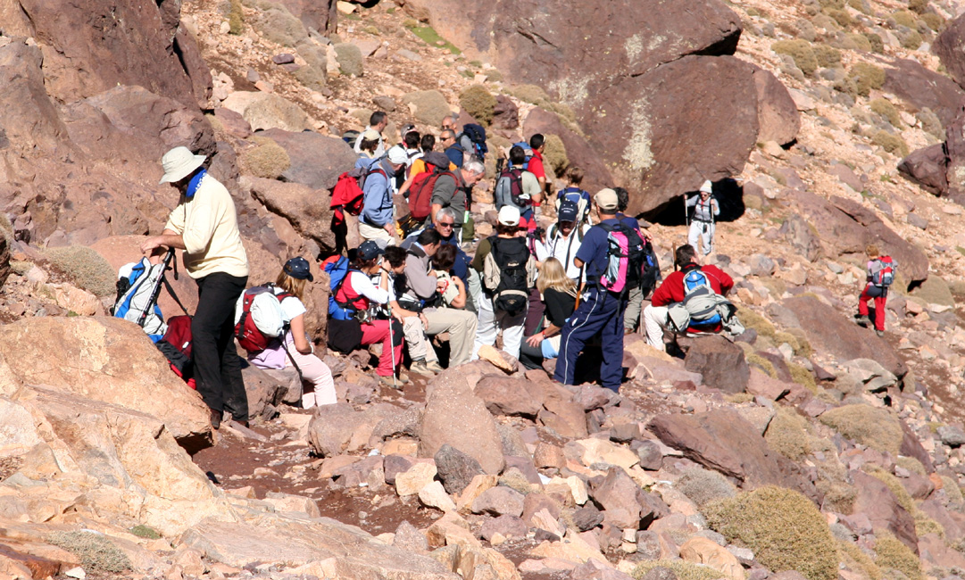
Then later, some 20 more people from Spain came up the trail in order to attempt
the summit the following morning. A small fireplace
in one corner of the room
provided a slight feeling of being indoors.
The rooms had white, cold walls with no decorations except
for a board with cards from
climbers and visitors.
The local staff was more than happy
to cook and serve me dinner, Berber soup plus a dish consisting of lamb, potato and
vegetables, not unlike the Norwegian dish "Fårikål".
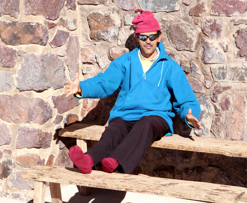
I talked to Omar from Sidi Chamharouch, he had never gone to school, had 4 children that
now went to school in the village of Aroumd. He spoke some English, all picked up from
tourists to Toubkal (The locals skip the "Jebel" when making reference to the mountain).
He took the opportunity to learn some more and we went through the words of "foot, leg,
knee, ear, nose" etc. It was overall a nice and interesting evening. Most people went
to bed around 2100 in order to get enough sleep before their summit bid the next
morning.
I woke up at 0600, pitch dark and most everybody still sleeping. A couple of members
from the Spanish group had just started getting organized using their flashlights. I quickly
dressed and collected what I needed, then went downstairs. I had 3/4 of the bread and the
excess water after filling my one liter bottle.
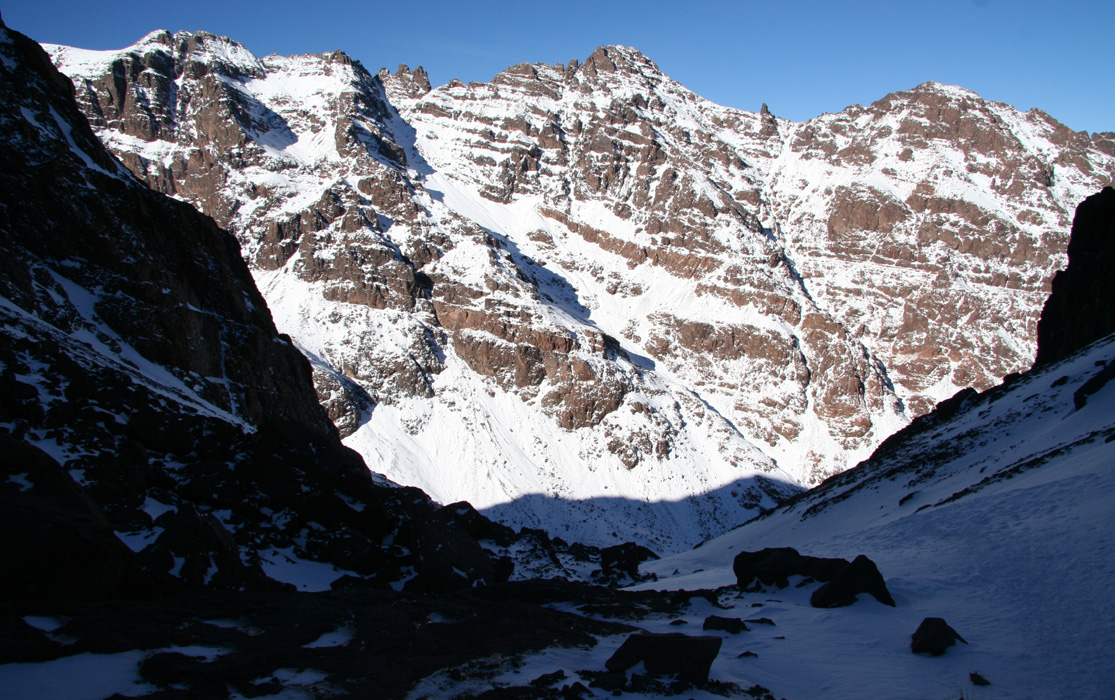
Crampons on outside the hut and then starting up the steep slope right across the stream.
The snow was good, the sun already hit the top part
of the peaks right across the valley.
The slope was not quite as steep as it had looked from the hut last night.
A nice morning view looking out the valley
I had hiked yesterday, the refuge below still
in deep shadows.
I quickly
gained elevation and entered the valley above where one cannot look back down at the hut
anymore. I realized that almost the entire climb would be in the shaddow, still my
jacket had ended up on the pack almost immediately.
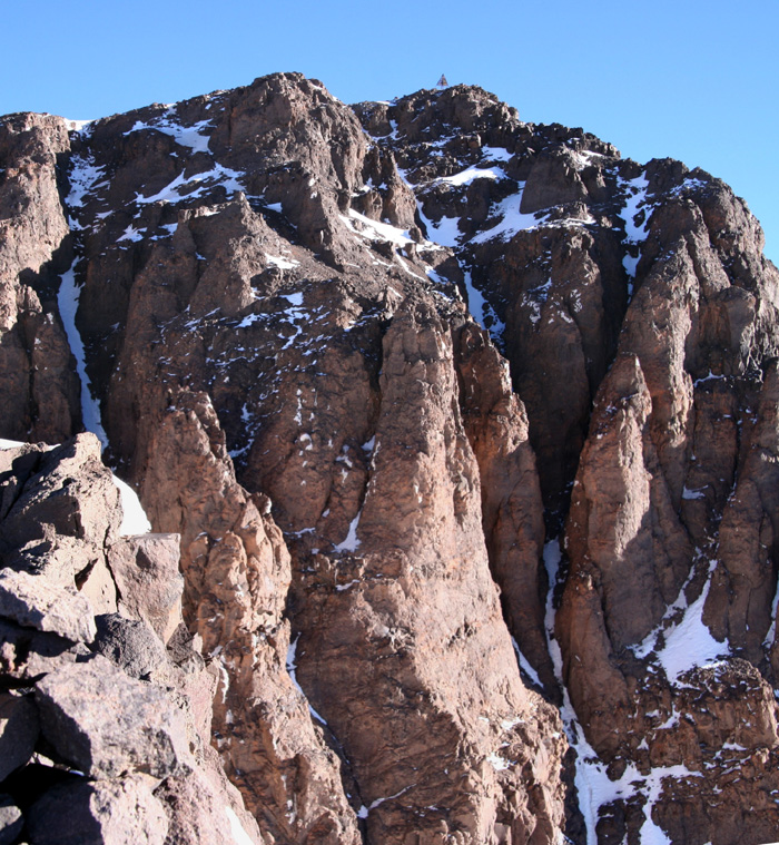
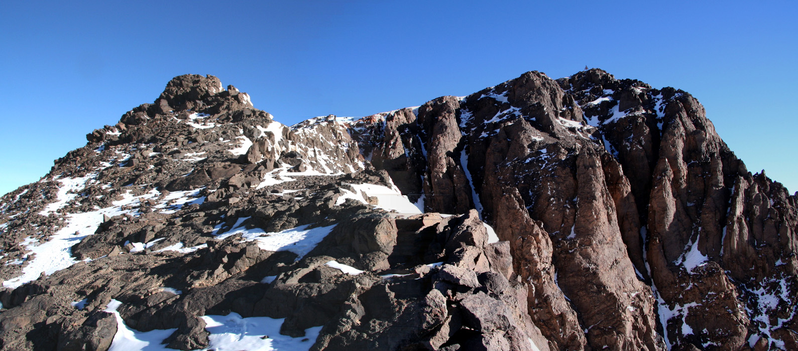
The terrain was now quite easy, then a steeper slope in order to gain the final ridge.
Finally, I had the first rays of sunshine striking me. I was about 15 minutes short of
the summit which could be
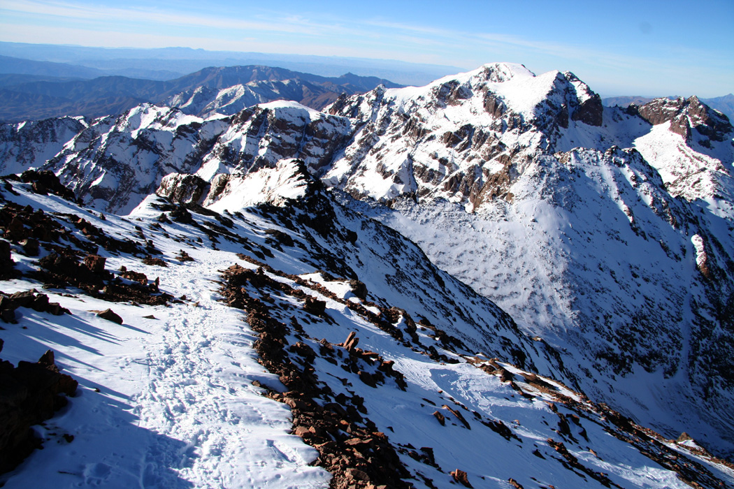
seen across an open void. The U-shaped ridge
looked pretty
rugged, but it turned out that one could traverse at the very upper end of some
snow slopes facing north-west.
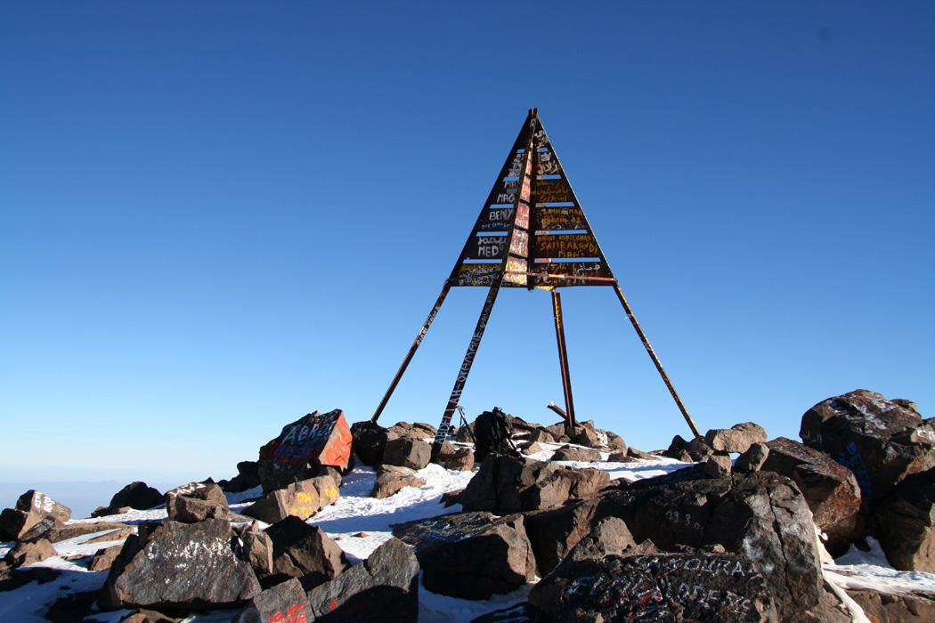
Precisely 2:15 after starting out I was standing on
the highest point of North Africa.
No other climbers to be seen, a slight breeze and
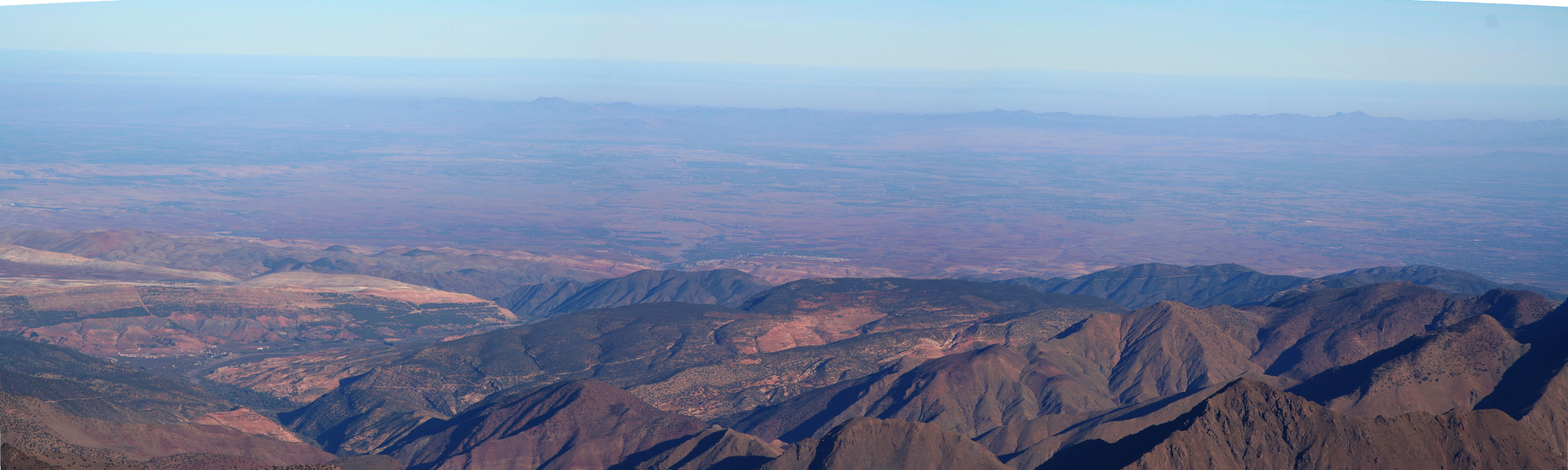
blue, sunny skies. The Atlas mountains is a fairly narrow range with a clear
linear shape. Thus, the views of lower, rolling terrain towards the Sahara and the view
of the flat plains around Marrakech
is broken by the Atlas, a barrier separating the true
interior from the somewhat more accessible territory to the north-west.
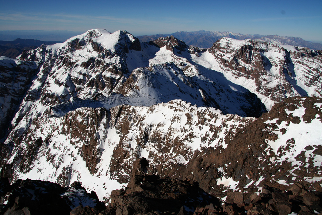
Looking south-west, there are a couple of other peaks
that exceeds 4000 meter, they
must also be accessible from the refuge.
I had a snack, the
rest of my bread and some water, then just sitting on a flat rock near the summit marker
reflecting on what a good day this was.
I started down after 30 minutes, the descent was easy and quick.
I wondered when I would
meet the Spaniards, but did not see them before entering the lower part
of the hanging
valley, just above the initial steeper slope
up from the refuge. I was back down at the
refuge at 1030, only one hour.
Packing my sleepingbag and snowshoes, paying and bidding
farewell to the friendly staff, then
heading down the valley at 1100.
I paused partway down and took some last
pictures up and down the
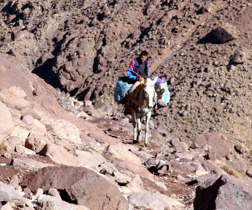
valley, then continued down to the south facing area free of snow. A young man riding
his mule with some supplies
for the refuge came uphill. Further down, a large group
from Spain. This coming week is a week full of holidays in Spain and many take the
opportunity to go on a somewhat longer vacation.
Sidi Chamharouch comes into view, first far below,
then more up front as I am met by
Omar. He offers me tea or coke (I welcome a coke), then shows me some jewlery that he
has for sale. I buy a silver arm chain for my wife. His price could also certainly be
bargained down substantially, I tell him what I can pay (still clearly generous) and
that he should use the money to further encourage and support the education of his
children. After a very pleasant 30 minute break
I continue the hike back down to
Imlil, arriving there at 1345, 2:15 walking time from the refuge. The Atlas has been left
behind, standing guard behind Aroumd
and the Mizane valley. I carry good memories
of friendly people, nice trails and a good ascent with me back to Norway.
The taxi was already waiting for me, the "one leg man" reappeared and expressed that
my "way too early" return was due to his lack of knowledge about my physical condition.
He suggested that I have a meal (give him some business) before departing. I politely
declined and headed for the taxi. He then asked if his brother could get a (free) ride
to Marrakech. I told him that this was OK as long as the taxi driver would not object.
It makes sense to use this form of transportation as efficiently as possible.
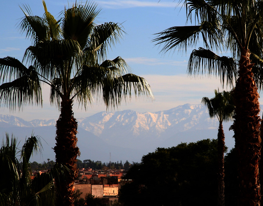
Shortly after 1500, I was again back at my hotel from where I could still
see the Atlas for a last time, then
later in the evening a
genuine Moroccoan dinner with my wife, celebrating what had been a very good
weekend for her (relax in the sun) and me (climb Jebel Toubkal).