Jezerce
- Jezerce
- 2694 m.
- Primary factor: 2036 m.
- Location: North in Albania
- Location: North 42:26.524, East 019:48.770 (GPS at the summit)
- Difficulty: YDS class 3 (3 meter only)
- Climbed October 1. 2007
Jezerce
|
|
How to get there:
From Tirana (or Tirana airport), go north on the main Hwy. to the city
of Shkodër. From there, continue north (direction Montenegro) to the village
of Koplik. As you approach the center of this village, look for a road that forks right with
a sign saying "Dedaj 13 km". This is approximately 90 kilometer from the airport near Tirana.
Measure from here. This road runs into a valley,
across a mountain pass, then descends to the
small community Thethi located in a pretty remote valley.
The following description giving both kilometer and approximate driving
times should be helpful when navigating to the trailhead.
| Km | Time | Action | |
| 0.0 | 0:00 | Sign going right, saying "Dedaj 13 km". | |
| 6.9 | 0:12 | Go left. | |
| 9.2 | 0:16 | Keep right. | |
| 13.2 | 0:24 | Keep right. | |
| 19.8 | 0:37 | Paved road ends (2007). | |
| 31.2 | 1:02 | You drive by a cemetery. | |
| 42.8 | 1:42 | You are at the col, location: N42:23.312, E019:43.172, 1673 m. | |
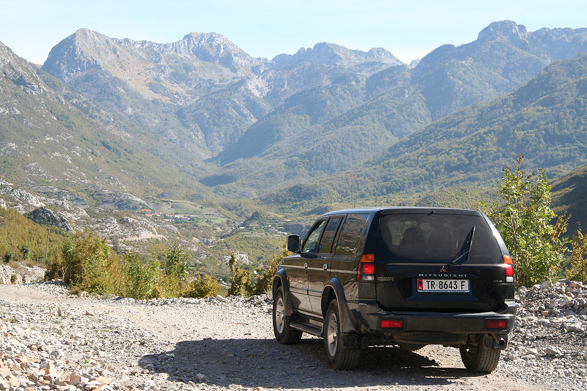
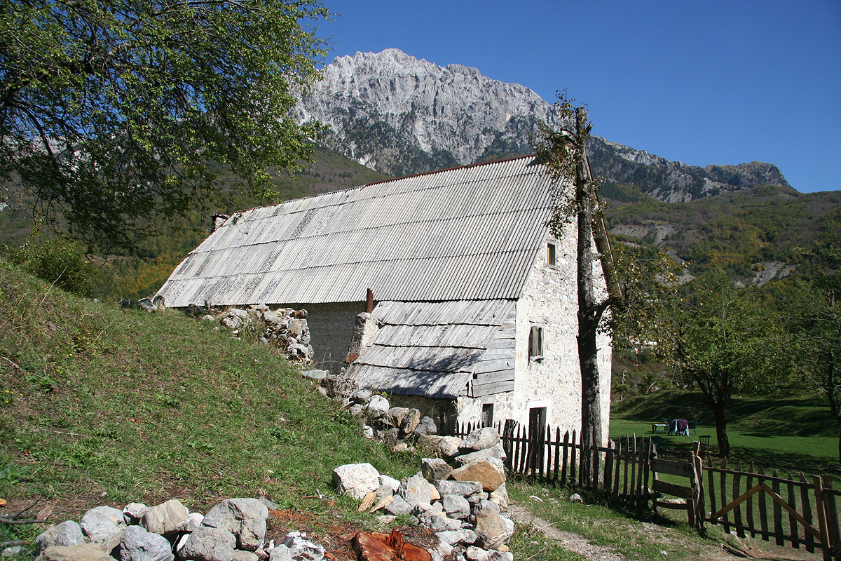
| 57.6 | 2:27 | Turn left into local farm/guesthouse. This is a reccommended stop, your location is: N42:24.164, E019:45.895, 870 m. | |
Actually, one may continue driving downhill and cross the river, then continue
up the valley to location N42:25.671, E019:45.703, elevation 958 m. However,
the car will then be unattended. We were advised to leave our car (safer) at
the farm and rather hike this relatively short section.
Route description:
From the farm,
follow local paths diagonally down and across the river
on an old, wooden bridge. The people there will provide details if needed.
On the other side of the river, you head straight uphill and regain the road.
Follow the road
until near its end, essentially to the alternative trailhead
described above. At this place you can collect drinking water if needed, this may
be difficult to find higher up.
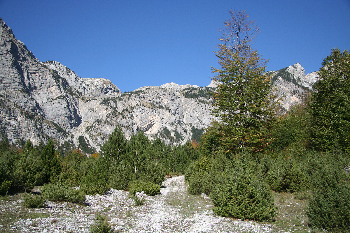
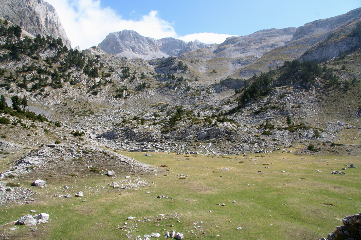
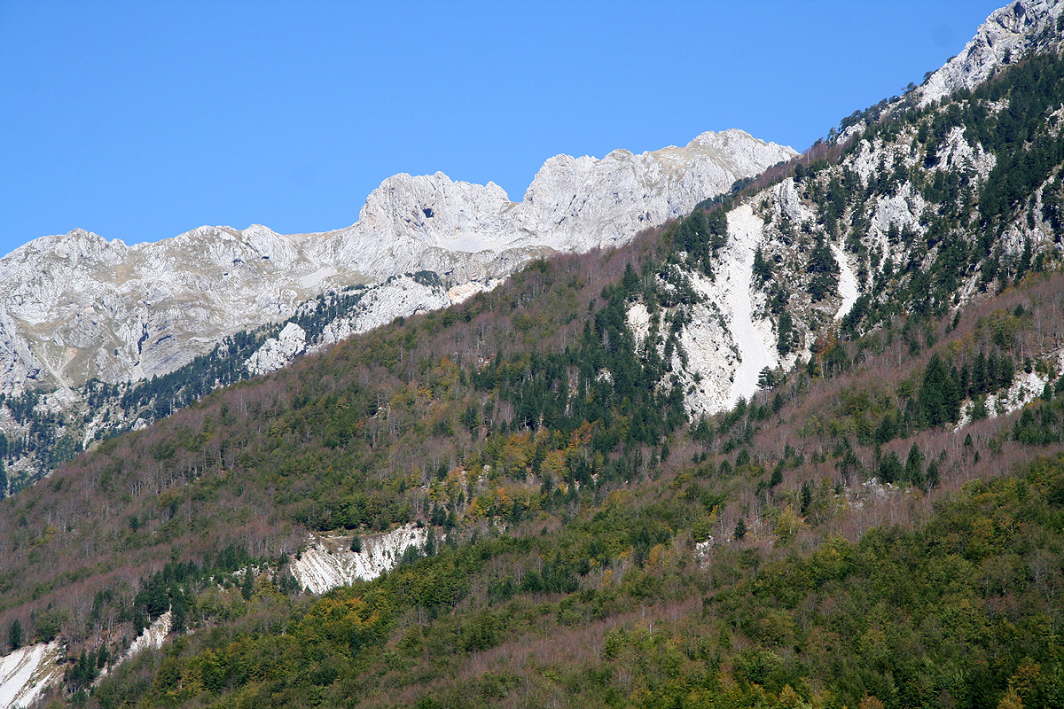
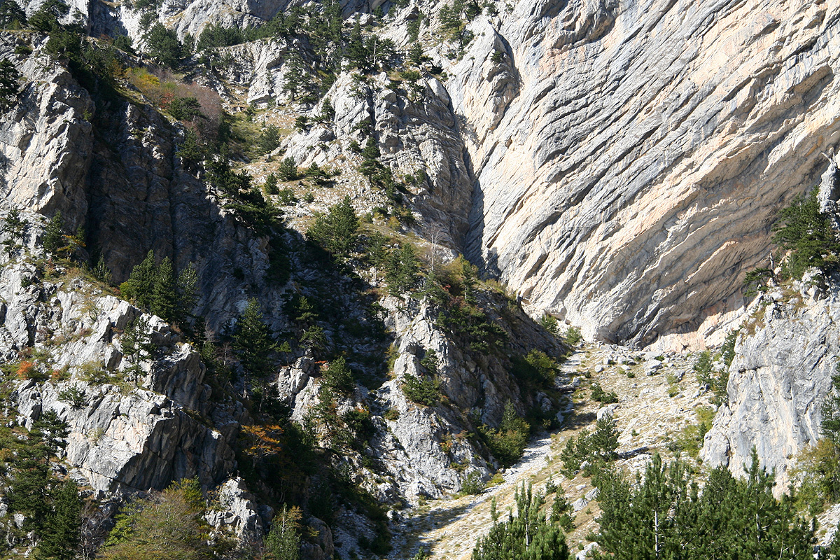
Follow the the trail as it heads straight towards the very end of the valley. This
valley ends in a quite steep wall of cliffs. The trail zig-zags uphill below a huge
overhanging cliff, then elegantly traverses left.
After gaining more elevation, the
trail continues uphill (slightly rightwards) towards a saddle that will lead across
to Montenegro. However, before you reach the top,
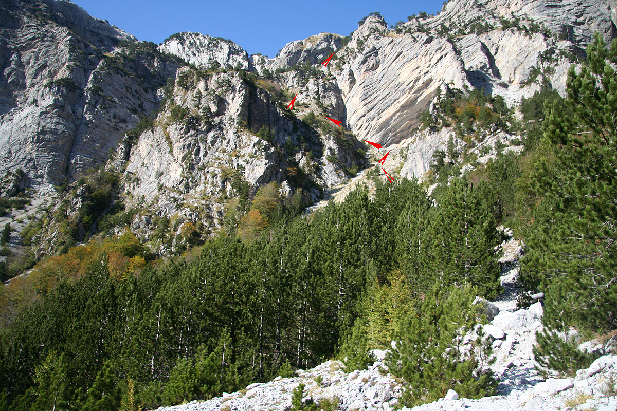
there is a pretty obvious trailfork.
Red arrows pointing in opposite directions are painted on the rock and the location
can further be identified as being just below a very visible cross that has been
erected a little higher. The location of this trailfork is
N42:26.559, E019:46.216, elevation 1668 meter.
Take the right fork. This trail now climbs gently while traversing right. It will reach
a small
saddle and then descend into a small depression which is fairly flat.
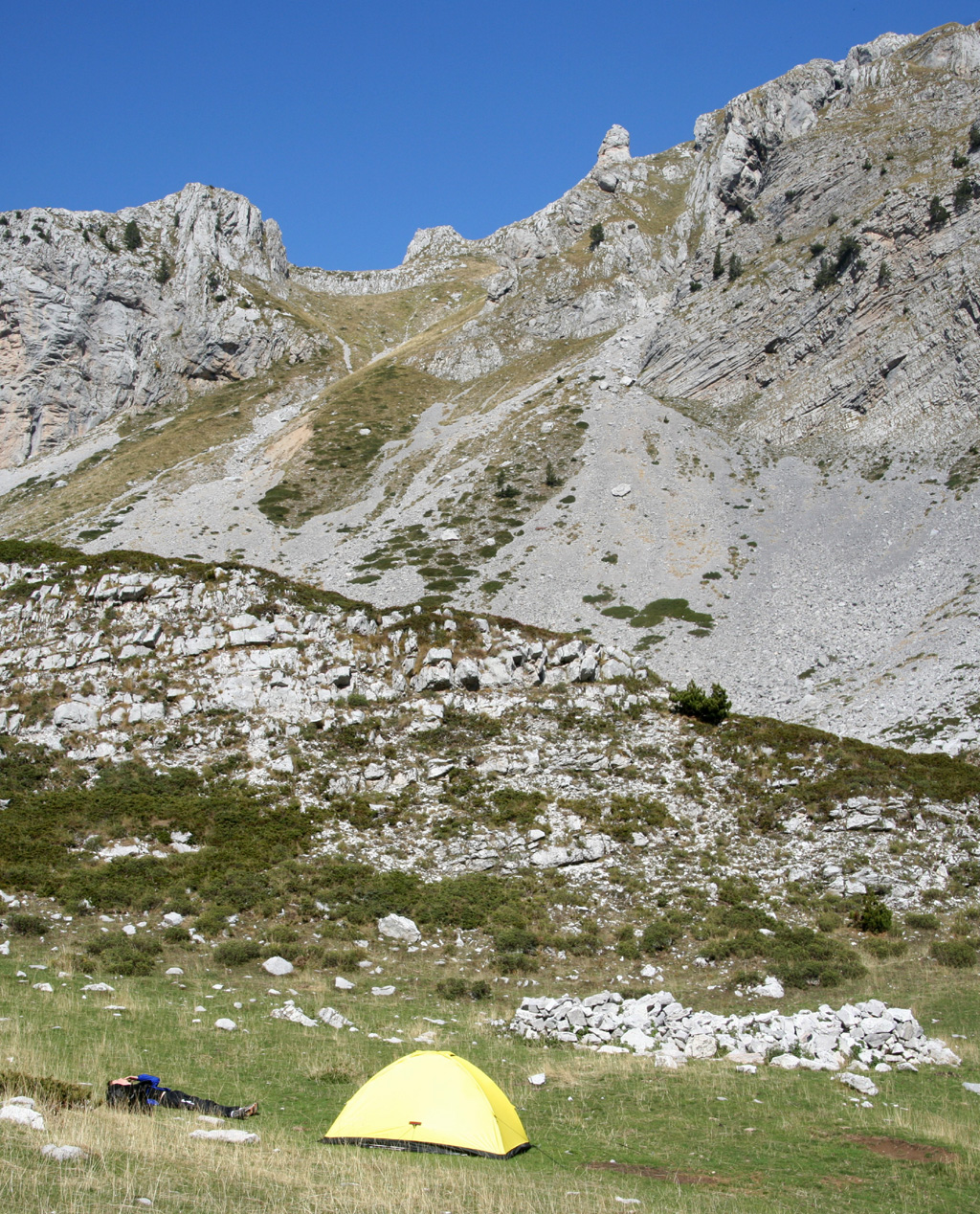
From this saddle, Jezerces comes into view for the first time.
One may camp here.
This location is N42:26.532, E019:46.899, elevation 1727 meter.
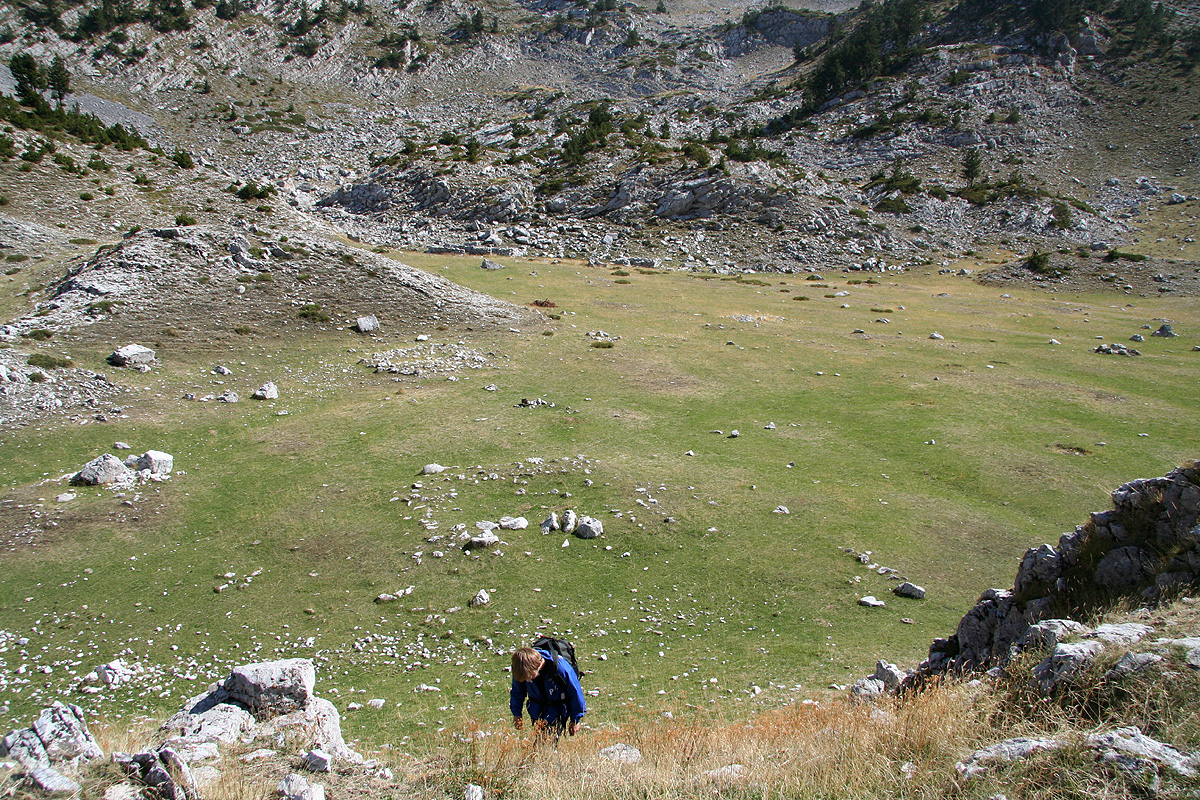
If one follows
the trail that stays in the hillside just right of this depression, one will within a few hundred
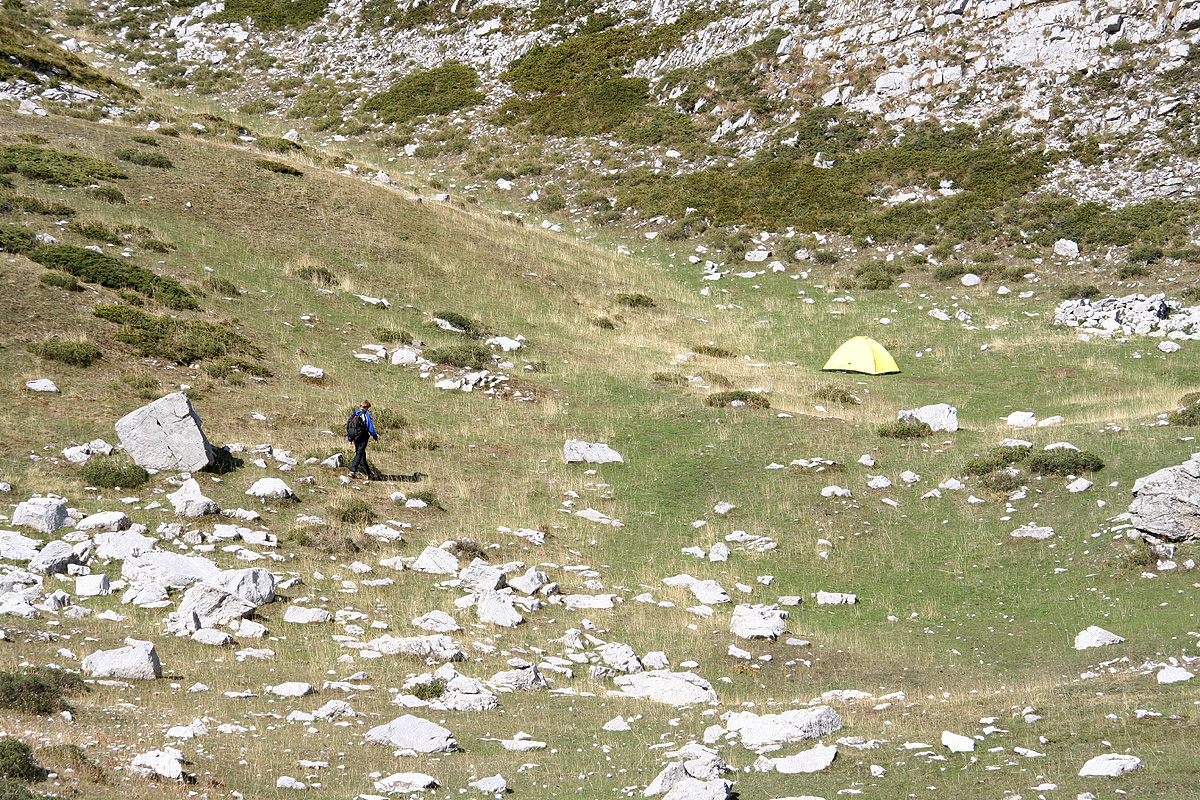
meter enter a much larger, flat area covered by grass.
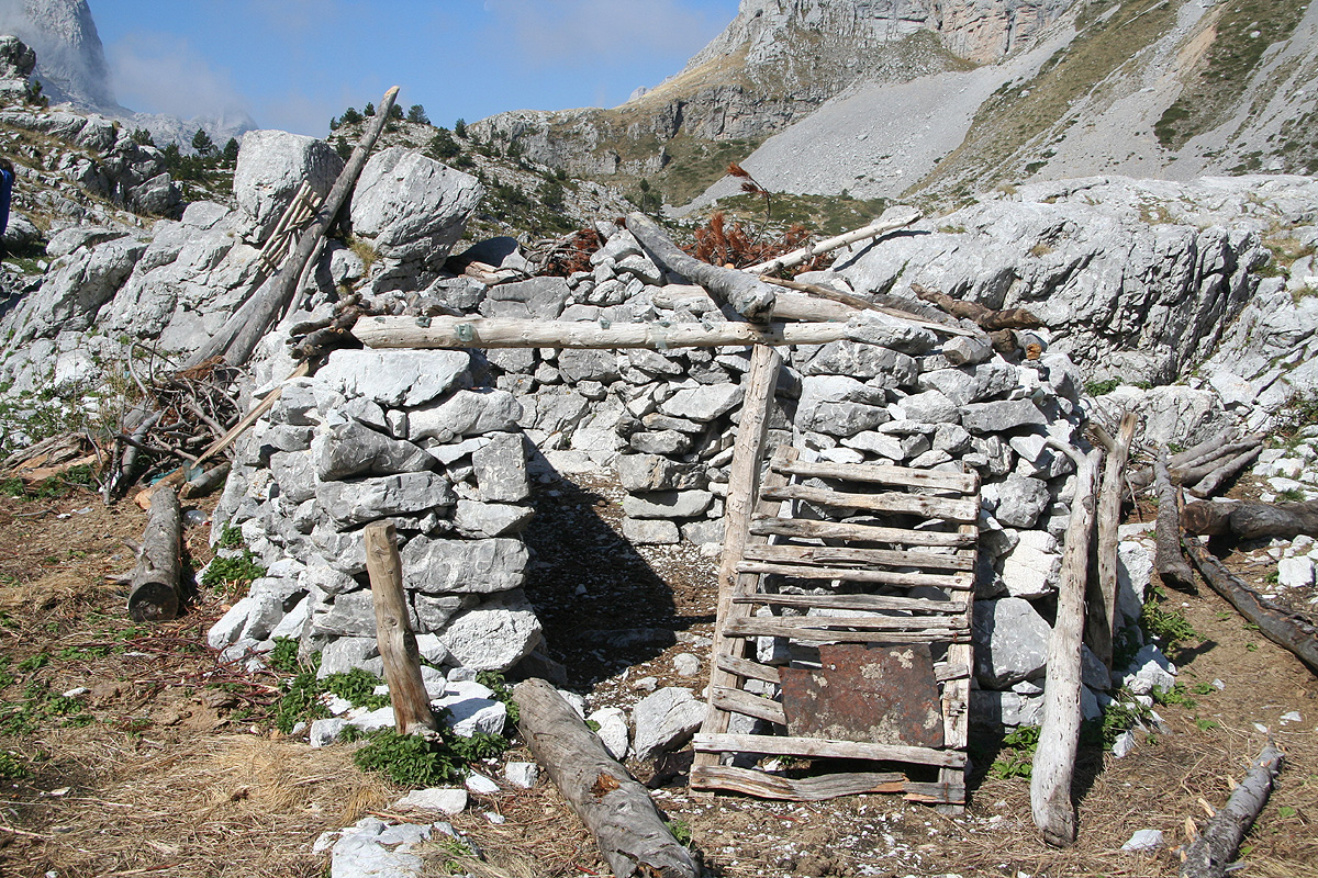
There are old ruins of shepherd's huts
in this area. This would be an alternative, very nice place to camp.
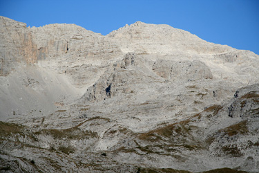
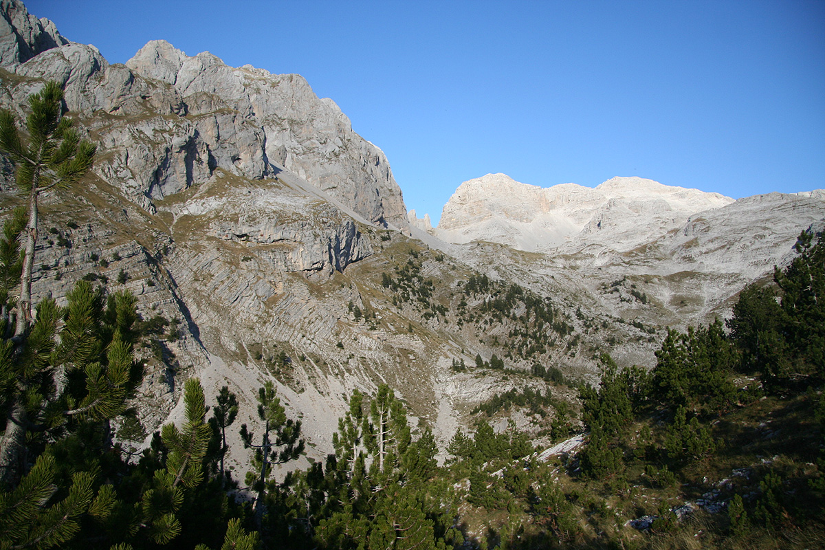
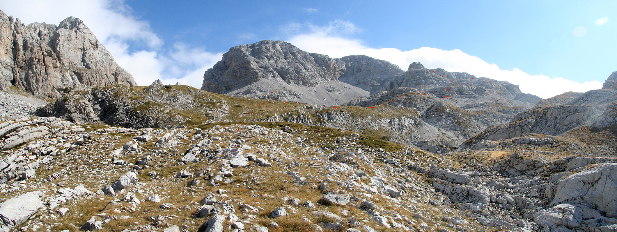
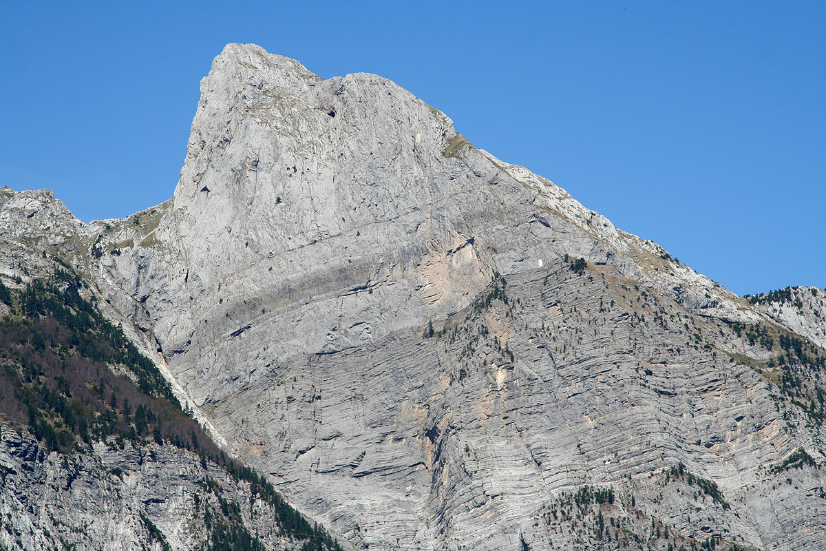
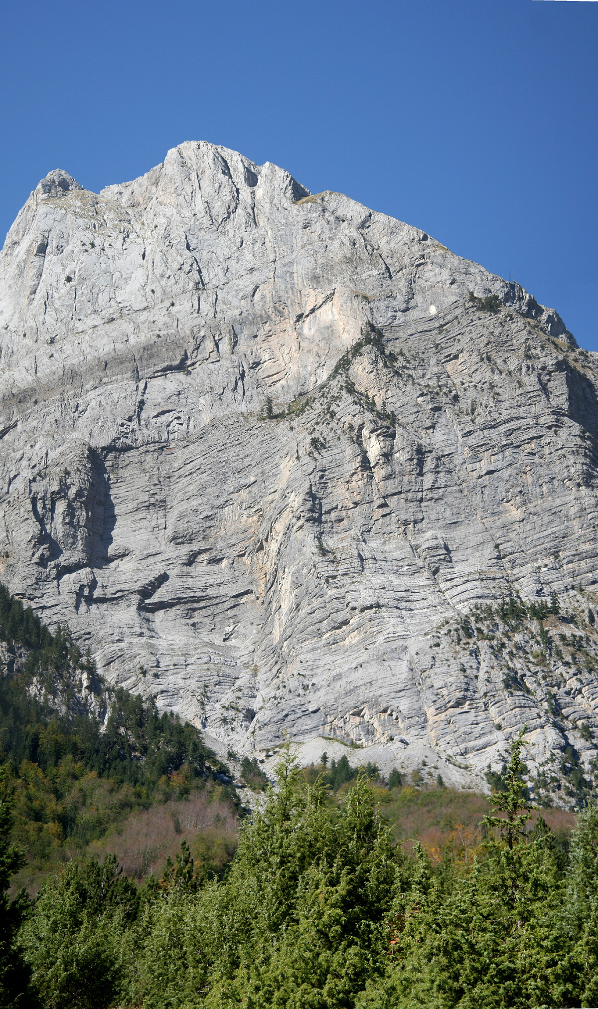
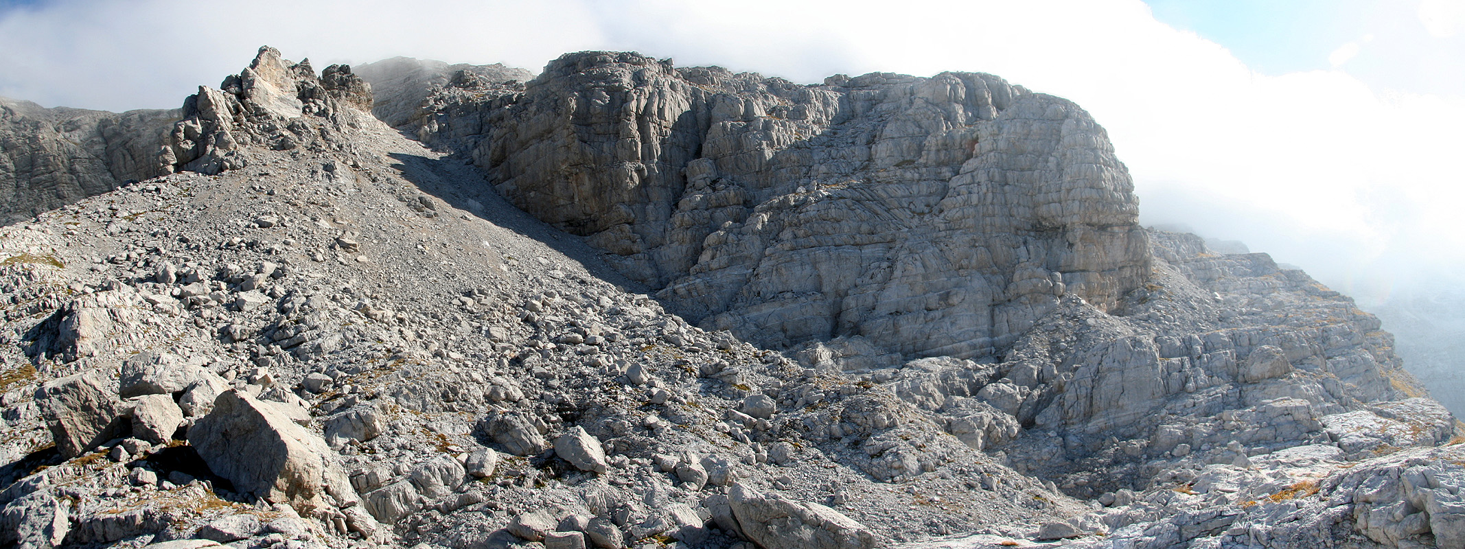
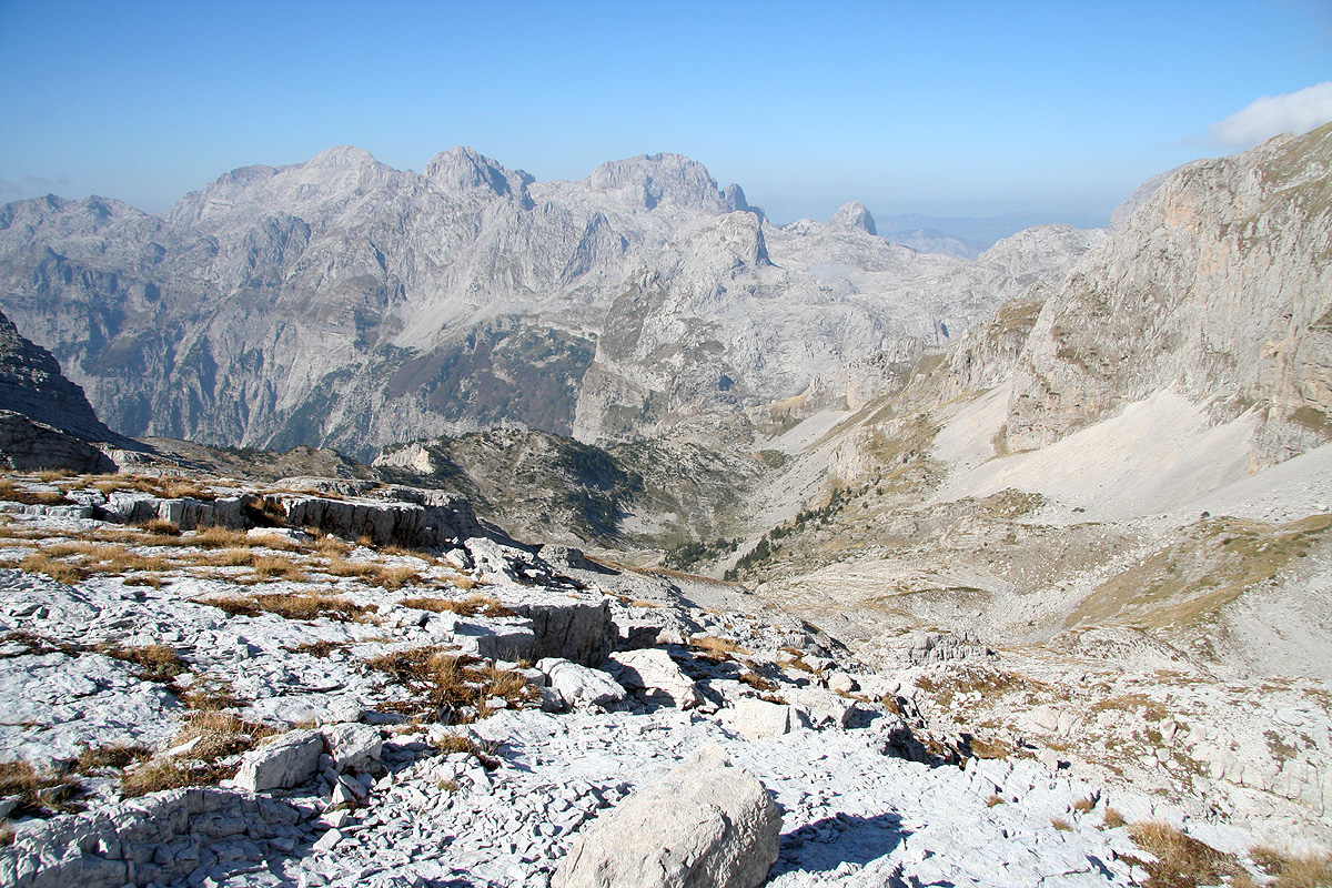
From the areas described above, the peak is within easy striking distance. Head uphill along
grassy slopes. You will see a very clear cut
(notch) in the rocks up ahead, slightly to your left.
This is NOT the route. More to your right, there are several rocks, one quite distinct with a sort
of upwards pointing block on its very top. The (best) route shall stay to the right of this point.
See the photograph
for further details. The deeper valley that you will have on your right, actually
turns sharply around these rocks in a huge left curve. The key to good routefinding here is to either
climb the rocks just right of the "pointing block" or traverse a bit more right below more cliffs,
then turn the corner and ascend along the ridge, now with the deep depression on your right hand side.
If you go more directly, just right of the "pointing block", you will end up on the opposite side and
meet the alterntive route that will merge in from your right side. Either way is fine.
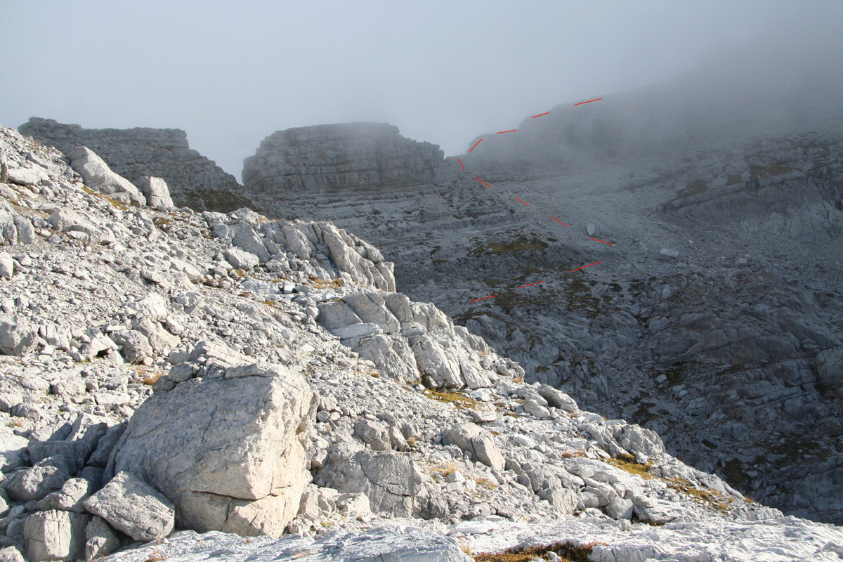
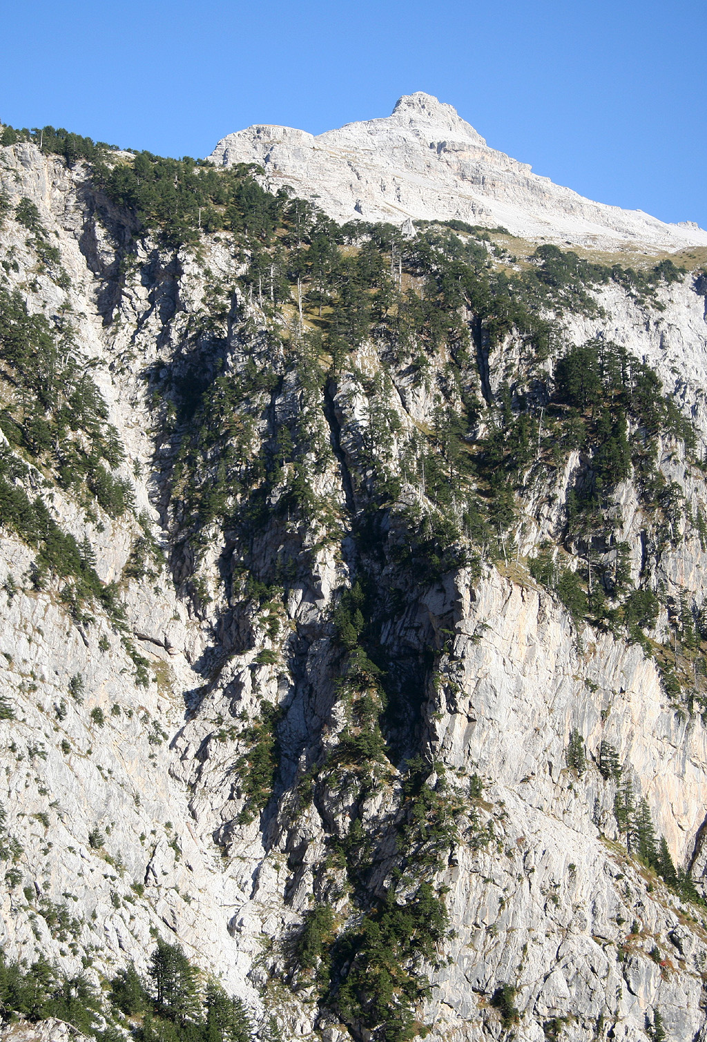
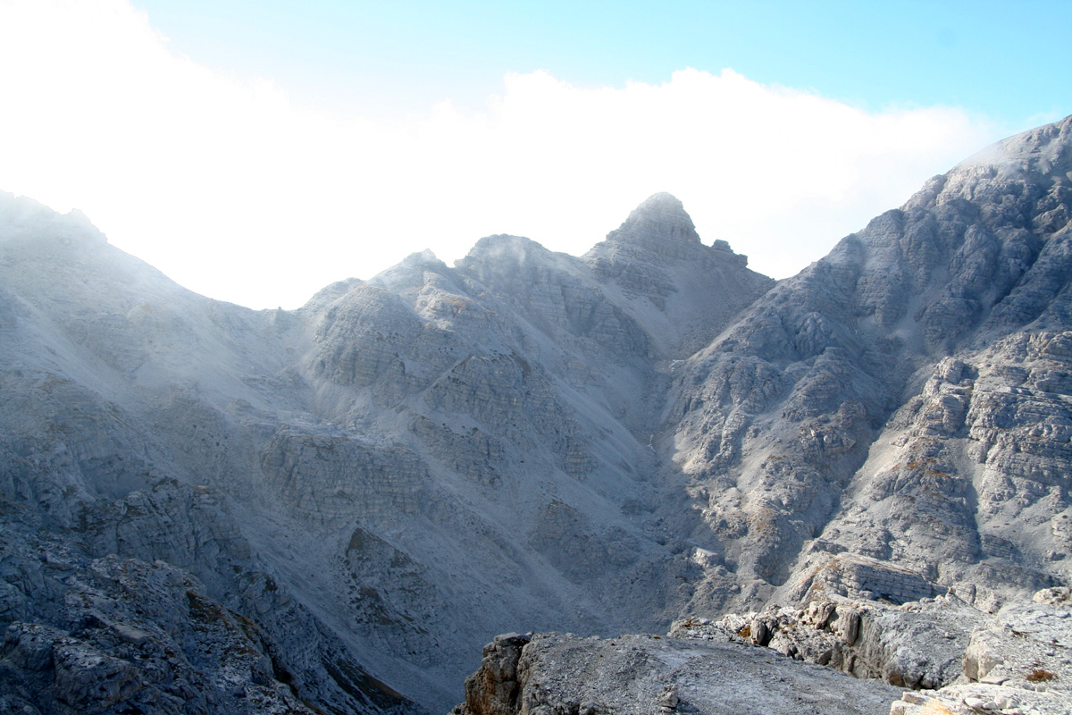
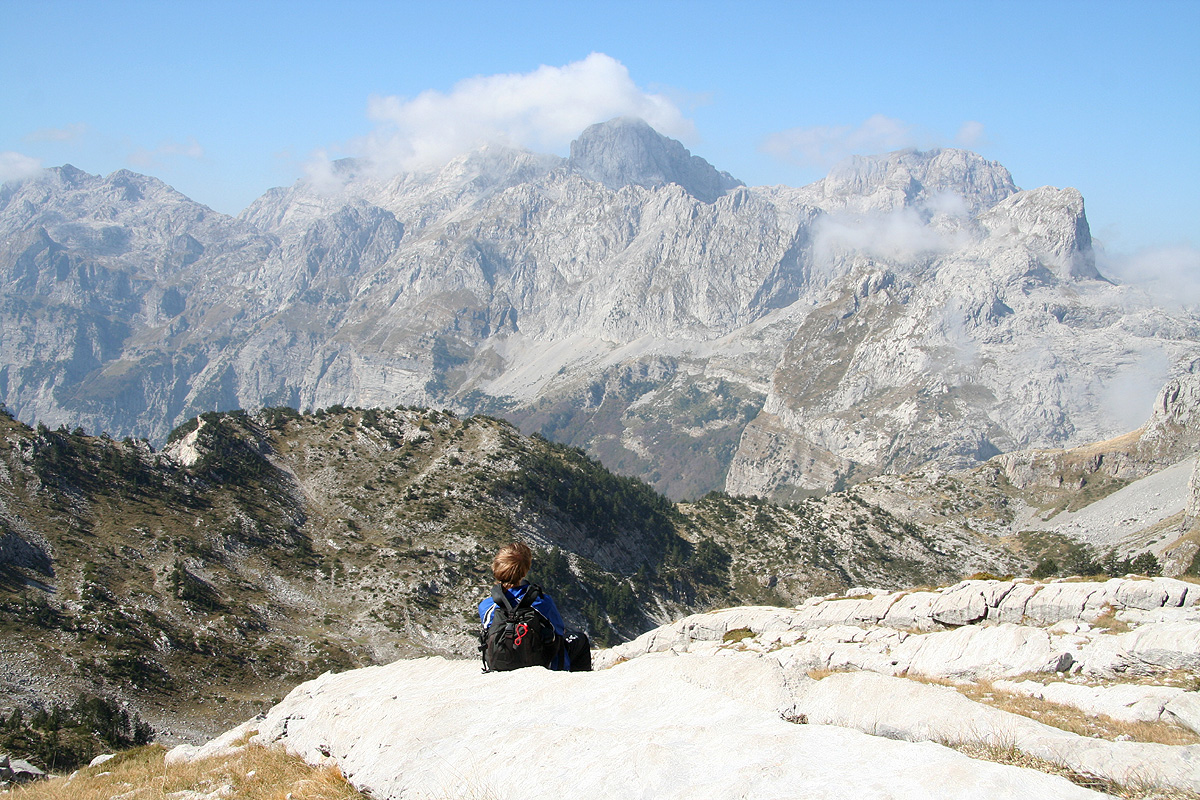
As you ascend along the depression that is now separating you from the peak itself, look for a suitable
place to exit right without loosing much elevation, in order to cross the talus/scree and gain the
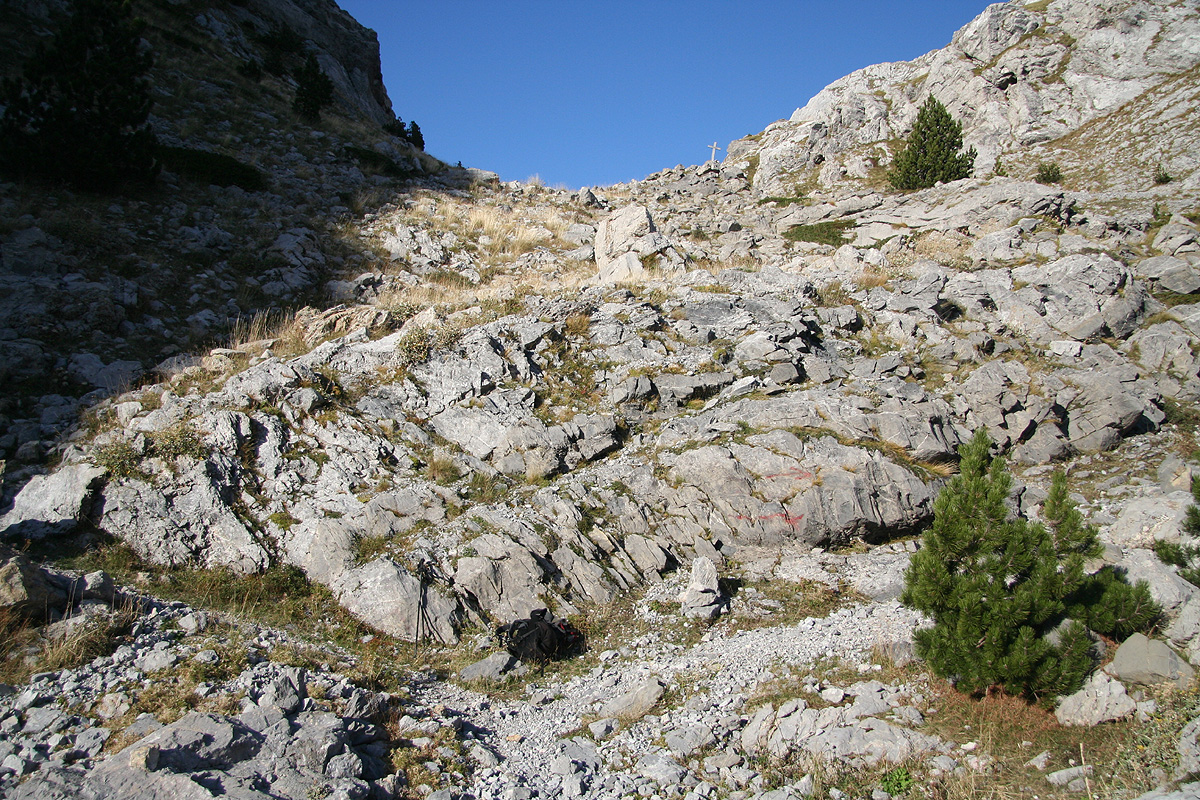
wide grassy slopes on the opposite end. From here, ascend easy terrain to a distinct col on the
main ridge. Study the picture
for precise identification and more details. In this col, scramble rather
easily upwards (to your right) and follow the top ridge a short section, then proceed a bit below and
on the right hand side of the top ridge. Look for an easy passage that will get you 2-3 meter higher up.
There are at least two places where this can be done easily.
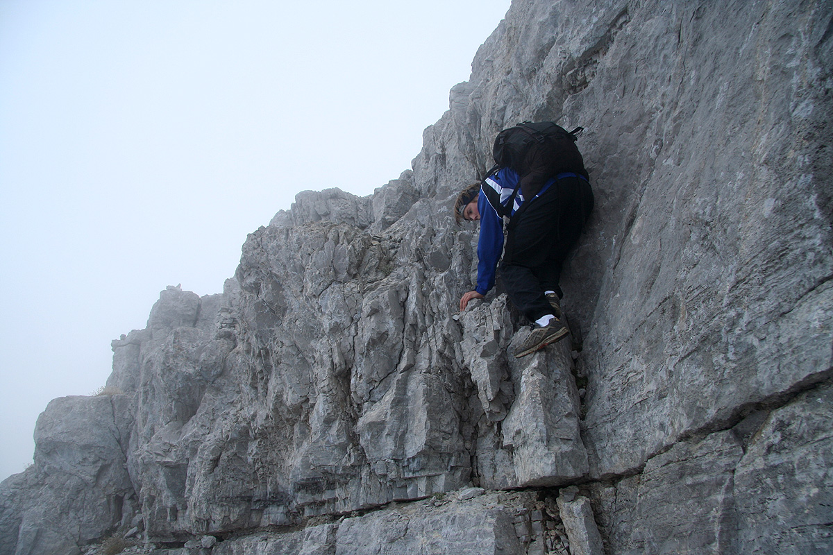
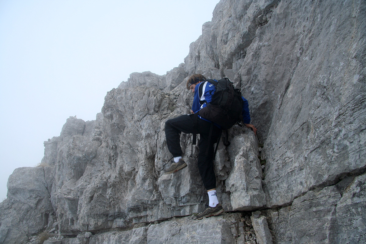
The climbing here is well protected
and quite easy, but rates as YDS class 3. This section is only a few meter.
On this higher level, there is a pretty wide and very distinct ledge that will take you further along, also
this time on the right side of the main ridge. This ledge gives direct access to easier terrain where
you should ascend uphill and gain the very natural col on the main ridge. This location is
at N42:26.584, E019:48.623, elevation 2600 meter. From here, one starts out up the main ridge which is now
quite broad and full of variable sized rocks. As you get higher, traverse left among huge boulders. In this
area you will pick up red trail markers that leads directly to the summit. Even without these, the remaining
part is easy, just proceed uphill where possible while staying left of the highest ridge until you
again regain the top ridge for an easy stroll the last few meter to the summit point.
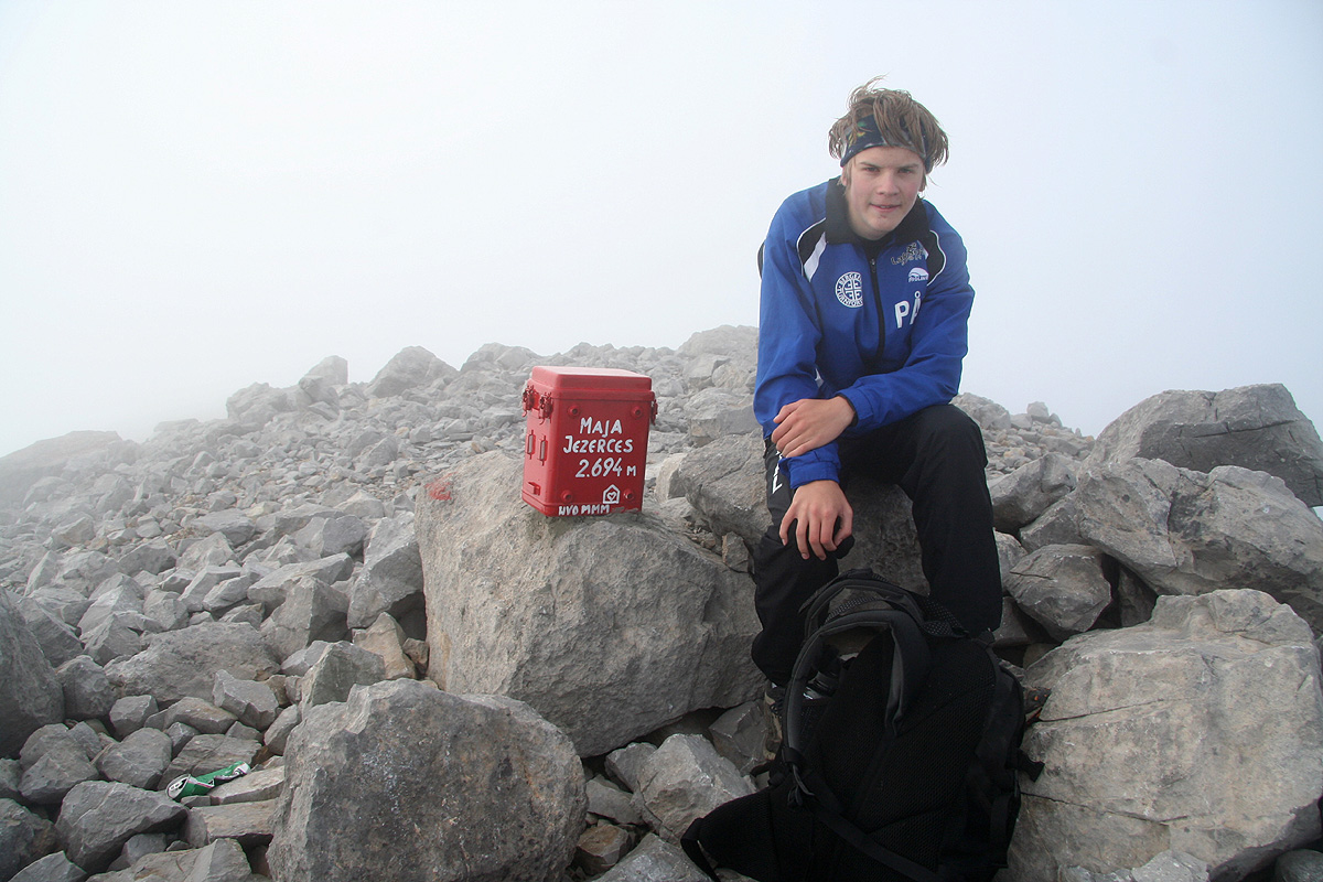
In August 2007, a red metal box serving as a trail register was placed on the summit. I suspect that it will
come loose, hikers should then just see that it is placed between rocks inside the small ring of rocks that
define the summit area.
For completeness, we provide GPS coordinates and approximate hiking times for
the route we followed in the table below:
| GPS coordinates and elevation | Time | Location | |
| N42:25.671, E019:45.703, 958 m. | 0:00 | End of road, trailhead. | |
| N42:26.559, E019:46.216, 1668 m. | 1:30 | Trail fork, go right. | |
| N42:26.532, E019:46.899, 1727 m. | 2:05 | Flat grass area, possible camp. | |
| N42:26.574, E019:47.618, 2027 m. | 2:37 | Waypoint on the route. | |
| N42:26.613, E019:47.798, 2108 m. | 2:52 | Waypoint on the route. | |
| N42:26.421, E019:48.038, 2243 m. | 3:12 | Waypoint on the route. | |
| N42:26.457, E019:48.123, 2268 m. | 3:22 | Waypoint on the route. | |
| N42:26.438, E019:48.275, 2355 m. | 3:32 | Waypoint on the route. | |
| N42:26.512, E019:48.346, 2417 m. | 3:42 | Waypoint on the route. | |
| N42:26.624, E019:48.502, 2497 m. | 4:00 | Waypoint on the route. | |
| N42:26.571, E019:48.605, 2574 m. | 4:10 | Waypoint on the route. | |
| N42:26.584, E019:48.623, 2600 m. | 4:14 | Last col on the ridge. | |
| N42:26.524, E019:48.770, 2694 m. | 4:30 | Summit. | |
Trip Report / Comments:
September 29. Travel day.
Pål Jørgen travelled from Bergen via Copenhagen to Vienna, while
I drove from Linz to Vienna this Saturday morning. Originally, this fall break was
planned for Slovenia and the Dolomites, however, a very miserable weather forecast
had made me change plans at the last moment. Thus, we were booked on an evening flight
to Tirana in Albania for a week of exploring this somewhat "unknown" country and hopefully
find our way to a few of its ultra prominent mountains.
We took a trip to the center of Vienna, walked around and had lunch before returning to the
airport. Our flight departed at 2225, arriving essentially at midnight. I had made arrangements
for the rental of a Pajero Sport Diesel 4WD truck, and reserved a room at the very nearby
airport hotel. This was all in the best order and we hit the bed as soon as possible.
September 30. Travel to high camp.
We started out after breakfast and headed north towards Shkodër.
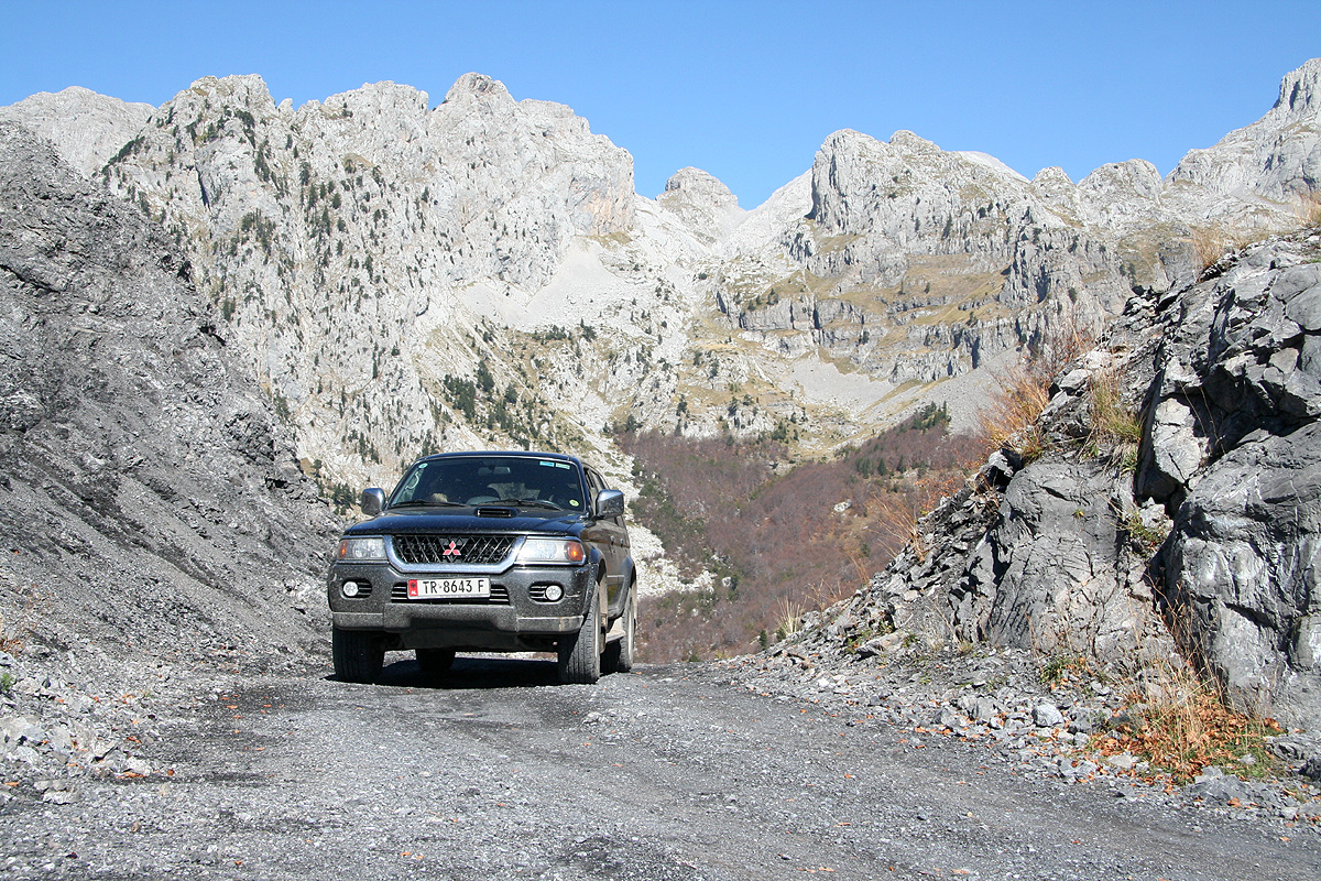
The adventure did not really start until we had left the paved road and navigated
the not so good dirt road
up the slopes towards the pass that separates Tethi from
the western part of Albania. What a facinating landscape, great mountains
and deep
valleys. The arrival into the Thethi valley was really nice. This valley is remote with
a lengthy access along a pretty bad road, then this rather isolated valley with its
steep mountains and friendly,
hospitable people. I immediately thought about how isolated people
living here must have been in the past and possibly still are during winter time.
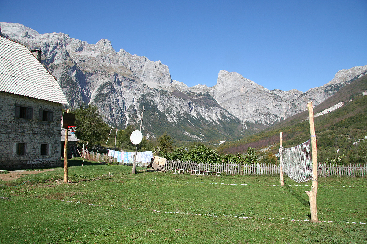
We noticed the sign pointing left to the little farm
that welcomed visitors and decided to
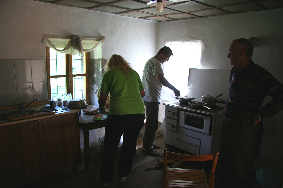
check if we could have a somewhat late lunch there. No problem, but since they did not know
that we were coming it would take an hour to prepare.
OK, we could rest and look around after
the pretty long travel from Tirana. We met a Dutch couple there, they had participated in some
restoration project and the man told me many stories about the valley and its local people.
Lunch was all made from local, valley products as is necessary if the connection to outside is
long and complicated. We agreed that the car should remain here while we climbed the mountain.
We started out around 1500, the plan was to hike partway then camp in order to climb the
mountain in the morning and hopefully, have time to drive towards Korab.
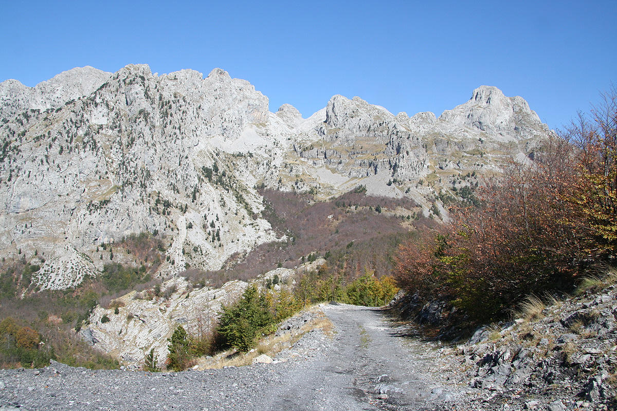
Even before leaving the road that heads up towards the end of the valley, one must simply
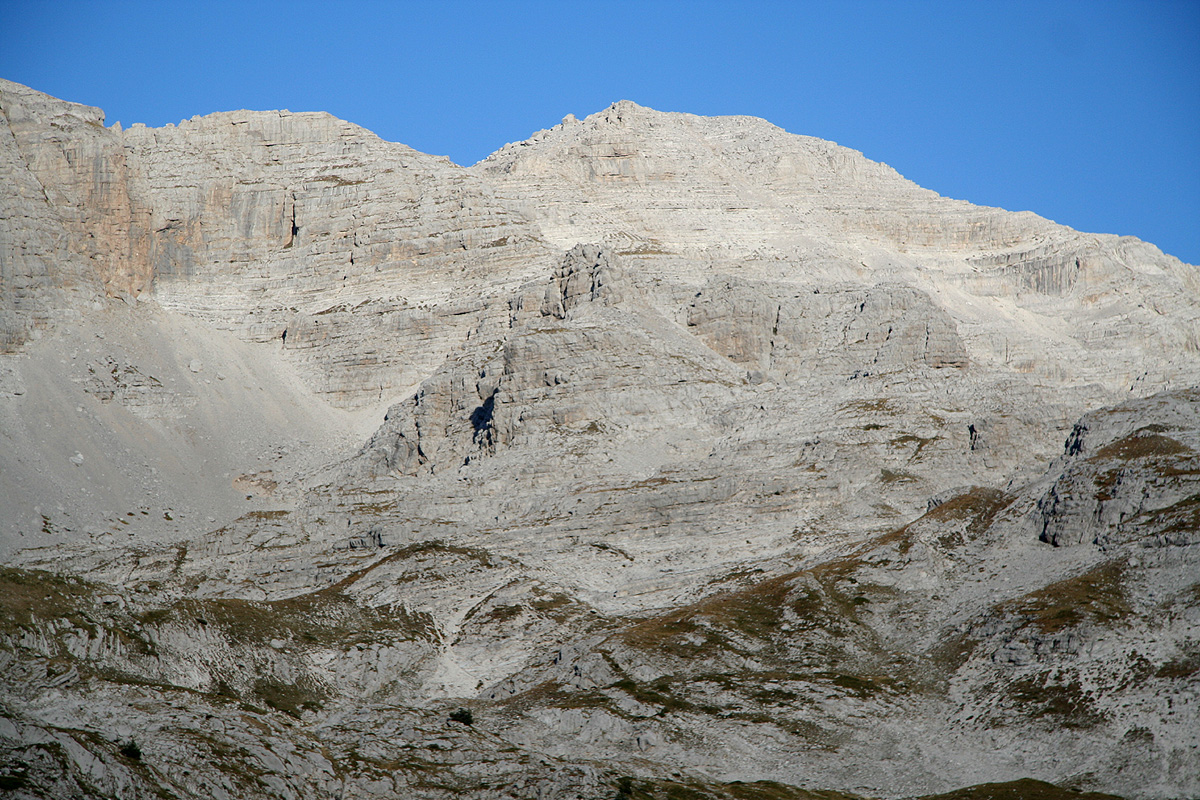
stop and look at the scenery. There are few valleys with similar qualities. Vertical walls seem
to abruptly close the valley. I wondered where the trail would climb out. As we came nearer, there
was one possibility and sure enough, precisely there, the trail had found an exit. By zig-zags up to
and actually under a huge overhanging cliff,
then an elegant traverse and a way up and across to
Montenegro was established.
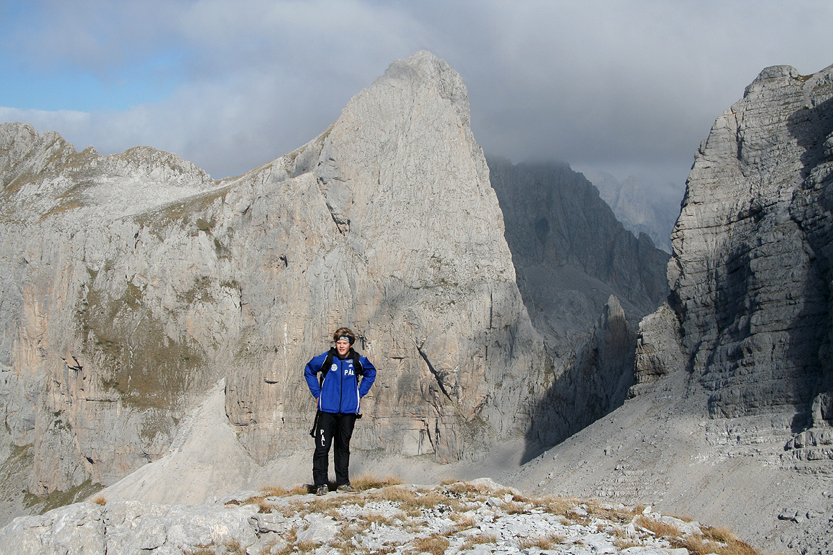
The peaks on either side were shining in the aftenoon light. A landscape
quite different from any other in Europe.
However, before crossing to Montenegro, we found the trail fork that would lead us to a rather
hidden away valley with grass that the shepherds have used for their sheep and goats since very
long time ago. We stopped at the first flat area around 1715 and established camp. This was according
to plan, we had seen the mountain and knew that we could climb it the next morning.
October 1. Summit day.
We got up at 0600 and were on our way up the first hills by 0630. It was pretty clear that
this ascent would involve a bit of route-finding. The first part was pretty clear, up the hill
in the broad valley until last grassy ridge that cuts across.
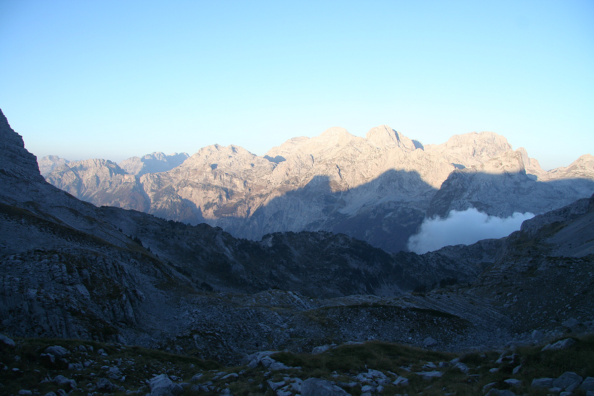
Our valley was still in the shade, but the sun was shining
brightly on the peaks behind us.
The next leg consists of very
heavily water eroded rock.
The water has carved deep holes and what reminds of glacier
crevasses in the limestone rock. We ascended by contouring around before gaining elevation along
the ridge above the valley/bowl
below to our right side. On the return, we cut right across this
area and descended more directly quite close to the characteristic rock tower
that can be seen from below.
It now got foggy and we could not easily see the rest of the route. However, common sense and experience
dictated a traverse across the talus field, then a gradual ascent leading us to the col on the main ridge.
From here, the route more or less unfolded quite naturally. The climbing section was both short and easy
and by 0850 we stood on the summit. Unfortunately, the summit was in the middle of a cloud and the temperature
was low enough to discourage any lengthy stay. We signed the newly esablished summit register, noting that
by far the most visitors to this peak were Czech people.
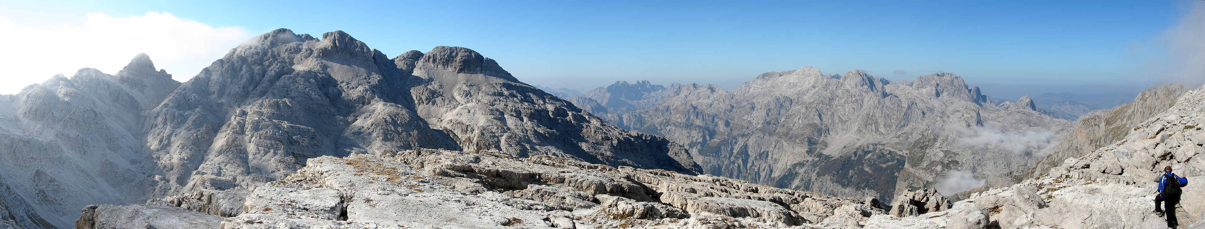
We left the summit after 20 minutes and descended out of the cloud and back into sunshine.
The view of
all the mountains around
us came back with full force.
We descended via the other large grass area and
noticed ruins after old shepherd's housing.
A good break was called
for when we returned to camp at 1120, before
our final 2 hour descent back into the beautiful Thethi valley. Saying goodbye to the friendly people
at the farm, we headed back out across the mountain pass.
The day was not quite over as we rather ambitiously hoped to reach the eastern city of Kukes before
finding a hotel for the night. In this way, we could aim for Korab already the following day.
This was easier said than done, the main Hwy. heading east turned out to be of very variable
quality. We stopped about 40 minutes for dinner, then continued driving with the hope to
be in Kukes by 0900. This hope was effectively destroyed when we hit a sign saying Kukes 70 kilometer
at a point where our map indicated that only about 45 kilometer remained. Later, we turned a corner and drove
straight into a recent rock-fall that had hit the road. Numerous rocks of variable sizes as well as a few
weighing more than 500 kilogram were scattered all over the place.
Just to make the driving experience complete, as we saw the lights of Kukes, the highway ran straight
into some sort of industrial site with no signs and no clear continuation. We first assumed that the
side road would lead us back onto the proper highway, but this was not so.
Going back to investigate further (pitch darkness everywhere), we noted some small cairns like
you often see in the mountains. Driving from one cairn to the next provided the key on how to
complete our journey to Kukes. Arrival 2230.
This trip continued to Korab.