Location: North 62:50.871, East 009:05.646 (GPS on the summit)
Trollheimen, Norway
Difficulty: YDS class 2.
Climbed March 18, 2007.
Information:
How to get there:
See the description for Trollhetta. Route description:
From Trollheimshytta, this mountain is an obvious target. Head across the flat
basin, cross the river Folda and head up slightly south (left) of Bossvasshøgda (815m).
Set your course for the small knoll that extends to the right (north) of a distinct
cliff band. There is no reason to gain elevation early as there are a few small valleys
with ridgelines between them that you then must cross. The rest of the route is well
described on a picture below. First, up a nice slope to elevation 1020, there are a few
small ponds here. The summer route makes a sharp left turn, while a good skiing route
crosses the small ponds and then makes a big ascending left arc to location
N62:51.581, E009:06.387, elevation 1156 meter. There is a large rock here resting on smaller ones, thus
making some open air below it. From this point, a pretty obvious ramp extends south. The terrain
is in fact, much easier than how it may appear from below. Continue to the ridgeline where this
route again meets the summer route. Make another 90 degree turn to the right and follow another
gentle ramp up to the flat plateau at location N62:51.281, E009:06.433, elevation 1330 meter.
The next slope is again quite gentle and takes you up to the main col between Snota and its north
summit (1562m). Finally, follow the broad ridge up to the Snota summit.
Comments/Trip report:
I started out early, at 0645 I was skiing across the first river. Snota was in full view, but
the weather was overcast, no blue sky could be seen. Skiing was easy, despite all the new snow
that had fallen yesterday. I made good progress and arrived at the base of the first cliffs
in a bit more than two hours. Unfortunately, just as I arrived into the more interesting and steeper
part of the mountain, the clouds descended upon me and reduced visibility significantly.
I could still make out a possible route above some cliffs, how steep or wide was impossible to
see. I realized that I could face white-out conditions on descent and therefore took a rather dense
and careful set of waypoints. My GPS had lost all its map information when I changed batteries
early on the first day of the trip, this made things a bit more interesting. I did not notice the
fact that the GPS memory had come loose (thus this problem could have been
fixed easily) until after my return to Bergen.
The climb was easier than I had expected, but the weather got steadily worse. Stronger wind picked up
and when I again encountered ice on the final ridge, I quickly decided to make the very last
leg on foot with crampons. This time, I had a short walk to the cairn, arriving there
at 1110, about 4.5 hours. The summit was rather
unhospitable and I hurried back down. From the small ponds, I took a compass bearing north-east and
crossed near lake Svartvatnet (889m), before going more north. By now, visibility was zero, completely white
everywhere and thus a bit difficult to judge if the terrain was flat or sloping.
My navigation was right on the money, a long nice slope got me down to the
broad saddle south of Tindfjellet, then further down to the lake only one
kilometer from the dam (picture from two days earlier). I was back at my car at 1400, about 7 hours and very
interesting route finding to the summit that captured my attention for most of the first day.
Resources:
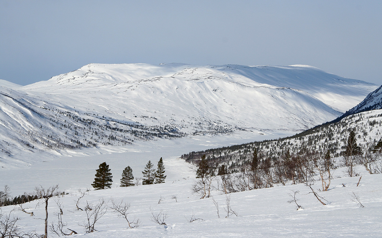
Images
Snota, as seen from Trollheimshytta. The time is just
before 0700, as I start out to climb the peak.
