Location: North 62:51.123, East 009:19.461 (GPS on the summit)
Trollheimen, Norway
Difficulty: YDS class 2
Climbed March 16, 2007
Information:
How to get there:
Trollheimen may be accessed from several convenient trailheads.
I decided to start from the north, the kommune center of Rindal being
the closest area with services.
Rindal is about 100 kilometer from Trondheim, travel from Trondheim to
Orkanger (2 toll crossings, 16 NOK each, exact change!), then take Hwy. 65
to Rindal. In Rindal, there is a nice rustic hotel called Saga. To find it,
take the second exit to Rindal (in a place called Bolme), then drive about
one kilometer and look for a (small) sign on a left hand side driveway.
In order to find the trailhead, measure from the gas station in Rindal located
on Hwy 65. Travel 8 kilometer (west) and locate a road that goes left with a sign
saying Folldalen. Take this road, after about 600 meter (beyond a farm), you
will find a self serve toll station. A single trip costs NOK 50 (in 2007).
Continue up the hill, the road then follows the east side of lake Follsjøen.
Finally, the road heads downhill to the base of the huge dam that contains the next
lake, Gråsjøen. In winter, the road ends here. In summer, the road may
continue a few more kilometer. There is a small parking area. This is the trailhead,
location N62:56.033, E009:07.575, elevation 430 meter. Route description:
The standard summer route traverses the mountain, the trail runs directly up
from the tourist hut Trollheimshytta.
In winter, this mountain is somewhat more of a challenge. I had heard, but not
in any reliable way that the summer route was unsuitable as a winter ski route.
The route described below is likely to work as a good winter route.
From the trailhead described above, follow the road up to the lake. If the ice
on the Gråsjøen lake is OK (most likely in normal winters), then descend
to the lake across broken ice (since the lake is normally lower as the winter progresses)
and ski along towards the south-east. Gradually, the slope on your left becomes more
gentle, leave the lake (approximately at N62:53.788, E009:12.483) and start a gradual climb.
Contour below Kongensgrøfjellet (932m) and cross the creek Kvernabekken just west
of the Kvernabekkvatnet lake. Continue a very gradual traversing climb in order to reach
the north ridge of North Trollhetta at elevation about 1000 meter. This ridge looks
pretty steep, but is not all that bad. Consider possible avalanche conditions. Most likely,
this ridge is dotted with rocks and only a fairly thin snow cover, thus safe to climb.
Zig-zag directly up, the steeper part is only about 100 vertical meter. As soon as the
slope is more gentle, one can contour around the north summit on the west side and reach
the broad saddle between the two summits. The final snow slope is easier if you go far left
(east), then follow the fairly gentle slope before reaching the large and very flat summit
area. Comments/Trip Report:
I had planned this three day skitrip for some time. I had never been to
Trollheimen before, so this was high time. My somewhat ambitious (but
realistic) plan was to climb the three highest and also most prominent
mountains in three days. The plan called for spending two nights at the
self serve hut Trollheimshytta, climbing Trollhetta along the way to the hut,
then do Blåhøa on Saturday and finally ski back out via the
Snota mountain on Sunday.
I flew to Trondheim, late Thursday, picked up a rental car and drove to Rindal.
I arrived around 1030 and was warmly welcomed by the Saga hotel, serving dinner
and a cold beer. The next day I had a hearty breakfast and then drove to
the trailhead, starting out shortly after 0830.
The weather was a bit windy, but partly clouded, with plenty of sunshine.
I immediately sensed the wilderness ahead,
scattered trees and good sized mountains.
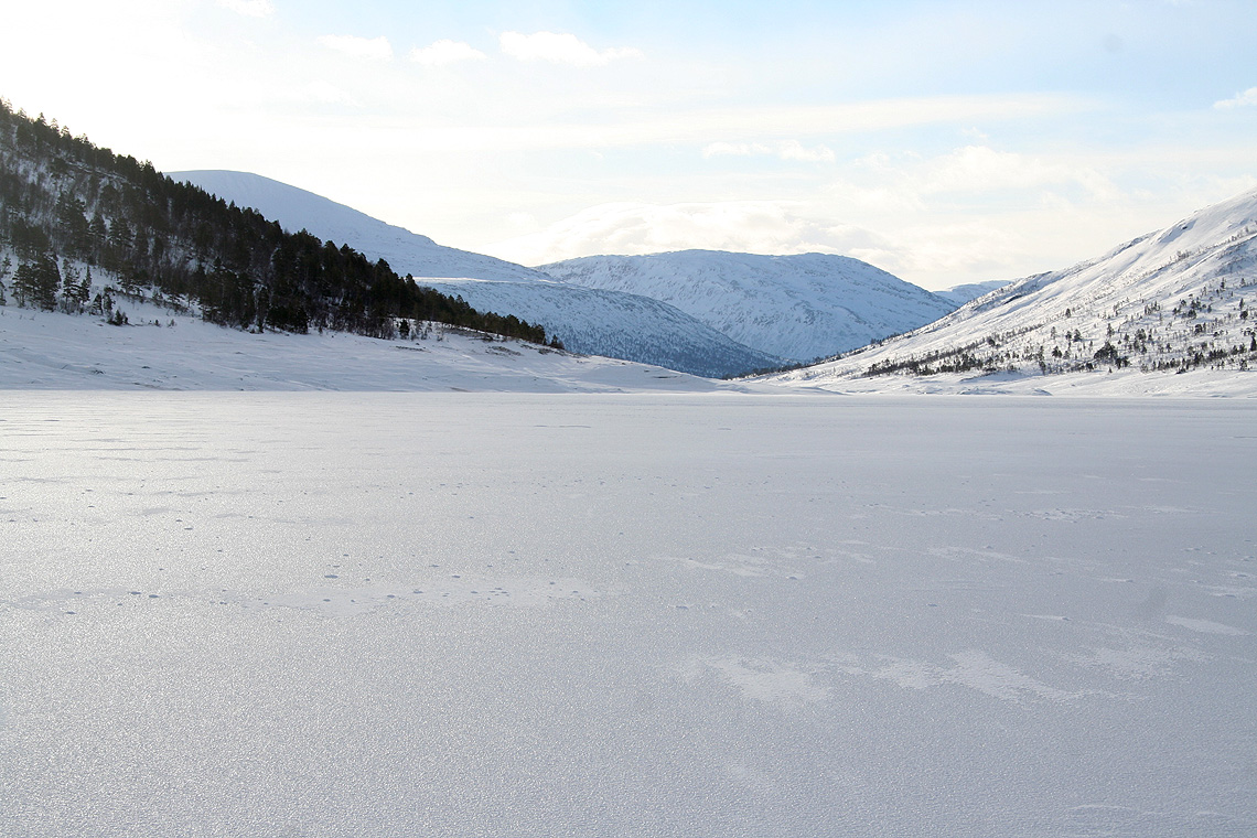
I skied
along the lake
on a near perfect surface, the wind came from behind and in less than
one hour it was time to leave the lake and start the gradual climb.
Trollhetta with her two summits was straight ahead.
I made a brief stop,
my skies needed new wax after running on the icy crust of the lake.
I could already feel that this promised to be a great trip, not a ski track anywhere, just
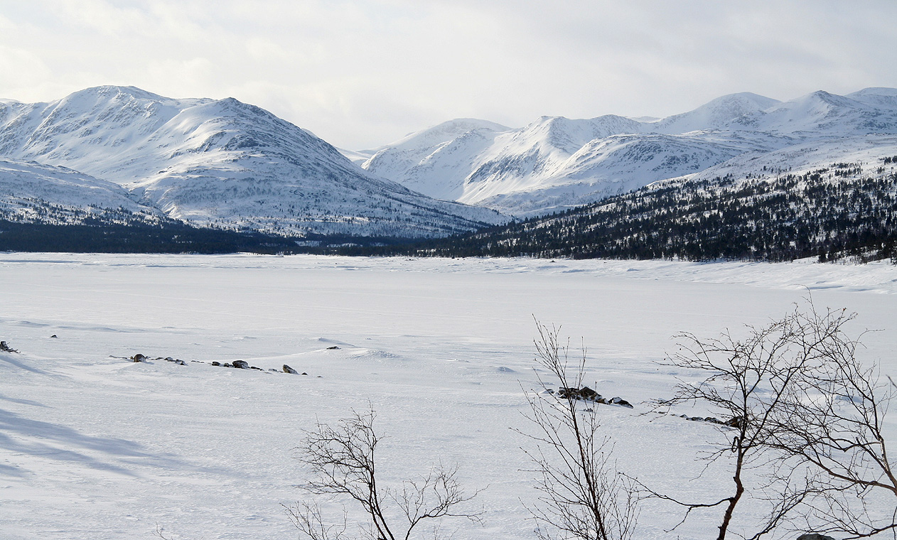
me paying a visit to quite a large scale mountain wilderness. Soon, I could see towards the
end of the lake,
somewhere beyond was the hut that I planned to use for the next two nights.
Skiing was a bit heavier, I sunk about 10-15 centimeter into the snow as I made my way
uphill between the trees. The trees are nicely scattered, no dense forest, always easy
to find a good track. There were several creeks coming down the slope, mostly open
water, but with enough snow bridges to make crossings easy. As I came above the trees,
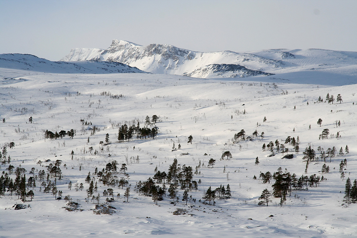
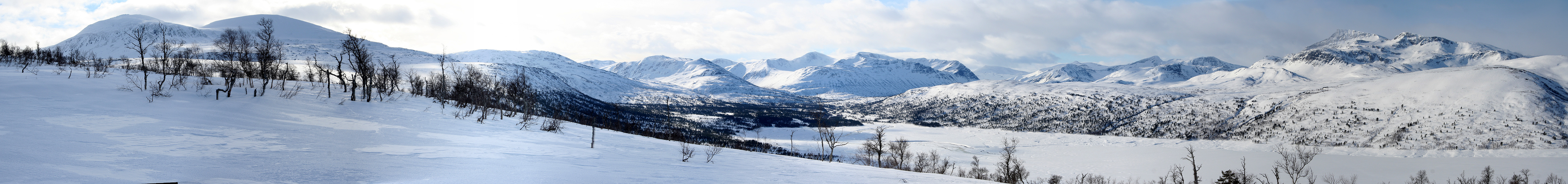
a nice panorama
unfolded from Trollhetta and around the end of the lake to Snota on
the opposite side.
Trollhetta was ahead, but the mountain that caught my imagination was behind and
across. Snota, truly the local queen ruling this wilderness.
I soon reached the lower part of the north ridge. The avalanche danger had been forecasted
as high, thus the snow accumulation would be an important factor when judging the rest of
the route. Just as I had hoped, the slope was dotted with rocks and did not pose any
danger. However, I had for some time been traversing a fairly icy crust with limited grip
for my skis. It had taken me slightly less than 3.5 hours to get here.
The slope above looked significantly steeper than anticipated. I decided to
leave the skis and proceed uphill with crampons, an ice axe and a single ski pole. This
decision meant about 5 kilometer of walking, clearly much more time consuming than using
skis. As it often happens, as soon as I got higher, the icy crust disappeared and the snow
was good for skis. Too late, my skis were barely visible a few hundred meters below. With
all hindsight, it would have paid to continue skiing up this slope.
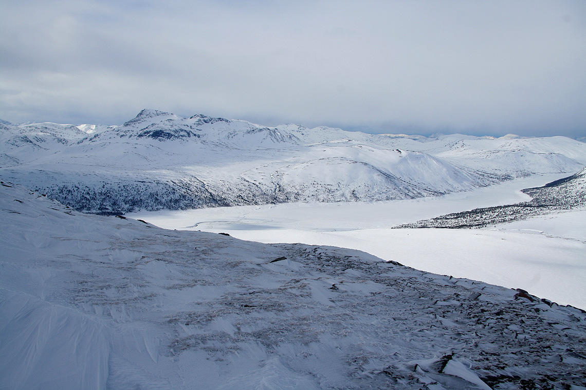
The landscape and the lake below
showed that I was making progress.
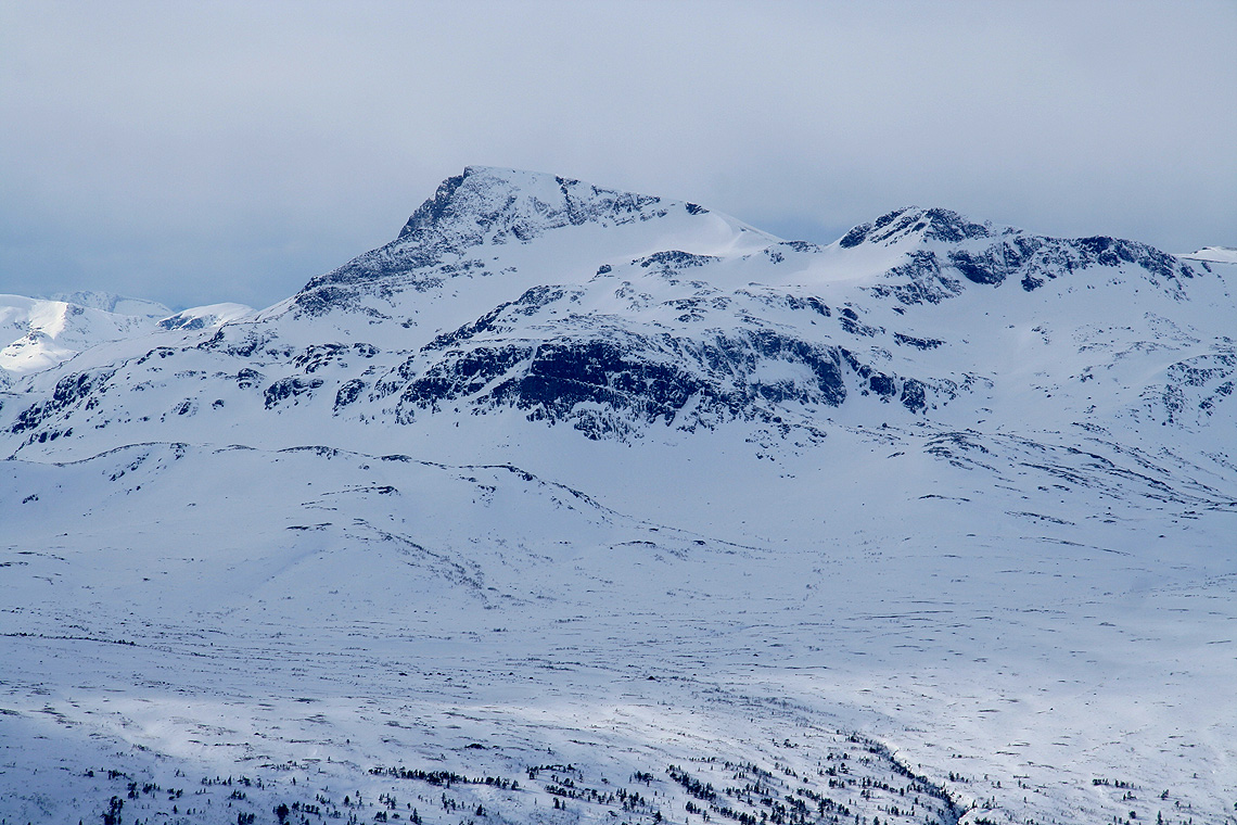
Snota continued to capture my attention,
lots of steep rock,
how would a ski route up there look?
The saddle was nice and broad, the final slope looked steep and had not a single
rock, however, as soon as I got across to its left (east) side, things looked
much better and I wished my skis had been with me.
The summit was very flat and it took a while before I came to the cairn. There were
more clouds, but still a pretty good panoramic view. I had walked about 1.5 hours and
a good rest was called for. When leaving,
I decided to traverse across the
north summit
on my return hike. That route looked better on foot and gave me reason
to, on average, be pretty happy with this long walk without skis.
I made a brief stop at the cairn, my climb had now lasted more than 6 hours and
quite a bit remained before I would reach the hut. The weather gradually turned
more windy and less sunny. I found my way down between some rather large rocks
and returned to my skis at 1520. A fairly quick ski brought me back to the
lake, almost at its southern end. My mind had this abstract idea that the hut
was located at the end of the lake. This is not entirely true and when the GPS
estimated a straight line distance of 3.9 kilometer, I realized that the trip
was not quite over. The forest and a couple of pretty big, open rivers further
complicated this last leg of my trip. I arrived at 1730, a very nice 9 hour
ski trip had come to an end.
It took until dark to discover a few key facts. The key to the (fire)wood storage
was not located as the sign read. There was more wood outside, however an axe to
make smaller pieces for starting the fire had been nice. Matches and candle lights were also
running low. The food supply was not overwhelming, but would serve its purpose.
I had dinner and dried some clothes before going to bed rather early.
The wind kept going all night and it started to snow. I got up at 0600, looked out
and went straight back to bed. Another look out at 0800 seemed slightly better.
I decided to get out and head towards my second goal,
the mountain Blåhøa.
Resources:
Images
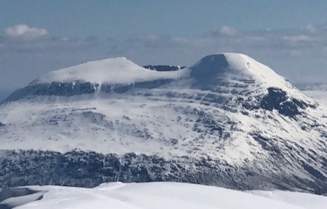
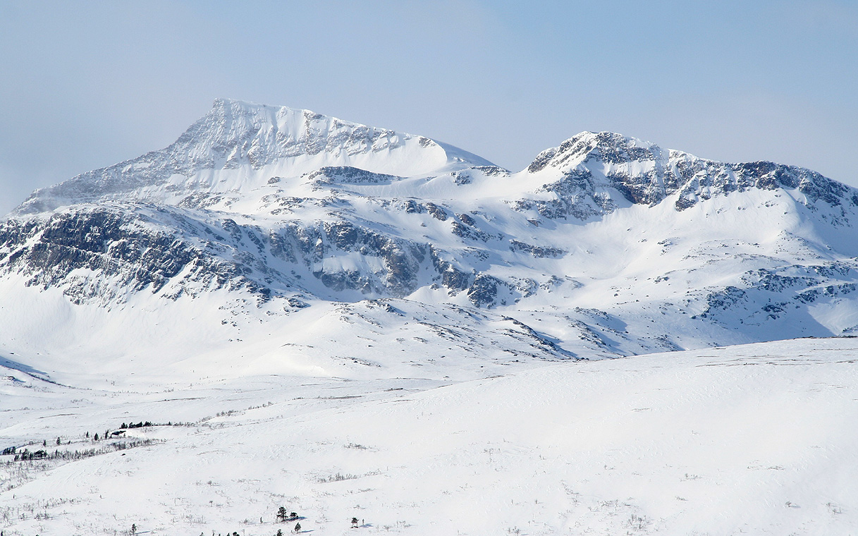
Trollhetta, as seen on the way from Trollheimshytta towards Snota.