Location: North 64.47031, West 21.75352 (GPS at the summit)
Climbed May 21, 2016.
Difficulty: YDS class 2
Information:
How to get there:
This mountain is not very far from Reykjavik. Drive Hwy. 1 (north), direction
towards Akureyri. Drive through the tunnel (toll 1000, in 2016), then north
of Akrafjall. You should see Hwy. 47 forking right. The next main intersection
should have Hwy. 504 turn off to your right, get onto this road. It is possible that
the number changes to Hwy. 502, in any event, drive this road, as it turns more east (right)
you will see the mountain up on your left. Pay attention, first locate a small turnoff (left)
road marked Tunga, continue to the next small road going right, it may have a sign
saying Efraskard. Turn onto this road, drive passed a parking area on your right, close to
3 small cabins. The road will fork, go right and gently uphill until the road ends.
Park here.
This is the trailhead, location N64.43344, W021.74635, elevation about 125 meter.
Route:
Continue directly uphill, there are some faint trails, the terrain is easy to
walk anywhere. Stay parallel to the river (on your left). Continue uphill as the
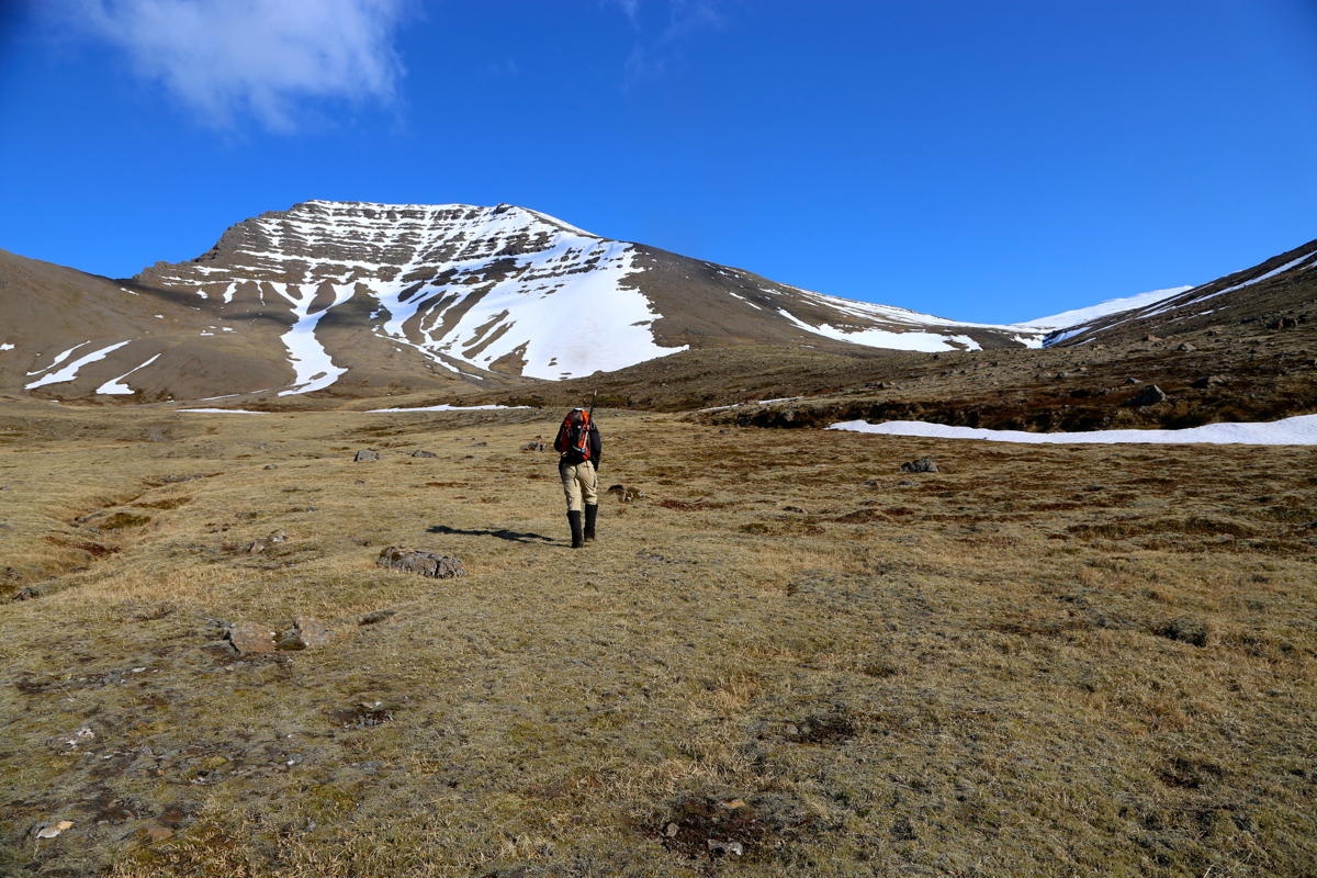
valley gradually turns left. You will see a big flank (hillside) coming down from
the mountain on the left side of the valley (to the right of the snow patch in the picture).
Cross the creek where convenient and
head directly towards this hillside. Do not climb it to the top, but rather
do a climbing traverse towards the horizon
on its right hand side. As you get higher,
Heidarhorn will come into view, more or less straight ahead.
Ascend the ridge and
follow it to the summit. Comments:
I had read the report of my good friend Arnt, thus decided to start from the south.
Somehow, we parked at the parking next to the cabins that he mentioned, thus failed to
drive and park at the obvious trailhead at the end of the road, about 50 meter higher.
We started out on foot since the snow line was quite high on this south facing route.
Leaving at 0810, we had a pleasant walk up along the creek, then up the steeper flank where
we hit snow on the top. The snow was still good for hiking and we reached the summit at
1030.
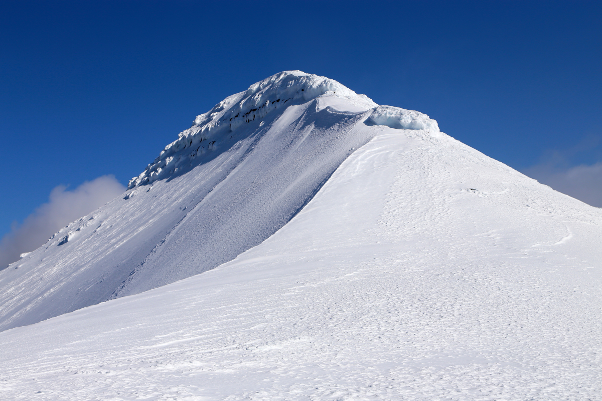
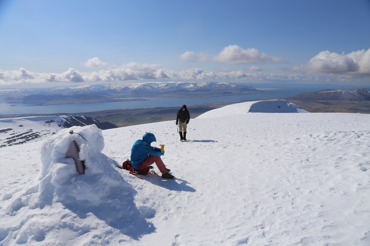
The summit has a steep drop on its west side.
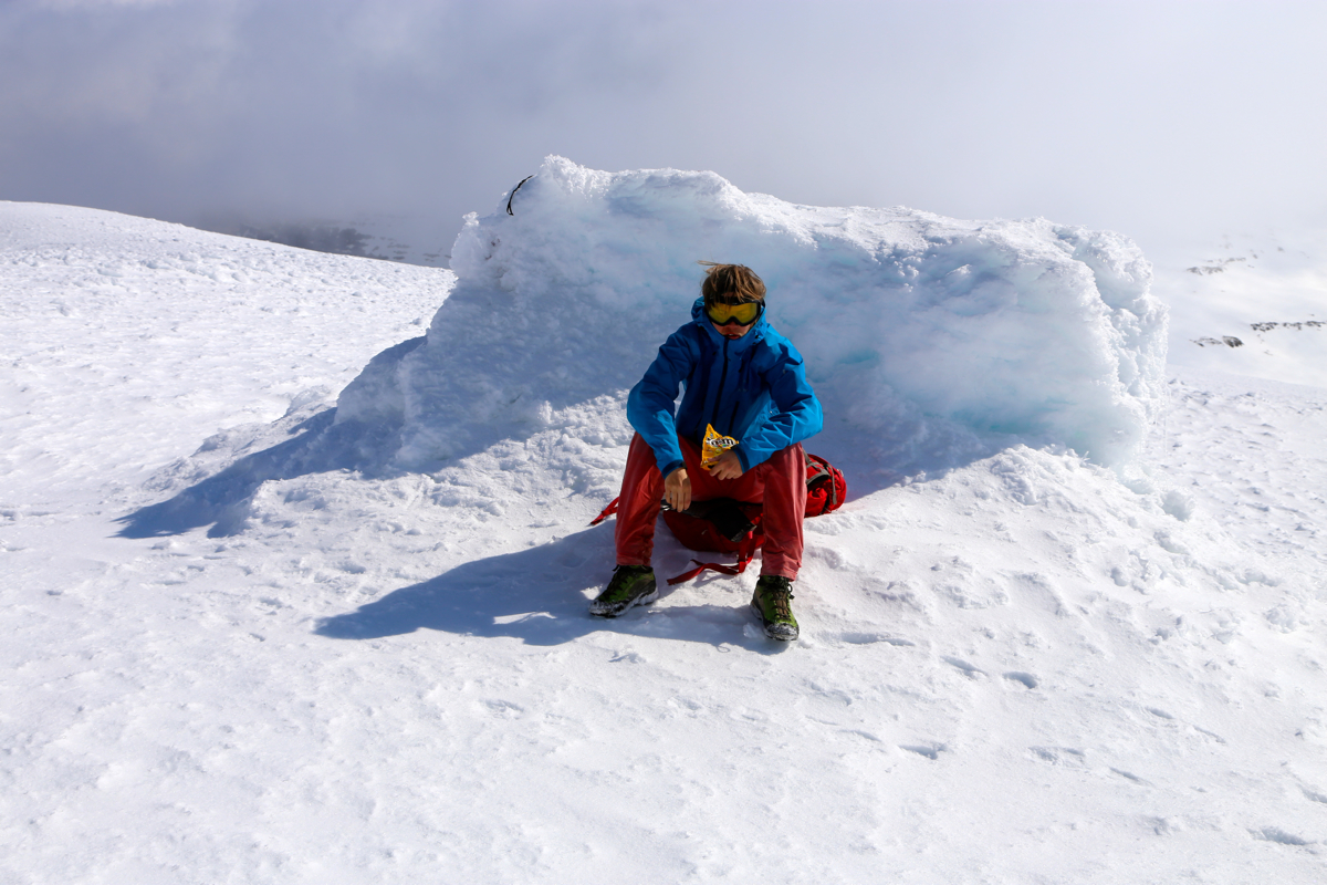
It was a bit breezy near the top, so no need for an extensive stop. We enjoyed the fine
scenery and had a closer look at Akrafjall, our last planned peak. Descending after
15 minutes, we walked back down and returned to the car by 1200. Our next move was a short travel to the
town of Akranes, a well deserved lunch being a high priority. After lunch, we then
climbed Akrafjall.
Here is a quick summary of peaks climbed in our trip to Iceland.
Resources:
Images
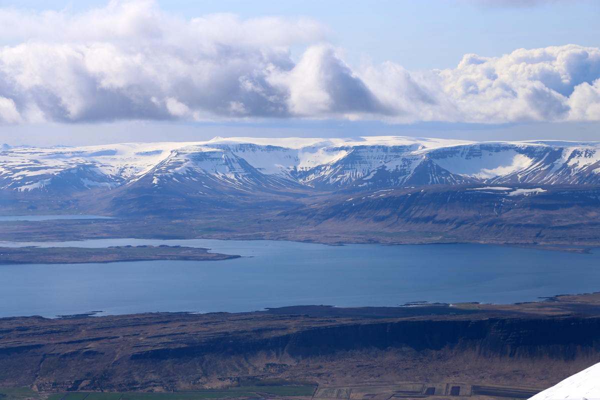
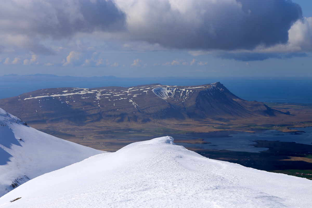
Esja, a very flat mountain, as seen from Heidarhorn.
