How to get there:
This peak is the highest point on the mountain Brandberg. This area is
a national park and an advance permit must be purchased before you go.
The mountain is famous for several thousand rock paintings that are
between 1000 and 3000 years old. This is quite a unique place and the park
is a UNESCO World Heritage site.
In 2023, a permit was about 100 USD. Contact the national park well in advance
(several weeks) at xxx. After receiving the payment and the permit, the park
will inform you about the assigned guide and his contact details. The permit fee
includes payment for the guide.
From the capital of Namibia, Windhoek, first drive a few hundred kilometer
to the town named Uis. You will meet your guide and do final shopping there.
You are expected to drive the guide (and possibly porters) from Uis to the
trailhead. The last part of this drive requires a 4WD vehicle. Keep this
in mind when renting your car in Windhoek. This last drive is about 55 kilometer
and will take more than one hour. The trailhead is located
near S21.24039. E014.58261, elevation about 770 meter.
Route description:
The trail is fairly well marked with cairns. Carefully search to find the next if at a spot
where the continuation is less obvious. A GPX track is always useful on this kind of trail.
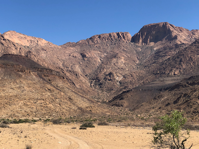
The route starts directly into the valley that sort of has a large characteristic rock-face
high above it. First, a bit on the left side, then more to the right. Ascending on smooth
rock slabs where these are available. After a first uphill step the terrain is more gentle before
another steeper ascent that gradually traverses left to a col before a short descent on the
opposite side leads to the well established camp site.
This location is near S21.19345. E014.55883, elevation about 1850 meter.
From the camp, the route continues a short way in the valley, then ascends left. From here,
it is fairly easy to follow ll the way to the summit. After a pretty long horizontal stretch, you
will finaly see the local summits in the summit area up to your right. The trail turns right and
completes the ascent to the summit.
Comments:
We woke up after a short night, on October 25., still in Lubango. This was not the
plan, see my report on Sierra de Neve. Breakfast at 0700, we
were on our way to the Namibia border around 0800. Bruno still being our driver.
On the Namibia side of the border a new driver should be waiting for us to continue the
pretty long drive to Windhoek where we have a hotel booking at Etango Ranch Guest Farm.
This will bring us back on our original schedule.
About 1200 kilometer, we had a few short stops, but mostly driving until arrival
at Etango Ranch, a nice place to stay just a few minutes from the main airport serving
Windhoek, the capital of Namibia. The time was 0100, a long day finally closing.
The goodf news was that we now were back on our schedule.
I picked up our rental car in the morning, then breakfast. Checkout at 1000. John and Dave
wanted shopping in Windhoek, then we were on our way to Uis, the small town closest to
the Brandberg mountain.