How to get there:
This mountain is on the island Tysnes. Easy to reach by ferry from Halhjem, south of
Bergen. The ferry should go to Våge. From Våge, drive south then turn left at Uggdal.
Shortly after this turn, find parking near a senior citizen home on your left. This location is
N60.007603, E005.503377, elevation about 50 meter.
Route:
Continue along the main road, then take the first side road right crossing the river (near a bus stop).
Follow this local road uphill, it will turn into a farmers forest road immediately going right of the
last house. Follow this tractor road as it climbs the first hill, elevation about 90 meter. Be alert as
the route (and forest road) makes a sharp left turn here and crossses a gate in the fence that might
be hard to see. Continue on the forest road until it ends and a well marked trail continues.
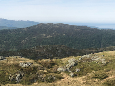
This trail continues up to around 400 meter of elevation, then ends. Continue south in easy terrain. There aretwo competing summits, the west summit has a large nice cairn. However, the highest summit is
the one to the east. Visit both, they are only about 350 meter apart.
Comments:
I arrived at the summit around 1330, about one hour from my car. I first headed towards the
correct summit, then noticed the cairn and crossed over only to discover that the cairn was
built on the lower summit. Since I had not been all the way (only very close!) to the correct
summit, I needed to make yet another trip across to properly visit the high point.
Back by my car around 1440. The ferry left at 1610, so I decided to also visit
Hovda.