Location: North N60.95395, E006.57017, elevation (GPS)
Difficulty: YDS class 2.
Climbed March 27. 2023
Information:
How to get there:
Drive E-39 from Bergen via Voss to Vinje.
Fork left onto Hwy. 13 here. Continue up on Vikafjellet, there is good
parking on your left just before a small bridge, at location
N60.97783, E006.52231, elevation about 930 meter.
Route description:
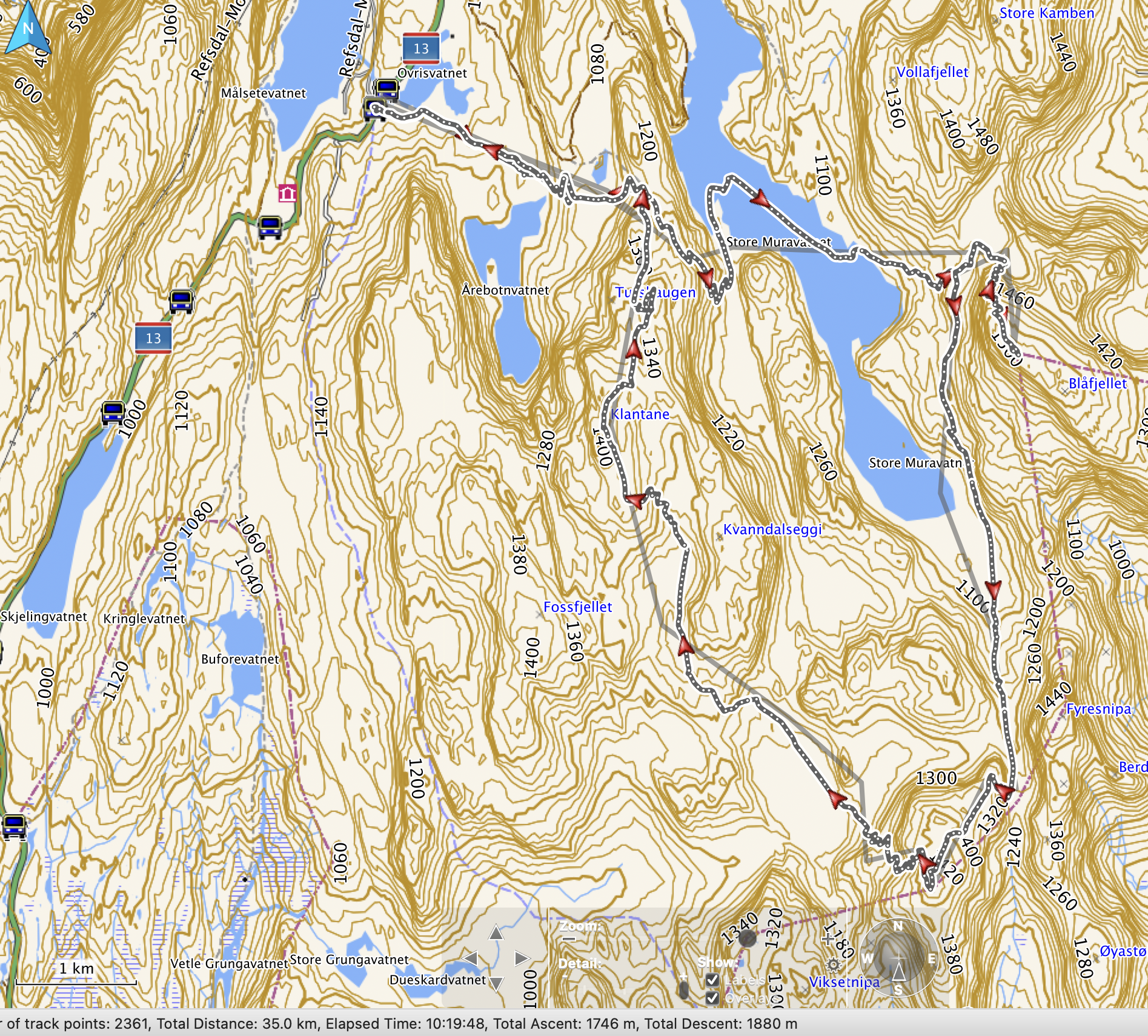
Start out along the power line that runs all the way to the col just
before lake Muravatnet. When approaching this col, ascend right and
continue up the small valley that extends uphill west (right) of point
1340m, and east of Tirshaugen (1306m). Continue uphill, slightly more
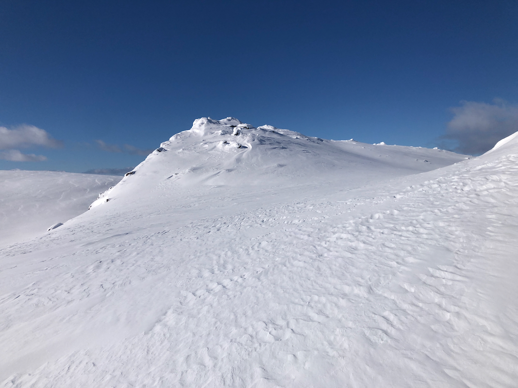
east to reach the west side of lake 1318 m. Finally, follow the main crest
to the summit. The highest point is about 65 meter south of
the cairn.
Comments:
I visited this peak as the last summit on a loop ski-trip.
Arriving from Uraskarfjellet, I had
first descended to Ytredalsvatnet (1117m), then ascended to lake
1234m, before a final climb (staying east initially) to the main
crest leading towards Klantane.
The time was 1610, about 9 hours since my start. I spent about 10 minutes
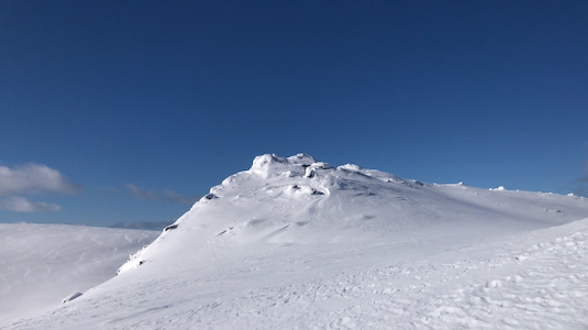
exploring the summit ridge, very steep on the west side, with some very
distinct summit points located south of the cairn. The weather was still
very good, but it was time to head back, still a pretty long drive to
Bergen. The skiing from here was nice and mostly downhill, first to
the col with the power lines, next following these back to the parking
area on highway 13. I ended this very nice ski tour by 1710. 10 hours
of skiing, 35 kilometer and roughly 1700 meter of ascent.