Mountain Info

Here is some additional info on some of the mountains that are listed with primary factors exceeding 1000 meter. In particular, the determination of the primary factor, by way of the location of the lowest saddle on the highest route to any higher mountain is often described.


Distribution per county

CountyNumber
Østfold 0
Akershus 0
Oslo 0
Hedmark 3.5
Oppland 2.5
Buskerud 0
Vestfold 0
Telemark 0
Øst Agder 0
Vest Agder 0
Rogaland 0
Hordaland 2
Sogn og Fjordane 6.5
Møre og Romsdal 11.5
Sør Trøndelag 0
Nord Trøndelag 0
Nordland 20
Troms 37
Finnmark 2
********* ***
Grand total 85

A 6.5 (or other non integer) entry means that a summit is shared with another county.


Gjegnen

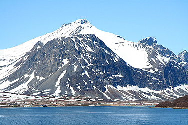
  • Gjegnen (Blånibba)
  • 1670 m
  • Primary factor 1460 m
  • Location: Near Ålfotbreen, Sogn og Fjordane
  • Location: North 61°48'09", East 5°49'16" (UTM: 32, 332523 +6856296)
  • Closest higher mountain: Høgste Breakulen 1957 m.
  • Saddle: The saddle at Skei, near the end of the big Jølster lake is 210 meter, the entire area west and south of Nordfjord is dominated by this mountain.
    Note that there is a slightly higher (only 23 meter) saddle along Hwy. 615, closer to the mountain, see Botnafjellet.
  • Saddle location, WGS: North 61:34:20, East 006:28:56
  • Saddle location, UTM: Zone 32, N6829111, E366314
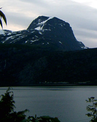
  • Picture: As seen from north-east (Eidskyrkja).
  • More info: (access, routes, picture)


Hamperokken

  • Hamperokken
  • 1404 m
  • Primary factor 1396 m
  • Location: Tromsø, Troms
  • Location: North 69°33'43", East 19°21'25" (UTM: 34, 436036 +7717905)
  • Closest higher mountain: XXX YY m.
  • Saddle: The saddle is between Laksevatn (3 m) and Sjovassbotn (0 m), the 10 meter contour passes through, while the 5 meter contour does not. Standard interpolation then yields a saddle elevation of 8 meter.
  • Saddle location, UTM: Zone 34, N7698662, E437807
  • More info: (access, pictures)


Skårasalen

  • Skårasalen
  • 1542 m
  • Primary factor 1385 m
  • Location: Ørsta penisula, Sunnmøre, Møre og Romsdal
  • Location: North 62°09'56", East 6°29'05" (UTM: 32, 369047 +6895180)
  • Closest higher mountain: XXX YY m.
  • Saddle: The saddle on the route from Fyrde to Bjørke is found to be 157 meter from the 5 meter contour map of the area. This is near and south-west of Buvatnet at 144 m. This mountain dominates everything else outside on the penisula to the north.
  • More info: (Access, routes and pictures)


Botnafjellet

  • Botnafjellet (local: Blåegga)
  • 1572 m
  • Primary factor 1339 m
  • Location: North-West of Skei, Sogn og Fjordane
  • Location: North 61°39'37", East 6°18'33" (UTM: 32, 357576 +6839287)
  • Closest higher mountain: Blånibba 1670 m.
  • Saddle: Hwy. 615 east of the Ålfotbreen glacier has its highest point near Fullskjeggvatnet (221.5 meter). On a 5 meter contour map the 235 passes through, while the 230 does not. This yields a saddle elevation of 233 meter.
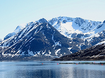
  • Picture: as seen from Sørsendalen (the north).
  • More info: (Access, routes and pictures)


Kvitegga

  • Kvitegga
  • 1710 m
  • Primary factor 1322 m
  • Location: West of Nibbedalen, Møre og Romsdal
  • Location: North 62°05'41", East 6°42'04" (UTM: 32, 380041 +6886858)
  • Closest higher mountain: Stolshyrna, 1852 m.
  • Saddle: The route Hellesylt, Tryggestad to the lake Hornindalsvatn has a sadde on Gråsteinmyra (near Kjellstadli). On the 20 meter contour map this meadow is between the 380 and the 400 meter contours. Interpolation on this map yields a saddle of 390 meter. More accurately, on the 5 meter contour of the area, we observe that the 385 contour bends back while the 390 contour goes through. On this map, the meadow is called Liamyrane. Thus, our best estimate for this saddle is 388 meter, giving a primary factor of 1329 meter.
    This closes off the three big penisulas to the north-west called Sunnmørsalpene.
  • Saddle location: (UTM: 32, 381256 +6879166)
  • Note: The summit is a glacial snowcap. The highest rock point has a map elevation of 1691 meter. On older maps the summit elevation was set at 1717 meter. However, due to glacial melting, the summit elevation is certainly lower today. The last edition of the official map has a clear 1700 meter contour. Standard interpolation, therefore gives an elevation of 1710 meter. Arnt Flatmo has recently measured the summit by handheld GPS to 1708 meter.
  • More info: (Access, routes and pictures)


Fresvikbreen

  • Fresvikbreen
  • 1648 m
  • Primary factor 1310 m
  • Location: Just west of Vik in Sogn
  • Location: North 61°02'02", East 6°46'16" (UTM: 32, 379648 +6768630)
  • Closest higher mountain: XX YY m.
  • Saddle: Is just east of Oppheimvatnet, near the main Hwy. E-16, connecting Voss and Gudvangen. On the 5 meter contour map Oppheimsvatnet that drains towards Voss, is 336.5 meter, while a very small pond, Barnatjørni (elevation 334.8 meter) located just a few houses from Oppheimvatnet, drains to Gudvangen. The 340 contours are never close, so consistent with this we assign (an interpolated) elevation of 338 meter to the saddle.
  • More info: (Access, routes and pictures)


Store Smørskredtind

  • Store Smørskredtind
  • 1631 m
  • Primary factor 1306 m
  • Location: In Møre og Romsdal
  • Location: North 62°11'59", East 6°43'51" (UTM: 32, 382000 +6898508)
  • Closest higher mountain: Kvitegga 1710 m.
  • Saddle: The saddle is along Hwy. 655, between Skylstad and Tryggestad. At a 10 meter contour map this saddle lies close to a small sideroad going west to serve the two farms Lundheim and Haugen. The 330 meter contour runs through whle the 320 contour turns around a couple of small (un-named) ponds just north of this area. Thus we interpolate the saddle to 325 meter.
  • More info: (access, pictures)


Njunis

  • Njunis
  • 1717 m
  • Primary factor 1305 m
  • Location: Målselv, Troms
  • Location: North 68°44'57", East 19°29'11" (UTM: 34, 438834 +7627184)
  • Closest higher mountain: Storsteinfjellet 1894 m.
  • Saddle: This mountain is the highest one far north with the exception of mountains on the Lyngen Penisula. This means that one can go as far north as one pleases before hitting the Baltic, via Sweden, Finland or perhaps even the passage from St. Petersburg to the Baltic. The higher neigbor is Storsteinfjellet to the south. There is a 412 meter saddle at the border cairn 272, the Swedish side drains to the lake Tornetrask which flows north of the high Kebnekaise peaks. Therefore, the primary factor is 1305 meter. The elevation 412 meter for the saddle near border cairn 272 has been determined based on the fact that the 420 contour goes through the saddle, the cairn itself is placed on a local high point of elevation 431 meter. I have further received information from Jarle Nilsen that has been on the spot and his best estimate is 412 meter.


Oksskolten

  • Oksskolten
  • 1916 m
  • Primary factor 1384 m
  • Location: In Nordland
  • Location: North 66°00'51", East 14°20'13" (UTM: 33, 469978 +7321669)
  • Closest higher mountain: Påssustjåkka 1935 m (in Sarek).
  • Saddle: A (close saddle): One can establish a primary factor of 1286 by following the vally and lake quite close to the mountain, that is isolate it with a highest pass of 630 meter.
    B (lowest saddle): Between border cairns 218-218A, there is a low saddle to Sweden. Holmtjønna (522 m) drains west while the very close Mørntjønna (529 m) drains east. On a 10 meter contour map, the 530 contour does not pass through, while the 540 contour do. Interpolation yields 535 meter for the saddle. However, from the map, it is likely that the true elevation is closer to 530 meter than 540 meter, we will use 532 meter until possibly further refined by a field trip to the area. This is north of the mountain, further south one can use the 359 meter saddle crossing south-east of Tunnsjøen.
    From this 532 saddle one may continue north and then to Sarek in Sweden where its closest higher neighbor is located.
  • More info: (access, route)


Store Trolla

  • Store Trolla
  • 1850 m
  • Primary factor 1292 m
  • Location: East of Sunndalsøra, Møre og Romsdal
  • Location: North 62°41.004, East 008°44.540 (UTM: 32, 486798 +6950366)
  • Closest higher mountain: Storkalkinn 1880 m
  • Saddle: The lowest saddle seems to be just north of Oppdal, near Hwy. E-6 in the direction of Trondheim. More precisely, the saddle is near Hallsettjønna where the 580 contour passes through while the 560 contour turns back. Thus interpolates to 570 meter using 20 meter contours, with 5 meter contours the 560 passes through, while the 555 contour turns back. We therefore assign the saddle an elevation of 558 meter.
  • Difficulty: Alpine PD, YDS class 4.
  • More info: (access, route, pictures)


Langlitinden

  • Langlitinden
  • 1277 m
  • Primary factor 1277 m
  • Location: On the island Andørja, Ibestad, Troms
  • Location: North 68°52'03", East 17°23'08" (UTM: 33, 596021 +7641493)
  • Closest higher mountain: XX YY m.
  • Saddle:This is the highest point on the island


Lille Russetind

  • Lille Russetind
  • 1527 m
  • Primary factor 1268 m
  • Location: Balsfjord, Troms.
  • Location: North 69°08'02", East 19°33'40" (UTM: 34, 442865 +7669986)
  • Closest higher mountain: Rostafjellet 1558 m.
  • Saddle:The saddle is located in Tamokdalen, just south of Tamokvatnet (259 m). On the 20 meter contour map the saddle would interpolate to 270m (Tamokvatnet is given an elevation of 263 m and the contour that passes through the saddle is 280). However, on the 5 meter contour map, the lake is 259 m and the 260 meter contour passes through the saddle very narrowly, but without touching or turning back! This would normally be a saddle elevation of 258m, but in light of the official lake elevation, we assign the elevation of 259 meter also to the saddle.
  • More info: (Access, routes and pictures)


Møysalen

  • Møysalen
  • 1262 m
  • Primary factor 1262 m
  • Location: Hinnøya, Lofoten in Nordland.
  • Location: North 68°31'33", East 15°27'01" (UTM: 33, 518460 +7601587)
  • Closest higher mountain: Skittendalstinden 1306 m.
  • Saddle: This is the highest mountain on the island Hinnøya.
  • More info: (access, pictures)


Stortind

  • Stortind
  • 1320 m
  • Primary factor 1242 m
  • Location: Tromsø, Troms
  • Location: North 69°27'07", East 19°10'31" (UTM: 34, 428584 +7705868)
  • Closest higher mountain: Hamperokken 1404 m.
  • Saddle: This saddle is located on Hwy. E-8 in Lavangsdalen near the small side valley called Andersdalen. On the 20 meter contour map one would estimate the height to 85 meter. Between contours 80 and 100, but much closer to 80. However, on the 5 meter contour map the 75 meter contour is the last one not reaching the saddle, while 80 passes through on separate sides of the Hwy. Interpolation then gives us a saddle elevation of 78 meter.
  • More info: (access, pictures)


Folgefonnen

  • Folgefonnen
  • 1662 m
  • Primary factor 1232 m
  • Location: West to south-west of the small town Odda. Odda is at the southern end of Sørfjorden, a branch of the Hardangerfjord. Folgefonnen is in Hordaland fylke (county).
  • Location: North 60°03'57", East 6°23'23" (UTM: 32, 354770 +6661631)
  • Closest higher mountain: Hårteigen 1690 m.
  • Saddle: Is located north-east of the small lake Grastjørn (425.2 m) at the upper end of Sørdalen. The river Jøsendalselvi drains north-east about 500 meter from Grastjørn (which drains south-west in Sørdalen. On a refined map with 5 meter contours, it is clear that the 430 contour clears the saddle on both sides. These contours are closest near a building marked 37/38, the road still runs between the two contours at this point. The saddle is therefore interpolated to 429m, since the distance back to the 425.2 m lake is considerable. Only a field investigation can get this any more accurate. (The saddle may theoretically be a couple of meters deeper only, bounded by the 425.2 meter lake from below.)
  • The list of Major mountains within its 1000 meter prominence cell.
  • More info: (access, route)


Rondeslottet

  • Rondeslottet
  • 2178 m
  • Primary factor 1229 m
  • Location:In Rondane, east of Gudbrandsdalen. The summit is right on the border between Oppland and Hedmark. It is counted with Oppland in the county list.
  • Location: North 61°54'53", East 9°51'00" (UTM: 32, 544706 +6864995)
  • Closest higher mountain: Snøhetta 2286 m.
  • Saddle:Is on Fokkstumyra at 950 meter if interpolated from the 20 meter contour map. This is near Hwy. E-6 between Dombås and Hjerkin. A closer examination on 5 meter contours shows Horrtjern at 945.5 meter draining north, it is further fed from a small pond at 948.5 meter further south on Langmyren. The 950 contours goes through this meadow as two parallel lines, we therefore conclude that the saddle is 949 meter.
  • Picture: as seen from south-west.
  • More info: (access, route)


Daurmål

  • Daurmål
  • 1448 m
  • Primary factor 1225 m
  • Location: South-west of Byrkjelo. West of the Hwy. connecting Skei (Jølster) and Byrkjelo.
  • Location: North 61°39'05", East 6°28'20" (UTM: 32, 366172 +6837958)
  • Closest higher mountain: XX YY m.
  • Saddle: The saddle is located at Klakegg, 222 meter high. More precisely, from the local city map with 5 meter contours, it is clear that the 225 meter contours goes through the saddle near a road intersection, while the 220 contours stay below the saddle. Interpolation to 223 meter is one of the more accurate saddle definitions available.
  • Note: The elevation 1448 is derived from 1447.92, the M711 says 1445 m.
  • Picture: as seen from Ytre Kandal (the west).
  • More info: (Pictures, Acess and routes)


Hjerttinden

  • Hjerttinden
  • 1380 m
  • Primary factor 1212 m
  • Location: Salangen, Troms
  • Location: North 68°59'43", East 18°13'32" (UTM: 34, 389098 +7656385)
  • Closest higher mountain: XX YY m.
  • Saddle: The pass from Setermoen to Brandhaug (west of Setermoen) is near Høymyra where there also is a road that branches south from the main Hwy. On a 5 meter contour map, we observe that the 170 meter contours go through the saddle (just barely), while the 165 contours do not. We therfore assign the elevation 168 meter to this saddle.
  • More info: (access, routes, picture)


Helldalsisen

  • Helldalsisen
  • 1351 m
  • Primary factor 1188 m
  • Location: Penisula south of Steigen in Nordland
  • Location: North 67°39'59", East 15°22'42" (UTM: 33, 516109 +7505734)
  • Closest higher mountain: Gaskacohkka 1517 m.
  • Saddle: The saddle is Lappvasskardet, just east of this saddle is Botelvatnet (155 m). On a 5 meter contour map, the 160 contour runs around the lake, while the 165 contour runs through the saddle. Interpolation then assigns 163 meter to the saddle.


Tromsdalstind

  • Tromsdalstind
  • 1238 m
  • Primary factor 1170 m
  • Location: East of Tromsø city.
  • Location: North 69°36'25", East 19°08'40" (UTM: 34, 427901 +7723163)
  • Closest higher mountain: XX YY m.
  • Saddle:The saddle is at Breidvikeidet, at the SW end of Breidvikdalen. This is near Nordbotn, SE of the mountain. On the 5 meter contour map, the 70 meter contour passes through the (very flat) saddle. The area is called Ramfjordmoen and has a "trigonometric point" measured at 68.5 meter. Our standard practice of going 2 meters down seems well justified assigning a value of 68 meter to this saddle.
  • More info: (access, route)


Arnøyhøgda

  • Arnøyhøgda
  • 1168 m
  • Primary factor 1168 m
  • Location: Arnøya in Skjervøy, Troms
  • Location: North 70°09'11", East 20°41'56" (UTM: 34, 488649 +7782997)
  • Closest higher mountain: Store Kågtinden 1228 m.
  • Saddle: This mountain is the highest point on the island Arnøya.
  • More info: (Access, routes and pictures)


Kågtindan

  • Store Kågtind
  • 1228 m
  • Primary factor 1228 m
  • Location: Skjervøy, Troms
  • Location: North 70°00'01", East 20°47'46" (UTM: 34, 492278 +7765954)
  • Closest higher mountain: XX YY m.
  • Saddle: This is the highest point on the island Kågen in Troms.
  • More info: (Access, routes and pictures)


Kolåstinden

  • Kolåstinden
  • 1432 m
  • Primary factor 1164 m
  • Location: Sunnmøre, Møre og Romsdal
  • Location: North 62°15'32", East 6°18'35" (UTM: 32, 360377 +6905923)
  • Closest higher mountain: XX YY m.
  • Saddle: The saddle is located along Hwy. 655 connecting Sæbø at Storfjorden to Ørsta. This valley (Bondalen) climbs gently to Videtjørn at 259.5 meter, shortly thereafter one has Bjørdal about 60 meter below. The saddle is determined from a 5 meter contour map. The saddle is located near the road as it completes its climb from Bjørdal and makes a right turn (when going north, ie. from Ørsta), three small lakes called Tretjørn is on the right hand side of the road while a small sideroad serving a property (marked 38/37) goes off to the left side. Shortly after the saddle, the road crosses a small creek that flows into Videtjørn. At this saddle the 270 contours do not touch, so our standard interpolation yields a saddle height of 268 meter.
  • More info: (Access, routes and pictures)


Kvigtinden

  • Kvigtinden
  • 1699 m
  • Primary factor 1161 m
  • Location: In Børgefjell, Nordland
  • Location: North 65°13'34", East 13°47'36" (UTM: 33, 443639 +7234216)
  • Closest higher mountain: Oksskolten 1916 m.
  • Saddle: The saddle is determined by following the river from Namsos up to Tunnsjøen at 358m, then south-east at the east end, saddle south of Allmannberga interpolated to 370m, there Tunnsjøbekken starts and flows into Sweden and Kvarnbergsvattnet. Thus, we have a 370 meter saddle south of Børgefjell. North of Børgefjell, we run east from the middle of Røssvatn in the valley Sørdalen. We pass Varnvatnet 413m, Famnvatn 494m , Bolvatnet 536m, and find a saddle less than 540 contour, so interpolate to 538 meter. Should verify the Swedish side with connection between this north and the south (above) saddle..


Skittendalstinden

  • Skittendalstinden
  • 1306 m
  • Primary factor 1163 m
  • Location: North of Ofoten, Skånland, in Troms.
  • Location: North 68°34'43", East 16°57'09" (UTM: 33, 579630 +7608677)
  • Closest higher mountain: Frostisen 1724 m.
  • Saddle: This is the highest mountain just north of Ofoten. The relevant saddle is near the road that connects Bogen with Grov on the east side of the mountain. Grunnvatnet (142.5 m) just north of the fork in the Hwy. drains south, while Botnelva only slightly further north drains north. On a 5 meter contour map there are two narrow passages that both connects below the 145 meter contour. We therefore assign 143 meter to this saddle.


Rohkunborri

  • Rohkunborri
  • 1659 m
  • Primary factor 1164 m
  • Location: Next to (west of) Altevatn, Bardu,Troms.
  • Location: North 68°33'20", East 19°21'08" (UTM: 34, 432835 +7605745)
  • Closest higher mountain: Njunis 1717 m.
  • Saddle: This mountain is the highest inside an area enclosed by Altevatn, the huge lake Tornetrask in Sweden and two connecting saddles, Altevatn east end, near cairn 278A at 495 meter, and Bardudalen to Sørdalen near border cairn 272 at 412 m. So with 495, PF=1164.
  • More info: (access, routes, picture)


Leirtinden

  • Leirtinden
  • 1203 m
  • Primary factor 1155 m
  • Location: North east of Finsnes, East of Rossfjordvatnet in Lenvik, Troms
  • Location: North 69°17'59", East 18°27'19" (UTM: 34, 399690 +7689893)
  • Closest higher mountain: XX YY m.
  • Saddle: The saddle connects Finnfjordvatnet (25 m) with the southern end of Målselvfjorden further east. The saddle is very flat on Fuglmyra. On the 20 meter contour map, this saddle interpolates to 50 meter. On the 5 meter contour map, it appears that to 50 meter goes through, while the 45 meter does not. We assign 48 meter to this saddle.
  • More info: (access, routes, picture)


Blåtindan

  • Blåtindan
  • 1378 m
  • Primary factor 1145 m
  • Location: South East of the fjord Malangen, Målselv, Troms
  • Location: North 69°11'12", East 18°49'33" (UTM: 34, 413861 +7676744)
  • Closest higher mountain: Botnskardtindan 1494 m.
  • Saddle: The mountain is separated from higher areas further east by the passage from Takvatnet (215 m) going north to Sagelvvatnet (91 m) which drains north to Skorsteinnes (at the Ballsfjord fjord). This saddle is near Takvatnet, from Takvassenden there is another smaller lake north called Fjellvatnet (231 m). The 235 meter contour passes through the saddle and we therefore assigned an elevation of 233 meter to the saddle.
  • More info: (access, routes, picture)


Higravtinden

  • Higravtinden
  • 1146 m
  • Primary factor 1146 m
  • Location: Austvågøy in Nordland
  • Location: North 68°21'23", East 14°47'28" (UTM: 33, 491456 +7582640)
  • Closest higher mountain: XX YY m.
  • Saddle: This mountain is the highest point on the island Austvågøy.
  • The list of Major mountains within its 1000 meter prominence cell.


Blåtinden

  • Blåtinden
  • 1142 m
  • Primary factor 1142 m
  • Location: Uløya in Nordreisa, Troms
  • Location: North 69°50'36", East 20°36'30" (UTM: 34, 484996 +7748498)
  • Closest higher mountain: XX YY m.
  • Saddle: This mountain is the highest point on the island Uløya.
  • More info: (Access, routes and pictures)


Istinden

  • Istinden
  • 1495 m
  • Primary factor 1105 m
  • Location: Lyngen, Troms
  • Location: North 69°36'52", East 20°06'33" (UTM: 34, 465431 +7723159)
  • Closest higher mountain: Store Lenangstinden 1596 m.
  • Saddle: The saddle is east of Stortinddalen and north of Skaidevarri (1158 m) which is again north of Istinden. This saddle has only maps with 20 meter contours. Interpolation gives a saddle value of 390 meter.


Øksfjordjøkelen

  • Øksfjordjøkelen
  • 1204 m
  • Primary factor 1131 m
  • Location: Loppa in Finnmark
  • Location: North 70°10'46", East 22°03'30" (UTM: 34, 540112 +7786277)
  • Closest higher mountain: XX YY m.
  • Saddle:The saddle is Alteidet between Altafjorden and Langfjordbotn. The E-6 Hwy. also runs through this saddle. The 75 meter contour runs through, while to 70 meter turn back without meeting. We therfore assign 73 meter to the saddle elevation.
  • More info: (Access, routes and pictures)


Sjunkhatten

  • Sjunkhatten
  • 1185 m
  • Primary factor 1147 m
  • Location: Between Fauske and Bodø, Nordland.
  • Location: North 67°28'44", East 15°07'32" (UTM: 33, 505423 +7484802)
  • Closest higher mountain: Blåmannsisen 1540 m.
  • Saddle: The saddle called Fauskeeidet going north-east from the small village Fauske. The lake Kvitblikvatnet (30 m) drains north. The saddle is much closer to Fauske, here the 40 meter contour runs through, while the 35 meter contour bends back. We therefore assign an elevation of 38 meter to the saddle.
  • Difficulty: The easiest route runs from the saddle between this mountain and Sjunktinden further west. Several ropelengths of Norwegian 3-4 climbing. This may be the most difficult mountain in Norway with prominence exceeding 1000 meter.


Hjortahorgi

  • Hjortahorgi
  • 1351 m
  • Primary factor 1103 m
  • Location: Between Voss and the Hardangerfjord
  • Location: North 60°31'40", East 6°21'12" (UTM: 32, 354818 +6713115)
  • Closest higher mountain: Raundalsegga YY m.
  • Saddle: The lowest saddle is located along the Hwy. from Voss to Granvin. More precisely, between the lake Opelandstjørni (on the Voss side) and Monsvatnet (243m) on the Granvin side. Based on 5 meter contours the saddle is lower than the 250 meter contour, interpolating (by going 2 meter down) results in a best saddle estimate of 248 meter.
  • The list of Major mountains within its 1000 meter prominence cell.
  • More info: (access, route)


Geittinden

  • Geittinden
  • 1556 m
  • Primary factor 1111 m
  • Location: West of Røssvatnet, Nordland
  • Location: North 65°46'34", East 13°45'06" (UTM: 33, 442913 +7295538)
  • Closest higher mountain: Oksskolten 1916 m.
  • Saddle: The path south of Røssvatnet and north of Hattfjelldal consists of three low sections. The first, at N65:41:36, E013:37:40 is between the 440 and the 460 contour, extremely close to a lake at elevation 441 meter. Since the area is a flat meadow, it is likely that this saddle is no more than 445 meter. The next section is between 460 and 465 meter contours at N65:38:59, E013:57:13. The last low saddle is between 450 and 455 on a 5 meter contour at N65:38:24, E014:03:07. Based on the above facts, we assign 445 meter to the saddle.


Midtre Sølen

  • Midtre Sølen
  • 1755 m
  • Primary factor 1091 m
  • Location: South West of Femunden, Hedmark
  • Location: North 61°53'03", East 11°30'56" (UTM: 32, 632297 +6863843)
  • Closest higher mountain: Storsølnkletten 1827 m.
  • Saddle: The lowest saddle is located between the big lake Femunden 662m, and the lake Feragen 654m, but closer to the north end of Femunden. The saddle is marked as being 664 m.
    Feragen drains north to the city of Røros, then south in the river Glomma. Femunden drains south into Sweden, however there are numerous paths between these two rivers further south that will stay lower than say, 500 m.
  • More info: (Access, routes and pictures)


Kleneggen

  • Kleneggen (Høgbøra)
  • 1964 m
  • Primary factor 1105 m
  • Location: East of Romsdalen, SW of Eikesdalen, Møre og Romsdal.
  • Location: North 62°23'48", East 8°12'17" (UTM: 32, 458949 +6918621)
  • Closest higher mountain: Storskrymten 1985 m
  • Saddle: Aursjøen is dammed, but drains NW. Its elevation is given to be in the range 828-856 meter. The saddle is in its south end (also called Gautsjøen). Godsjøen (elevation 851 meter) a bit further SE drains south. There is yet another lake between this and Aursjøen called Trælen with elevation 857 meter. The map does not conclusively indicate any drainage from this lake. The best local map has 10 meter contours and the 860 contours runs through without touching. They are quite close as they cross the road that runs across Kvitmyrin. Based on this, it seems most correct to estimate the saddle elevation to 859 meters.
  • More info: (Access, routes and pictures)


Seilandstuva (Nordmannsjøkelen)

  • Seilandstuva (Nordmannsjøkelen)
  • 1078 m
  • Primary factor 1078 m
  • Location: On the island Seiland, south of Hammerfest, Finnmark
  • Location: North 70°26'46", East 23°05'37" (UTM: 34, 578253 +7816998)
  • Closest higher mountain: Øksfjordjøkelen 1204 m.
  • Saddle: This mountain is the highest point on the island Seiland.


Botnkrona

  • Botnkrona
  • 1072 m
  • Primary factor 1072 m
  • Location: Alsten in Nordland
  • Location: North 65°57'42", East 12°37'37" (UTM: 33, 392210 +7317712)
  • Closest higher mountain: XX YY m.
  • Saddle: This mountain is the highest peak on the island Alsten.
  • More info: (Access, routes and pictures)


Reitetinden

  • Reitetinden
  • 1262 m
  • Primary factor 1064 m
  • Location: Highest on Elveskardtindan, Salangen in Troms
  • Location: North 68°49'19", East 17°37'41" (UTM: 33, 605988 +7636815)
  • Closest higher mountain: Blåmannsisen 1540 m.
  • Saddle: The saddle in Lavangseidet on Einarmyra. The 200 contour runs through, while the 195 does not make it. Accordingly, we assign a saddle elevation of 198 meter.


Mannfjellet

  • Mannfjellet
  • 1552 m
  • Primary factor 1059 m
  • Location: Storfjord, Troms
  • Location: North 69°16'22", East 20°08'31" (UTM: 34, 466171 +7685045)
  • Closest higher mountain: XXXX
  • Saddle:There is nothing higher to the north and east that concerns us. Higher peaks are west of Signaldalen, we must consider the saddle at the upper part of Stordalen. This saddle is at the "three country cairn" 294 next to lake Goldajavri. This saddle has been given the elevation 493 meter.
  • Saddle location: UTM: (34 482137 +7661135), Treriksrøysa


Løksetinden

  • Løksetinden
  • 1242 m
  • Primary factor 1069 m
  • Location: Near Lavangen, Dyrøy, Troms
  • Location: North 68°55'55", East 17°33'27" (UTM: 33, 602641 +7648944)
  • Closest higher mountain: Hjerttinden 1380 m.
  • Saddle: The highest point along Hwy. 84 which runs from Laksebotn and north. Using 5 meter contours, the 175 goes through, while 170 turns. The saddle is north of Rubbåsvatnet and given the elevation 173 meter.
  • Note: The M711 map shows 1237m, while a more accurate measure shows 1242.08 further east along the ridge.
  • More info: (Access, routes and pictures)


Fedalsnibba

  • Fedalsnibba
  • 1609 m
  • Primary factor 1066 m
  • Location: Right on the border between Sogn og Fjordane and Møre og Romsdal, just north of the northen part of Strynevatnet.
  • Location: North 61°58'55", East 6°58'55" (UTM: 32, 394303 +6873811)
  • Closest higher mountain: Rindalshornet 1682 m.
  • Saddle: There is a connection from Hellesylt via Frøysa to Flo at Strynevatnet. More precisely, near Nedre Flosætra there is a lake Ångelsvatnet elevation 540 meter that drains to the north. The saddle is located just SW of this lake. The 545 meter contour clears well on both sides of the pass and our standard interpolation therefore assigns 543 meter to the saddle.
  • Comment: This mountain is listed under Sogn og Fjordane in the county table, strictly speaking it belongs to two counties.
  • More info: (Access, routes and pictures)


Storsteinsfjellet

  • Storsteinsfjellet
  • 1894 m
  • Primary factor 1184
  • Location: Near Narvik, in Nordland
  • Location: North 68°13'53", East 17°52'30" (UTM: 33, 619021 +7571461)
  • Closest higher mountain in Norway: Suliskongen, 1908m
  • Closest higher mountain in Sweden: Påssustjåkka, 1935m
  • Saddle: A (close saddle): The mountain is separated from other areas by a drainage that ends in Rombaksbotn fjord (just east of Narvik) in the north and Skjomen fjord in the south. The saddle between these two areas are located in Doaresvagge (South of Hunddalshytta) between lake 808 and a lake 805 slightly north. Interpolation between contour 820 and 840 gives a saddle level of 830 meter. This point is north of the mountain and north of the more significant lake with elevation 787m.

    B (lowest saddle): There is no higher mountain north in Norway, however we must separate it from the Kebnekaise mountains in Sweden and Suliskongen further south in Norway. From Skjomen, up Norddalen to lake Cunojavri at 702 m, then interpolate saddle across to Tornetrask at 710 meter. (The 720 contour is well above..)

  • More info: (External link: trip report, picture) (In Norwegian).


Ørfjellet

  • Ørfjellet
  • 1751 m
  • Primary factor 1073 m
  • Location: Saltfjellet, Nordland
  • Location: North 66°47'21", East 15°15'01" (UTM: 33, 511068 +7407915)
  • Closest higher mountain: XX, YY m.
  • Saddle: The saddle is near the Arctic Circle on the high point along the road E-6 near Stødi. On a 10 meter contour map, the 680 contours go through the saddle close to the railroad track. The 670 contour turns back with clear margin. The railroad quotes the station to be 680 meter, we therefore conservatively interpolate the saddle to 678 meter. We therefore conclude that the PF= 1073.
  • More info: (Access, routes and pictures)


Biellogaisa

  • Biellogaisa
  • 1510 m
  • Primary factor 1055
  • Location: Storfjord, Troms
  • Location: North 69°18'22", East 19°46'49" (UTM: 34, 451953 +7689014)
  • Closest higher mountain: Jiehkkevarri, 1833 m.
  • Saddle:The saddle is in Langdalen, north of the mountain. On the M711, 20 meter contour map the 460 contour goes through the saddle. The saddle is marked on the map with 455, so we assign this elevation.


Soltindan

  • Soltindan
  • 1051 m
  • Primary factor 1051
  • Location: Ringvassøya in Troms.
  • Location: North 69°53'21", East 19°19'55" (UTM: 34, 436054 +7754429)
  • Closest higher mountain: XX, YY m.
  • Saddle: The mountain is the highest point on the island Ringvassøya.


Lille Forra

  • Lille Forra
  • 1228 m
  • Primary factor 1100
  • Location: Near Steigen, in Nordland
  • Location: North 67°56'57", East 15°42'56" (UTM: 33, 530045 +7537400)
  • Closest higher mountain: Åndersbakkstindan, 1235 m.
  • Saddle: The saddle is to the east, locate Hopvatnet (5 m) and proceed up the valley, first east then more north to Lomtjørna (119 m). The lake Makkvatnet (117 m) further north drains north. On the M711 20 meter contour map the 140 contour goes through and interpolation gives 130 meter. On the 5 meter contour map, we observe that the 125 meter contours come quite close, but do not pass through. Thus the saddle is between 125m and 130m, we therefore interpolate to 128 meter.
  • Saddle location: UTM: (33 534478 +7523421)
  • Note: The M711 map seems to list an elevation of 1127m, this is an error.


Heilhornet

  • Heilhornet
  • 1058 m
  • Primary factor 1055 m
  • Location: Bindal, (south) Nordland
  • Location: North 65°04'38", East 12°08'15" (UTM: 32, 647544 +7220739)
  • Closest higher mountain: Gisen 1167 m
  • Saddle:Kjeldeidet, the 5 meter contour passes through with considerable margin. We assign 3 meter to the saddle elevation.
  • More info: (access, route, pictures)


Glitregga

  • Glitregga
  • 1297 m
  • Primary factor 1053 m
  • Location: South of Hornindalsvatnet, Sogn og Fjordane
  • Location: North 61°54'27", East 6°22'17" (UTM: 32, 361986 +6866666)
  • Closest higher mountain: Gulkoppen (to the east) 1304 m
  • Closest higher prominent mountain: Kyrkjefjellet 1482 m
  • Saddle: The saddle east to Faleidet in Nordfjord. Highest point is near Langeset, marked on the M711 map. More precisely, go a bit south from here (cross the road) to the farm Kårstadbakken, then further south across a flat (wet) meadow. At the end of this meadow is the saddle where two 245 meter contours are close, but do not touch. The lowest point is explicitly given as 244.5 meter on the 5 meter contour map.
  • More info: (access, route, pictures)


Lavangstinden

  • Lavangstinden
  • 1215 m
  • Primary factor 1037 m
  • Location:Tromsø penisula right across from the Lyngen penisula, Troms
  • Location: North 69°33'52", East 19°36'33" (UTM: 34, 445871 +7717960)
  • Closest higher mountain: Sennedalfjellet 1385 m
  • Saddle: The saddle is north of Nakkevatnet (164 m), the 180 m contour passes through on the M711 20 contour map. On the 5 meter contour map we see that the 175 contour does not go through, so we assign an elevation of 178 meter to the saddle.


North of Ingerbakktinden

  • North of Ingerbakktinden
  • 1215 m
  • Primary factor 1047 m
  • Location: Penisula south of Steigen in Nordland.
  • Location: North 67°43'15", East 15°37'04" (UTM: 33, 526201 +7511907)
  • Closest higher mountain: Andersbakkstindan 1235 m
  • Saddle: The saddle is not towards Helldalisen as one might suspect, but rather just south-west of Eiavatnet (162 m). The 170 meter contour goes through, while the 165 meter does not. The saddle therefore has an assigned elevation of 168 meter.


Store Blåmannen

  • Store Blåmannen
  • 1044 m
  • Primary factor 1044 m
  • Location: Kvaløya in Tromsø, Troms
  • Location: North 69°44'05", East 18°35'25" (UTM: 34, 406926 +7738176)
  • Closest higher mountain: XX YY m
  • Saddle: The mountain is the highest point on the island Kvaløya. The saddle to the southern part of the mountain is at the end of Ersfjorden. On a 5 meter contour map, the 50 meter passes through while the 45 meter contour comes extremely close to touch, but not quite. based on this, we assign the elevation of 48 meter (it is likely a few meter lower) to the saddle. The highest mountain on the southern part, Skitntinden (1042), which is only 2 meter lower, therefore gets a PF that is a respectable 994 meter.
  • More info: (access, pictures)


Nordsaulo

  • Nordsaulo
  • 1768 m
  • Primary factor 1038 m
  • Location: On the border between Norway and Sweden. Border cairn 236 Aa, northeast of Balvatnet. This is the highest point on the entire Norwegian-Swedish border.
  • Note: The actual summit point may be in Sweden, but the border runs so close and across a fairly flat area, so we define this peak to belong to both countries.
  • Location: North 66°58'51", 16°11'23" (UTM: 33, 551971 +7429767)
  • Closest higher mountain: Suliskongen 1908 m
  • Saddle: At border cairn 238, the saddle is interpolated to 730 meter.
  • Saddle location: UTM: (33 560386 +7437139)
  • More info: (access, routes, pictures)


Bentsjordtinden

  • Bentsjordtinden
  • 1168 m
  • Primary factor 1050 m
  • Location: Ballsfjord Penisula in Tromsø, Troms
  • Location: North 69°30'42", East 18°37'00" (UTM: 34, 406977 +7713256)
  • Closest higher mountain: Blåtindan 1378 m
  • Saddle: The mountain is separated from other areas by the low area connecting the fjord Malangen with the fjord Ballsfjord (all the way south at the end of the fjords). The saddle is between the lake Litlvatnet (94 m), and the lake Josefvatnet (89 m) a bit further east. On the 5 meter contour map, the souhernmost saddle (south of point 207) has a 120 contour that goes through while the 115 turns back, giving the saddle an elevation of 118 m.
  • More info: (access, pictures)


Vanntinden

  • Vanntinden
  • 1031 m
  • Primary factor 1031 m
  • Location: The island Vanna (Helgøya) in Troms
  • Location: North 70°05'53", East 19°46'51" (UTM: 34, 453745 +7777311)
  • Closest higher mountain: XX YY m
  • Saddle: The mountain is the highest point on the island Vanna.
  • More info: (Access, routes and pictures)


Spanstinden

  • Spanstinden
  • 1457 m
  • Primary factor 1034 m
  • Location: Between Lavangen and Gratangen, Lavangen, Troms
  • Location: North 68°41'59", East 17°51'59" (UTM: 33, 616235 +7623618)
  • Closest higher mountain: Snøhetta 1506 m.
  • Saddle: The mountain is separated from other areas by the highway from Gratangen fjord to Fossbakken 200m, and from Fossbakken along Hwy. E-6 to the Ofoten fjord. The highest point along E-6 marked at 428 m, near Bakkemyrsvatnet at 422 meter. However, on the north side of Bukkemyrhøgda, the 425 contour passes through the saddle while the 420 turns back. We therefore define the saddle to be 423 meter.
  • More info: (Access, routes and pictures)


Smisetnebba

  • Smisetnebba
  • 1175 m
  • Primary factor 1027 m
  • Location: Between Ålvundfjorden and Sunndalsfjorden, Møre og Romsdal
  • Location, North 62°48'12", East 8°25'59" (UTM: 32, 471147 +6963814)
  • Closest higher mountain: Viromskjerringa 1374 m.
  • Saddle: The saddle is near Ålvundeid, the 150 meter contour passes through, while the 145 meter turns back. The saddle is therefore interpolted to 148 meter.
  • Saddle location, UTM: Zone 32, N6959172, E476444


Hermannsdalstinden

  • Hermanndalstinden
  • 1027 m
  • Primary factor 1027 m
  • Location: On the island Moskenesøy.
  • Location: North 67°56'31", East 12°56'11" (UTM: 33, 413590 +7537868)
  • Closest higher mountain: XX
  • Saddle: The mountain is the highest on the island Moskenesøy.
  • Note: The M711 map states 1029, while a 10 meter contour map claims 1027 m.
  • The list of Major mountains within its 1000 meter prominence cell.
  • More info: (Access, routes and pictures)


Trollvasstinden

  • Trollvasstinden
  • 1441 m
  • Primary factor 1025 m
  • Location: On the Lyngen Penisula, Lyngen, Troms
  • Location: North 69°38'51", East 19°58'05" (UTM: 34, 460004 +7726948)
  • Closest higher mountain: Istinden 1495 m
  • Saddle: The saddle Tytebergdalen - Fastdalen is 416 m. This saddle separates the mountain from Istinden.
  • More info: (Access, routes and pictures)


Sætertind

  • Sætertind
  • 1095 m
  • Primary factor 1027 m
  • Location: On Hinnøya, just west of Tjeldsundet in Harstad, right on the border between Nordland and Troms.
  • Location: North 68°35'12", East 16°21'38" (UTM: 33, 555493 +7608910)
  • Closest higher mountain: Møysalen 1262 m
  • Saddle: The saddle connects Gullesfjorden and Lødingen. The valley is called Austerdalen and has a high point at Stormyra, between the 65 and 70 meter contour, so saddle is defined to 68 meter.
  • More info: (Access, routes and pictures)


Drangen (Stortinden)

  • Drangen (Stortinden)
  • 1022 m
  • Primary factor 1022 m
  • Location: On the island Rolla
  • Location: North 68°47'32", East 17°02'06" (UTM: 33, 582210 +7632573)
  • Closest higher mountain: XX YY m
  • Saddle:The mountain is the highest on the island Rolla.


Kirkestinden

  • Kirkestinden
  • 1677 m
  • Primary factor 1022 m
  • Location: South-East of Kirkesdalen, Målselv, Troms
  • Location: North 68°47'16", East 19°06'02" (UTM: 34, 423371 +7631915)
  • Closest higher mountain: Njunis 1713 m
  • Saddle:Anjavassdalen west of Njunis has a saddle marked at 655 m.


Eidshornet

  • Eidshornet
  • 1629 m
  • Primary factor 1006 m
  • Location: Geiranger, Møre og Romsdal
  • Location: North 62°09'08", East 7°08'42" (UTM: 32, 403396 +6892544)
  • Closest higher mountain: Skårene 1829 m, (east) across the valley.
  • Saddle: The valley connecting Geiranger with Eidsdal (to the north) has a high point saddle of 610 m (interpolated) near Grandesætra from the M711 20 meter contour map. However, on the 5 meter contour map the 620 meter contour does not go through, while the 625 meter contour does. We therefore assign the elevation 623 meter to this saddle. This is just the high point of the scenic road Ørneveien (Eagle's road) from Geiranger.
  • More info: (Access, routes and pictures)


Stormauken

  • Stormauken
  • 1249 m
  • Primary factor 1021 m
  • Location: Målselv, Troms
  • Location: North 62°09'08", East 7°08'42" (UTM: 34, 418917 +7662635)
  • Closest higher mountain: Blåtindan 1378 m
  • Saddle: The mountain is separated from Blåtindan to the north by the passage from Takvatnet (215 m) going west along Hwy. E-6 towards the Målselvfjord. Here, the 230 meter contour goes through the area, while the 225 does not. This pass is therefore assigned an elevation of 228 meter.
  • More info: (Access, routes and pictures)


Skåla

  • Skåla
  • 1128 m
  • Primary factor 1030 m
  • Location: Between Langfjorden and Fannefjorden east of Molde, Møre og Romsdal
  • Location: North 62°44'20", East 7°37'03" (UTM: 32, 429415 +6957254)
  • Closest higher mountain: Snarketind 1149 m
  • Saddle:The saddle is the low section connecting Eidsvåg with Sunndalsfjorden. A bit closer to the Sunndalsfjorden side, south of the farm Toven, is the meadow Stormyra. The low point is near the Hwy. 62 and this meadow. On a 5 meter contour map, the 100 meter contour goes through, while the 95 meter turns back. Accordingly, we assign a saddle elevation of 98 meter.


Breidtinden

  • Breidtinden
  • 1017 m
  • Primary factor 1017 m
  • Location: Senja, Troms.
  • Location: North 69°27'05", East 17°39'15" (UTM: 33, 604010 +7706997)
  • Closest higher mountain: XX YY m
  • Saddle: This is the highest point on the island Senja.


Vassdalsfjellet

  • Vassdalsfjellet
  • 1587 m
  • Primary factor 1026 m
  • Location: Tamokdalen in Balsfjord, Troms
  • Location: North 69°06'00", East 19°57'16"", East " (UTM: 34,458385 +7665898)
  • Closest higher mountain: Kistefjell 1632 m
  • Saddle: This saddle is the highest point when crossing from Dividalen to Altevatn. There is a number of small lakes all listed with elevation 560m in this area. We assign the value 561 meter to the saddle, giving a primary factor of 1026 meter.
  • More info: (access, routes, picture)


Kråktinden

  • Kråktinden
  • 1045 m
  • Primary factor 1012 m
  • Location: Steigen, Nordland.
  • Location: North 67°42'52", East 14°57'10" (UTM: 33, 498056 +7511042)
  • Closest higher mountain: Storvasstinden 1180 m
  • Saddle: Is located north of the peak across the narrow Botnen area. There is a long, very narrow valley, the 35 meter contour goes through, while the 30 meter does not. We assign the value 33 meter to the saddle.


Rasmustind

  • Rasmustind
  • 1224 m
  • Primary factor 1006 m
  • Location: Just south of the very narrow passage that almost connects Balsfjorden with the fjord west of Lyngen, Balsfjord, Troms
  • Location: North 69°21'40", East 19°31'35" (UTM: 34, 442096 +7695373)
  • Closest higher mountain: Biellogaisa 1510 m
  • Saddle: Located in the valley (Lakseelvdalen) south of the peak. Coming from the south-west end one finds Storvatnet at 148 meter, then going of the hill Litjevassberget at 247.5 one finds Litjevatnet at 204 meter. The saddle between these two lakes is 218 meter based on 2 meter below the 220 meter contour. It remains to check the saddle on the west side of the hill. There, near the road, at Bjørnjernmyra, the 215 meter contours come extremely close, but they do not meet. Therefore, we should stay with the 218 meter definition of the saddle. An on site survey would likely show that the saddle is closer to 216 meter.
  • More info: (access, routes, picture)


Nona

  • Nona
  • 1013 m
  • Primary factor 1013 m
  • Location: North 68°55'17", East 16°26'56" (UTM: 33, 558207 +7646313)
  • Closest higher mountain: XX YY m
  • Saddle: This is the highest point on the island Grytøya.


Trollfjellet

  • Trollfjellet
  • 1010 m
  • Primary factor 1010 m
  • Location:Tjeldøya, Nordland
  • Location: North 68°28'35", East 16°16'20" (UTM: 33, 552147 +7596559)
  • Closest higher mountain: XX YY m
  • Saddle: This is the highest point on the island Tjeldøya.


Eidetinden

  • Eidetinden
  • 1020 m
  • Primary factor 1002 m
  • Location: Near Bodø, Nordland.
  • Location: North 67°33'32", East 14°56'53" (UTM: 33, 497842 +7493700)
  • Closest higher mountain: Breidviktinden 1154 m
  • Saddle: The saddle between Ryvatn and Liatjern is less than 20 meter high, in fact, there are several distinct passages between 20 and 15 meter on a 5 meter contour map. We therefore interpolate 2 meter down and assign 18 meter to the lowest saddle.


Storsølnkletten

  • Storsølnkletten
  • 1827 m
  • Primary factor 1049 m
  • Location: Alvdal Vestfjell, Hedmark
  • Location: North 61°58'47", East 10°17'26" (UTM: 32, 567700 +6872614)
  • Closest higher mountain: Rondeslottet 2178 m
  • Saddle: The relevant saddle is located near Stadsbyøyi. This is south of Folldal. The hill Åsen has a saddle on both its west and east side, both are (775-780), interpolated to 778 meter. The clearest saddle is on the west side.
  • Saddle location: (32 551555 +6877786) (west) and (32 552776 +6878368) (east)
  • More info: (Access, routes and pictures)


Tverrbakktinden

  • Tverrbakktinden
  • 1392 m
  • Primary factor 1038 m
  • Location: Lyngen, Troms
  • Location: North 69°51'01", East 20°16'33" (UTM: 34, 472214 +7749366)
  • Closest higher mountain: Store Vakkastinden 1399 m
  • Saddle: The saddle is at the south end of Nordlenangsbotn. There is a lake Vakkasvatnet 284 m, the saddle is south of this lake near point 424. On a 10 meter contour map the saddle is explicitly given as 354m, resulting in a primary factor of 1038 meter.
  • More info: (Access, routes and pictures)


Suliskongen

  • Suliskongen
  • 1908 m
  • Primary factor 1010 m
  • Location: East of Sulitjelma, Nordland
  • Location: North 67°08'48", East 16°22'32" (UTM: 33, 559670 +7448415)
  • Closest higher mountain: Ryggåsberget, Sarek, Sweden 1946 m
  • Saddle: There are no higher mountain further north in Norway. Going south in Norway, the nearest higher peak is Oksskolten 1916 m, dropping to 630 m quite close to the base of Oksskolten.
    However, going east into Sweden, towards Ryggåsberget, the north south water divide is lowest in the northwest corner of the lake Fastajauvre, 985 meter. Just north of this lake is a small lake marked at 901 meter that drains north. It appears that the saddle stays below the 900 contour, thus making the saddle higher than 985 meter and lower than 900 meter. We interpolate this saddle to 898 meter. North of Fastajauvre, there is a small hill with two more saddles, one on either side. However, these are both between contour 900 and contour 920.


Eidskyrkja

  • Eidskyrkja (Kyrkjefjellet)
  • 1482 m
  • Primary factor 1037 m
  • Location: North of Hornindalsvatnet, Møre og Romsdal
  • Location: North 62°01'01", East 6°15'41" (UTM: 32, 356725 +6879111)
  • Closest higher mountain: XX YY m
  • Saddle: The relevant saddle is located in the valley connecting from Austfjorden to Hornindalsvatnet. Just south of Grøndalsvatnet is a small lake Instetjønna with elevation 444 meter. This is also just in Sogn and Fjordane as the border to Møre og Romsdal crosses the NE end of this lake. A few meter SW of this small lake, the 445 meter contours almost touch and an elevation of 445.0 meter is indicated. We therefore take this as the true elevation of the saddle.
  • More info: (Access, routes and pictures)


Store Skagastølstinden

  • Store Skagastølstinden
  • 2405 m
  • Primary factor 1015 m
  • Location: Hurrungane, west in Jotunheimen, Sogn og Fjordane
  • Location: North 61°27'41", East 7°52'14" (UTM: 32, 439864 +6814721)
  • Closest higher mountain: XX YY m
  • Saddle: Since this mountain is the 3rd highest in Norway, we need to examine a highest possible path from here to Galdhøpiggen, 2469m. This path runs north to Fannaråki, then across a saddle north in Vetle Utladalen to Smørstabbreen, further across near Leirvassbu to the Galdhøpiggen area. The first saddle is in Jervassdalen at about 1470m, then about 1510 across to Keisaren. North of Fannaråki, east of Prestesteinsvatnet (1356-1333), there is a saddle west of Steindalsnosi (1488m) at interpolated 1390m, the 1400 contour passes through. At the other side of this peak is another saddle that also interpolates to 1390m, this one is likely to be a bit lower, just judging from the map. The next saddle across north in Vetle Utladalen stays barely above 1400 m, just north of Utledalstjørn (1403m). The next low point is near Leirvassbu, Leirvatnet is 1401 meter, the interpolated high path circles south and east around the lake across an interpolated saddle of 1410 meter. Thus, the lowest point is definitely below 1400m, interpolated between the 1380 contour and the 1400 contour to 1390 meter.
  • Saddle location: UTM: (32 447162 +6822638)
  • Picture: as seen from Turtagrø (the west).
  • More info: (access, routes, picture)


Tronden

  • Tronden (Tron, Tronfjellet)
  • 1665 m
  • Primary factor 1008 m
  • Location: East of Alvdal, Hedmark
  • Location: North 62°10'28", East 10°41'37" (UTM: 32, 588253 +6894775)
  • Closest higher mountain: Storsølnkletten 1827 meter
  • Saddle:The saddle is near Gammeldalsvangan, Gammeldalen drains north and Brydalen drains south. On the 20 meter contour map, the 660 m contour runs through this saddle. On the 5 meter contour map, the 655 meter contour turns back on either side, while the 660 meter still goes through. Thus, interpolation gives a saddle value of 658 meter.
  • Comment: This is the only mountain in Norway with more than 1000 meter of prominence that has a road to its very summit. You should hike it from Trondsvangen in order to say that you "climbed it".
  • More info: (access, routes, picture)


Trollvasstinden

  • Trollvasstinden
  • 1285 m
  • Primary factor 1002 m
  • Location: North 62°02'22", East 5°59'32" (UTM: 32, 342752 +6882235)
  • Closest higher mountain: Matøskja 1332 m
  • Closest higher prominent mountain: Kyrkjefjellet 1482 m
  • Saddle: The saddle is located along Hwy. 14 south of Storsætervatnet. More precisely, the saddle is located at the Hwy. just where there is a small road going east, there is place called Tua there, as well as a firing range, the name Stigedalshytta can also be found. At this location the 285 contours are parallel on each side of the main Hwy., the "natural" low point is therefore interpolated to 283 meter. This is all derived from a map with 5 meter contour interval.
  • Picture: South ridge.
  • More info: (access, routes, picture)


Frostisen

  • Frostisen
  • 1724 m
  • Primary factor 1054 m
  • Location: South-west of Narvik, just west of Skjomen.
  • Location: North 68°14'51", 17°10'33" (UTM: 33, 590040 +7572079)
  • Closest higher mountain in Norway: Durmålstinden 1727 m south of Norddalen in Skjomen).
  • Closest higher mountain in Norway with PF exceeding 1000m: Storsteinfjellet 1893 m.
  • Saddle: The mountain is separated from higher ground by the drainage into Sørskjomen up to Kjårdavatnet (616m) and connecting to Sitasjaure (614) (the saddle here is 670m). Further south one can connect to Hellemobotn across a saddle of only 570m. There is another 670 m saddle connecting the lake 621m south of Iptojavri with Rarkajaure 660m. Which saddle is lower is hard to tell from the maps.


Return to Petter's mountain page

Maintained by: Petter E. Bjørstad, petter@ii.uib.no, © 1997-2008