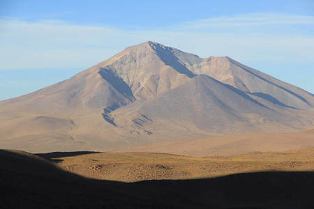
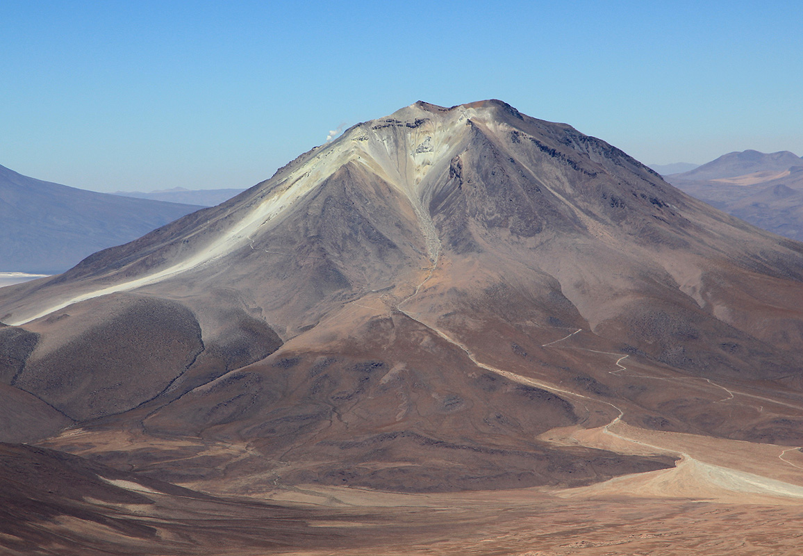
Cerro Tomasamil
- Cerro Tomasamil
- 5854 m
- Primary factor 1624 m
- Bolivia
- Location: South 21:17.547, West 067:58.111 (GPS on the summit)
- Difficulty: YDS class 2.
- Climbed January 4 2011.
|
|
Copyright Petter Bjørstad, 2009-2011.
Information:
How to get there:
This mountain is located east of the Chile/Bolivia border, east of the better
known mountain Cerro Ollague, located
near the small border community (border crossing) with
the same name. There are several large mountains (all volcanos) in this area. There are many
small dirt roads in the area, access from the small town of Ollague is pretty straightforward.
Access is best from the north-south dirt road that runs east of Cerros Cañapa, then
west of Cerro Tomasamil. Locate a point near location S21.266, W68.023 along this road. With a 4WD it
is realtively easy to just leave the road and drive towards the lower slopes of Cerro Tomasamil.
We drove to location S21:16.060 W068:00.133, elevation about 4350 meter and established our camp
there.
Route description:
From the described trailhead/camp, one should head towards the very long and pretty gentle ridge
that forms the left skyline as viewed from camp. Follow this ridge all the way to the summit.
The footing is pretty good all the way. Higher up, what appears to be the summit, is a false summit.
The last part of the ascent follows a fairly gentle ridge that eventually tops out at the summit.
Comments:
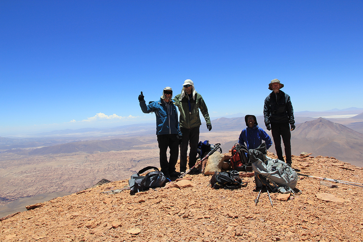
This climb would have a pretty large vertical gain, we started shortly after daylight at
0605 and it took us 6 hours including several short
rests along the ridge, to the summit.
It was nice to see all 6 members of
our team making this summit, our last goal in Bolivia.
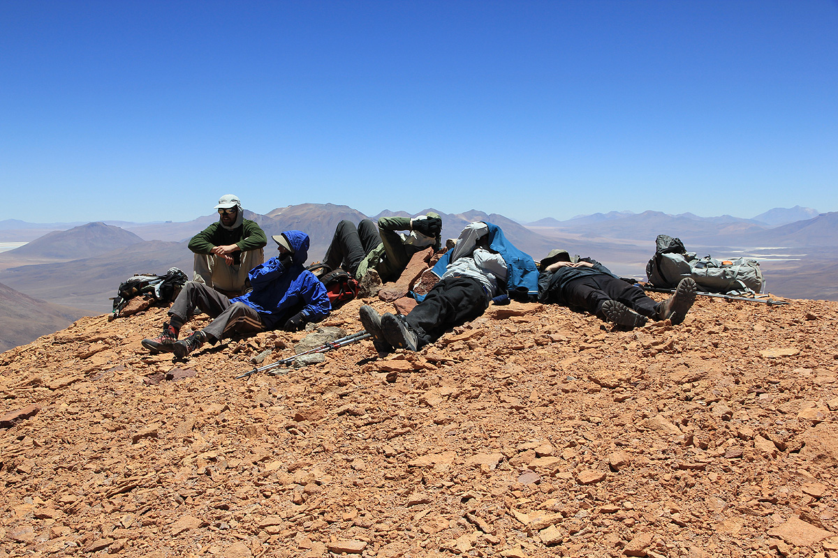
We spent a good 1:15 at the summit, relaxing in the relatively warm and comfortable weather.
Leaving at 1320, we again largely descended on loose scree in the bowl next to the ridge.
We arrived back at camp by 1630 after a return hike that included multiple rests in the
good weather and since acclimatization really favored spending as much time as possible
at elevation before our drive into Chile.
A summary of peaks climbed are available.
A full trip report can
also be consulted for more pictures and additional
details.
Resources: