Cerro Chorolque
- Cerro Chorolque
- 5571 m
- Primary factor 1593 m
- Santa Barbara, Bolivia
- Location: South 20:55.103, West 066:02.140 (GPS on the summit)
- Difficulty: YDS class 2.
- Climbed December 31 2010.
|
|
Copyright Petter Bjørstad, 2009-2011.
Information:
How to get there:
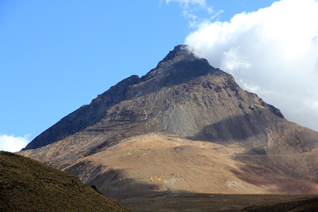
This very prominent mountain is located right next to the mining town of
Santa Barbara. Perhaps more accurately, Santa Barbara is located pretty high on
the slopes of Chorolque. Locate the road connecting the city of Tupiza with the
city of Uyuni. This road has a very distinct bend at location S20:57.319 W066:09.563,
elevation about 3800 meter, where the small side road serving the
Santa Barbara village heads east. Drive about 15 kilometer, before arriving at the
Santa Barbara village, there is a gate with a guard house. How easy (or difficult) it is
to get permission to climb this mountain remains a bit unclear (see below). Continue
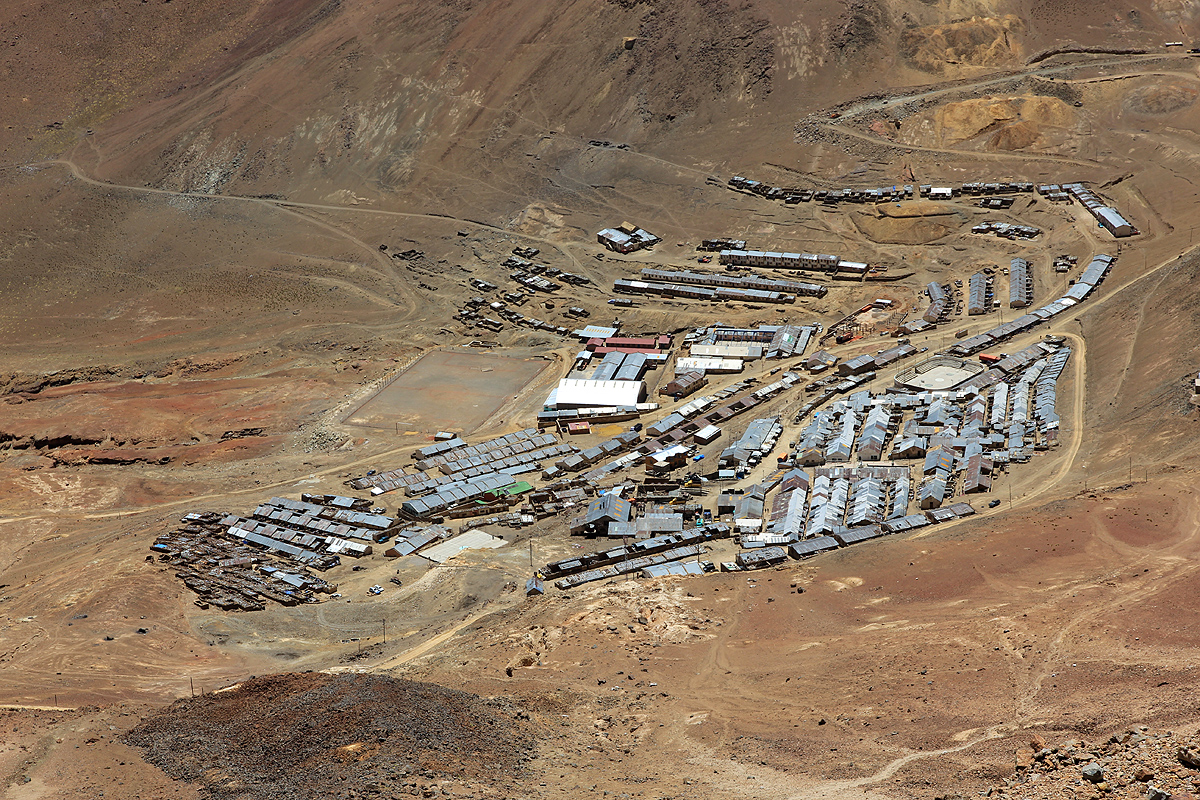
driving to the streets of the small village Santa Barbara. This village is located at
almost 4800 meter of elevation, must be one of the highest permanent villages anywhere.
The location is S20:55.408 W066:02.983.
This would be ok as a trailhead. We were permitted to drive a bit higher (on a mining road)
and eventually parked at S20:55.408 W066:02.983, elevation about 5035 meter! This was a
pretty good place to turn the vehicles around and about as high as one could drive without
any issues.
Route description:
From our trailhead, we proceeded a short stretch along the road, then took a miners foot trail
that cut more steeply uphill. This path was generally ok to follow as it took us higher and
somewhat more right (when facing uphill) on the mountain face. Eventually, we continued our climb
going uphill as we traversed further right on more loose ground. Care is needed as the slope
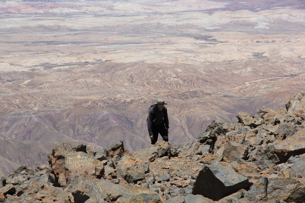
is steep enough to have rocks falling. This traverse got us to a pretty distinct point on the
proper South ridge, point marked with a cairn.
From here, follow the ridge all the way to the
summit, perhaps going off a bit to the left side where this looks pretty obvious. There is a trace
of a trail most of the way. Some easy scrambling among larger boulders in a few places.
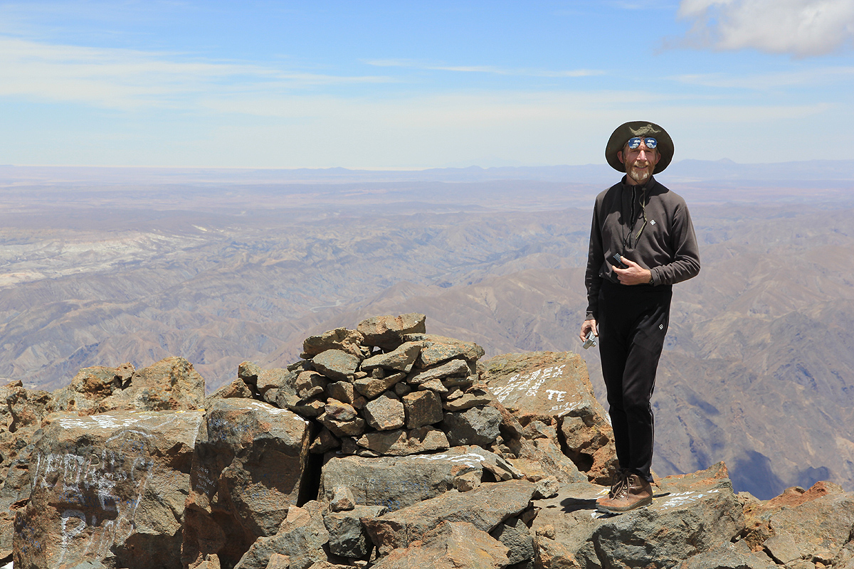
There is a pretty big summit plateau stretching
along a summit ridge. The far side has a steep
drop. There are a couple of cairns, the highest natural rock is close to the steepish drop
on the north side.
Comments:
We camped along the road from Tupiza at a nice place above 4000 meter. The next morning, we drove
to the turn-off and followed the road to Santa Barbara. After a brief stop at the guard station we
were permitted to proceed to the village itself. It seemed that we would need a permit from the
office of the mine. However, this was New Years Eve and the office was closed. Quite some discussion
(in Spanish) followed and it was not entirely clear where this would lead. Eventually, it was agreed
that we could drive a bit further up the mountain and climb it. It is not clear that this would have
been the result if the office had been open.
We started hiking at 0930 and made the summit at 1125.
Great view back down to Santa Barbara.
After spending a full hour in beautiful weather
and with a very nice view, we descended at 1225 reaching the car by 1345.
A summary of peaks climbed are available.
A full trip report can
also be consulted for more pictures and additional
details.
Resources: