Rwenzori Trip Report, December 28, 2009 - January 11, 2010.
Copyright Petter Bjørstad, 2009-2010, photos by Petter Bjørstad, Tor Erling Bjørstad and Rob Woodall.
Before the Trip, Preparations.
I visited Uganda in October 1994 and lectured at the Makerere University in
Kampala as well as acting as an advisor for their attempts to establish
email, a local computer network etc. At that time, I climbed Kilimanjaro
before coming to Kampala. Towards the end of my stay, I travelled west by
a jeep from the university and visited the Rwenzori trailhead up by the small
village of Ibanda. I also spent one night at the already then pretty fancy
Mweya Safari Lodge.
Now, after 15 years, it was time to return and climb the highest peaks
of the Rwenzori. My son Pål Jørgen was enthusiastic about such a trip,
it also turned out that Tor Erling would like to come along provided that he
finished writing his PhD thesis before Christmas. So he did and just as plans were
being finalized, my friend Rob emailed and asked: "Costs and flight times, if
the invitation still stands?" (I had suggested this earlier, but at that time Rob
had different plans.) Thus, the team ended up being 4 and departure date was set for
December 28. with a return flight from Uganda on January 10.
With the airline tickets in hand, all that remained was to make the necessary
arrangements for a successful trip, including a safari, to Rwenzori and Eastern Africa.
Local reservations were done without too much effort using email and a couple of
phone calls.
A very brief history of the Rwenzori
The Rwenzori history is so facinating that one simply cannot avoid writing a few words about it.
Speculations about the source of the Nile dates back to BC. Almost 2000 years ago the Greek geographer
Ptolemy placed some snowcapped mountains near the equator in the middle of Africa, on his map. He
called these mountains Mountains of the Moon and put forward the hypothesis that this was the source
of the Nile. Actually, there is some evidence that his source of information may have been a merchant
named Diogenes, reported to have travelled inland for 25 days and listened to what natives had explained.
To find these mountains turned elusive, in particular, since the Rwenzori is almost always obscured in clouds and mist.
The exploration by Europeans picked up in the second half of the 19th. century when a large number of expeditions
travelled in what is now known as East Africa. It was not until Henry Stanley made a verified sighting of
snow capped mountains on May 24th. 1888, that the existence of these mountains was indeed proven. Stanley named
the range the Ruwenzori (later changed to Rwenzori), a local name meaning "rain-maker".
The first route into the mountains followed the Mubuku river, this is the same route as we hiked when
returning out. Already in 1889, Stanley is back in the region and W.G. Stairs from his party makes an
exploratory trip, reaching an elevation of about 3254 meter. From here, he could confirm that the peaks
were in the vicinity of 5000 meter high and that the summits were covered by snow. From 1891 to 1905, several
parties travels up the eastern valleys and some participants reach elevations exceeding 4000 meter. For various
reasons none of the major peaks were within reach of these early explorers.
Then, in 1906 the famous Luigi Amedeo di Savoy, Duke of Abruzzi, prepared a carefully designed scientific as well
as mountaineering expedition with the aim to fully explore these mysterious mountains. The team consists of 6
men, 4 alpine guides and the famous photographer Vittorio Sella. They left Naples on April 16th
and reached the
first foothills of the Rwenzori by June 1. The duke and his guides made the first ascent of Margherita Peak on
June 19th. By July 18th the expedition returns to Ibanda and started the long journey back home to Italy.
They have made a total seventeen (first) ascents, collected scientific information about geology, plants and
animals. Vittorio Sella made extensive landscape photography and a detailed map in scale 1:40.000 was produced.
The scientific results were published in two volumes, Il Rwenzori: relazioni scientifiche, in 1909.
The well know mountaineer and explorer Eric Shipton made the third ascent of Margherita Peak (as well as Mount
Speke and Mount Baker) as late as 1932 (with Bill Tilman). The peaks have had severe access problems during
time of unrest and violence, but in more recent years they are climbed quite frequently, although Margherita
Peak, being the highest, have many more ascents than Speke and Baker.
Regulations and Reservations
The Rwenzori National Park is a UNESCO World Heritage Site. Treks and climbs in the
park must be organized with the Rwenzori Mountaineering Services, RMS, see below for
contact information. This applies to private as well as commercial tours, in fact,
since most everything (guides, porters, cooks etc) are provided for by the RMS regardless,
I would certainly recommend that any interested party look into just organizing their
own private tour.
Trips can be made almost any time of year, but the best periods are likely to be in
the December-February and June-July timeframes. There is almost always some rain in
Rwenzori, but these times have at least in the past, been somewhat better.
Entry to Uganda is granted by paying US dollar 50. (called a visa fee), at the
airport upon arrival. As of 2009/2010, there were no checks for vaccination (yellow fever),
however, one should consult with health authorities before leaving to find out what
immunization may be recommended. There is malaria in Uganda, not in the mountains, but
in the area that one must travel through. We carried some mosquito repellent, some mosquito
travel nets (for beds) and took a tablet of malarone every day as a precautionary measure.
The hotels mentioned below, all provide high quality mosquito protection in their guest rooms.
Clothing, Boots, Huts and Climbing Gear:
The most important piece of gear is rubber boots, these should have good soles and extend up
to just below your knee. The Rwenzori has a lot of mud and slippery roots and wood that has been
placed in the mud to facilitate crossing. The temperature is never really low and there is
rather seldom any wind to write home about. Temperature at night may drop to a few degrees
below zero Celcius, a warm sleeping bag should be carried. The huts have beds with a mattress
and a pillow, but no blankets. The trail to the first hut can be hiked with ordinary trail
shoes. There is only summit day when mountain boots are nice to have, one may need crampons
on Speke and Margherita. A climbing rope should be carried on Margherita and Speke, also note that
conditions can be quite variable. With more rain, the local rock can turn extremely slippery.
Likewise, one may experience conditions with thin layers of ice (verglas) on the scrambling sections
making them very hard if not impossible. The fixed ropes on Margherita may limit the need for
climbing gear to a prussik (or a jumar), we abseiled two sections on Mount Speke. Normal mountain
clothing, an inner wool layer, a fleece layer and a windproof outer shell is sufficient. A warm hat,
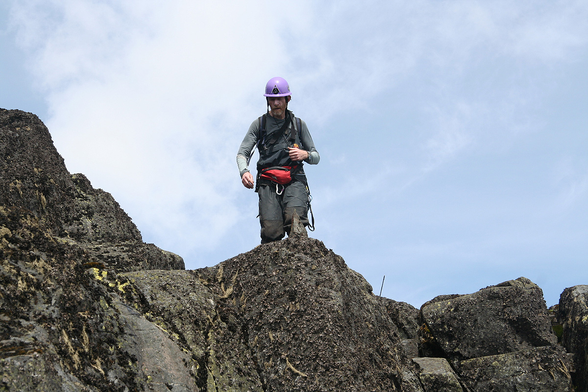
gloves and sunscreen/sun glasses. We used climbing helmets, but rockfall danger is relatively
small along the normal routes.
Food and Cooking:
There are basically two options; one may just bring mountain food from
home. We took 32 servings of REAL (Drytech) dehydrated food, we brought
160 gram portions of müseli for breakfast and carried an assorted
supply of snacks (rich in carbohydrates) for lunch. The alternative is
to contact the RMS (or a cook, see below) and specify the number of people
and the planned number of days. He will then take care of everything.
The first alternative makes it less likely to have any team member affected
by digestive problems from the local bacteria/meat, while the second alternative
most likely gives a more interesting and possibly better tasting dining
experience.
Day -1, December 28th. We fly from Norway.
Up at 0420, taxi at 0440, ugh! this is early. Bergen has lots of snow
this Christmas, snow that delays traffic and causes problems also for
the airlines. Our flight was at 0630, however snow removal etc. called
for waiting, we departed around 0715.
Weight and baggage limitations are often causing headaches for mountain trips,
not this one, it turned out that we each could check 46 kilogram of baggage,
far more than we carried or needed for a trip like this one.
Plenty of connect time in Amsterdam, we departed on time at 1005 and arrived in
Nairobi at 2000, the time here being 2 hours ahead of European standard time.
We transferred to Kenya Airways and completed our flights, arriving at Entebbe
airport around 2300. We bumped into 6 Norwegians and a Swede in Nairobi, they were
part of a Hvitserk (commercial) expedition to Rwenzori. Fortunately, they were
scheduled to start the trek one day after us, the huts are small and it is nice
to not make them more crowded than needed.
We cleared through immigration and customs in 10 minutes, then located the driver
from Boma Guesthouse.
He subsequently took us there without any incidents or delays.
I checked in and the boys got a room. I was supposed to share a room with Rob. Rob had
arrived some 9 hours earlier and was now asleep, but where? Nobody knew, and a couple
of phone calls to the staff that had been in the reception earlier in the day were
necessary. Before long, we were all aleep, well deserved after a long, but uneventful
first travel day.
Day 0, December 29th. We travel from Entebbe to Kasese.
We got up at 0700, nice breakfast with egg and sausages. Our first day in Africa.
Our driver showed up early and
we were on our way at 0800. First to Kampala where
a quick visit with a local ATM produced 500.000 Uganda Shillings. Subsequently a short
stop to view a large number of bats,
right in the middle of town, just reinforcing
the fact that we were in Africa. Then onwards to
the Kampala office of the RMS (Rwenzori Mountaineering Services). They have their
office right next to the Uganda National Park Administration, very convenient.
It looked awfully tempting to book a mountain gorilla safari, but no time for this,
unfortunately. I met Monica, with whom I had exchanged email prior to our arrival.
We worked out the detailed schedule and I paid her US dollar 2.800 in addition to
the 2.500 that I had already transferred by wire. She immediately went next door
to pay about 1.080 to the park authorities, this way I received the proper documents
to enter the Rwenzori National Park without any delays.
Back in the car, we now set out for Fort Portal, the main town in the west, somewhat
north of Kasese. Shortly outside Kampala there is a rather long section (about 50 km?)
of the road that is a continuous, dusty dirt workzone. It is a bit disappointing
to me to see that this road hardly looks any better than 15 years earlier. We make
a brief stop to buy barbequed goat meat on wooden sticks, something simply does not change,
the identical scene from 15 years previously came vividly back in my memory.
We arrived in Fort Portal
around 1445 and had (a late) lunch with the driver and Patrick.
We agreed that he also should provide us with local transportation, ie. up through Ibanda to
the RMS office tomorrow, likewise pickup and transfer to Queen Elisabeth National Park on
January 7th. Finally, he would drive us from the park to our accommodation at
Cassia Lodge in Kampala on January 9th.
After lunch, we continued south along the foothills
of the Rwenzori. Finally, in the town
of Kasese, then a bit west to locate our hotel Margherita.
We were expected and enjoyed a
good dinner before heading for the bunk. Another long day, but now we all felt excited
about the trip that could begin the next morning.
Day 1, December 30. We hike from Nyakalengija to Nyabitaba hut.
Our driver collected us as agreed around 0800. We enjoyed the breakfast and actually
left about 15 minutes late. back down to Kasese, then north to the location where
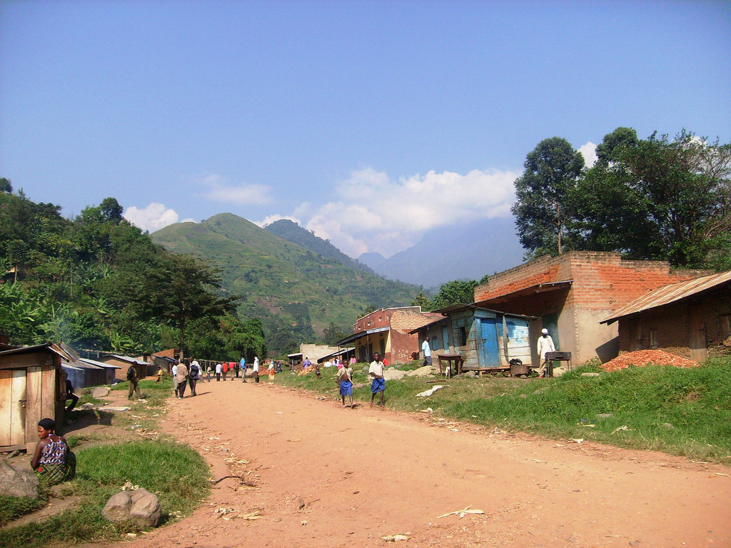
a small dirt road leads into the foothills and the village of Ibanda. This road fork
is close to location N00:15.362, E030:06.957, elevation about 1100 meter.
The road is rough, but can be driven by ordinary cars with care. We pass through
Ibanda and finally arrive, at 0915, in the village of Nyakalengija, the RMS office and property
is on the right hand side, a big sign leaves no doubt. This location
is N00:20.535, E030:02.644, elevation about 1600 meter.
Things are pretty efficient. We are given a small, introduction to the Rwenzori by
the main office, introduced to our two
guides, Sebestian and George. One bag is delivered
for local safekeeping, the remainder of our luggage is weighed, we have an allowance of
100 kilogram. After removing 3 liter of bottled drinking water (to be carried by Pål),
we are OK with the weight.
Our party will consist of the 2 guides, our cook Limbali Ambrose and 8 porters. In addition,
2 more porters will assist us up to the second hut (John Matte), then return in order to hike
up and meet us at the Guy Yeoman hut towards the end of the trip. In this way, they can support
the 11 other, in particular with reasonably fresh food supplies.
We started hiking at 1045. Initially, the
route follows a village road as we walk by local
houses and their farming fields with banana trees and other crops. After 30 minutes, we arrive
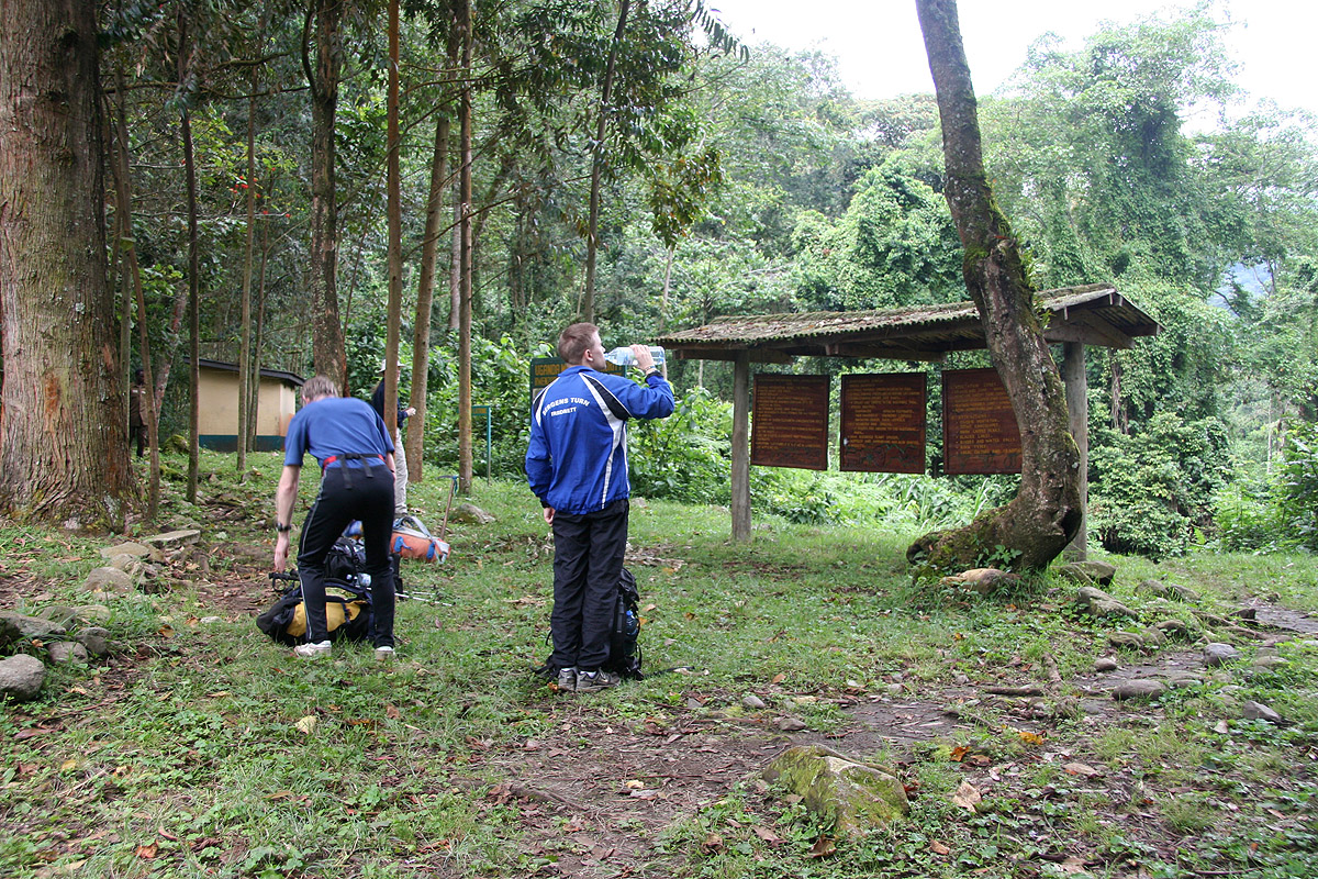
at the National Park checkpoint. Here, we sign in and show our (paid) park permit. The whole
procedure takes about 15 minutes. Soon after continuing,
we make a second brief stop to
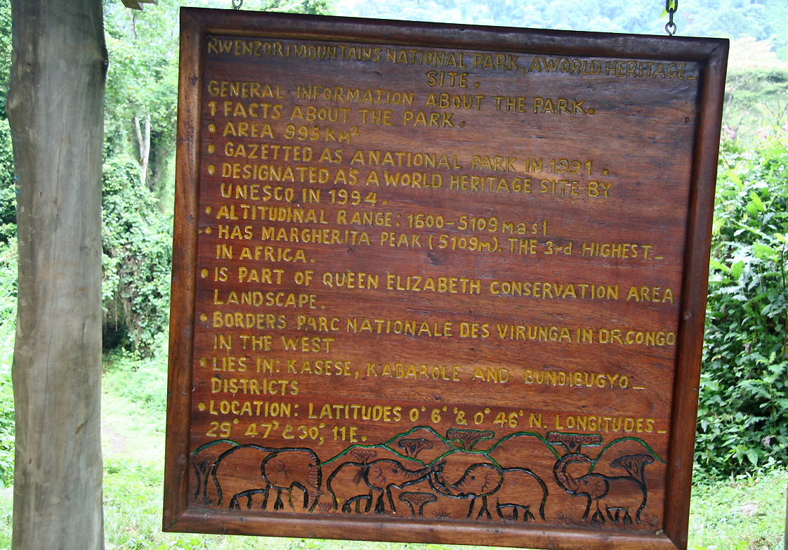
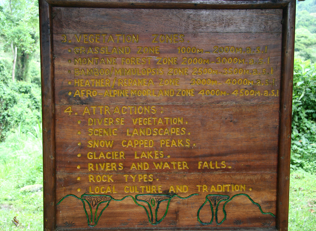
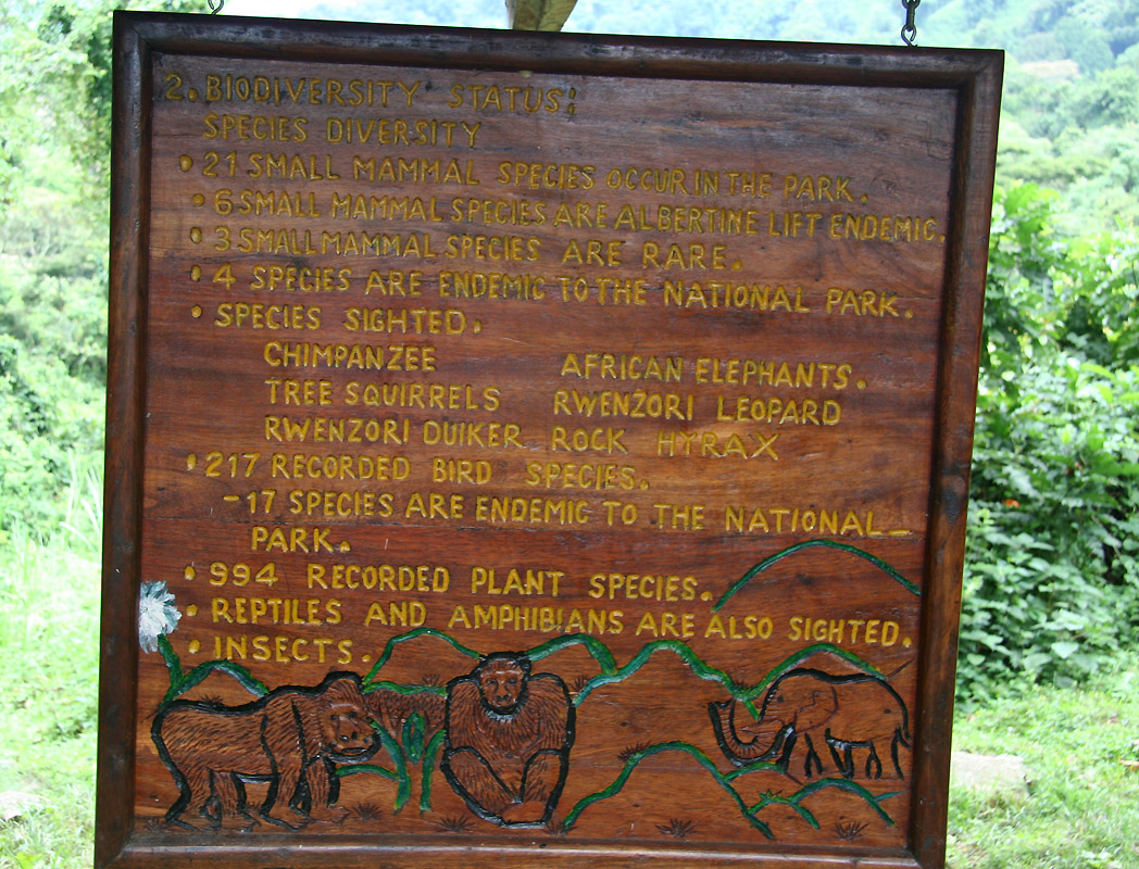
look at the information posted on large boards of tree.
These boards tell a bit about
the park,
its
plants and wildlife
as well as
general park regulations.
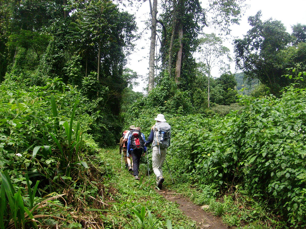
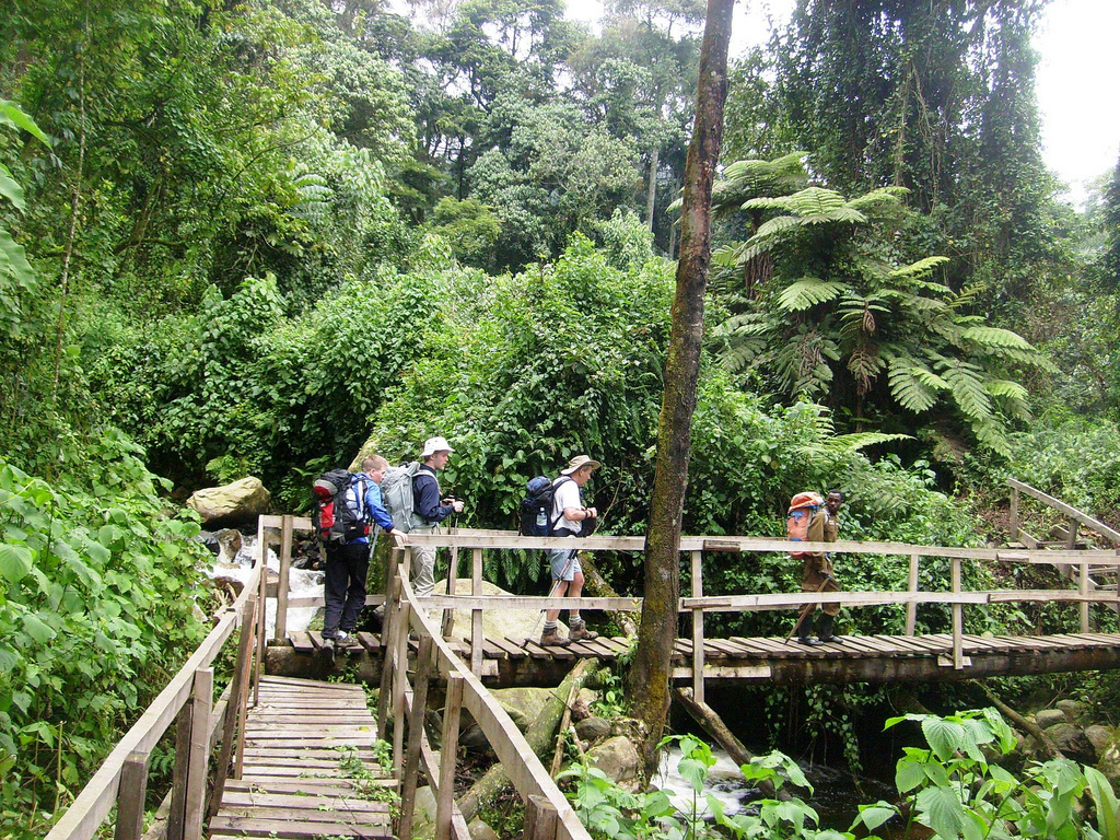
The path gets appreciably smaller as we head into the jungle.
The trail follows the left (W) side
of the Bujuku river and crosses a few side rivers by wooden bridges.
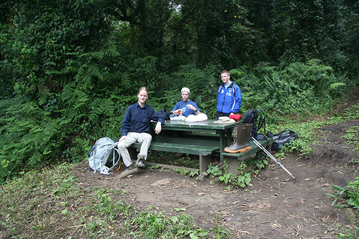
The trail goes a bit up and
down before it crosses the last side river and arrives
at a small rest area with benches and
tables. We rest for 30 minutes before climbing a sustained uphill. This is a pretty distinct
ridge and as it levels out a little, we soon
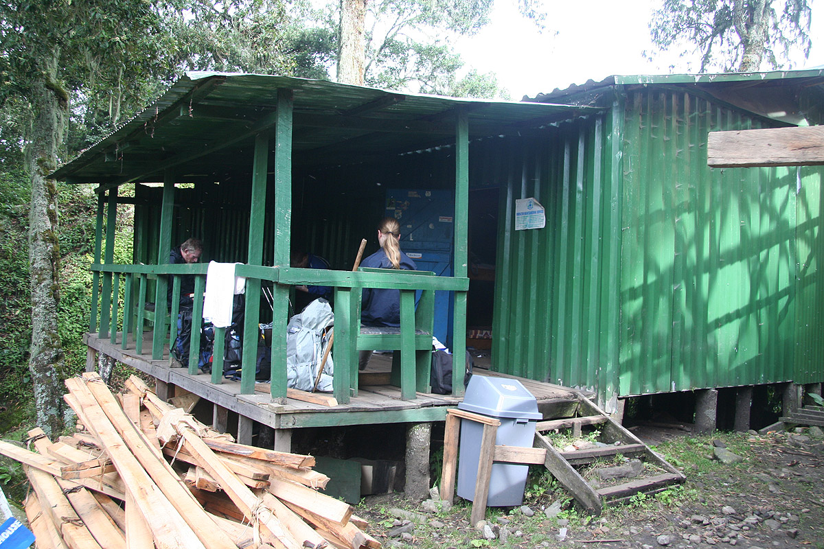
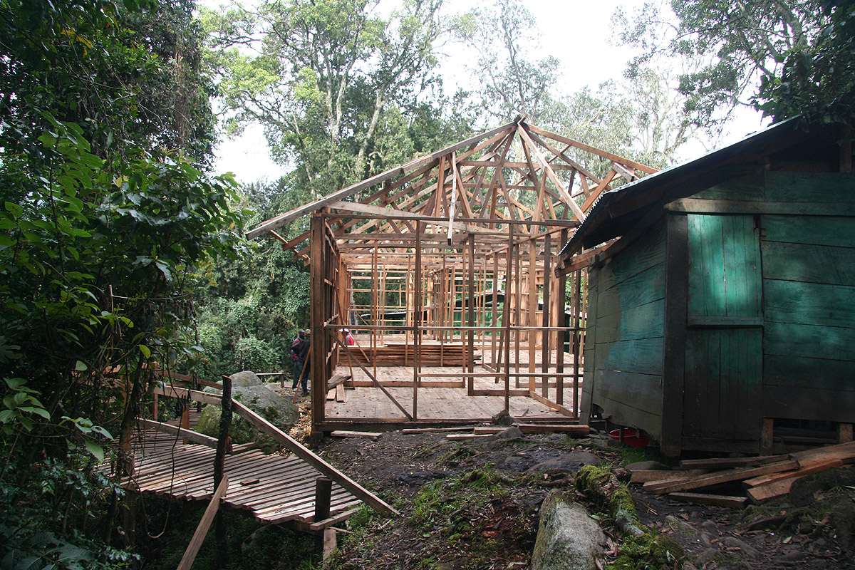
arrive at the first hut, Nyabitaba, location
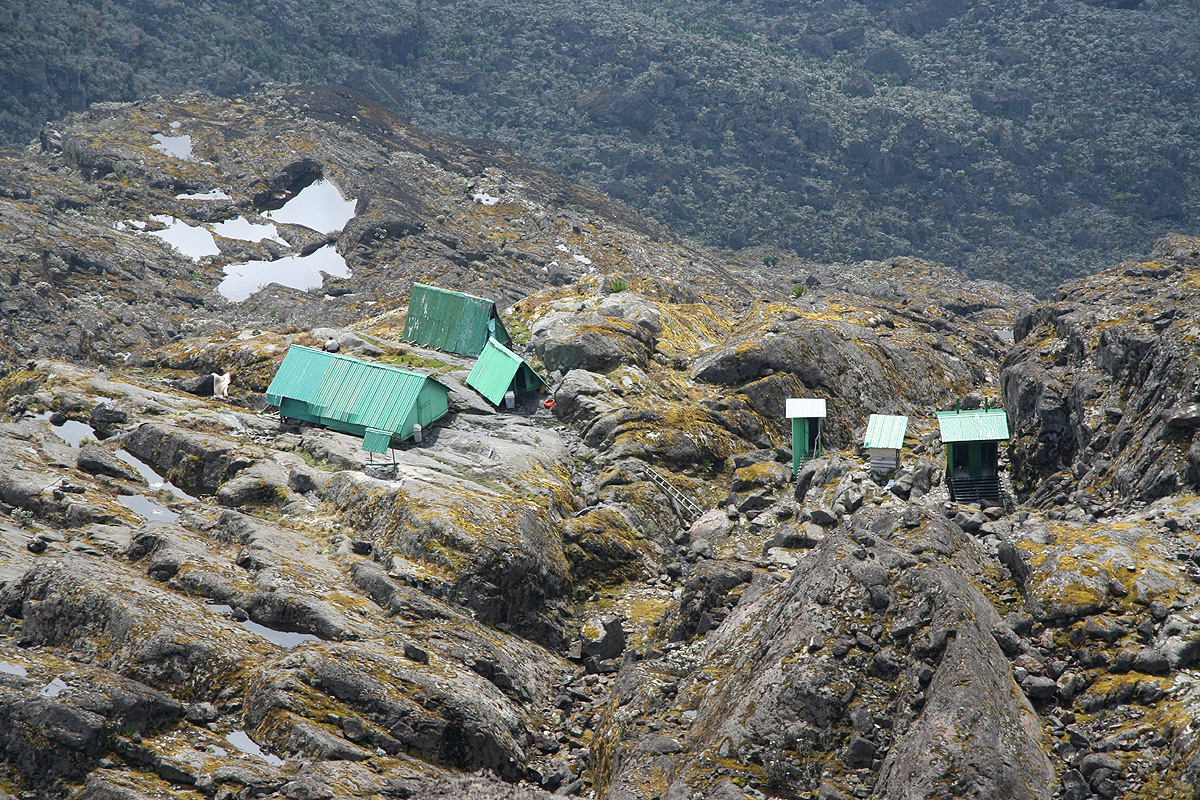
N00:21.490, E029:58.732, elevation 2663 meter. The hut is quite comfortable, there is a terrace
outside covered by a roof, inside there are beds with mattresses and pillows. The guides and
porters have a house about 100 meter further along the ridge. Fresh water is provided by way
of a pipe from higher up. Right next to our hut a new and
larger hut is under construction.
We arrived at 1410, a net hiking time of 2 hours and 40 minutes. We all agree that this
was an easy day, the guide laughed when we told them that today was a "half-day" (of effort).
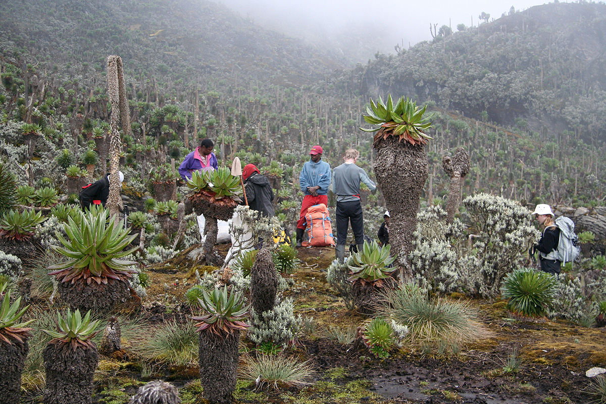
Day 2, December 31. We hike from Nyabitaba hut to John Matte hut.
We wake up at daybreak and have already agreed to start by 0830. This is a daily routine, every
(early) evening we have a short meeting with the guides. We normally make a brief review of the
day that has come to an end, then discuss and agree on when to start the next morning, perhaps
also a few words on what lies ahead for the next days hiking/climbing.
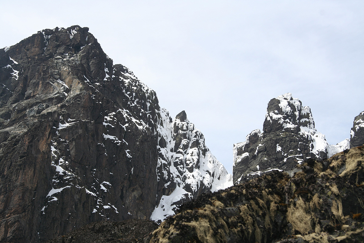
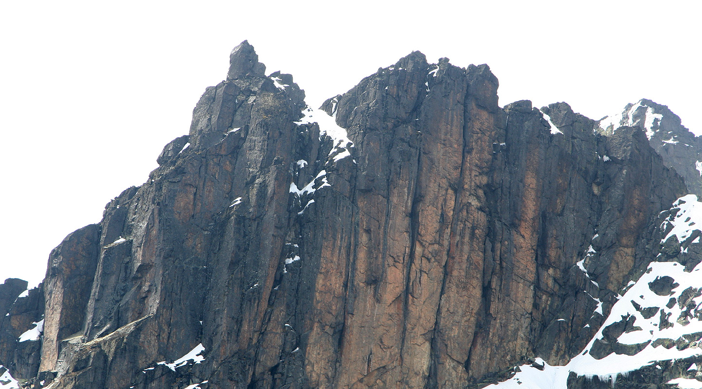
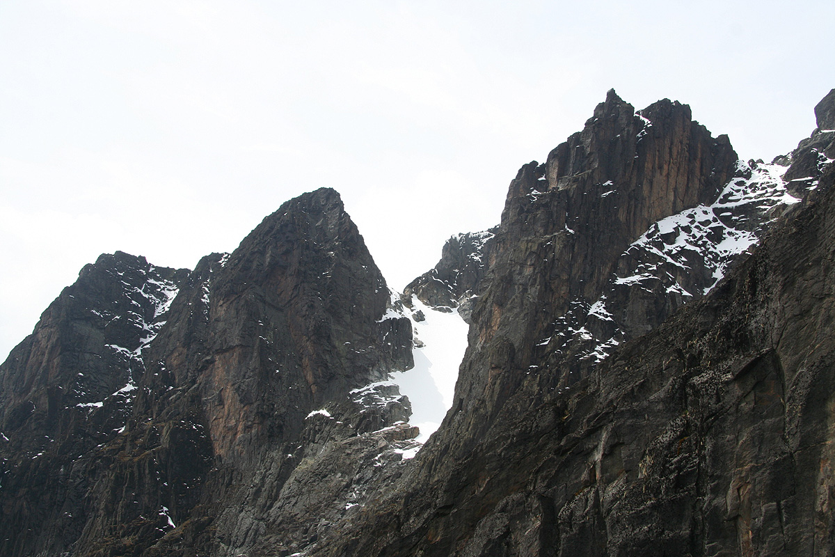
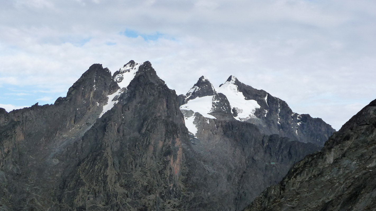
Today is a fine morning and the view across the Bujuku valley is clear.
There, the Portal Peaks
rise high and mighty. (The picture shows Rutaria, 4280 m.)
We get off at the agreed upon time and continue gently uphill along the
top of the ridge for a few minutes. Here, we arrive at a trail fork. This is where we shall
return in about a week. We fork right and descend steeply down
to the Bujuku river. The vegetation is still very dense and
displays a palette of green variation.
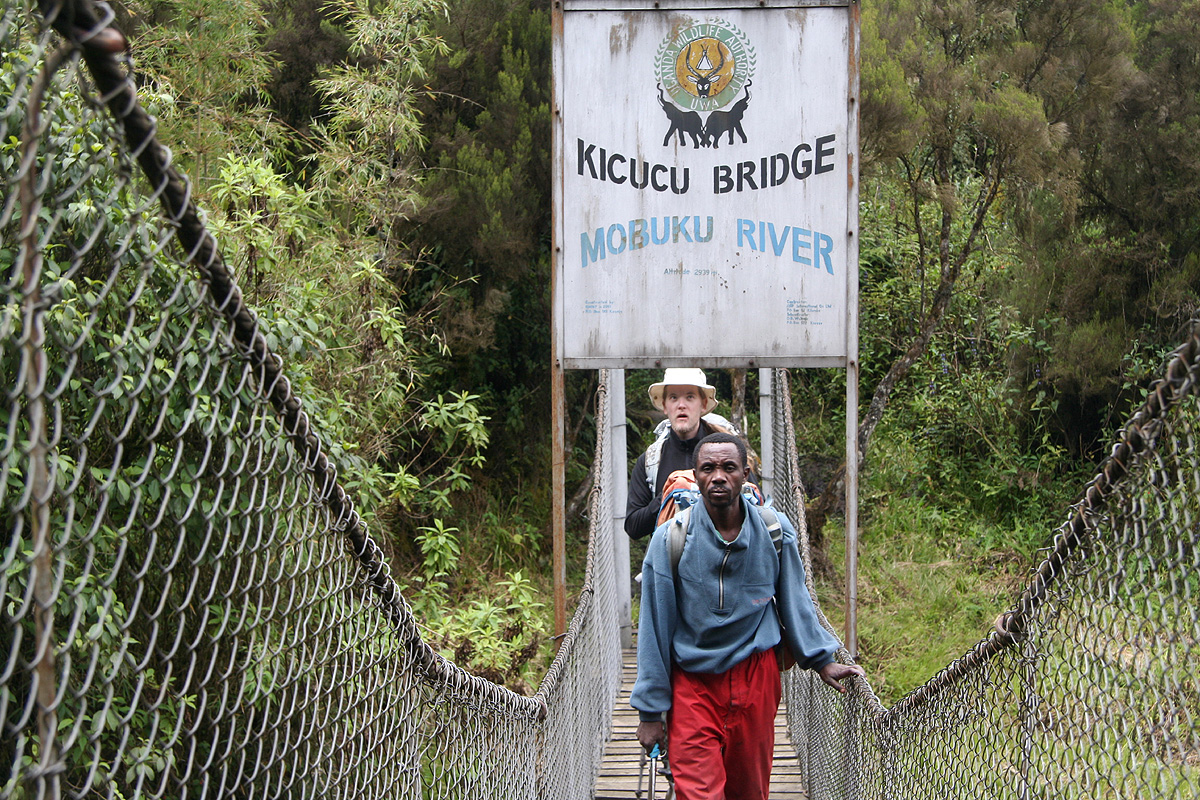
We cross
on quite a modern suspension bridge.
Just upstream is the confluence of the Mubuku (left)
and the Bujuku river.
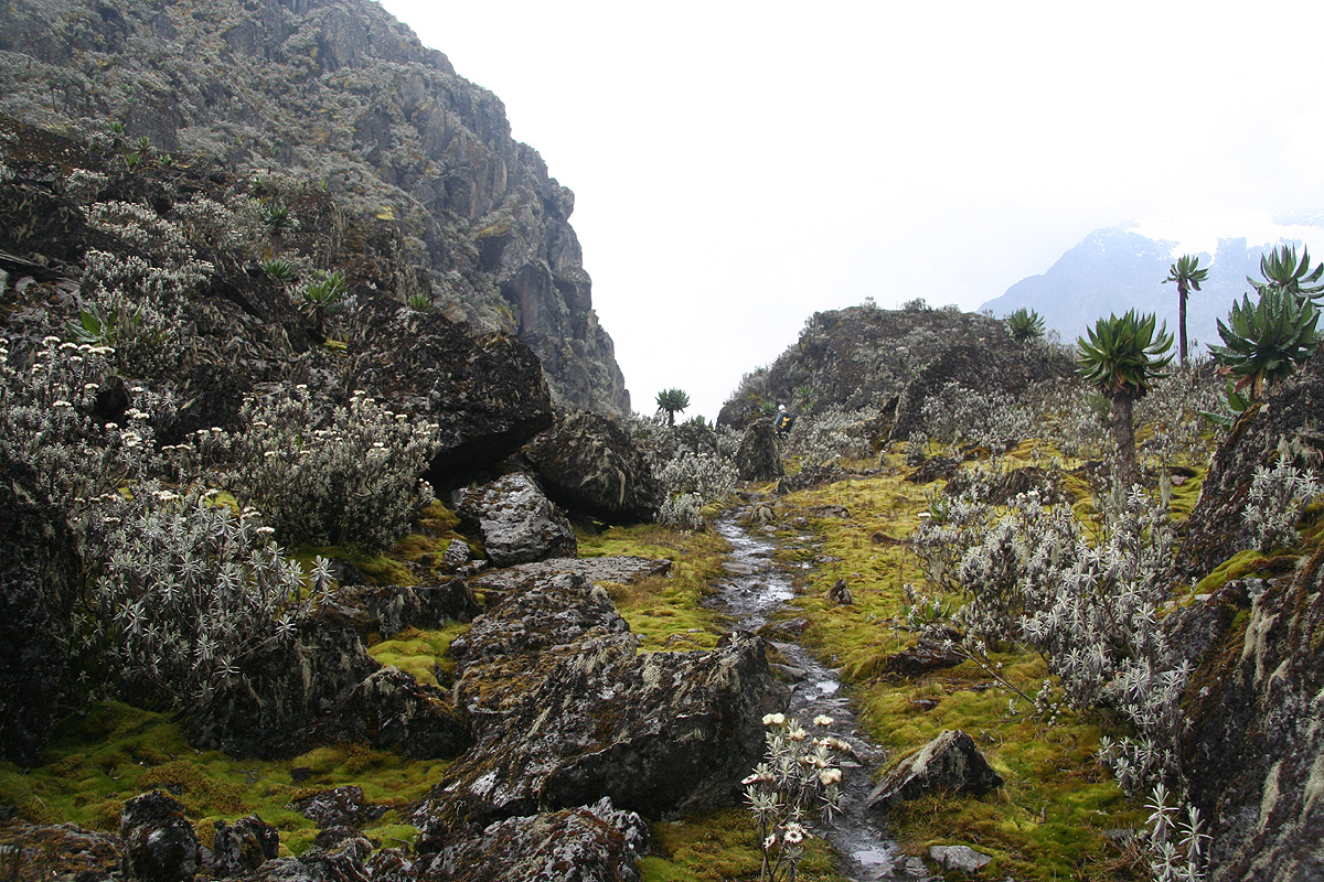
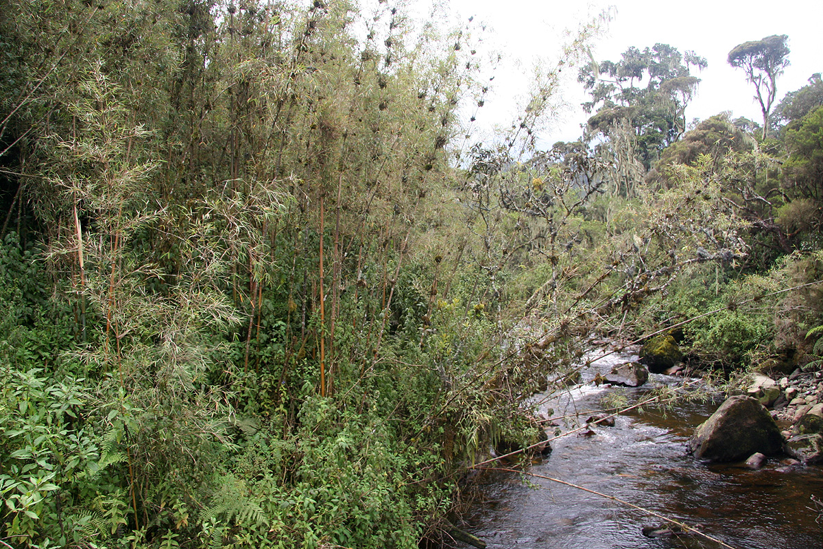
The trail climbs immediately, then heads upstream quite high above the Bujuku river. We hike
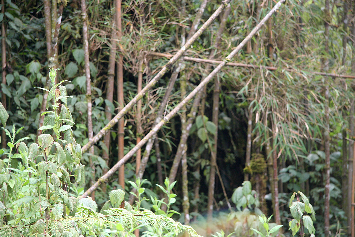
through bamboo forest and the trail is considerably more rugged than yesterday. There are
frequent ups and downs, many more (big) rocks obstructing the path and also more
muddy sections. We eventually emerge onto a clearing
caused by a smaller landslide, then again
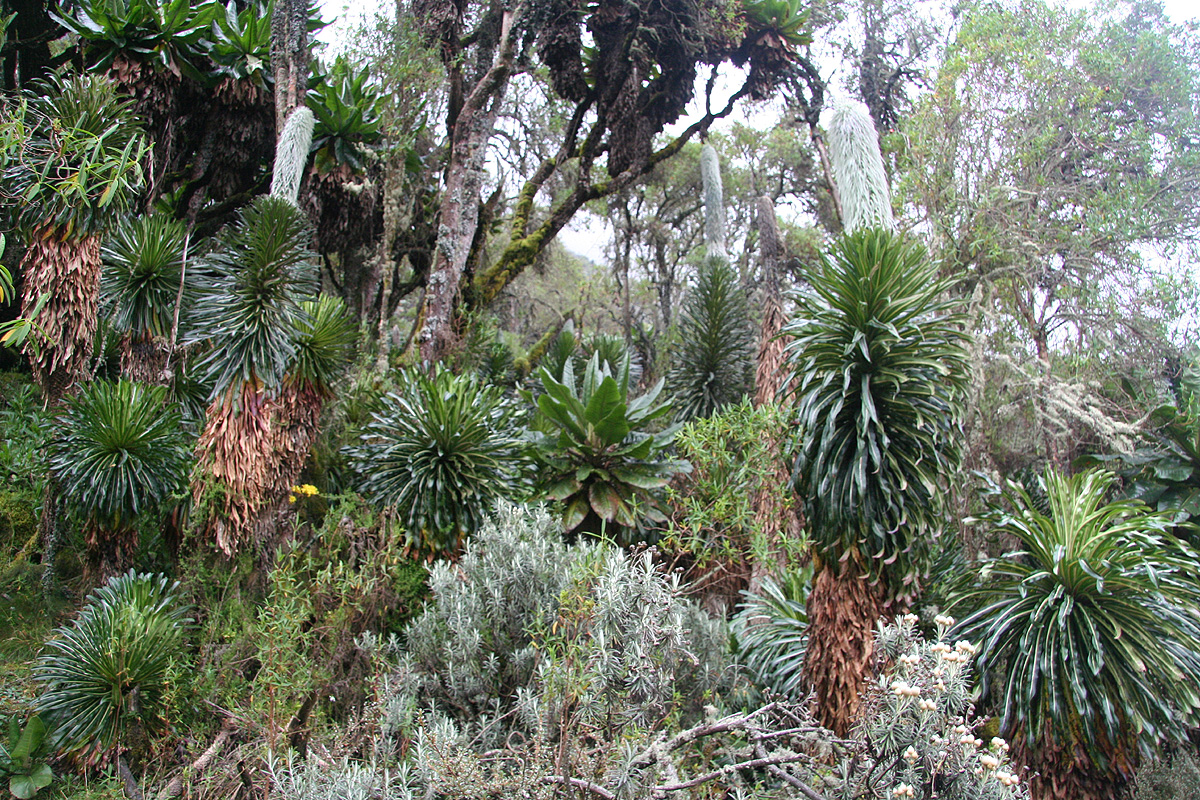
into more jungle, but the vegetation has changed. Here, we see giant tree heather
that may grow
to 30 meter. Parts of the trail winds
through very dense forest, not an ordinary type with
"normal trees", but rather a fairy tale type of
vegetation. The three of us from Norway,
quickly agreed that this was a forest
very suitable for (Norwegian) trolls, they would just
love to live in this chaos of entangled vegetation.
We pass an old hut, the Nyamuleju, close
to a small rockshelter, this place does not see active use
any longer.
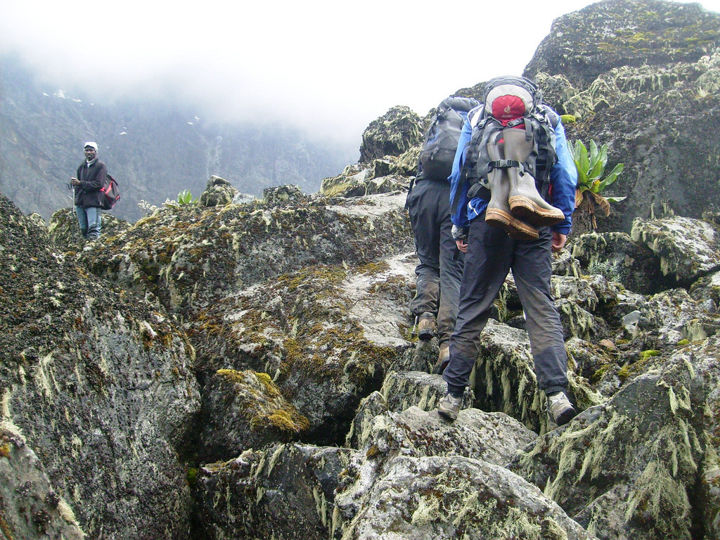
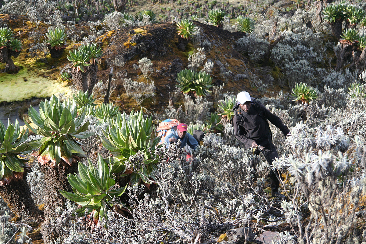
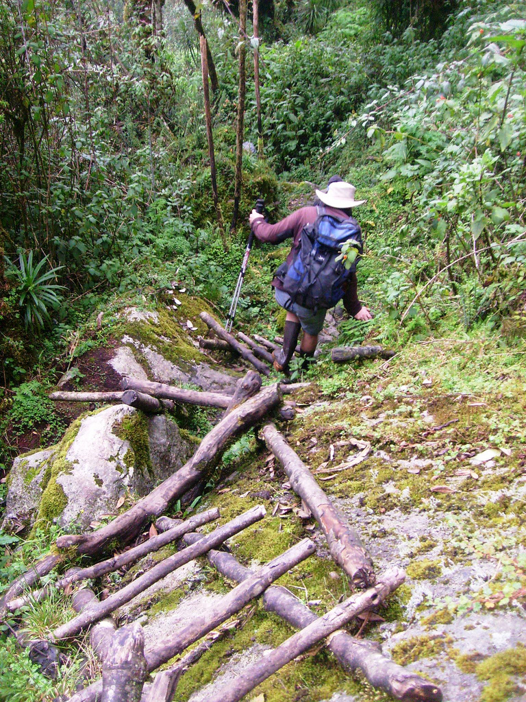
Even closer to the hut, we run into more of the famous Rwenzori bogs, rubber boots
are a must. Often there are wooden poles or bamboo in the mud, but these are slippery and
requires good balance. My
walking poles show a new, very useful property, I can use them to
probe for patches where a step is not likely to immediatly sink deep into the mud.
We arrive at John Matte hut at 1220,
we have had a few small (5 minute) rests, but no major stop today.
We all agreed that this had been a very interesting day, but overall fairly easy in terms of
physical effort. The location is N00:22.991, E029:55.766, elevation 3412 meter.
The hut has been built in a very nice location. There
are good views down the valley, just on the
upper side one
can descend to the Bujuku river and
collect drinking water.
Perhaps even more exciting, for the
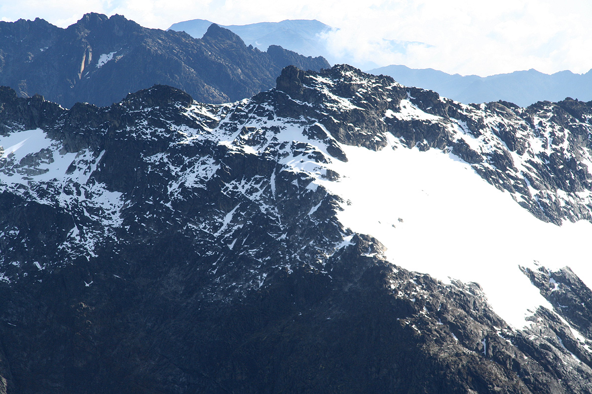
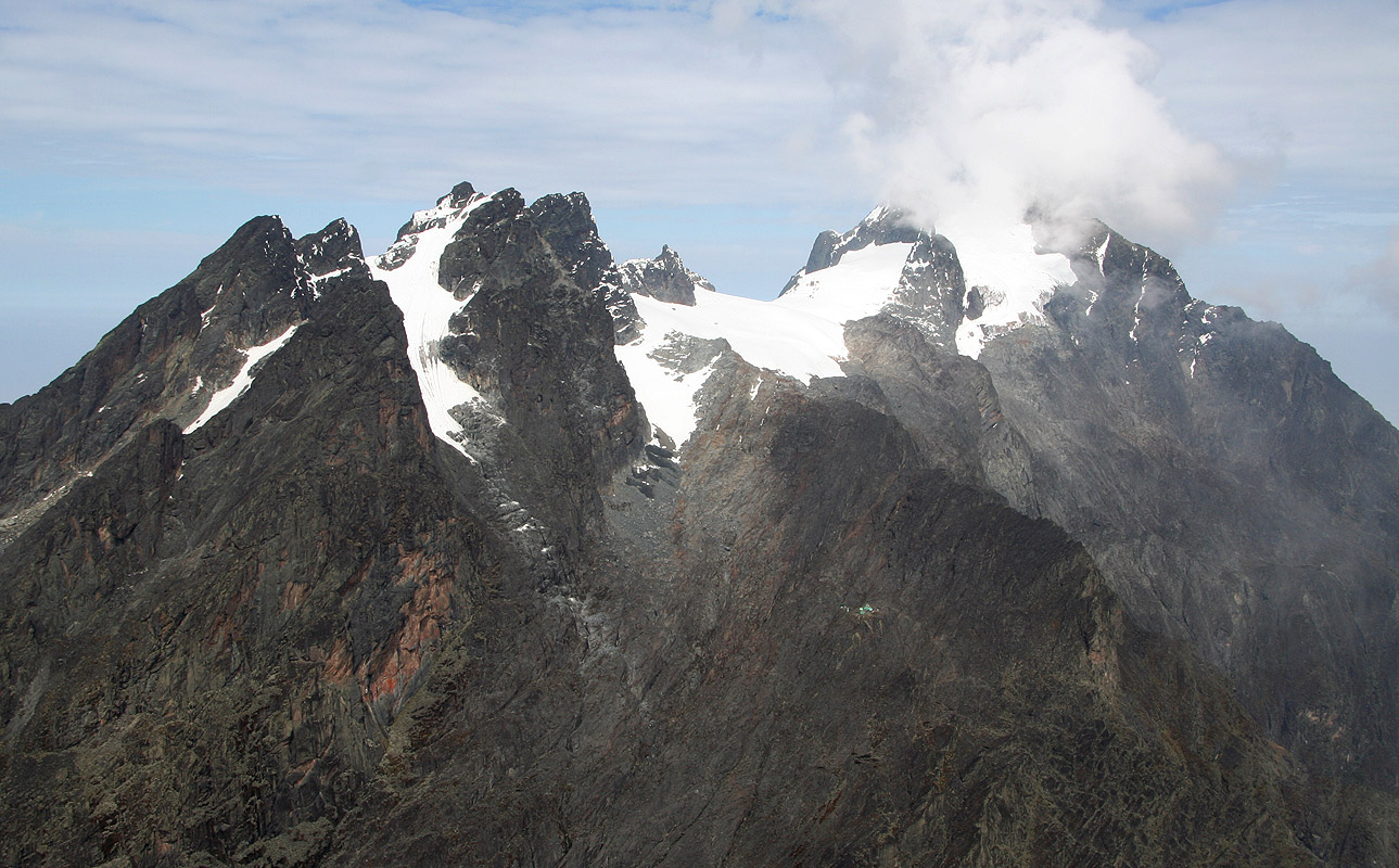
first time we can see our primary goals.
Mount Speke right, Mount Stanley with the Alexandra and
Margherita summits as well as a white glacier, then Mount Baker further left. Today is New Years Eve
and the moon appears to be full. Our guides and porters
decide to stay up until the arrival of
the new year, they sit around a small charcoal fire to keep warm. Our team feels less obliged and
falls asleep well before midnight.
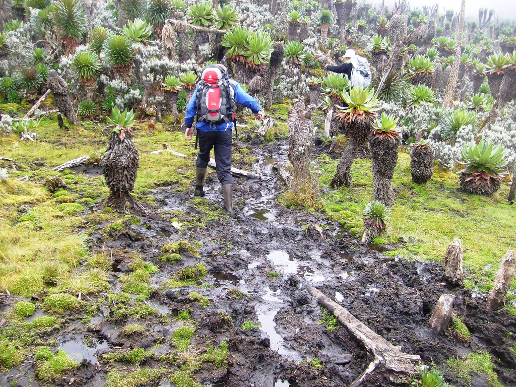
Day 3, January 1. We hike from John Matte hut to Bujuku hut.
Today, we have quite an early start. Our guide knows that a large team from Austria is
ahead of us on the route. Similarly, the group of 8 Norwegians should be one day behind
us on the trek. Our guide is worried that the different schedules will make several large
groups "collide" up at the small Elena hut. I never quite followed his logic, to me it
looks pretty clear that the Austrians should move to Elena ahead of us, while the Norwegians
should follow the day after us. However, I am not succeeding in convincing Sebestian of this.
Our guides have made one observation: Our team is quite stronger than average and is able
to complete the normal hut to hut distance in far less time than most teams. Therefore, they are
now thinking that we could go to the next hut, Bujuku, then proceed to climb Mount Speke in the
same day. By doing this, he thinks that we may be able to move up to Elena hut ahead of the
Austrians.
We started out at 0712, shortly after daybreak. The trek today is most well known for
its big bogs. Shortly after leaving, we first find a nice boardwalk, then
cross the Bujuku river
on a rather precarious bridge
made by woven branches. We then entered the Lower Bigo Bog. The bog was covered almost from
one end to the other by a fairly new boardwalk. The
only focus while walking here, was to decide
if one should step on every second board or, with longer steps, on every third board. The bog
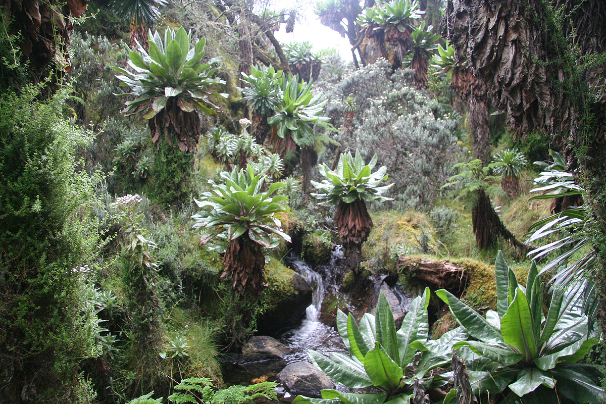
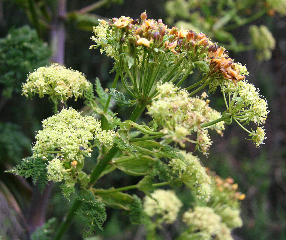
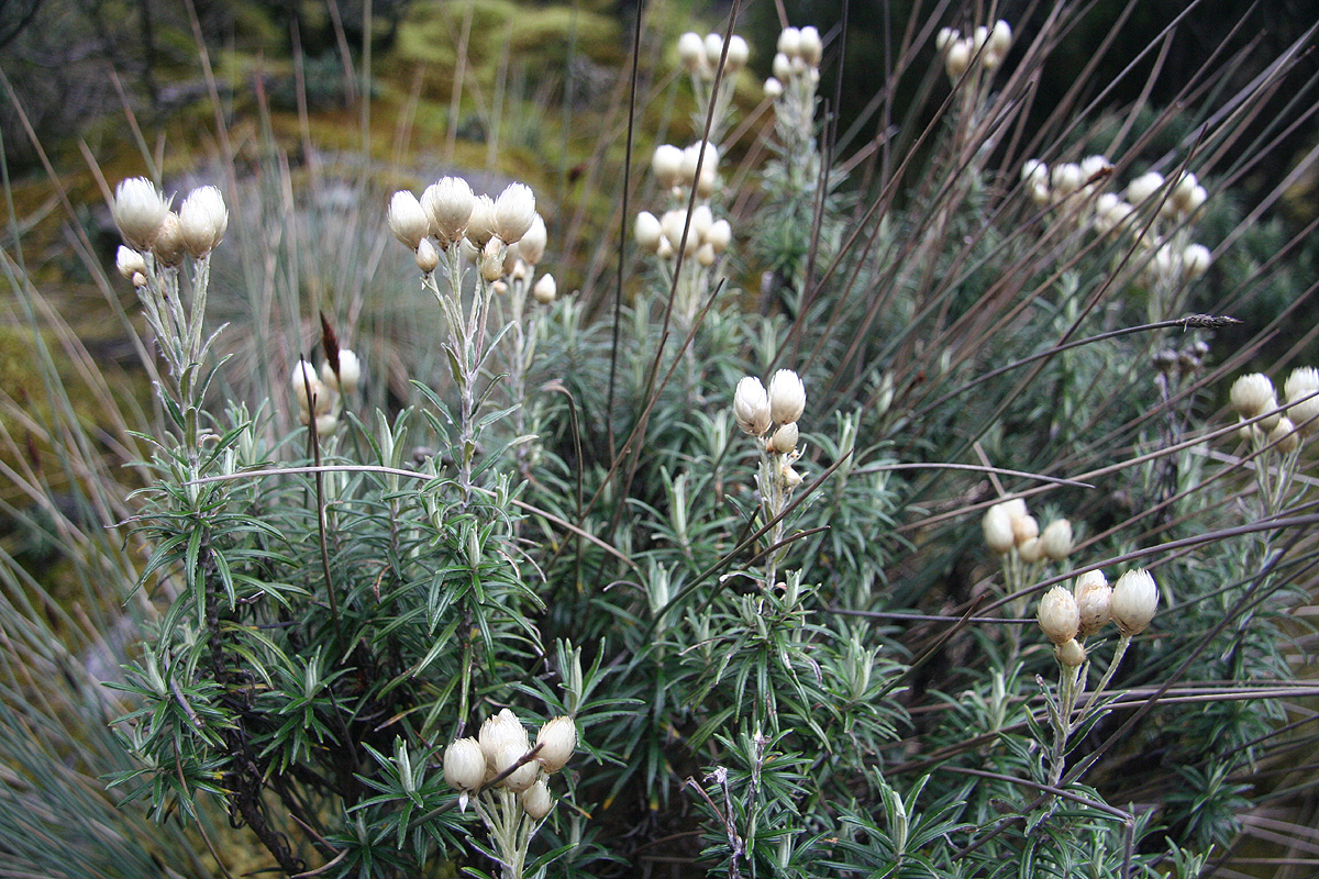
has giant lobelia and other unusual plants growing on it.
At the end of the boardwalk, the trail
immediately ascends a rather steep rock-step in order
to get up to the Upper Bigo Bog. This Bog had no useable boardwalk and progress depended largely
on successful jumps from one tussock to the next, not always easy. The plants
are amazing,
the giant lobelia and
the giant groundsel grow everywhere.
At the far end is yet another
step, fairly steep with giant groundsel and more tree heather. At the top, we first take a well
deserved rest and
look back down the valley to
see what terrain we have walked through.
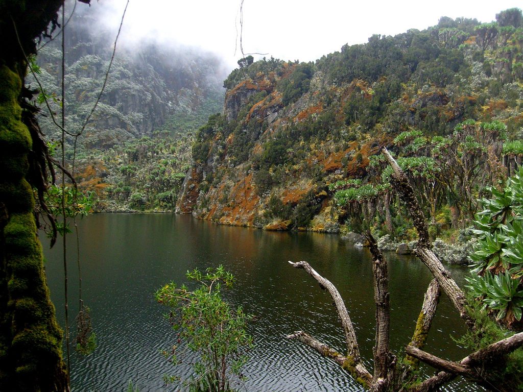
The trail again gets muddy as we now
approach the Bujuka Lake. The route
follows the right hand side of this lake,
if we had not seen muddy trails before now, this lakeshore left no trace of doubt. Very muddy
and almost impossible to stay dry as we looked for semi-dry passages, sometimes all the
way down by the lake, at other times higher up, overlooking the lake.
Once the lake is behind,
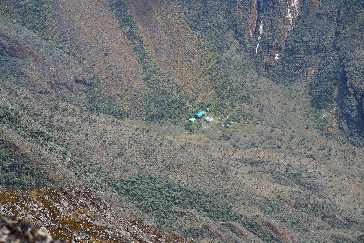
our trail improves as it gradually climbs to the Bujuku hut, located
at N00:23.081, E029:53.275,
elevation 3964 meter.
We arrived at 1030, quite a good time. Not surprisingly, the porter with the heaviest load,
our climbing gear, showed up fairly soon thereafter. Obviously, he had been instructed to
move fast in case we would need our climbing gear for a same day ascent of Mount Speke.
Each day we pack 5 bags for the porters, climbing gear, food, sleeping bags, tent and pads and
a bag for general clothing. However, upon checking with the Austrian team it now became clear
that they would move to Elena tomorrow, thus everything would unfold the way I had hoped and
no big collisions would seem likely.
We were now at almost 4000 meter and somewhat surprisingly, Rob had a reaction to the elevation.
He stayed behind to rest, while the Bjørstad family went
out to explore the trail and pass
leading into Congo as well as the beginning of the climbing route to Mount Speke. We did not bring
any rain gear along on this brief excursion, the 2 o'clock rain happened and all three got pretty
wet.
For the first time on the trip, we share a hut with another group. The Austrians returned from
a shorter day hike. The hut is plenty big for 12 people and tomorrow they shall move out just
as the Norwegian group is about to arrive.
Day 4, January 2. We climb Mount Speke.
See also the route description.
Early up, today is our first climb. For route description,
see the Mount Speke page.
We were on the trail by 0640 and needed head lamps for the first 20 minutes.
We hiked to the place we visited yesterday,
then proceeded up the rock slabs having
a very helpful crack coming all the way down. The final move, involving a tree trunk,
was tricky and we pulled out the rope to provide a bit of extra assistance.
The terrain continued upwards, surprisingly wet, slippery and muddy, with relatively
short pitches of scrambling interspersed. Care was absolutely in order since the general
slope below us stayed steep. After a pretty long hill, we reached somewhat
more level ground. From here, the route went sharply left
and we gradually gained more elevation as our view into Congo
got more extensive. We made a short stop before
continuing a gentle contour to our right in
order to reach a pretty easy, but nice slope leading higher. This part of the ascent concluded
via an easy scramble up a distinct gully. After a bit of more easy going, we crossed some large
boulders and quickly realized that the terrain would get considerably steeper. Off to the right,
we could see the lower end of the glacier, but there seemed to be no easy access there.
The alternative is to ascend the broad ridge that extended above us before forming our local
horizon.
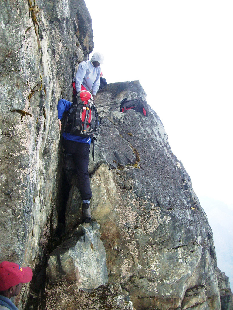
Our guide had trouble getting up and Pål following right behind tried to help (push?) as well
as telling him where he could find a foothold (high on the left side). As soon as the guide cleared
the pitch, he started getting the rope out. Pål followed without too much effort, but did
admit that this was a hard
move. I followed next and tied a prussik on the rope for safety. The
trouble was a very slippery, slanted rock from
where to launch the crux move. Under dry conditions,
perhaps this would feel very different? Tor made up his mind to stop below this point and
enjoy the beautiful scenery while waiting for us to complete the climb. The pitch would have been
easy with the assistance of the rope, however, he did not feel highly motivated after looking at our
more or less clumsy climbing.
Our guide decided to leave the rope behind on the top of this pitch, a pretty obvious sign that
the rest of the climb should be easier. Indeed, more scrambling, but never exceeding (YDS) class 3,
then an easy access to the snow. The snow was
soft, so no need for crampons. We climbed up and
into a snow gully heading more left. Turning right around a rather big rock, this route led to
a final section of easy scrambling before getting onto easier uphill (class 2) terrain that led
all the way to the summit point.
We arrived at 1040, exactly 4 hours after departure. Unfortunately, we had mostly fog around us.
A brief moment of sun from above did not appreciably increase our views to nearby mountains.
Pål made the precise comment that after walking 3.5 days through extremely unfamiliar
nature, we had now arrived
at a place that looked very similar to
what he had seen in Norway:
A mix of rock, snow and fog with no vegetation or sign of life except lichen on the rocks.
We stayed 20 minutes, then started our descent back down
to Tor. Abseiling the last section
seemed far better than any alternative. Similarly, we abseiled by the tree trunk and down
to the trail at the very end of the climbing route. We were back at Bujuku hut by 1320 after a very
successful climb of our first mountain in the Rwenzori.
A few hours later, the Norwegian party (Hvitserk) showed up. They were soaked, it had been
raining while they struggled along the shore of lake Bujuku, water from below as well as from above.
We all felt that the day had helped improve our acclimatization and that we were now ready
to move up to Elena hut and attempt our primary goal, Margherita Peak, the highest peak
in the Rwenzori.
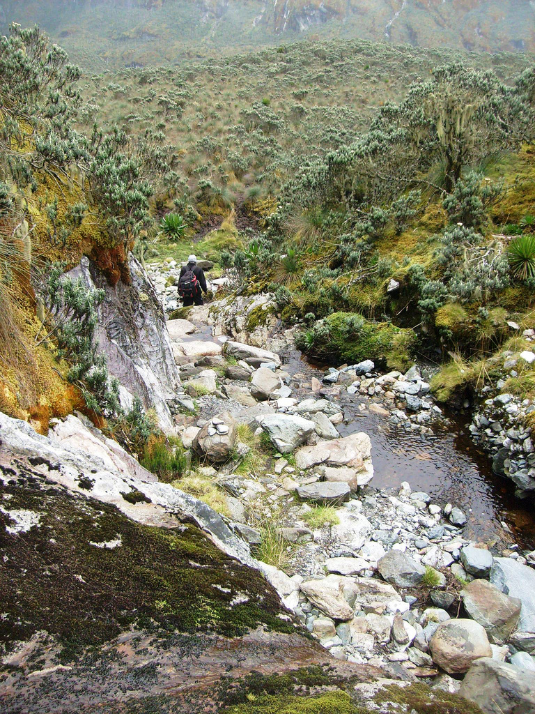
Day 5, January 3. We hike from Bujuku hut to Elena hut.
Today is an easy day, the goal is just to move up from Bujuku to Elena hut, about
600 meter of elevation gain. We start out at 0900. Initially, trail contours around
the Bujuku valley (on its right side when viewed downwards from Bujuku hut), then it
gradually climbs in order to gain a spur on the ridge that runs down from Elena.
The first part of this route is again very boggy.
Gradually, we climb more and get onto
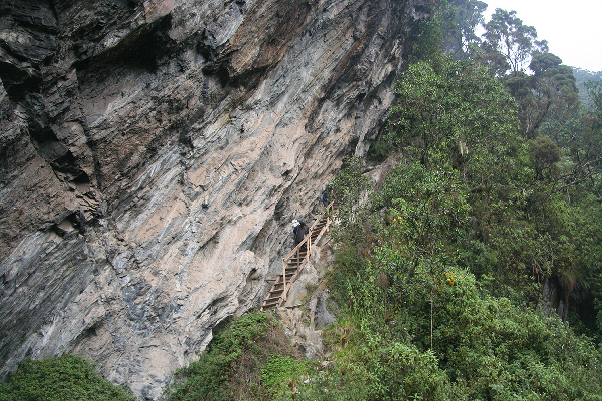
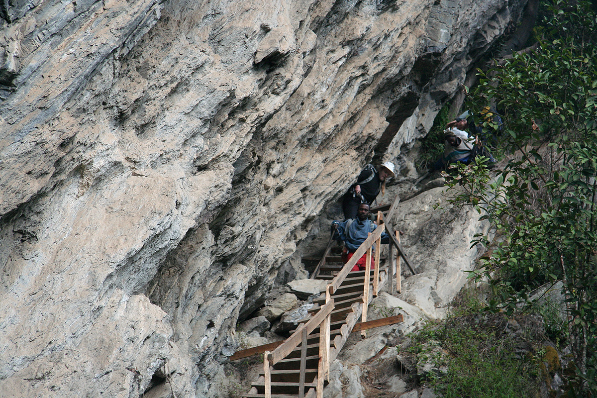
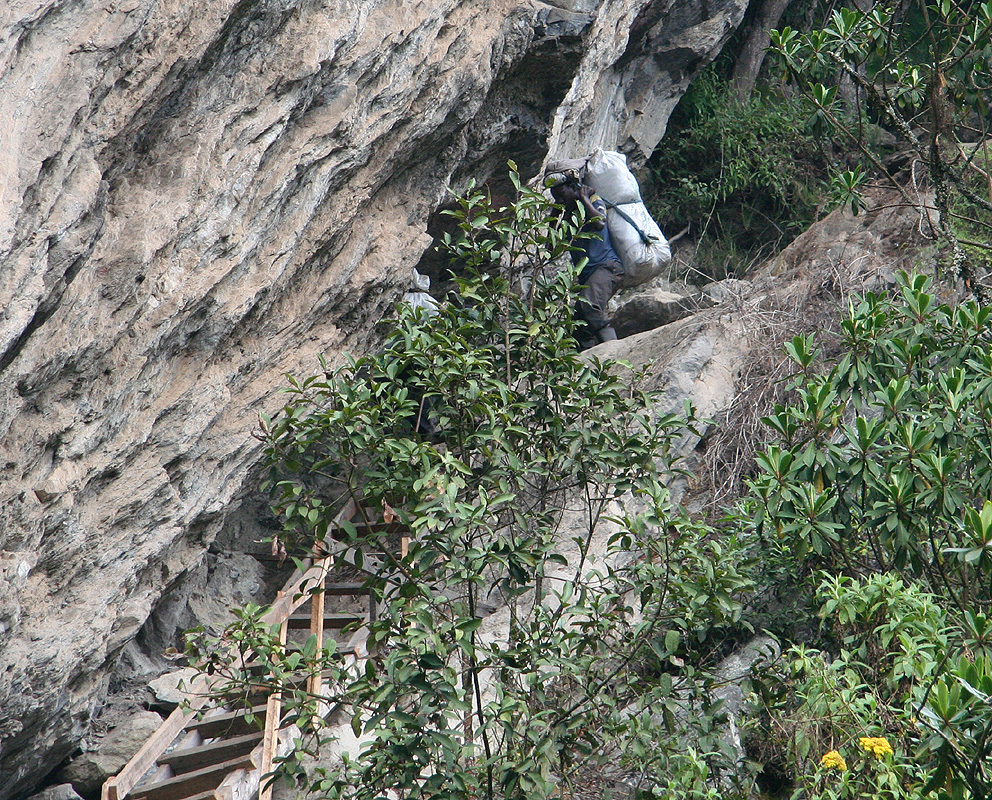
drier trail. This first
leg culminates with a ladder
leading to the top of a good sized
gully. From here, the trail forks, one can proceed to the Scott-Elliot pass and then descend
to the hut Kitandara, or one can fork right (uphill) and climb to the Elena hut.
We rested briefly
and took time to appreciate the view from this very fine point.
From here, we also had a good view of the Scott-Elliot Pass.
The trail follows
some large terraces, first one that climbs right until it connects
nicely with terrain features that
provide a very natural route across the
main ridge crest, giving views down towards Kitandara.
From here, the remaining leg is pretty short,
crossing slabs of rock with a bit up and down until
arriving at the Elena hut. We
arrived at 1130,the location is N00:22.366, E029:52.938, elevation
about 4560 meter.
Meanwhile, the Austrians had not returned from their summit bid yet and their gear was all over the
small hut. Not much to do except waiting for their return. Finally, around 1300, we spotted them on
top of the ridge and before long they had all returned safely. They had all successfully been to
the summit, but clouds had enveloped the highest peak before their arrival. They cleaned out in
preparation for descending to Kitandara, and around 1400 we could all stretch out in our sleeping bags.
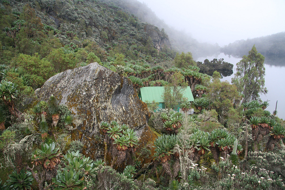
This hut can sleep about 10 in the large room, there
is a smaller room behind (separate entrance) that
can hold 2-3 more. Being only 4, we had a very comfortable quarter before our summit day. Rain arrived
again around 1400, just as the two previous days. Before dark, the rain stopped and the fog cleared
giving us a very nice light on the impressive nearby peaks.
Day 6, January 4. We climb Margherita Peak.
See also the route description.
In order to maximize our chances of good weather at the summit, we agreed to start around 0600.
I looked out around 0530, the rocks were dry, the black sky full of sparkling stars. The Big Dipper
was perfectly upside down as it always is when viewed from the Equator. I could strongly sense that we would
have a perfect day.
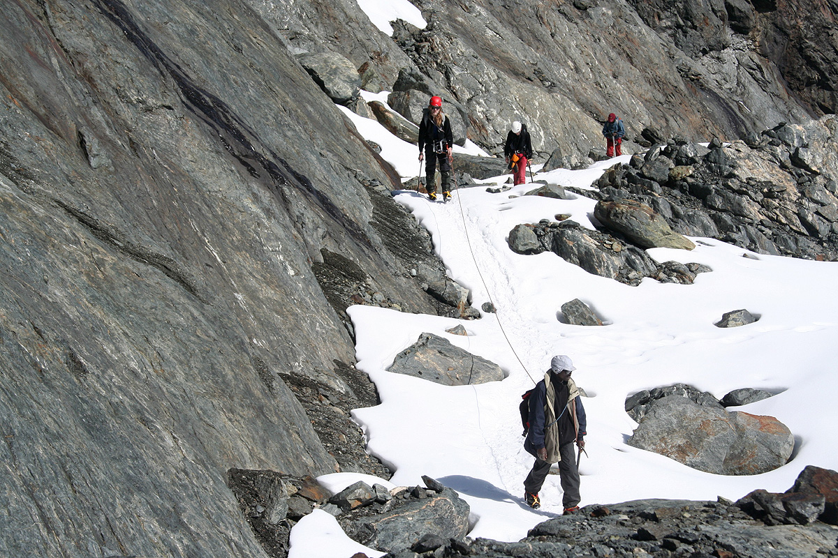
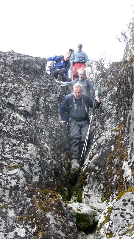
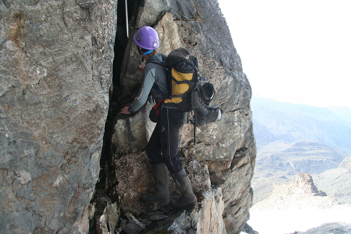
Thus, we were on our way with head lamps by 0605. The weather was good and the rock had dried up
since yesterday. We quickly came to the first climbing section and moved higher with a very
reasonable pace. A couple of small stops to locate the best way in the dark was needed. There
is a fixed rope coming partway down, but it did not seem to follow the most convenient route.
We climbed for the most part on the right hand side of this rope, following a fairly
small gully, then shifting right into a next (also small) gully higher up.
By the time we had reached the more level area connecting directly to the
Stanley glacier, colors in the sky
indicated that morning would arrive and that torches could be
put away.
We arrived at the glacier, our
guide started to organize the rope, while I stepped up
onto the glacier proper to take some pictures.
As it turned out, Rob followed my example
and the guide decided to put the rope away. It was unintentional, but the overall effect
turned ok, the (glacier) route was in excellent conditions and a rope was certainly not
needed.
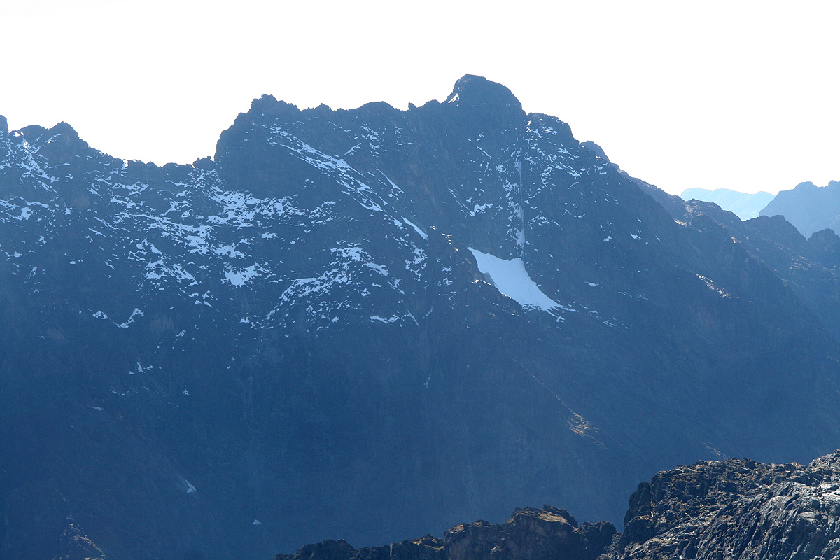
We proceeded along the glacier in beautiful
sunshine with the classic view of the
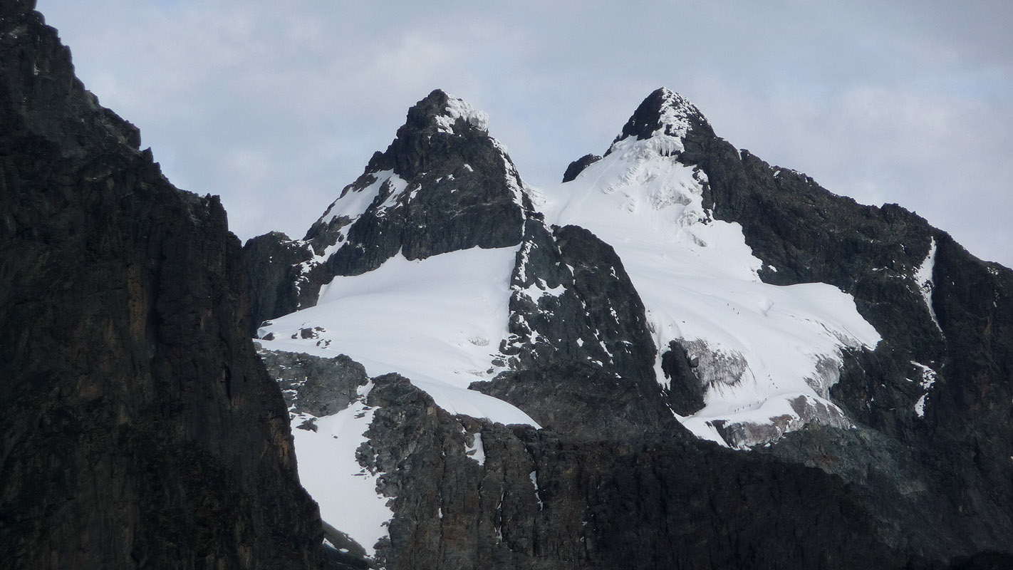
twin peaks Alexandra and Margherita just ahead.
Behind, Savoia (4977 m) with the morning sun reflecting
off her brown rock.
It was not immediately obvious
where the route would go, but soon we realized that
it was possible to descend on the right side
of Alexandra and reach a lower section of the Margherita glacier.
The descent was quite easy, snow filled gullys
then a steeper rock section where
fixed ropes would lead us to a short ladder. From here, the glacier was pretty flat
leading across to the somewhat steeper part that provided access to the upper
part including the col between Alexandra and Margherita.
The snow was close to perfect for crampons, crisp and still cold from last night.
Only the spikes would sink in giving you a firm and reliable step. We ascended the
steepest part of the slope and soon the upper part of the glacier stretched out in
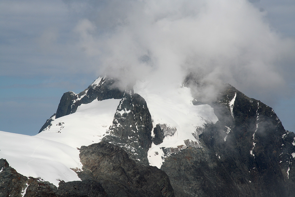
front of us, gently uphill to the col between Alexandra and Margherita. Alexandra
was draped with large, irregular snow formations along
her top ridge, pretty unique,
I think you need the combination of high elevation, cold nights
and almost no wind with the blazing
equatorial sun every morning to create this kind of irregular snow sculptures along
the top ridges.
We were on the biggest glacier that still remains in Africa. It has already been cut into
separate pieces, when the Duke of Abruzzi was here in 1906, the entire Stanley group was covered by
a single, large glacier. The climate predictions strongly indicate that it will be totally gone
within a few decades. We decided to call for a rest
before embarking on the final summit push.
We then advanced steadily up the last snow hill
before the final obstacle, a steeper part
of rock. The glacier used to be thicker before. One could then ascend more or less
directly to the rock traverse that gives access to the main summit ridge. Now, this
step has been greatly simplified by the placement of a ladder. I took a good look
at the rock further left, it certainly looked possible to climb along some cracks there,
then arc right and connect with the rock a few meter above the top of the ladder.
There are fixed ropes from
the top of the ladder that leads a few steep meter higher
then connects with an exposed, but easy rock traverse
that runs right and connects
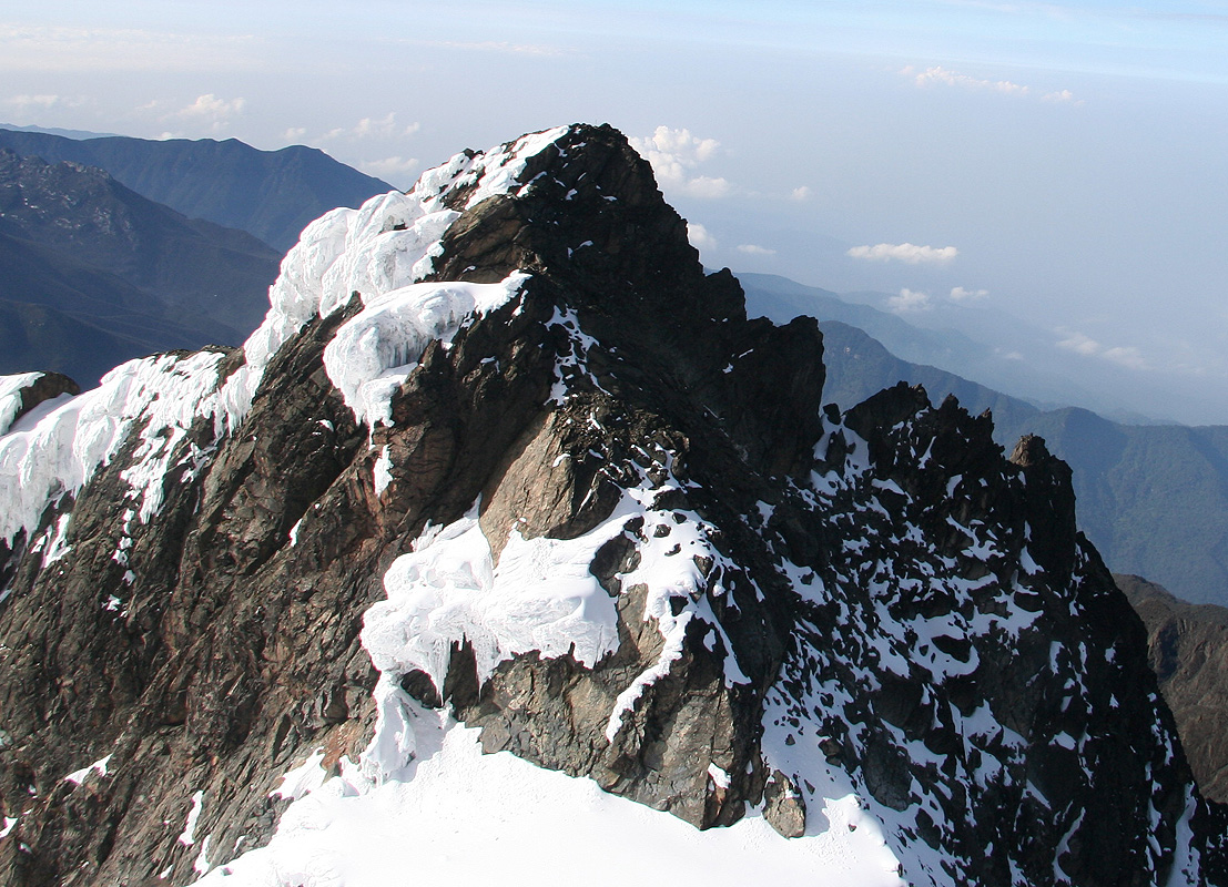
with the main Margherita summit ridge.
I used a prussik for additional safety and quickly arrived at the end of the climbing
section. The sky was still deep blue, no wind.
A few moments of final steps up this
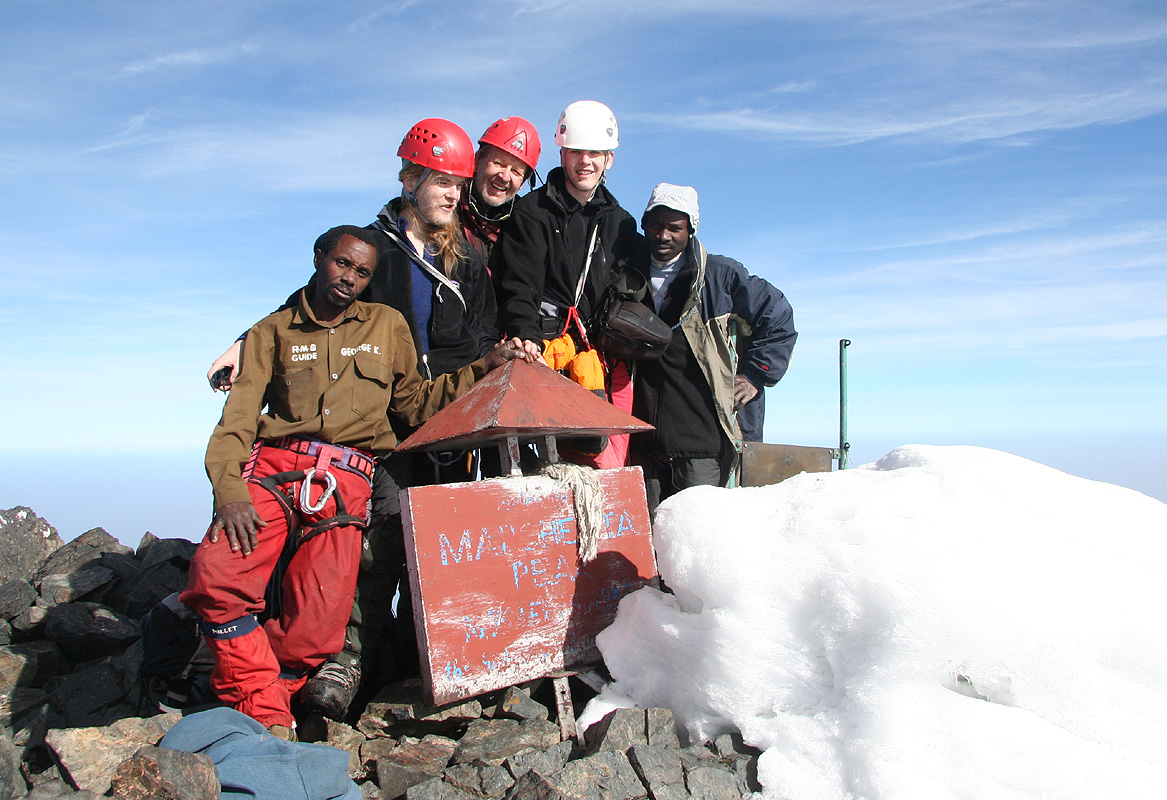
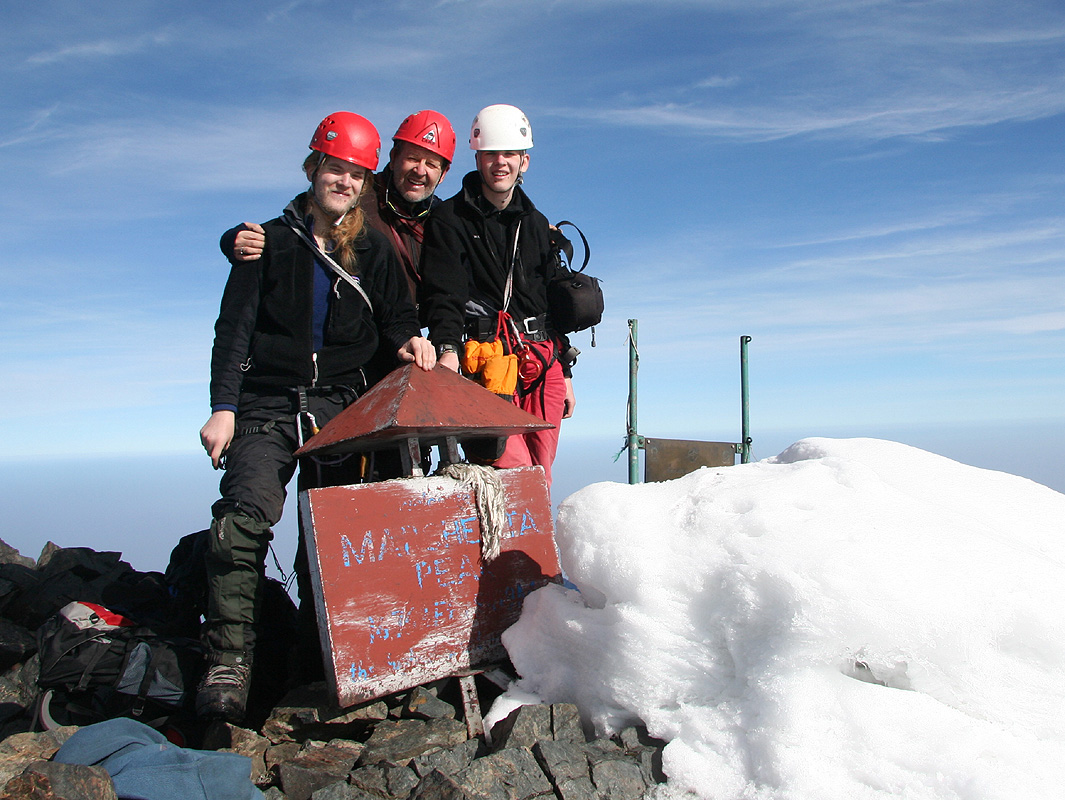
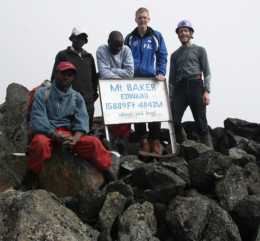
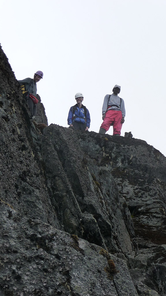
easy ridge and then on the summit. The main objective of the trip had been achieved.
The entire team, a very
happy bunch, on the summit on what had to be the very best
day we had had in the Rwenzori.
Tor quickly captured the panorama view with his camera:
We could see Mount Speke and
Mount Baker very clearly, the twin - Alexandra very
nearby. She is only 18 meter
lower.
My GPS showed exactly 5109 meter on a first reading, then 5108 meter in a second sampling session.
Group photos, the full team, but
also a few shots of just Dad (very proud) and his two sons.
It is a great privilege for me to have the chance of sharing trips like this one with my two
sons. Perhaps there will be a couple more before I get too old for such adventures?
Pål and I scramble along the ridge into Congo. The subsidiary peak named Albert at 5087 meter,
lies ahead. Its prominence is very minimal, the ridge looks pretty rugged, but seems to cooperate as soon
as you start moving. We decide to turn after about 50 meter, not because of any difficulty, but everybody
else stays at or near the summit. We have been solid in Congo by now, in fact one may fall pretty deep into
Congo unless walking carefully.
Not only is this the border between two countries and at the same time, the highest point in both of
these countries (only 2 other places like this), this is also the continental divide with water
draining into the river Congo in the west, while at least parts of the Rwenzori feeds the Nile further
east (some/most water gets trapped into the great Rift Valley to the east). These are the famous Mountains
of the Moon, described almost 2000 years ago, discovered only 122 years ago.
It had taken us 3:15 to reach the summit, we never rushed, but took time for photography and short rests
along the way. We stayed around about 25 minutes before slowly starting our descent. Again, the summit
provides inspiration and the goal, but it holds little intrinsic value. It is the experience of travelling
to and returning from the summit that carries most of the value, the friendship, the sense of a common
cause, the nature we see and admire along our path, these are the reasons that make climbing
mountains such a very satisfying occupation.
We descended without any problems, strolled back up the traverse
to the Stanley glacier and came back
on the rocks before
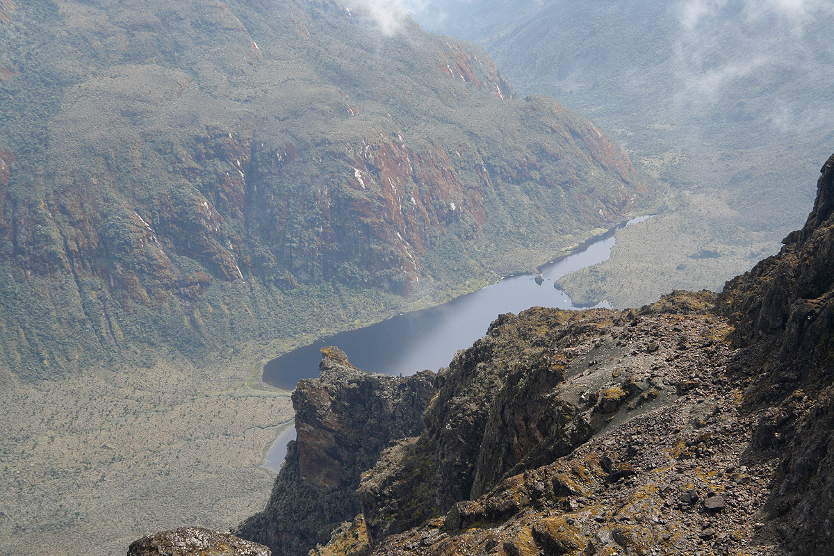
the final descent to Elena. A very fine view back
down to the Bujuku hut and
to lake Bujuku, yes indeed,
we are a bit higher here! Now, in full daylight, we can appreciate
the landscape near Elena hut, the cliffs
are quite steep, our route is one of very few feasible ways.
We are back at Elena hut by 1140, a little less than 2 hours. The other Norwegian group has not
arrived, this is good, they shall not have to wait like we did yesterday.
We pack and organize our gear, then depart at 1255. The hike is downhill and the trail is nice.
I carry my gumboots and decide to change over only when we are back down in the bogs. We first
descend to the Scott Elliot Pass, the
old map gives 4370 meter, while our GPS read about 30 meter
lower, suggesting that Mount Baker may have a prominence just exceeding 500 meter.
There are huge boulders near the pass, further down the trail runs just below some very
steep cliffs coming down from Baker. The vegetation returns
as we descend to the upper Kitandara
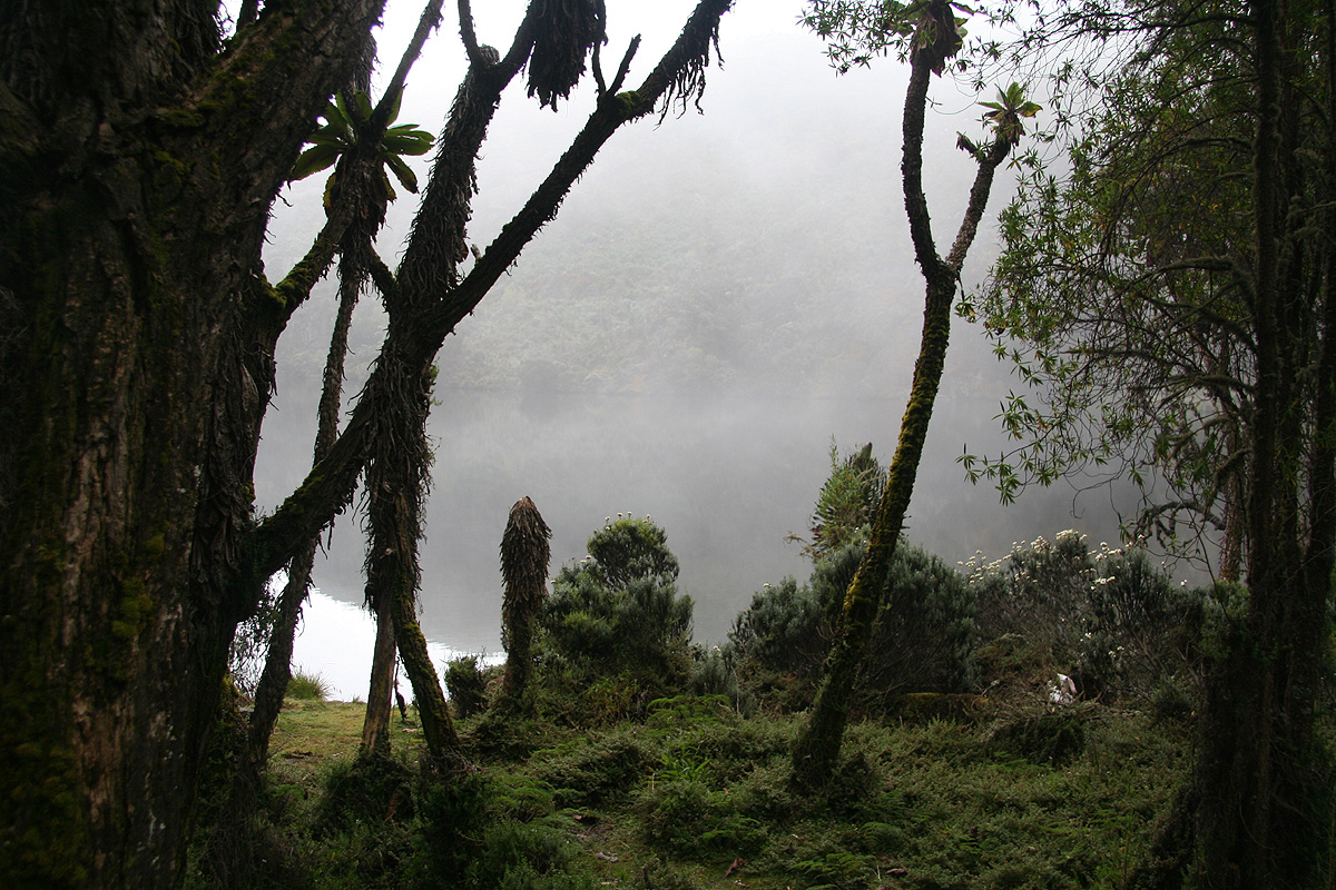
lake, then proceed to the lower lake. Our hut is
located right next to the lake in a pretty
scenic location, N00:20.945, E029:53.212, elevation about 3995 meter.
The trees and plants around here
are indeed very impressive and quite
beautiful with endless variations. We
arrive at 1440, Tor is about 10 minutes
ahead of the team. Still no rain, today was different from the previous days, the weather
stayed clear much longer and the rain did not come.
Day 7, January 5. We climb Mount Baker.
See also the route description.
Today, we decided to start after dawn, that means after 0700.
Sebestian thought that was a bit late given the very ambitious
program that had been planned. The Kitandara hut can only sleep
about 18 people, worse, the accommodation for guides and porters is
pretty miserable, in fact worse than any other hut.
The trouble is coming behind us. Today, 11 people will try to climb
Margherita and a group of 13 will hike directly from Bujuku to here.
Our plan called for climbing Baker and stay here at Kitandara for two nights.
This would mean that 28 people will compete for space in this hut and as many
as 60 porters with no good space at all!
No wonder our guide was strongly in favor of a somewhat tougher plan; climb
Baker, then continue the hike to the Guy Yeoman hut, we would have it to
ourselves, leaving "only" 24 people competing for a bed at Kitandara.
We left at 0710, the trail started uphill immediately. This section is pretty
steep and pretty slippery. There are short ladders made by local branches, high
steps and several places where a supporting hand is helpful. We carried slightly
more in our backpacks today, mainly mountain boots and ice axes, the gumboots were
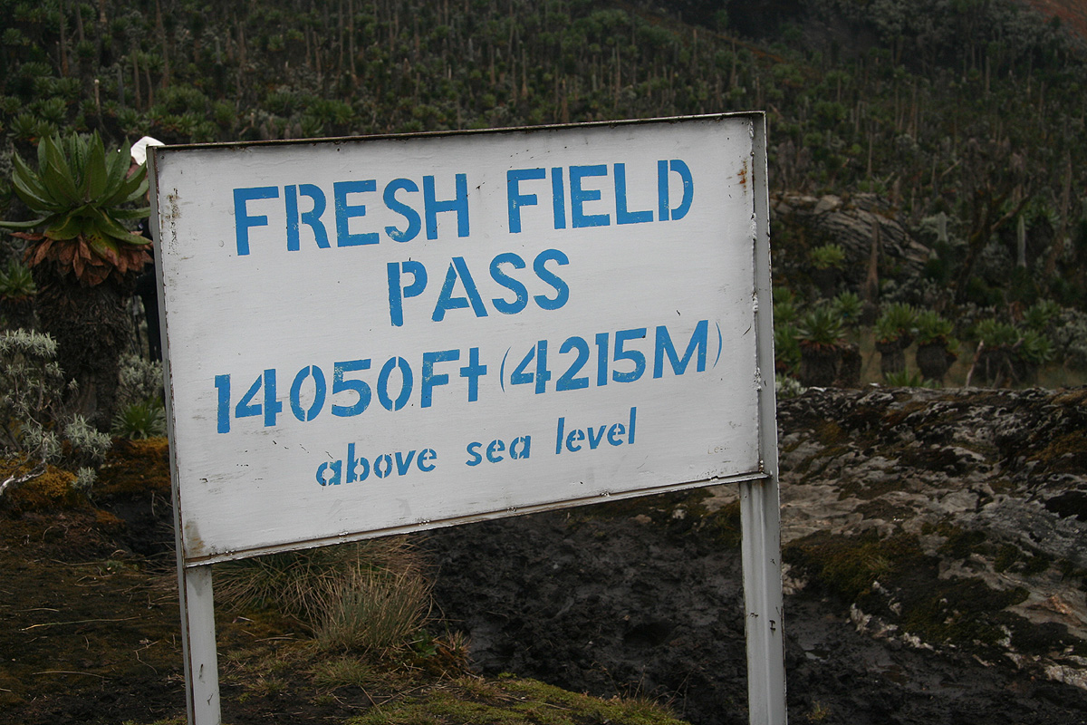
needed on the feets. We reached the Freshfield Pass at 0800, this is the place
where the climbing route to Baker forks left.
We had a brief stop and reorganized gear. It had been agreed that one or two porters
would wait here and then carry things like our mountain boots from here to Guy Yeoman.
Setting out for Mount Baker, we followed a small,
but very visible climbers trail. The route
is also marked by small cairns. We could in fact, have changed into mountain boots only
5 minutes from the Freshfield Pass, the deep mud did not go any higher, however, we stayed
with the gumboots all the way to the top
of a V-shaped gully. (Picture from descent.)
A brief rest here, leaving
the gumboots behind. Rob felt more comfortable in the lighter boots than in his heavy
plastic Scarpa and ended up climbing Mount Baker in his welly boots.
We also had our cook
come along today, nice company all the way to the summit. This was the second time he
climbed this mountain.
We had a good view across to the Stanley group, we could see the Elena
hut and the route we
had completed yesterday.
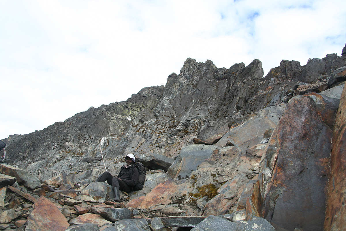
The weather was nice and the rock very dry. The scrambling increased as we got higher.
Tor decided to stop and rather enjoy the fine scenery from his current location rather than
feel uncomfortable with some exposed scrambling without the security of a rope.
Interesting how these three peaks all differ. Speke was slippery, Margherita certainly
defends her position as the Queen, having fine mixed climbing. Finally, Baker enters the scene
and provide us with very nice scrambling on dry rock. Speke had two points that were
the clearcut difficulties, Baker has several short sections of scrambling, but they are
all of similar difficulty. The announced crux on
Baker stands out as different, but not
necessarily more difficult than
some other places, it depends very much on personal,
subjective opinions. Overall, Pål expressed his opinion that Baker was a YDS class 3
route. I guess Rob and I tend to agree and by this measure, Baker is then the "easier"
of the three summits.
We arrived at the summit by 1045, just
in time before clouds started
to move in and obscure
our views. Just a bit earlier, we had spotted
several groups of climbers on the lower part
of the Margherita glacier. Obviously, this must have been the Norwegian group from Hvitserk.
We took the normal summit pictures, and celebrated the good views across to the Stanley group.
Soon, Margherita had her summit in a cloud that
seemed likely to remain. We started our descent
around 1100. The "crux" crack turned out to be very easy as I discovered a good foothold on the
outside (right side when facing up). In this way, one avoids the narrow crack altogether.
Soon, we hooked up with Tor, actually climbing down
a slightly different route from the one
we had followed while ascending. We continued downhill along a higher variant of the route, also
this marked by small cairns. We stayed closer to the main ridge, before descending back down and
merging with our uphill route. By 1300, we were
down at Freshfield Pass where two porters were
waiting for us as agreed in the morning.
We started our second hike for the day, the trek from Freshfield to Guy Yeoman, at 1315.
The first part followed a very nice trail with smaller sections of up and down until we got to
the top of what forms the Mobuku valley. After the first
descent we ran into bogs and really
wet terrain. Eventually, the best route was walking downhill
in a fairly small creek, wet, but
not muddy.
Further down, Pål, Rob and Sebestian got ahead, while Tor and George followed behind.
Thus, I ended walking by myself as a one man group in the middle. The next and final downhill
section seemed to never end. I could see the flat valley floor with the Guy Yeoman hut in the
distance, but how to get down without any serious incident? The terrain was somewhat steep, full of
bottomless mud, with a maze of slippery roots, often partway up in free air. The art of making
correct decisions about where to place your next step seemed increasingly challenging. It was pretty
evident that a single error of judgement was likley to make you fall into a big mess of mud and
steepish slope with rather unpleasant consequences. I was not entirely happy, wouldn't it be nice to just
step as somebody ahead, essentially leave this tricky decisions to another mind? No such choice, perhaps
it was equally well that there were nobody around to hear a few of my instant descriptions of how
devilish this trail really was. In any event, I made no wrong steps and came down to the main
Mobuku river still in one piece. There, I caught up with Pål and we somehow got ahead of
Sebestian and Rob. We continued partially in the river, and after crossing it a number of times, we
entered home stretch through some grassy fields with the hut straight ahead. Arrival at 1600, 9 hours, this was
definitely our hardest day in the Rwenzori.
Location N00:20.636, E029:55.643, elevation about 3470 meter.
We had a light drizzle of rain during the last 20 minutes,
the first and only rain while on the trail in our 9 days of hiking.
Day 8, January 6. We hike from Guy Yeoman hut to Nyabitaba hut.
We were now essentially a full day ahead of our original schedule. In order to stay ahead of
the groups that were behind us on the trail, we still decided that we should take a short and easy day
and move back down to Nyabitaba today.
Originally, we had planned to trek from Guy Yeoman and all the way out
in one day. By splitting this into two days, we could arrive early and then possibly make lunch at the
Mweya Safari Lodge in Queen Elisabeth National Park, tomorrow.
We had a lazy morning, Yeoman is located in a flat section
of the Mobuku valley, quite
a scenic place. We then decided
to distribute the tip before departure.
The porters had really put
in an impressive effort on what would be a 9 day trek, we decided to tip them with 21 US dollars each.
I certainly hope that the RMS pay them well, but the tip is certainly going to the guys that have
earned it. We had a small ceremony where I spoke a few words about how successful the trip had been and
how they had a big share in this. Photos were taken and
the tip handed over with a warm handshake to
each and every one. One porter had caught some illness and already returned, but I was assured that he
would receive his share as well. The guides got 50 each
and the cook ended up in between the porters and
the guides. Everybody seemed quite happy,
the tip was well deserved and I guess a bit more than what they
receive from commercially organized tours.
We started out at 1050 and arrived at Nyabitaba by 1400. An easy day. The trail continued
downhill in several steps
with somewhat more level areas in between. The most interesting part of the
route was a rather steepish descent right
next to an overhanging cliff. Wooden stairs has been built,
one can only imagine how this part of the route must have
been without this improvement. We moved back down
into lower zones of vegetation, the bamboo forest was
perhaps even more distinct and impressive along
this trail than what we had seen along the Bujuku river when trekking uphill.
We descended further and reached the Mobuku river, another
nice bridge got us across, the route then
contoured back onto the ridge where our (first and) last hut is located.
A while after our arrival, a couple from Switzerland came up from the trailhead. They were bicycling
in Uganda and did not want to do any climbs, just the circuit trek around Mount Baker. Even later,
a single hiker arrived directly from Kitandara. He came from Australia and was a semi-professional
collector of national highpoints, having already climbed the highest point in more than 80 countries.
We had an interesting chat about many exsotic places while the first tropical rain in 9 days hit the roof
with intensity and corresponding noise.
Day 9, January 7. We hike from Nyabitaba hut to Nyakalengija.
Our last day in the Rwenzori. We started hiking at 0800 and arrived at the National Park
headquarter (check-in/out) by 0930. Shortly thereafter, around 1000, we were back at the
RMS compound. I had called Patrick from Nyabitaba the day before and asked about being
picked up by 1100 instead of by 1400 as tentatively agreed before we started our trek.
What was no problem yesterday turned out to be a slightly more difficult task today, since
Patrick had been unable to contact the driver. He in turn, had driven back to Kampala.
A few phone calls followed and our driver finally turned up at 1210. We had a nice drive
down to Ibanda where we said goodbye to our guides, then continued to Queen Elisabeth National
Park and the Mweya Lodge, arriving there by 1420 and catching a very nice lunch.
We really deserved a good, luxurious stay
and I had reserved us the Royal Cottage, a nice separate
building with 2 bedrooms and 3 bathrooms plus a living room that served as storage space for all
the luggage. We booked a safari jeep (Landcruiser) for our next morning game drive, relaxed by
the swimming pool and prepared
for an evening meal in the restaurant. Dinner at 1930, we really
appreciated the change from dehydrated food to the fine selections of African food from a resort menu.
The Hvitserk group arrived around 2100, we finished dinner by 2200 and walked back to our
Royal cottage looking forward to a good nights sleep.
Day 10, January 8. We are on safari in Queen Elisabeth National Park.
We start out at 0630, the earliest time according to park regulations.
Soon, the equator sun rises
across the African savanna, hopefully, many animals will still
be active.
Our driver, Vincent
is excellent. He spots
the hard to see animals (such as lions) at an incredible distance.
We see many different lions, small cubs playing in the high grass as well as a larger
female lion. The Uganda Kob, the
local antelope, is present in large numbers.
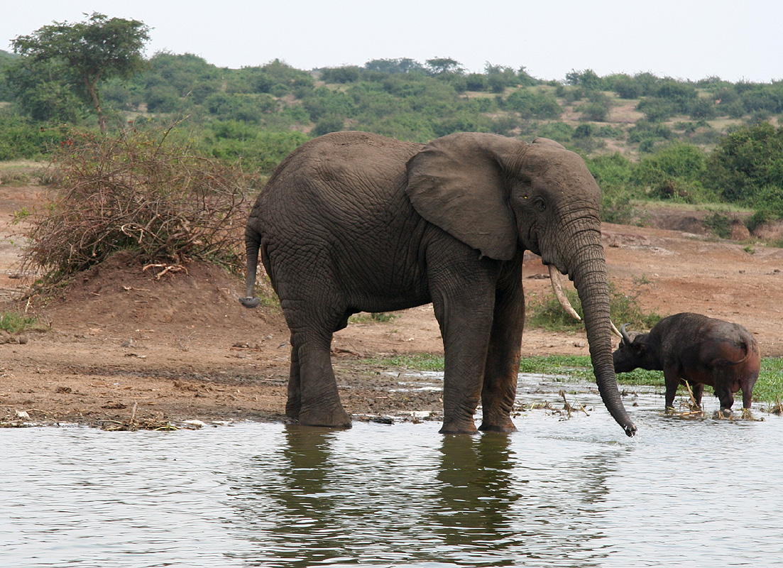
The African buffalo is present
almost everywhere, single individuals as well as medium sized groups. Towards the
end of the drive we even see a leopard, the only group to observe one. It approached some
dense vegetation and in the next second an antelope came jumping out in great leaps, a very
nice scene, but impossible to capture with the camera.
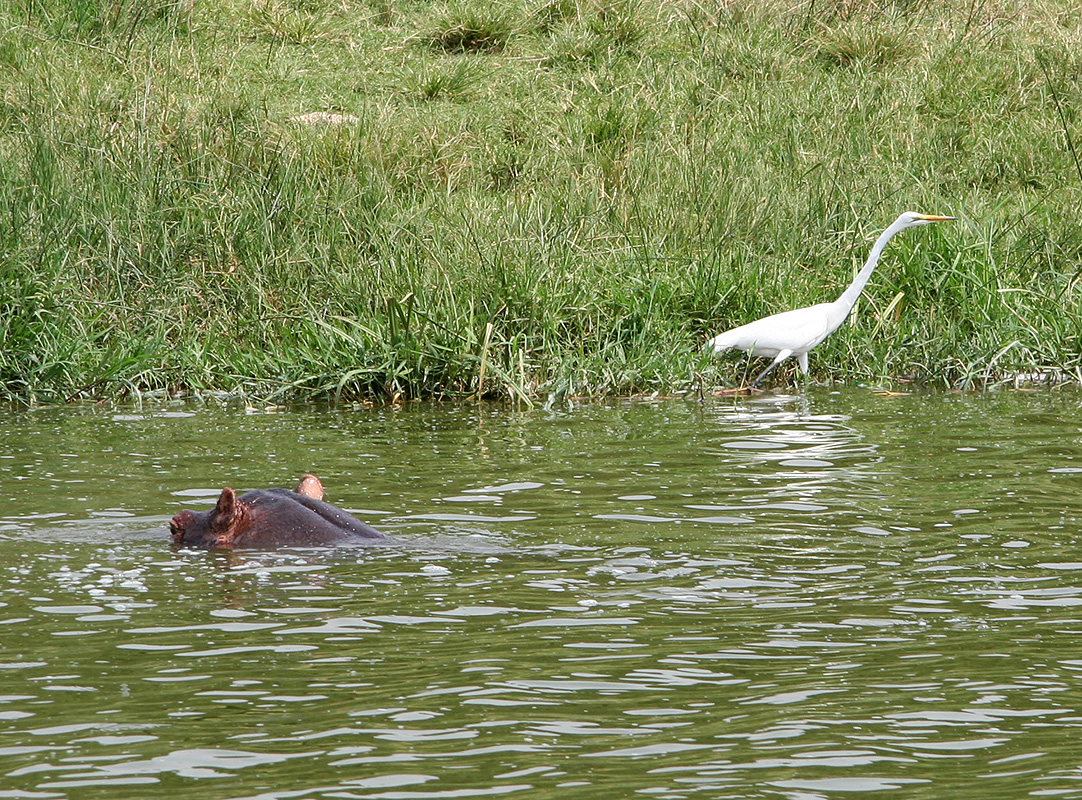
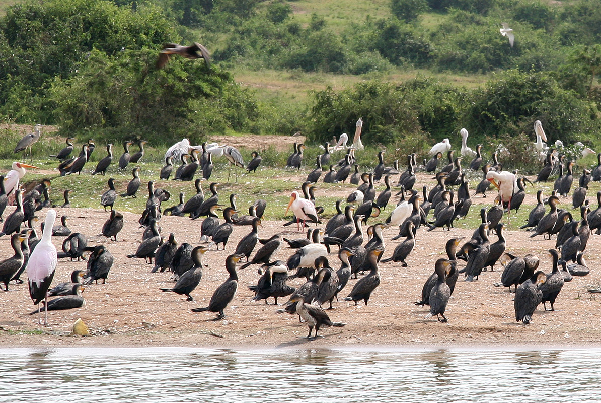
After a late breakfast followed by an early lunch, it is time for the well known boat cruise
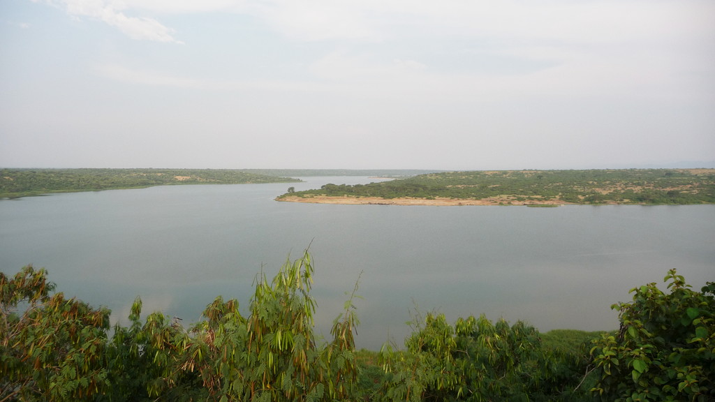
on the Kazinga channel. This is a natural channel, several
hundred meter wide, that connects
the smaller lake George (north) with the larger lake Edward (south). This boat trip is an
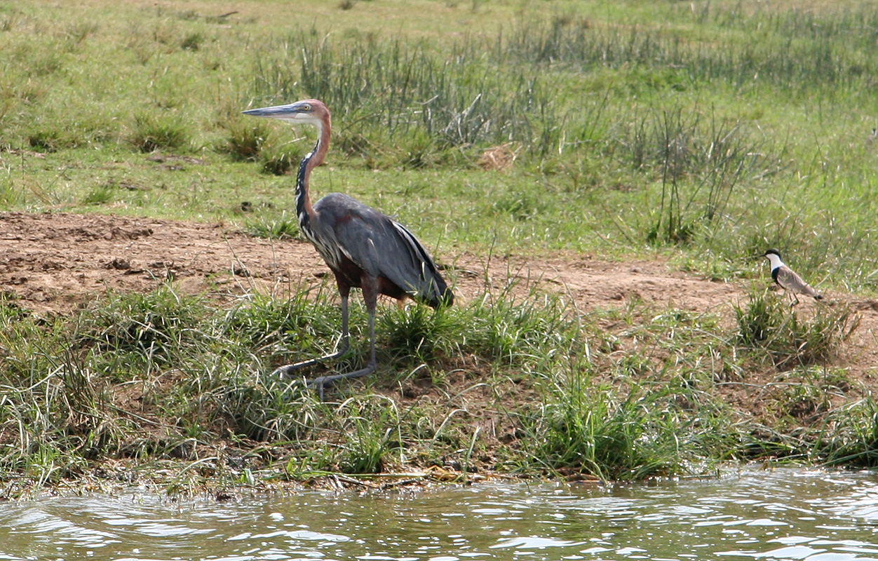
excellent way to view a large and varied wildlife in the national park.
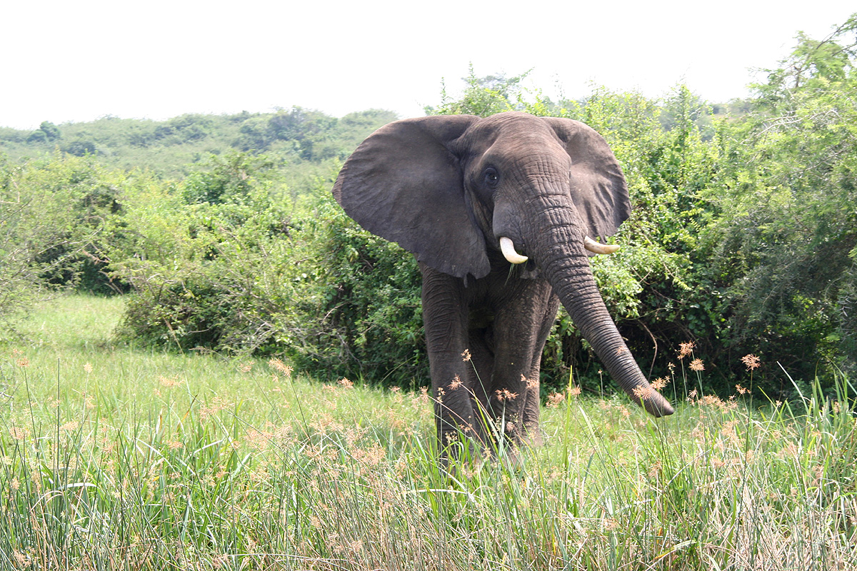
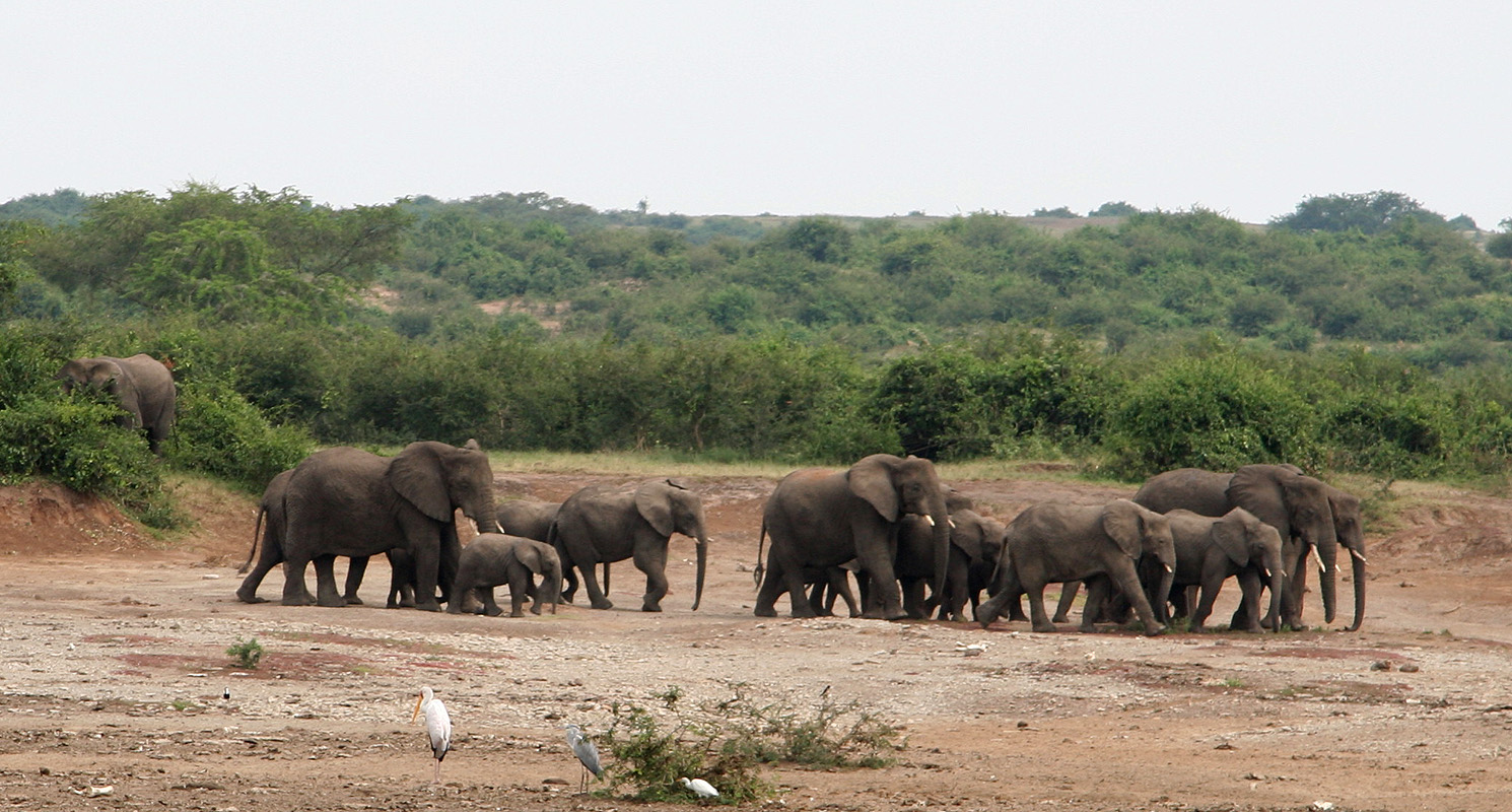
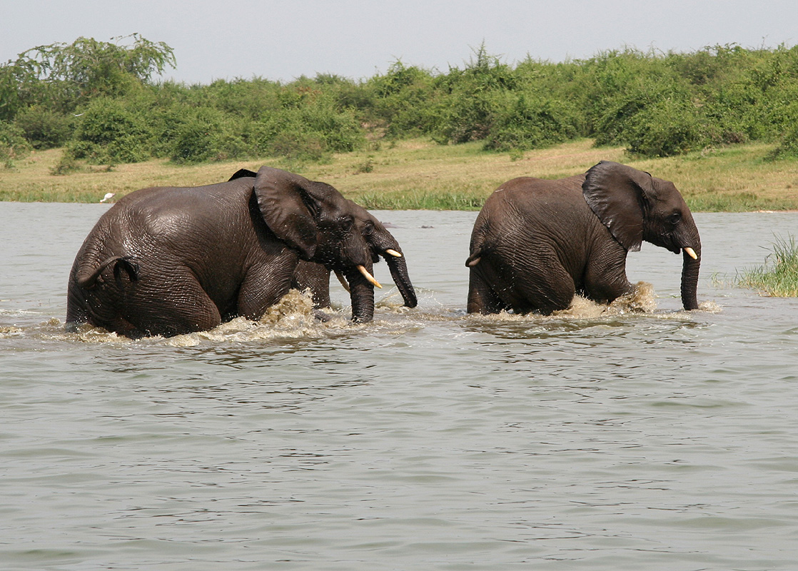
The elephant seems to
be present in larger numbers than
I can recall from my visit here in 1994. They come down to
the water and often go for a short swim, ie. they cool off with
a bath and it appears that
they play and are having a good time. The water is also home to
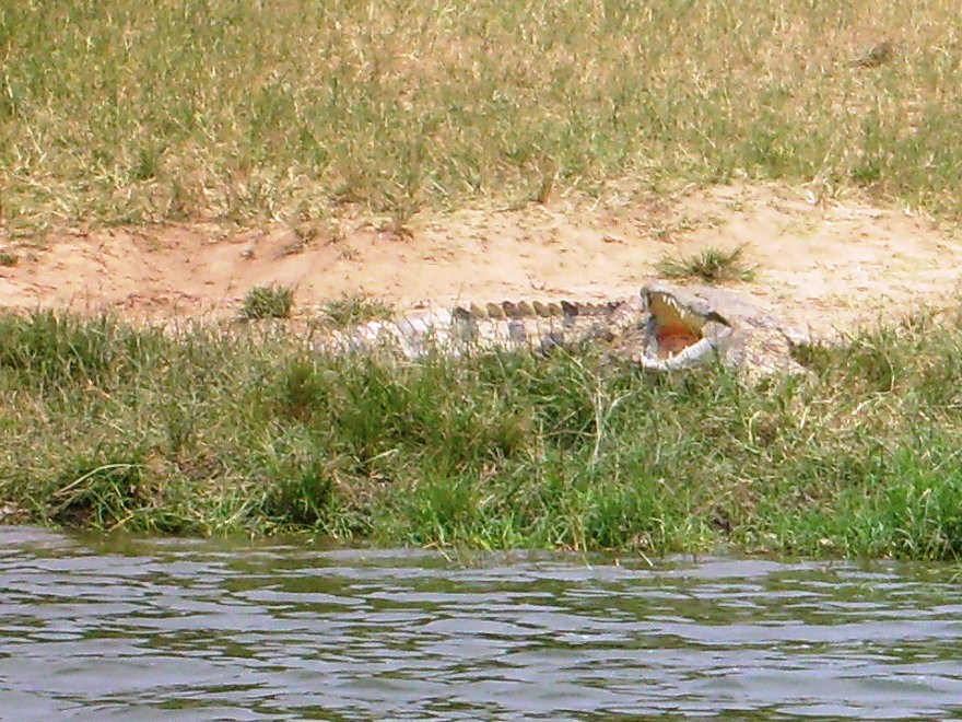
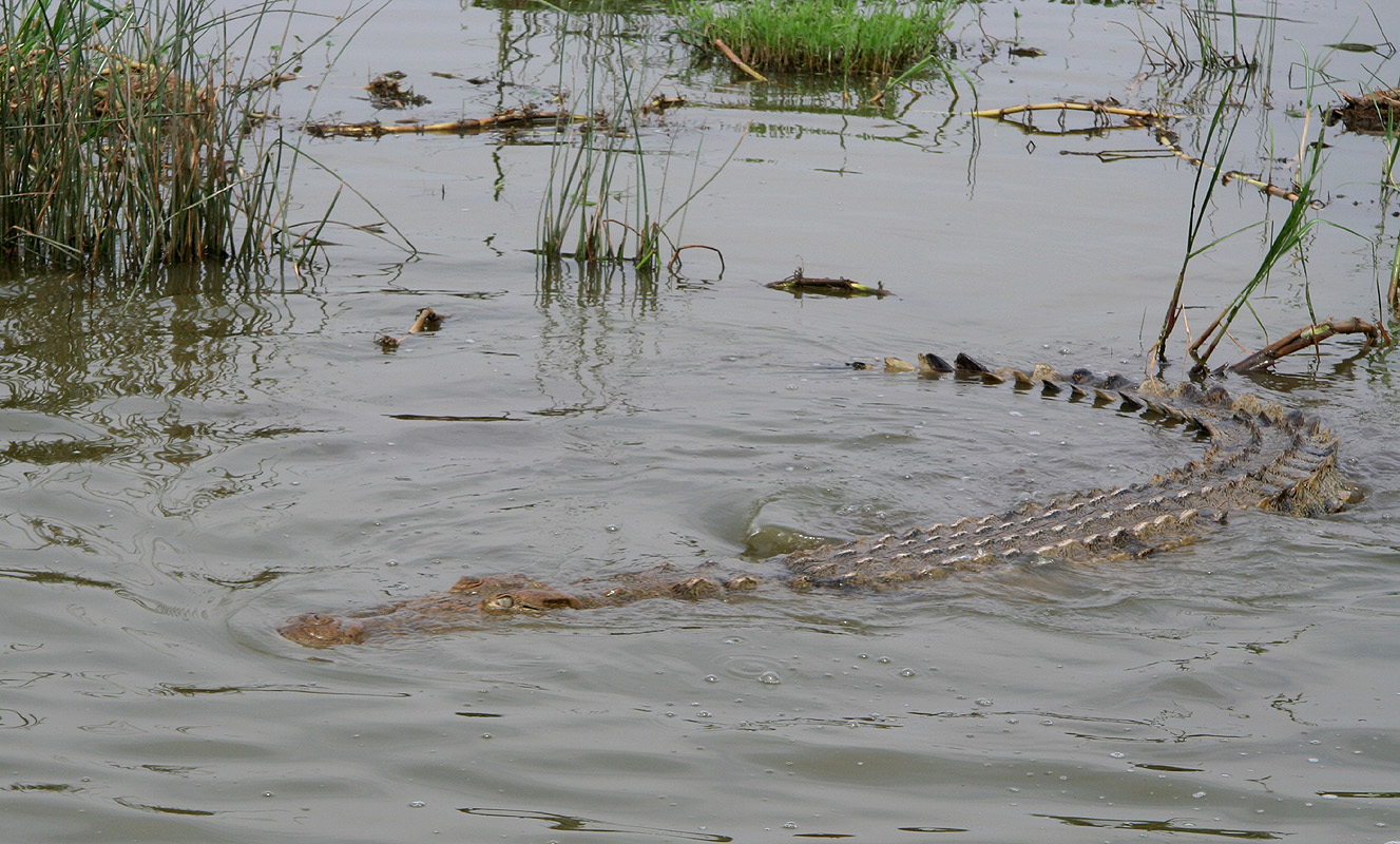
the famous Nile Crocodile, a very
fearsome creature in the water. Perhaps
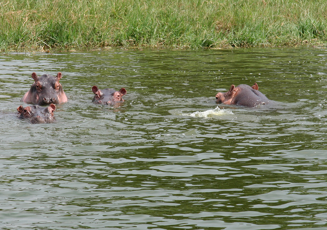
best known for its large population of Hippos, they can
be seen in large groups along the edge of the channel. There is also a very rich population
of birds here. On my last visit there were large groups of colorful flamingos. This time, we
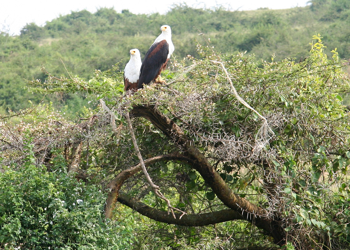
spotted some nice eagles, a very
impressive bird, as well
as many groups of other birds that could be recognized by
Rob, he is quite a bird specialist and enjoyed this trip to the fullest extent.
Quite pleased with a full day of activity, we concluded with another excellent dinner
at the lodge.
Day 11, January 9. We travel back to Kampala.
We started out at 0630 with yet another morning Game Drive.
Obviously, one never knows
what can be seen. Yesterday was extremely successful, I guess statistically, we should
see less today. This was also the only chance for the Hvitserk group to do a morning
drive, hopefully it would turn out as well as the previous morning.
Well, statistics seemed to rule, everything turned out to be much more quiet. We had
a nice and quiet drive in
perfect African savanna landscape, but the animals were
largely absent. We saw some lions at a very long distance, too far away to be of
interest. Being a bit spoiled from yesterday, I guess lions were our primary focus.
Towards the very end of the drive, most other parties had already returned home for
breakfast, our expert driver suddenly stopped and pointed: "Leopard"! And yes indeed,
a nice leopard sitting
in silhouette on top of a termite mound. Leopards are hard
to spot, this was our second in two days.
One cannot, but be impressed of their ability to hide.
A bit later, we saw it standing
in the grass, then as soon as it laid down, only a high resolution digital photo
was able to spot it, impossible to
see directly. This sight was well worth the morning
excursion and we returned quite excited to the Mweya Lodge for a final breakfast.
On the way back, we stopped to check out a traffic accident, fortunately, the driver was
ok, but said he had received a blow to his head.
Our driver showed up ahead of time and just after breakfast, at 1115, we were off on our
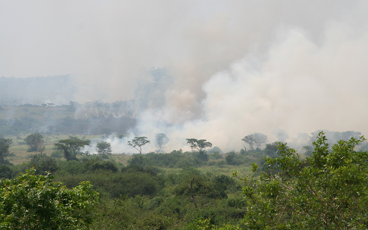
long drive back to Kampala. Just north of Kasese, the local
people were burning a pretty large area, this practice
is quite common, but does not look good when driving by.
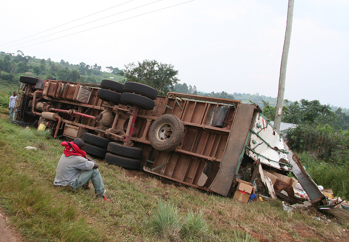
Another traffic accident, it seems like people drive too fast on roads that are below
standard.
We stopped and bought more wooden sticks with goat meat, a great
snack for driving, but except for a couple of additional short stops, we drove directly
to Kampala. Trying to follow the directions for Cassia Lodge proved to be nontrivial.
Their small map indicated a right turn after a Shell gas station, trouble was that this
road had two Shell stations and we were supposed to turn after the second one. Well, traffic
was congested and everything took time, including the wrong turn, we spent about one
full hour in the Kampala evening rush. Happy with a solid dose of driving, we checked into
our hotel shorly before 2100.
Day 12, January 10. We fly back to Norway.
This day was designed to be lazy and relaxing. Rob and I woke up with a nice,
but difficult to capture, sunrise across lake Victoria. We finished organizing
gear as Rob would have a separate departure. Around 0900, it was time to test the
breakfast, quite acceptable. Before long it was lunch time and time to wish Rob
a good travel home. He left by hotel car (US dollar 40.) to the airport around 1400.
Tor got busy using the complimentary (but slow) internet, while Pål relaxed by
the poolside and got himself involved in teaching a local guy how to swim. It turned
out that several of the guests from Uganda did not know how to swim, they where quite
astonished seeing Pål swim the entire length of the pool under water.
We had booked the hotel car at 1830, our drive to the airport starting in daylight and
ending after dark. This drive took one hour. At the airport, we again saw the group
of 8 from Hvitserk. They had arrived back in Kampala pretty late the previous evening.
Our flight directly to Amsterdam, was right on time at 2255, thus a flight where one
should sleep in order to arrive back in Europe on monday morning. We had more than
4 hours of connecting time in Amsterdam before a final short flight brought us back
to Bergen, Norway. Bergen had experienced record low temperatures, quite a change from
25-30 Centigrades in Africa directly into 10 below back home.
Warm thanks are due to Rob, Pål and Tor for all efforts and contributions
to make this trip a very successful and memorable event.
We monitored
heart rate and blood oxygen saturation while on the climb. These values
are plotted here.
To organize a trip like this is not really difficult and it saves you a considerable
sum of money compared to the alternative of going with a commercial (adventure) company.
We did not really try to do this trip with the lowest possible cost.
The cost is per person, most everything scales with the number of persons, it is very
feasible to make this trip as a two person team only.
I provide a rough, but
accurate (2009/2010) cost below:
Cost category
Cost in Euro
Air travel (Bergen, Norway to Entebbe, return)
1500.
Rwenzori Mountaineering Services + Park Entrance
970.
Food for the mountains
110.
Local travel (Entebbe - Kasese etc.)
110.
3 local hotels (Entebbe, Kasese, Kampala ) inc. meals
One should note that the safari was quite luxurious, we stayed in the Royal Cottage etc. Also,
the airfare can most likely be reduced substantially, Rob reports that his airfare from London would be
only half the price.
For reference, a typical trip organized by a commercial adventure company in Norway would
in 2009/2010 cost about Euro 5000. when all costs (also private) are included.
Further information, Contacts and Links:
Here follows a list of internet links and other appropriate contact information
that may be useful for anybody that wants to plan and organize a trip to the Rwenzori.
Tor's pictures from the trip. Rob's pictures from the trip. Rob's trip report. The Boma Guesthouse, near Entebbe. Convenient for late arrival. They pick you
up at the airport.
Email: boma@infocom.co.ug , phone: +256(0)312264810. Cassia Lodge, Kampala, overlooking Kampala and lake Victoria.
Nice place to stay, when in transit.
Good restaurant, friendly people. Airport service for US dollar 40. (2010).
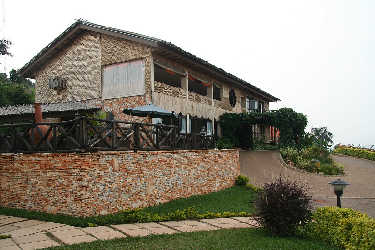
Email: info@cassialodge.com , phone: +256(0)755777002. A Norwegian place between Fort Portal and Kasese in the Rwenzori
foothills. An excellent alternative to staying in Kasese.
Email: visitmitandi@gmail.com , phone +256(0)782500979 / +256(0)782348475. Hotel Margherita, Kasese, a good place to stay before the trek.
Email: margheritaltd@gmail.com , phone: +256(0)483444015. Mweya Safari Lodge, Queen Elisabeth National Park,
Email: mweyaparaa@africaonline.co.ug , phone: +256(0)312260260/312260261. Rwenzori Mountaineering Services, (RMS) one should stop by
their Kampala office before heading west.
This address is: Rwenzori Mountaineeriing Services,
Kampala Reservations Office, UWA Head Quarters, Plot 7 Kiira Road, PO. Box 3530, Kampala.
Email: trek@rwenzorimountaineeringservices.com ,
phone: +256(0)41237497 Kampala Office, +256(0)483444830 Kasese Office.
Local transport: Most hotels can arrange this. RMS can also organize transport.
We used a local taxi operator
located in Fort Portal, try calling Patrick at +256(0)772483758
One of our guides as well as our cook asked if we could recommend their services
to future visitors to the Rwenzori.
They are hereby recommended: Guide: Kule Sebestian, Email: sebestiankule@yahoo.co.uk , phone: +256(0)776424493/+256(0)701424493. Cook : Limbali Ambrose, Email: limbaliambrose@yahoo.com , phone: +256(0)785106591/+256(0)773304205.