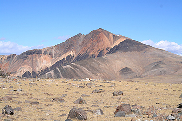
Location: North: 37:38.040, West: 118:15.345, (GPS at the summit)
Climbed October 15. 2005.
Difficulty: YDS class 1.
Information:
How to get there:
Locate Bishop in Owens vally, east of Sierra Nevada in California.
Hwy. 395 runs north-south, then find the small town of Big Pine about 24 kilometer
south of Bishop. I drove to Bishop from the San Francisco Bay area via
Hwy. 120 across Yosemite National Park and Tioga Pass (closed in winter).
From Big Pine, take Hwy. SR-168 east, after about 21 kilometer you reach
Westgard Pass where White Montain Road heads north (left). There is a sign, since
this road also serves as access to the famous Bristlecone Pines, the oldest living
thing on earth.
The first 15 kilometer of this road is paved, then the main road continues as dirt
while the paved road forks right and serves Schulnman Grove with a visitor center and
more information about the bristlecones.
Continue along the good dirt road for another 27 kilometer to the Barcroft Gate. The
road is closed here with parking on the left side just before the gate. As of 2005 this
road was perfectly fine for ordinary cars.
This location has elevation 3563 meter and coordinates N37:33.456, W118:14.144.
Route description:
From the trailhead, pass the gate and continue up the road.
This road climbs gently in the beginning, then becomes more level higher up.
Follow the road to the research station. The route/road runs on the lower side of
all the facilities, then turns more uphill (left) beyond the buildings. Next the
road climbs the hill and reaches a flat saddle area where a small old building that
looks like a telescope house is located on your right side.
From here, the trail (which is still an old jeep road) descends to a pretty flat area
and the White Mountain Peak comes into view. The route continues, first flat, then slightly
uphill to reach a knoll from which one can descend to the highest connecting saddle with
White Mountain Peak. After this descent, there is a final uphill slope to the peak. The road/route
runs in wide zig-zags and it is really much better to head straight uphill a bit right of
the ridge to the summit. There is a small stone hut (locked) at the summit, appearently the
research station conducts additional experiments at the very summit. Comments:
After a long, but nice drive from San Jose in the Bay Area, I arrived at the trailhead
at 2200 and slept in the car until early the next morning. I left the car at 0520, the near
full moon had set and the sky was filled to capacity of brilliant stars. I arrived at the summit
at 0850 and spent 30 minutes there. Leaving at 0920, I reached the trailhead at 1200 noon.
The route is easy, but a substantial hike at pretty flat, but high elevation. One should be
careful and avoid being caught by bad weather high up on this route. See more details in
my trip report. My N5 trip continued to
Mount Jefferson the next day.