Location: North 40:46.581, West 110:22.378 (GPS at the summit)
Utah, USA
Difficulty: YDS class 2
Climbed: July 26, 2008
Information:
4
How to get there:
This peak is the highest in Utah, but the easiest access goes via
the state of Wyoming. From Salt Lake City, locate Interstate I-80 and
go east. Your travel distance on I-80 will be somewhat more than 100 miles.
Travel through Park City and continue east to Wyoming. In Wyoming, pass the
city of Evanston and continue to Exit 39. Exit here, and start measuring the distance
from the freeway as you go south on Hwy. 414.
You will see signs for Urie, and further south along Hwy. 414, the small town
of Mountain View. Go straight at mile 2.7 and enter Mountain view at mile 5.1.
In Mountain View you may find food (grocery on your right) as well as gas and few
restaurants. At mile 5.9 (south in MOuntain View), turn right and enter Hwy. 410.
At mile 12.9, Hwy. 410 turns right while you should continue straight on a wide, good
dirt road. You enter the Wasatch National Forest at mile 21.2, then at mile 25.0 you
turn left. Continue along the main (wide) dirt road until you enter a large, left curve
at mile 28.7. The road to Henry's Fork Trailhead continues straight ahead here as a
somewhat smaller road. Continue straight at mile 32.0 and keep right at mile 34.7.
You arrive at the trailhead at mile 35.3. The road can be driven by ordinary cars all
the way. Find parking here, location N40:54.564, W110:19.869, elevation 2875 meter.
Route description:
This is a long hike, but with a very good trail most of the way.
The climb can clearly be done in a single (long) day by a strong hiker,
however the "standard approach" is to make it a three day climb.
Aside from the distance, a single day effort has an increased risk due
to the possibilities of thunder in the afternoon hours.
From the trailhead, proceed along the very good trail as it follows the river
along its right side (when going uphill). The terrain is dominated by forest and
the trail is sometimes close, sometimes a bit more away from the river. The elevation
gain is so gradual that one almost never notice it.
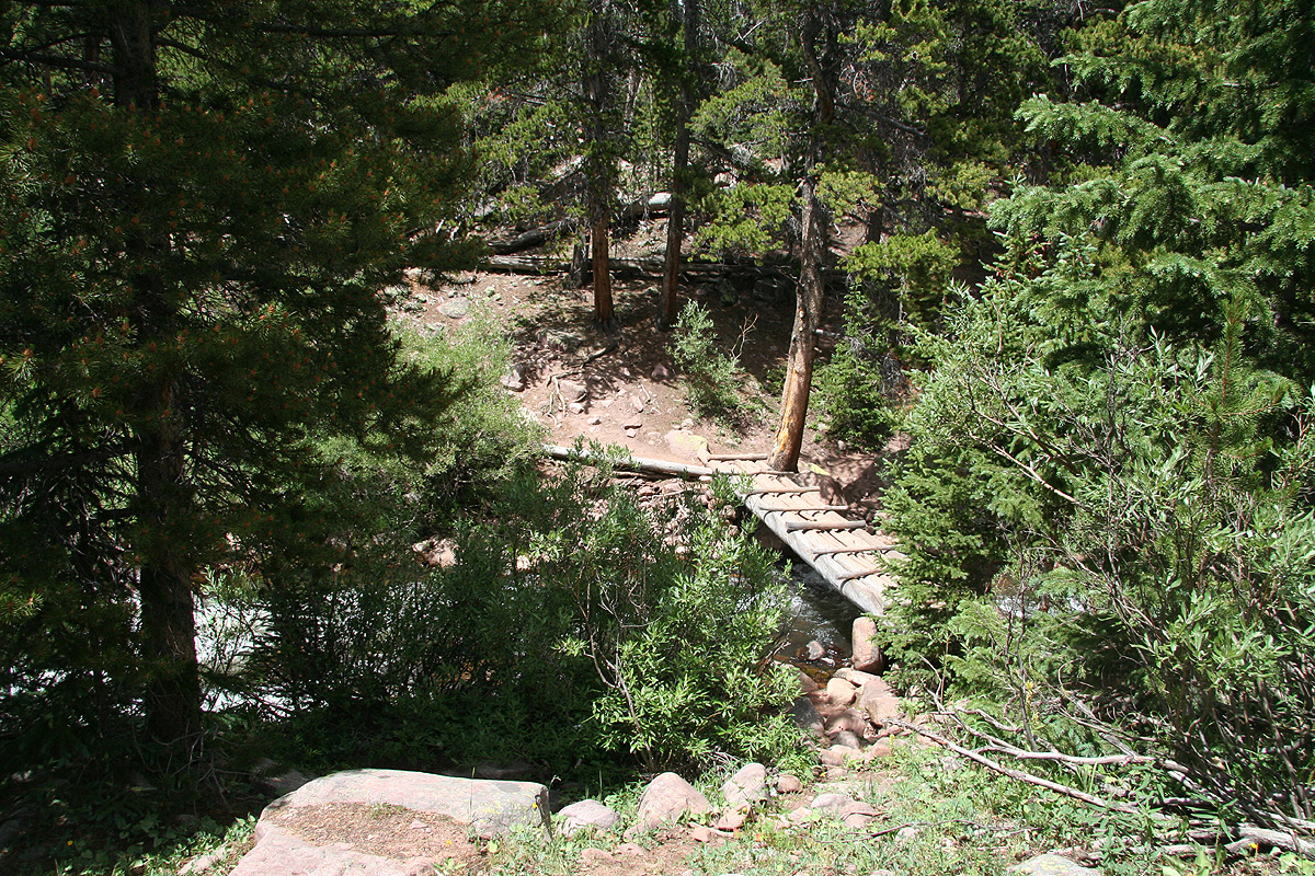
The first important waypoint is really the crossing of the river. There is a foot-bridge
at this point, clearly marked by signs. After this crossing the trail runs parallel to
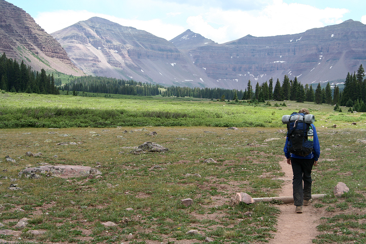
the river, crosses a short section of trees before emerging into open meadows. This is
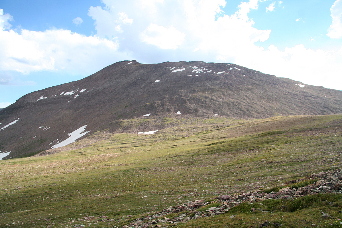
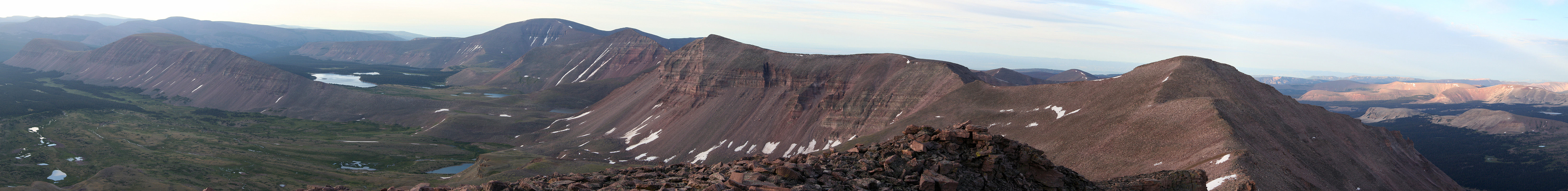
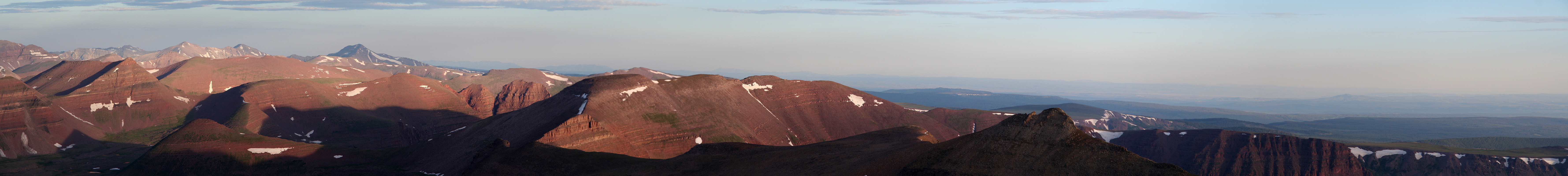
where you clearly can see the mountains that borders the basin, in particular, Kings Peak
is clearly visible more or less straight ahead as you look through the Anderson Pass.
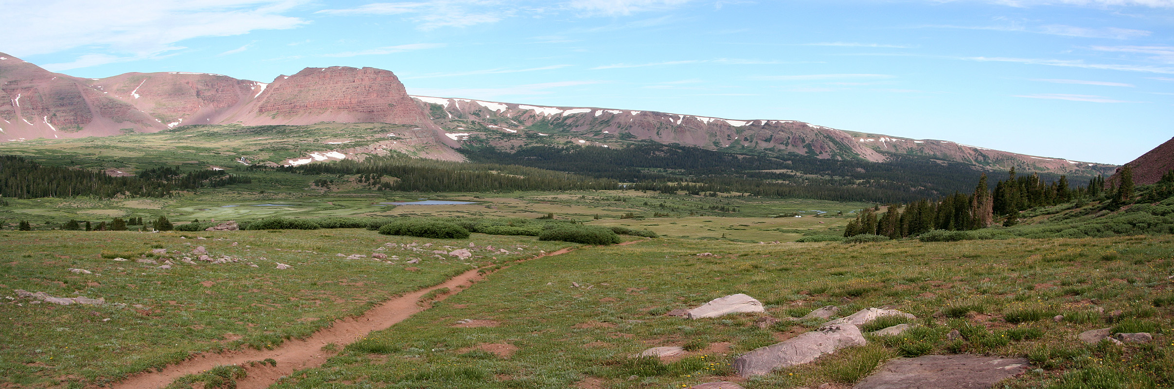
The trail continues across the meadows and crosses another brief section of trees before
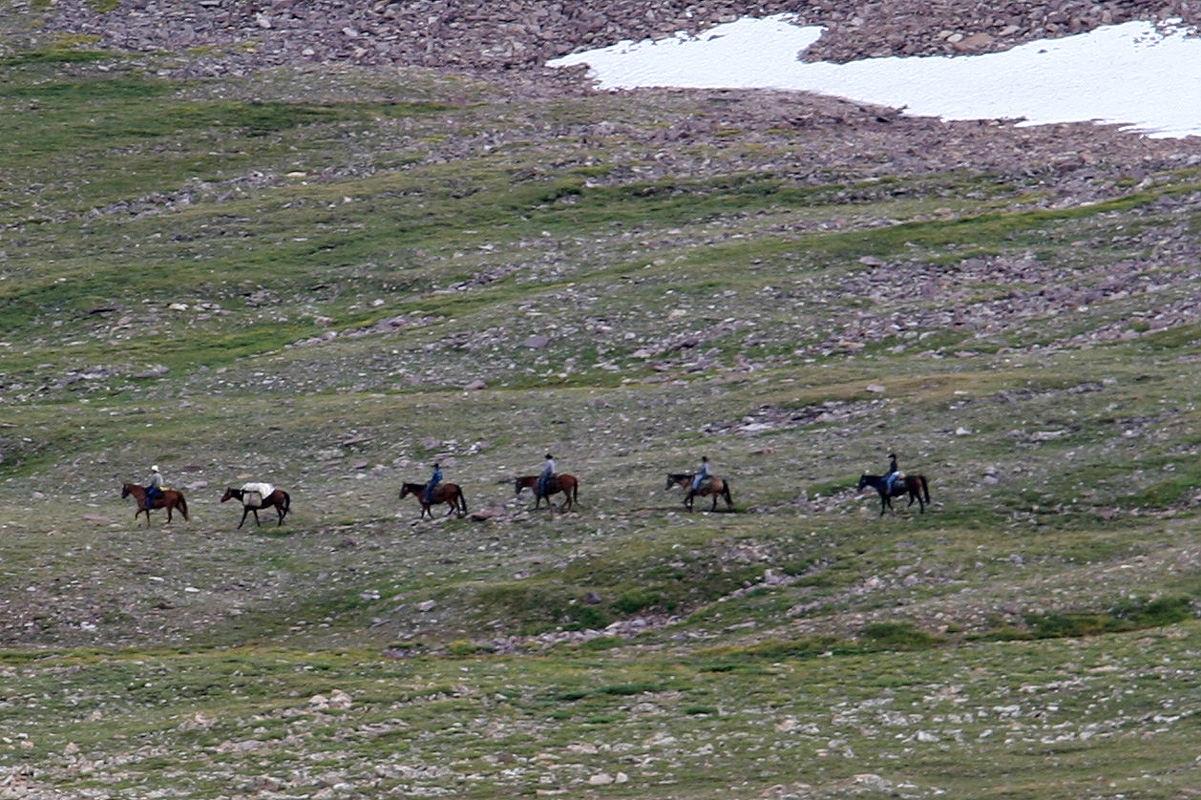
more meadows. Many hikers make camp in this area and spends to nights with a summit
day on the second day of their hike, then hiking back out on the third day.
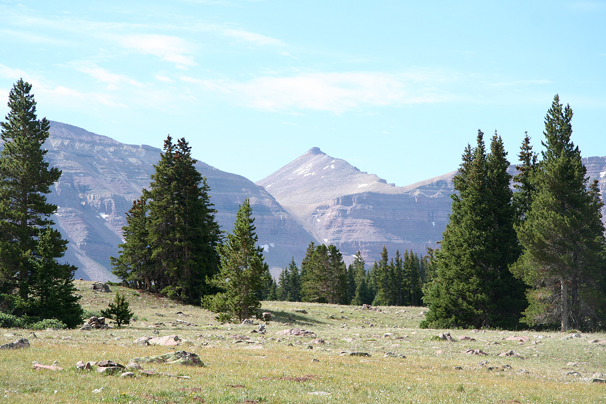
From these meadows, one can also clearly see the three variations of the route that are
possible further onwards. Anderson Pass is the pass across which you see Kings Peak. To the
left (north-east) of this pass is a rounded mountain (3994m), then Gunsight Pass on its left side.
Alt. 1
Follow the good trail up and to the top of Gunsight Pass. Immediately on the other side, a very
clear trail traverses right, (towards the slope of the 3994 meter mountain), then climbs the
slightly steeper section (very short) before gaining the fairly flat, broad shoulder that
provides immediate access to the valley between this peak and Kings Peak. The trail is partly
marked with cairns in the short, steeper section (YDS class 2 terrain). This route will continue
across a fairly flat, but rocky area in order to meet the main trail near the place where the
ridge on Kings Peak comes down towards the Andersen Pass area.
Alt. 2
Leave the trail well before it turns into the short valley leading up
to Gunsight Pass and pick a route that will get you to the bottom
of the pretty distinct gully coming directly down from Andersen Pass.
Scramble up this 300 meter gully (it was snow free at the time of our climb), then
merge back with the other routes just beyond Andersen Pass.
This gully is likely to be about YDS class 2+, however, since I have not climbed
it this is just guessing based on trip reports written by others.
Alt. 3
Follow the main trail to Gunsight Pass and continue along this trail as
it descends to the basin below before turning right around the cliffs and
then ascends back up into the valley that gently climbs to the Andersen
Pass area. This variant is YDS class 1 until reaching the beginning of the
summit ridge.
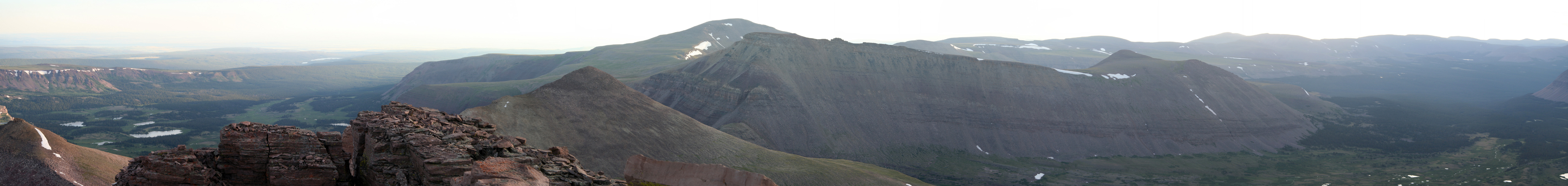
From the Andersen Pass area, all three alternatives merge and follow the obvious ridge
to the summit of Kings Peak. To be more precise, the route tend to stay a bit on
the left side of the top ridge as it climbs upwards. The right hand side (when going up)
of this main ridge is rather steep. This section is again YDS class 2, quite similar to the
short section described in Alternative 1.
In my opinion, Alternative 1 above, is by far the best and the route that should be preferred.
The short section of class 2 terrain is not more difficult than the top ridge, thus if a party
intends to climb the peak they may as well also cross this terrain. Alternative 2, is clearly
the most direct, but also the steepest variant. However, Alternative 1 is only marginally
longer and clearly a much safer as well as more pleasant route.
Comments:
I did this hike with my son Pål Jørgen.
We started from Snowbird near Salt Lake City in the morning and were ready
to leave the car at the Henry Fork Trailhead at 1230. There were quite a number
of cars parked at the trailhead and obviously many other parties that wanted
to climb this peak.
We rested
near the foot bridge that
crosses the river, hiking there took about
2 hours. As we continued across the more open meadows
we soon observed tents, it is
clear that most parties allocate 3 days - one day to hike into the upper parts
of the large basin, one day to climb the peak and then a third day to hike back out.
We did not carry a tent and had decided to make this climb in a 2 day effort.
Thunder started and some rain developed, fortunately not much. We carried sleeping
bags and rain gear, but the hope was that we would avoid rain during night.
Still, we decided to just make a break and wait out the rain. At this point, we had
hiked for about 3.5 hours. The rain ended almost as suddenly as it had started, however,
I quickly discovered another problem. This area was really full of fairly agressive
mosquitos. Having forseen this, we applied some mosquito-repellent spray on bare skin
as well as on my wool shirt. Unfortunately, with rather limited effect. In particular,
I sprayed my right shoulder extensively, but after the trip I could count at least
20 mosquito stings just there. It looked like the spray had the exact opposite effect,
informing the mosquitos that this was an area that could be attacked.
We continued on to Gunsight Pass, arriving there around 1645. The weather was still
unsettled and we decided to wait at this pass and see how the weather developed. By 1800,
it seemed pretty clear that we would not have any more thunder that night. We therefore
continued the nice traverse around peak 3994 and entered the slopes of the high valley
that runs between this peak and Kings Peak. The time was 1830, we were at location
N40:47.298, W110:21.834, elevation 3763 meter. Happy with our progress, we decided to
rest and sleep
right there. Obviously, the hike to the summit would be a rather easy and
short trip the next morning.
The night was clear with thousands of stars, then later a very small moon appeared before
daylight gradually returned around 0500. We started out at 0550, having decided to
return for breakfast after a trip to the summit.
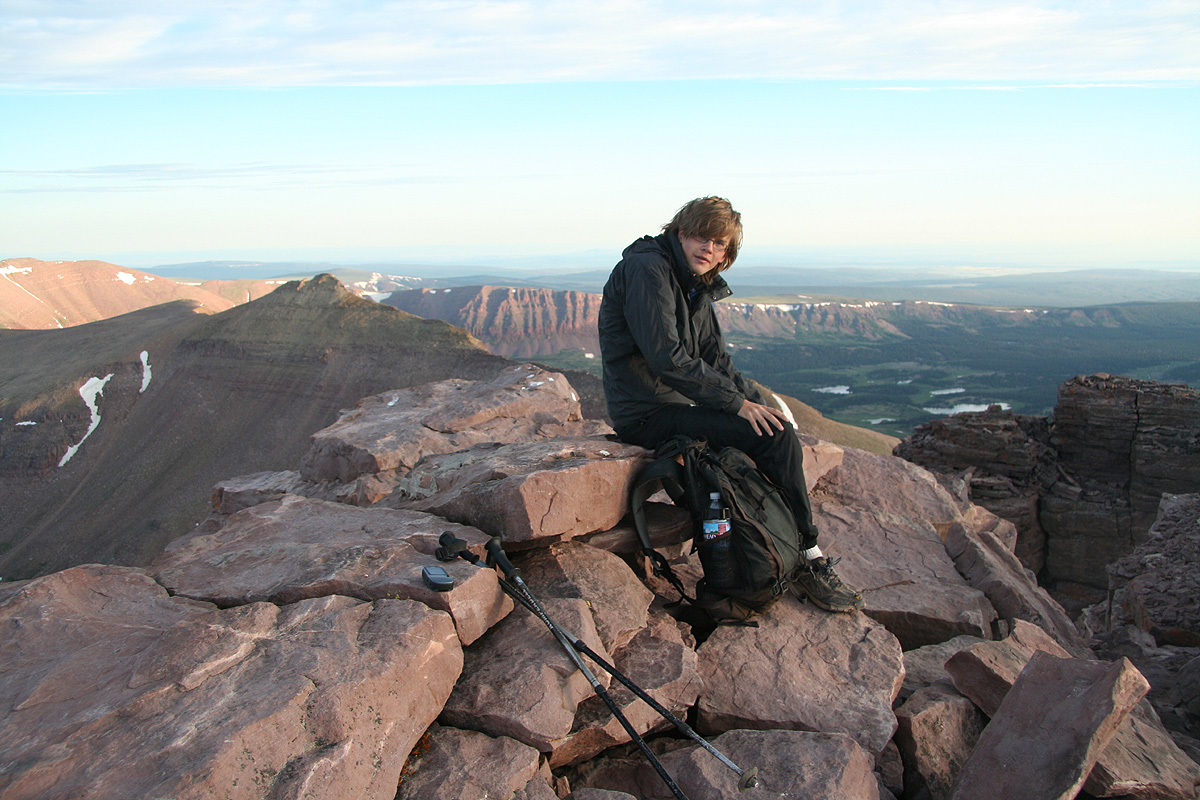
It took us less than one hour to the summit
and we enjoyed the view for quite some time.
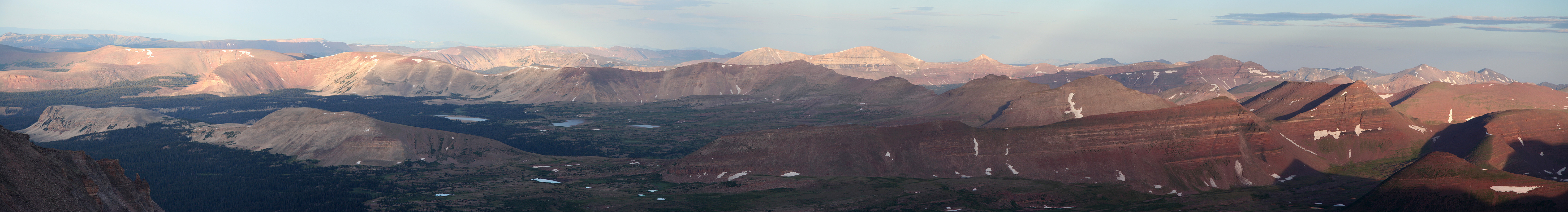
This peak is certainly located in a big wilderness area. There are huge basins with chains
of mountains in every diection. It occured to me that a crossing of this area using
skis in the winter must be a good project.
We returned to our primitive camp for breakfast around 0800, then started on the hike out.
Reaching the car at 1220, we felt that this trip was a good way to conclude
our Ultra prominence hiking in the USA, in the summer of 2008.
Resources:
Images
Kings Peak, as seen when emerging from the forest.
