Location: North 40:23.455, West 111:38.762 (GPS at the summit)
Utah, USA
Difficulty: YDS class 1
Climbed: July 24, 2008
Information:
How to get there:
Salt Lake City is the natural point of refeence. This mountain is very
popular and serves as the main, major hiking goal for many people living
in Salt Lake City as well as in the many communities near Utah Lake south
of Salt Lake.
From Interstate I-15, use exit 272 and go east along Hwy. 52 (also called 800 North).
This road ends in a junction with Hwy. 189, go left here, the sign says 189 North.
Continue approximately 7 miles along Hwy. 189, the road is called Provo Canyon Road. The key landmark is to notice when
you drive through a short tunnel. Immediately after this tunnel, make a left turn onto Hwy. 92.
Continue up the valley along this road for about 6 miles. You will pass the Sundance Resort (on your left),
then arrive at a toll booth. Most likely, this booth is unmanned and you will find a large parking area on your
left and a self serve parking fee station. Pay for parking and park here. This is the trailhead, location
N40:24.260, W111:36.305, elevation about 2090 meter.
Route description:
From the trailhead parking, head uphill along the wide, obvious trail that
starts out on the right (upper) side as you enter the parking area.
This trail starts out as a wide dirt path, then higher up you get to a
slightly confusing sign telling that the trail continues straight as well as
goes right. The intention is to indicate a foot bridge (going right) in case
of (substantial) water in the creek ahead. In July, there was no water and proceeding
straight ahead is the natural choice.
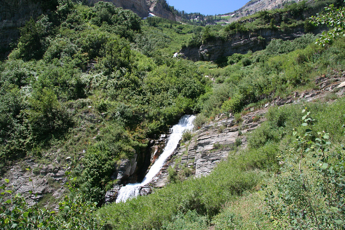
From here, the trail is actually paved about 1.5 kilometer onwards. The trail first
turns nearby a waterfall
formed by the main creek coming down this valley, then
climbs and visits the next waterfall formed higher up by the same creek. At this
point the paved surface of the trail ends and a more normal trail will take you
higher.
This trail starts out with some rather very long switch-back turns on the slope above.
The elevation gain is rather moderate. A very long traverse right followed by an even
longer traverse back left will bring you into
the upper part of the valley climb which
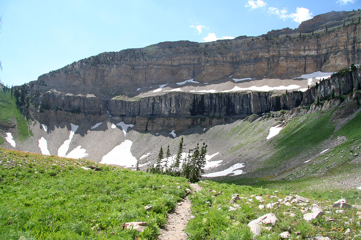
is now more constrained by the rock formations. You will cross the same creek several
more times, one of these crossings is again near a small waterfall where one actually
may walk behind the water without getting wet. The trail now gains elevation in shorter
turns and the horizon above quickly gets more within reach. The middle section up here
has a somewhat confused trail, there are several variants, however, they all merge back
into a single trail a bit higher up.
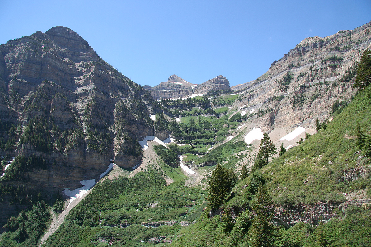
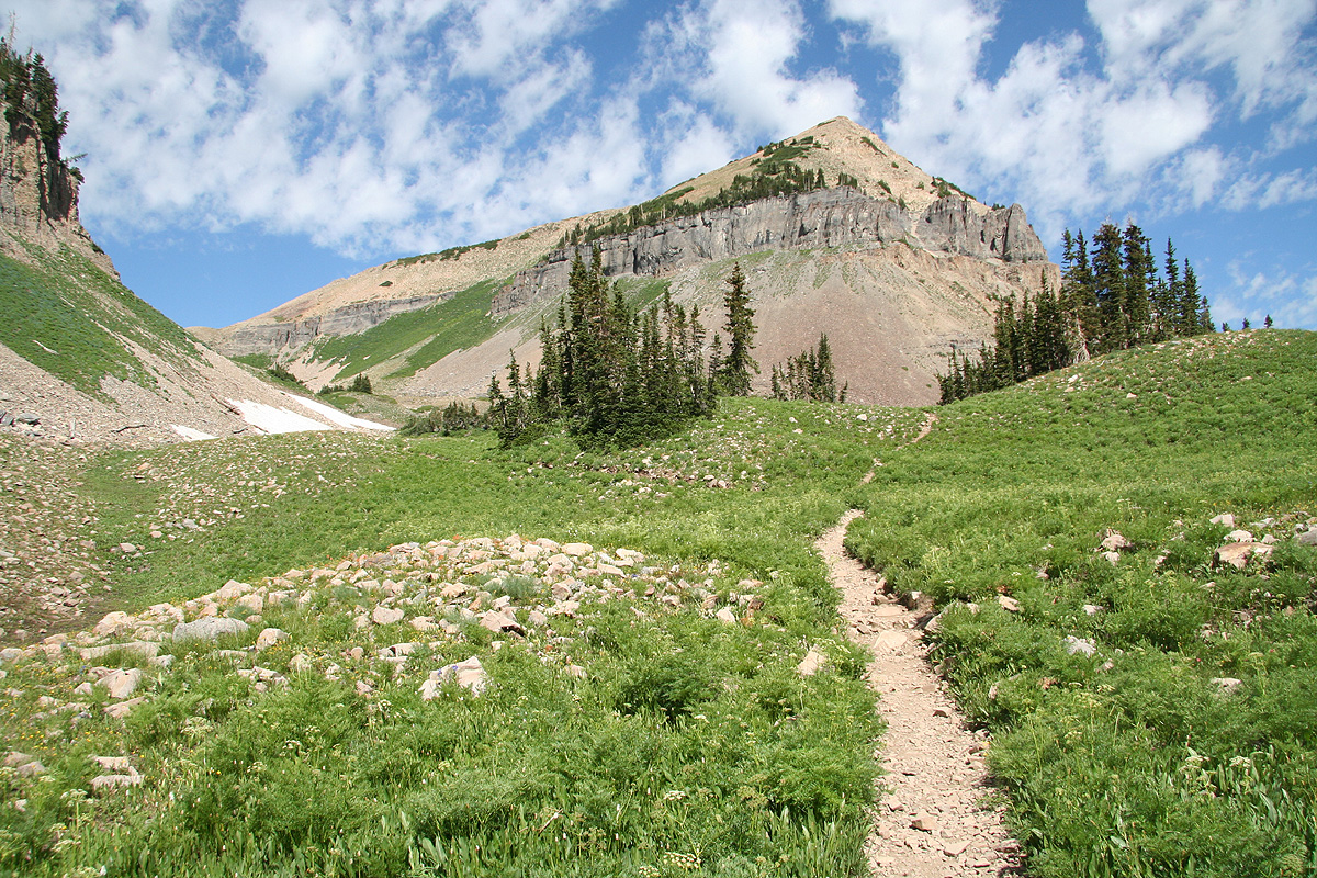
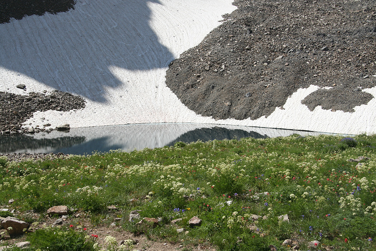
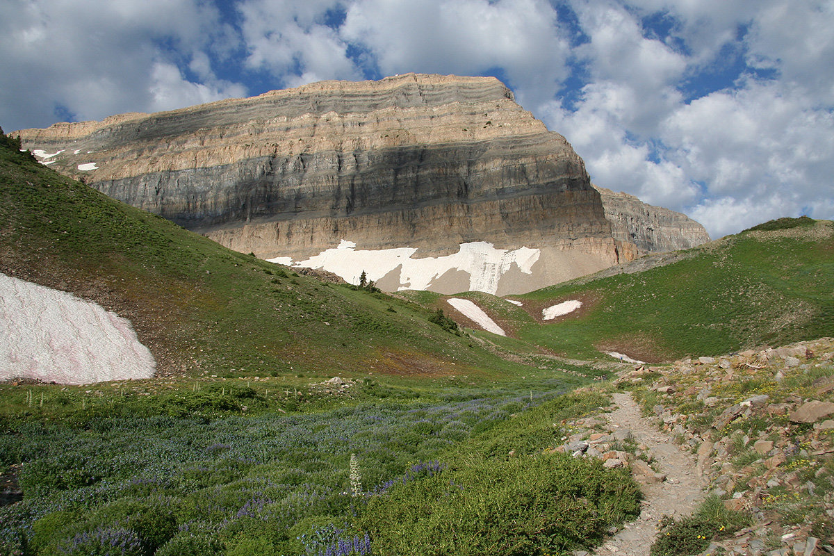
The next section, when you have gained the obvious "horizon" while climbing the (steep) valley,
is gentle as the trail first curves left and gives you a
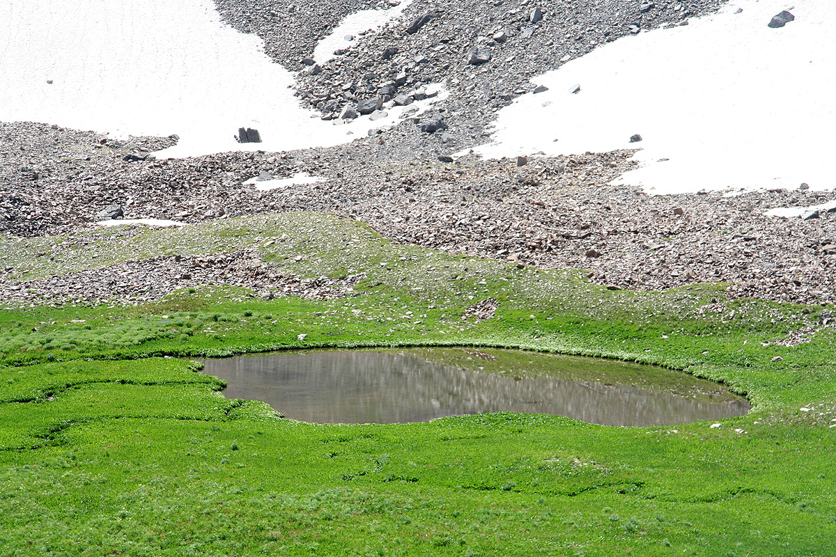
nice view of a small meadow and pond,
then goes more right and ascends slightly
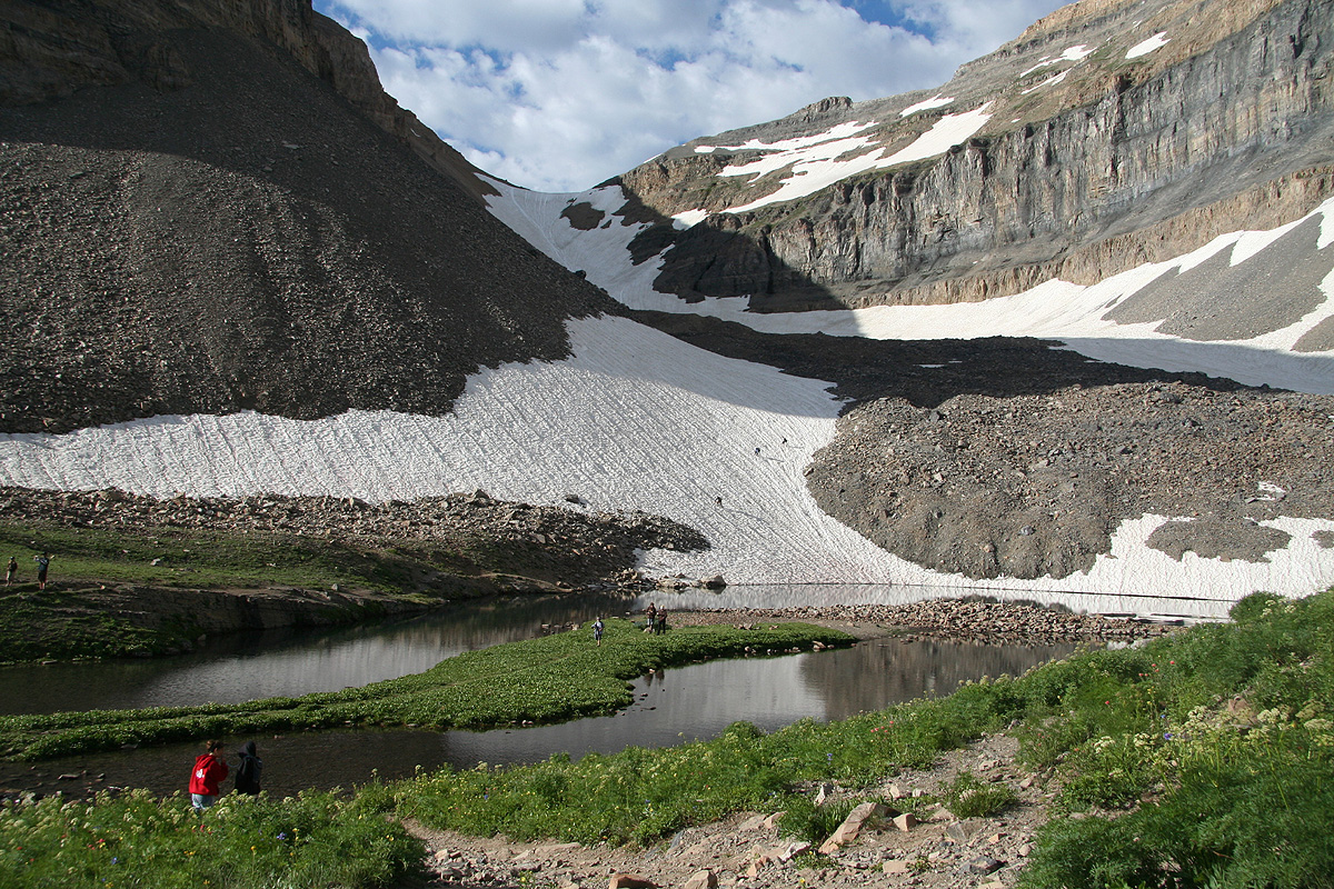
more to gain the main lake just below a permanent
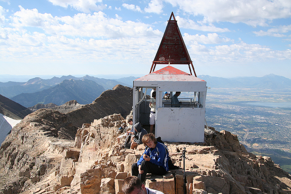
snow field. At this point, the summit is straight ahead, you can see a summit structure on
top of the very steep cliff that raises ahead.
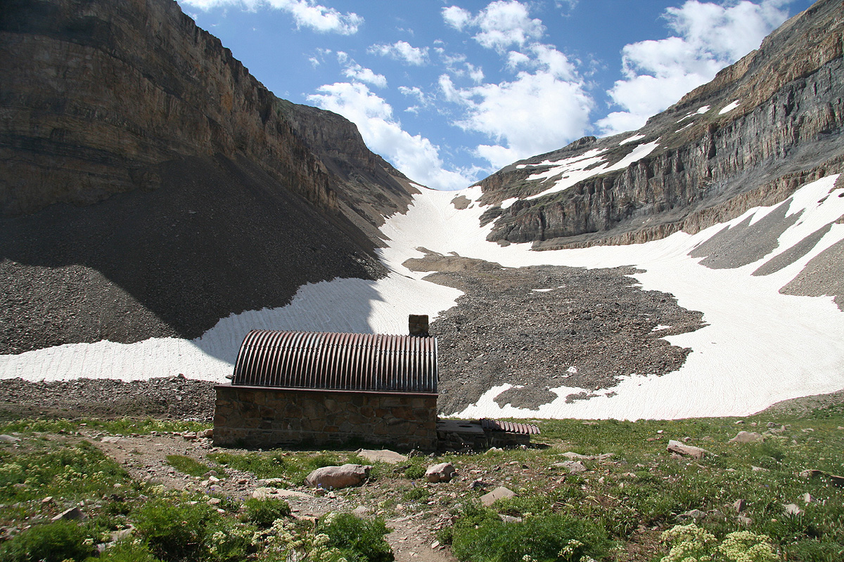
From here, there are two possible routes.
The trail bends right (do not cross the creek or any part of the lake), and
passes a small hut having a curved (semi-circle) roof.
That is, the route shall take you right (north) of
the steep cliffs that runs up to the summit. This trail traverses along a fairly distinct
route where cliffs drop to a basin floor further down, while other cliffs form steeper
terrain above you (on your left). The passage is not difficult as there is a nice trail.
This trail hits semi-permanent snow on the other side, earlier in the season this snow may
perhaps also extend to the traverse and then one should carry an ice axe (and crampons) here.
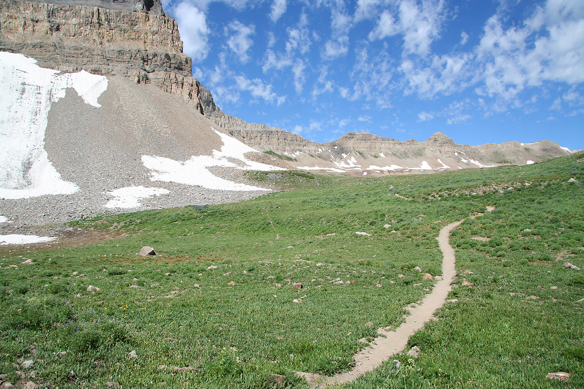
The route continues its fairly horizontal traverse, then gradually climbs while still going
right, in order to meet up with another main route to this summit, called the Timpooneke trail.
The two trails now climbs the final section to the summit, first a bit along its north
ridge, then off (on the right or west side), zig-zags up a fairly steep gully (when there is
still snow, this might pose a problem),
then continues to gain the ridge
and the summit.
The alternative route branches off down by the lake. Across the lake, you will see a permanent
snow field that extends up the valley to the left of the steep summit cliffs. The snow extends
up to a pretty distinct col at the end of this small valley. Proceed across the creek where
the lake ends and hike the snow all the way to this col. In summer, this snow may be quite
hard and icy. The slope towards the end is moderate, but could still cause problems unless
you have proper footwear. Good boots will normally suffice, crampons will make this route
a trivial hike. From the col, there is a small, but good trail that leads to the summit.
This trail stays left of the main ridge most of the way.
Comments:
I did this hike with my son Pål Jørgen.
We left the trailhead at 0620 and started hiking up the trail. Somewhat to our
surprise, we met hikers going downhill before one hour had passed. Higher up, I asked a couple
of guys about their hike. They said they had started at midnight since they were in pretty
good shape. Appearently, some parties start alread around 10 PM (the day before!)
We made good progress and arrived at the small lake around 0830. From there, we took
what looked like an obvious route,
up the valley, up the snow field, then the ridge
to the summit. This turned out to be an "incorrect", but possible route. The correct route
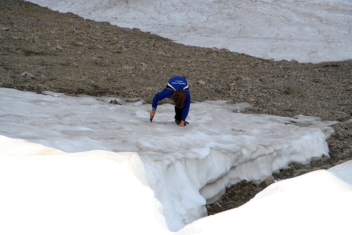
traverses to the right side (when viewed from below) of the summit cliffs. Actually, Pål
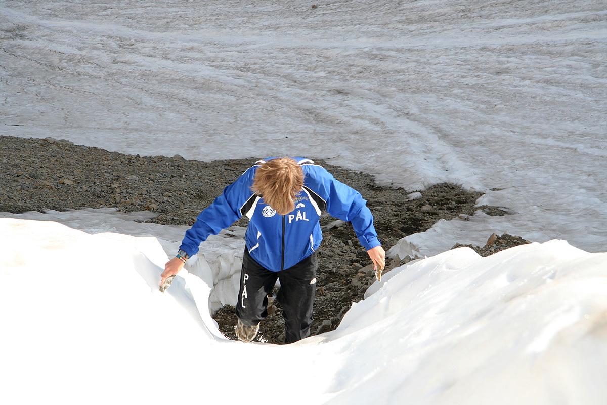
Jørgen had extremely worn out (sort of falling apart) running shoes that turned out
to be very slippery on the
somewhat hard snow. Despite this, the snow was no big deal and
we could have climbed up along the edge of the snow if forced to
do so. This snow is called
a "glacier" by the locals, since it stays around from one winter to the next. Obviously, it
is not a glacier, but rather a fairly large, permanent snow field.
From the col above this snow, a pretty obvious trail will lead upwards largely on the left side
of the ridge line, and take you to the summit.
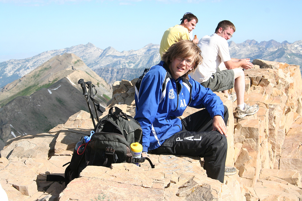
We arrived at the summit at 0935,
3:15 up is likely a bit faster than what one should plan for.
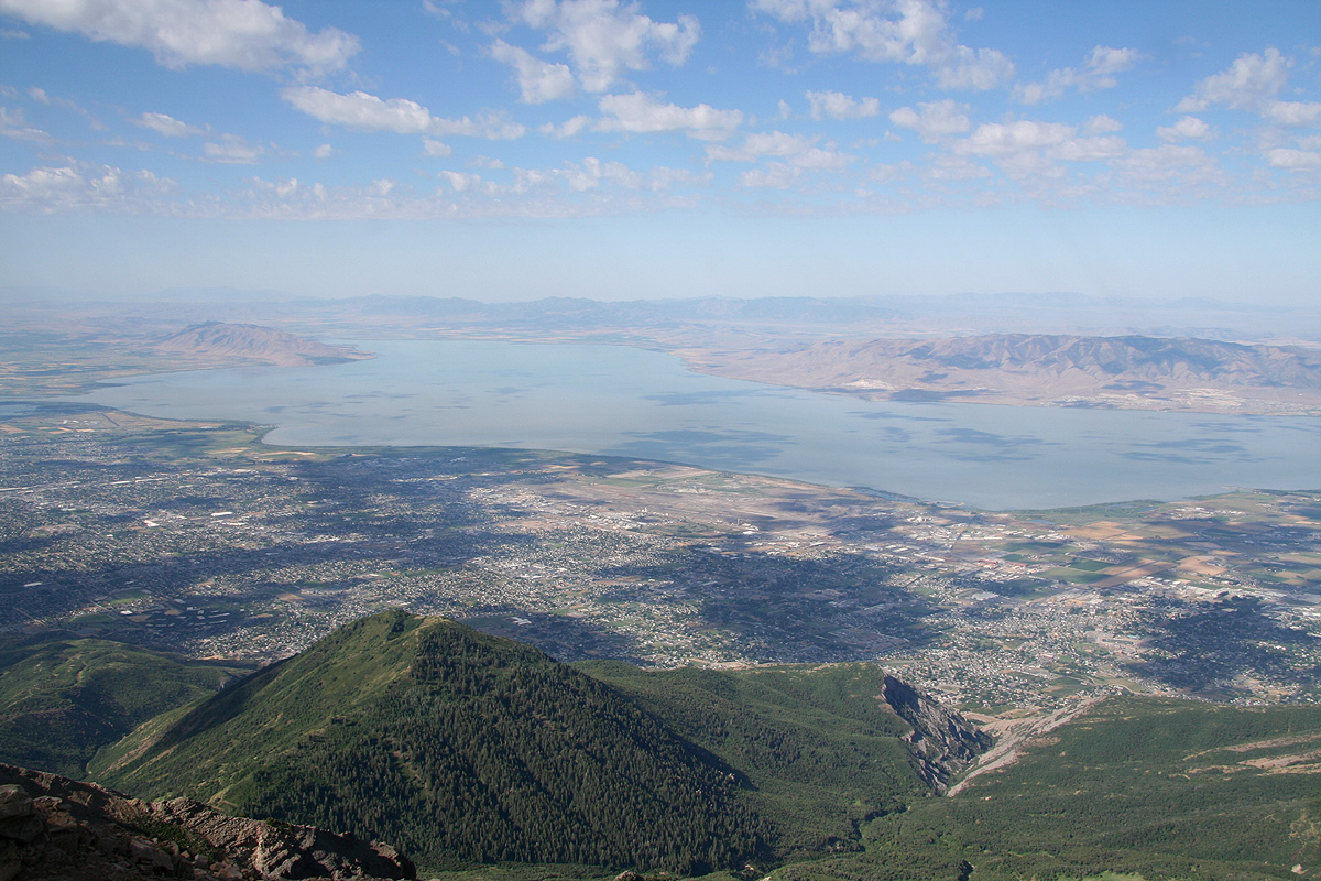
There were about 5-6 more people at the summit when we arrived. We talked to a man that could see back
down to his house, it seems
like this is not uncommon, the entire Utah valley and the Utah Lake
was just directly to the west. He had been to Norway two years as a misionary, he came up the
Timpooneke trail and it had only taken him a bit more than 2 hours, - extremely fast pace.
We started back down after a very nice 30 minute break, this time along the official trail.
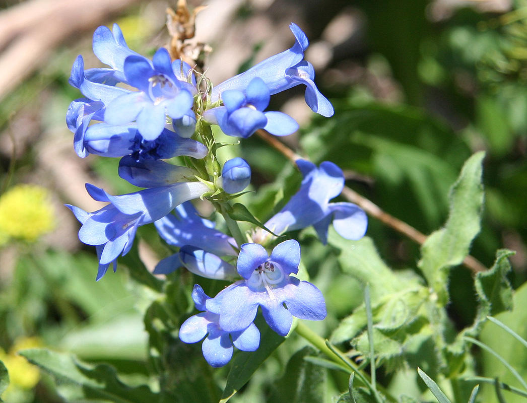
I made numerous stops in order to photograph the landscape,
peaks and flowers.
Towards the end, it got quite hot and I got tired. Hiking downhill on a paved
trail was not exactly nice for my knees, dirt is much to be preferred.
Still, I arrived back at the car by 1150 where Pål Jørgen waited with a cold
coke, just what a thirsty dad needed right then.
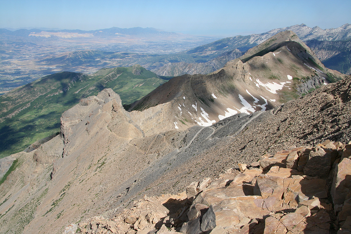
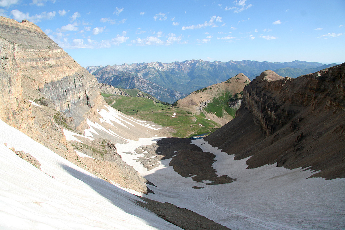
Summit view to part of the route. The trail gains the
area in the middle of the picture and proceeds to the small
lake. The trail can be seen going left, while the snow
alternative forks right (as seen in this picture).
Summit Panorama III. The view is north-west to north,
Mineral Basin (Snowbird) and the
mountains around can be seen to the
far right. Mount Baldy and Sugarloaf
Mountain are the two rightmost tops.
