Location: South 07.38349, East 110.07122 (GPS on the summit)
Difficulty: (YDS) class 4 (one move)
Climbed July 20, 2015
Information:
How to get there:
A good point of reference is the saddle between Sindoro and Sumbing. A highway is
running across this pass. Near its highest point, turn towards Sumbing and
locate the Registration office. This location is S07.35021, E110.02855,
elevation about 1400 meter. The trailhead is located near the end of
this street, a bit more uphill, at location S07.35417, E110.03454, elevation
aboout 1470 meter.
This is a quick summary and reference to climbs made in the summer 2015.
Route description.
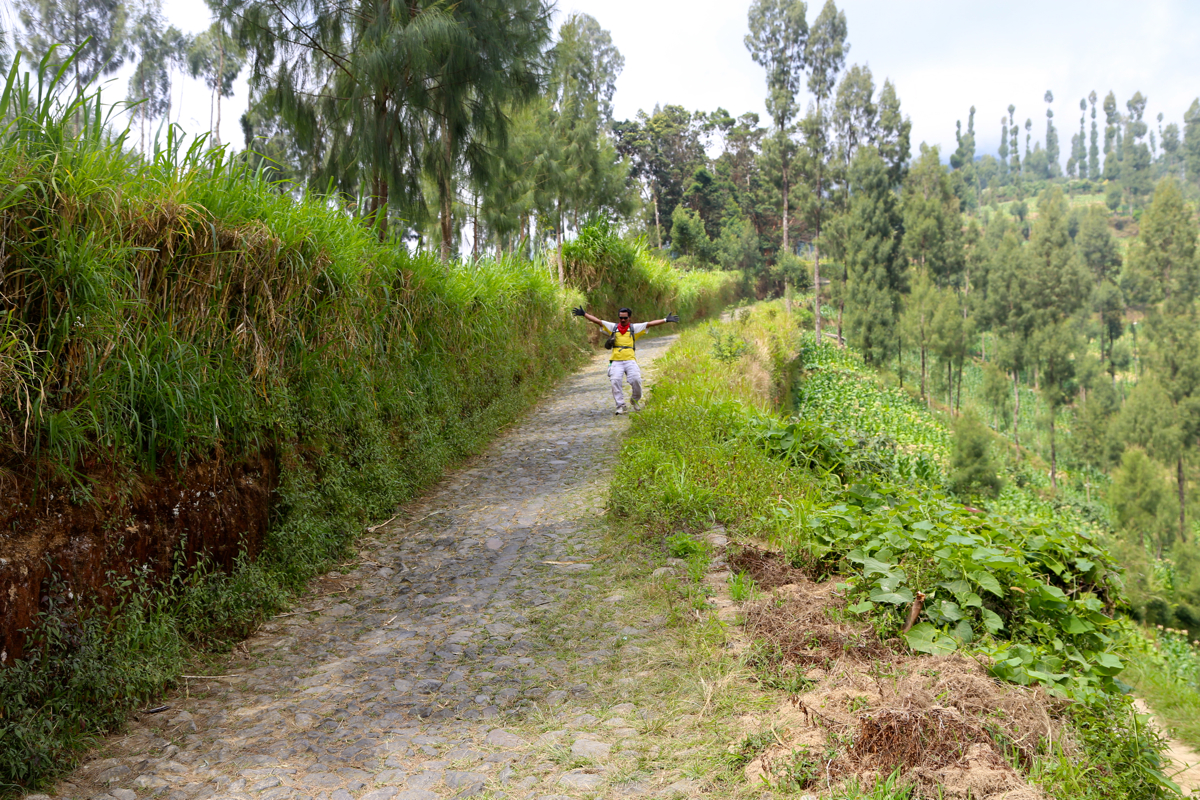
The first part of the route follows a farmers road,
first left, then
uphill. Transportation by motorcycle is possible (cost 25.000 in 2015).
The road ends at elevation 1930 meter, location S07.36216, E110.04935.
The trail continues directly from the road. It is quite easy and gentle uphill
in the first part, then follows a steeper section that may be cumbersome (slippery) if wet.
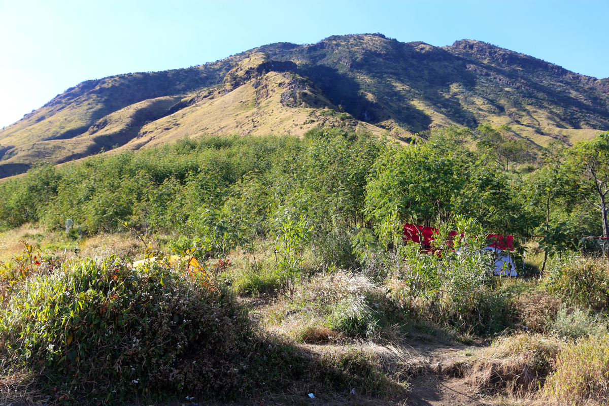
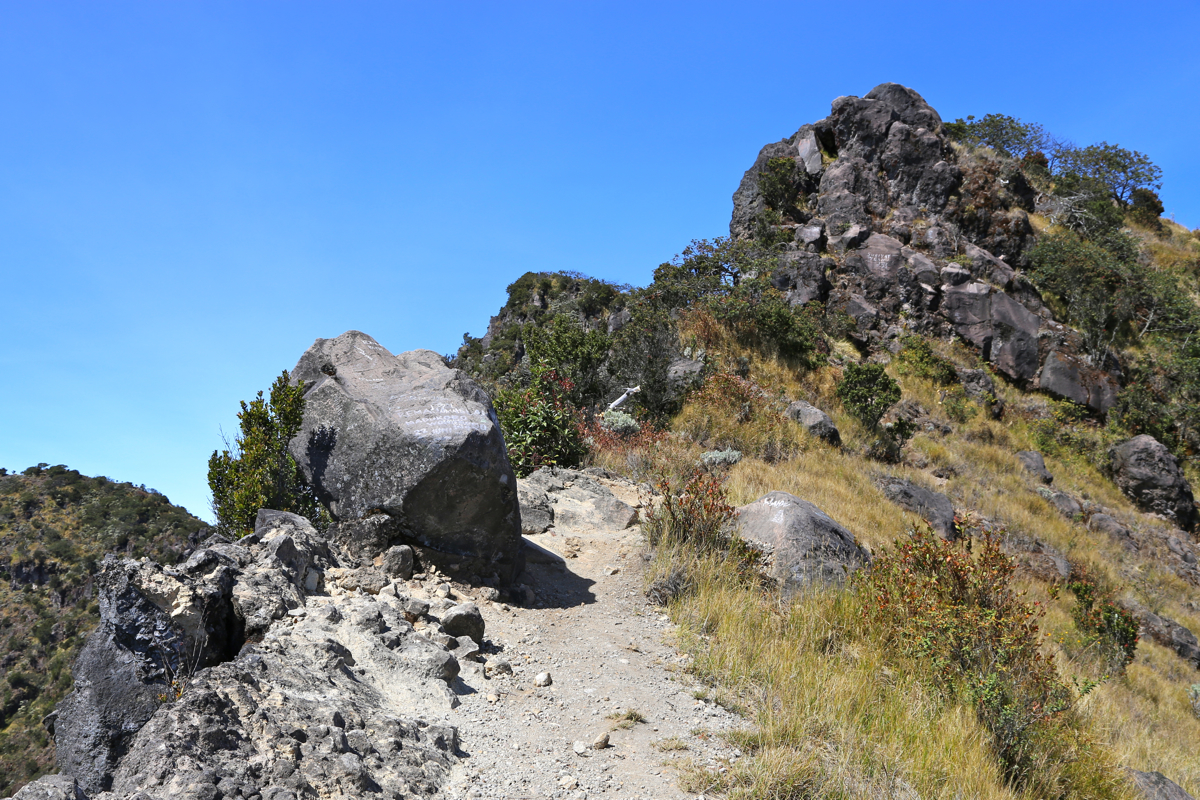
Above here, the route stays on a nice ridge
and there are several spots suitable
for camping. With stead climbing, the route comes up to some steeper rock that is
bypassed going left, then regaining the ridge higher up.
The final section up to
the rim is going more or less straight uphill. Before, but very near the crater rim,
you will hit a sign that indicates a trail fork. In order to get to the highest point,
turn right and follow a clear trail that runs horizontally somewhat below the crater rim.
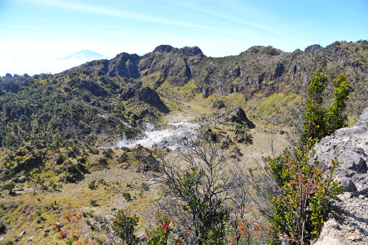
Soon, this trail emerges onto the rim itself
and the terrain ahead comes into view.
There are two local tops further along the crater rim. The highest point is on top
number two. At the base of the first top, scramble (very easy) up left, then follow
a ramp downslope to your right. The path will then take you easily to the first local
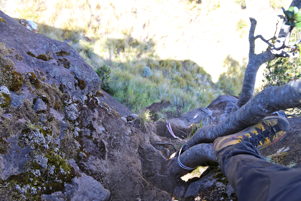
top. From here, follow the path down towards the saddle that separates the two tops.
This saddle is wide and gentle, however, a rock-band creates a difficulty at the very end
of this descent. Approaching from above, the steepish section leading down to the
saddle looks worse than it is.
Still, care is needed here as the terrain is sloping
out and handholds are less than perfect. To reverse this section, ie. to climb back up,
is considerably easier as you then better see where you have good footholds. This is
the crux of this route, YDS class 4, although a very short such section.
Continue across the saddle, then follow the vague trail (very few people go here),
as it contours around on the right before reaching easier terrain where the path can
go straight uphill to the summit.
Comments:
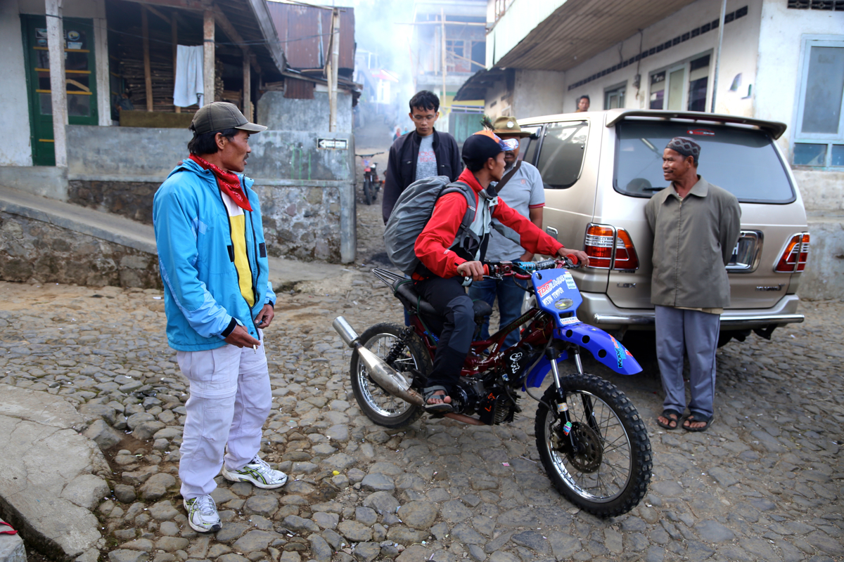
I left my "Base Camp" at Mesastila at 0530 and arrived at the registration
office around 0630. The climbing fee was 10.000, then another 50.000 to get
a motorcycle ride
for myself and my guide to the upper end of the farm road.
Having read that almost nobody climbed the true summit because of a technical
difficult section, I decided to have a guide along on this trip. Not in order to
show the route, but rather to have company. It is better to be two people when
negotiating a bit demanding terrain.
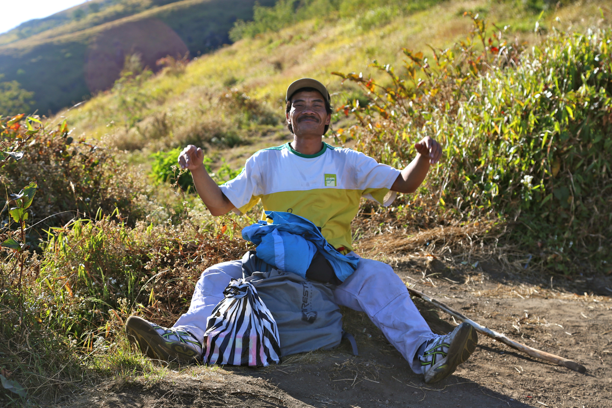
My guide was Marjo Pitut, a very friendly
guy that certainly fullfilled my expectations. As it turned out, he had never
climbed to the summit before, and he did not know the route or what kind
of difficulty, but that was of no consequence as far as I was concerned.
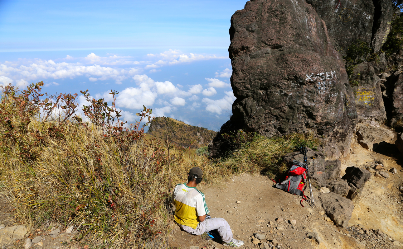
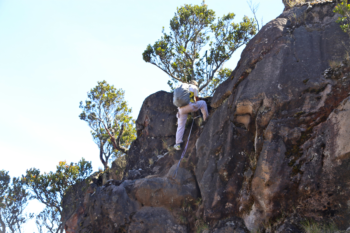
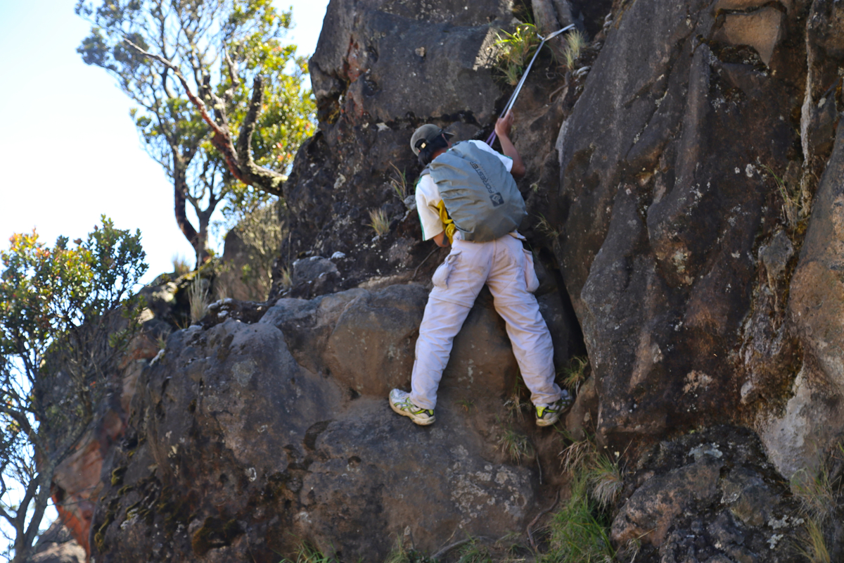
We started hiking at 0705 and with a few breaks for water, reached the rim
at 0945. Proceeding along the rim carried no problems until I came to the
crux section and looked down. Far enough that one would not like any issues
here. Marjo came right behind me and showed some signs of slight concern.
A solid tree stood right at the top, a perfect anchor. I pulled out 3 slings
from my backpack, this was just exactly what was needed to protect this
downclimb. I could see that Marjo was more happy, when he asked about the
strength of my slings. I told him that they were "indeed very strong" and proceeded
to climb down first. My weight being at least 20 kg more than Marjo, he seemed
quite happy. Soon, he was coming down
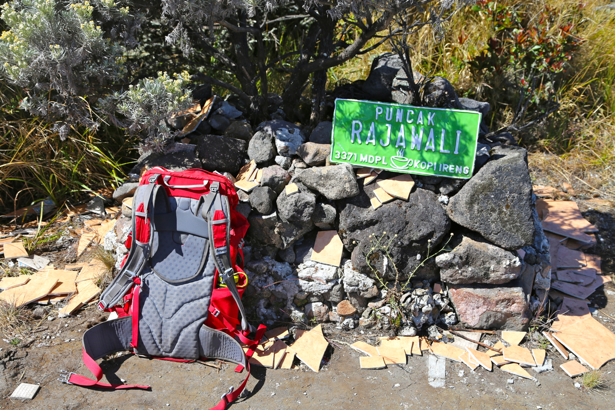
with no more concerns. The rest was easy and
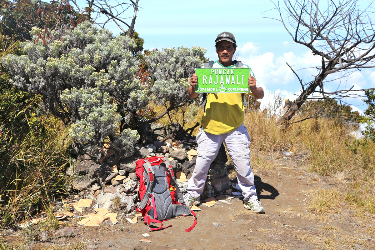
we arrived at the summit at 1015. Marjo was as happy as me, he took many pictures
and looked around to see the views
in all directions. We stayed at the summit for 30 minutes. There were many people
at the rim closer to where the trail came up, but nobody else attempting to
come up here to the highest point.
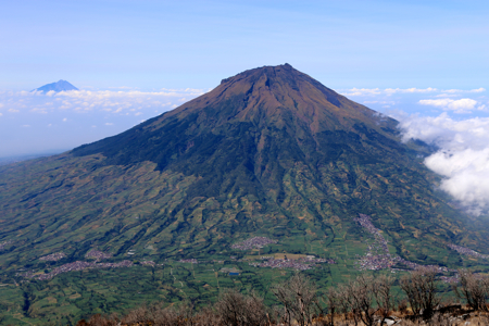
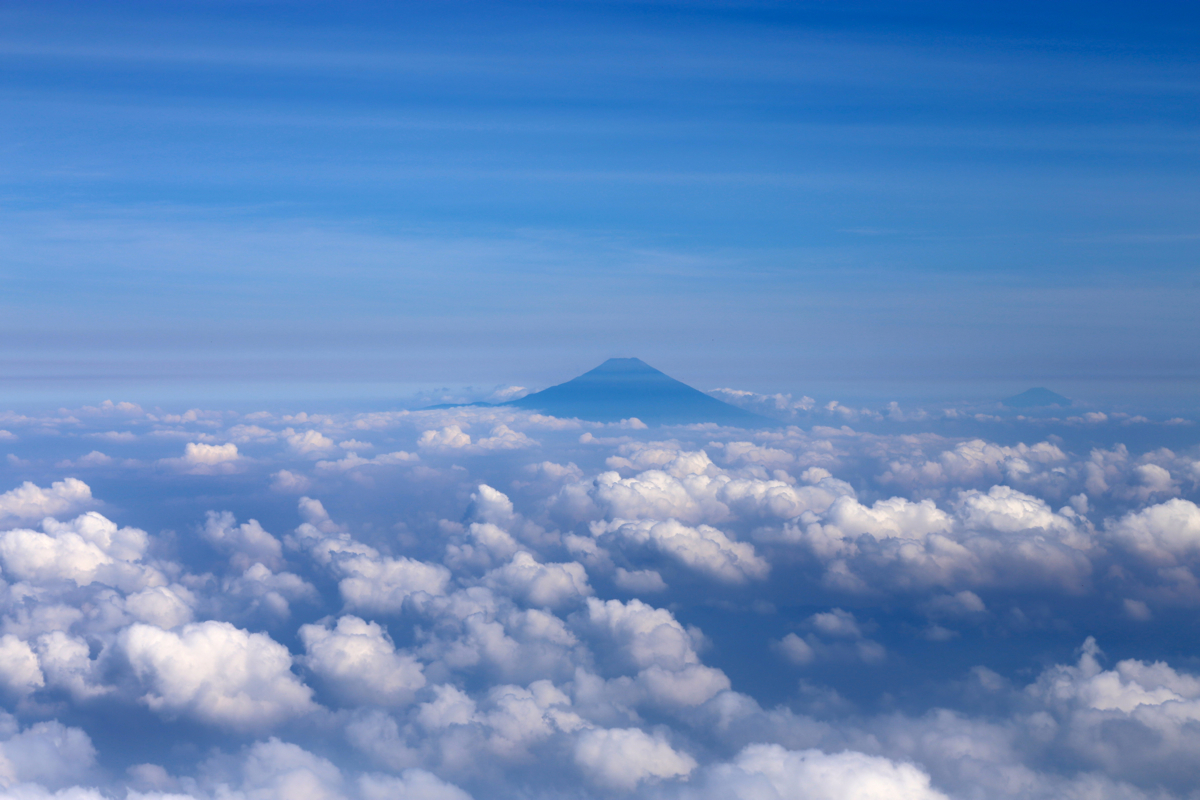
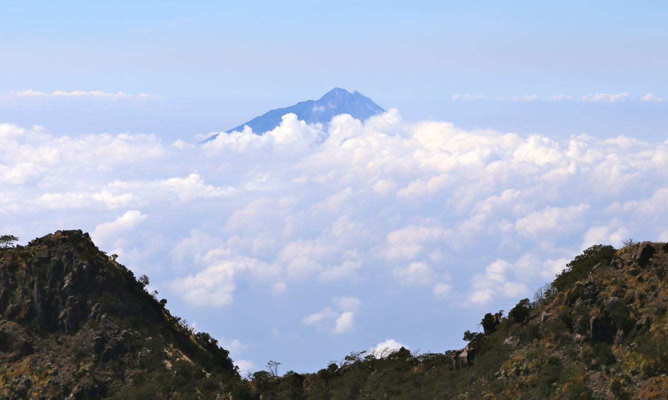
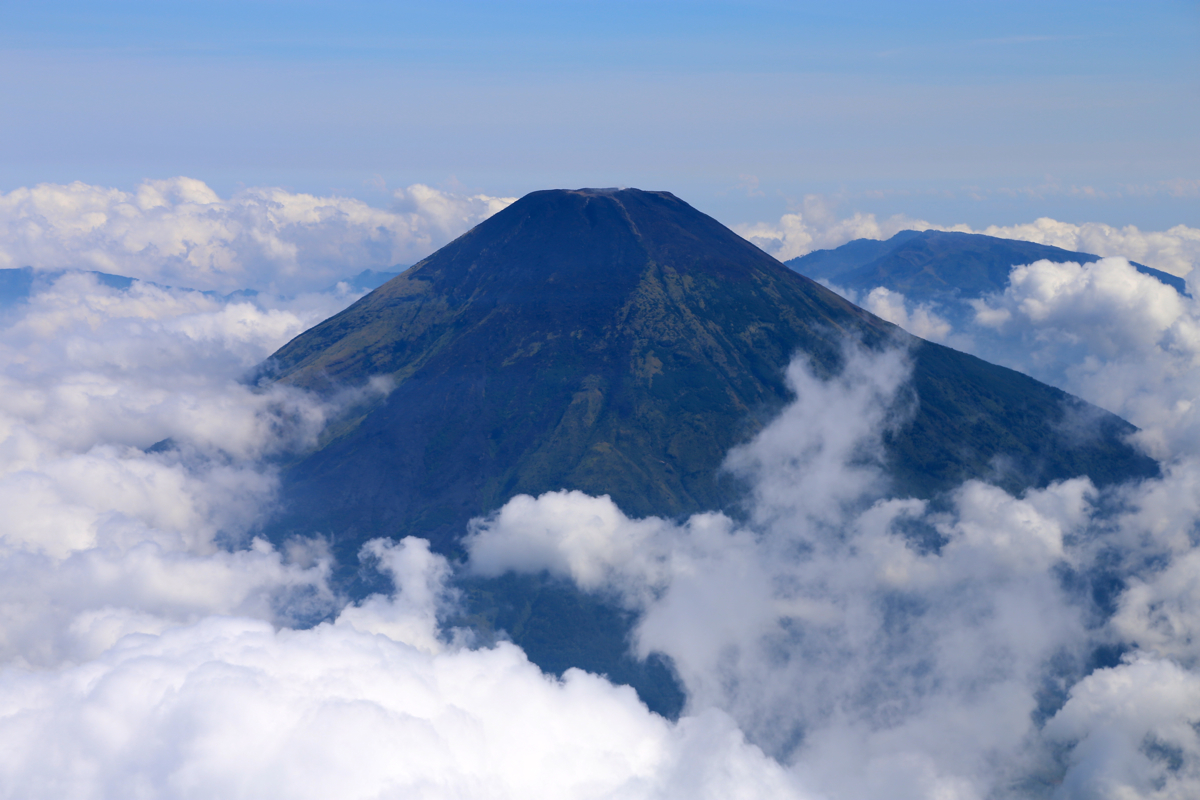
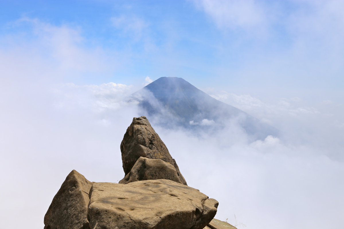
We had good views across to Slamet, also back down
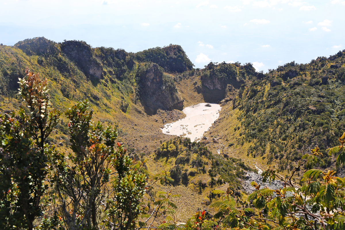
into the crater of Sumbing, a pretty
large, and somewhat stretched crater.
Also, the view across to yestedays climb
of Merbabu with
its neighbor Merapi.
Not to mention the little brother, Sindoro, that
I climbed 2 days ago.
We returned to the rim access point in 30 minutes. The climbing back up
was considerably easier (as it often is), since coming from below shows where to
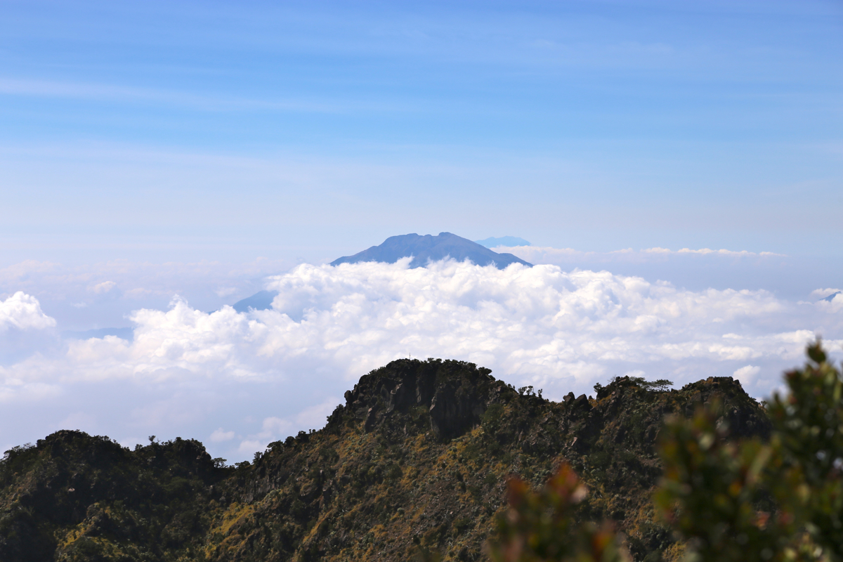
place your feet. The clouds were now rising and
even Sindoro began to disappear.
Proceeding down, we reached the starting point at 1300, then another
35 minutes to walk down the road to our car and driver.