Location: North 39.00253, West 106.08916 (GPS on the summit)
Difficulty: YDS class 2
Climbed November 11. 2017.
Information:
How to get there:
From Denver/Lakewood drive Hwy 285 to Fairplay. Continue about 15 more miles,
look out for a signed forest road that forks right. The sign reads
Buffalo Peaks Road. This is Forest Road 431. Drive this road 8.2 miles. You are
then at a place where the road turns right (away from the mountain). Park here,
location N39.02548, W106.09842, elevation about 3250 meter.
Route description:
There may be some old logging tracks that can be followed in summer. With snow on
the ground it is hard to locate any good path. The forest is filled to capacity
with fallen trees, hiking is somewhat cumbersome. Find a line that roughly gets you
to waypoint N39.01894, W106.09593, at around 3400 meter. Then onwards to a place near
N39.00726, W106.09586, elevation about 3650 meter. You are now out of the trees and hiking is
easy up to the summit. This summit has a small cairn built from characteristic, local
rocks.
Comments:
I arrived Friday evening in Denver for the 2017 Supercomputer conference.
Staying in Lakewood with my good friends Ellen and Sverre, I received a warm
welcome and traditional Mexican dinner. Sleeping late on Saturday, the main
priority being to adjust the jet leg. My plan was to attempt Mount Ouray on
Sunday and just move to its neighborhood on Saturday. It got dark already at 1700
yesterday so I knew that a hike today would have to be short.
After Fairplay, I noticed the sign "Buffalo Peaks Road" and recalled that this
peak indeed has prominence around 600 meter.
I drove Forest road 431 8.2 miles, at this ppoint the road turned away from the peak,
so I decided to park. There was no indication of a trailhead - too bad. I did not
have any map or information, but some hope that the summit was on top of
the mountain as I had seen it from the forest road. (There was a sign along the road
pointing ahead and saying "Buffalo Peaks".
The forest road had mainly a snow surface, no problem to drive on, but I realized that
I would be hiking in snow in a pretty long forest slope.
I left my car at 1250, heading more or less straight uphill. The snow was not terribly deep,
so hiking was ok, but I immediately felt the lack of acclimatization - thin air up here
compared to Bergen that I just left.
The main trouble soon became pretty obvious, fallen trees all over the place. In fact so many
that they had fallen on top of each other and effectively blocking the way. The route turned
zig-zag, always trying to spot a path that avoided climbing across these obstacles.
Thus, I was very happy when finally breaking out of the trees and into pretty nice above
timberline terrain. The bad news was the view of East and West Buffalo peaks now coming
into view. They were clearly higher than the mountain I had seen from the road. Which one
would be the highest was hard to say. (West is 4062m, 8meter higher than East.) However,
it was obvious that my available time would not permit any ascent of the two peaks. My goal
would be the highest point on the mountain that one can see from the highway. Hopefully,
it would rank as independent.
I arrived at the small, but nice cairn at 1430. It was cold and windy and I did not take
any pictures (obviously a mistake!). However, the view was pretty nice, both across the
plains of Fairplay, as well as to the East and West Buffalo peaks in the opposite
direction. I stayed only 5 minutes before starting back down.
The descent was uneventful, slightly easier walking down-slope in the snow, but the
maze of fallen trees were equally troublesome. I took a slightly more direct course
downhill and arrived back at my car my 1600. Only one hour until dark, confirming my
decision to not even try the two main peaks.
I drove onwards to Poncha Springs and checked into a local motel, Poncha Lodge, a rather
modest, but completely OK place. Hopefully, tomorrow I can climb Ouray.
Resources:
Images
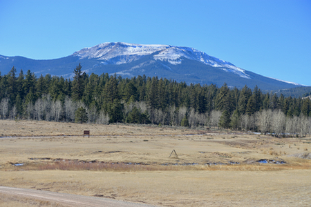
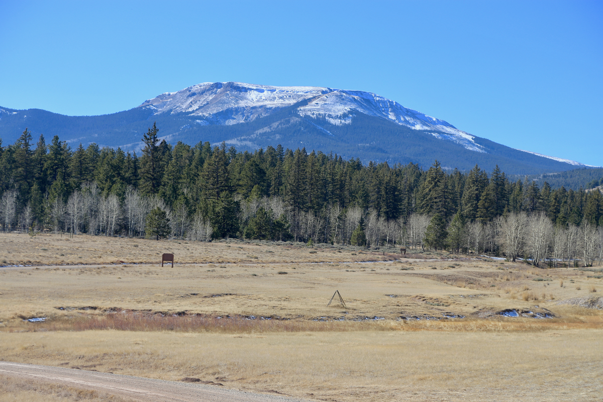
Buffalo Peaks. as seen from the road. The East and West peaks
are hidden behind. UN 12644 is essentially the highest visible point.