Location: North 46:30.541, East 10:32.694 (GPS at the summit)
South Tirol, Italy
Difficulty: YDS class 4, PD+
Climbed: August 30, 2008
Information:
How to get there:
The starting point is the small village of Sulden in Italy. You may reach this
village from the south via Trento and Bolzano, then Hwy. SS38 north and west to
Spondigna where SS38 makes a left up the valley to Gomagoi. In Gomagoi, one turns off
to the left and drive a short stretch up to Sulden.
Alternatively, one may approach via Landeck in the north or from Davos to the north-west.
In the former case, go south on Hwy. 180 to reach Spondigna or in the latter case,
go south-east through Zernez along Hwy. 28. Coming this way, you cross Pass dal Fuom (2149m)
where Ortler comes into view.
As you enter the small village of Sulden, look for the church on your right
hand side. This is just as the road curves left. Turn right and then left as you
locate parking behind the church. From here, you have a short walk next to an open
field in order to access the chair lift. This is the trailhead, location
N46:31.604, E010:35.069, elevation about 1850 meter.
Route description: Hut hike:
After exiting the chair lift, hike around on its lower side and follow
a road that traverses left (when viewing down slope), as it also
descends a bit. Locate the trail that traverses the basin while preserving
as much elevation as practical. This trail curves around along the hillside until
traversing some old moraine terrain, then starting its climb up to the Tabaretta hut.
From this hut the trail continues on a long traverse, then more zig-zag in order to reach the
crest above. From here, the trail stays right of, but fairly close to the top of the ridge
until arriving the Payer hut.
The trail to the hut is quite nice all the way, a bridge has been put in to cross a section
that would otherwise be difficult. The last stretch along the ridge has a few cables as there
is some exposure, however the trail is fine and mostly horizontal here.
The Payer hut has a rather spectacular position as it takes up
almost all available space on the fairly narrow ridge.
The hut has many somewhat smaller rooms, a design I find preferable to having a couple
of gigantic rooms for sleeping. Reservations can be made by calling +390473613010.
From the hut, you have
a good view of Ortler, however
many complications and quite a bit of hidden terrain is not visible.
Summit climb:
The route starts directly from the hut as it traverses to a small col on the main
ridge before a somewhat longer traverse across a loose slope. Beyond here, the first
(YDS) class 3 moves are needed in order to descend a steep, but short step. Further onwards,
the route either crosses a somewhat level section
before descending steeply towards
a new col, or one can descend right and contour around this step on the right hand side
(when facing towards Ortler.) The route continues with more uphill climbing, there are small
variations here and there. The terrain is generally quite loose and
care is important in order to avoid any mishaps.
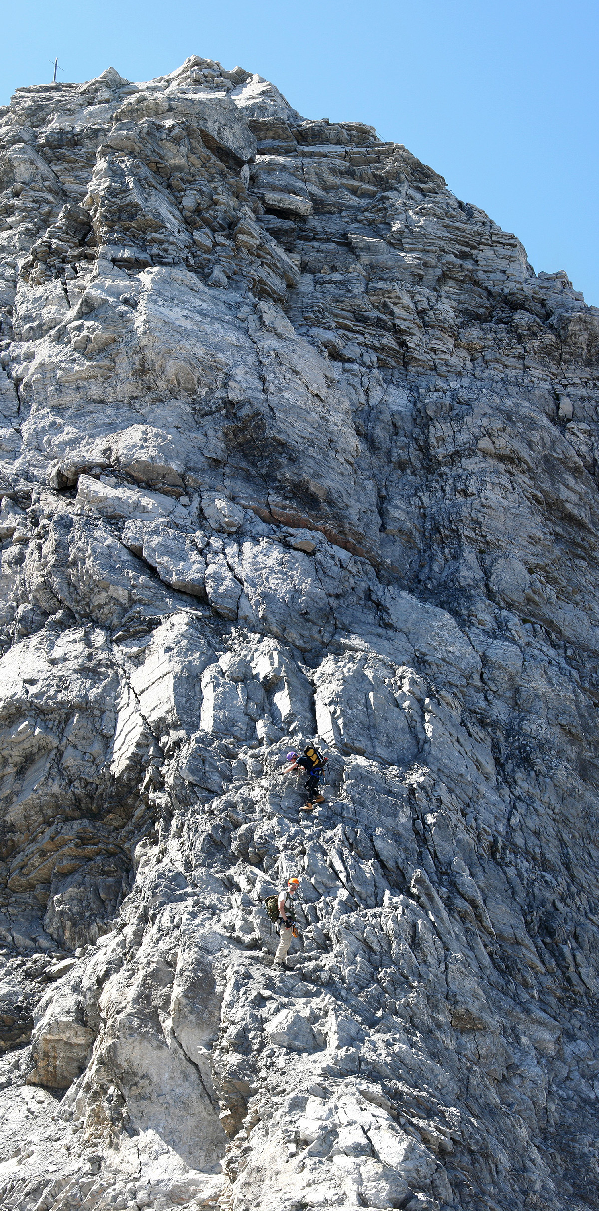
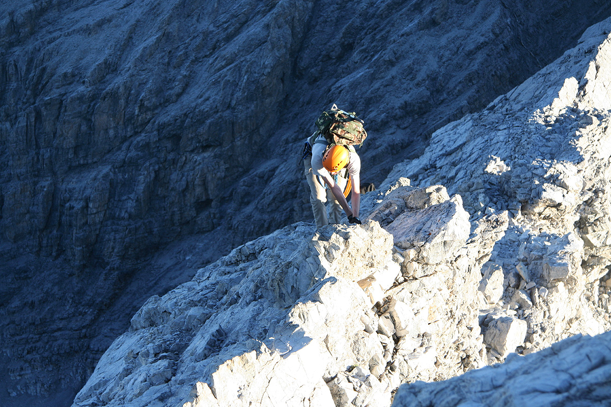
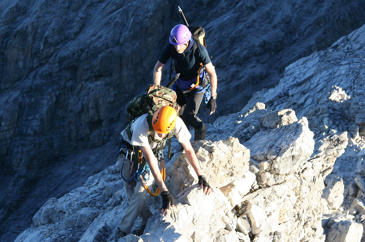
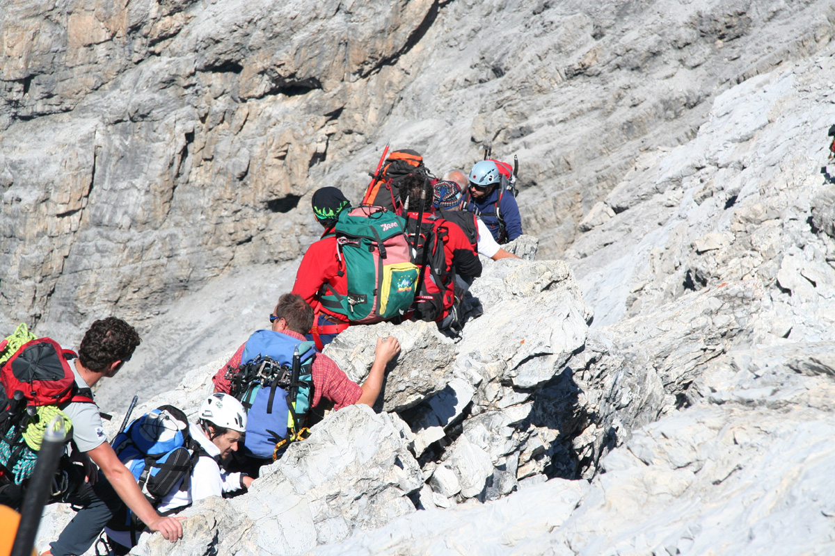
Eventually, the sustained scramble gets you down to a new col in the main ridge, followed
by a fairly high and steep rock ridge.
There is a chain along this section and (finally!) the
rock is good with quite a few holds for hands and
feet. The climb up here is (YDS) class 3 when
using the chain, class 4 (UIAA III) if the chain is not used.
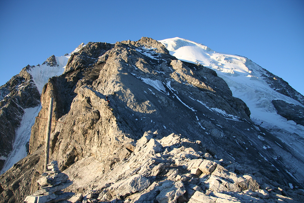
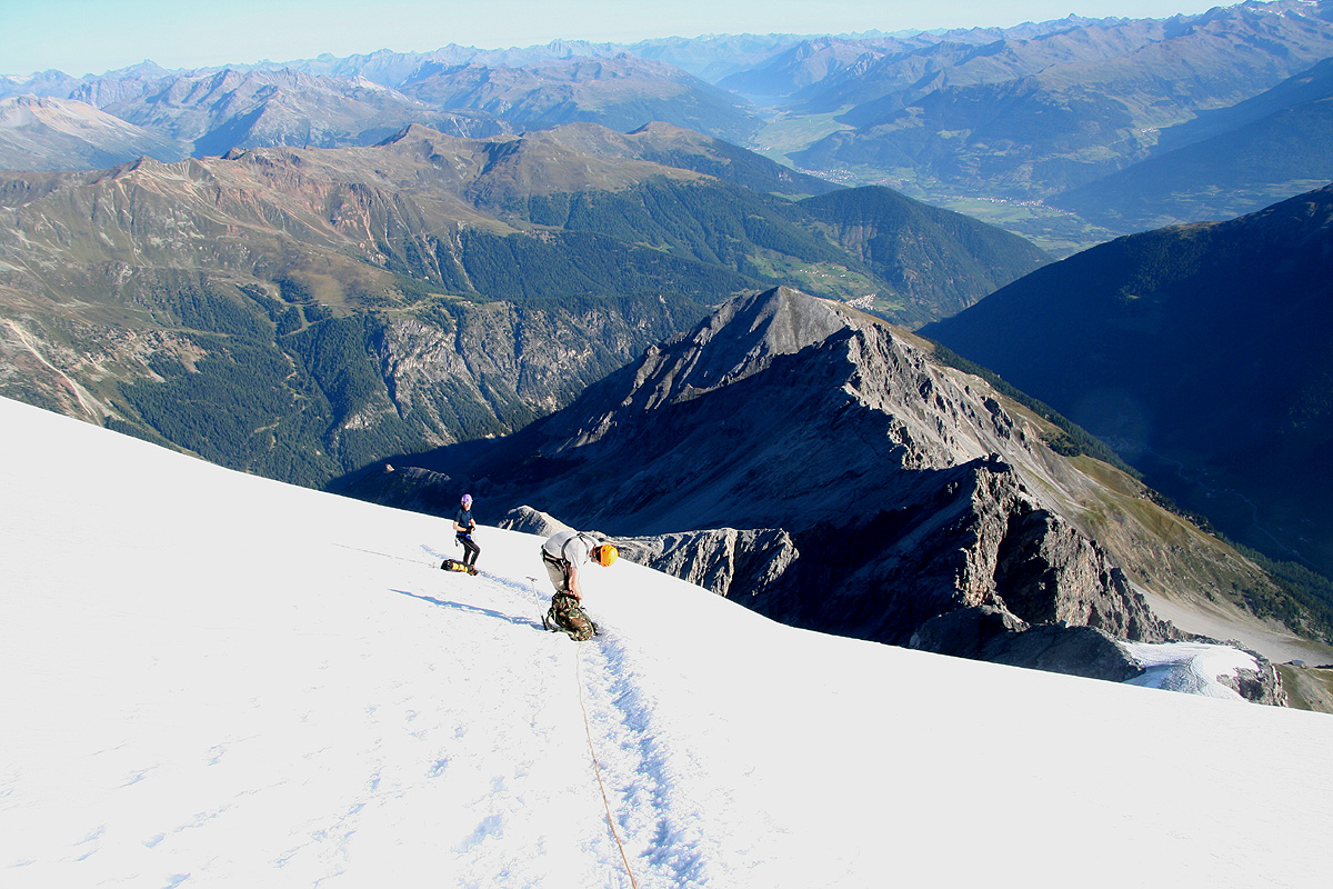
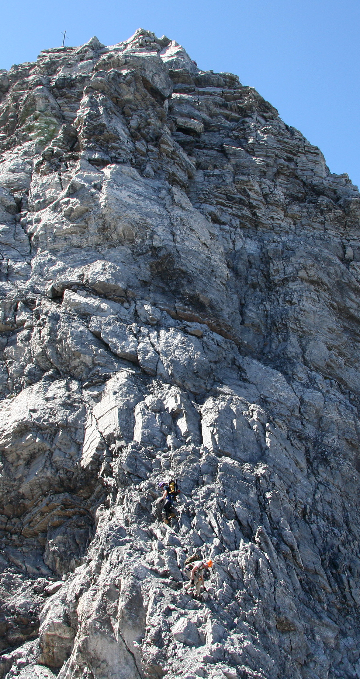
From the top of this ridge one can see the rest of the rock route
and its access point
to the glacier. One follows the ridge, as it gets
more narrow, then starts to angle more
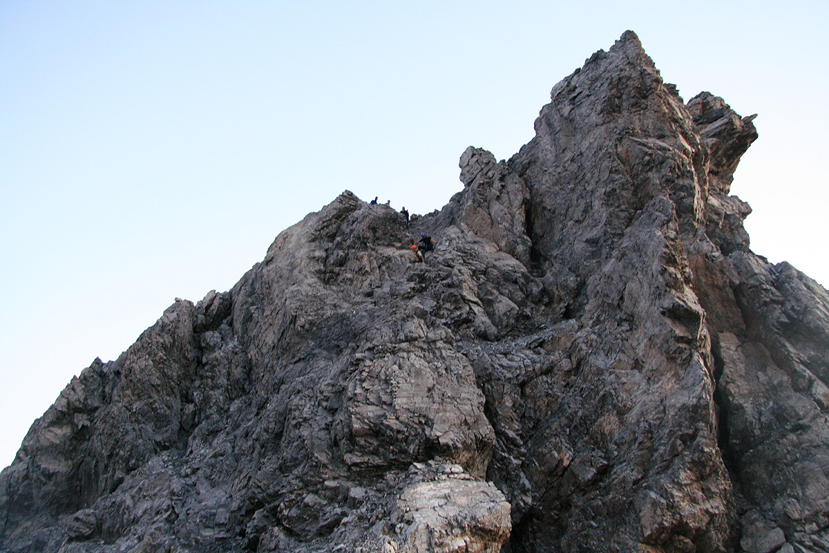
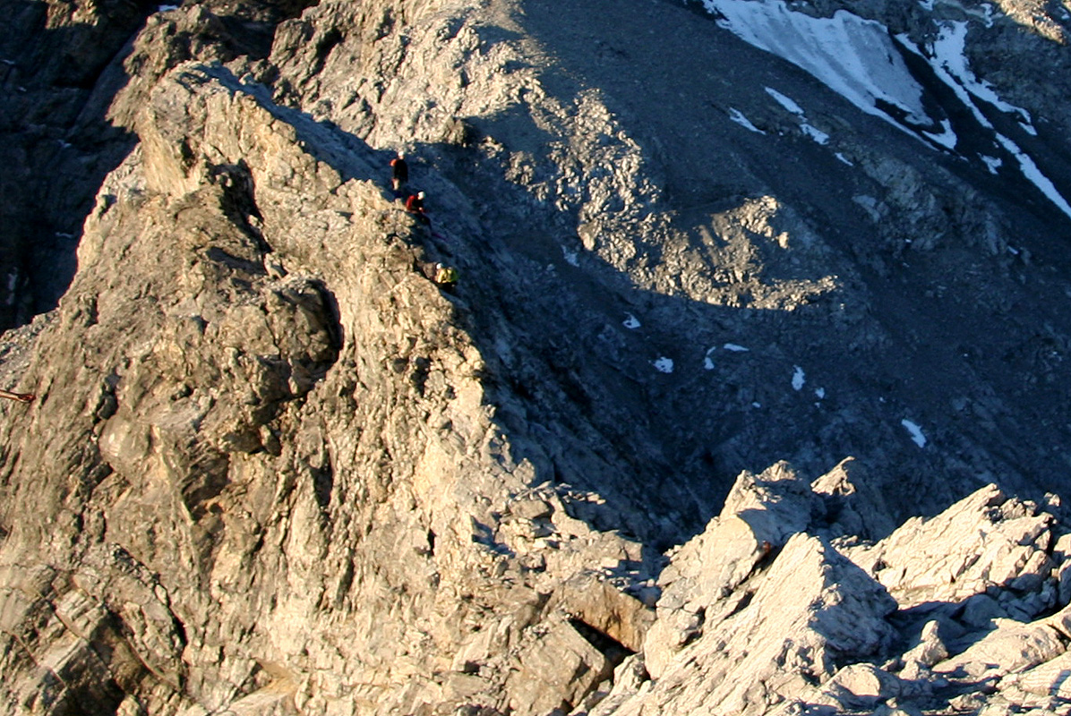
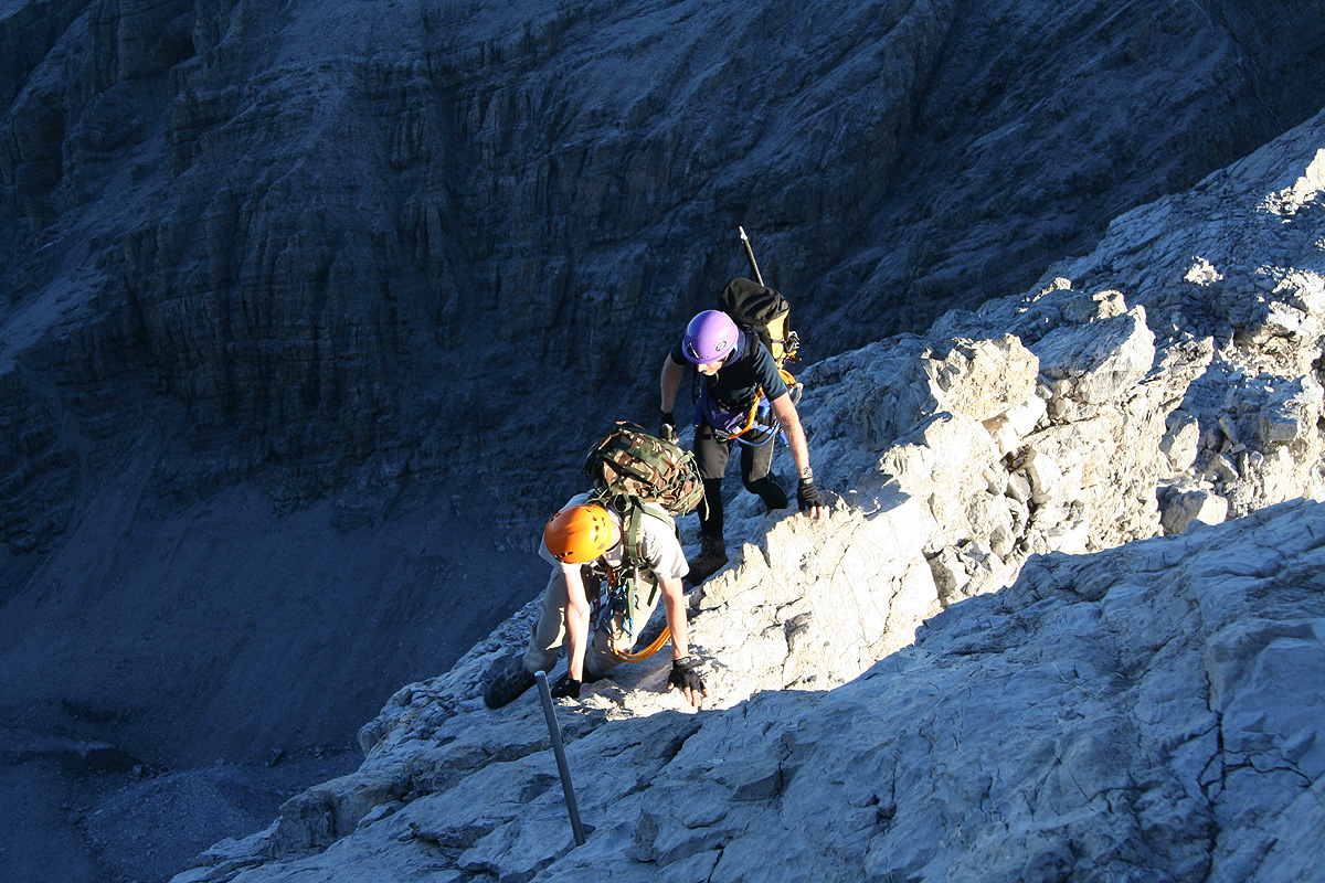
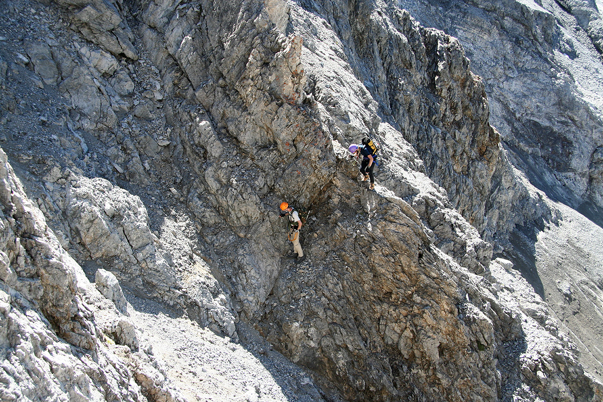
upwards as well. The previous picture shows three
climbers on the very narrow (and quite exposed!) part
of the ridge. The lowest climber is right near
the crux of the rock route, a step on the very narrow
ridge. This is definitely (YDS) class 4 terrain. After reaching a new col on the ridge (behind the helmet of
the upper climber), the route traverses rather easily to the right (where many climbers can be seen in
the picture).
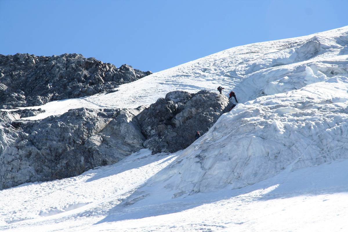
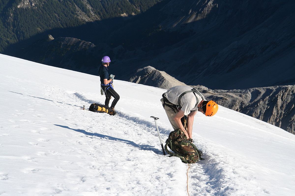
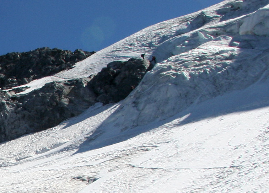
The glacier route also has a few points that should be negotiated rather carefully.
First, the route zig-zags up a moderately steep glacier.
Higher up, a rock band is blocking
most of the way. With climate change and global warming, the glacier is shrinking and this
rock band becomes a more and more serious obstacle since it is steep and keeps getting higher.
We were still able to stay on the
ice and climb around the right end of this rock. On descending,
many climbers decided to rappel this cliff instead of down climbing.
Above this cliff band, we continued a zig-zag ascent of a rather icy slope before reaching easier ground.
The only potentially difficult section above this point was the rather steep part of the next snow slope.
It is possible that also this steep section turns to ice very late in the season. In such a case, this
area may require belays for safe passage.
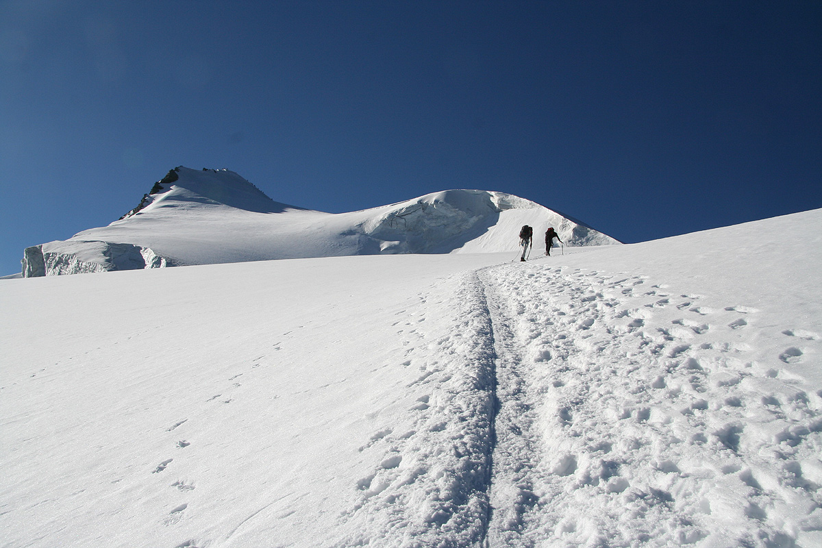
Above the steep step of the glacier, the upward slope gradually eases.
The route contours around what looks
like a local snow hump on its right,
then turns more left to gain the short, summit ridge. The summit
with a nice cross is located at the far end of the short ridge.
Comments/Trip Report:
I did this climb together with Andy Tibbett and Rob Woodall. We had agreed to meet
in Sulden and attempt to climb Ortler.
The trip started with an unpleasant scare, I had set my mobile phone alarm for 0445 and
prebooked a taxi for 0500, in order to catch my 0600 flight. However, as I half asleep looked
at my watch and read 0515, I realized that something had gone very wrong indeed. My wife drove me
(fast) to the airport and I caught the flight with zero time to spare. On board the airplane, I
realized that my mobile phone was still at US time, that is 6 hours behind.
I flew via Copenhagen to Zürich, then
drove to Sulden. It took me about one hour to clear out of the airport and fight
traffic in the center of Zürich, then 4 more hours before getting to Sulden where
Andy and Rob had arrived just 15 minutes earlier. They were about half-way with their two
week mountain climbing vacation and had invited me to join them for this weekend.
It was my first meeting with Rob, a very accomplished mountain climber/hiker that sent me
an email already in September 2006 suggesting that we should find some common objectives.
Andy suggested that he should only do the hut hike and let Rob and me attempt
Ortler. I immediately turned this idea down and strongly requested that we all three should
set out for Ortler the following day. Obviously, we should be prepared to help make this
ascent a safe and memorable one for the entire party.
We got off the chair lift at 1630, then had a pleasant hike in about 2 hours to the Payer hut.
Dinner at 1900 tasted well and we were all prepared for an early morning start. Getting up at 0500,
we deliberately did not hurry in order to start just at dawn. I left my headlight behind in the hut as we
started walking around 0600. Daylight was coming fast as we carefully walked along the narrow
climbers trail with small loose rocks seemingly everywhere. We could see a few headlamps on the slope,
thus indicating where the route led.
Obviously, most people were ahead, but the day was long and the weather forecast perfect, so no need to
hurry. We moved along and soon I came to a rather steep downclimb towards what appeared as a major
col in the ridge. The route sorted itself out and as I got down, I also noticed a bypass trail that
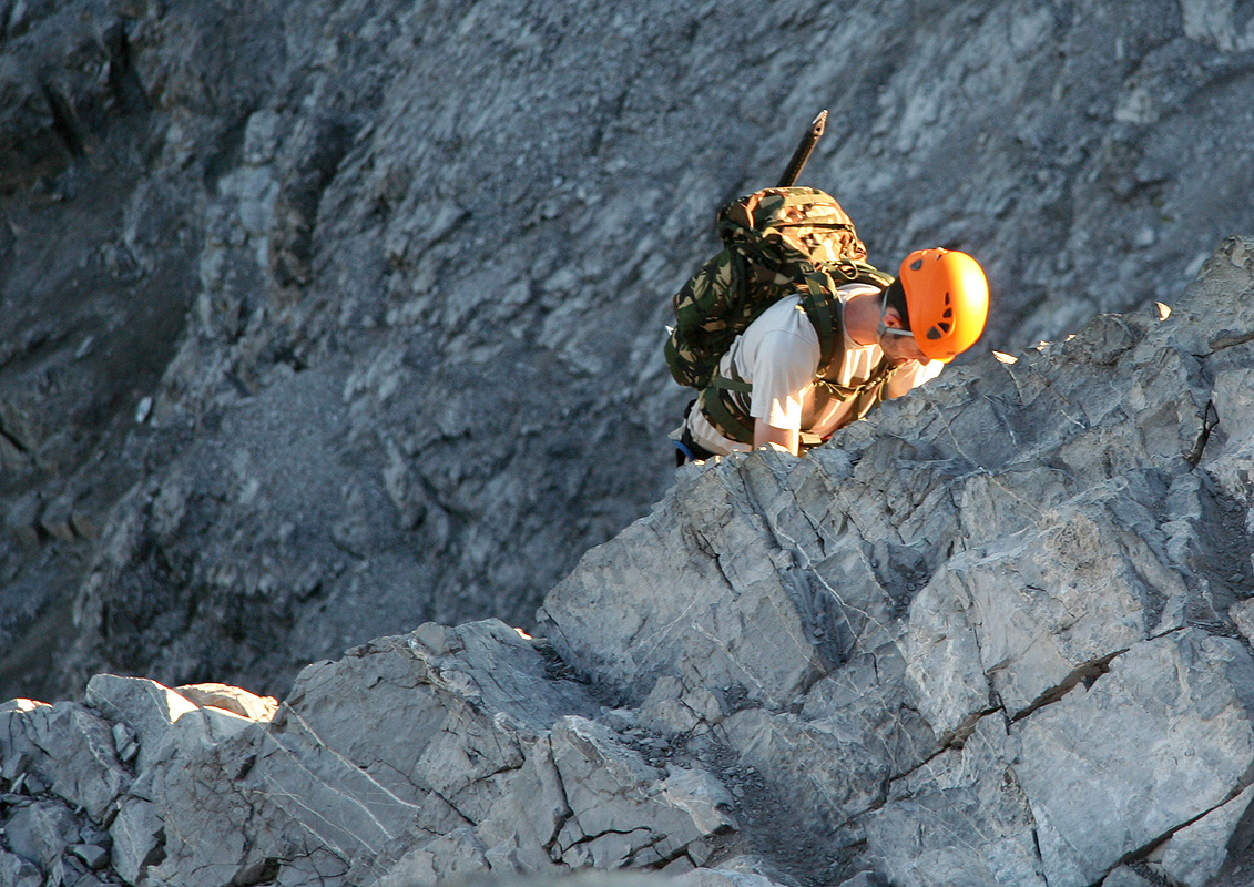
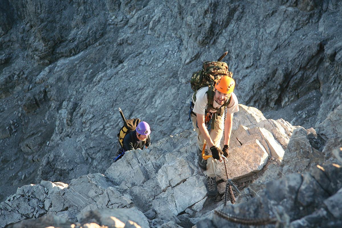
seemed quite popular. We continued along and arrived at the steeper ridge. I had asked that we all bring
a "Via Ferrata Kit" along, in this way one could self-belay this part of the route. Getting to the top,
I could now see the rest of the rock route as it was obvious where people changed into crampons and roped
up for the glacier part. Between there and here, a very narrow and very exposed ridge that connected to
a somewhat higher col, needed to be traversed. I observed 3 climbers on the ridge, the last one obviously
having some difficult section to cross.
Our climbing up and along this ridge went quite well.
There is certainly a crux move and I realized that it
would be even a bit harder to down-climb. The rock on this part was very good and I was impressed
by Andy, he moved easily and seemingly without
much fear across and up. We hit the col and could follow the
easy climbers trail across the last slope to find a very nice point of access to the glacier.
From descriptions I had read, it seemed like we would have to climb a short, but steep rock step also
higher up. By looking ahead, I soon realized that this would not be needed provided we could climb the
somewhat steeper ice just at the right end of the band of rock. The conditions were nice and this climb
as well as the next two slopes went rather easily. This was ice, not snow - and any slip here would be difficult
to stop. Knowing that Andy had limited experience on ice, I reminded him to be careful and check every
step. Most likely, completely unneccessary, he came ascending upwards with all required skill and caution.
What remained was the steep step above. It looked easy from a distance, but here perceptions deceive you
compared to looking at a similar section of rock. Rock almost always looks harder than it is when viewed directly
on from a distance, with a snow slope it may often be the opposite effect. The steepest part was indeed
quite steep and care should be exercized. The small trail made by numerous climbers was certainly helpful.
If the snow melts and turns this section into an ice slope, then this would indeed become a new difficult
point on the route.
From here on, the climb
was an easy walk along a good track in the snow. We arrived at the summit at
0930, quite a few people were already sitting along the top ridge. A few teams were also coming up from
the opposite side along the route called Hintergrat (difficulty AD).
Fantastic weather! No wind, warm sun
and clear sky. A mountain landscape laid out in all directions. I took a 360 degree panorama that certainly
captured many well known peaks. We rested and had some (early) lunch.
Photos at the summit cross, followed
by helping other teams with their summit pictures. At 1030, we felt ready to start the descent, knowing that
it would take at least the same time as our ascent.
Descending the steepest snow section, we were overtaken by a team of two. Completely
needlessly, they passed Rob and Andy, then could not easily pass me since I was right at the short,
but steepest part. It would have "delayed" them at most 3-4 minutes if they had waited for us to get
back down on the easier slope. Such behavior is, unfortunately, quite common in the alps and
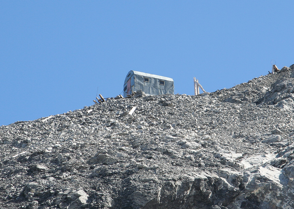
shows a lack of good mountaineering manners. Further down, we observed that most people seemed
to go out the main ridge to the (unmanned) hut Bivacco Lombardi,
then traverse down towards the
rock band and descend it via a rappel. As our
rope would likely be borderline short for such
a rappel and since the icy section we had climbed up seemed well within our skills to also
climb down, I never gave this option much consideration.
We proceeded down the same way as
our route of ascent. A team of two had set up a belay with an ice screw by which he secured
the descent of his girlfriend. We waited until they were all done, after all, we should all be out
to enjoy the mountain and the scenery should'nt we? There is clearly some increased risk of
ice fall (seracs) in this area, therefore not a place to spend excessive time, especially not
late in the day. Everything looked quite frozen and stable and our down-climb, which I protected
from below, went without any difficulties.
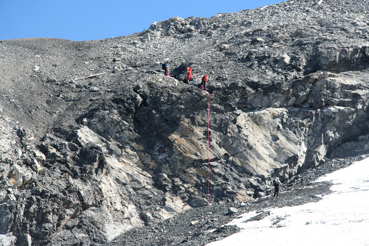
The exposed rock ridge had turned into a real bottleneck. As we approached,
the ridge was jammed by climbers waiting for people
ahead to descend the step in the ridge. Fortunately, most people
understood that the only thing to do was to enjoy the fine scenery and let people take whatever
time they required. Most teams were roped and made improvised belays in order to safeguard each other.
Sitting there for a while, at least has the effect of making people getting used to the location.
We descended without the rope, but used three connected long slings for extra safety.
The rock ridge protected
by a cain was down-climbed pretty much like we climbed it, each using a
via ferrata kit for protection.
On our way back, I accidentally followed what looked like a good climbers trail down a broad gully.
This turned out to lead us off-route
and another gully with very loose rocks had to be crossed
in order to get back on route. I apologized to Rob and Andy, we definitely did not ask for more
complexity than what the standard route had to offer! A side effect of this was that we bypassed the
somewhat steep section that we had down-climbed on our way up. This bypass is clearly the easier route.
We came back to the Payer hut by 1430, 30 minutes more on descent just shows that this was generally
fairly complex terrain.
A well deserved relaxing time outside on the terrasse followed. A large beer further
contributed to the good feelings near the end of a day that brought many good
memories. We left perhaps closer to 1530 in order to descend back down to the
chairlift. As we passed the Tabaretta hut, it occurred to me that the last chair lift
would be at 1700 and that was only 45 minutes away. We continued at a reasonable speed and
arrived at the top of the lift with less than 5 minutes to spare!
Back down at the cars, we agreed that the planned one day ascend of Pizzo Coca would perhaps
be a bit heavy, considering that we would also have a pretty long drive to get there. We therefore
decided to travel to the base of Piz Kesch and aim for a one day climb the next day.
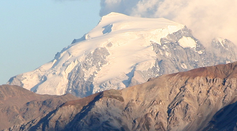
Crossing back over Pass dal Fuom, we stopped and took a last
look at Ortler glowing in the evening light.
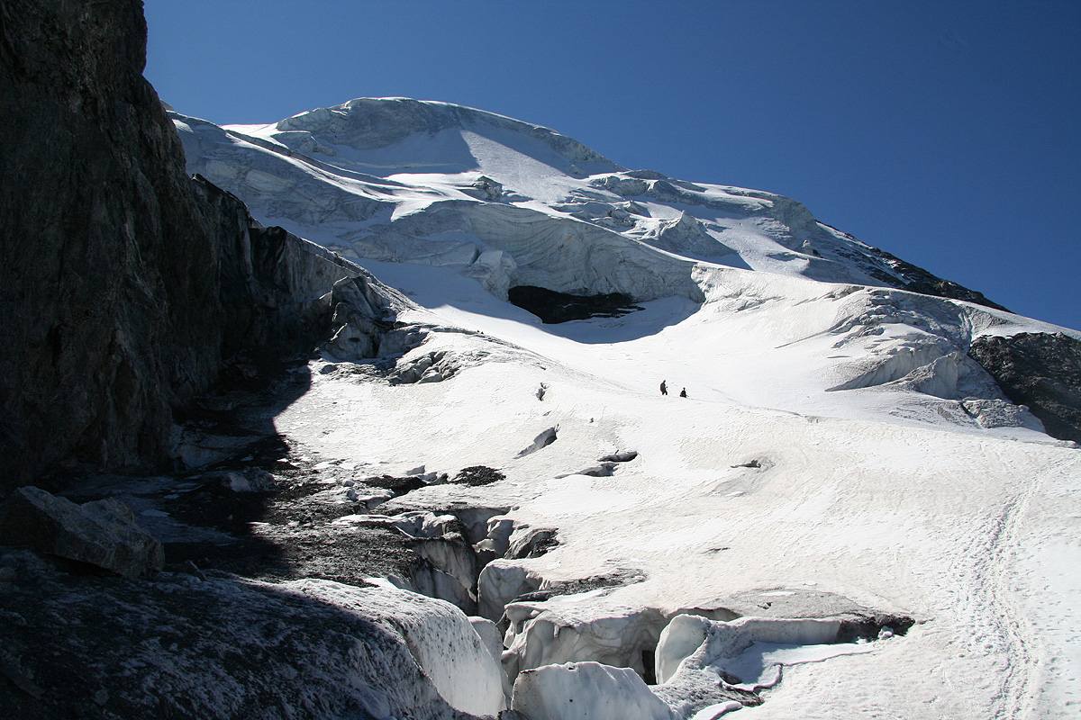
Above the steep slope. The Payer hut can be seen out on
the ridge. The Bivacco Lombardi, closer near the end of the snow. We ascended ice
on this side of the Lombardi, then the steep snow slope from the snow that can be seen below.