Location: North 37.39317, East 034.63088 (GPS on the summit)
Difficulty: YDS class 2
Climbed July 19. 2016.
Information:
How to get there:
This summit is about 60 kilometer north of Mersin, a town at the very
eastern part of the Turkish coast. Access is from the north.
First locate Hwy. D750 running east-west north of the peak. The starting
point is a road going south from D750 at location N37.52053, E34.57964, there are
(different) signs for Darbogaz and Gumus here. This road is located 5.6 kilometer
east from the main intersection (where D805 heads north from D750) in the
town of Bayagil. Measure from here (km 0.0).
At kilometer 1.2, go left, there is a sign saying Gumus 5. At kilometer
5.4, you enter Gumus, then immediately, keep right. Drive uphill, then at
kilometer 8.7, sharp left, more uphill. The road climbs steadily, at kilometer
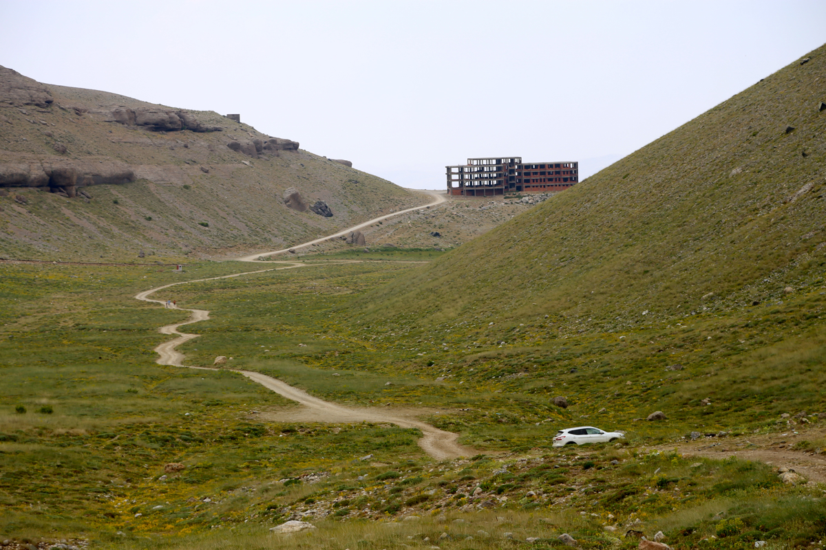
12.6, turn right onto a good quality dirt road. This road climbs a ridge and continues
on the very top of the ridge towards an unfinished building (now looks like a ruin),
shortly before you may drive left or right around a small hill. This building is at
kilometer 18.7. Leave the dirt road here, going left around the corner of the building,
descend to a small valley basin and drive to the far end. You are now at the end of
a road, kilometer 19.7. This is the trailhead, location N37.41388, E034.56551, elevation
about 2360 meter.
It looks like the dirt road actually climbs to near a lake west of the route, this may
be an alternative trailhead, somewhat higher, but overall, most likely not much better
than the trailhead described.
Route description:
This is a very fine mountain route, however, be aware that it is quite long with
more than 1500 vertical meter of ascent along the way. bring enough water and plan
for a full day in the outdoors.
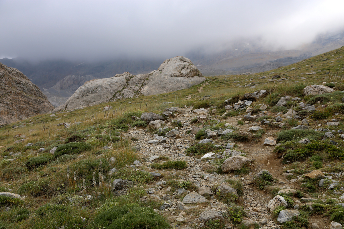
From the trailhead, start out along the only trail that climbs up in a little valley.
After a short while, you ascend on this trail on the right hand side of the small valley.
This trail connects to a lake that is sort of right when you face uphill, while the route
shall ascend a valley which is left. Thus, a short-cut is in order. Note the very first
time your trail passes on the right hand side of a
solid piece of rounded rock, just after this,
leave the trail left, descend slightly and find your way through what will be a pretty natural
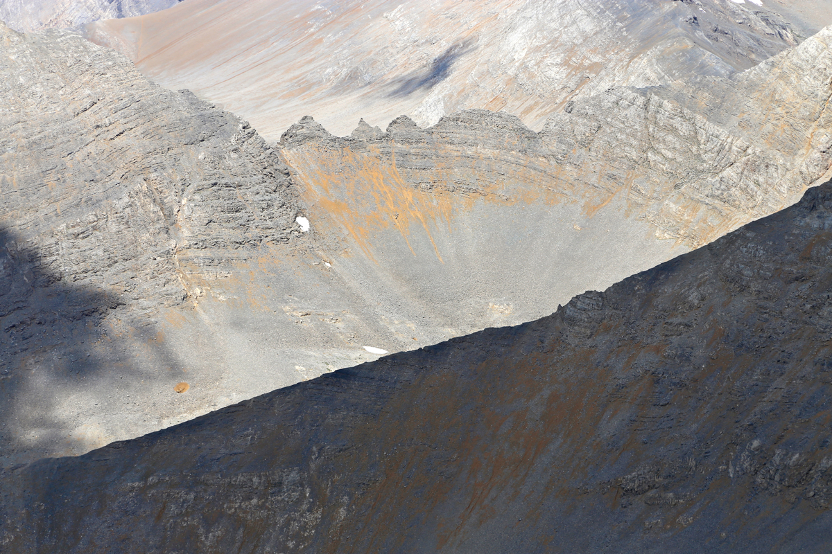
passage between limestone rock formations. The route follows the lowest possible path, sometimes through
quite narrow passages. Shortly, you will emerge overlooking a green meadow. Cross this and pick up
a trail that runs on the far side. This trail actually comes from the same lake (that you have avoided).
Follow this trail (left) as it ascends between large boulders, then continues uphill in the middle of
a pretty large valley. Your line of travel is now pretty straight ahead all the way to a small notch that
you can see at the horizon, up front. In order to get there, first complete the hike into and slightly
uphill in the valley, next, observe a very distinct gully that provides access to the next, higher level.
This gully is steeper, with some loose scree, but quite short and easy. Above the gully, the vally continues
more uphill, the line of travel is the same. The last section before the skyline is distinctly steeper with
a mix of rock and loose scree. Ascending along the left side enables you to stay on rock most of the way,
similarly, it may be better to descend in the scree more in the middle.
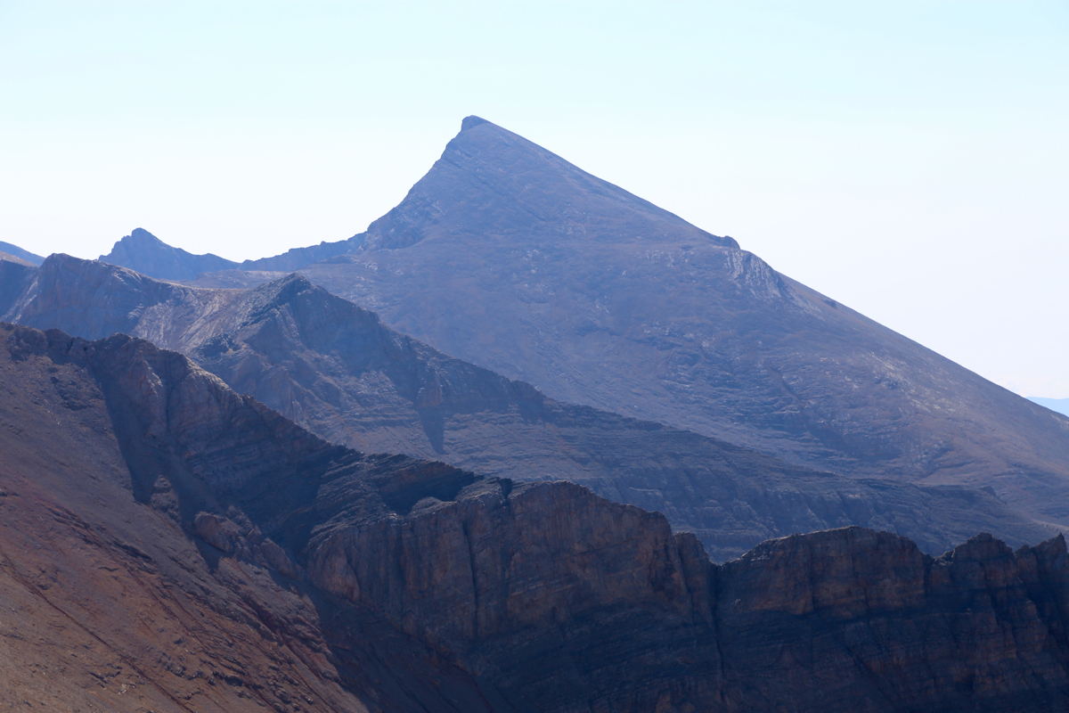
You will reach the small notch (or col) that you have seen since way down in the valley. This location is
N37.39684, E034.59541, elevation about 3390 meter.
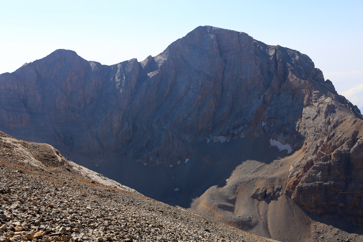
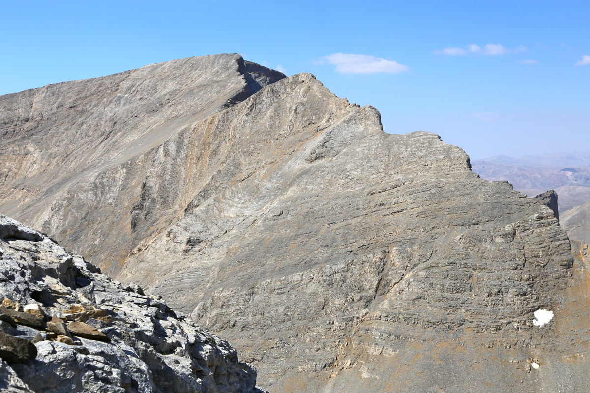
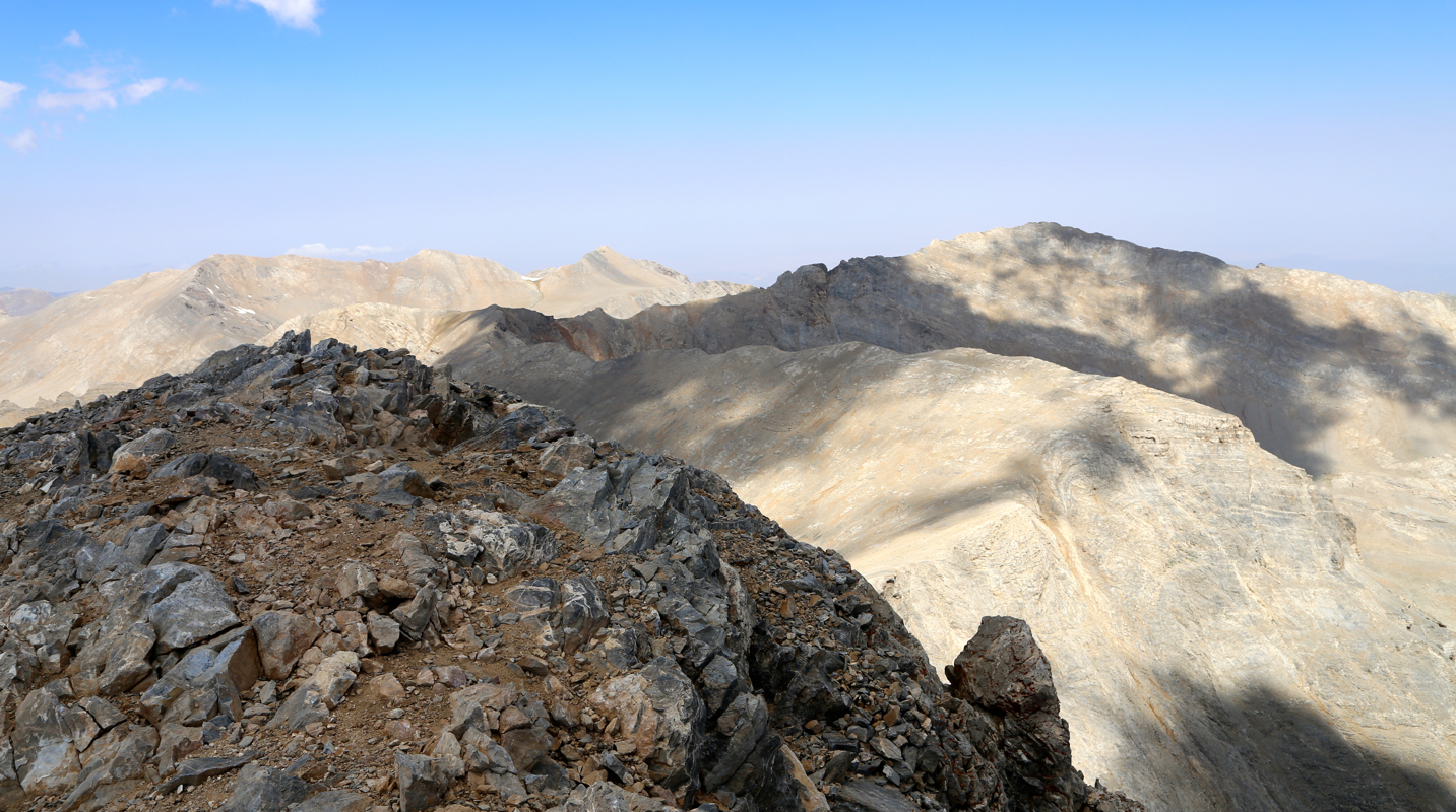
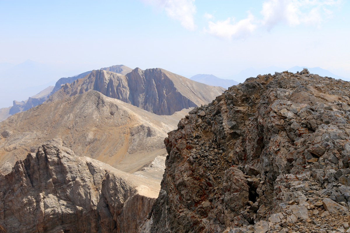
From here, you can see the summit, but there is quite
a long ridge traverse that still needs to be done.
You have a nice rock face across a basin on your right.
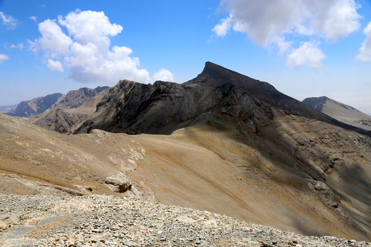
When facing Medetsiz Tepe, one should note
that there is a peak with prominence exceeding 150 meter, only about
40 vertical meter up to your left.
This is the highpoint
of the first ridge
that you will need to descend.
Consider climbing this peak, immediately or when returning.
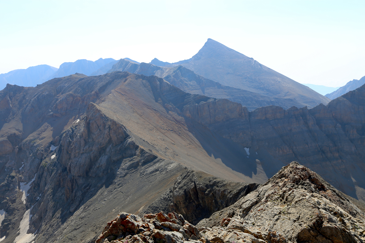
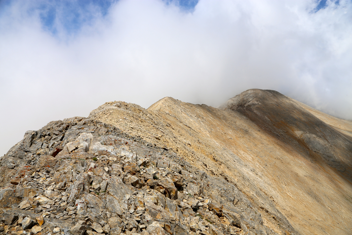
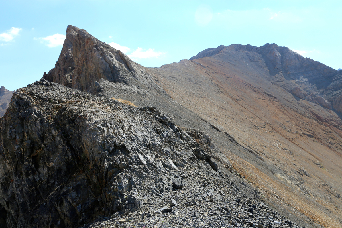
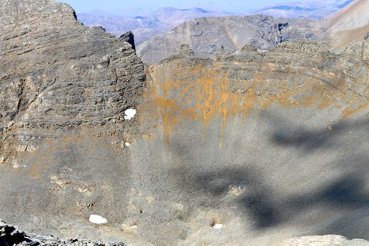
In order to access the ridge, do a climbing traverse left (from the col) until you reach or are near the
ridge. The route bypasses some minor cliffs on your right, but it is best to stay fairly close to the ridge
itself.
You will descend to the key (prominence) saddle of the peak located close to the beginning of the (ridge)
route, then ascend gently to a minor top. Cross
over the top of the ridge, very nice, but
quite easy. Next, the trail crosses on the right hand side of the top ridge, reach a big cairn trail marker,
then ascend in order to cross the last minor top before getting down to the final ridge that will take
you to the summit.
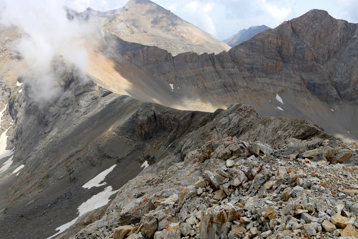
The main trail crosses the face, then turns (abruptly) uphill towards the summit. However, there is a
somewhat shorter trail that climbs more directly from the final saddle, try to follow this route, it may
be a bit shorter.
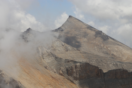
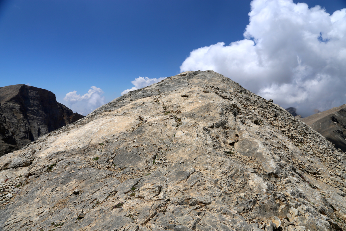
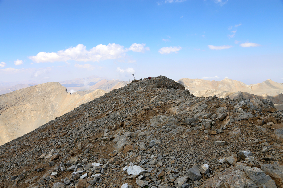
The summit consists of a short ridge with two points,
about 30 meter apart of similar height.
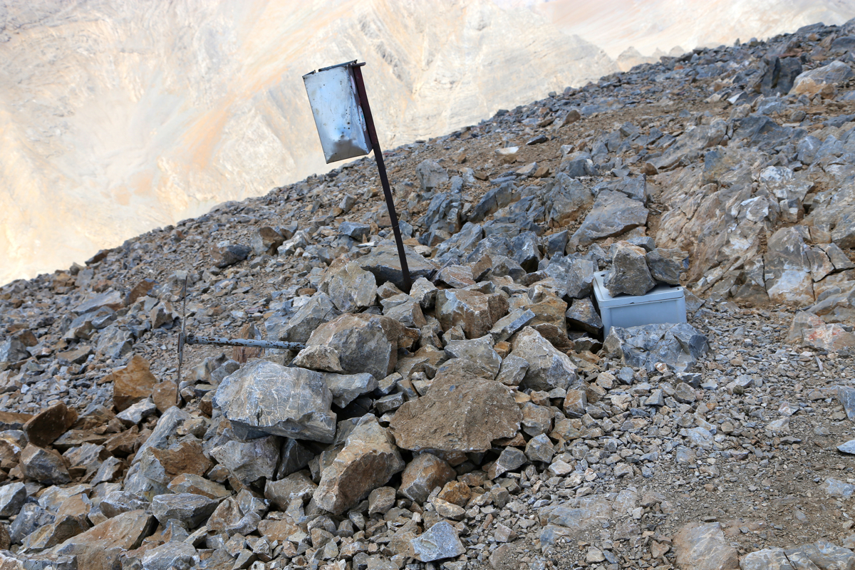
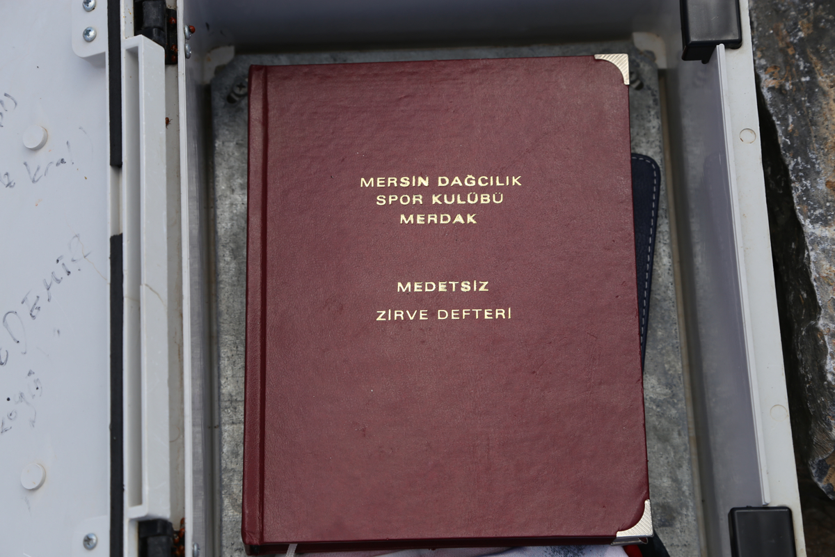
There is a cairn and a visitor register
inside a box protected by a few rocks.
Comments:
This was the last and final Ultra that could be climbed from our BC in Cappadocia, unfortunately,
the two other peaks in this area, require at least a party of two since one should use a climbing rope for
safety. The excellent trip report (on Peakbagger) by Rob Woodall, indicated that this would be a long day.
I started driving (from Uchisar) at 0410 and arrived
at the trailhead by 0615. Change into hiking gear and general
preparations, I was ready to go at 0630.
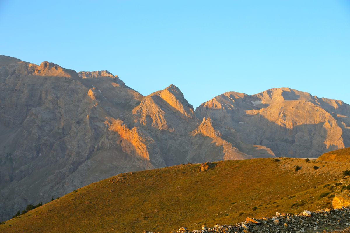
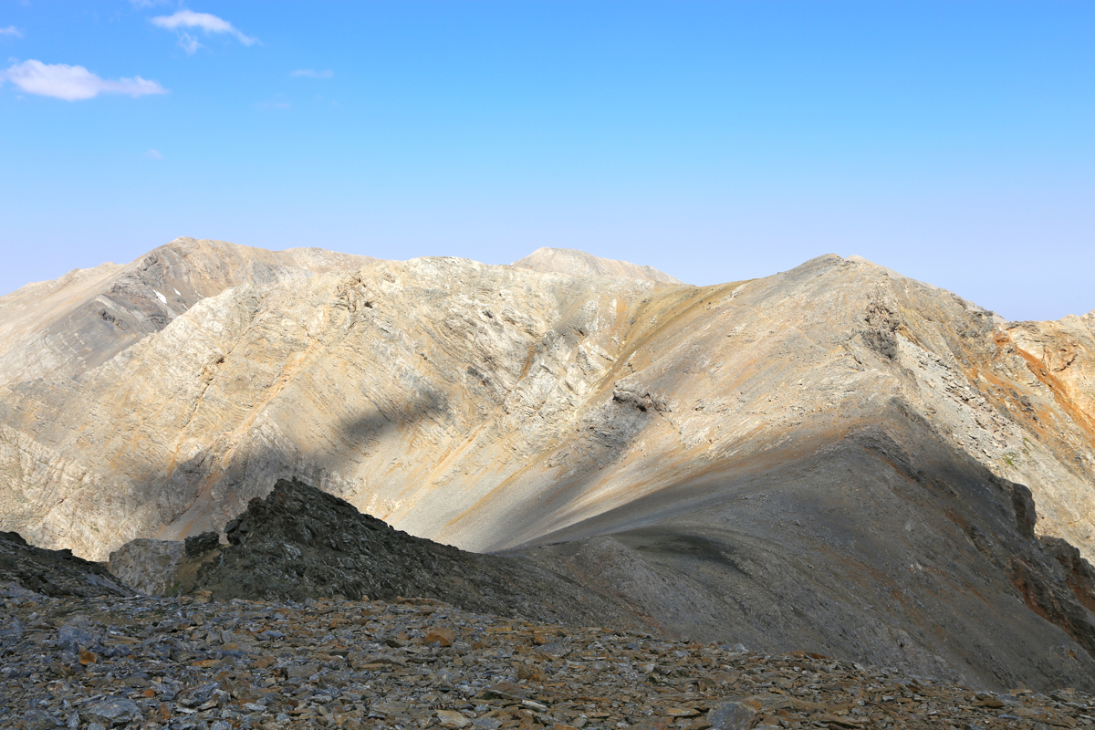
The morning sun was hitting the local peaks,
it looked quite rugged, but also very nice.
The terrain was nice and the walking easy as I gradually climbed towards the col at my local horizon. When the
terrain got steeper, I moved left in order to stay on rock and avoid the scree.
I arrived in the col shortly after 0900, some water and photography, before starting the ridge walk.
It did look like a long way, and it was not easy to see how the ridges would connect and how much elevation would
be lost and regained along the route.
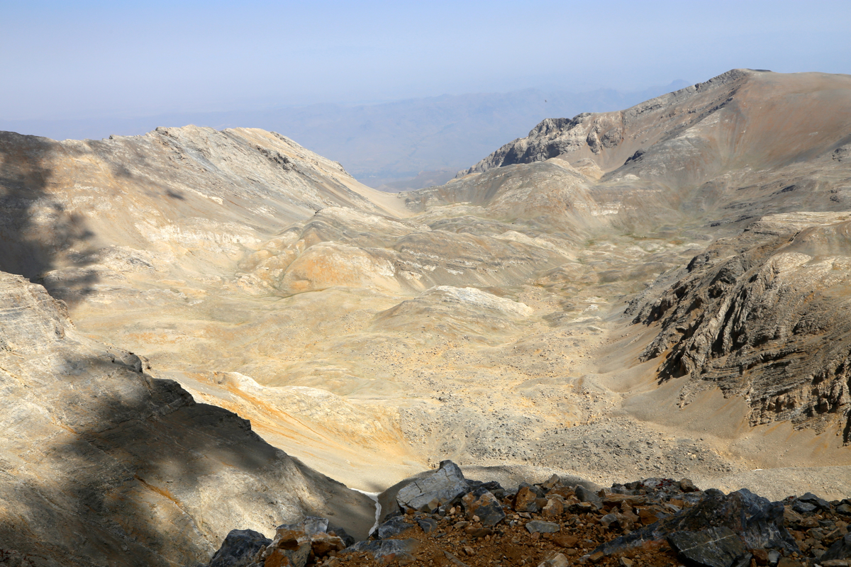
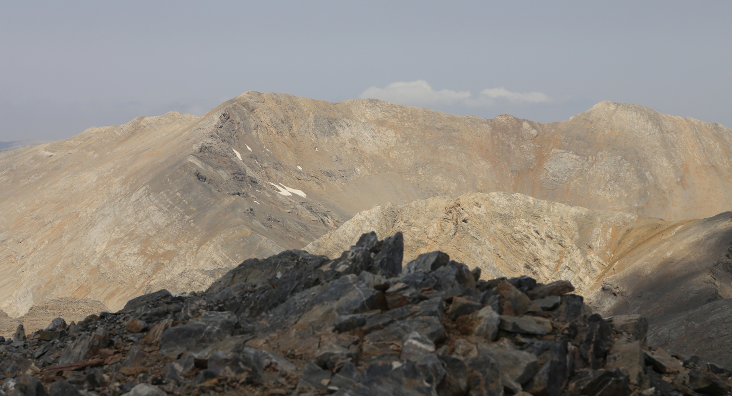
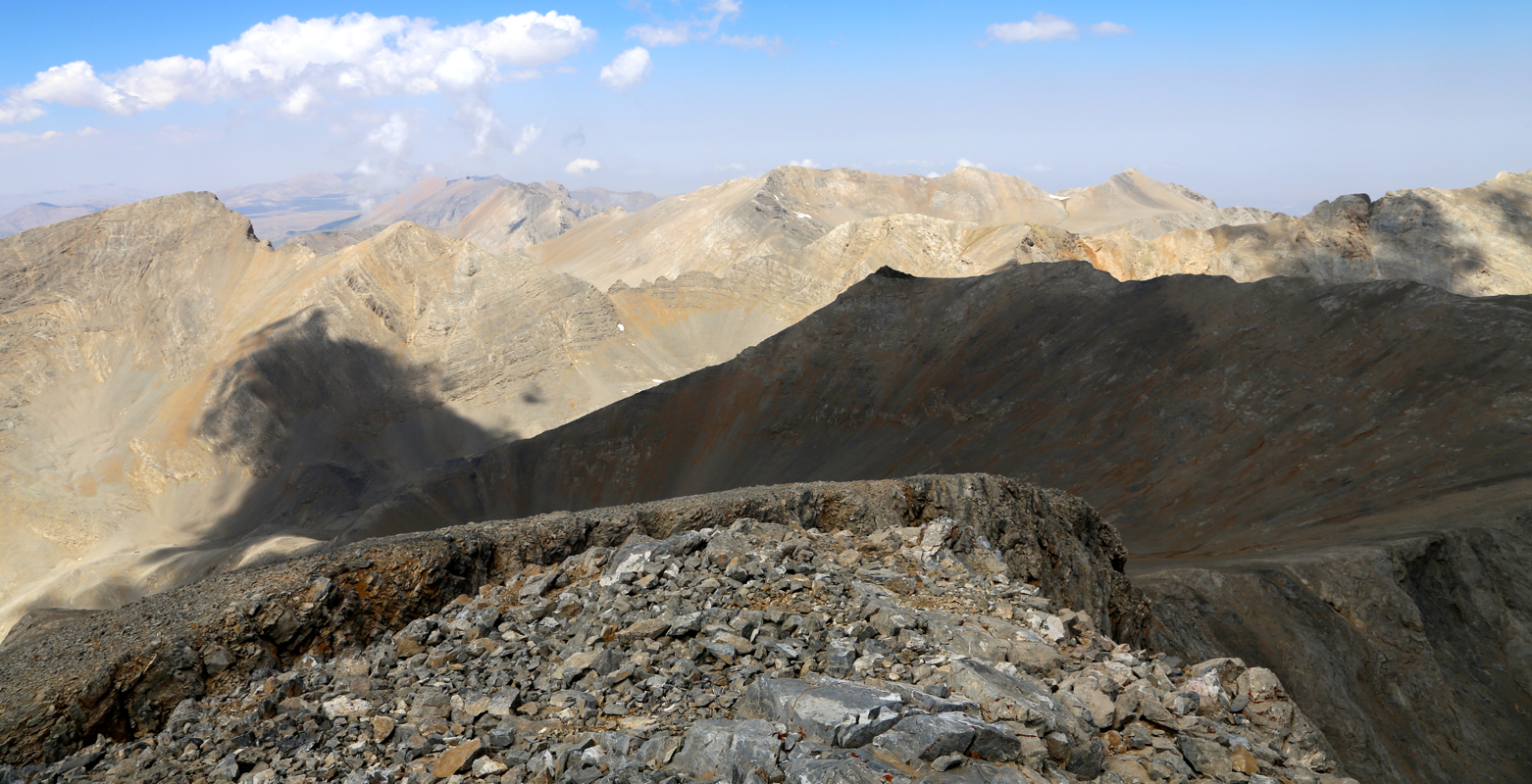
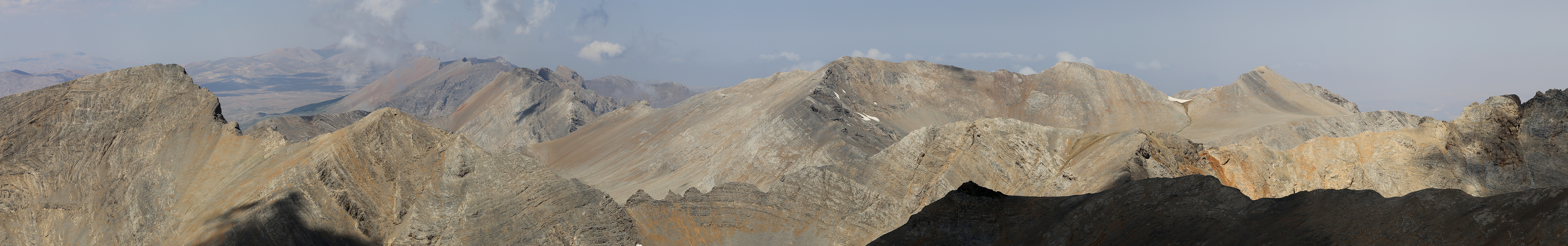
The scenery is very good, rough terrain and
some nearby ridges that you do not have to traverse.
When I arrived at the mountain itself, I noticed quite
many wild animals
ahead, some kind of deer living high up,
not much to feed on in this area. I arrived at the summit at
1100, so about 1:45 hours from the first col.
The summit had a very nice visitor book
located inside a solid box that took some trial and error before
I figured out how to open.
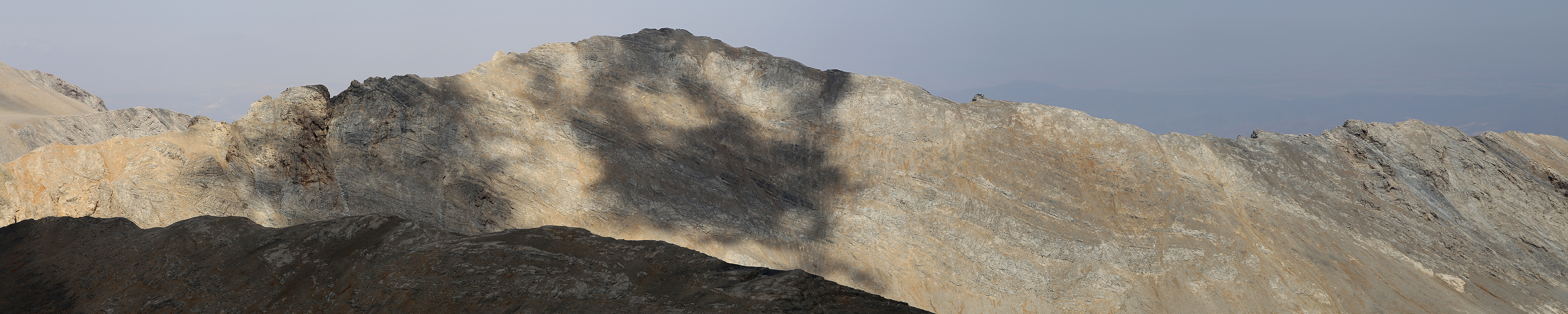
The drop on the steep side of the
short summit ridge
is quite dramatic.
I left at 1130, after a good break with quality time to look around.
The mountain landscape in this area is quite
rugged and covers many peaks,
a big contrast from the volcano Hasan Dagi that I climbed 2 days
ago. I had noticed that the summit right
next to the first col was indeed the highest locally and
I had already verified that its prominence saddle was substantially more than 100 meter lower.
My next destination was therefore this peak, a small detour, arriving there at 1245, quite a bit
faster on my return. A new break of 15 minutes seemed well deserved on this
extra credit peak. The remaining hike was equally nice, I made use of the scree when descending from the col.
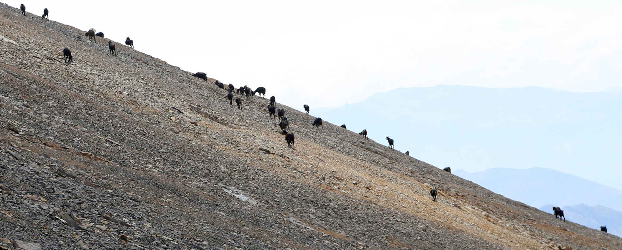
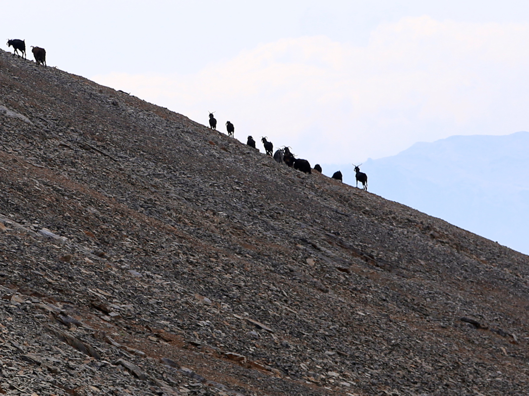
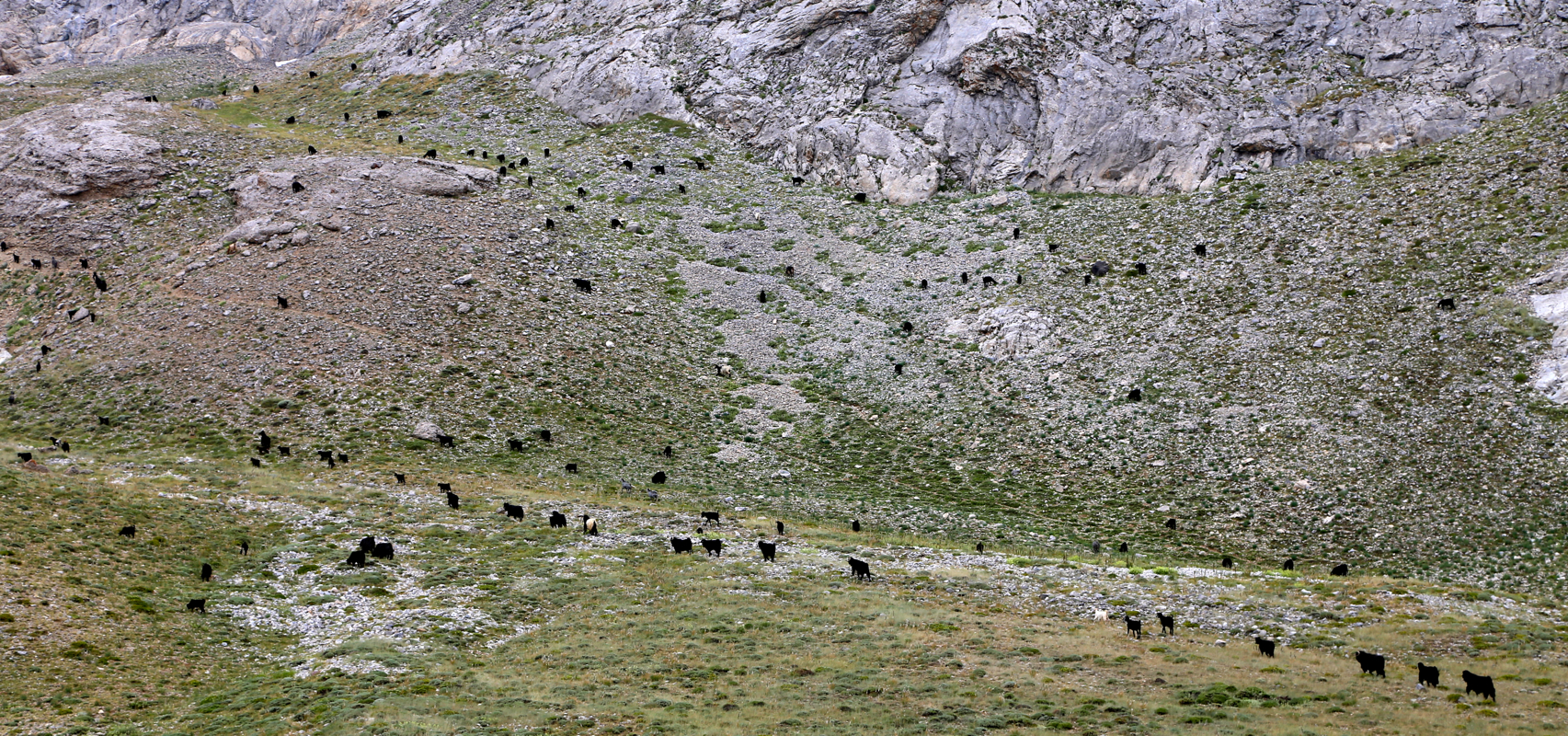
The big flat grass where my route would cut across was now full of goats,
I did not see any signs of
the dogs or a shephard. back at my car by 1445, a total trip time of 8:15, a full and very nice day in high country.
The drive back to Cappadocia was uneventful, arriving there at 1730, time for a swim and relaxing
before dinner time around 1930.
Here is a quick summary of peaks climbed in our trip to Turkey.