Mount Joffre
- Mount Joffre
- 3433 m
- Primary factor 1505 m
- Alberta, Canada.
- Location: North 50.52838, West 115.20681 (GPS on the summit)
- Difficulty: YDS class 3
- Climbed August 12. 2018
Mount Joffre
|
|
How to get there:
From Calgary, take Hwy. 1 towards Banff, but turn south onto Hwy. 40 (about 30 kilometer
before Canmore). Drive about 45 kilometer, then take Hwy. 742 forking right. Shortly, look
for signs for the Peter Lougheed park, this road forks left. Drive to a parking area called
Upper Kananaskis Lake Parking. We parked at location N50.60999, W115.11822, elevation about 1710 meter.
The parking signs/regulations are also a bit confusing, but at least we experienced no more hassle
parking here for 2 nights.
Red Tape:
Many of the peaks in the Canadian Rockies creates completely hopeless
red tape if you come from Europe with the intention to climb them. This
is unfortunate as it creates frustration, delays and actually a lot more
pollution than a more visitor friendly system would. We were forced to drive
many hundred miles (extra) north then south since climbing the 7 peaks in order were
not an option.
The worst experience was Mount Joffre. There is one natural camp-site, however with only
5 slots and these are typically reserved half a year in advance. However, most reservations are
no shows, when we were there 4 out of 5 slots were not occupied on two different days.
When asking permission to camp closer to the mountain, the response was quite negative. The park
also asks that hiking after dark is avoided due to the grizzly bears in the area. However, single
day hikes do not require a permit, this mountain can be climbed in a long, single day.
I therefore wrote the park and informed them that we would start shortly after midnight and
expected to get back (barely) within 24 hours. A major part of the hiking would be at night.
I explicitly pointed out how much better it would be to just camp close to the glacier.
No reply for a couple of days, then unexpectedly, an authorization from the highest level that
we could camp at a location identified with a google map screenshot! What about sending map
coordinates? Anyway, this was good news and we quickly found the location, quite a reasonable one,
on the map. Overall, this was a rather long and frustrating process, completely unnecessary.
Route description:
Hike along the huge trail that runs along the south side of
Upper Kananaskis Lake, roughly 4.5 kilometer. The trail to look for
forks left and runs by Hidden Lake to Aster Lake. It is normally best to
hike along the very edge of Hidden lake, the trail is good and very easy
to follow. After Hidden lake, the ascent starts, first up among trees, then
onto a large slope of talus that is ascended on a traverse in order to
gain reasonable terrain higher up and further into this valley. A waterfall
tells you that following the valley floor is not an option.
The trail will lead you to the Aster Lake Campground. It has 5 wooden platforms
(for tents), see the red tape section above. Continue up to Aster lake and follow along its
shore to the left. Turn a ridgeline that comes from your left hand side (south) and continue
south into a distinct valley. Follow the creek (small river), on the left side, better
terrain a bit up along some local flat sections. Note the characteristic mountain
on the right side of this valley and the rocky slabs ascending to a saddle on the
north (right) side. This is your route.
Cross the river, it had quite a bit of water when we ascended, much less 2 days later
when we descended.
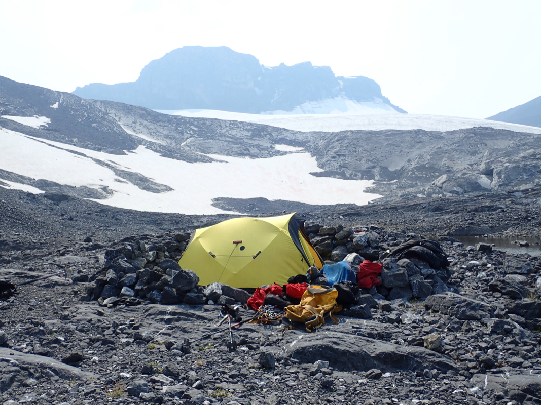
Ascend the slabs to a local ridge line.
There are visible signs of camps here. Clearly, the most reasonable place to camp
when ascending this peak.
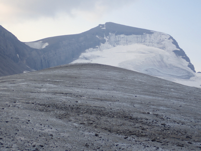
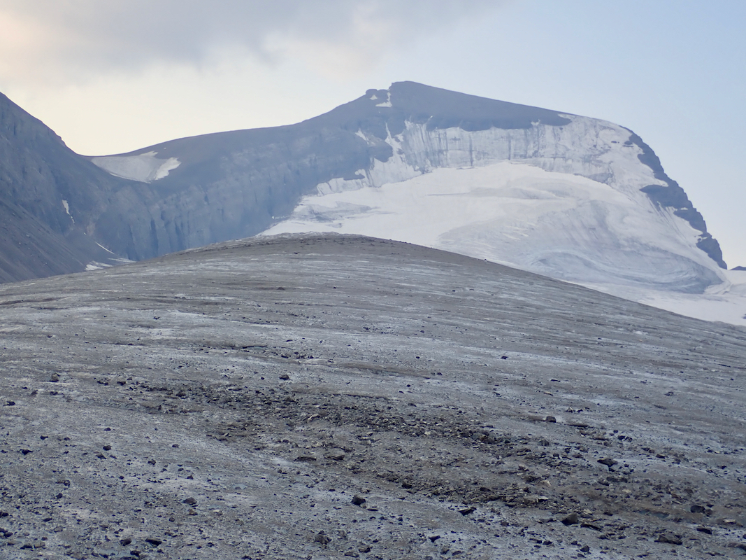
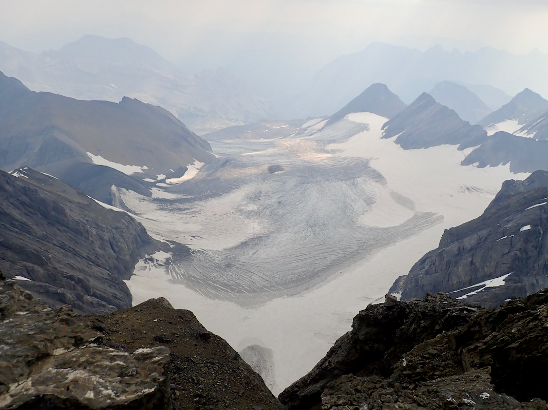
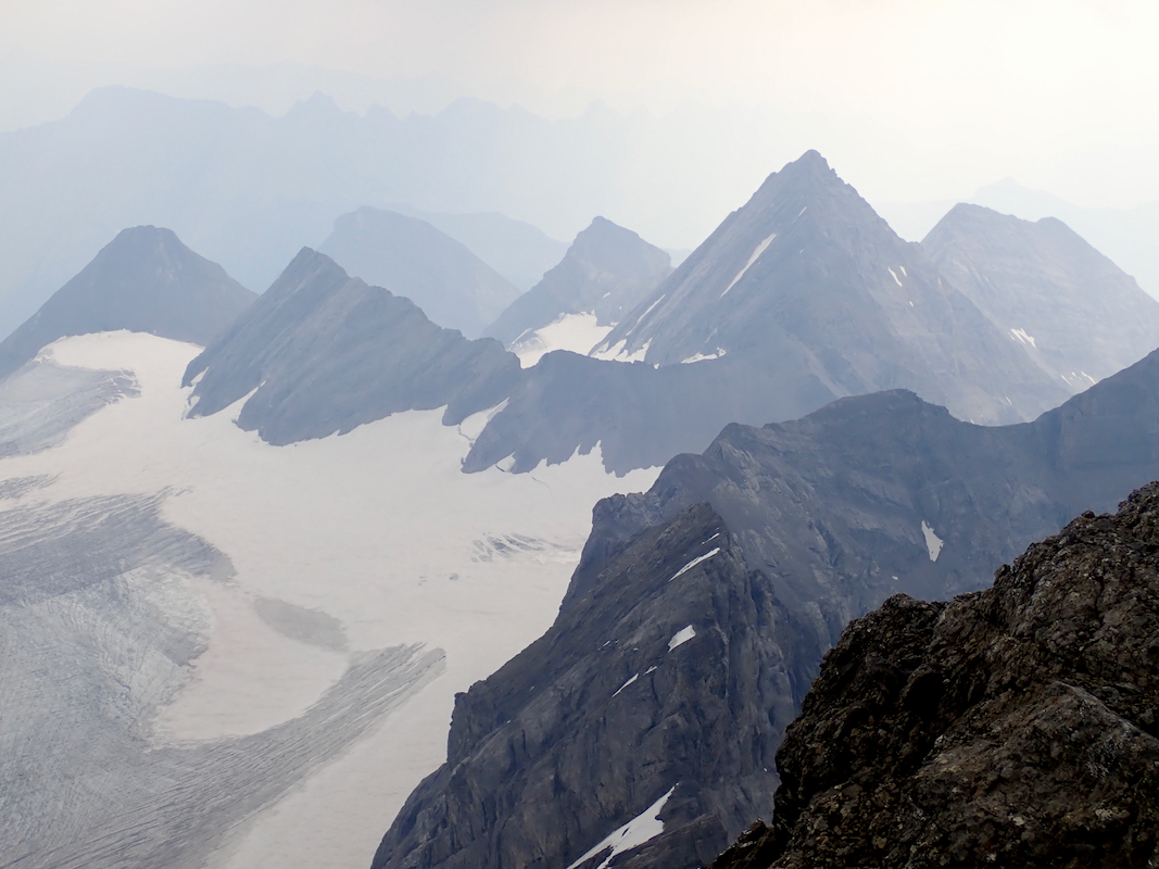
From here, continue a gentle line of ascent in order to reach the Joffre Glacier.
It is best to hike up the middle of this glacier, few crevasses. You will now
see the remaining part of the route. There are two alternatives. One option is
to follow the glacier until it steepens, then ascend steepoer ice to the very
right hand side. Recent melting may make this route less attractive, if there is
a good layer of stable snow, this route may be quite attractive.
The other option is to ascend the rocks on the left and gain easier ground that
then may be followed all the way to the summit. This is likely the easiest
route to climb Mount Joffre.
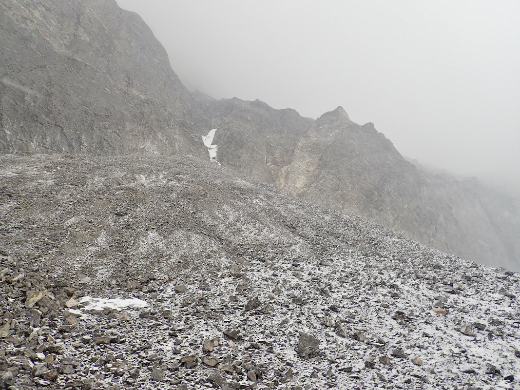
You will see some pretty vertical gullies in
the rock, aim left of these to find a corner with loose scree/talus and two
gullies starting a bit higher up. Take the rightmost of
these two gullies,
see the picture. Easy (YDS) class 3 scrambling will get you to the top, be
careful as there is quite a bit of loose rocks in the gully that easily could
hit people below you.
Once on top of this local plateau, follow a climbers trail (just a walk) to
the summit.
Comments:
After a rather lengthy process with the park authorities, we were set to
go, arriving at the campground near the main lake in the afternoon on August 10.
We camped at an official (self serve pay) slotand started early the next morning,
walking at 0700. The campground at Aster had a single tent, just showing
that this stupid reservation system is badly broken.
The hike to our designated camp-site took 8 hours.
The next morning, we were also hiking at 0700. We followed the main crest of
the small glacier, then approaching the rock on the left hand side. The climbing up
this gully was much easier than anticipated from reading a trip report. Thus, in
3 hours we were at the summit of Joffre.
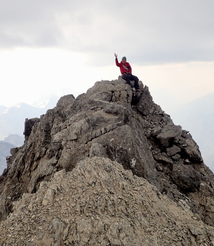
We rested about 30 minutes, time for some
pictures and looking around on the view. However, it soon started to snow, and this
weather persisted, the snow started to accumulate on the ground. We decided to
descend before things got worse. A spell of bad weather, we got back to camp at 1300, but it was
not very nice to continue with the current conditions. We therefore decided to stay
a second night and hopefully descend with better weather the next day.
The next morning was sunny, we left at 0730 and had a very nice hike back down to Aster lake, again,
on ly one tent at the 5 platforms. Next,
onwards on a good trail down to the really big trail along the final lake. Back at the
car at 1300. Thus, we had a total time walking of 19 hours, indicating that a single
day trip within 24 hours is indeed possible.