Location: North N46.16104, East 006.92326, (GPS at the summit)
Difficulty: (YDS) class 2+
Climbed September 21, 2013.
Information:
How to get there:
There are two approches, from Geneve one should travel to the east end
of the big lake then via Monthey and the valley Val d'Illiez to Champery, or
continue on the main motorway past Monthey to Martigny. This report will
describe the route from Martigny.
In Martigny, drive to the north-west side of town and locate the Hwy. (and railroad)
that head north. A big windmill is also easy to see in this area. Just before this road
leaves the city, there is a signed road that goes left and subsequently climbs
the steep slope on the left (when facing north) side of the valley. The road sign says
Salvan and Les Marecottes. The distance from Martigny to Salvan is about 7 kilometer.
When you arrive in the village of Salvan, continue uphill and follow signs that says
Vallon de Van. This road is quite narrow and has a few (short) tunnels that
are just big enough for a normal car to pass through. Drive about 6 kilometer from Salvan,
stay on the paved road and ignore side roads. You will arrive in a small valley where
there is a camp ground, this place is called Van d'en Haut. The road forks with the
left branch crossing a small wooden bridge. Stay right here (do not cross!) and continue
a short stretch on the narrow road until it ends in a grass area where one can park.
This location is N46.14135 , E006.99000, elevation about 1420 meter.
Route description: Hut hike:
The climb can be done in a single day from the trailhead, however it is recommended to
arrive the day before and hike
to the nice mountain hut Auberge de Salanfe. This hut has
phone +41-277611438. (You should call ahead and make a reservation.)
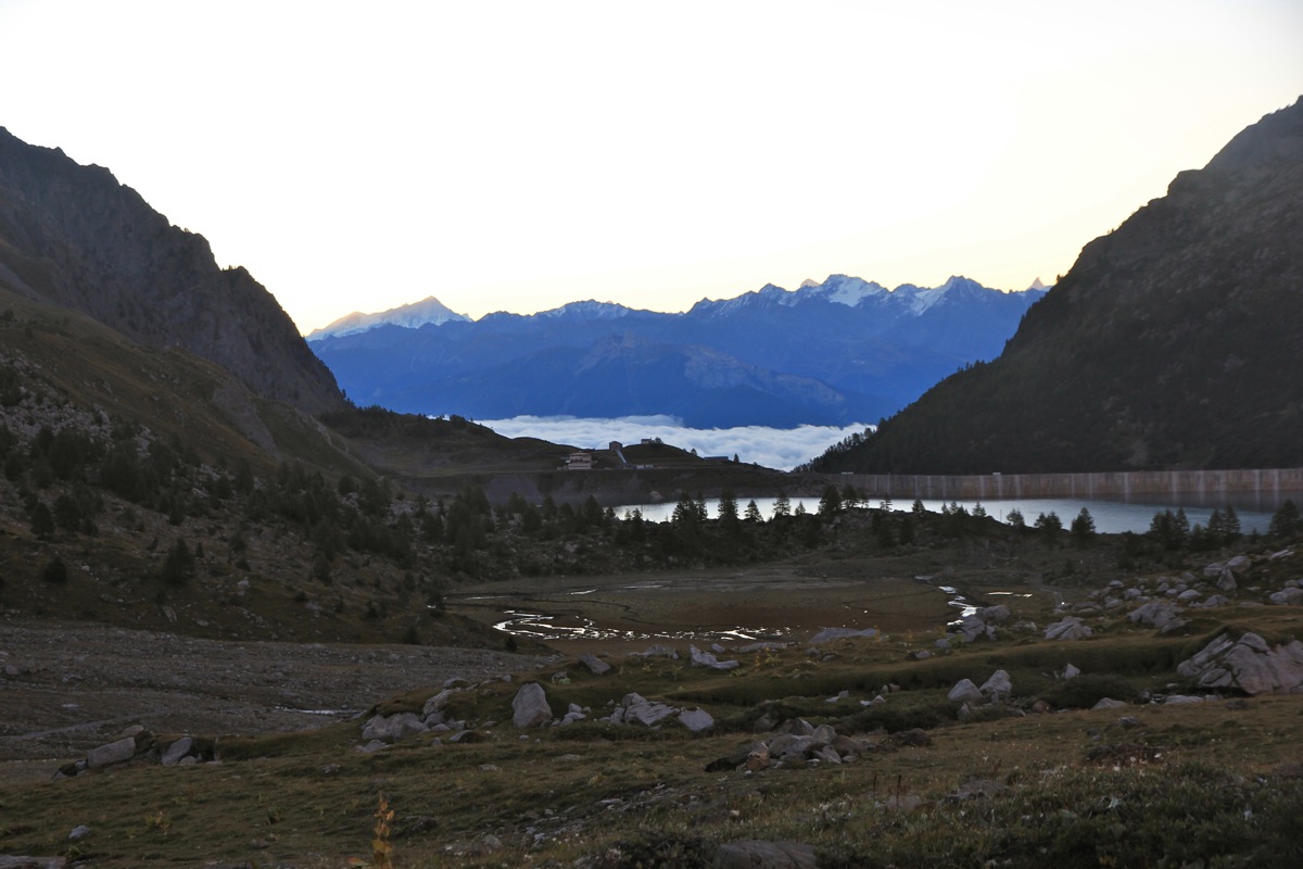
From the car park, continue into the valley. There is a marked trail as well as a rough mountain
road. The trail is steep and has several sections of metal stairs. The hut is located next to
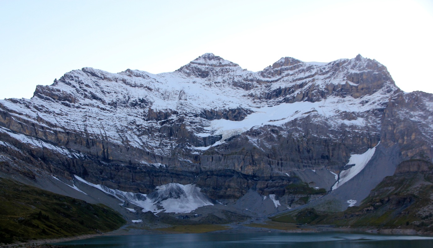
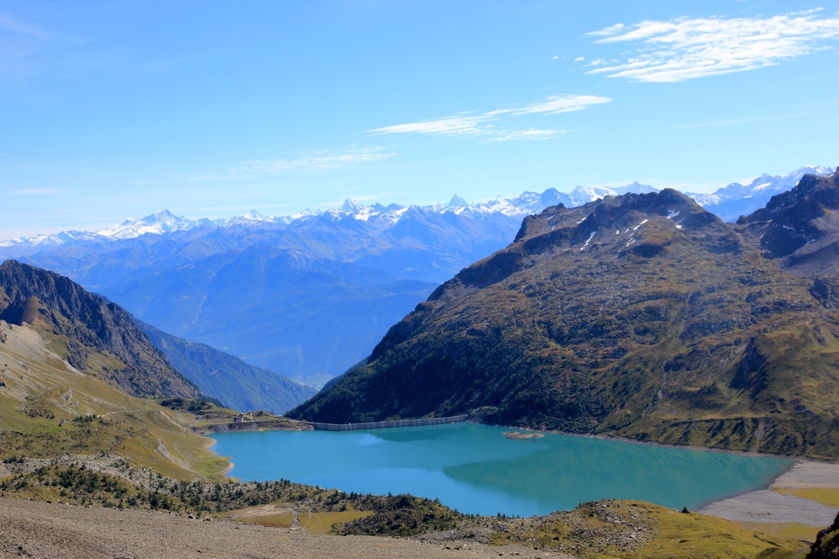
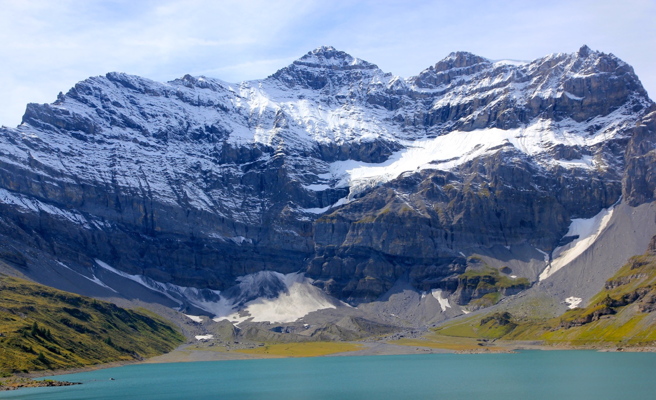
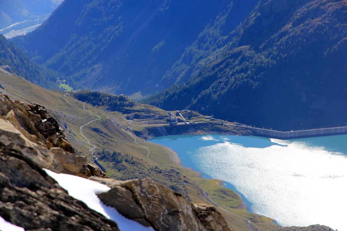
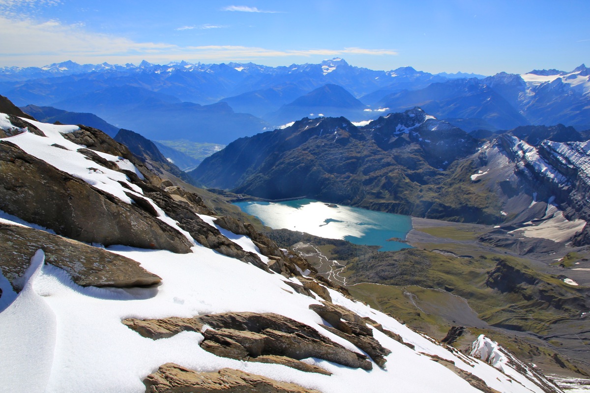
a large concrete dam that contains the Lac Salanfe. The elevation is about 1950 meter and the hike
from the parking to the hut takes about one hour.
Summit climb:
From the Auberge de Salanfe, follow the small road (only for walking) that runs along the lake (to the right or
north side). After a while, you cross a man-made drainage that runs into the lake and there are signs for the
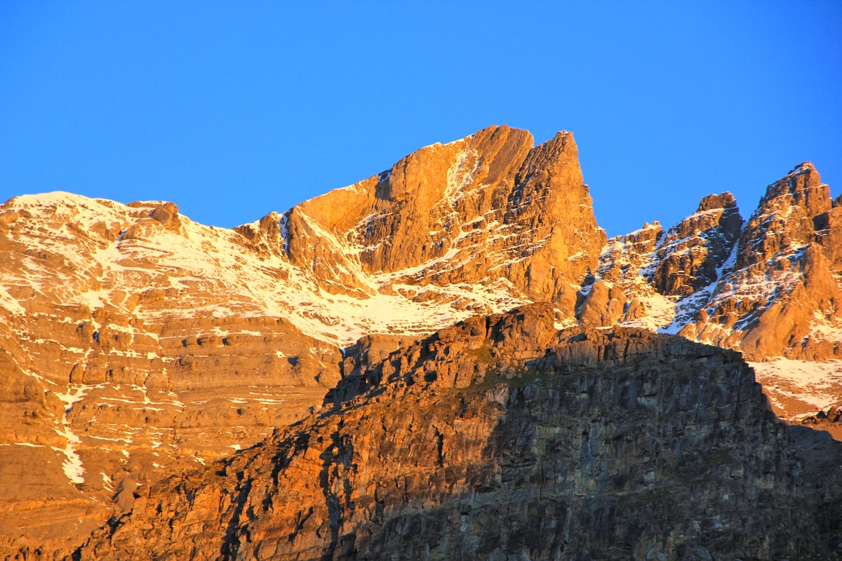
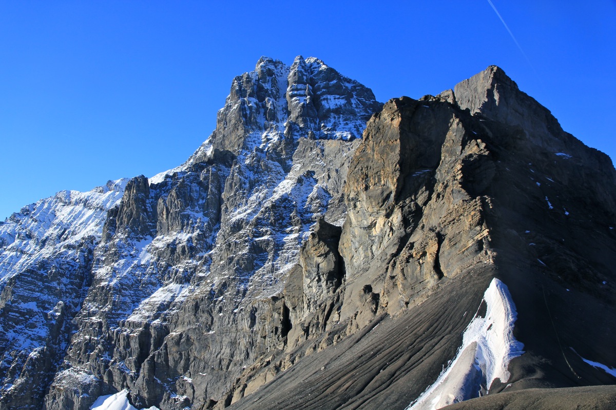
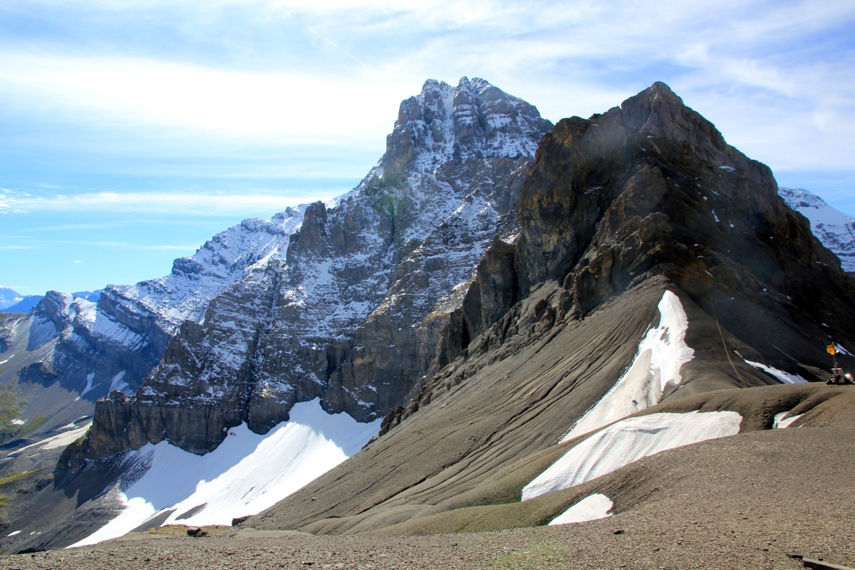
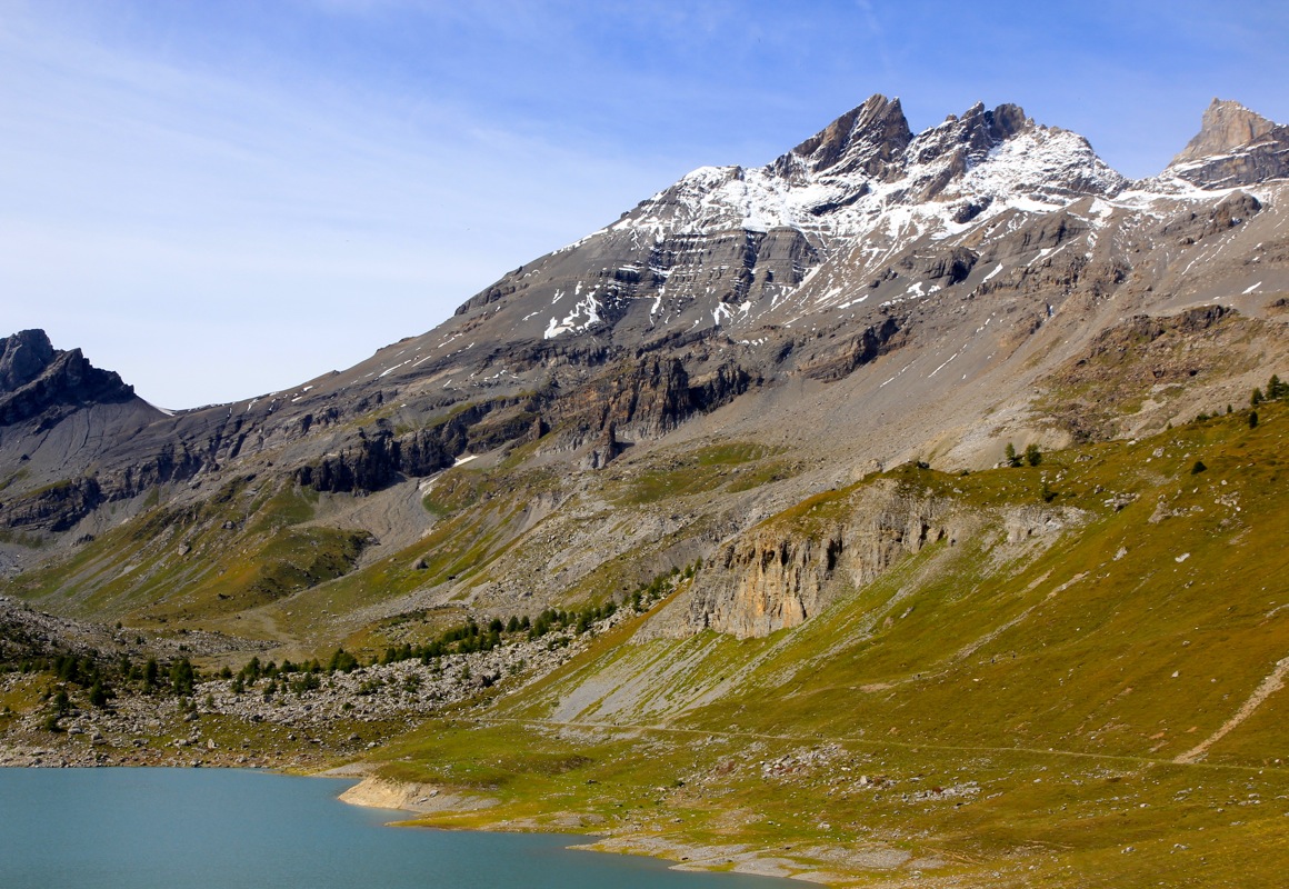
Col de Susanfe, this is the correct way. This col is the passage between Haute Cime (right) and the impressive
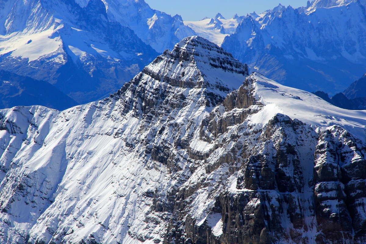
Tour Sallière (3219m) that towers at the end of Lac Salanfe.
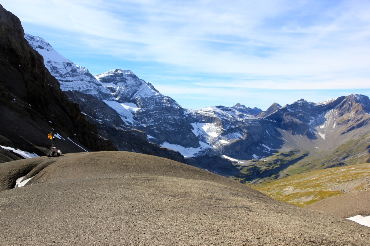
The trail gains elevation, keep left in the next trail fork. The route then contours around towards the col and
crosses a small cliff band, then finishes up a gentle and very even slope passing a bivuac hut shortly before
reaching the col. This col is at 2495 meter and the route to Haute Cime starts here.
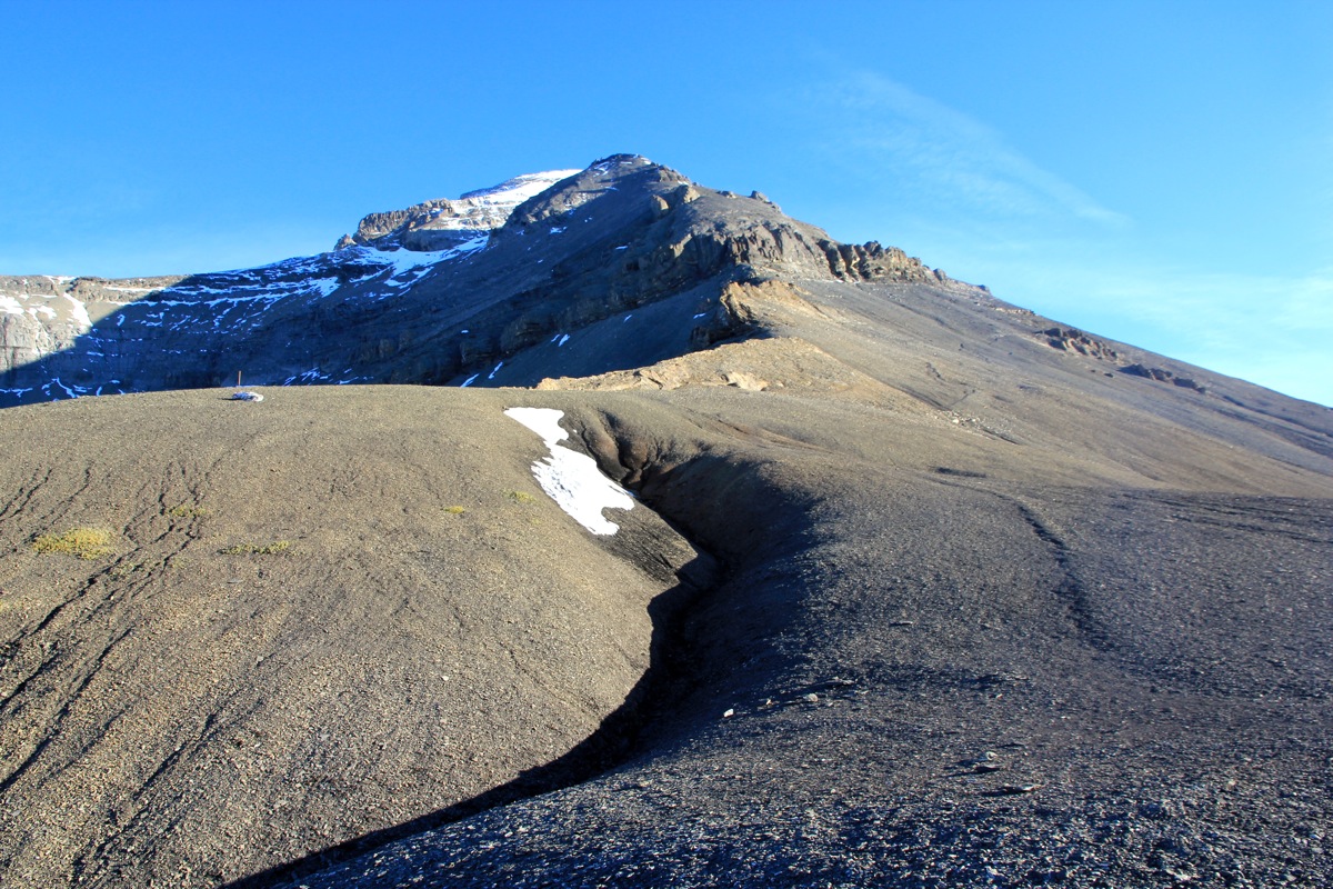
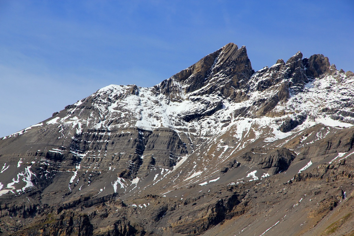
Follow the trail uphill, it first stays right in order to avoid steeper ground directly above. Higher up, the route
(well marked here!) crosses some minor cliffs before getting back on the same loose rock slope that really
characterizes this mountain. The route zig-zags uphill and then reach the distinct shoulder that may be
seen from below. After this horizontal stretch,
the final summit slope runs uphill. This slope is steep enough that
some care should be exercised if the slope is covered by snow.
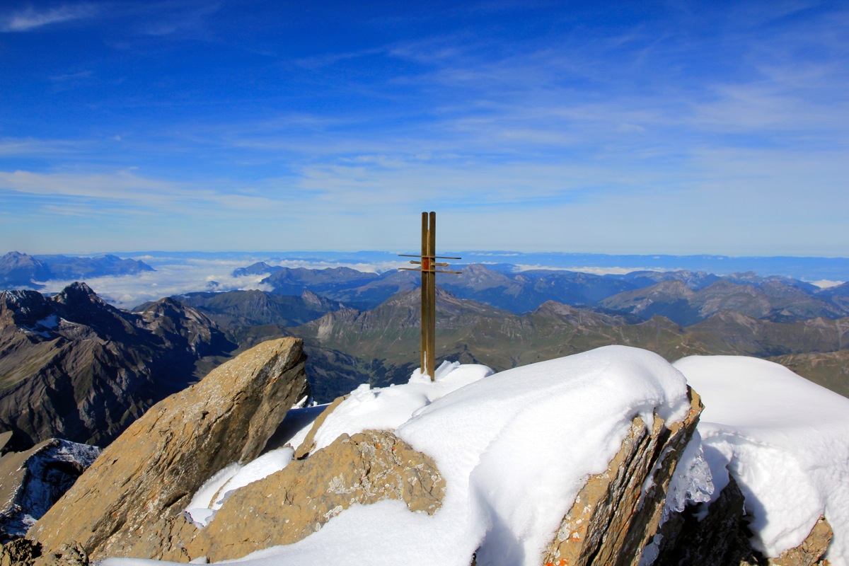
The summit consists of a short ridge with large,
jagged boulders. The cliff on the far side is rather steep and one should be rather careful.
Comments:
I had been in Lugano, then climbed Togano and continued driving in the
afternoon across the Simplon pass to Martigny. After a slight confusion about
how to find the proper trailhead, I walked from my car and up to the very friendly
Auberge de Salanfe in about 50 minutes. Evening light across the lake to
the massive peak across,
then the more sloping Haute Cime up to my right. Tomorrow would be
the day of my final Ultra in the Alps.
An excellent dinner and pretty early bed.
The hut could serve breakfast from 0630, my plan was to start around 0700.
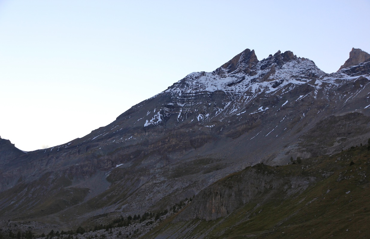
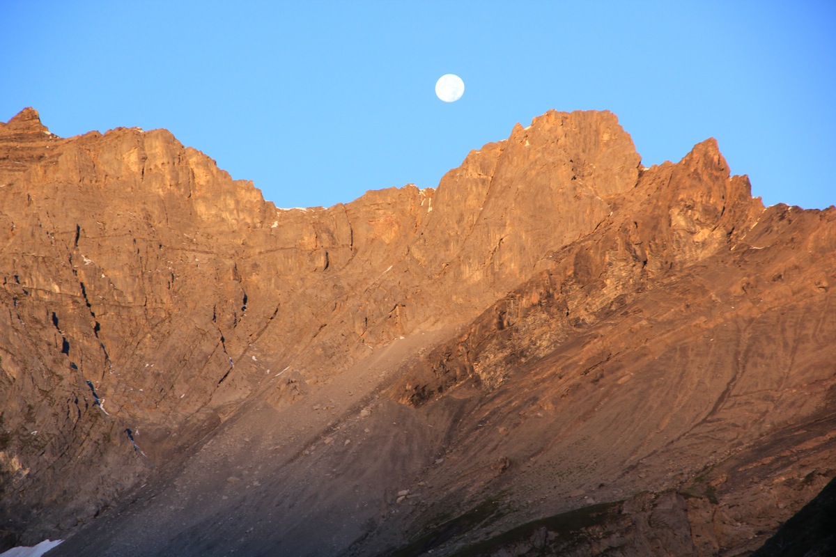
It was a gorgeous morning, the full moon was
sitting in the middle between Tour Sallière and
Haute Cime. The morning was cold, most likley below
zero last night and certainly so at higher
elevations. This climb would mark the completion of three different goals, the top 50 peaks in Europe
ranked by prominence, the top 100, also by prominence as well as all Ultra prominent peaks in
Europe, ie peaks having at least 1500 meter of prominence. It would be a solo climb, just as many of
the previous peaks on the lists.
I left on time at 0700. The walk along the lake was easy and soon I was on a good trail running up
towards the Col de Susanfe. Nobody else on the trail or higher up on the mountain.
I was walking in the shade,
but the higher slopes were already glowing in the morning sun.
I arrived at Col de Susanfe
after 1:30, at 0830. I expected more climbers to start
out from the hut located beyond this col, but
nobody had arrived in this area yet.
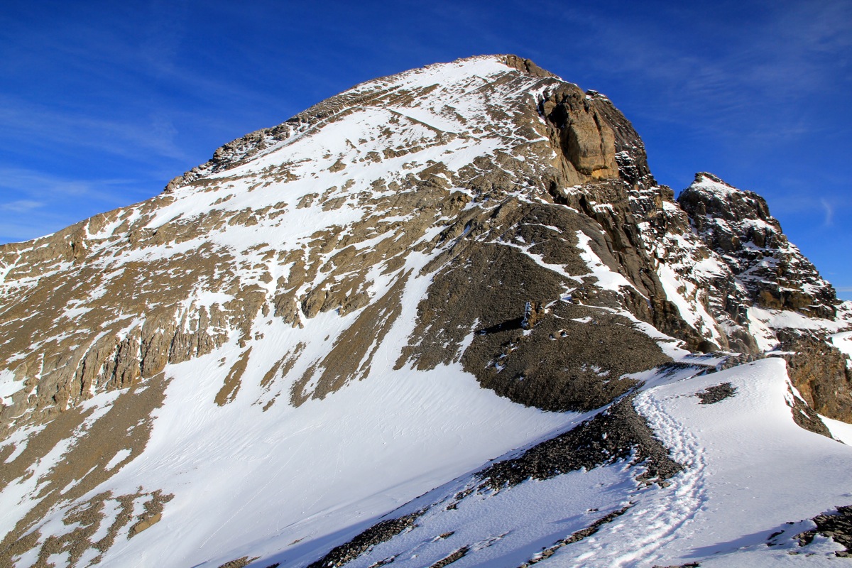
I continued uphill, the terrain on this slope is full of small, loose rocks and a pretty
clear trail showed the way uphill.
Higher up, there was a short, but easy band of more
solid rocks. The route here was very well marked with cairns before the trail in more
loose rocks resumed. Finally, the trail topped out on the very distinct, short horizontal
ridge that led to the final summit slope. The final slope was mostly covered by snow and this snow
was frozen solid. The sunny yesterday had left a soft surface, this had turned completely solid
during the cold night. It was obvious that crampons and an ice axe would be better than a pair of
walking poles. I left my poles behind and continued uphill with crampons providing excellent footing.
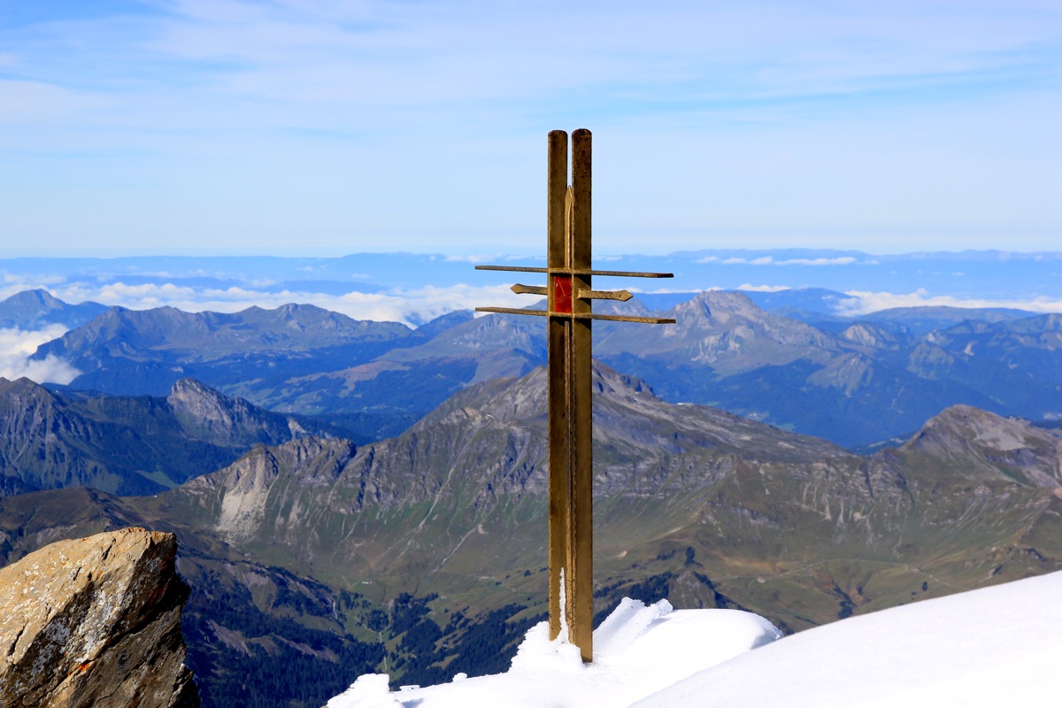
As I got within the last few meter, I noticed old foot prints going to the highest point at the very
rightmost part of the short summit ridge. No signs of any previous steps in the direction of
the summit cross.
Consequently, I carefully climbed to the highest two rocks
quite close to the cross
and decided that this would be my spot to rest, make photos and enjoy this fine summit.
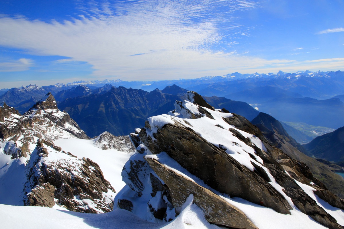
I had arrived at the summit at 1030, and I spent a bit more than 30 minutes on the top.
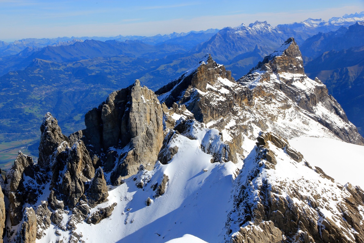
Looking across to the other "teeth",
I felt happy that this one was indeed the highest "tooth".
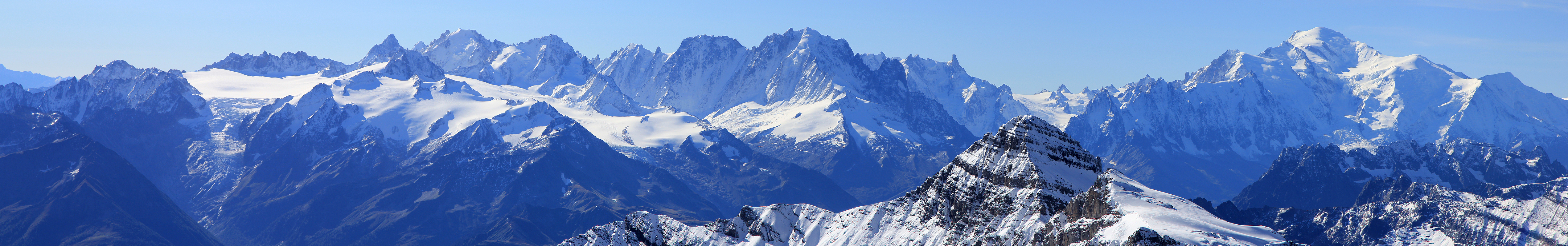
The summit was an excellent viewpoint.
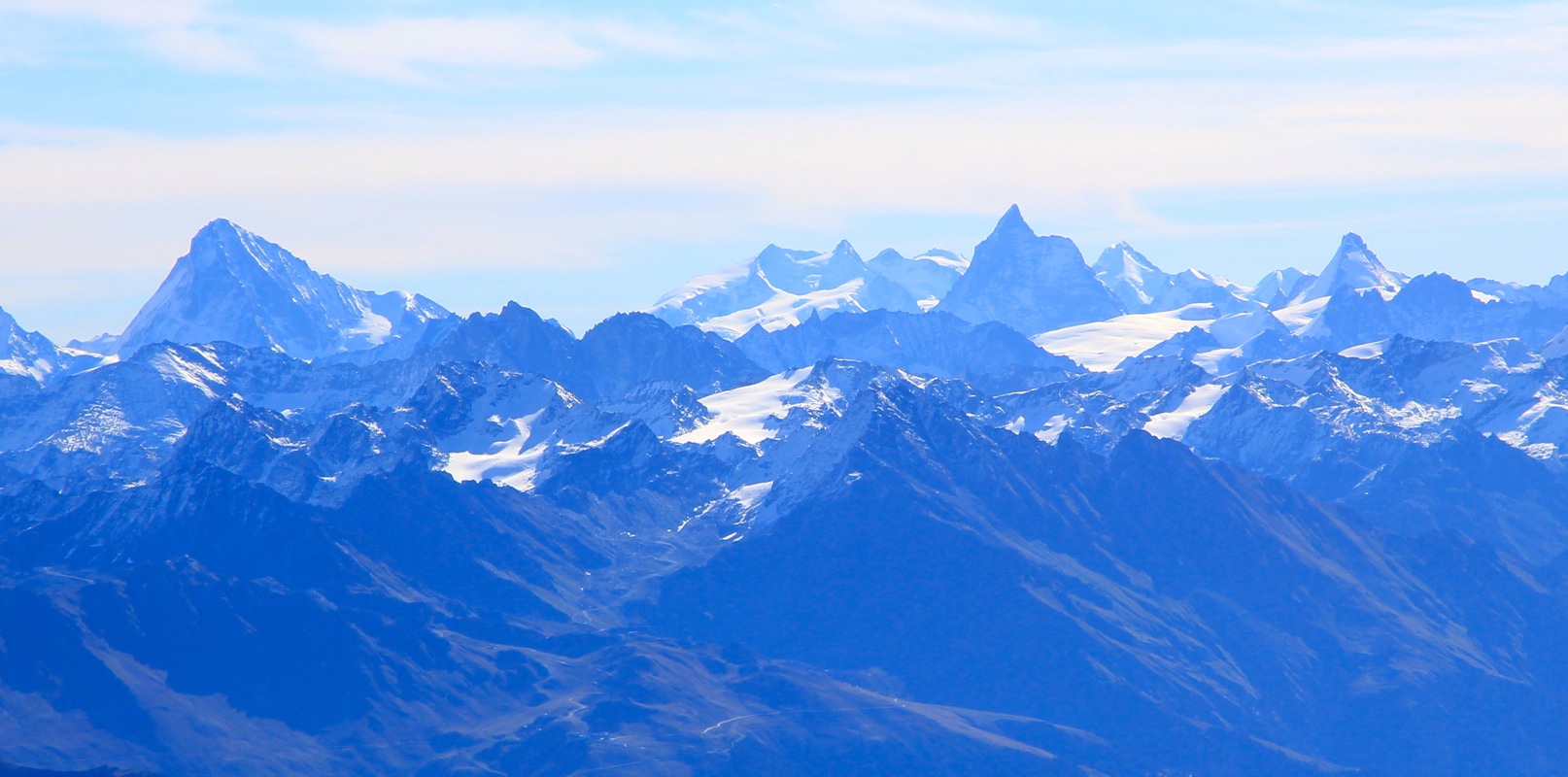
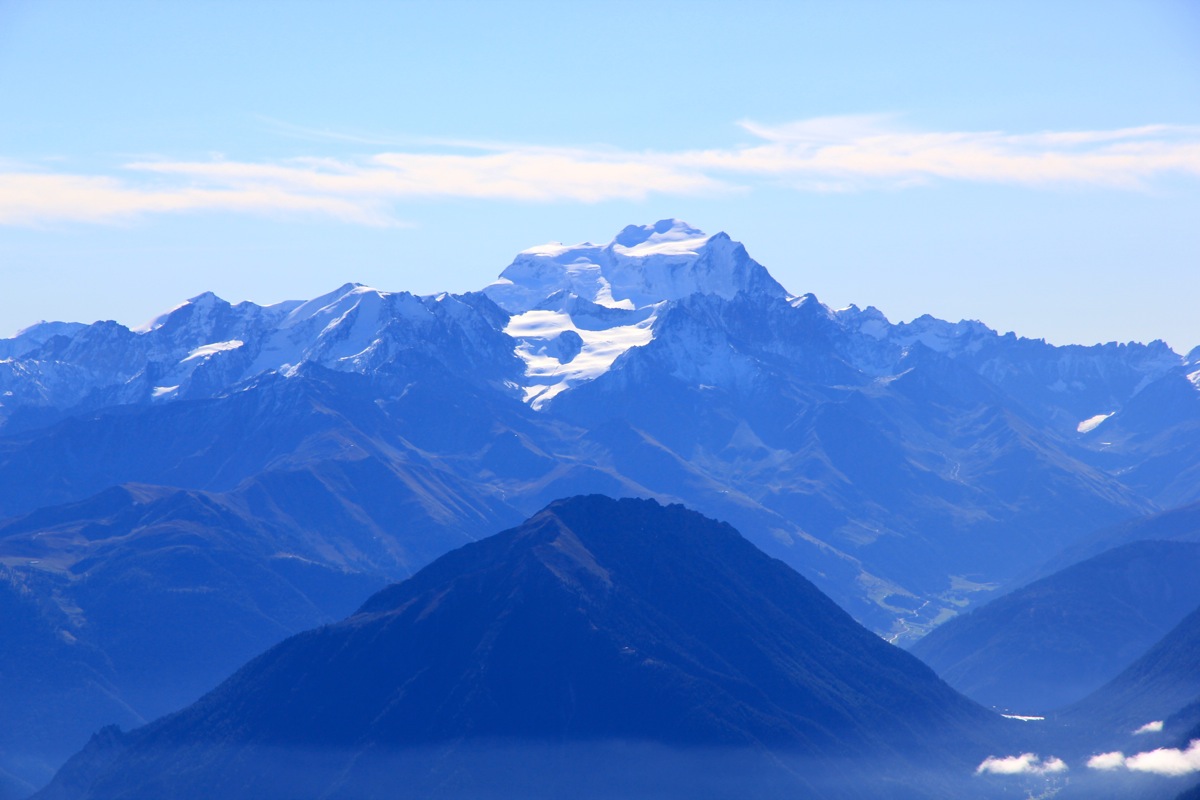
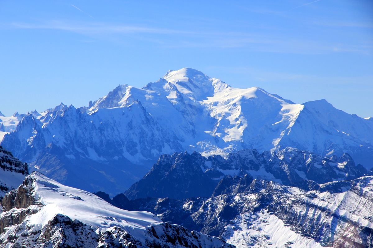
I could see across to Grand Combin and smile with memories
of our interesting ascent a year ago. Further right,
the queen of the Alps - Mont Blanc, not last
year, but almost 40 years ago when I climbed it with two of my best friends.
At last after a very good rest and a fantastic view all around, I decided to start my way down.
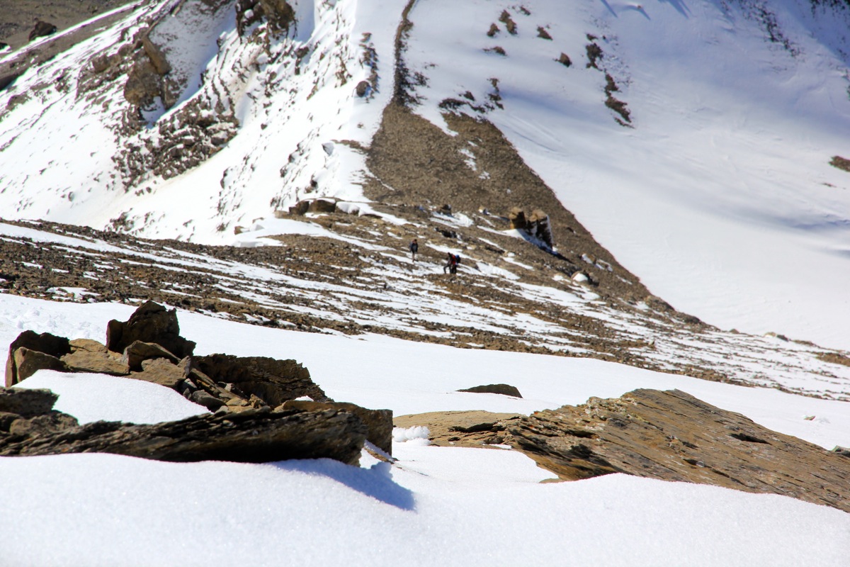
Still, I was all alone on this nice peak. First half way down the snow slope,
I met a few parties
on their way up. I noticed that the snow was already getting softer in the strong sunshine. The party
coming up had crampons, but steps in the snow could now be seen and I reflected that the other parties
possibly started later in order to get softer snow and then better steps in the final snow slope.
Further down, below the horizontal shoulder, I met a young couple from Finland, but working in Geneva.
We had a nice chat and I adviced them to be careful at the upper section. The remaining descent was easy
and I reached the Col de Susanfe at 1215.
No need for a long break,
I continued along the nice trail back to
the mountain hut.
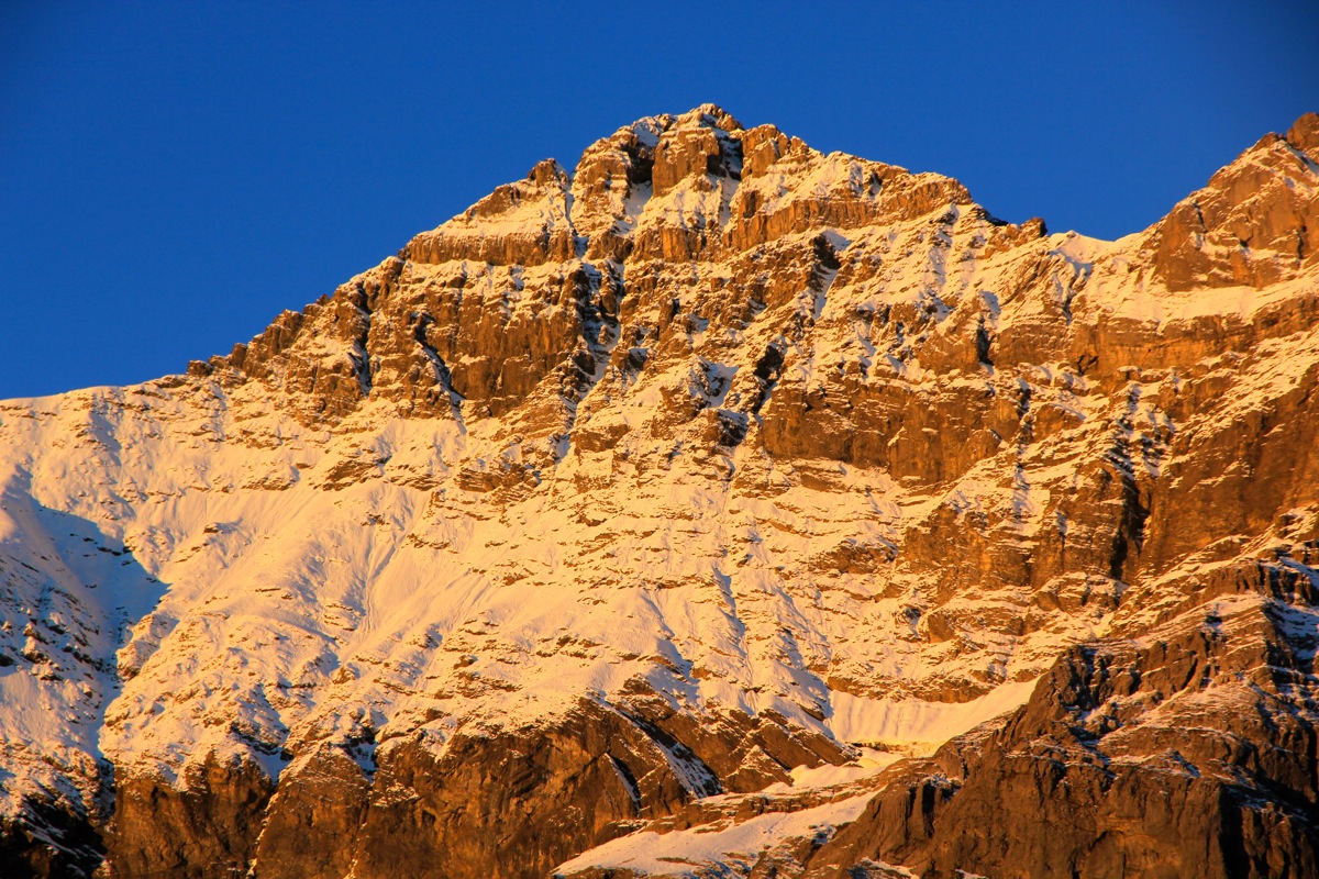
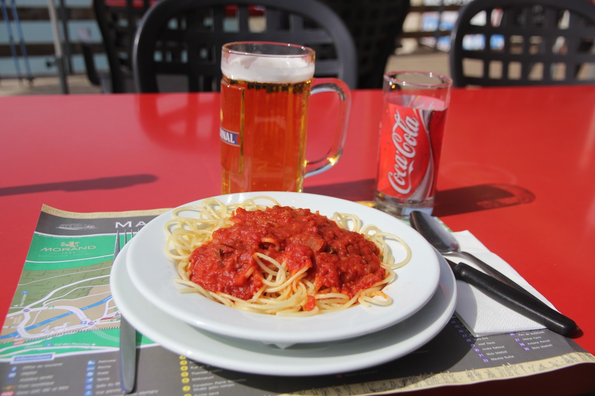
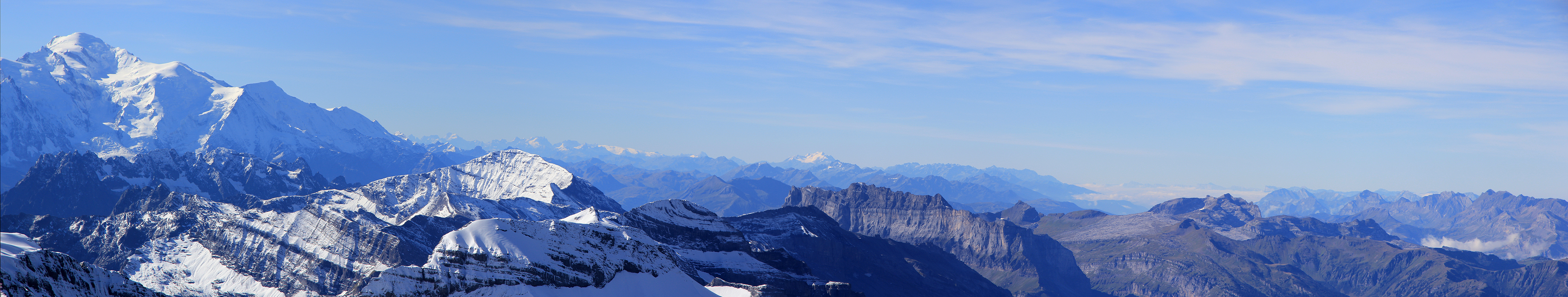
Summer had returned and it was warm out on the terasse. I ordered a beer and a nice
pasta lunch at 1325. There were many people having lunch and enjoying the
impressive view of Tour Sallière across
the lake and its slightly higher neighbor, Haute Cime, a bit
further right.
By 1425, I was ready to continue down to my car.
This trail is mainly a steep downhill and after only 35 minutes it was time to change and get ready
for my onwards travel. It was tempting to have a nice dinner in France and I set out driving to
La Chapelle d'Abondance. This location would serve as an ideal location for a morning hike
to Les Cornettes de Bise the following day.
