Location: North 40:27.573, West 112:37.581 (GPS at the summit)
Utah, USA
Difficulty: YDS class 1
Climbed: June 29, 2008
Information:
How to get there:
Salt Lake City would be a good point of departure.
Head west on Interstate I-80, about 20 miles, and get off on
exit 99. Drive south on Hwy. UT-36 until you can turn right
on Hwy. UT-138 (this might be 3-4 miles from I-80). Drive
UT-138 into the town of Grantsville, continue through town
until near its west end, where you turn left on South West Street,
there are signs here for Willow Canyon Campground. Drive about
5 miles south, you will first see a sign for North Willow Canyon,
contine until the right turn-off that have a sign saying South
Willow Canyon. Take this road, the first 3.1 miles are paved, then
a good dirt road continues about 4 more miles further into the canyon. Ignore several
side roads to the left that serve various campgrounds.
Just before the end, the road forks, but there is a one way only sign on the
left branch. Continue along the right fork until the top of the hill where
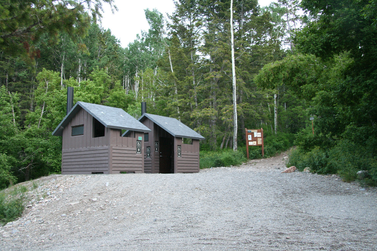
there is parking for about 10 cars on your left. There are two outhouses
just ahead on your right. Park here, this is the trailhead. Location
N40:29.003, W112:36.410, elevation 2267 meter.
Route description:
It is highly recommended to do this hike as a loop. I will describe the
loop clockwise, which is likely the best option.
The trail heads straight uphill just on the right hand side of
the two outhouses.
Follow this nice trail gently uphill until you cross
a creek. On the other side, bear slightly left (downstream) and locate
a signed trail fork. The right fork goes to Willow Lake, the left trail
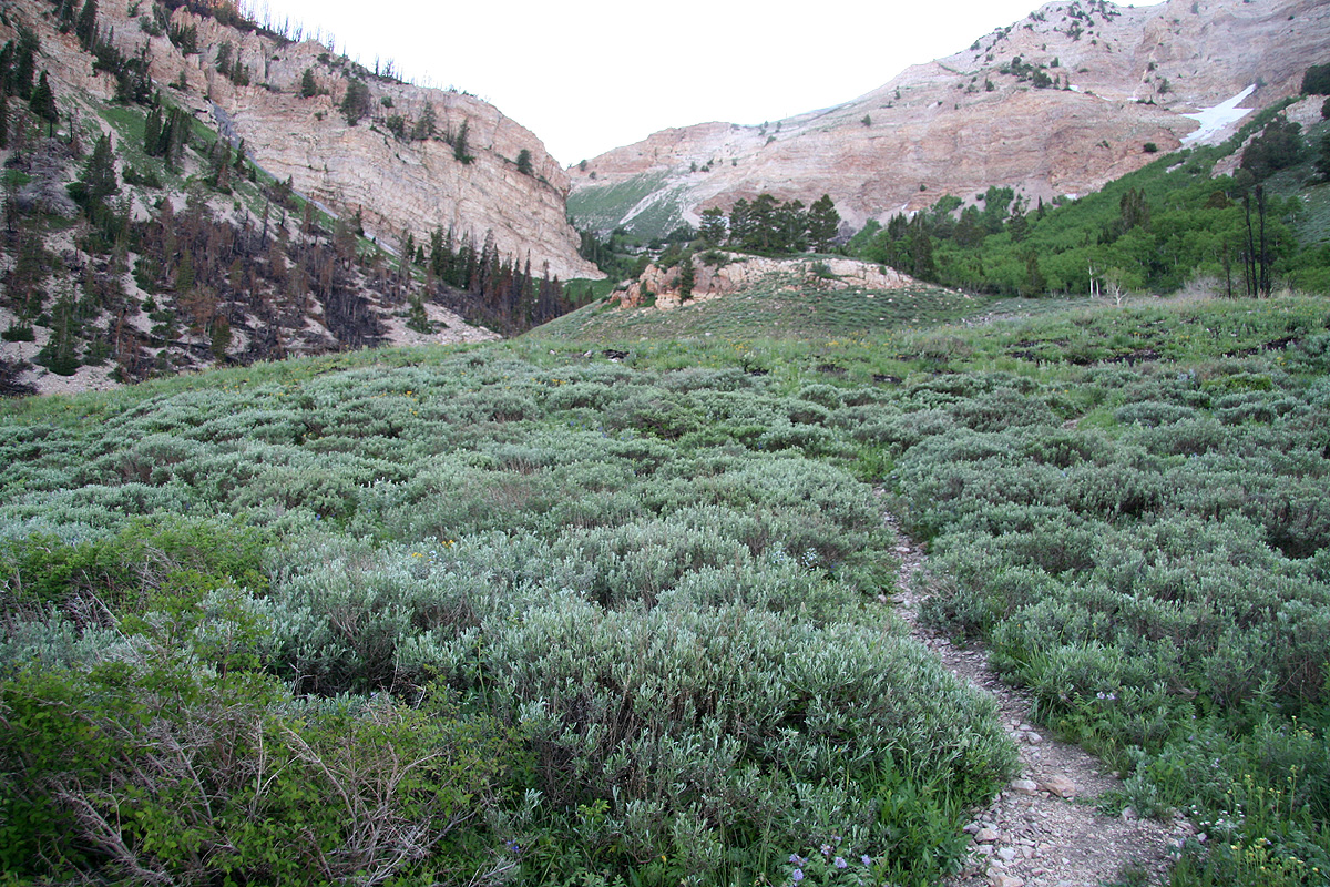
is called Deseret Peak trail. Follow this trail as it enters a separate
valley left of the main drainage where the creek came down. The trail
climbs this valley, partly across open grass, higher up through a section
of forest, before a final somewhat steeper push to a shallow saddle on the
ridgeline. This location is N40:27.423, W112:36.880, elevation 3067 meter.
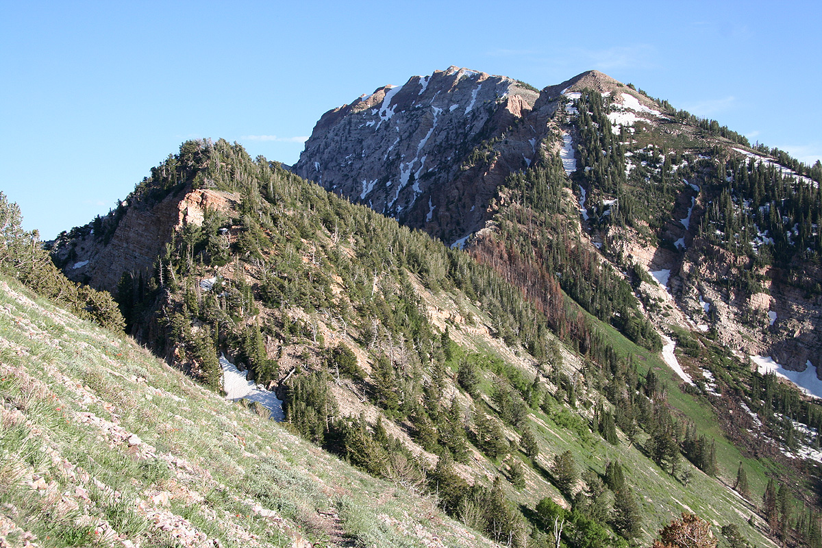
From here, the peak is up to your right. Follow the trail as it gains elevation
and traverses left in order to enter the broad ridge above. From here, the
slope is very gentle as the trail makes its way to the summit.
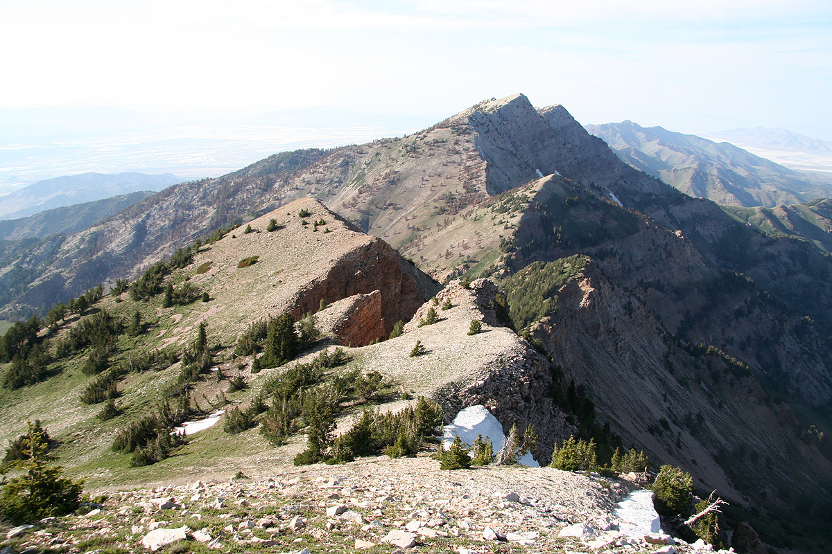
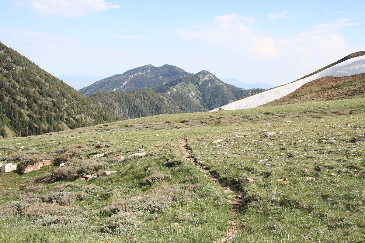
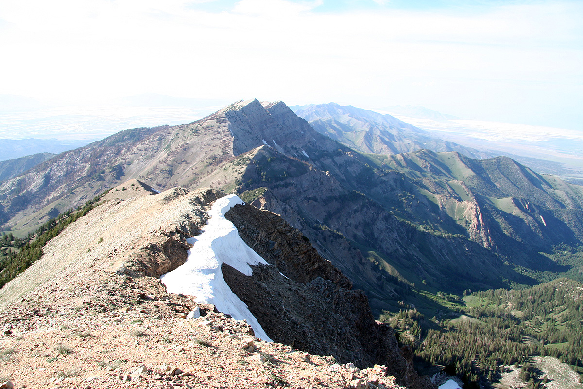
The return hike can now be done by descending
along the north ridge that
connects to the well separated and quite impressive summit further north.
This trail is still quite easy to follow, although slightly smaller than
the ascent trail. You will descend quite steeply (the trail zig-zags) down
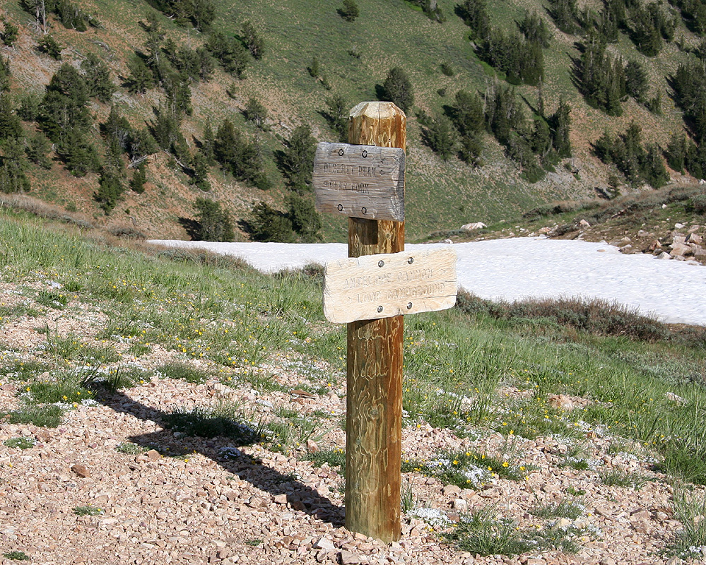
to a first saddle that has recently been affected by a forest fire.
From here, the trail traverses to saddle number 2, there is a sign in this
saddle pointing further ahead (uphill) that just says "Trail". Continue towards
the third and final saddle. The trail climbs a bit, thus saddle number 2 is the
lowest one and the one that will define the prominence of the northern peak.
Arriving in saddle number 3, if time permits and the weather is good, consider
climbing the northern peak as well. A small trail heads uphill in that direction.
The route, however, descends back down (that is to your right) from this saddle.
Follow the well groomed trail as it zig-zags down into this valley
and eventually
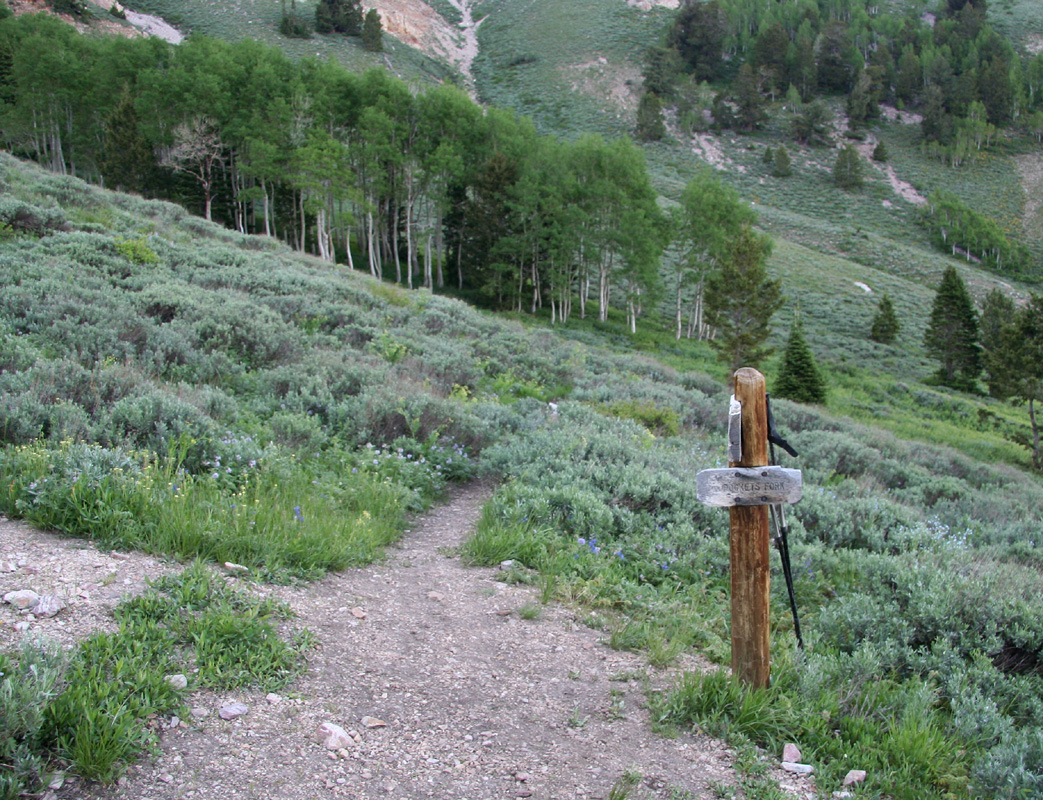
connects with the trail that serves Willow Lake. There is a wooden sign here and
this location is at N40:28.874, W112:37.302, elevation 2715 meter.
The sign pointing
up to the saddle from where you descended reads "Rocker Fork",or something similar,
it is a little hard to read.
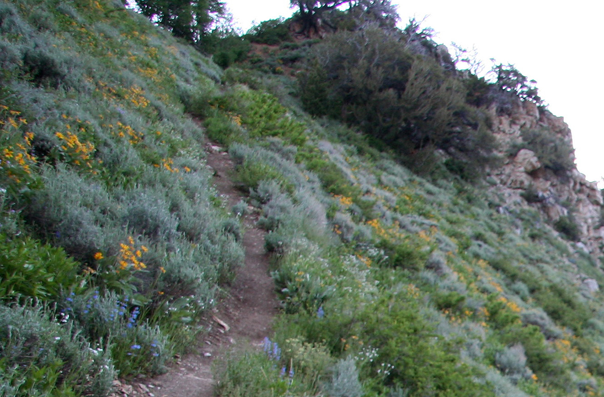
Make a right towards our trailhead and follow this nice trail as it contours around and
enter the main valley that runs below the impressive face of Deseret Peak. You will
cross the stream that we also crossed early on our ascent, then continue downhill
to the trailfork and a second crossing (back) of this stream. Finally, proceed
the final, short section downhill to the trailhead.
Comments:
I arrived at the trailhead around 1445, and soon thereafter
thunder, then rain started. It thus looks like this hike
will be tomorrow.
Hey, the rain has ended, I bet the weather will only improve into
the evening. What about an evening hike? I wonder when does it get dark
around here? Better take a headlamp along, just in case.
A friendly team of hikers just returned, they had been to
Willow lake and got rained on when going back. They offered me a cold
beer, nice taste right now. We talked about the local mountains in
Utah, the guy had been on quite a few.
I said goodbye and started hiking at 1620. The trailfork (after hiking
to the place where you cross the creek) was well signed, I continued left
on the Deseret Peak Trail. This trail ascends the valley just left of the
main drainage from the peak. Nice trail,green grass, trees and more and more
blue sky. No hikers to be seen, they had all returned by now. Higher up,
the trail ran into a forest area.
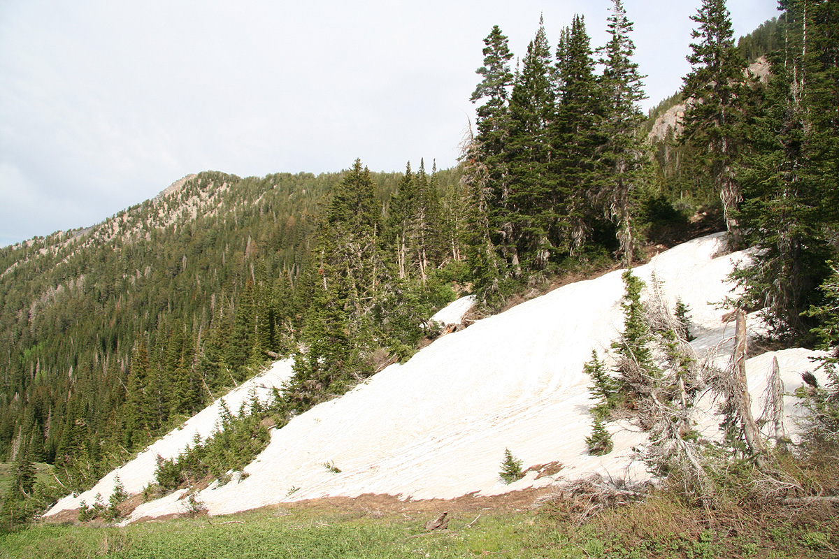
Big patches of snow covered up the trail
and fallen trees everywhere made progress considerably slower. I soon lost
the trail completely, but assumed that I would find it higher up as soon as
I got out of this jungle of fallen trees.
Higher up, just below the rim of the ridge, the terrain got steeper. The slope
was covered by snow. I proceeded upward, kicking steps in the soft upper layer
of snow. Soon, I was at the saddle
and could see down the valley on the other
side. I could see, what looked like the summit to my right. The peak had a
significant slope of snow near the horizon.
I proceeded up and the trail traversed
nicely and cut across the top snow in a rather trivial way. From here, it was
easy going to the top, arriving at 1820, exactly 2 hours.
The weather was now near perfect. Unfortunately, stil a lot of haze and no conditions
for panorama pictures. I looked at the ridge going north.
I knew that one could hike
this ridge then descend to the Willow Lake trail and thus make a loop hike. It looked
like daylight would still last quite some time, so I decided to give it a try.
The ridge was nice and the trail pretty good. I had to cross one chute with snow, but
this caused no big concern although some care was definitely called for.
Looking back towards the summit,
this ridge looks a bit more rugged than it really is.
I came down to the Willow Lake trail at 1940
and returned along this nice trail
back to my car at 2020, precisely 4 hours and the daylight was still present for
another 30 minutes.
To read about the other peaks climbed on this trip, see this summary.