Location: North 46.01816, West 110.27670 (GPS at the summit)
Difficulty: (YDS) class 3
Climbed August 9, 2012.
Information:
How to get there:
Crazy Peak is located north of Interstate 90, near Livingston. More precisely, travel
east on I-90 to Big Timber and go north on Hwy. 191. Travel north on Hwy. 191 for about 8 miles,
then look for a road going left (west) named Wormser Rd. Perhaps more significant, signs for
Half Moon Campground. This dirt road is quite good and continues for several more miles. It is well
signed, near the end the road stays left and passes through a gate (close it behind you!). You
will then arrive at a rather large campground with a loop drive. There is also a separate parking
area.
This is the trailhead, location N46.04290, W110.23919, elevation about 1980 meter.
Here is a quick reference and summary of all
peaks visited on my 2012 summertrip to the USA.
Route description:
This route is not the standard, but likely a better option. We descended the standard route, see the section
below.
The Bigtimber Creek trail (an old dirt road) starts at the SW corner of the trailhead parking lot.
Next, follow the N bank of the creek, cross a bridge to the S side and continue upstream. Further along,
the trail again crosses the creek on a bridge. Do not cross, but leave the trail and head uphill. This bush walk
is fairly easy, the terrain is quite ok to walk. When possible, one should stay a bit right (west) of the direct
uphill slope. As you break out of the trees and into open landscape, you should see a pretty large bowl/valley heading
south. Hike up this bowl, if the bowl is further right (west), then contour into this area as soon as you are
above the timber line.
From this valley ascend the obvious buttress that connects up towards the right, connecting to the ridge higher up.
This buttress has many ledges and is (YDS) class 2+, with some class 3, steep but not difficult.
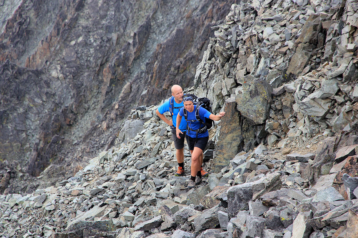
This leads onto the NNW ridge, ascend this ridge on mostly good rocks. There is one short extremely narrow section
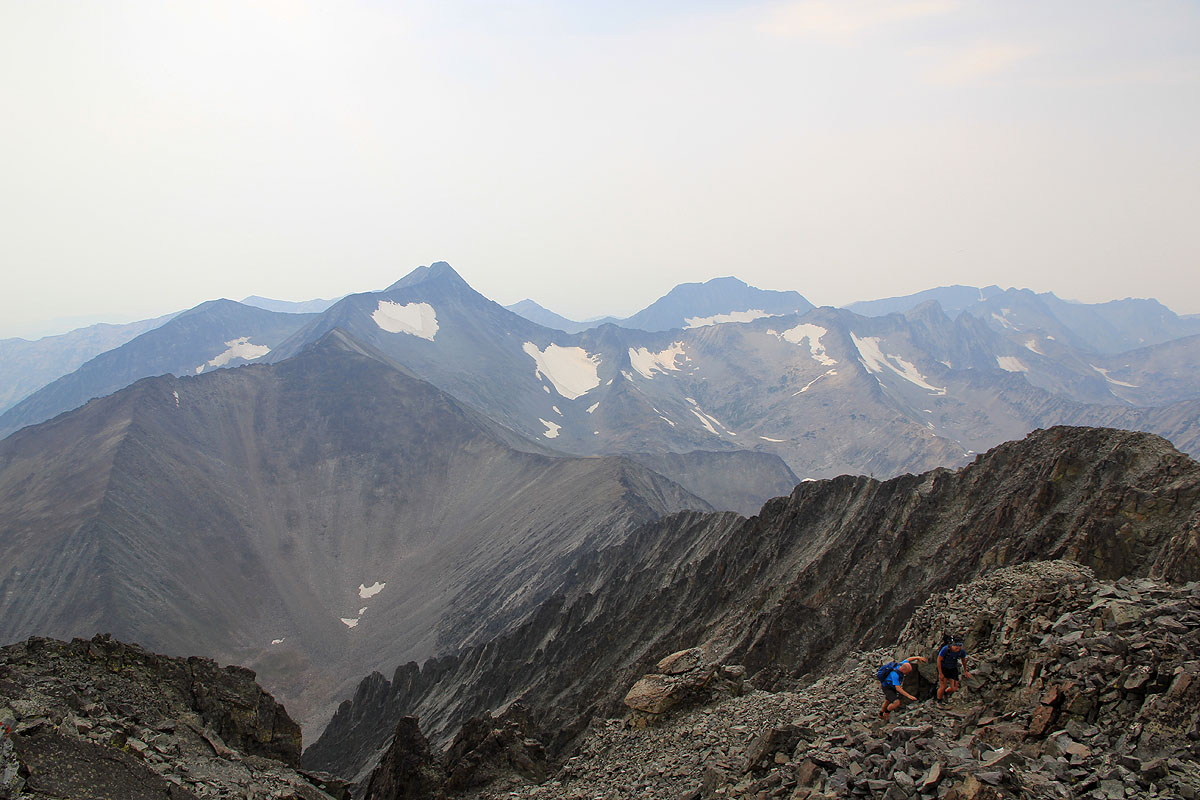
with some exposure, but technically very easy. The route now enters a broader area, all talus. It is not too difficult
and continuing the ascent will get you to the top of a false summit, located NW of the highest summit, but separated by
a pretty deep cut.
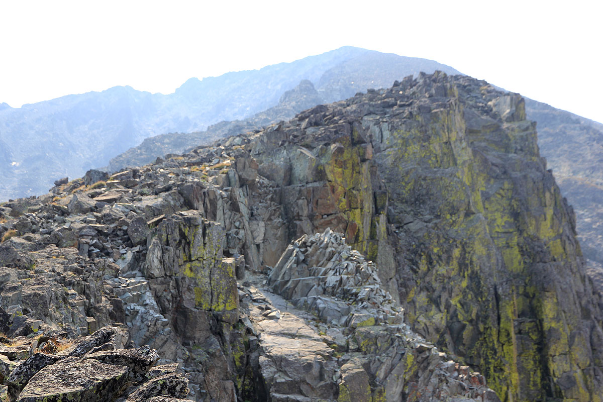
Locate a pretty obvious, deep and narrow gully that leads to the bottom of the cut. This is full of loose
rocks so care is needed by any multi-person party. Ascend left around the (larger) gully, climb some obvious
ledges and turn left around a corner, below cliffs.
This will bring you across to more talus and a climbers trail
that connects easily up to the proper summit.
The normal route will descend from the false summit along the west ridge. Follow this ridge as long as it is easy
to descend, then turn north and descend on loose and somewhat unstable talus directly down into the valley that
continues down to Blue Lake. Exercise utmost caution in order to avoid releasing rocks that may hit people
further downslope. The Blue lake must be circled left (west). Pick up a good trail here and ascend across a local
hilltop before descending back into the main valley with Big Timber Creek. Join the main trail and hike down the valley
all the way back to Half Moon Campground.
Overall, the route of ascent described above, is likely a better route also for descending.
Comments/Trip report:
We drove across the state (from Libby) after a climb of Snowshoe Peak the day before. Arriving shortly
after midnight, we said hello to Greg Slayden before going to bed. Greg had arrived earlier and we had agreed
to climb Crazy together the next morning. Due to our late arrival, a pretty slow start seemed in order.
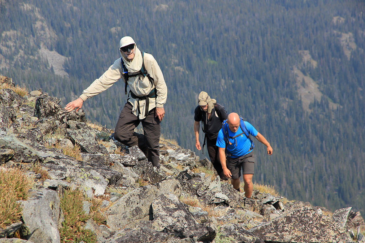
We started at 0820 and decided to explore an alternative route described in the guide book by Cedron Jones.
The bush walk is easy (we have been trained up in Glacier Nat. Park.) and soon we are above the timber line.
Eager to gain elevation, we ascend some rocky slabs only to realize that this will lead us to the wrong summit.
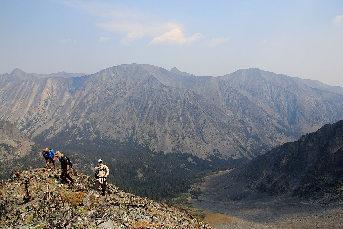
We descend a bit and contour down west into the valley from where a distinct and bulky buttress connects with
a proper ridge.
We climb the buttress and
continue up the ridge, finishing on a broader
slope of talus that ends at
the false summit of Crazy. Here, we join the normal route that comes up the west ridge (on our right).
An easy scramble brings us across to the proper summit.
We arrive at 1335 and spend 40 minutes on this fine spot.
Leaving at 1415, we cross back to the false summit, then descend the west ridge (normal route). The slope from this
ridge and down into the basin above Blue Lake, is loose and pretty dangerous wrt. climber released rocks that will
shoot down the slope.
We arrive at Blue Lake, hike around to the left (clockwise) and pick up a bigger trail that subsequently
connects with Big timber Creek and the main trail back to half Moon Camp. We arrive at 1900, a 10:40 hike.
This was the last peak for Melanie and Eirik. Many thanks for very good company, so also to Greg for
joining us on this climb. This was my 56th US ultra prominent peak (in the lower 48 states), obviously Rob
and I will now head for Cloud Peak in Wyoming, the last peak on this attractive list of climbing goals.
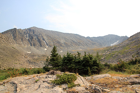
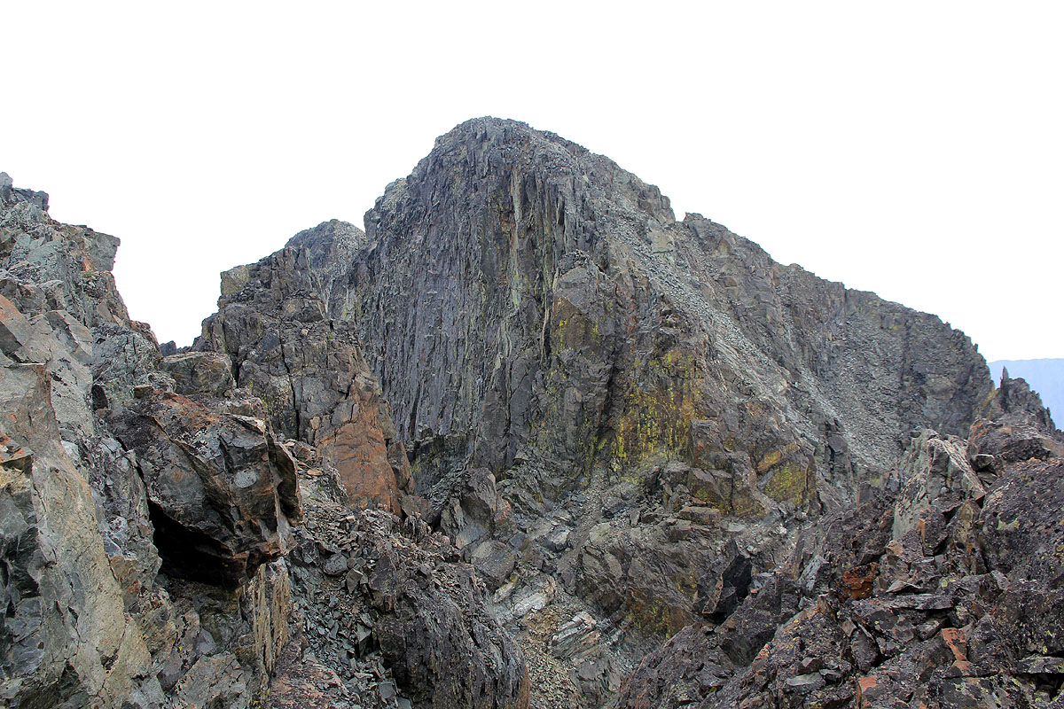
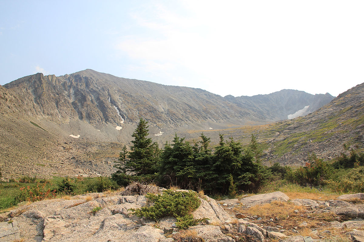
Crazy Peak, the false summit is the highest
visible point in the left part of the picture.
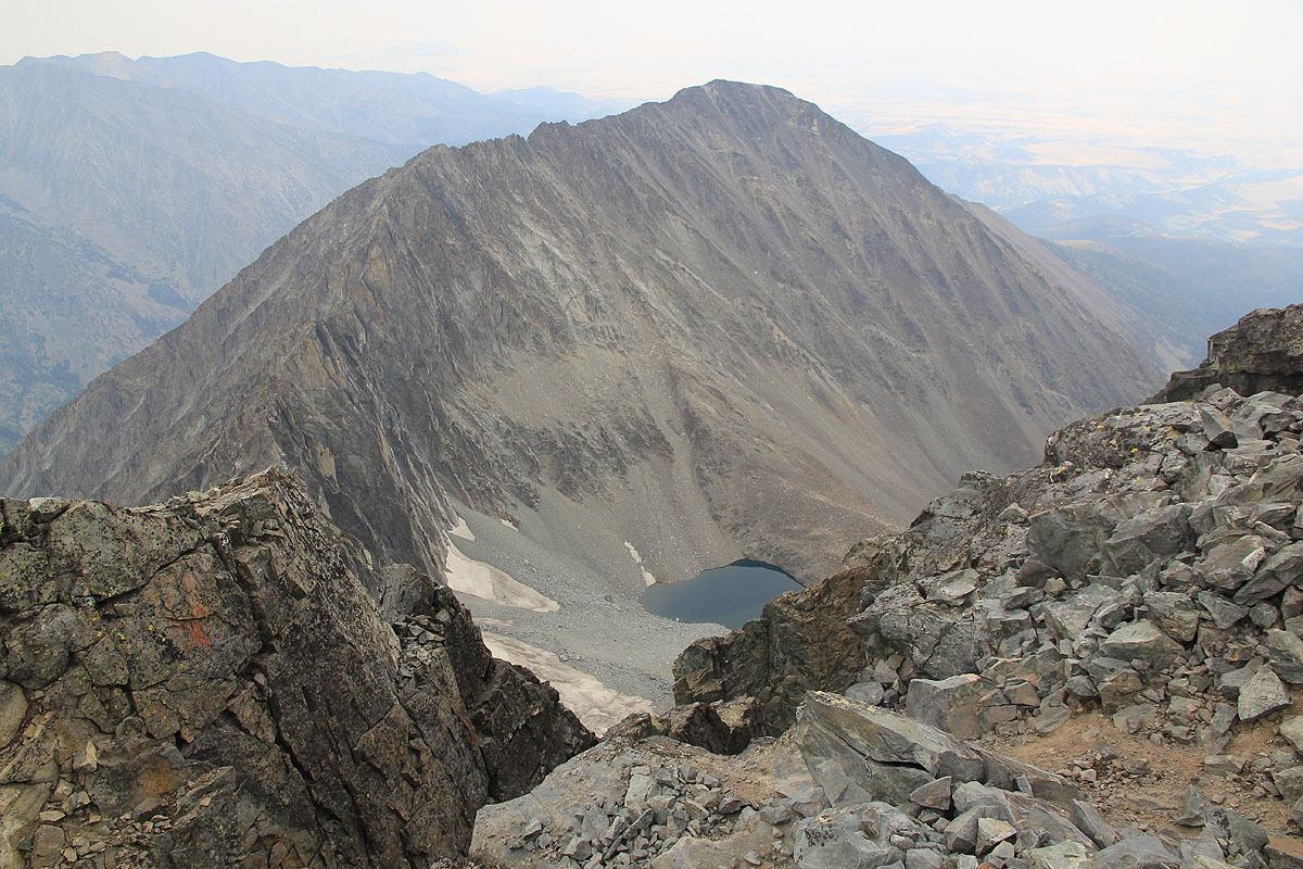
The normal route ascends this valley, then left up the slope, then left again along the long ridge.
The route of ascent. The buttress is between the lower snow patch and the
two higher ones. The ridge we ascended then runs up to the false summit. The west ridge can be seen behind.