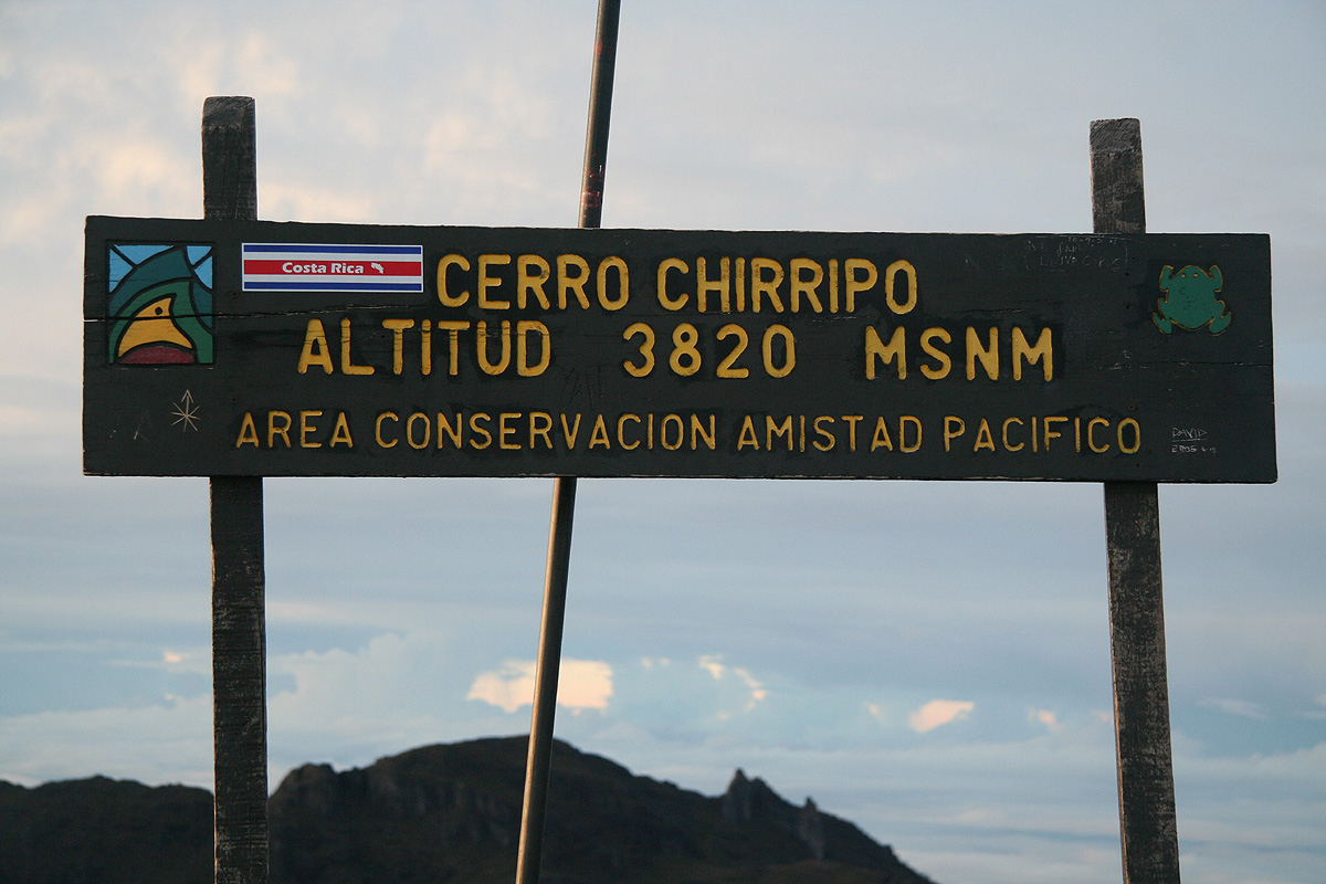
Cerro Chirripo
- Cerro Chirripo
- 3820 m
- Primary factor 3727 m
- Costa Rica HP.
- Location: North 09:29.045, West 083:29.320 (GPS at the summit)
- Climbed December 4. 2007.
- Difficulty: YDS Class 2
Cerro Chirripo
|
|
From San Jose, head south on the Pan-American Highway, called Hwy. number 2 south of San Jose.
Look for signs with directions to Cartago, in order to find this road. Cartago is the first
major city approximately 20 kilometer south of San Jose. Hwy. 2 runs south just west of Cartago.
You will notice a Shell gas station on your right as you drive on a pretty straight section of the
road as you touch the west side of Cartago. Measure your driving distance from this gas station.
The Hwy. proceeds to climb across a rather big divide, crossing near the summit Cerro de la Muerte
(Mountain of Death!) at 3451 meter. There is a short side road all the way to this summit.
From here, there is a very long downhill section more or less all the way to
the city San Isidro de El General. Pay attention here, after passing the bus station, you cross
two bridges, be alert as you shall exit left immediately after the entrance to a Maxi Bodega store.
This store is also on your left side. The small road that forks off left is not signed. This
exit is at kilometer 113.2 (as measured from the Shell gas station). The location has
coordinates N09:22.007, W083:41.824.
At kilometer 121.6, turn right. There are signs for Chirripo National Park here. The paved road
ends and the dirt road is rough, but may be driven with care by an ordinary car.
Turn right at kilometer 130.7, again there is a sign for Chirrpo.
You will pass the park ranger station on your left and a couple of motels.
At kilometer 132.8 you have
hotel El Uran on your left side in a rather steep uphill.
This hotel is located at N09:28.255, W083:35.111, elevation about 1490 meter.
The trailhead is now less than
100 more meter up the hill. Note that the trail leaves the road at this point, going right.
Route description:
To the mountain hut:
The trail forks right from the small road less than 100 meter uphill
from hotel Uran. There are good signs at this location. Immediately,
the trail heads uphill. There is a rather large ridge that will define the
route to higher ground. This ridge is not always easily recognized due to the
jungle vegetation, however you will notice how the terrain slopes downward on your
left and on your right at various points along the way. The trail is marked with
milepost signs every kilometer, there are also more informational signs telling
about the various climatic zones that the trail traverses - Zone of the great oak trees,
zone of the bamboo etc..
At kilometer 4 you cross into the Chirripo National Park. The trail (in December) is
very muddy and somewhat slippery. You keep climbing until kilometer 6, the next kilometer
is more level along the top of the ridge, then descending slightly as you arrive at the
Refugio Llano Bonito hut. This shelter is supposed to be an emergency shelter as well as a place for
resting along the way. Both with respect to distance as well as actual hiking time, this shelter
is the half-way point
between the trailhead and the mountain hut where hikers spend the night.
After leaving this hut, the trail again climbs distinctly up to kilometer 10. The trail is much
drier beyond the half-way point as it climbs first on the left side of the ridge, later more
across on the right side. Near kilometer 10, the trail emerges into a more open landscape
as it climbs above the treeline for the larger trees. There is a main drainage on the right
hand side. The trail gradually levels off and even has a couple of downhill sections as it
traverses the hillside towards kilometer 13. Shortly before kilometer 13, the trail again heads
uphill in order to test your strength and determination. At kilometer 14, there is a sign saying
"The Last Steps" and indeed what remains is 500 meter which is largely going gently downhill to
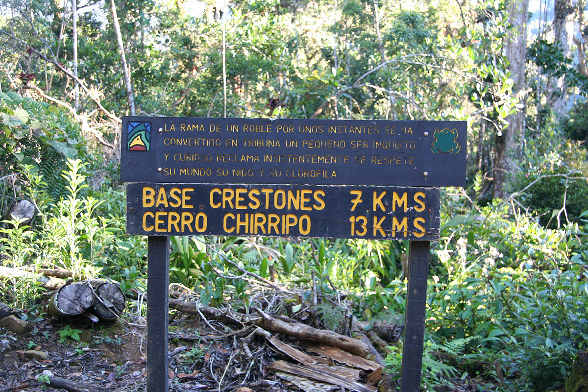
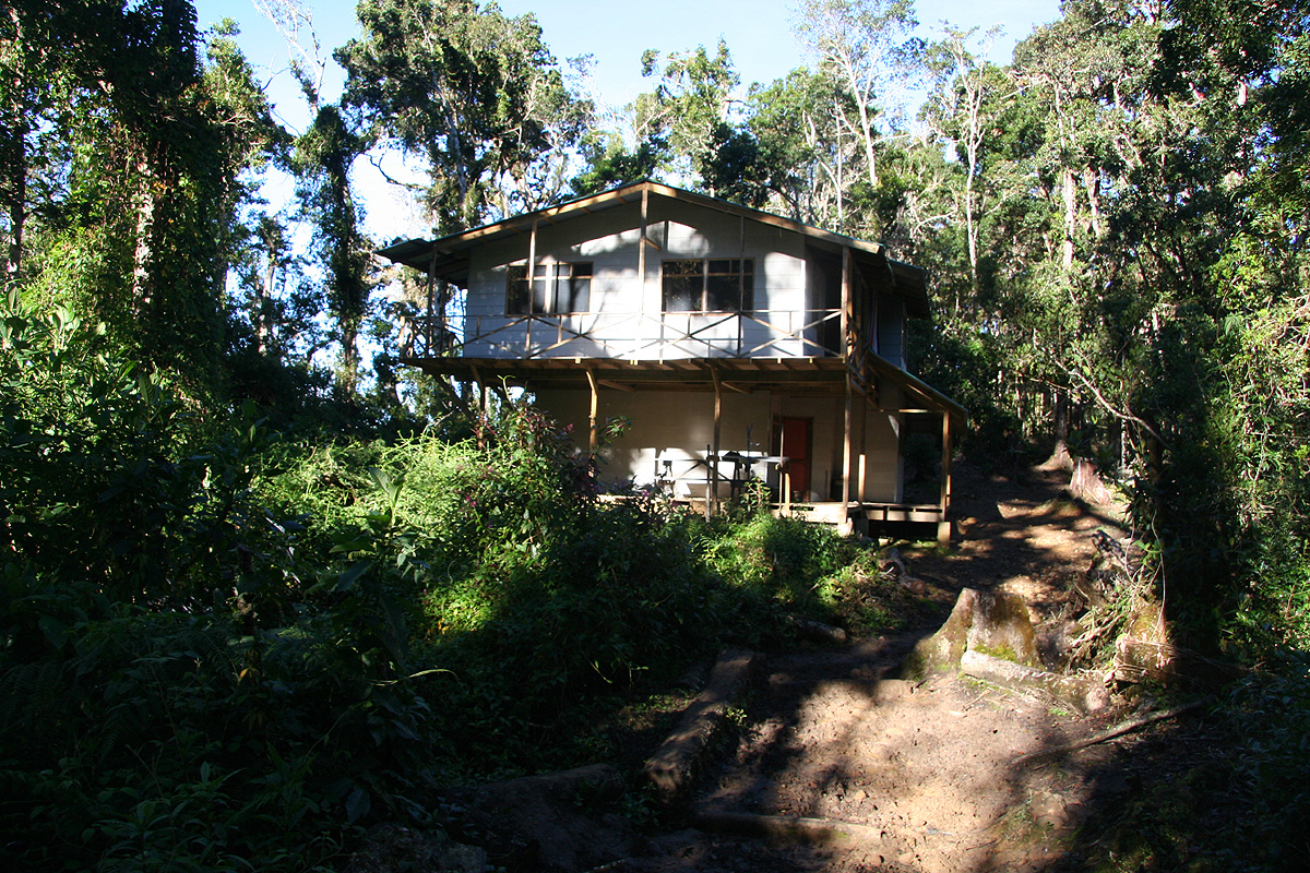
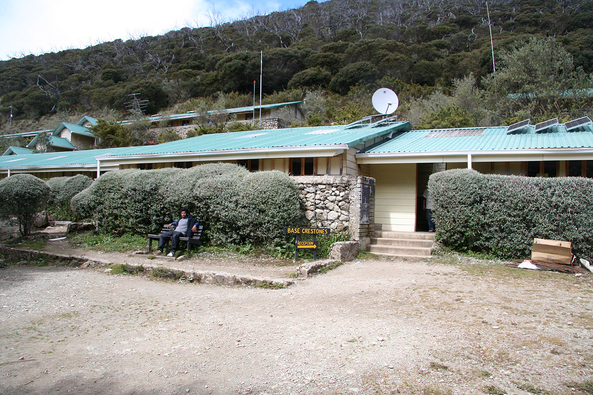
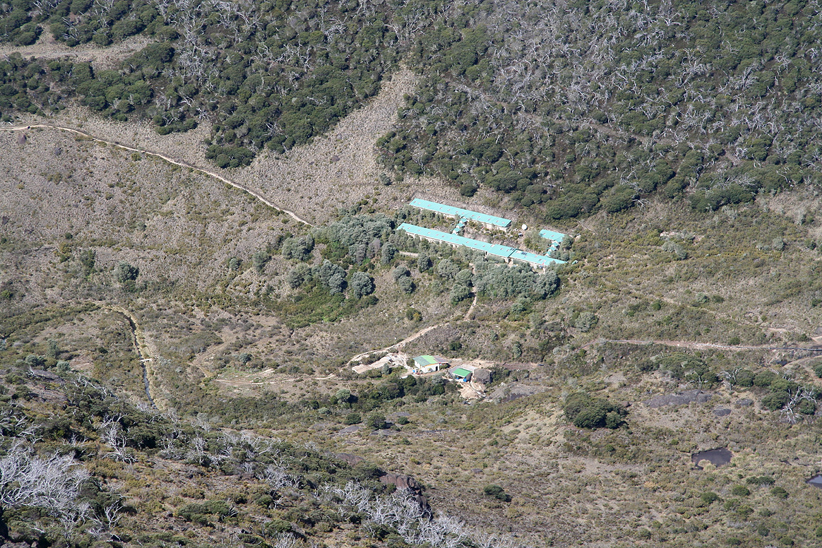
the mountain hut. This hut is called Centro Ambientalista El Paramo or somewhat easier Base de Crestones.
Its location is at
N09:27.407, W083:30.296, elevation about 3337 meter.
From the mountain hut to Cerro Chirripo:
Right outside the main entrance there are signs
for Cerro Ventisqueros as well as for Cerro Chirripo.
The distance to Chirripo is given as 5.1 kilometer.
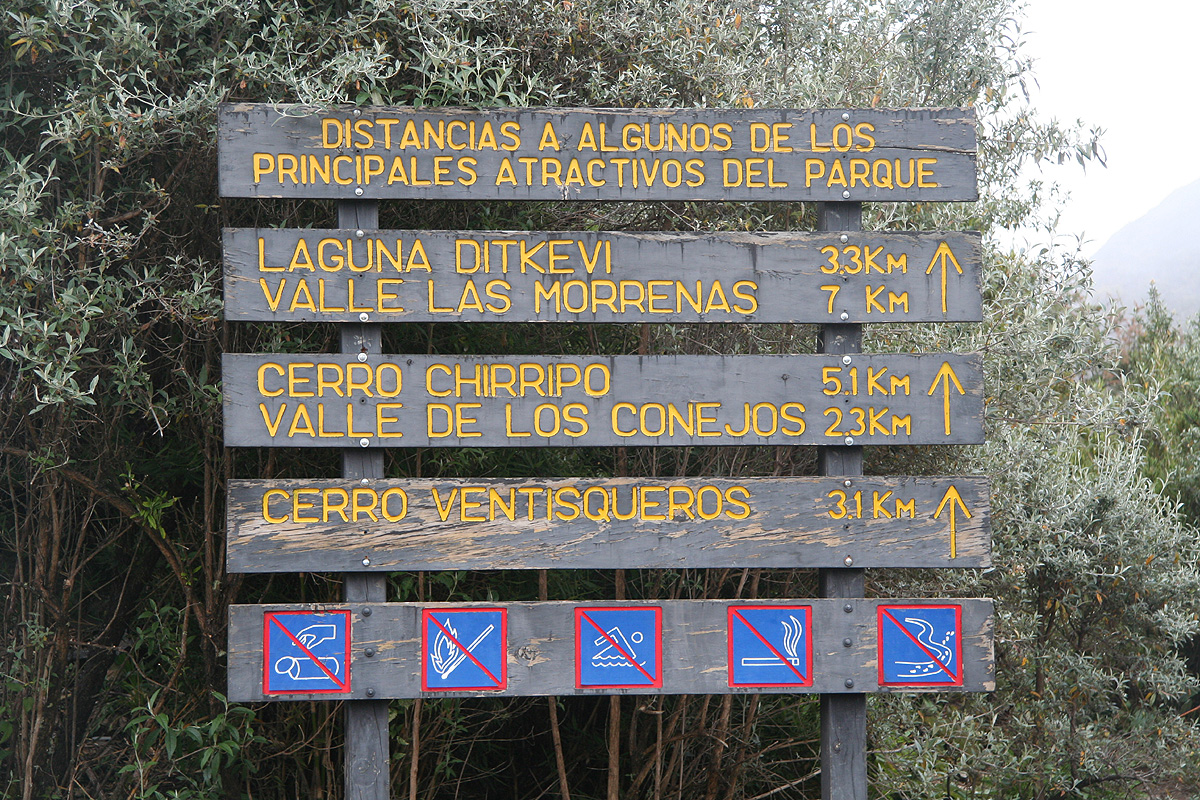
The trail heads up the valley and before long, you pass a sign for Cerro Ventisqueros forking left.
The Chirripo trail continues straight ahead until you are in the pretty flat, upper basin called
Valle de Los Conejos. At this point,
location N09:27.926, W083:29.410, elevation about 3473 meter, you will enter a T-shaped
trail fork with big signs. The trail to Cerro Chirripo goes left while the loop trail across
Cerro Terbi runs right. The sign here tells you that 2.8 kilometer remains. There is also a sign for
Lago Chirripo pointing the same way. On your return hike, I would strongly recommend to take the trail
to Cerro Terbi at this point, this is a nice variation and enables you to bag an extra peak.
The trail now heads left and climbs a little before it again makes a turn more right in order to ascend
to the col between Cerro Piramide (on your right) and the ridge with several local tops that extends all
the way to Cerro Ventisqueros. This col is at location N09:28.703, W083:29.415, elevation 3702 meter.
The route proceeds by a short an easy traverse below Cerro Piramide to a new col, forming the direct
connection between Piramide and Chirripo. You will now have the
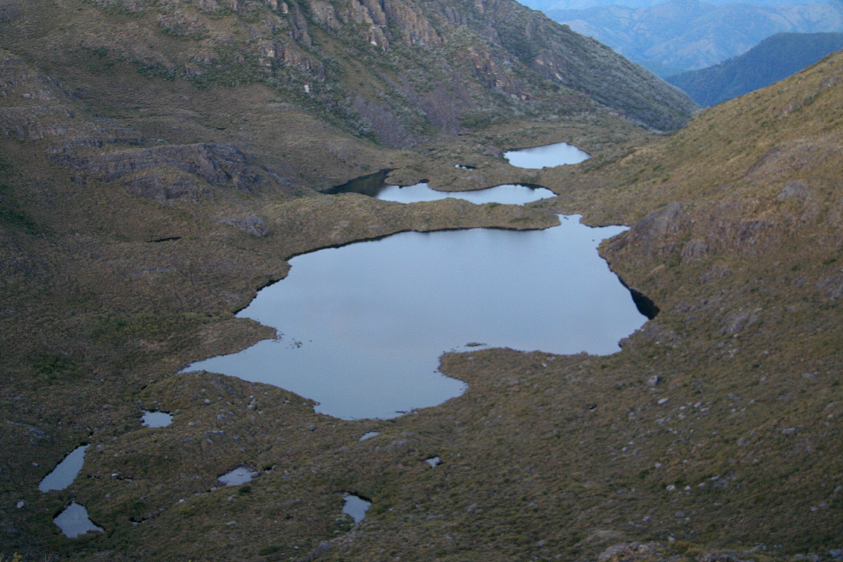
lake Lago Chirripo below you on your
left side. This last col is located at N09:28.882, W083:29.311, elevation 3697 meter. From here, the trail
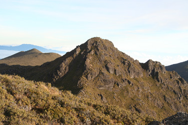
to Chirripo runs more or less directly along the ridge and then up to the summit. This is by far the
steepest part of the route, but with very nice steps all the way.
Still, the terrain is steep enough to class this very short and final section as YDS class 2, up to this point
the entire hike has been YDS class 1. The summit
has a large sign as well as a box with a summit register. The summit
is a point on the main divide and two creeks start in this vicinity, Chirripo Atlantico and Chirripo Pacifico.
Trip Report:
After establishing a local headquarter at Punta Islita,
my wife Heidi would enjoy the sun there while
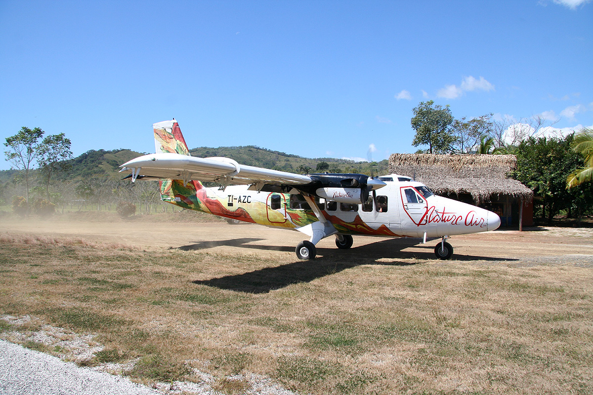
I climbed Chirripo, I left the tiny local airstrip by Twin Otter
around 1100 on December 2. The rental car was waiting for me at the local San Jose airport and by 1315 I was
negotiating San Jose traffic in order to find the Pan-American Highway heading south. This basically involved
crossing the entire city while looking for signs pointing me in the direction of Cartago. Cartago is the first
city south of San Jose. After passing the outskirts of this city, the road runs uphill in order to cross
the mountain Cerro de la Muerte (The Mountain of Death). This mountain takes the road well above 3000 meter before
an even longer downhill section brings you back down to San Isidro de El General.
I knew that I should take a side road from here, unfortunately, there were no signs. Thus, after going too
far, I stopped at a gas station and was told to go back 4 stop-lights, then turn right.
This advice worked well and I proceeded along the proper road which then turned into a rougher dirt road before
arriving at hotel El Uran shortly before 1700. Very friendly people received me, a good dinner was served, free
internet provided etc. They even insisted on serving me breakfast the next morning at 0445 in order for me
to start my trek around 0500.
I went to bed early, it was completely dark and the sky was filled with thousands of brilliant stars. The Big Dipper
completely upside down. always fascinating for a native from Norway where this star constellation is the one best
and most frequently seen. In Norway, it is called "Karl's wagon" and it always does look like a wagon with a long
proper handle to pull. Near the equator, it is a miserable sight, "off the road" and turned with its "wheels" spinning
in the air.
I started hiking at 0515. Just as I came to the trailhead, I noticed two young, nice looking girls with backpacks,
but otherwise lightly dressed obviously prepared for steep uphills and warm weather. I said hello and started my
uphill hike. The trail was nice, but very muddy and somewhat slippery. After 4 kilometer, I entered the
Chirripo National Park and then arrived at the Llano Bonito hut at 0715.
I took a 15 minute break, drank half my
water bottle and enjoyed a chocolate (brought from Norway) before continuing at 0730. The trail was now much
drier and around the 10 kilometer mark it also leveled out. Emerging above the treeline (for large trees) provided
a good view ahead. A large drainage on my right hand and it was pretty clear that the trail would gain the valley
higher up. I arrived at the mountain hut
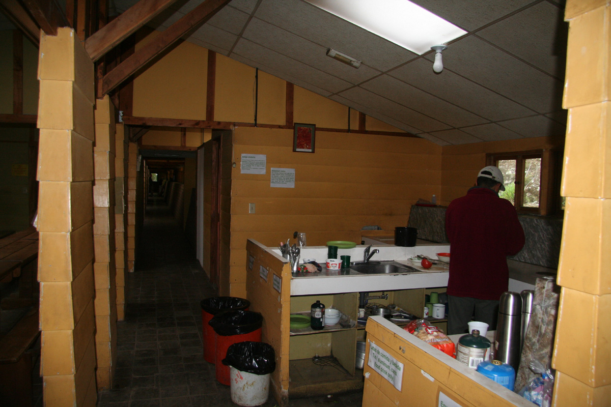
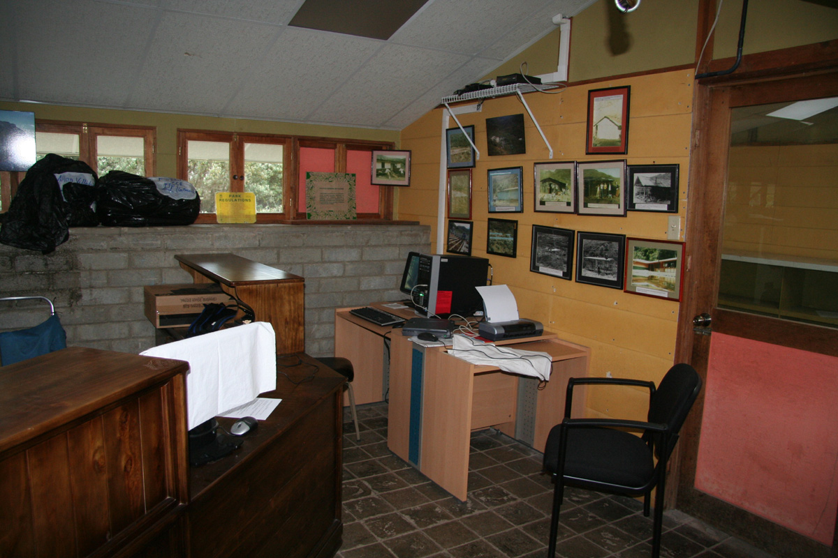
precisely at 0930. I checked in and was assigned room A6. A pretty large
hut with a large (5-6?) staff of rangers.
The hut design seemed very inefficent, a hut this size in Europe would
easily have capacity to house several hundred. This hut had few beds despite its size. No services, no heat and a large
staff, but what they were supposed to do remained a mystery.
I talked to an American couple that just returned from the summit of Chirripo. They both worked for the Red Cross and
were living in St. Louis. They needed to catch a 4PM bus and therefore headed downhill. It was way too early to
just hang around. In fact, I realized that I could have proceeded to climb Chirripo, then return back down to
my car within a single day. However, this trip was not planned as a single day trip. The prospects for clear weather
in the early morning was likely better as clouds already had started to accumulate. I decided to climb the second
highest peak in Costa Rica, the Cerro Ventisqueros today, then climb Chirripo tomorrow.
This hike was easy and nice, a short, fun ridge before the final short uphill. I had started at 1030, made the summit
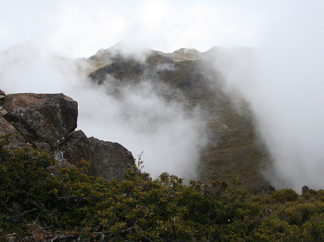
at 1145. From the summit, I got a good view of the mountain landscape. The clouds were now rapidly climbing the mountain
slopes from several sides. Just before leaving, the clouds
climbed from opposite sides of the connecting ridge that
connected this summit to the main mountain plateau.
I returned at 1215 and was back at the hut at 1300. There,
I met the two girls (C and L) that I had seen early in the morning.
The hike up to the hut had taken them 7 hours. They had also been assigned to room A6, a room that had 4 beds altogether.
C came from Colorado, while L was from Washington DC. They were 25 years old and participated in an international
teaching program where they had been assigned to two different (small) villages in order to teach kids while living
with a host family. They wanted to see the sunrise from the summit and planned to start hiking at 0230. I advised them
to travel light and not to start before 0300 at the earliest. C and L put their own twist on describing the hut:
"Very cold, no heat,
no hot water, but free wireless internet."
How likely would it be that somebody would climb
about 2000 vertical meter taking their laptop along? Later, I talked to an engineer from San Jose. He had
installed and just finished testing a 13KW mini-power plant based on hydro power in the local creek nearby.
C and L had planned to stay 2 nights at the hut, but quickly changed their mind when I suggested that they
could get a ride with me back to San Jose provided that they would hike back down early the next morning.
We slept early (as there is little to do after dark at a place like this) and I slept well until C and L
started their preparations for their hike shortly after 0200. They left on schedule at 0300. I was very much
awake by then and decided to follow at 0330. In this way, I might have time for a few extra peaks and
still be back down in time for a daylight drive back to San Jose.
Starting at 0330, I walked rather slowly as I did not want to catch up with C and L before the summit. I could
see their lights further ahead. Unfortunately, the sky was not as clear as yesterday morning. Some stars, but also
a scattered layer of very high clouds. Overall, it still looked like a pretty nice day.
Up ahead, C made the summit of Chirripo around 0445, with L arriving around 0500. I arrived just moments behind
and we then rested while waiting for the sunrise.
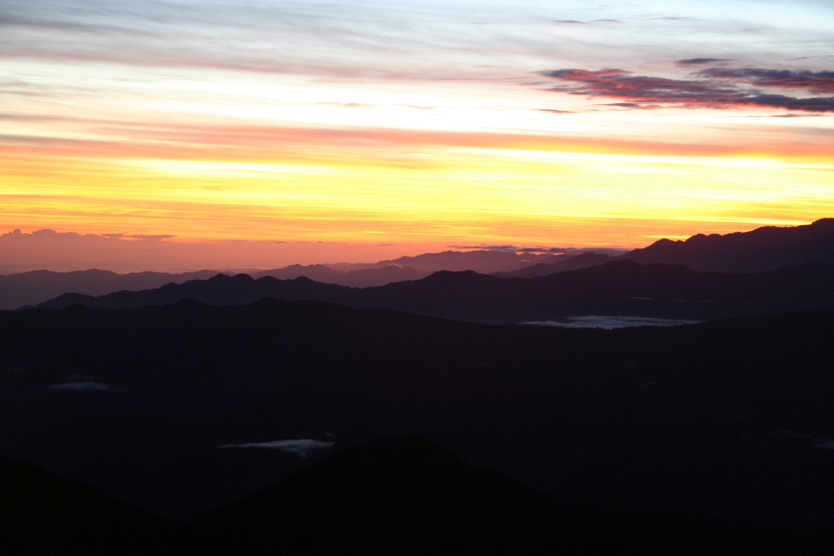
The best colors was actually before the sunrise with red clouds
and nice patterns. The sun finally arrived around 0530 and I started back down at 0545.
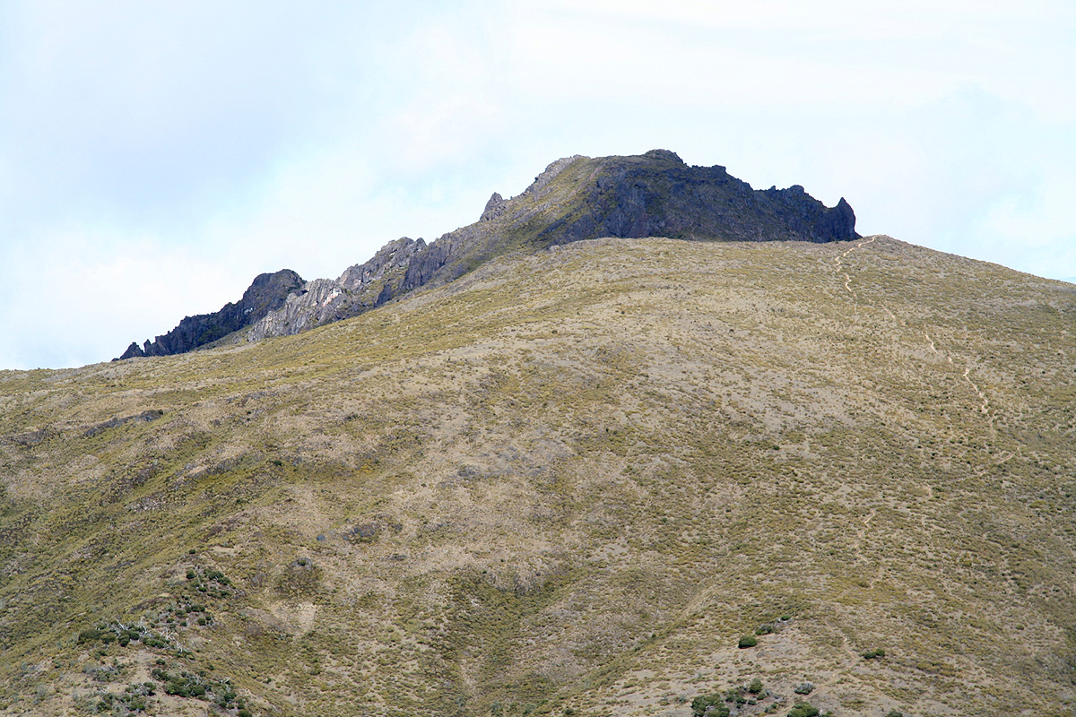
I headed down to the first saddle, then directly up on the third highest summit in Costa Rica,
the Cerro Piramide. There is no trail to this summit, but the terrain is easy
YDS class 2. The top had a small cairn and very good views back into the valley basin as well as across
to the next two peaks. The view back to Cerro Chirripo was also very good from here
as the sun was hitting the ridge I just had descended. I had
reached this summit around 0610 and left around 0620.
I contemplated to just hike down the ridge on the opposite side, but decided to
head back to the trail, follow it back down to the upper valley basin, then deciding what to do next.
I had told C and L that it would be good if they could leave the hut and start the downhill hike before 0900, while
I would aim for 1000. As it turned out, they started down already at 0815. My plan was to complete a "Grand Tour
de Chirripo" by climbing the two remaining peaks, Pico Sureste and Cerro Terbi before returning to the hut.
Thus, I returned by the trail to the Valle de los Conejos, then took aim directly for the col north of
Pico Sureste. This involved crossing a few creeks that had dug fairly deep into the soil, aside from this the
vegetation was not too bad and I made good progress. Somewhat to my surprise, I came upon a trail shortly before
reaching the col, learning that I could have found an even better route. Climbing the north ridge of Pico Sureste
was fun with rock and some easy route finding. My route was perhaps YDS class 2+, however one can likely find a route
that stays at class 2. I reached the summit of Pico Sureste at
0745 and decided that another good rest was well earned. This peak had more rock at its upper sections and a small,
but nice cairn at the very top.
My next goal would be Cerro Terbi, this peak has a trail access, but it seemed most natural
to continue the ridge traverse rather than returning to the valley floor. I thus descended to the saddle separating
the two peaks, then continued my ascent. The terrain here turned out to be more complex than expected. I should likely
have stayed as high as possible, the way things turned out, I found myself traversing high on the north slope in pretty
messy terrain. Quite a fight in order to gain what looked like the highest point from the direction I was coming.
My route involved a few sections of YDS class 3 terrain, however this can be avoided by descending more directly
and rather using the trail that ascends from the Valle de los Conejos. Finally there, not surprisingly there was
higher terrain further ahead. The good news was that the route now looked easy and in fact, I quickly stumbled
upon the trail as it came up to my small col through a rather narrow crack from my right hand side. Following this trail
a very short distance, I found myself sitting on my 4th. independent summit of the day at 0900. The views from
this vantage point was nice. One could look
directly back down to the mountain hut as well as back to Chirripo and
further across to Ventisqueros.
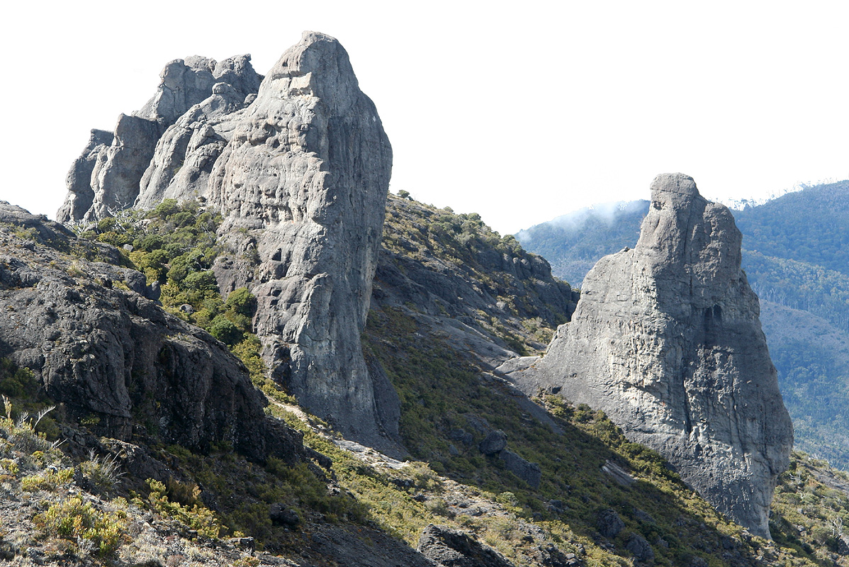
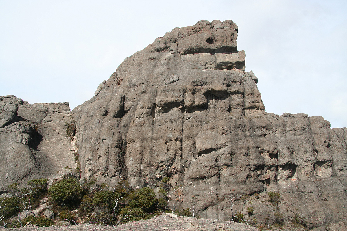
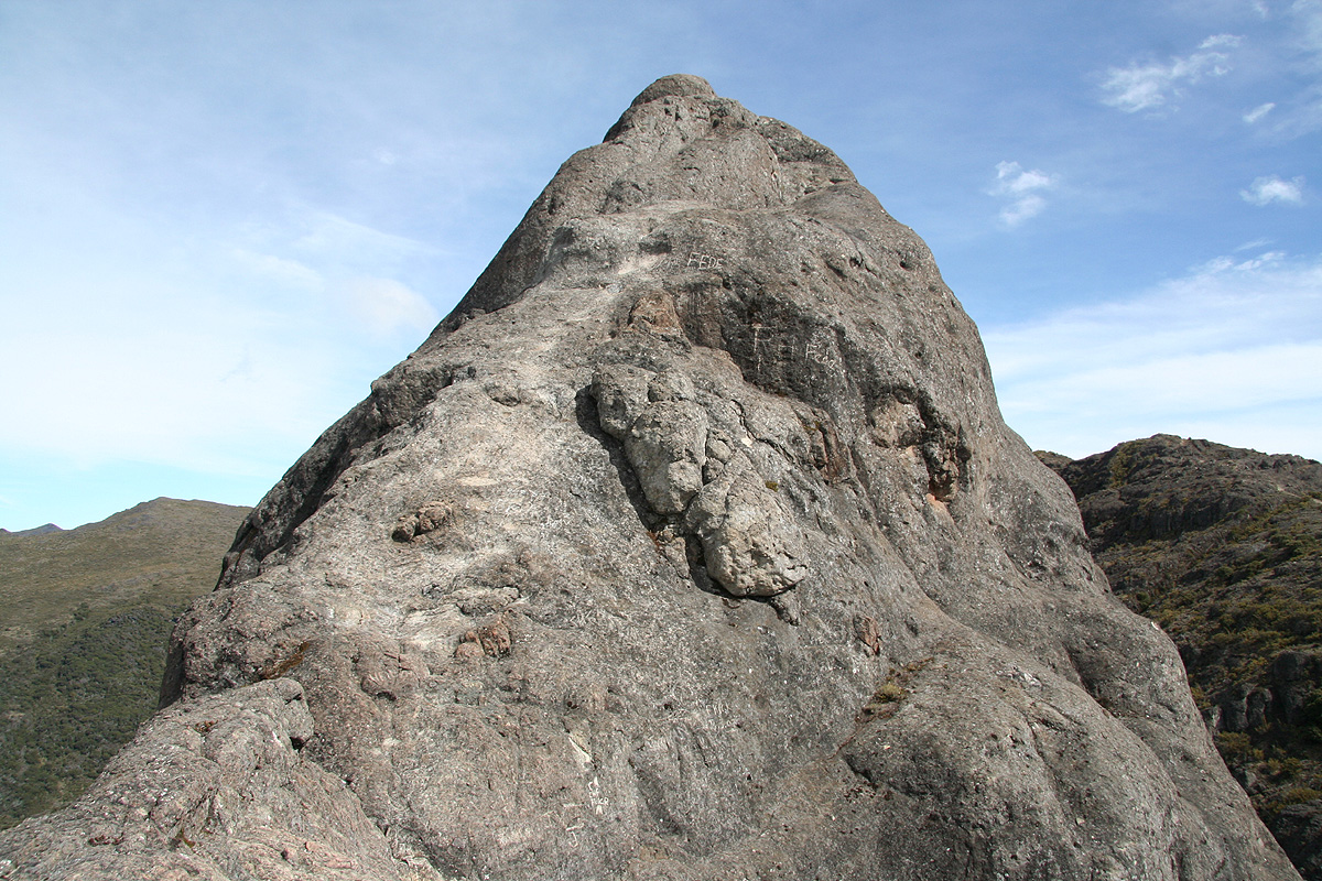
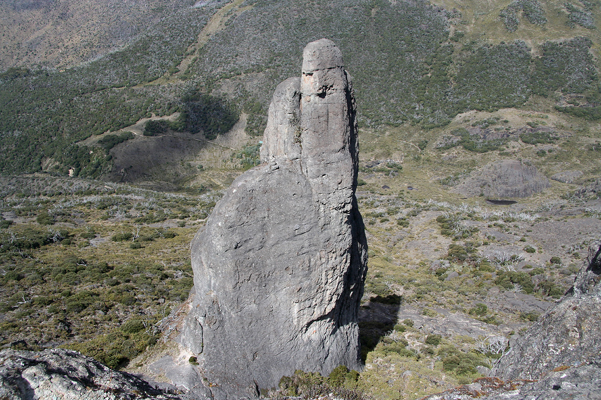
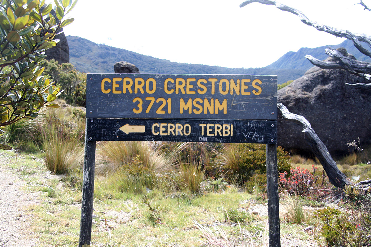
My route now took me down to the interesting rock formations
called Cerro Crestones.
The highest of the two rocks can
be climbed from this side on very good friction rock. I climbed
half way up, a little beyond the first saddle point,
but decided that this rock was steep enough that a belay would be appropriate.
The view from this saddle to the second, even more difficult pinnacle
was nice, but reminded that
any mishap here would be very dangerous.
Thus, I soon climbed back down, then returned along the trail
as it made its way directly back down to the main creek and
the mountain hut. I reached the hut at 0945 and took a well deserved break as well as sorting out gear and packing for
my return hike.
I left at 1015 and wondered about how far ahead the girls might be. I asked a couple of uphill parties and was relieved
when they told me that the two girls were way ahead. The return hike took exactly 3 hours with the 7 kilometer mark
again being the halfway point after 1.5 hours. I caught up with C and L 2 kilometer before the trailhead, the timing
could hardly have been better. The girls were fighting the slippery trail, my boots were somewhat better. I went ahead
and thus had time to change into shorts and sandals as well as buying some coke for the girls before they popped out
at the trailhead.
We had a good drive back to San Jose despite heavy rain for the first 1.5 hours. C and L knew about an inexpensive, but
nice hostel - Kap's Place, a place that can be recommended for anybody needing a place for an overnight stay in San Jose.
In fact, there is also another, similar place right across the street providing a second option in the immediate neighborhood.
We went out to celebrate our successful ascent of Cerro Chirripo with a nice dinner at Cafe Mundo. C and L only made about
3 US dollars per day, so a restaurant meal seemed beyond their financial scope, it was therefore very nice to treat them
to this well deserved way of concluding what had been a pretty long day.
The next day, I drove back to the small airport where Nature Air operate their flights. I had been smart enough to record
the GPS coordinates of the airport and thus found my way back without too much trouble. Soon, their Twin Otter plane would
take me back to Punta Islita, arriving there well before lunch time.