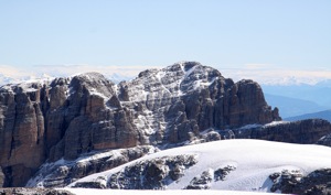
Location: North 46.17946 , East 010.89990 (GPS at the summit)
Difficulty: (YDS) class 4
Attempted September 1, 2013.
Climbed September 14, 2013.
Information:
How to get there:
This mountain is located near the resort village Madonna di Campiglio.
This village is north-west of Trento and can easily be reached from the big
freeway connecting Innsbruck (north) via the Brenner pass with Trento (south).
From Trento,one can either head west on SS45, connecting with SS237, then north
on SS239, or go north on A22 (towards Innsbruck), then go west on SS43 connecting
with SS42 to Dimaro, finally south on SS239.
One can also drive north-east from Milan via Bergamo (Hwy. SS42 via Passo di Tonale),
then right (south) in Dimaro on SS239. Madonna di Campiglio is about 20 kilometer
south from Dimaro.
There is a big tunnel bypassing Madonna di Campiglio on its west side. You should exit into
Madonna di Campiglio from the south end (downhill side) of this tunnel. Drive across, ie. do not
go north towards the center. Cross the river and look for signs to Rifugio Vallesinella. You will
eventually make a right turn in order to get onto this narrow (but paved) road. There are
people collecting toll, in 2009 this was Euro 7 for an overnight stay. Follow this small road
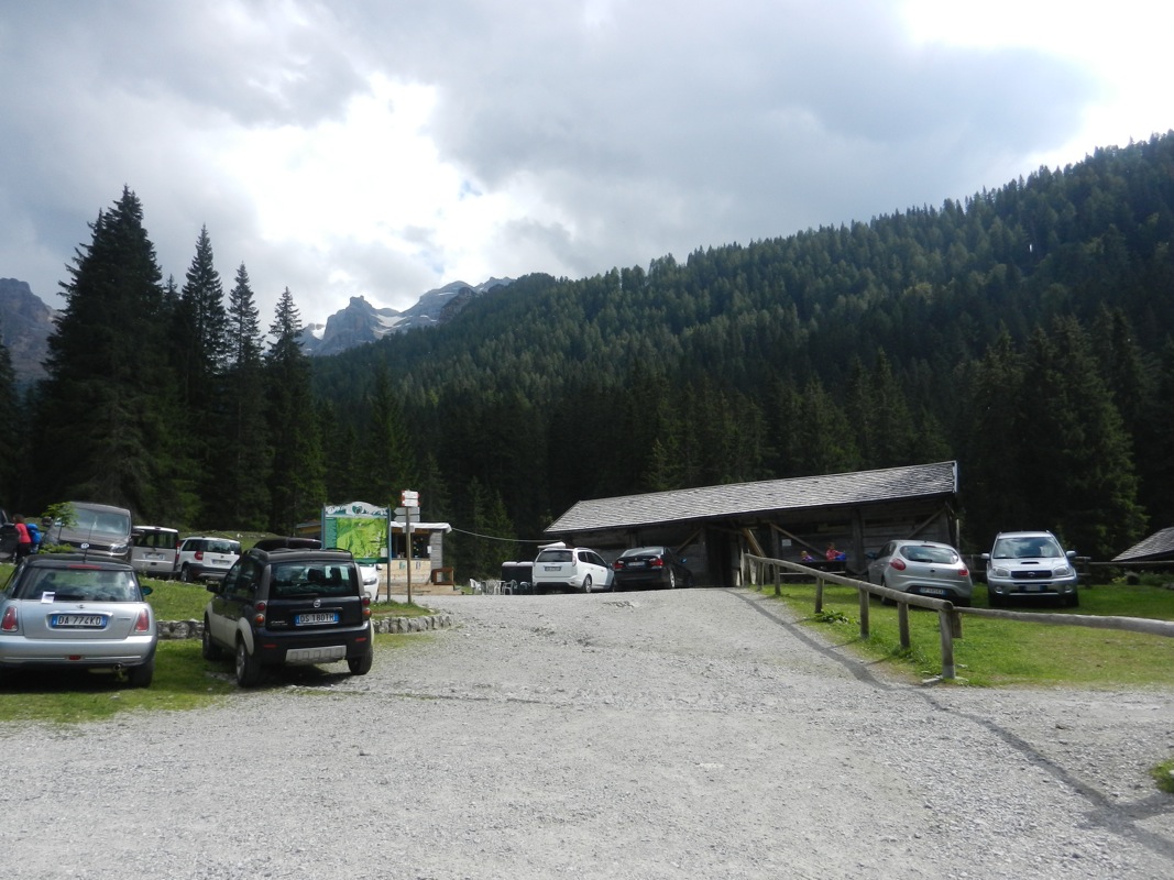
until you arrive at a pretty big parking area
at Rifugio Vallesinella. This is the trailhead,
location N46:12.380, E010:51.145, elevation about 1520 meter.
Route description: Hut hike:
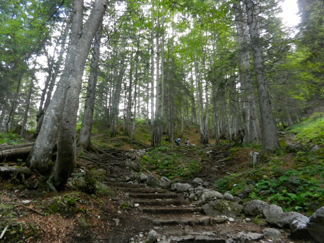
From the parking, descend slightly in order to cross the river.
Check that you start out on a trail with signs for Rifugio Brentei.
The trail (no 317)
now ascends the hillside and
emerges on a ridge by Rifugio Casinei, elevation 1850 meter.
Continue along trail 318, with signs for Rifugio Brentei. After a little while, trail no 328
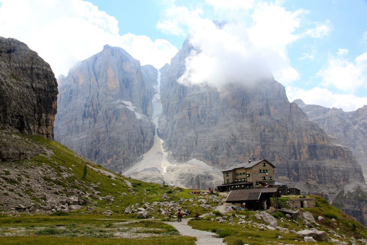
forks left, while you continue straight on trail 318 until you arrive at Rifugio Brentei, 2175 meter.
The time to Brentei is normally less than 2 hours.
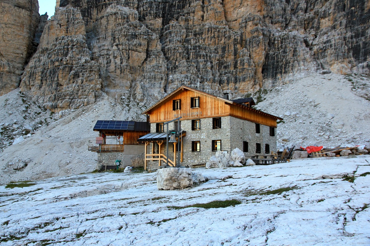
This is a possible place to spend the night, with a bit more time, then consider to proceed
to Rifugio Alimonta. You then turn left just before Brentei and follow the signed and marked
trail up the valley to Alimonta,
this is perhaps 15 minutes beyond the place where
the climbing route starts. Hiking time from Brentei is about one hour.
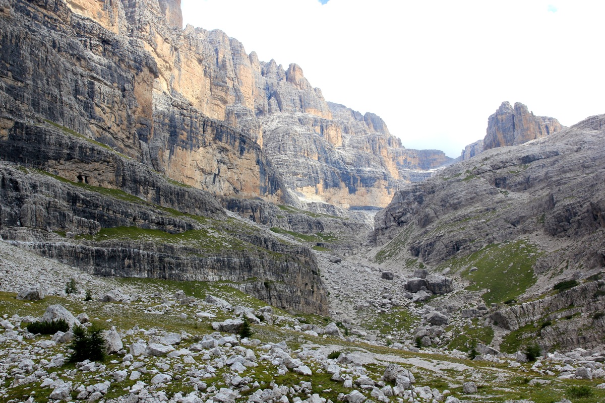
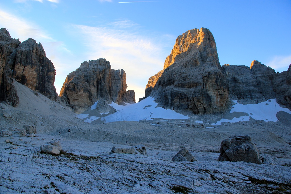
The climbing route starts where the trail (uphill) from Rifugio Brentei has reached more
level ground at the very beginning of a flat valley. The trail to Rifugio Alimonta makes a
right turn here in order to bypass a minor cliff band. This location is
N46.17709 , E010.88954, elevation about 2470 meter.
Summit climb:
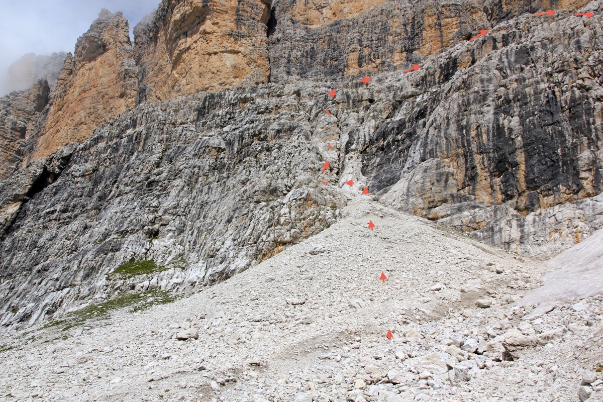
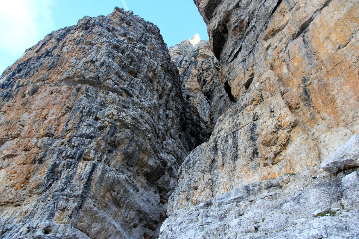
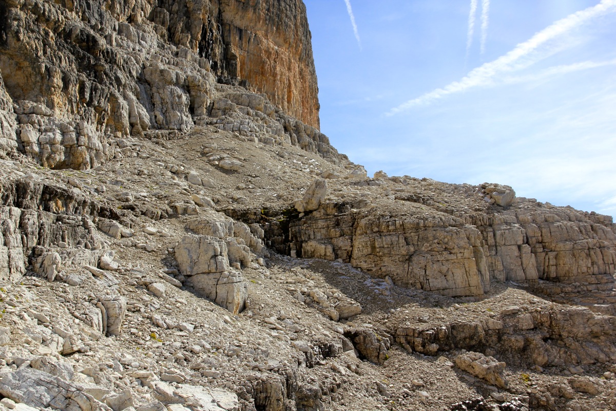
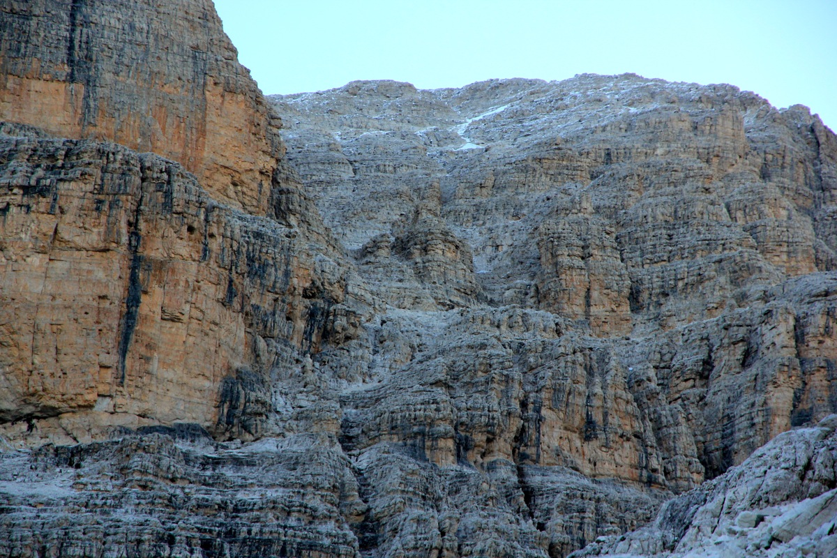
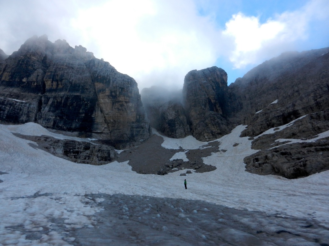
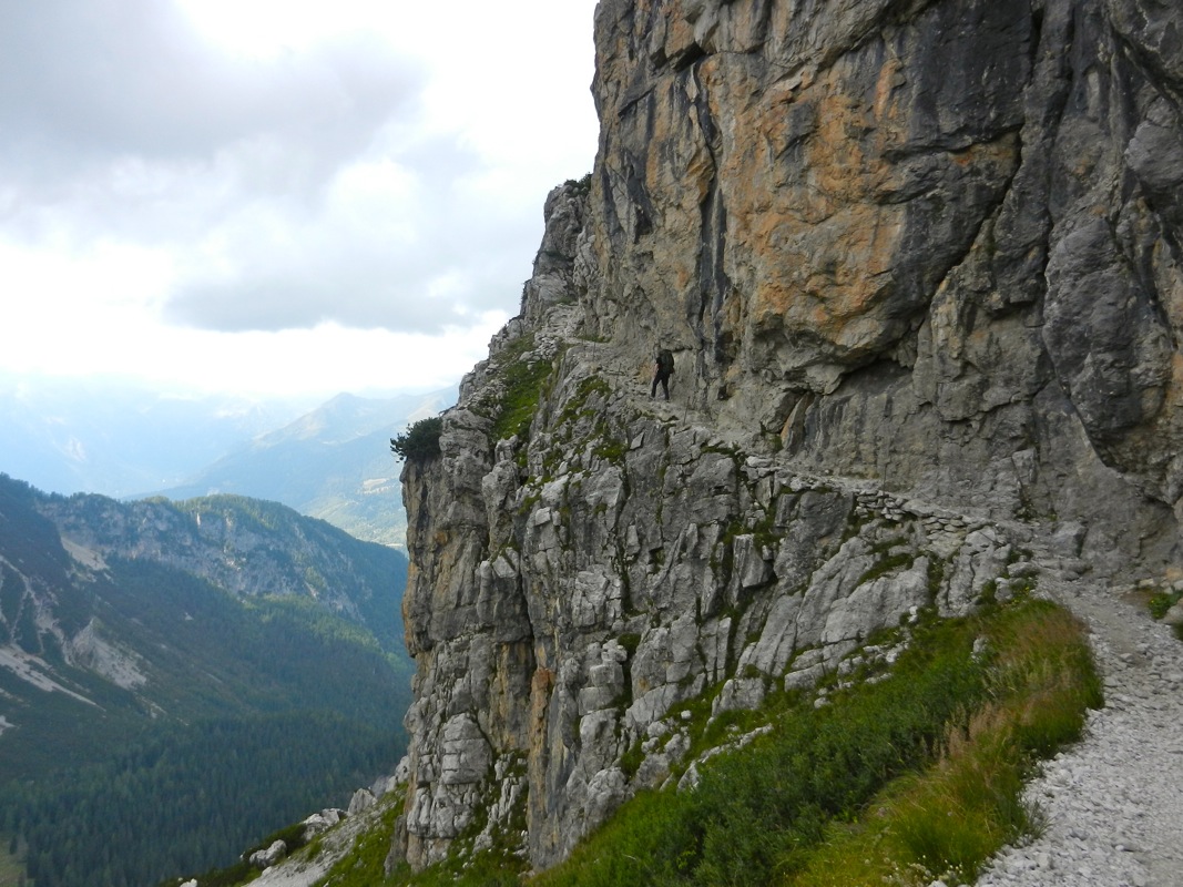
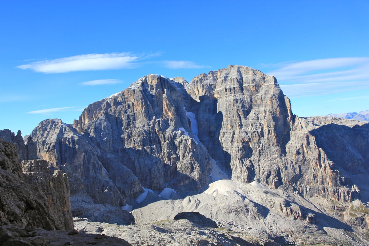
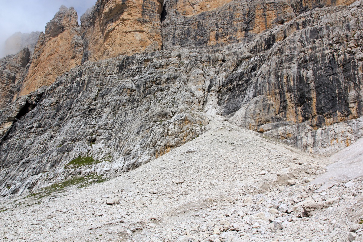
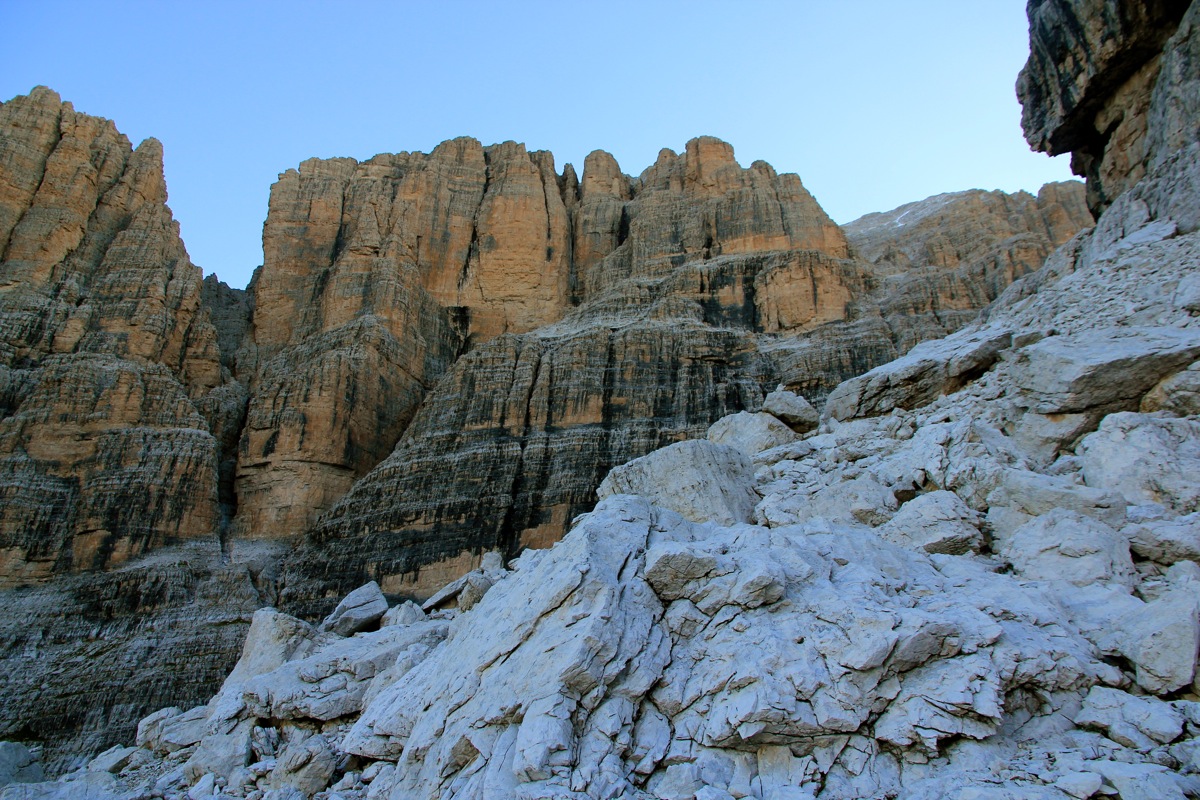
From the point where you leave the trail,
turn left and look at this terrain.
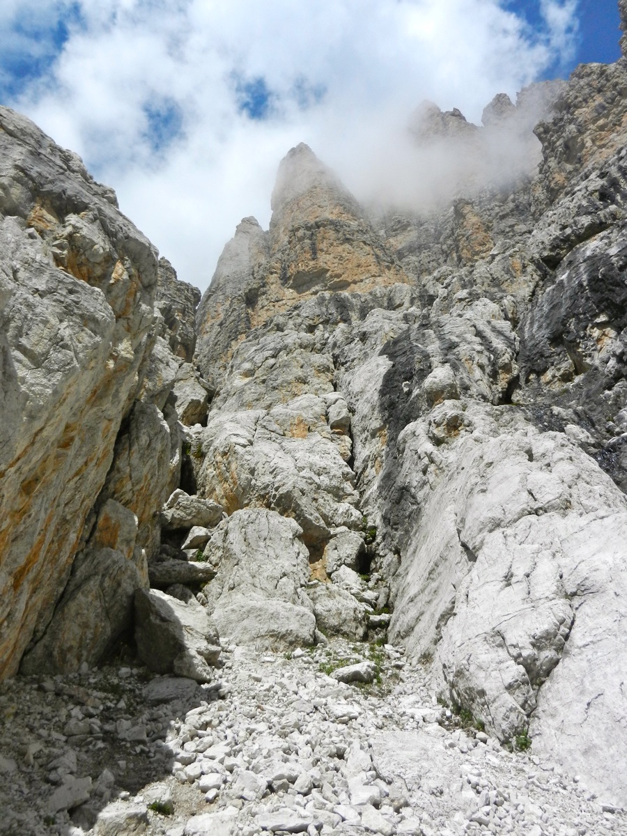
Proceed up the lower scree
and into the narrow gully,
pass a rock on its right side,
then cross left and gain the ridge on the left side of the gully via an easy step.
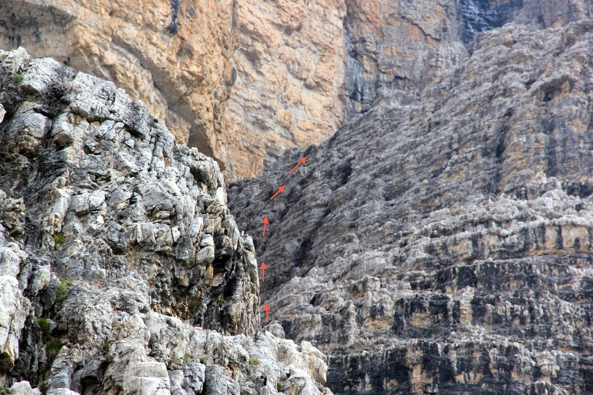
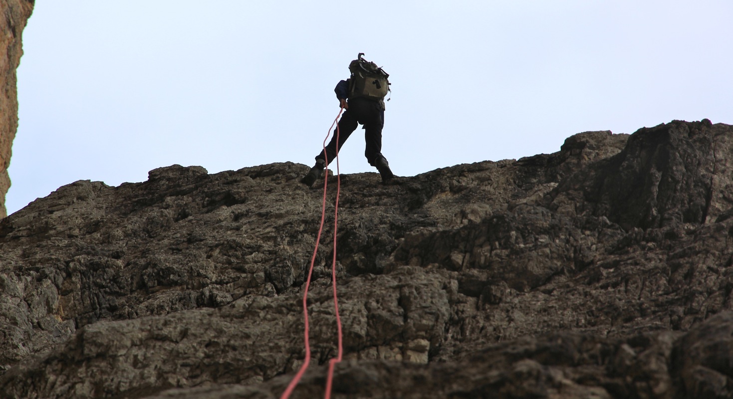
Climb up the ridge as outlined by arrows on the picture.
The climbing consists of a section with (YDS) class 3 followed by two separate, but short
steps each at class 4.
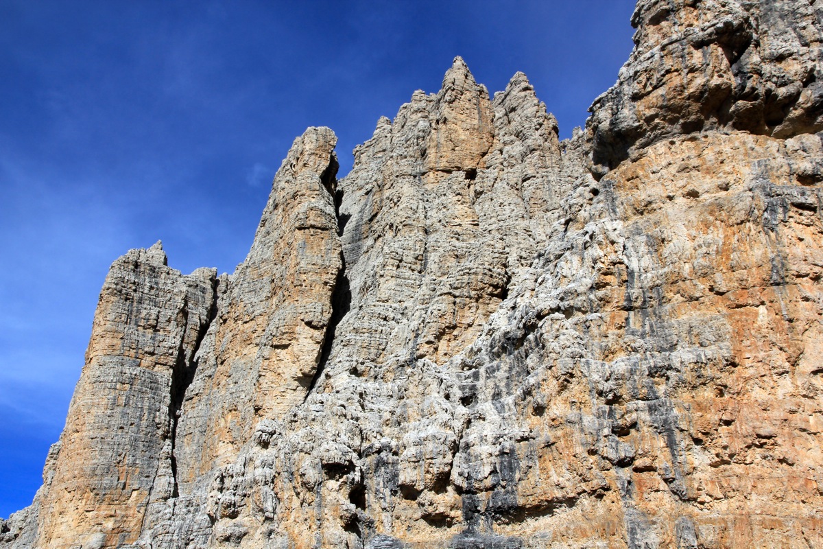
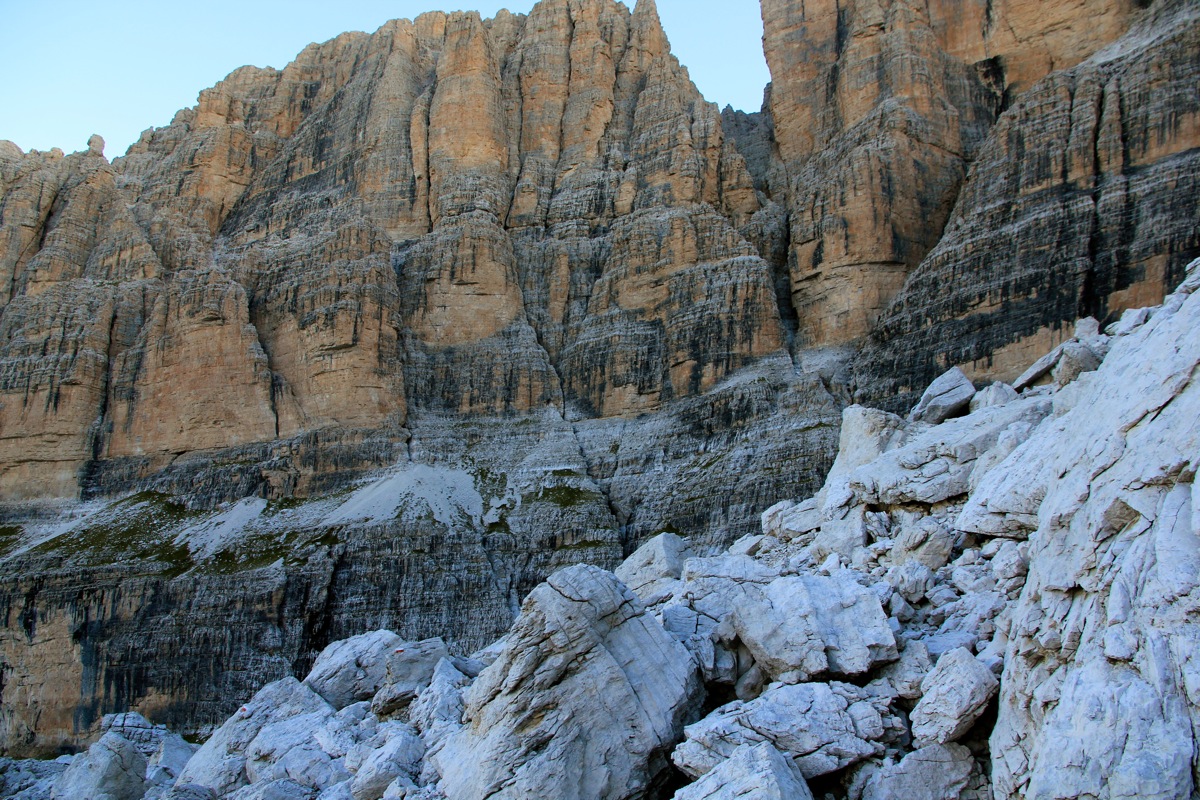
Once on top, continue uphill on scree and gradually turn right, following a vague climbers trail.
Traverse further and reach a narrow cut in the rock that
may be bypassed on an interesting ledge.
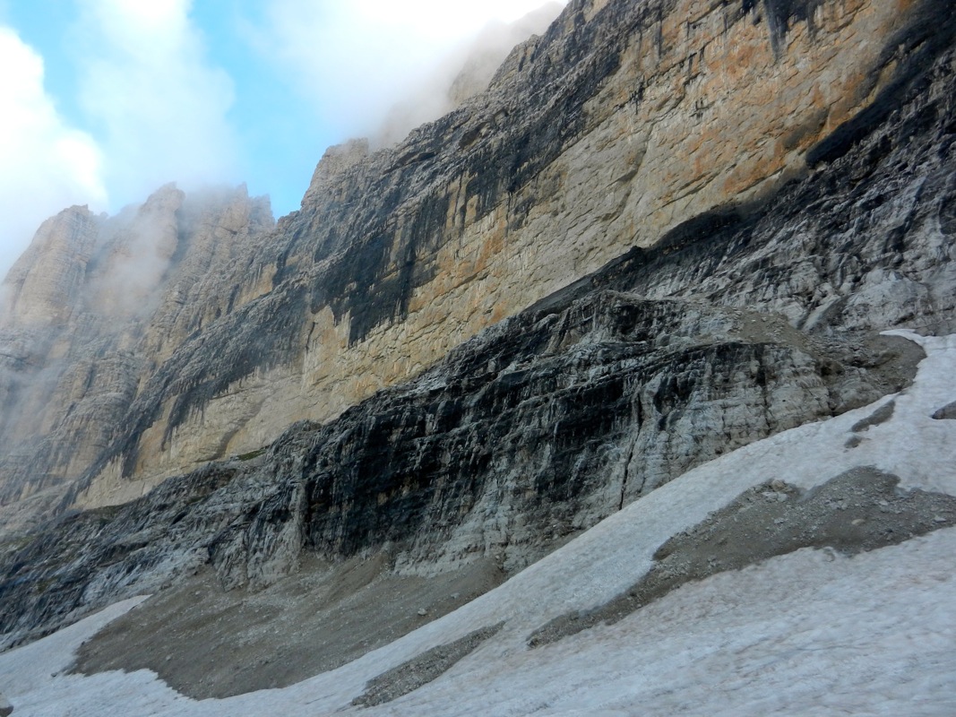
Next, the route climbs higher (easy)
and turns the corner to reach the main gully that
separates Cima Mandron (above you) from Cima Brenta (further right). The gully may be crossed most
easily by going a bit down, then ascend easy rock on the opposite side and traverse into the
gully reaching it above a huge chockstone. Continue a bit upwards in the gully, then traverse right
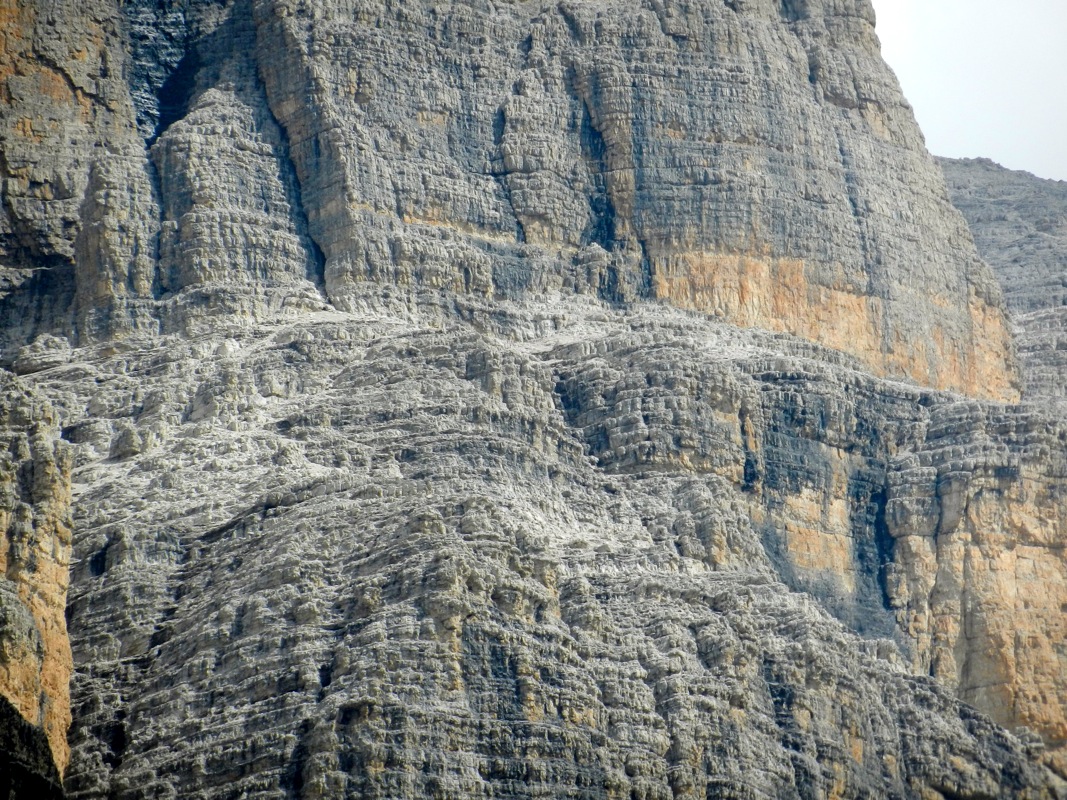
onto a system of ledges.
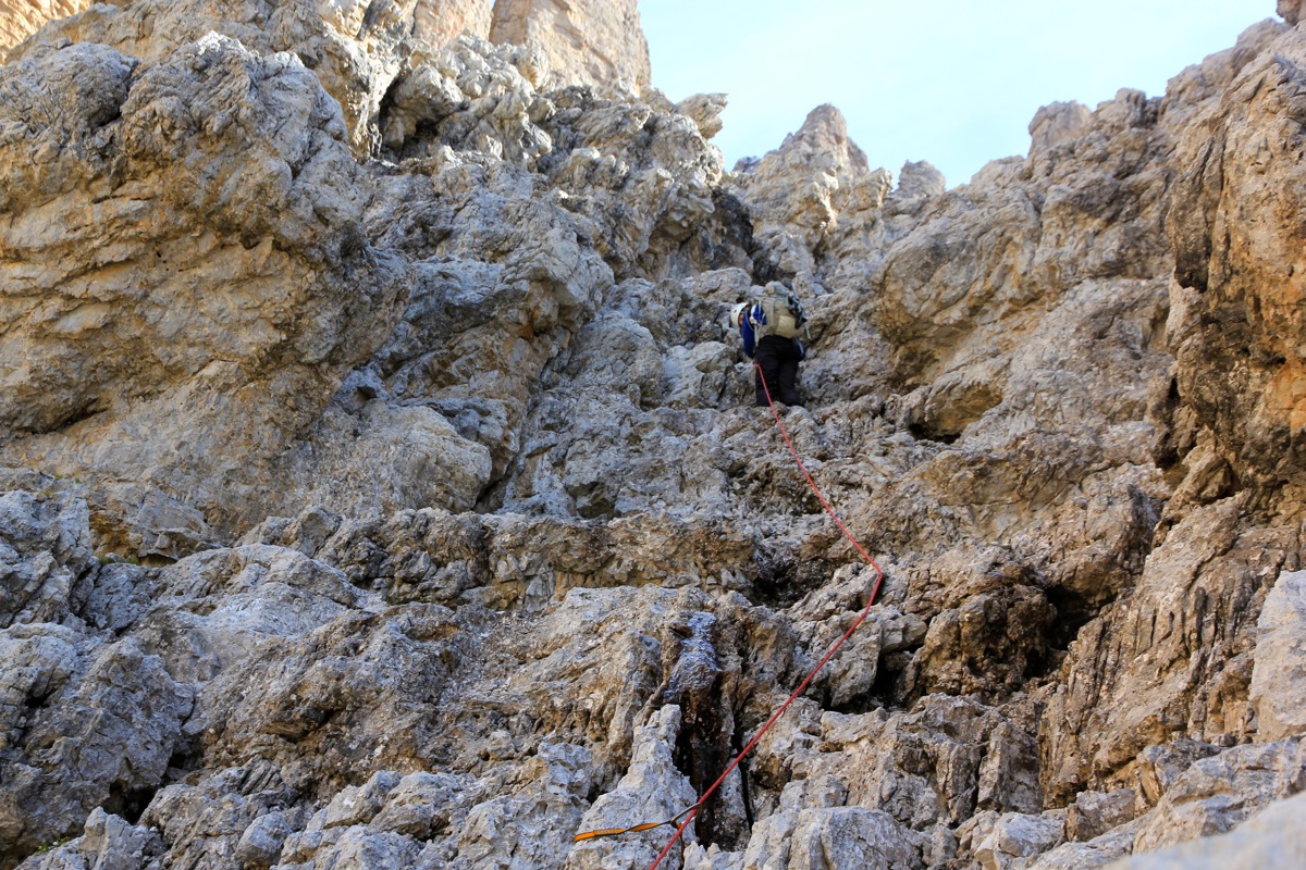
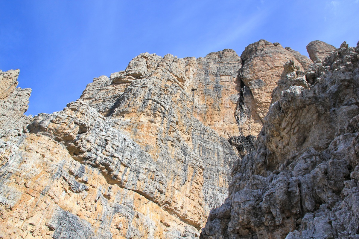
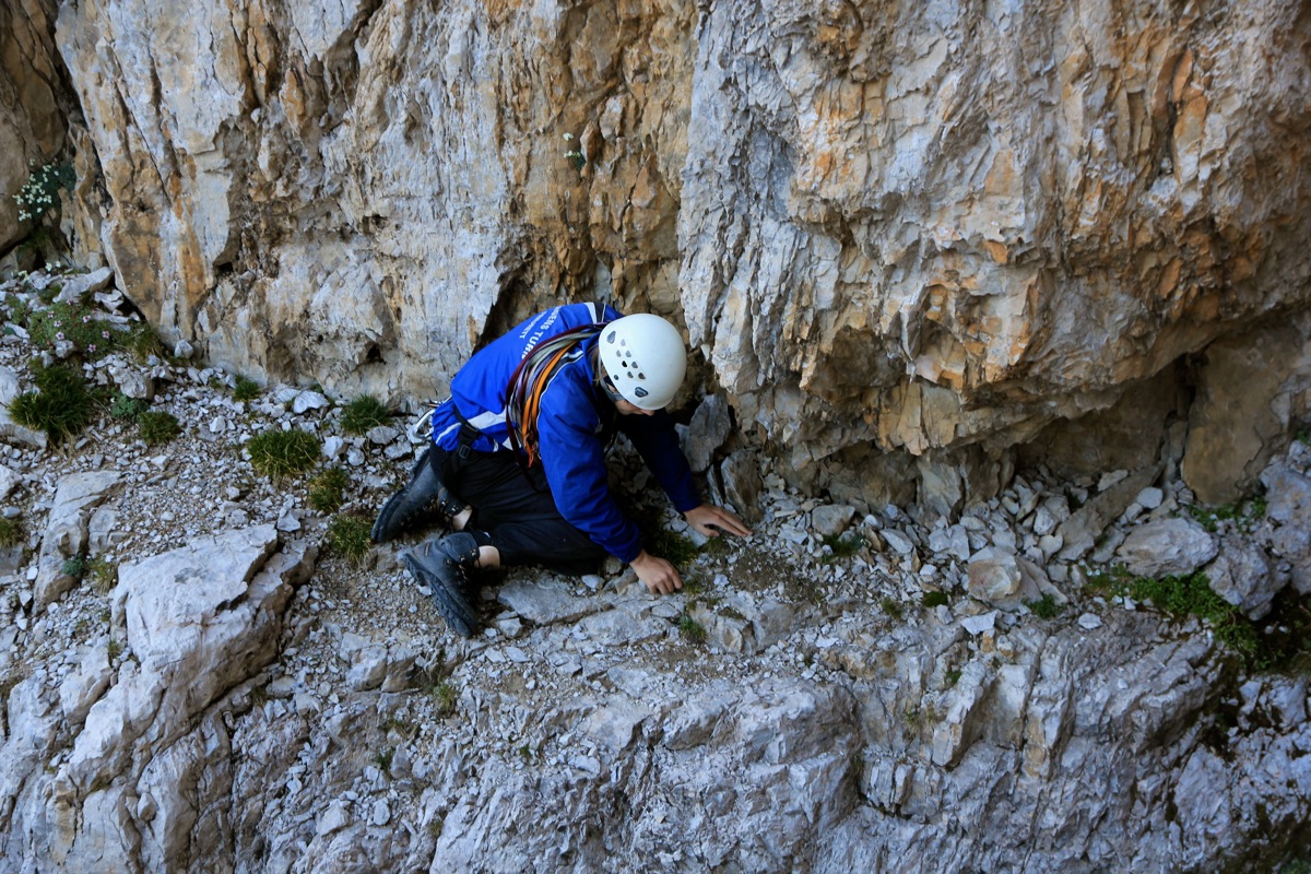
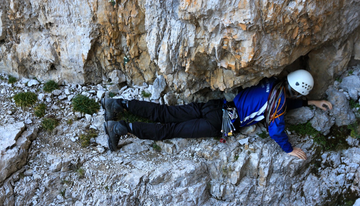
From here, climb the wall above you.
There are many ledges, but also somewhat steeper sections and
the overall steepness of this wall is
considerable. One may decide to protect this climb with a rope
depending on experience and confidence. The climbing is (YDS) class 4, there may be a pretty complex
easiest route, however, there are many variations possible.
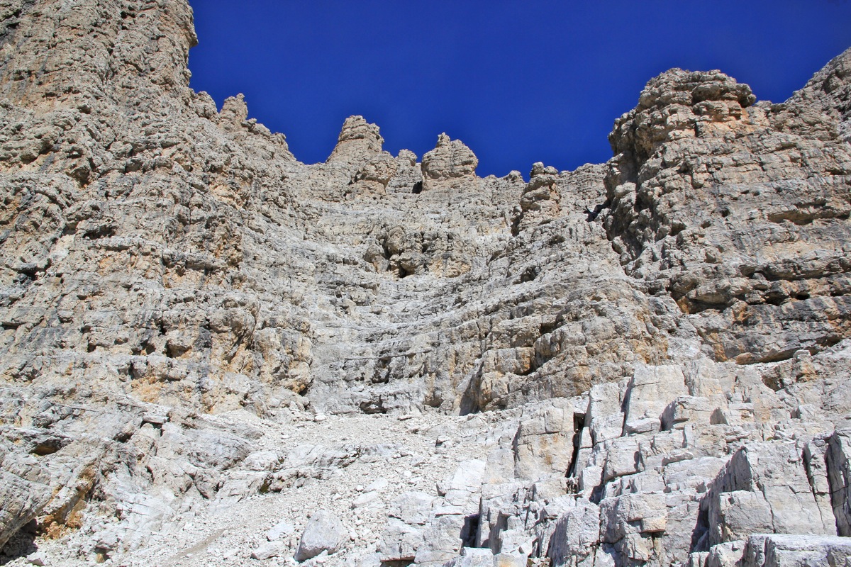
At the top, the slope becomes less steep.
The route continues uphill, marked with a couple of cairns.
It is extremely important NOT to start a traverse right along what looks like a nice, broad ledge.
Rather, continue to climb uphill to the highest ground that is easy to reach above you. From this level,
a traverse along a very nice, broad ledge will lead
into the lower part of a large amphi that comes down
between the west and the east summits of Cima Brenta.
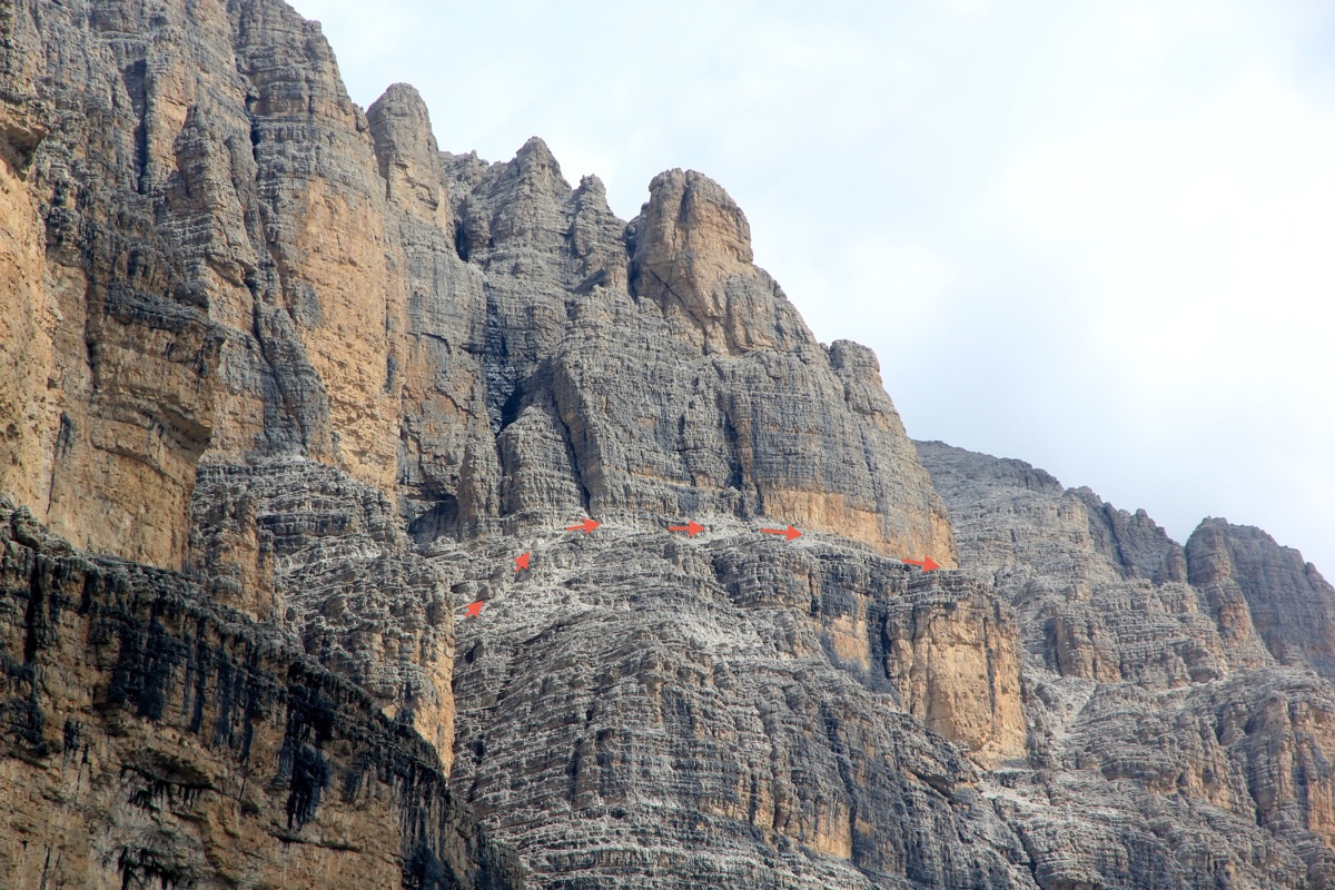
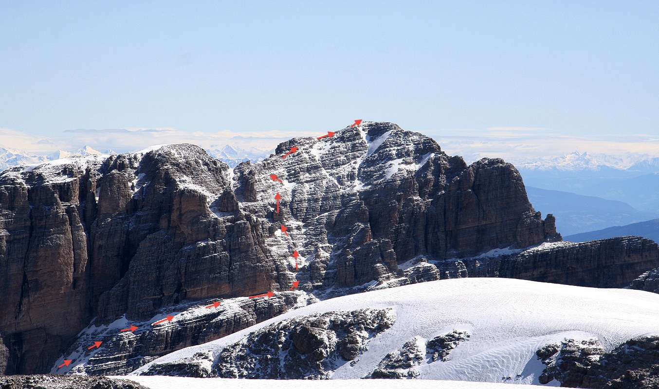
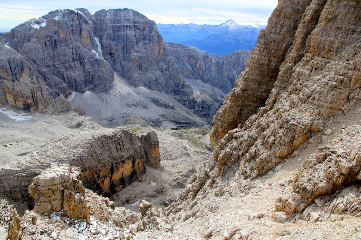
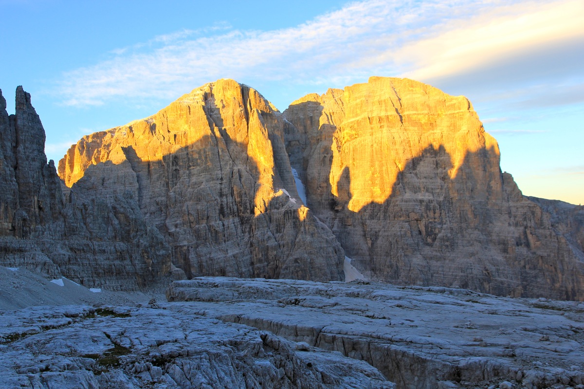
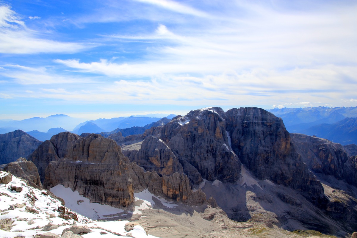
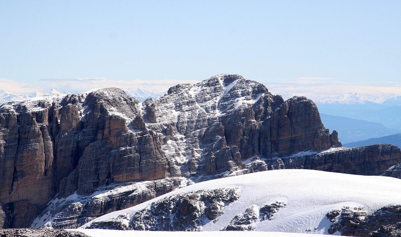
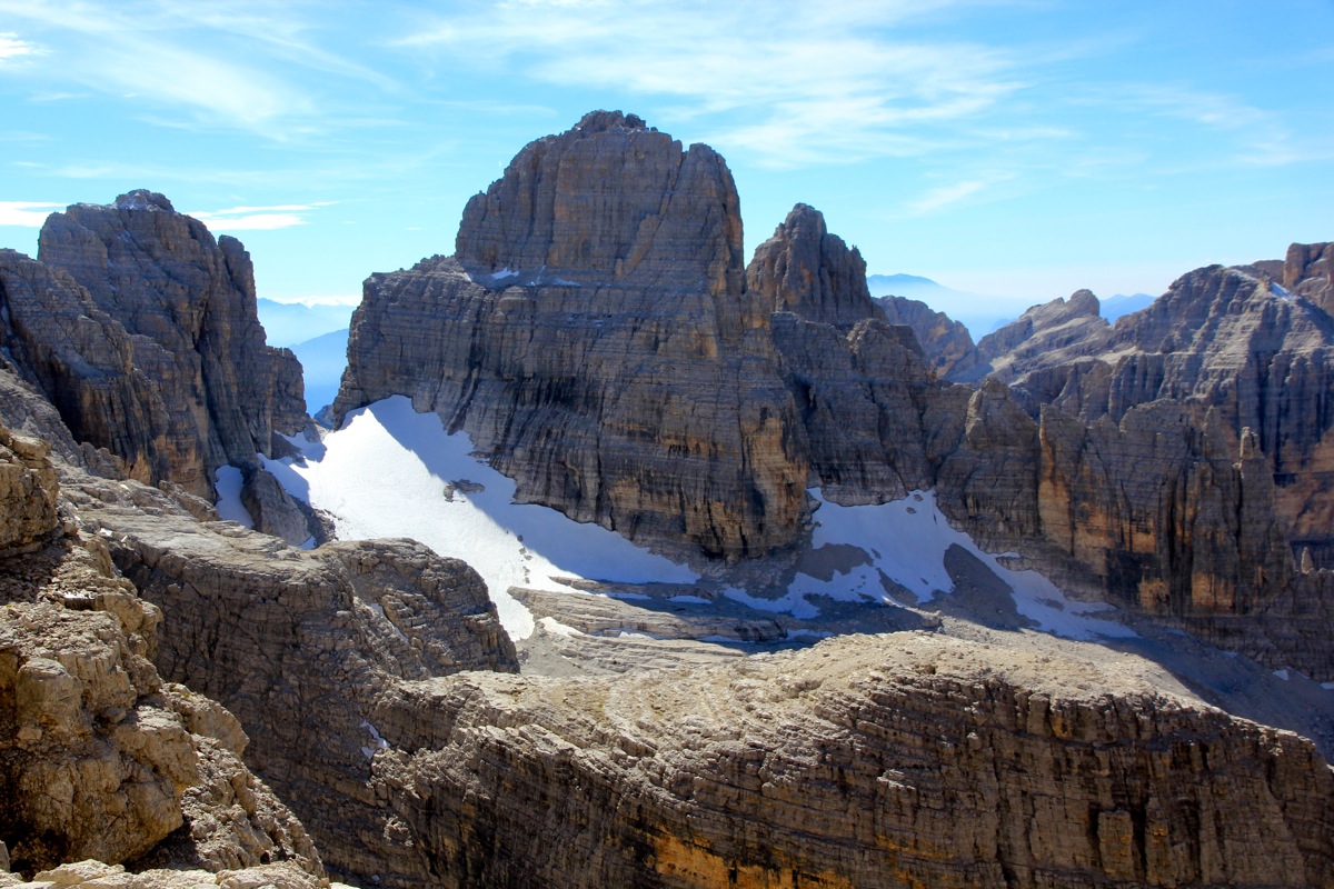
The remaining part of the route is well indicated in this picture taken
from the summit of Cima Tosa.
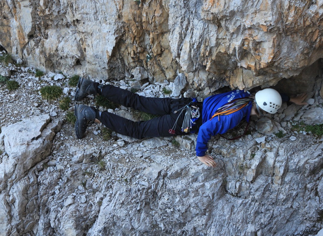
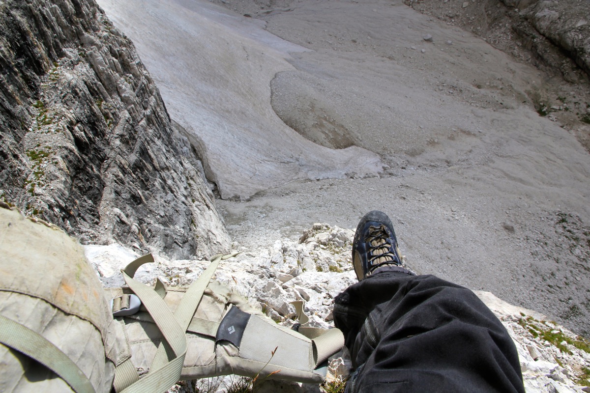
Climb a crack (YDS class 4, picture from descending) on the
right side, this is further right than arrow 8. Next, pick
your way on ledges gradually leading
left and continue a short passage in the main (left) gully.
(The previous picture is looking down this section.)
Subsequently, move a bit more right
and find a way on many ledges with short pitches of climbing in between them.
Counting from the summit (see picture), our route went right from below arrow number 4,
across to the gully that then runs uphill to the lower part of arrow number 2. The route indicated
by the arrows 3-4 is also possible.
We connected with the gully as explained above, then scrambled to
the top ridge somewhat
right of the lower part of the connecting ridge between the west summit (lower) and the main (east) summit
of Cima Brenta (as referred to in the picture).
The top ridge can
then easily be followed to the summit. Comments / Trip Report: Attempt, September 1., 2013:
After our successful climb of Antelao, Åke and I slept a second night at
rifugio San Marco, then left after breakfast
and drove a scenic route across
to Madonna di Campiglio. Åke needed new mountain boots and the town had
siesta until 1500. Very unfortunate, but we decided to wait until the store would
open. Åke got his new Sportiva (light) mountain boots, we then drove onwards
to the trailhead. Starting at 1530, we hiked the very scenic trail and
arrived at Rifugio Brentei at 1730 well ahead
of dinner.
The next morning, we left at 0700 and hiked the trail uphill in the direction of
Rifugio Alimonta. According to our description, we should continue straight into
a narrow valley where the trail turned right,
then locate a circular depression. This made perfect sense and we proceeded up
the (narrow) scree and through the gap ahead. Up there,
we found the circular flat area,
largely covered by snow. The next thing was to locate a gully/chimney crossing
the cliff band. This did not look quite right,
but a passage did exist and we explored it.
Åke then pointed out that we were supposed to climb up under the summit of
Cima Mandron, while we were clearly below Cima Brenta. Obviously, something were wrong and we
returned back down to where the main trail between Brentei and Alimonta turned.
Here, we quickly identified the correct chimney - the description on Summitpost had been very
misleading, we had wasted a couple of hours.
Our problems were not over. As I started up the ridge going parallel with this chimney, it became
clear that Åke felt uncomfortable. We then climbed roped, protecting this section, obviously
more time elapsed. I sensed that time was running out and that Åke still did not enjoy the
climb, the conclusion was easy - I suggested that we should turn around and descend.
Thus, we descended carefully
back down, then hiked back out to the car. We still had a pretty
long drive in order to get to Ascona in Switzerland, where I would attend a conference the next
4 days.
Luckily, I knew there would be a second opportunity in two weeks, I immediately sent an email
to my son Pål Jørgen and asked if he would be able to join me. Climb, September 14., 2013:
Pål Jørgen and I flew to Milan on
Friday morning, picked up a rental car
and drove to Madonna di Campiglio. We were ready to hike by 1730 and had already called ahead
to Rifugio Alimonta, informing them
about an estimated arrival time of 2000. Pål set up
his normal, fast pace and we arrived already at 1945. The friendly hut-keeper looked at us and said
"you need to stay outside for another 15 minutes". We were immediately served an excellent dinner,
our surprise was genuine when the "big beer" turned out to be full one litre mugs. Most alpine huts
consider a "big beer" to be a half litre glass.
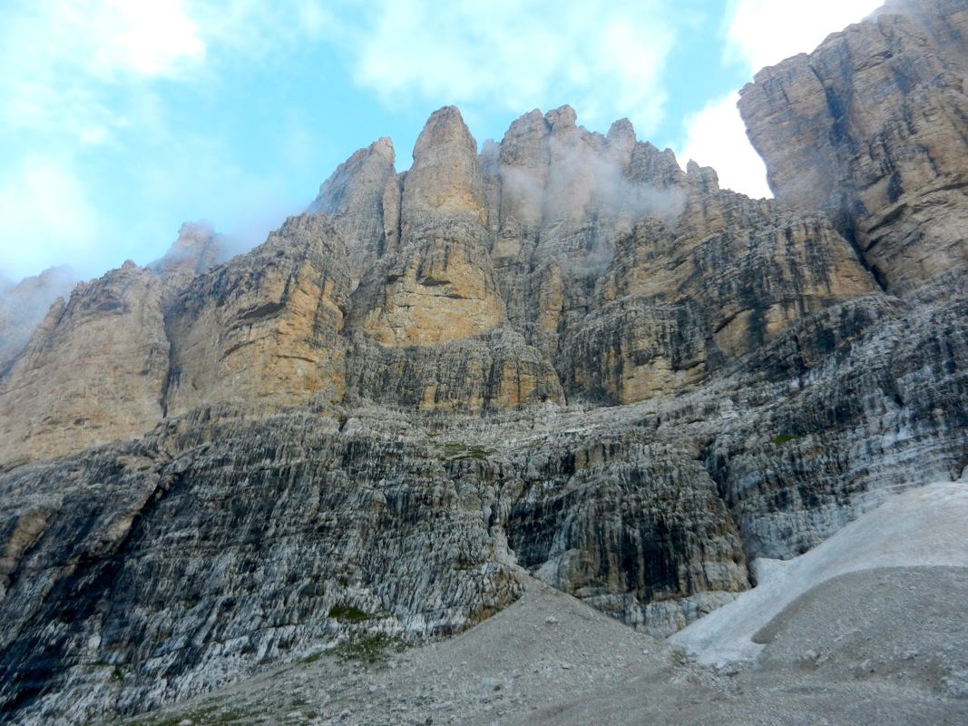
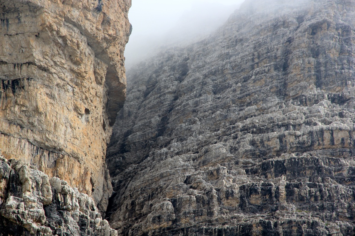
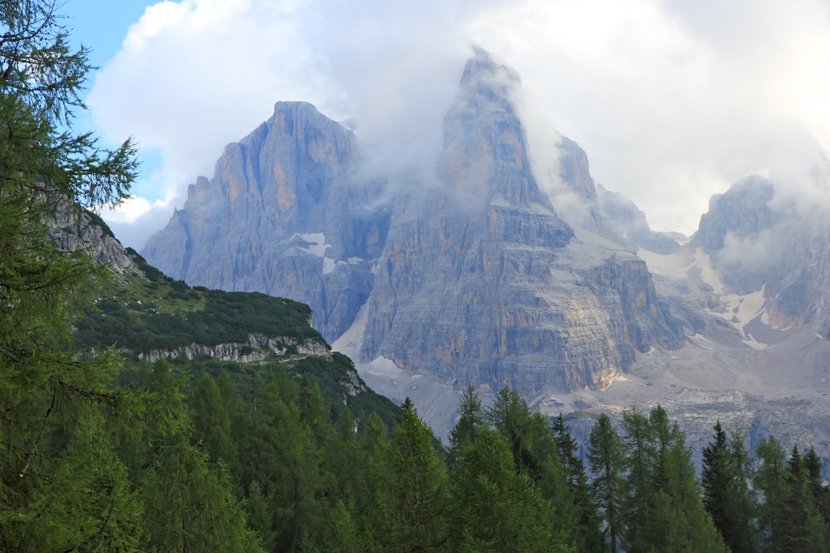
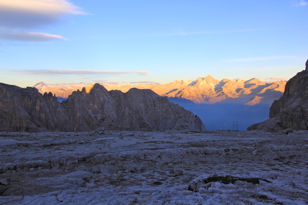
The next morning was gorgeous.
The Alimonta hut has a spectacular location with vertical mountain
walls around. The sky was clear and the sharpness of the cliffs
made them even more imposing.
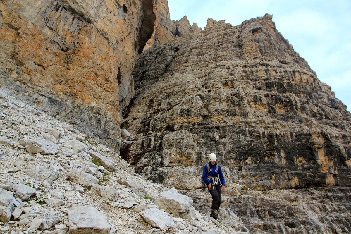
We left the hut at 0715 and had a nice walk downhill to the small valley where the route starts.
We left one backpack and a few items at the base of the gully, then ascended to the top of the
scree. This first aection was familiar to me and we quickly climbed up the small ridge passing
two short sections above my previous turn-around point. These were both (YDS) class 4. At this time,
we agreed that we most likely would prefer a rappell on our return at this location.
The continuation was more easy ground, we then discovered a faint climbers trail crossing the
next slope. Quite surprisingly, another deep crack had to be crossed and the trail led to
a perfect crossing. An interesting ledge that
carried us far enough to get safe ground below.
Also a good example of terrain that would be easier on the return since we would then start from
below and enter the ledge a bit further out.
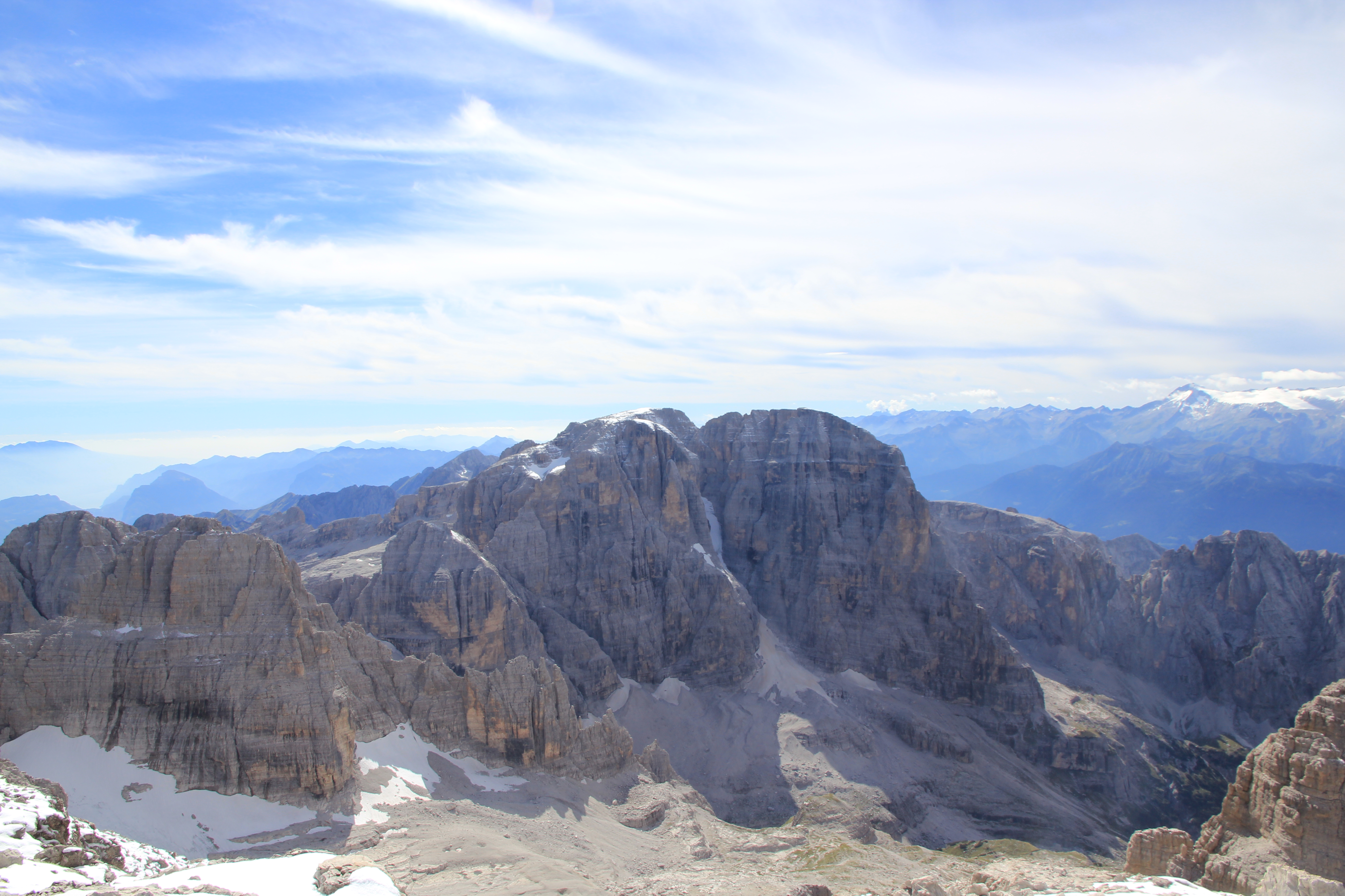
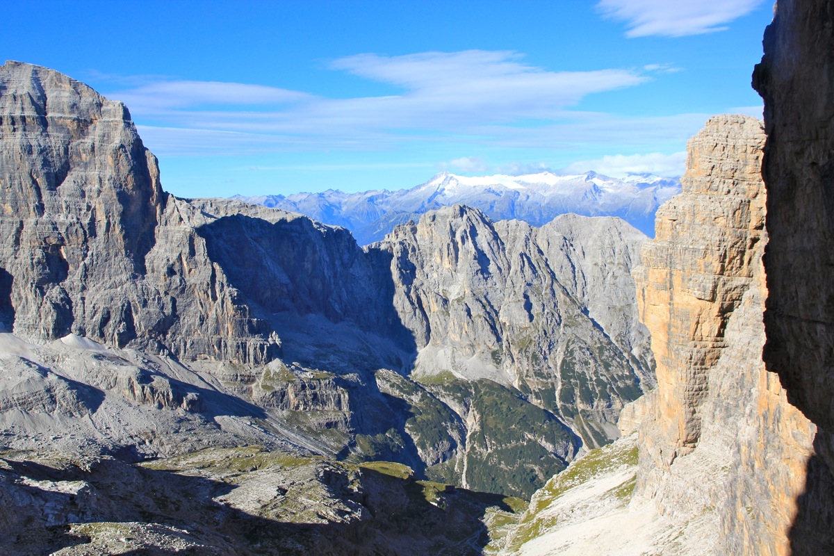
From now on, as we climbed, we could look across
to Cima Tosa and see how well we were doing.
Such a comparison seemed more encouraging than looking upwards.
From here, the best route climbs higher (more left) and this was poorly marked. We finally entered
the main gully/crack that separates Cima Mandron from Cima Brenta. We looked at the high entrance along
a narrow ledge, but quickly agreed that a much safer access would be to go low and then ascend the
wall on the opposite side in order to get into the gully above the big chockstone.
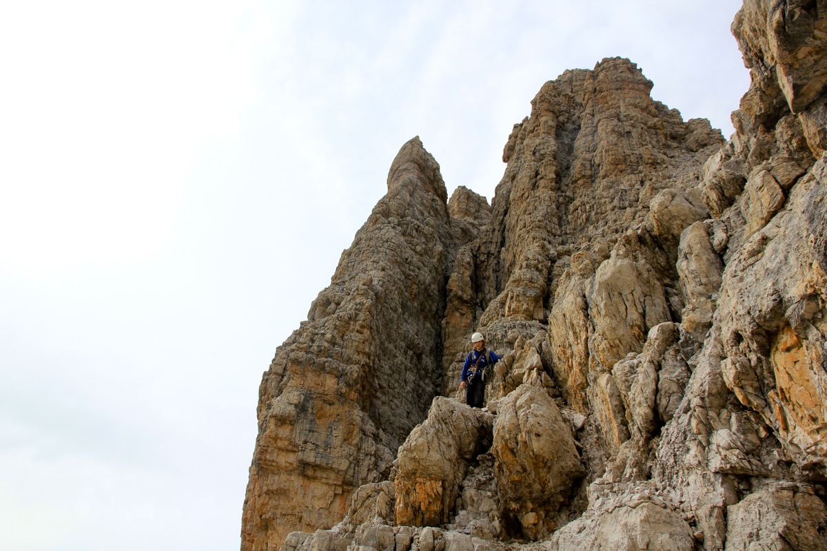
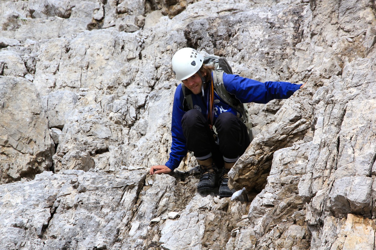
Next followed a stretch of scrambling higher on the wall with the two stripes. There are many
ledges and one can probabely find a reasonably easy way up. However, we carried a 60 meter rope
and decided that we might as well use it and climb more directly to the top from the ledge we were
on. Pål would lead and I would follow. We climbed two lengths, they were both less than the
full rope, before getting onto a more gentle slope.
While Pål put the rope back into the backpack, I proceeded up and across a short flat section, then
again uphill, but on an easy slope. I looked back and noticed Pål coming across the flat section
behind me. I continued uphill among the rocks until reaching a small cairn, obviously indicating that
we were on route. As I turned around, I did not see Pål. Mysterious, I shouted his name and "where are you?"
No reply. Hmm, could he possibly have picked a route more left, and still be behind the ridgeline
there? I scrambled across and looked. No sign. More shouting, deep silence, only the echo from the steep
cliffs on my right. This was indeed very unexpected. I decided to scramble back down to the spot where I
last had seen him. No sign. Thinking about what possibly could have happened, I came to the conclusion that
he somehow, did not notice where I went, and that he had taken off along the pretty wide ledge that extended
sort of horizontally to the right. However, I could not see him for as far as I could see. Well, I had no desire
to start hiking along a ledge that clearly was wrong. As far as I could understand things, this ledge would
eventually get Pål below the point from where to continue uphill on Cima Brenta. Most likely, the ledge
did not continue that far or it would in any event run into more difficulties. A full hour had passed and it was
beyond me why he would continue for so long without seeing me. I reclimbed the local hill and continued all
the way around a corner to the lower part of the final climb to Cima Brenta. Shouting again, this time
having success, Pål answered from somewhere way below me. The terrain from there to here looked ugly and
I shouted back that he had to return all the way back to where he saw me lasttime, then ascend and get over to here.
I sat down in the sun and waited, about 40 more minutes and he fianlly appeared. This trouble had taken a bit
more than two hours. It is kind of hard to believe that such things can happen. Pål agreed that with a little
bit of thinking it should have been plain obvious that i could not possibly have been ahead of
him along such a precarious ledge for such a long time. I learned again (the last time was on Antelao) that one
needs to stay extremely close to a partner, never ever pull ahead.
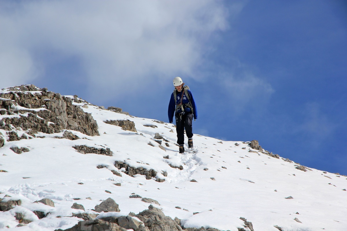
We decided to drop the crampons and ice axes, it was pretty obvious that the little snow that remained on
this south slope would not cause any problems. The remaining climb was not difficult, but still quite sustained.
There is very likely some easier route, but we preferred to stay more or less on a line and get to the
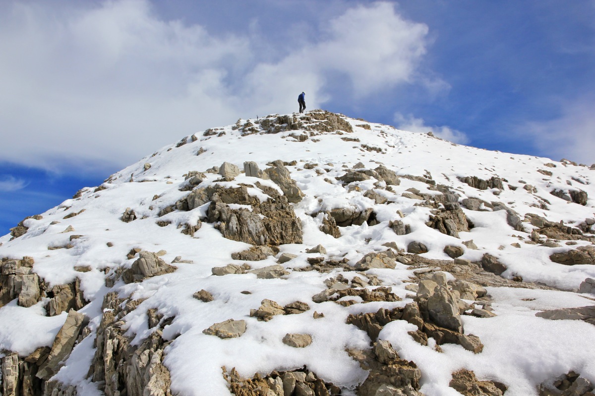
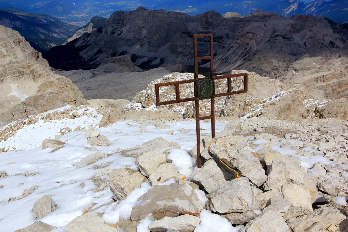
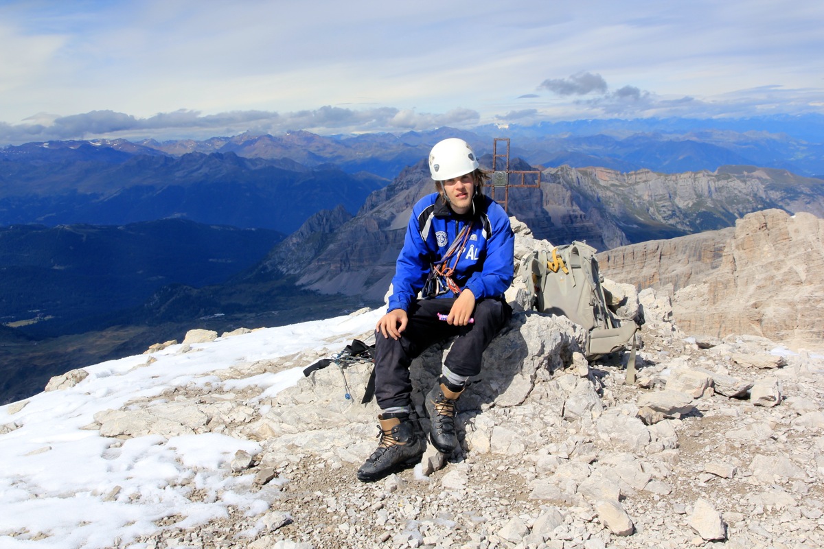
main crest. From there, it was a short and easy walk to the summit and its small marker.
We arrived at 1415,
7 hours after the start, however at least 2 hours were wasted due to us getting
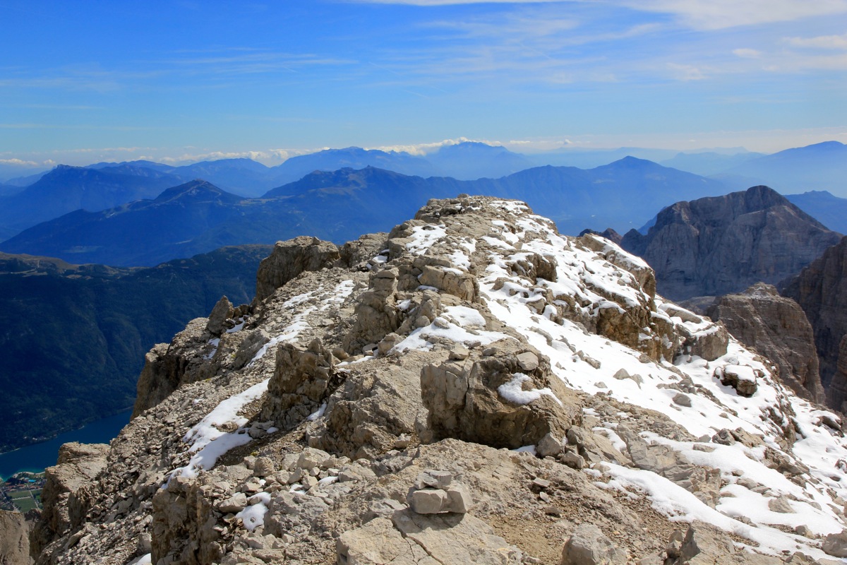
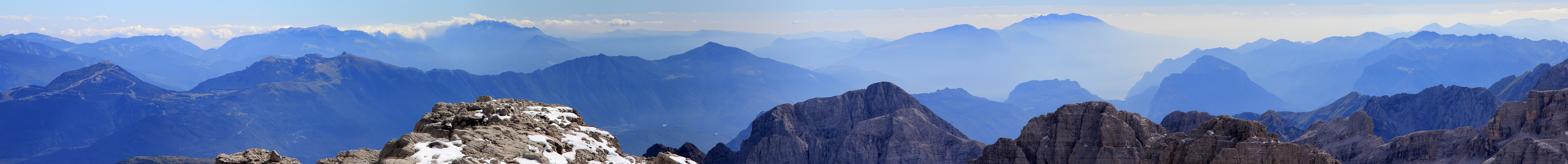
separated. There is a fairly short, almost level summit ridge.
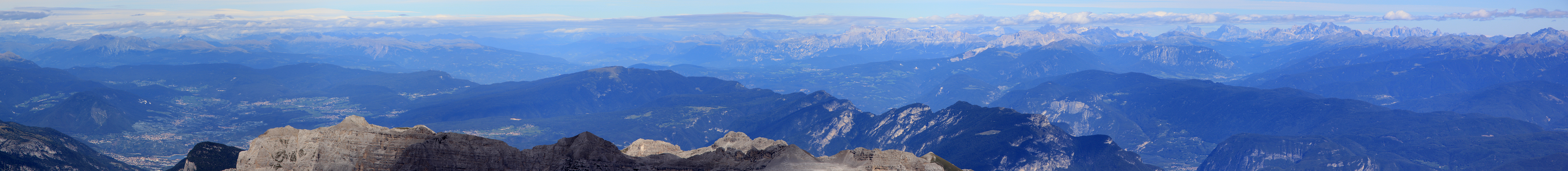
The view was pretty good, but some haze prevented the ideal, very sharp view of peaks and
ridges. I took many photos of Cima Tosa in order to secure
at least one good picture that can be used
to analyze the elevation. This is obviously not a frequently visited summit, we saw many more people on
Cima Tosa, most likely because they think they are climbing the highest point. Also, I decided to take 3 readings
of the summit elevation as measured across a 5 minute interval (each time) using the average option on my Garmin GPS.
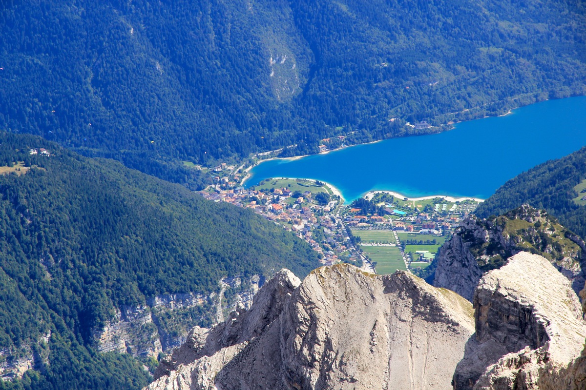
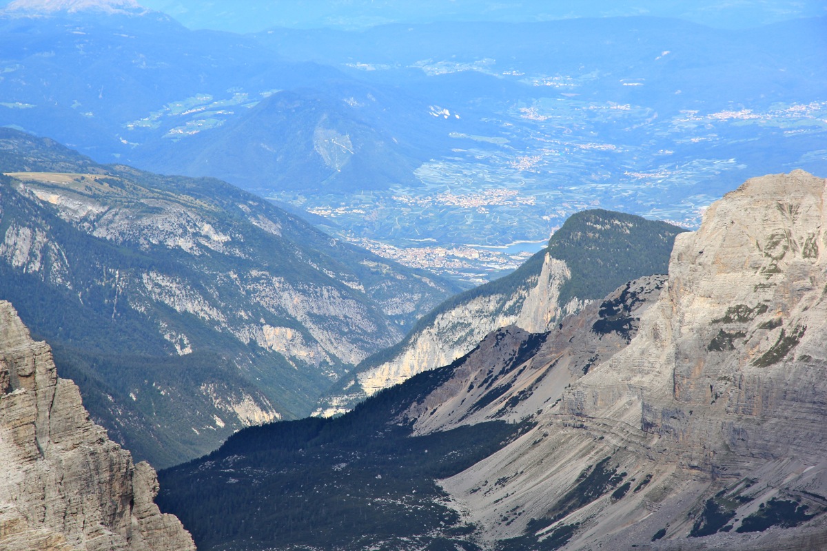
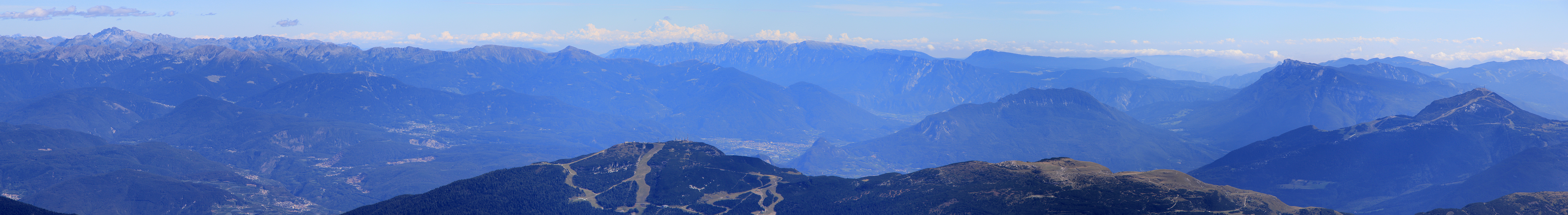
The summit even provided a nice view
directly to the north end of Lago di Molveno, a popular place to
start hiking in the Brenta group.
We left at 1445, knowing that the descent would also be quite long.
The downclimbing to the place were we had
left our crampons and axes went smoothly. Back at the steeper wall leading down to the dividing gully,
we decided to do two rappells, each 30 meter.
This got us safely down at the (trival) price of leaving two
solid anchors (each with a backup) in the wall. What remained was the two short but steep pitches at the
initial ridge/rib. By now, we had done so much down-climbing that this also could be done without
using the rope. Still, a long and careful descent, we agreed that our most attractive option would
be to hike back up to Refugio Alimonta and spend a second night there. Arriving again at 1915, we felt that
dinner was well earned.
The next day we had an easy walk out to the parking area, then departed for Milan. Pål should fly
back to Norway early the next morning, while I headed up to Lugano where the welcoming reception
for DD22 would take place later in the evening.
I owe my best thanks to Pål Jørgen. He says yes on short notice and provides good company
and essential contribution in order for his dad to get up on this rather steep mountain.
What is the prominence of Cima Brenta?
This mountain is at the center of several mysteries related to
understanding which mountain is at the lower end of the list of
European ultra prominent mountains. The story started on July 19.,
2009, when Pål Jørgen and I climbed
Cima Tosa
Cima Tosa was, according to all maps, the highest in the Brenta group,
however, our climb of Cima Tosa provided strong evidence that we really should
have climbed Cima Brenta in order to ascend the highest local peak.
Additionally, this information has left it highly uncertain if Cima Brenta is
an ultra prominent mountain or not.
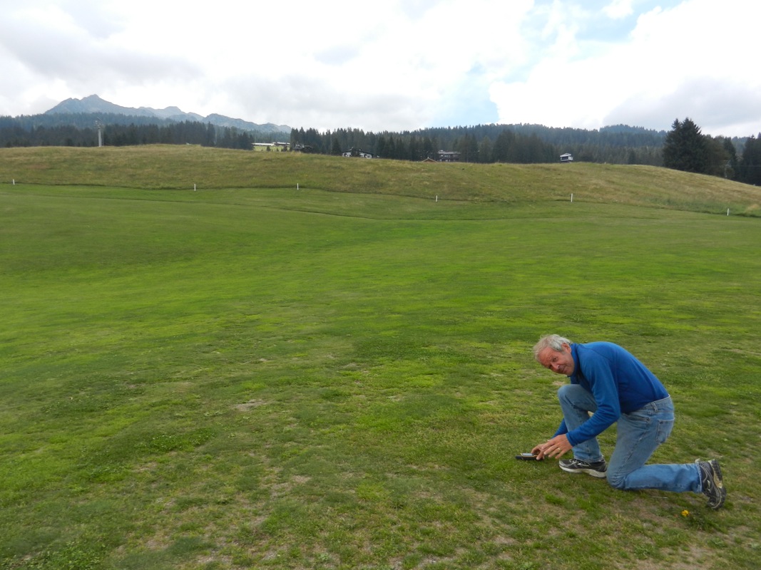
Cima Brenta has a map elevation of only 3151 meter, this is close to 1500 meter above the
saddle on the golf course north of Madonna de Campiglio.
The saddle on the golf course was measured by
my Garmin GPS taking two different measurements
each doing a 5 minute average. The results were 1655m and 1658 meter, ie. an overall average
of 1657.5 meter.
Similarly, the summit elevation of Brenta was measured via 4 separate measurements, all with
averaging, for a total of 20 minutes. These results varied from
3159 meter (lowest) to 3166 meter, with the average value being 3163.3 meter.
Based on these measurements (using the same GPS unit), the difference between saddle and
summit is 1506 meter. Taking upper and lower limits, these measurements estimate the
prominence of Cima Brenta (provided Brenta is higher than Cima Tosa) to fall in the
interval from 1501 meter (lowest) to 1511 meter (highest). As the figures clearly indicate,
there is significant uncertainty, however, the results support a conclusion that it is more
likely that Cima Brenta has prominence exceeding 1500 meter than the opposite.
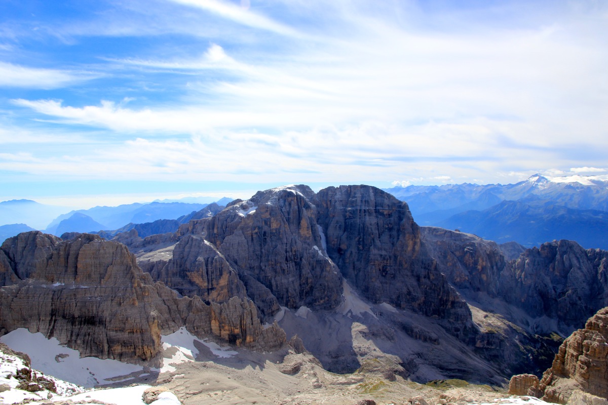
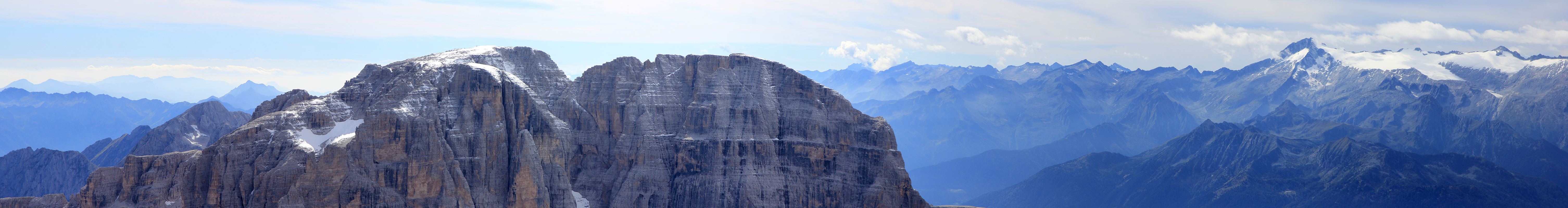
Using the software Geopix, written by Edward Earl, we tried to analyze the relative elevation
of Cima Brenta and Cima Tosa based on this photo.
(Actually, the original with higher pixel resolution.)