Location: North 33:22.460, West 105:48.528 (GPS at the summit)
New Mexico, USA
Difficulty: YDS class 2
Climbed: July 19, 2008
Information:
How to get there:
This mountain is located near the resort village of Ruidoso, about half
way between Albuquerque and El Paso. Locate Hwy. 70 and turn north in Ruidoso
on Hwy. 37/48. This road enters a busy business section, then makes a sharp
right at a traffic light, with a "66" gas station on the corner. Measure from
here. Continue along Hwy. 37/48, 5.4 miles. You will then see a Shell gas station
on your left side and a road marked 532 going left. Signs for Apache Skiing.
Turn onto this road, at mile 10.5 you pass Oak Grove Campground on your right.
Continue uphill until mile 17.2. You are now in a sharp left curve immediately
before the ski area. The trail with a sign reading "Scenic Trail", starts here.
You may find parking off the road on the right side of the road. This trail is
also named "Trail 15". Park, this is the trailhead, location N33:23.969, W105:47.373,
elevation about 2988 meter.
Route description:
Start out along trail 15, it makes a gentle ascent of an open field before hitting
trail 25. Follow trail 25 (left) as it runs up along a small valley and eventually
gains the main crest at location N33:23.946, W105:49.083, elevation about 3430 meter.
Turn left and hike along the crest until you reach the upper part of the ski area,
continue uphill in order to reach Lookout Mountain.
From Lookout Mountain, descend along the broad ridge to the wide saddle separating
Lookout from Sierra Blanca. Ascend the broad, grassy slope until it levels off.
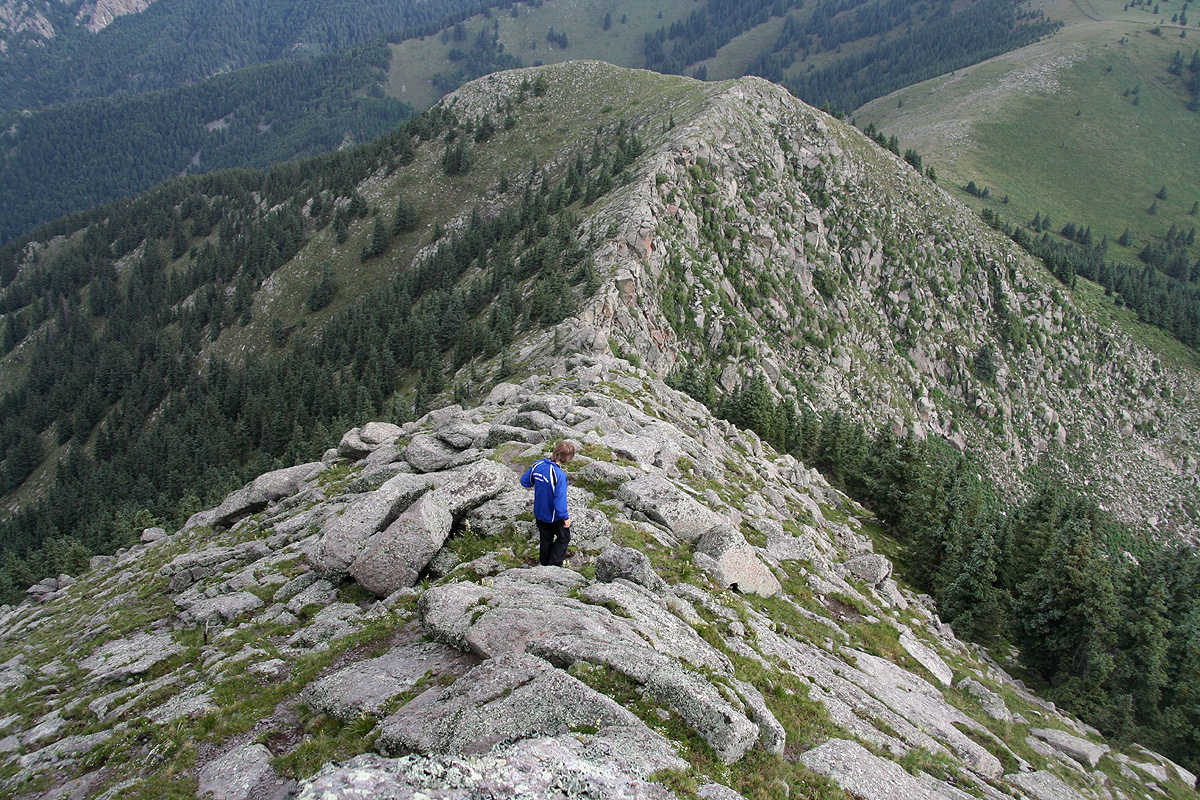
From here, a more distinct and rocky ridge leads directly to the summit
of Sierra Blanca.
Comments:
I did this hike with my son Pål Jørgen. The plan was to do this
on Friday, July 18th, then travel north to Gallup the same afternoon. We started
out from our motel (Comfort Inn) already at 0530 in order to make this an early
ascent. The day before, when we arrived, the area had an unusually heavy afternoon
storm and a nearby town got completely flooded.
We therefore got a considerable surprise about 5.1 miles up road 532, right next
to the Oak Grove Campground, a big barrier across the road and huge signs saying:
Road Closed".
This was indeed bad news. The remaining road to the trailhead was
about 7 more miles. We could hike it, but this would add at least 4 hours to our
trip and perhaps get our summit time close to a new possible heavy thunderstorm.
Surprise number two:, there was no cell phone coverage for our cell phones. Thus,
no way to inform Heidi about the situation and that a hike would be an all
day effort.
I decided to return to the hotel and consider our options. One possibility would
be to leave this summit for later and proceed directly north towards Utah.
We consulted Google Maps and discovered what might be an alternative access road.
The next couple of hours were spent driving a few smaller mountain roads to see if
we could find an alternate access. However, this turned out not to be the case. It seemed
clear that Google did not differentiate well between roads and hiking trails.
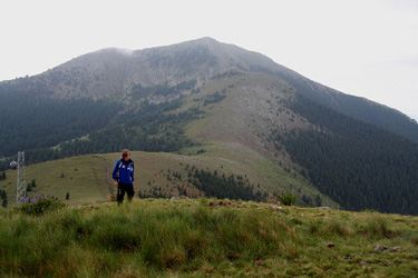
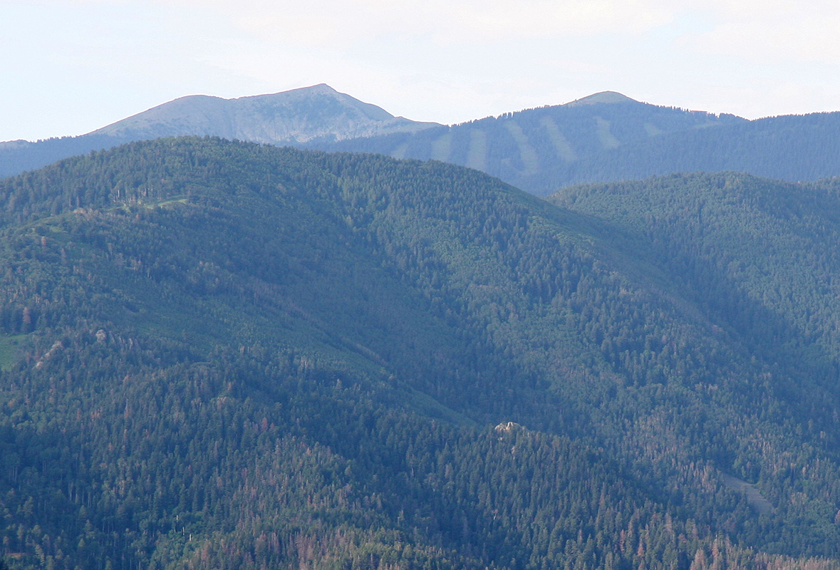
We got to a ridge from
where we could see Sierra Blanca and
Lookout Mountain in the distance.
At the end of all this, we again drove up to the 5 mile closure and actually located
a person that was responsible/involved in the ongoing construction work that had
made them close the entire road. She told me that the closure signs would remain in
place, but that no work would take place tomorrow - Saturday. Thus, we were welcome to
drive the road the next day. We booked another night at the Comfort Inn, then went out and
had an excellent evening meal.
Saturday morning, we left around 0600 and were ready to hike from the trailhead by 0630.
The weather looked questionable, thick, black clouds and not a single patch of blue sky.
We started out and soon came across a small group of elks, perhaps 5-6, they did not expect
a disruption at such an early hour. We arrived at the summit of Lookout Mountain after
1:20, proceeding to the top of Sierra Blanca with arrival there at 0835a.
The final ridge up Sierra Blanca
is quite nice, never difficult, but still giving
you the feeling of climbing a mountain.
Somewhat surprisingly, the GPS recorded an elevation closer to 3670 meter, whereas the
official elevation is only 3659 meter. We rested and looked around. This peak is really
by far the biggest in a large area. We left at 0850, including time for a nice
chat with a climber (plus dog) that we met on the summit ridge. Returning, we
bypassed Lookout Mountain on its right side, then continued to descend and finally
hit trail 25 near the gully that has formed at the innermost part of this city.