Location: North 39:14.302, West 105:33.226 (GPS at the summit)
Difficulty: YDS Class 2
Climbed March 8. 2008.
Information:
How to get there:
Bison Peak is the highest point in the Lost Creek Wilderness area. The name relates
to the local river that disappears in many locations, for then to show up further
along. The area has an extensive system of caves.
From the Denver area, locate the intersection between the freeway 470 and another big road
named Hwy. 285. This is west of Denver. From this intersection, drive 51.3 miles (82.5 km) south
on Hwy.285. You will pass the village of Bailey as well as cross the prominence saddle for
Bison Peak at Kenosha Pass (3042 m). At 51.3 miles you are in the very small village of Jefferson.
Here, Hwy. 77 goes left right next to the only small store in town. This road is also signed with
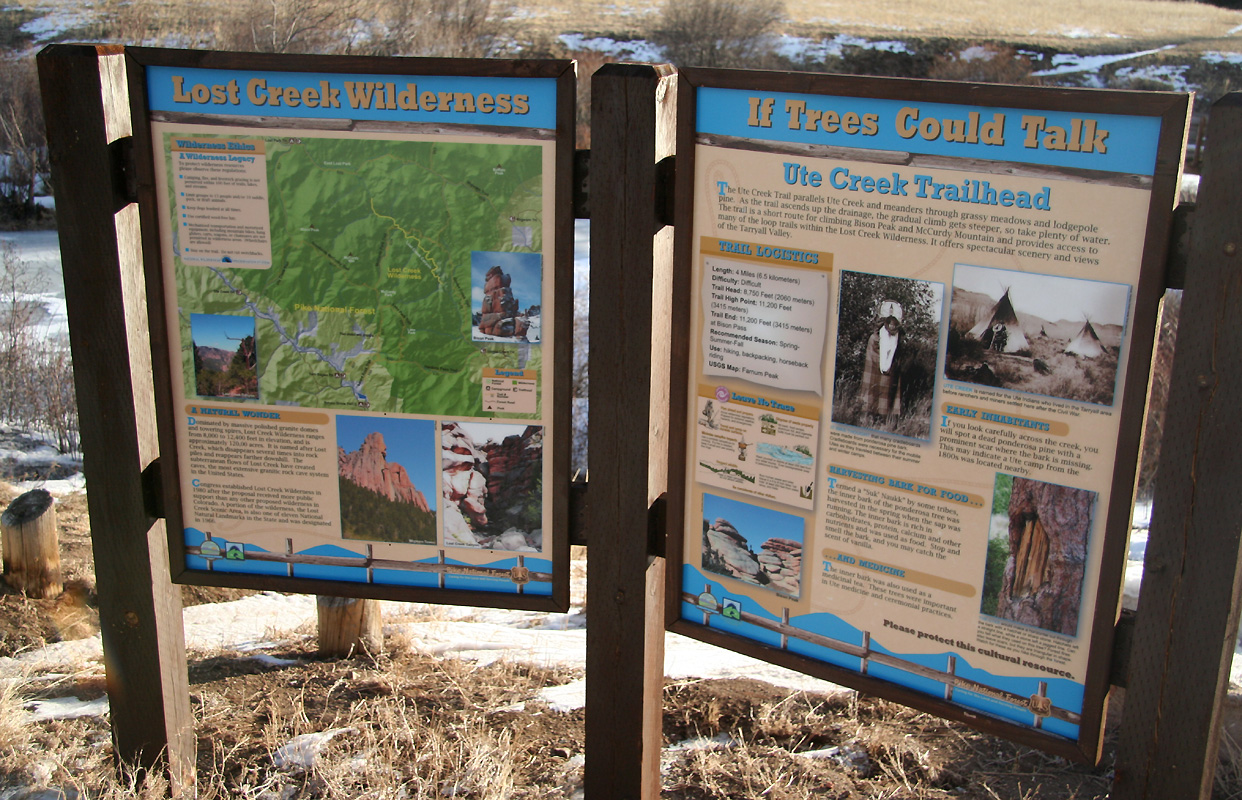
Tarryall. Take this road and follow it 20.7 miles (33.3 km). The Ute Creek Trailhead is the on your
left side with parking and information signs. Just 3.3 miles (5.3 km) before the trailhead, you cross
a bridge and the road forks. Hwy. 77 forks left, make sure to follow this road. The trailhead is
located at N39:11.894, W105:33.226, elevation 2676 meter. Park here.
Route description:
From the trailhead, cross the river on a nice bridge, then follow the trail as it winds its
way sort of right while gaining a small local saddle. The trail now descents a little before turning
more left into a fairly distinct valley. After crossing a creek, the terrain again opens up and the ridge
that gives access to Bison Pass is now straight ahead. The trail ascends this ridge, first on its right side
before gaining the crest higher up. After an ascending traverse on the left side of the crest, the trail
again turns right and reaches a fairly flat area in the vicinity of Bison Pass. The pass itself is not
very well defined, being pretty broad and with the entire area covered by trees.
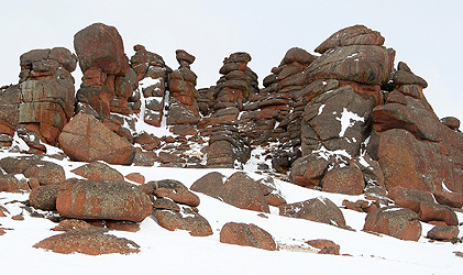
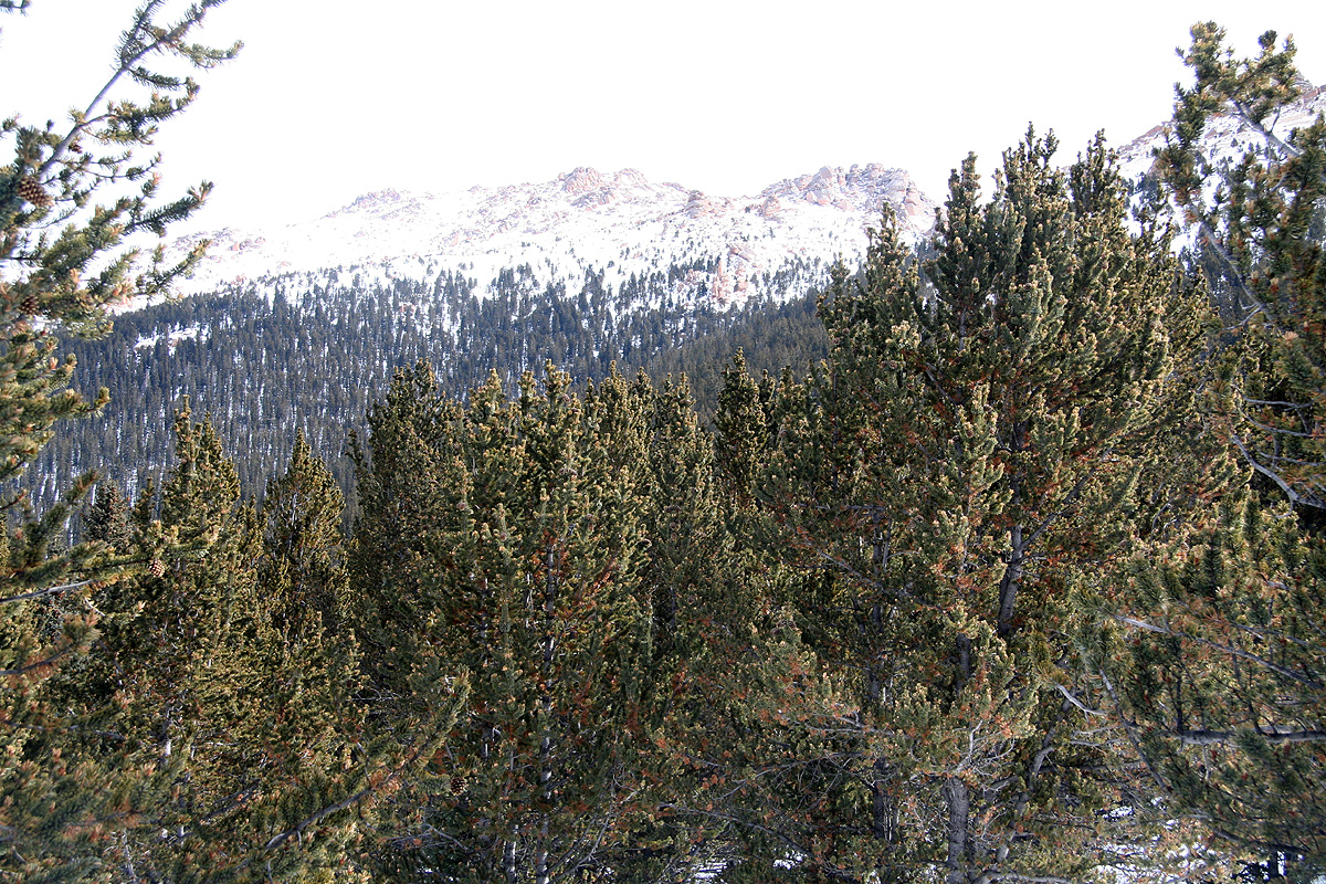
You will now see the Bison Peak area above a final slope that must be climbed. Ascend this slope and
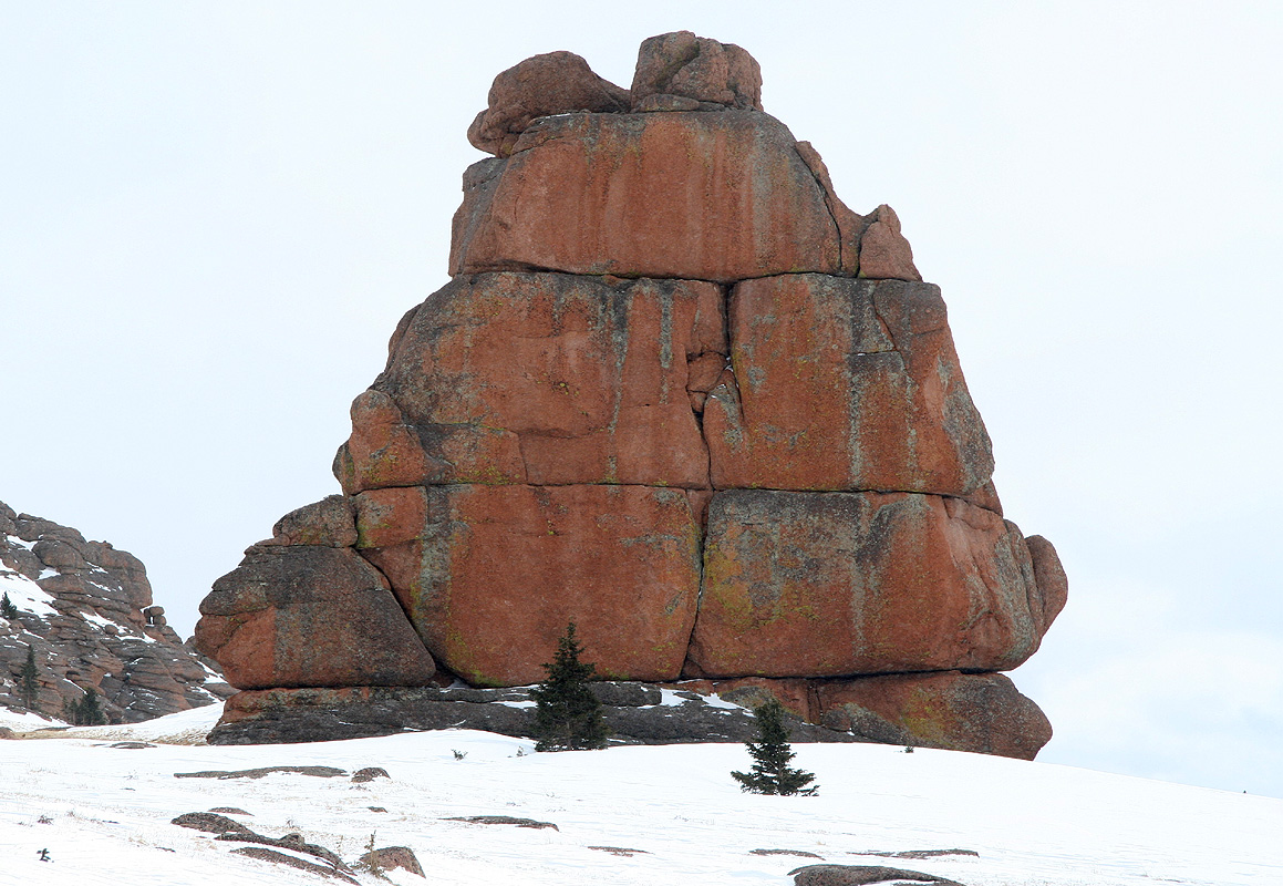
continue to the shallow saddle that has a very characteristic "obelisk" of rock. Further along you will
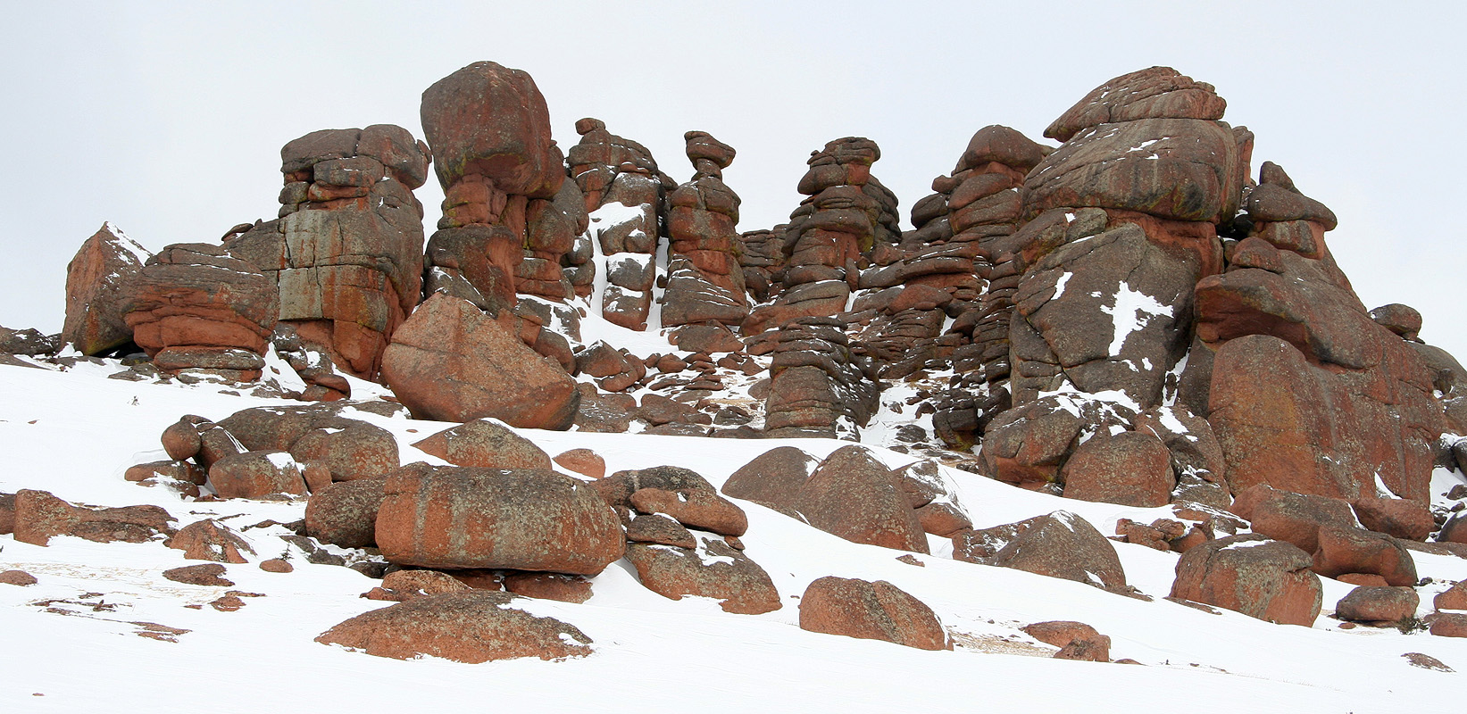
see what appears to be the highest point, a semi-circle of great rock sculptures. The true summit lies
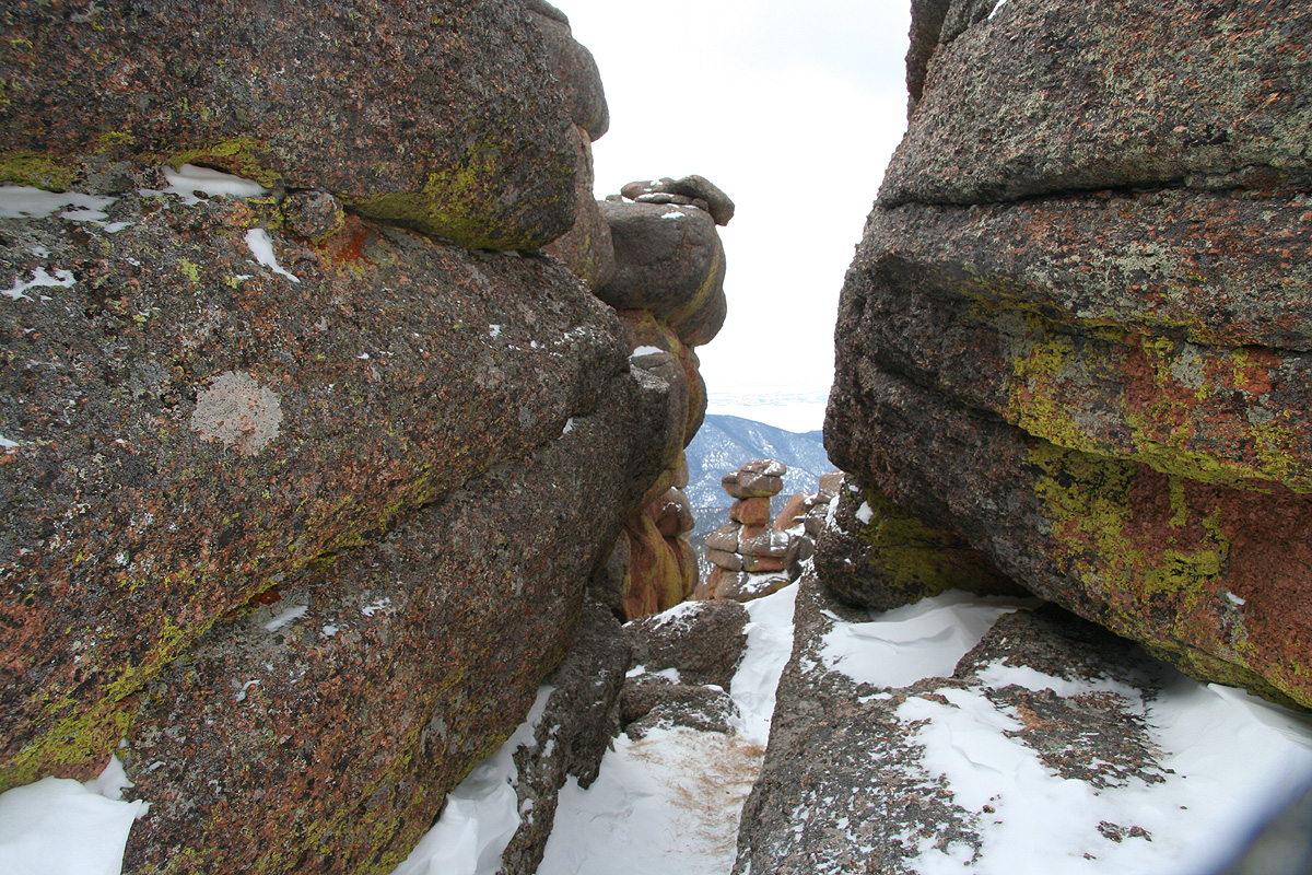
further behind. The easiest way would be to bypass these rocks on your left, however it is more
interesting to hike straight up the middle, then pass through a narrow crack before emerging on the other
side. Finally, ascend the last slope, possibly on the right hand side in order to find a good path leading
to the very summit.
Comments:
I had arrived in Colorado already a week ago after my initial visit at Stanford University, where
I (somewhat unexpectedly) had hiked Copernicus Peak.
I started out from Ellen and Sverre (in Lakewood) at 0530 and arrived at
the trailhead
around 0700. It was obvious that the skis would go on the backpack as the
trail had minimal snow. I started out at 0715 and made good progress along the trail and
up the hill. I had rented skis (at REI) the day before, unfortunately, they did not have longer skis
than 180 cm. Another problem being that they only rent wax-free skis, this can, of course,
be understood when skis are rented.
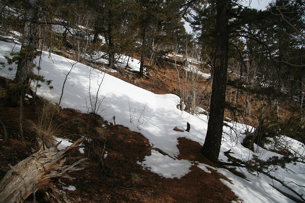
The trail had patches of snow, but pretty easy to follow on foot. As the somewhat south-facing trail
started its ascent up the ridge, there was actually
less snow than further below.
However, as I climbed this ridge higher the snow cover gradually became more consistent until
I safely could put my skis on.
I soon discovered that the "wax-free" did not provide much friction with the prevailing
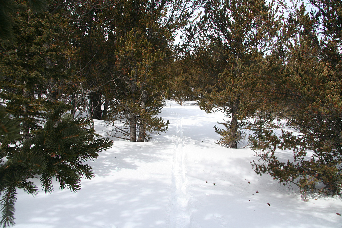
snow conditions. Aside from this, I made good progress and soon entered the almost flat
area near Bison pass. From here, I had my
first view of Bison Peak
and the final hill with trees that needed to be climbed.
It had taken me about two hours to Bison Pass, but here the snow conditions deteriorated badly.
I started breaking through the snow and discovered loose, "sugar snow" extending all the way to
the ground. This only got worse as I started up the final hill and soon I found myself with
snow above my knees, trying to force a zig-zag trail among the trees. The slope was not steep,
perhaps around 20 degrees, but with this kind of snow skiing was close to impossible.
The struggle to gain elevation was one of the worst I have ever had in deep snow. It took me
more than 2 hours to climb what would normally have been a rather trivial hillside. I understood that
the only way to find better conditions would be to reach the treeline above me. Fortunately, my GPS
told me that I eventually would succeed. I "skied" (to the extent that this struggle could be called
skiing) the last 70 vertical meter moving 157 meter horizontally, in 42 minutes. This corresponds
to an average speed of 0.22 km/hour, while climbing only 100 vertical meter.
As soon as I came out of the trees, the snow became better as expected. The wind had not only made
it much firmer, but largely removed it altogether. With only localized patches of snow on the mountain
itself, I soon decided to leave my skis and continue on foot.
I contoured around a local peak, then descended to the broad saddle
with a very impressive rock tower.
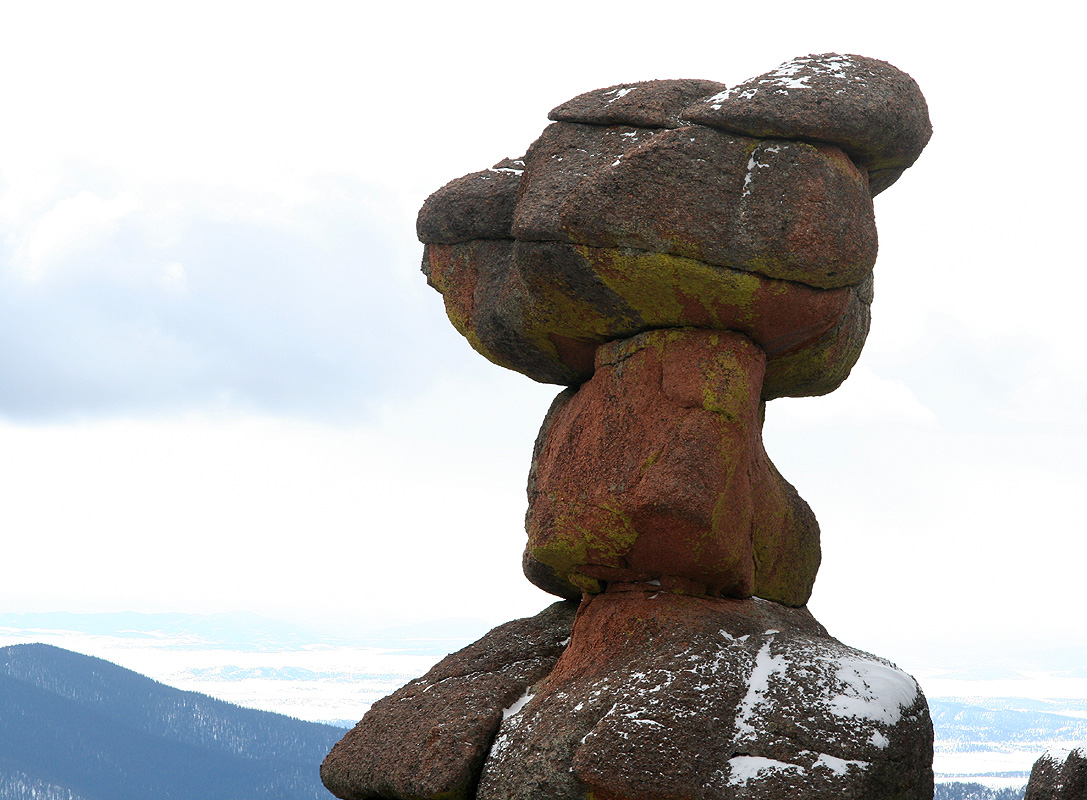
The higher peak looked impressive as I headed uphill. For a while, I wondered if this was indeed
the summit. There were several impressive rocks
above me and hard to say which one were highest.
Slightly concerned that the very top would require climbing, I proceeded directly uphill and located a
a very narrow passage in order to gain the
rear side of these cliffs. Looking through this crack, I now saw
the true summit a bit further away beyond a wide, but shallow saddle.
I proceeded across and contoured around the summit, gaining it by kicking steps in a moderately steep, but
very short snow slope that topped out at the summit. The time was 1240, it had taken me almost 5.5 hours
to reach the summit. I signed the summit register, it seemed like few (if any?) had been here since last fall.
I rested, took photos and had a small lunch. Unfortunately, the weather was not great
for summit pictures. Further east, the weather looked quite bad and I decided to decsend before anything like
it might find its way across to my area. Although the fastest way would be to bypass the rock formations to
the right, I could not resist walking straight through it once more.
The head is just an incredible example
of what nature can create.
I retrieved my skis and followed my track back down through the deep snow section. A single ski track and
suddenly the going is quite easy. A well deserved reward for 2 hours of really frustrating work. I reached
the car at 1530, about 2.5 hours after leaving the summit.