Gunung Argopuro
- Gunung Argopuro
- 3088 m
- Primary factor 2745 m
- Java, Indonesia.
- Location: South 07.96432, East 113.56658 (GPS at the summit)
- Difficulty: YDS class 2
- Climbed August 7. 2019

Gunung Argopuro
|
|
How to get there:
This excellent web-site on climbing
Indonesia peaks should always be consulted.
The best trailhead for a single day ascent is Bermi on the west side of the peak.
Locate the city Probolinggo then move about 20 kilometer east near Kraksaan.
Exit Hwy. 1, going south on Raya Condong, this road runs immediately west of a river.
Drive to Tjondong where there is a hotel, continue uphill, fork left at
location S7.92322, E113.43297. This road leads to the trailhead. My driver
continued a short distance on a rougher (unpaved) road and we parked at
location S7.95811, E113.49596, elevation a bit below 1000 meter.
However, anywhere near this location
will serve well as a trailhead.
Here is a summary and quick reference to the climbs on this trip.
Route description:
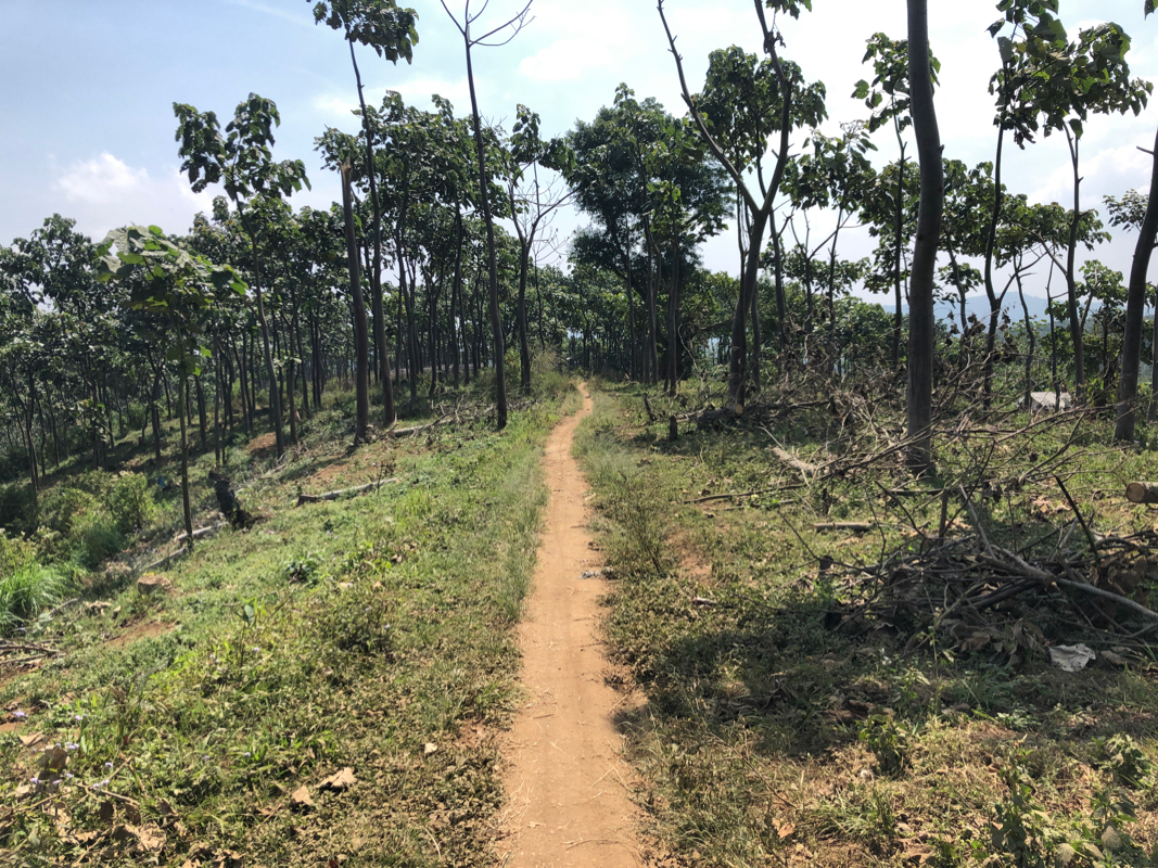
This entire trail is quite nice. It is really (YDS) class 1 almost all the way,
however, due to a few slightly steeper spots it still has an overall classification
as (YDS) class 2.
From the trailhead, the trail initially
climbs very nicely with farmed land on both sides.
Near location S07.96609, E113.50647, elevation around 1130m, there is a structure having a roof,
but no walls. I left the big horizontal trail here and picked a smaller trail uphill that started
on the right hand side of this structure (facing uphill). Higher up, the trail runs in gentle
switch-backs, in fact local people travel by motor-bike up this trail, all the way to the
barrier just before the crater lake. There are short-cuts, generally more eroded and the best
route is likely to follow the path that is used by the bikes.
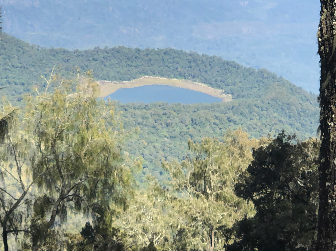
Just before you top out on the small local crater that has a lake inside, the trail is
carefully blocked by a wooden structure. My guess is that this is just to prevent
motor-bikes to run into the lake area. Pass through a smaller opening in this barrier, then
descend slightly towards the lake. One may pay a visit ot the lake by heading straight down to
its shore, or continue on the trail by turning left before getting all the way to the lake.
The trail is a bit fuzzy here, but this will sort itself out as soon as you have moved a bit
further left. The route now basically continues on
part of the crater rim, a nice and gradual
ascent where you may have some partial views of the lake below on your right hand side.
After a while, the route will traverse a bit more left as it climbs a hillside in order to
reach a distinct col at
location S07.97692, E113.55617, elevation around 2460 meter. The trail
turns left and climbs a small ridge before it descends towards the base of Argopuro itself.
Soon, you arrive at a dry creek, this is location S07.97358, E113.55901, elevation again near
2460 meter. There is a trail fork here, a longer route runs straight (more horizontal), while
the route to Argopuro forks left and immediately heads uphill. Take this trail. The ascent
is overall quite easy with only a few slightly steeper sections (sand that mahy feel a bit
slippery.) Higher up, the trail traverses a bit right and you will see thge beginning of some
flat area that are part of a pass.
There are some slightly ill-defined forks in the trail in this area.
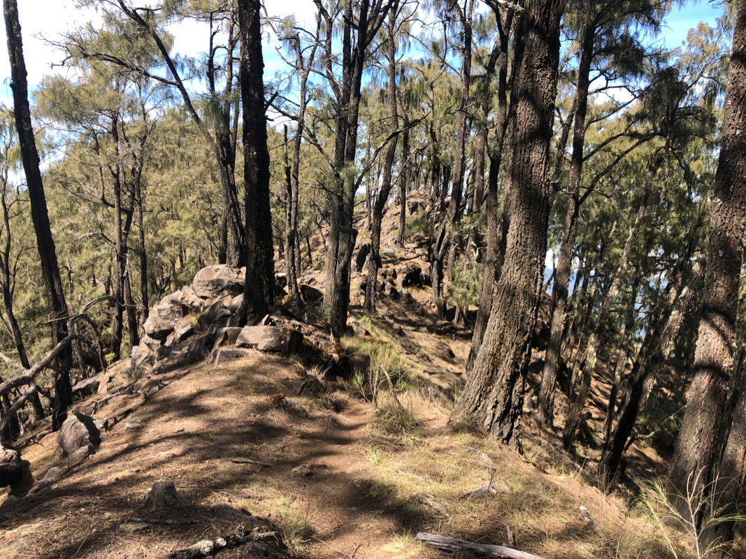
Keep right and stick to the ridge that continues uphill. The route steepens for a short
section (YDS class 2), then returns to easy walking. You will ´cross a false summit point
with a flag, descend slightly and follow a delightful ridge
the final ´(short) leg to the
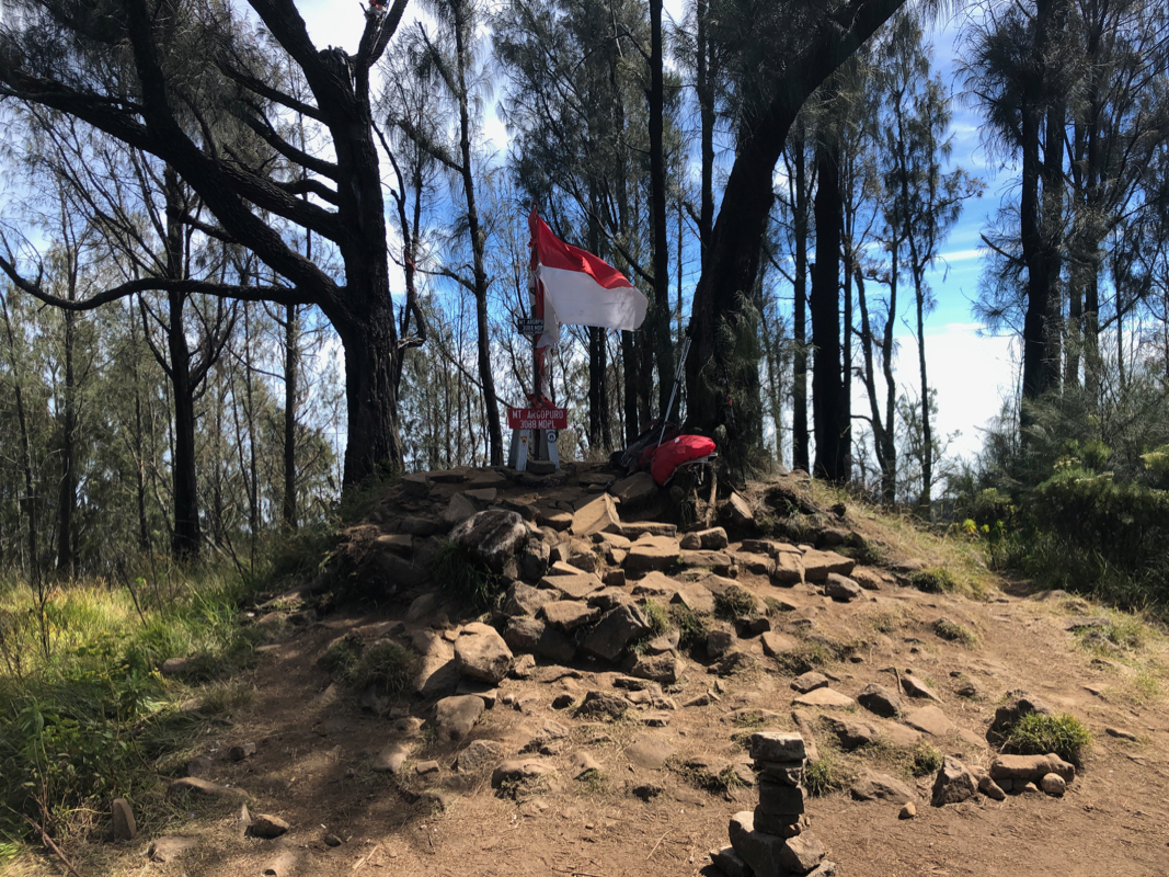
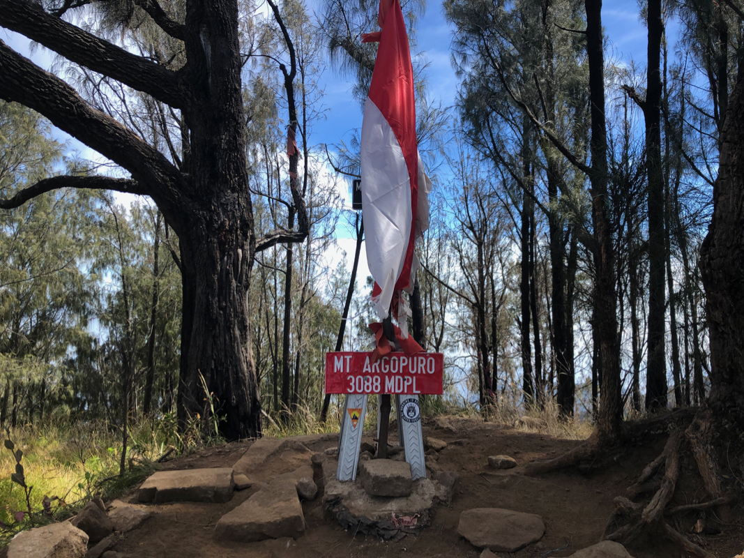
summit. The summit has a marker, stating name and elevation.
Comments:
We had moved to our last hotel on this trip, Bangsring Breeze in the small community
Bangsring directly across the strait between Bali and Java, ie. about as far east as possible
on Java. Unfortunately, this implied a pretty long drive in order to access my planned trailhead
for Argopuro. Thus, the plan was to leave after lunch and drive close to the trailhead, find a
hotel for the night, then start early the next morning and hopefully complete the climb with
reasonable time left in order to drive back to Bangsring in time for dinner.
A hotel with the desired location, Kampoeng Kita Hotel, only a few kilometer from the trailhead.
I thought it would be nice to get accommodation also for my driver and reserved a Superior Suite
for up to 3 people, the price was still quite reasonable. This done via Booking.com, normally quite
a problem free way to reserve hotels. We left around 1400 and shortly thereafter this hotel
started sending me messages that unless replied to, they would cancel the reservation. The number
they asked to call did (naturally!) NOT answer any calls. Never mind, but a bigt annoying.
We arrived around 1900. After a bit of language trouble (zero English spoken), I got the room.
A quite small room with 3 beds crammed in. I guess they set a new standard for "Superior Suite".
I asked about dinner and a Bintang (Indonesian beer). More confusion followed. They produced
a menu with 3-4 Indonesian descriptions, and I decided to play it safe ordering chicken and rice.
They first insisted on serving this in the room. As there was no place to sit in the room, I
requested a table somewhere else. Then the Bintang, it turned out that it could only be
purchased in the bar. We were then off to find the bar. The bar had no tables and rather
loud music. Paying cash in advance was needed to get the Bingtang, after more discussion
it was agreed that it could be carried to a table in the hotel restaurant and consumed
there. Returning to a room with a few tables (progress!) we sat down and after the use of
some force, (no bottler opener), the beer was ready. After a while two plates each with
a pretty ugly looking fish was served, one for my driver, one for me. Chicken? Well, they
were out of chicken so the fish was served (at twice the price of the chicken) as a
siubstitute. Fine, we had dinner, the rice was good, the fish was 90 percent bones, the
Bintang was good as always. We went early to bed, the start next morning set to 4 AM.
Got up around 0340, and we were soon driving up the hills towards the trailhead. I directed the car
until the road basically ended. Told him to be back at noon and the wait until I returned,
regardless of how long that might be.
Starting at 0430, it was still pitch dark and stars on the sky. I had my good light and
navigating this trail did not pose any problems. I made a brief stop at 0530, daylight was
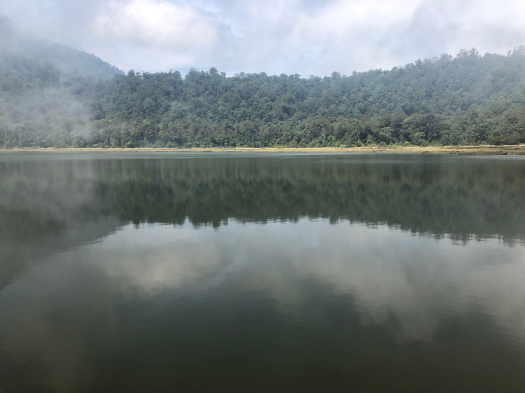
coming and the torch could be put away. I made the crater lake rim after 2 hours and decided
to pay this lake a visit on my return hike.
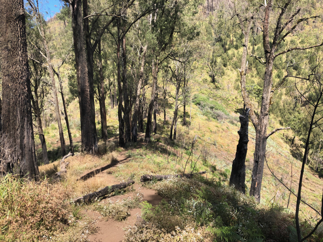
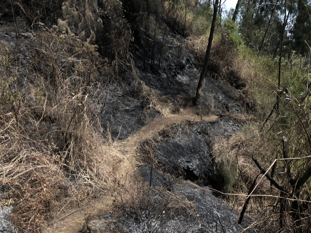
The trail now continued to the saddle, crossing a patch of recent fire
on the way. Pieces of burnt
wood were still producing fresh smoke, so not completely extinguished yet.
I arrived at the trail fork by the dry creek
around 0800 and continued directly uphill, arriving at the summit at 0915.
I had met 3 people descending about half way between the lake and the saddle, two more
were at the summit. I left after a 15 minute break at 0930. Descending was easy, mostly a very good trail.
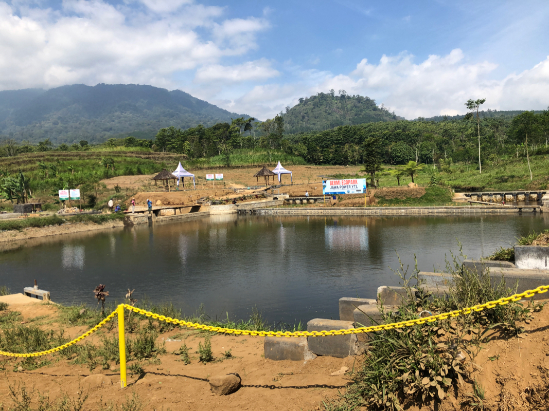
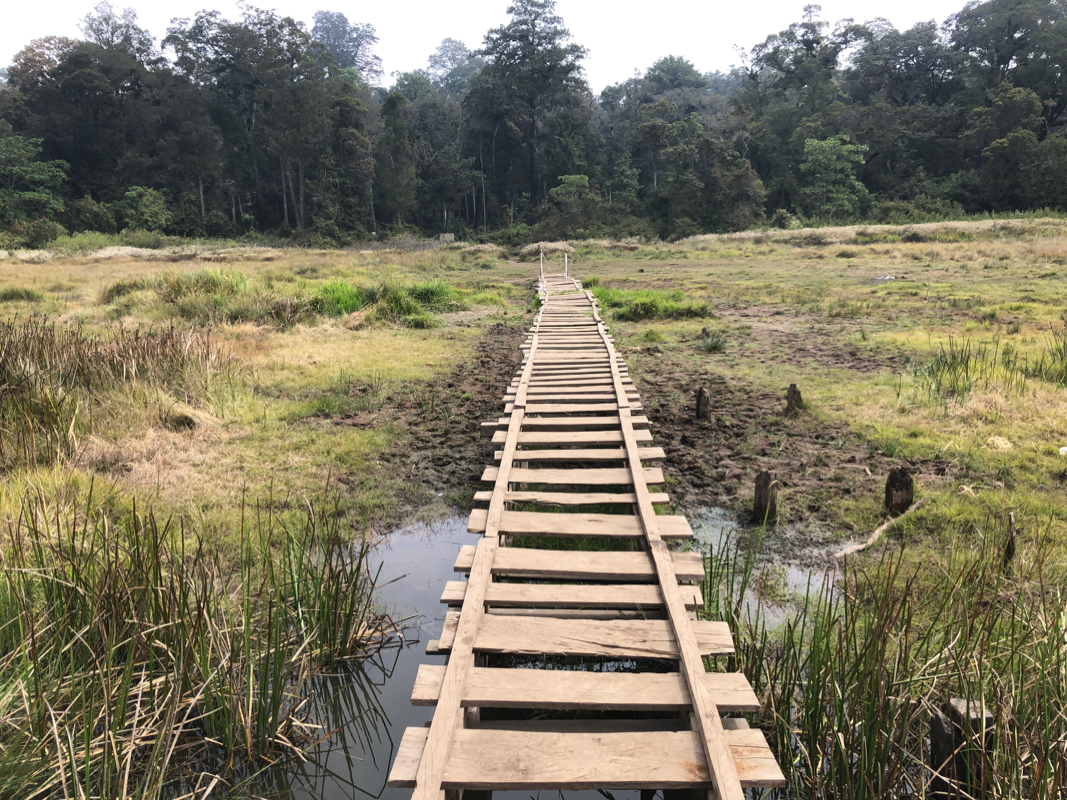
I made a small detour to visit the crater lake, a walkway had
been built all the way out into the water. There were
many signs around, but all in Indonesian. I then continued down mostly following the
track used by motor-bikes. Near the end of the steeper part, I was met by three motor-bikes all offering
a ride down to the village. Ojek, Ojek, they suggested. I told them that this time I
preferred to walk, so unfortunately, no business for the ojeks. I reached the trailhead and my
car waiting at 1310, so 3:40 descending, including the visit to the crater lake.