Location: North 46.45187 East 012.26173 (GPS at the summit)
Difficulty: (YDS) class 4
Climbed August 20, 2014.
Information:
How to get there:
This mountain is located in the Dolomites, south of the well
known village of cortina D'Ampezzo. From the north, one may travel via the
Brenner pass, coming from the south one travel north from Venezia towards
Belluno (Autostrada), then continues north to San Vito di Cadore - a small, but
quite nice village.
Locate signs for Rifugio Scotter (or San Marco or Galassi)
and follow a small, paved road uphill (to the east),
until you arrive at a large parking area and a ski lift. A road continues uphill on the
right hand side, there is a gate here and a sign that says that one may only drive
further very early in the morning or after 1830 in the evening. If the lift is running,
one may park and take the lift up to Rifugio Scotter. The best option is likely to arrive
around 1830, then drive uphill. This road runs steeply uphill and turns into gravel
fairly soon. It is rough, but quite ok for a normal car when driven carefully.
Keep left at the fork just before Rifugio Scotter,
and continue a bit higher. The road makes a final traverse towards the left (when viewing uphill),
then ends at a small parking (10 cars). Park here, this is a good trailhead, elevation
about 1680 meter, at location N46.47507 E012.23425.
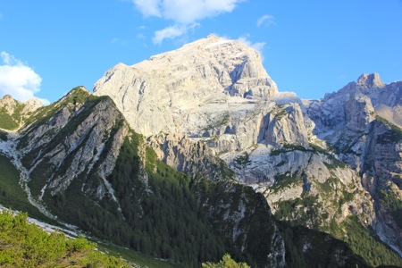
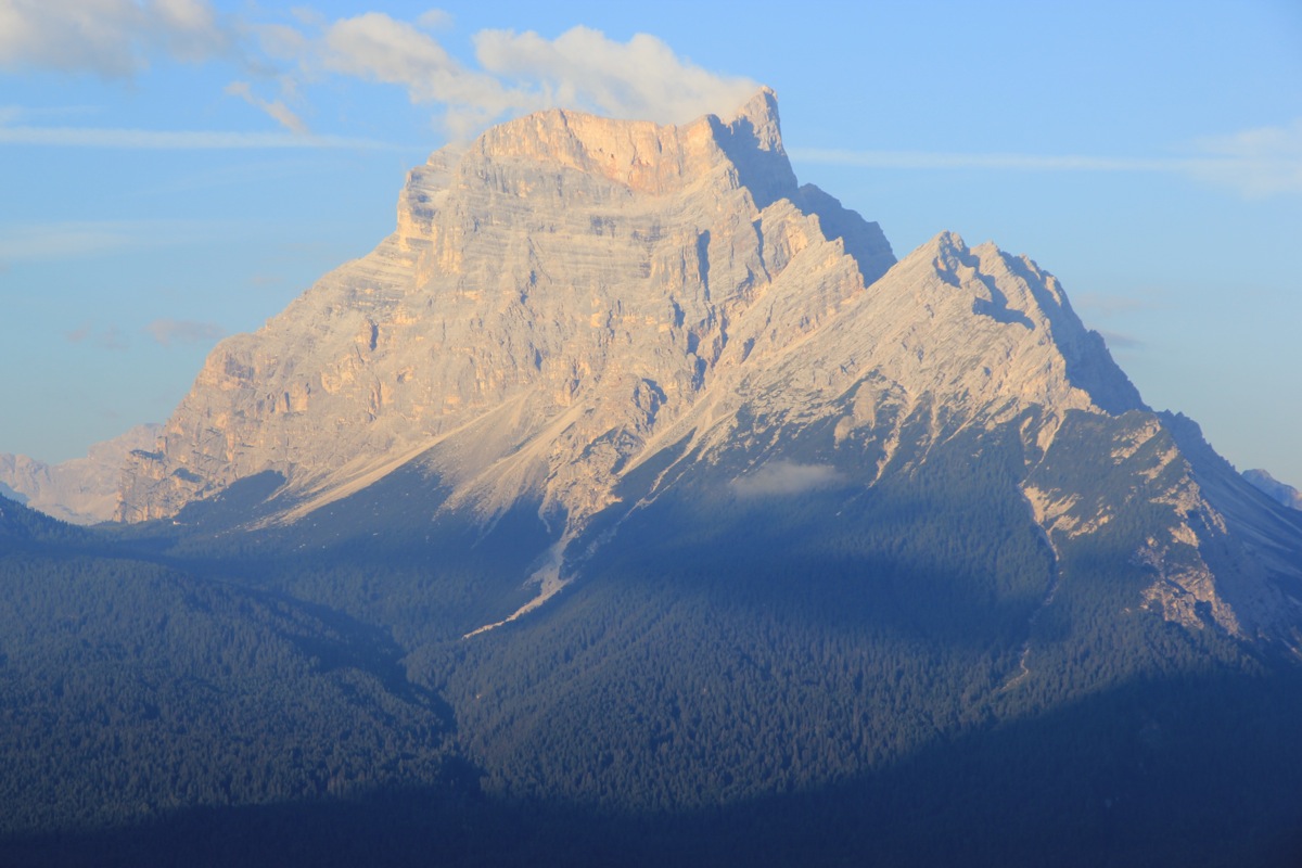
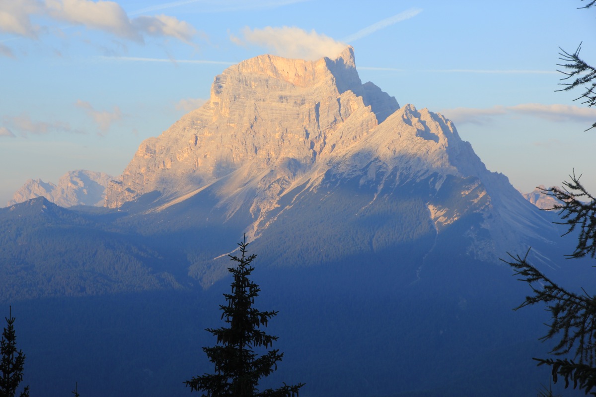
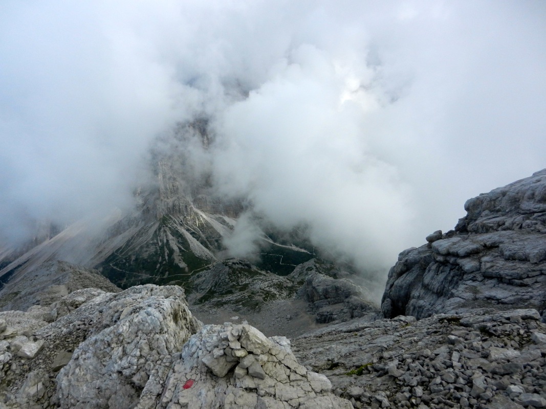
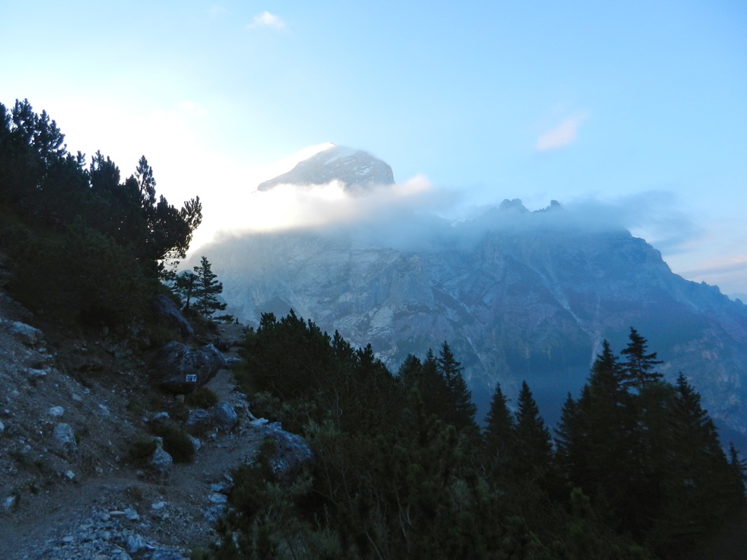
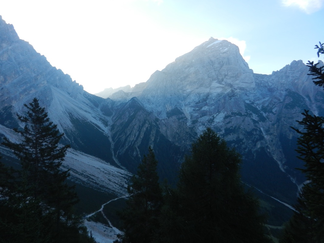
This area is very scenic, the view across the
valley is fabulous. In fact, there are several
nice mountains that may be viewed from this trailhead.
Route description: Hut hike:
There are good signs at Rifugio Scotter. If starting from the high trailhead described above,
then continue in the same direction as the road, make a short descent and pick up the trail
to Rifugio San Marco.
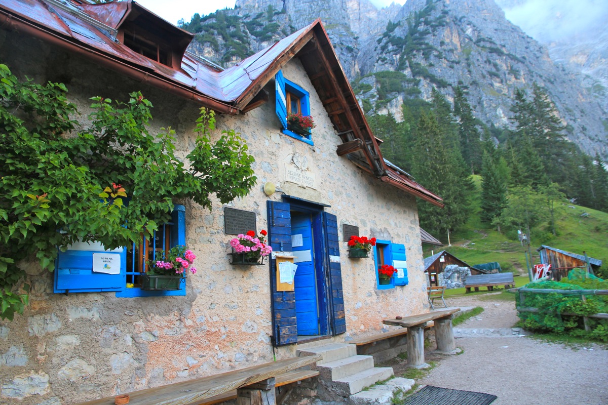
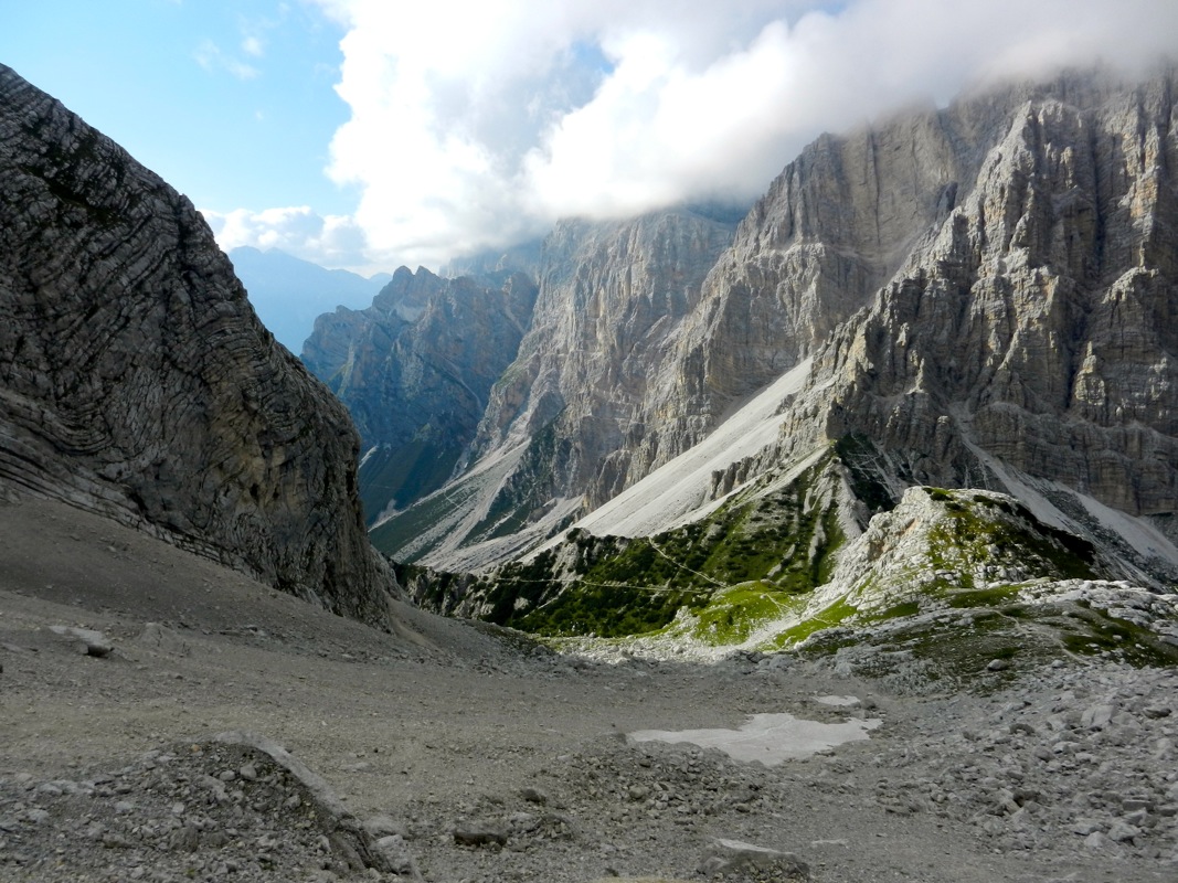
Quite a short hike will get you there (about 30 minutes). This is a possible
place to stay. The other option is to continue a bit more than one hour to Rifugio Galassi.
Galassi is located beyond and a slightly below the main saddle on the north side of Antelao.
(Thus, one must go a short distance back when starting from Galassi.)
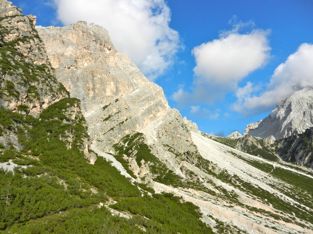
The route starts out from the main saddle (a signed trail).
Summit climb:
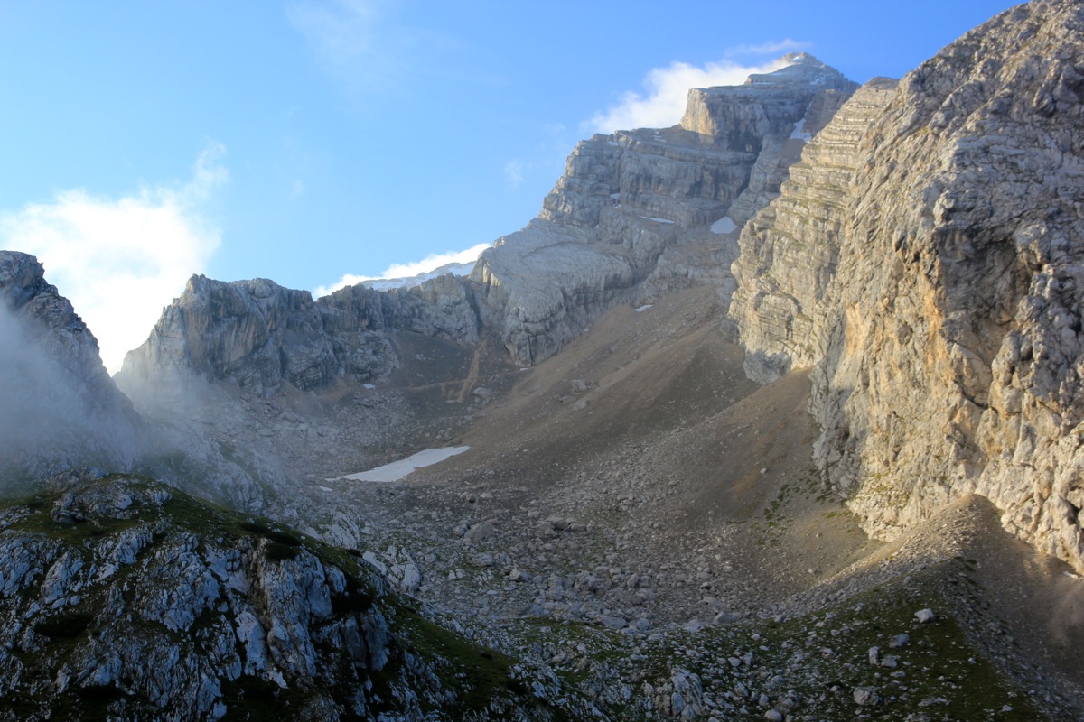
From the col, head directly towards Antelao, initially
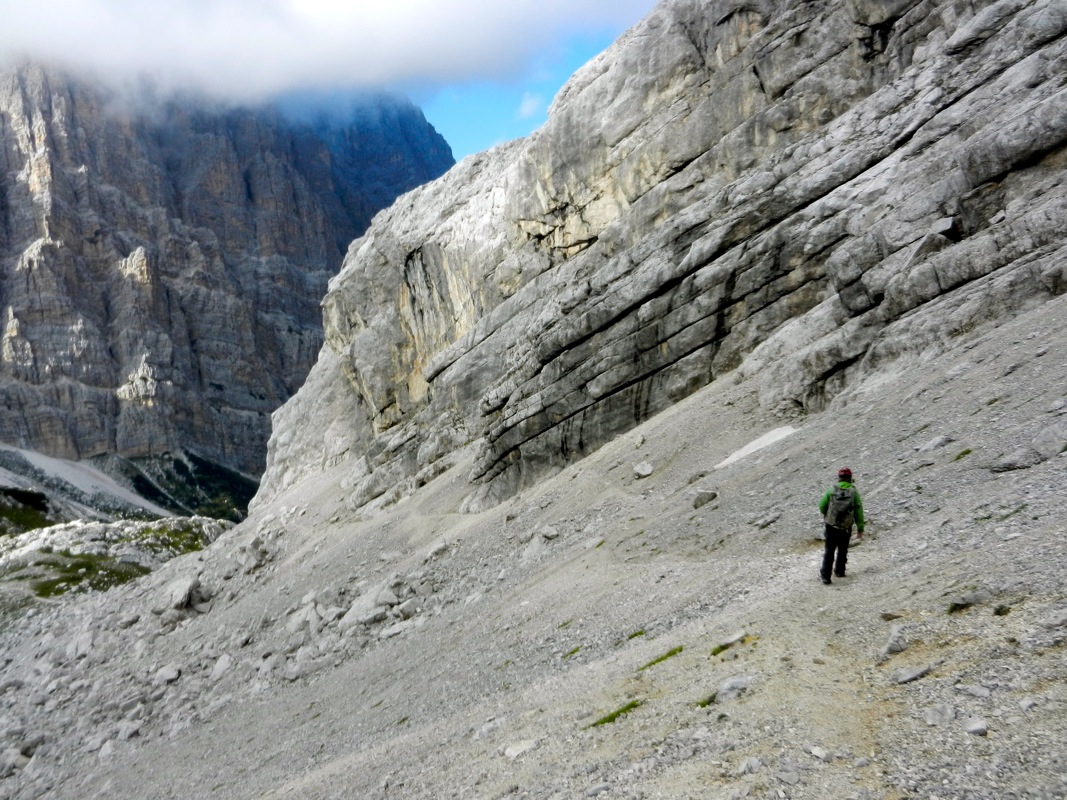
along a trail that climbs into a smaller basin.
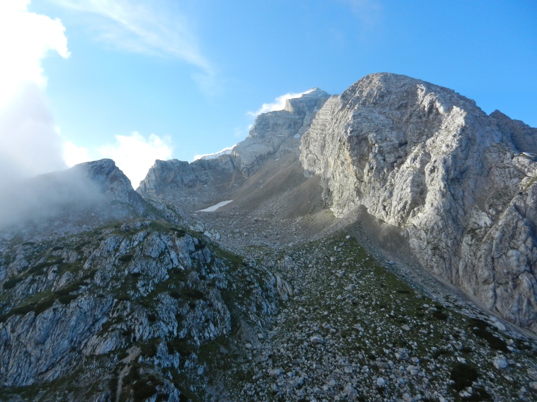
The trail continues uphill and
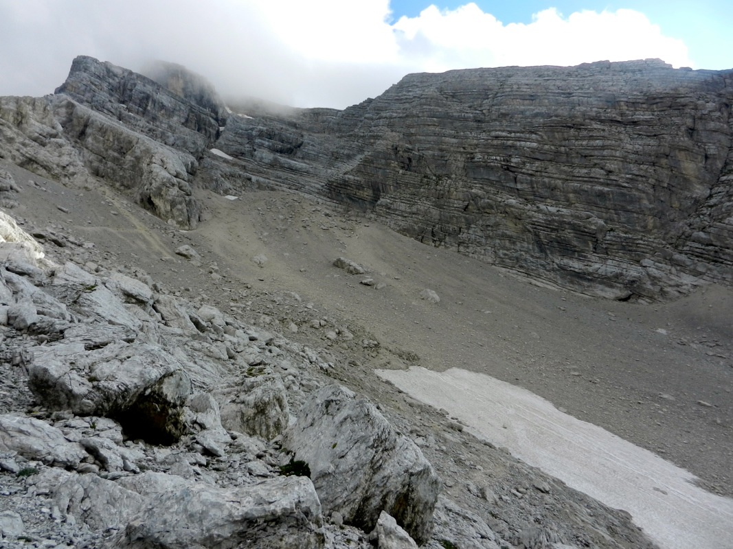
towards your right in pretty loose scree. Continue uphill
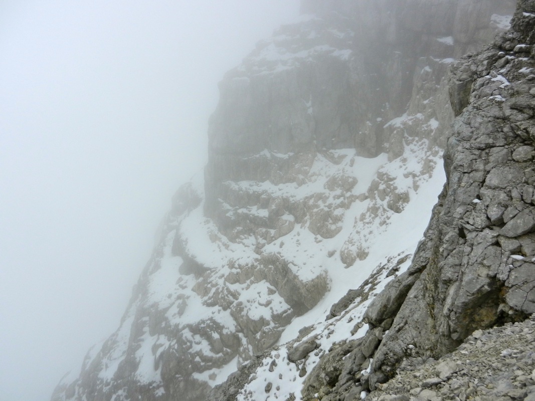
to near the highest point (of the scree). The route now traverses a small, smooth area of rock.
Follow the red paint that shows the best route. Climbing of (YDS) class 3 here. The objective is
to scale the high wall on the climbers
right hand side (when looking in the direction of Antelao).
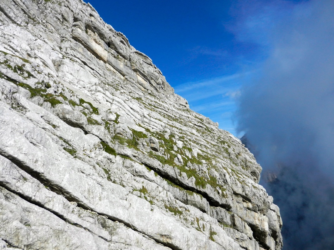
This is possible by following several ledges that slope uphill (from right to left) and a bit
of easy climbing to connect between them. Initially, there is a short stretch going right that
actually descends a little. The final ledge
is pretty smooth and has a fairly narrow
section just before the top. There is significant exposure and this ledge is certainly
very unpleasant when wet or when covered by ice or snow.
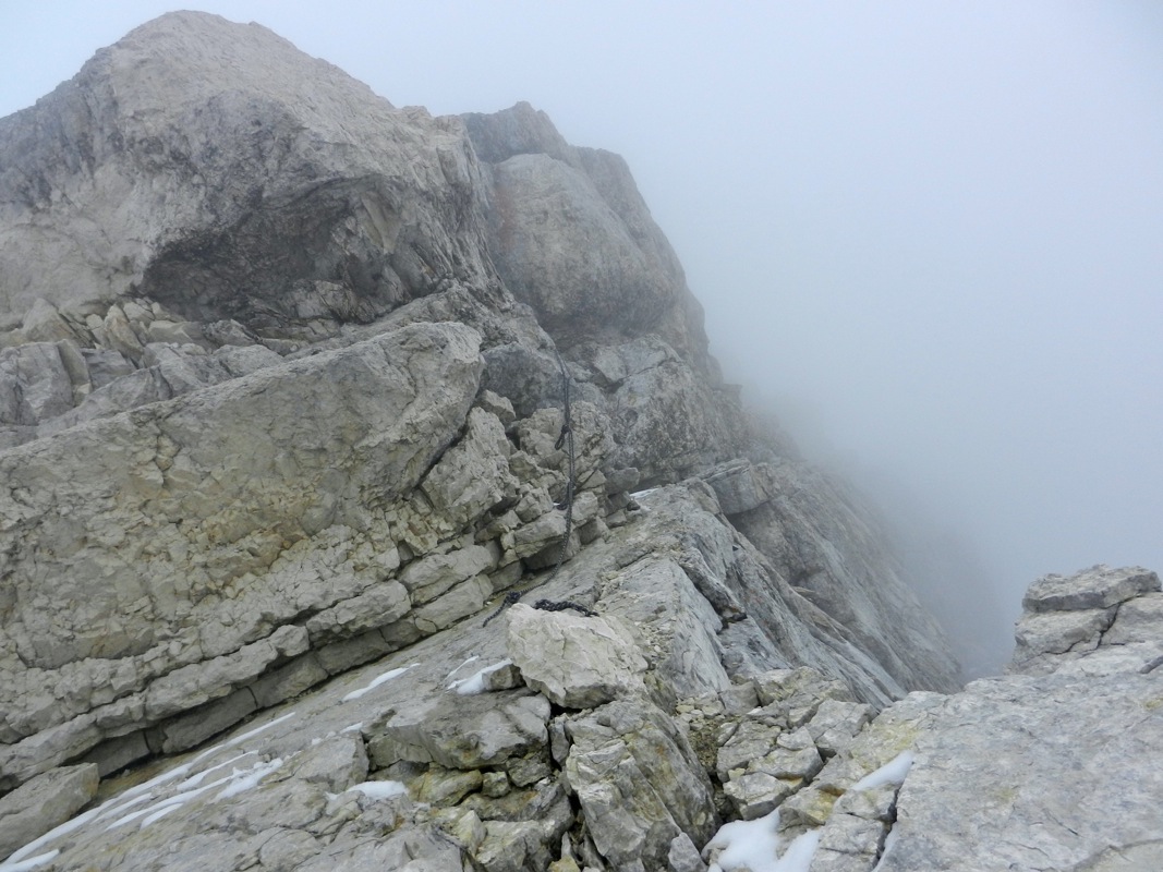
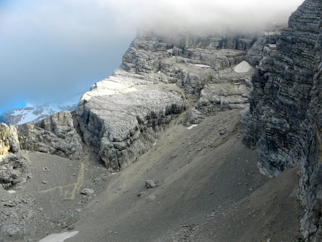
This part tops out on the main ridge and
this point is marked by a cairn, pay attention for your
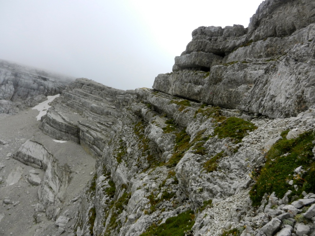
return. Next follows three sections with very
characteristic, flat, tilted rock.These sections are pretty good when dry and
free of ice/snow. They are partly covered with loose
scree that should be avoided,
they also have various cracks that
may be followed for increased
safety, when required. In general, the red marks
show the best line to follow uphill.
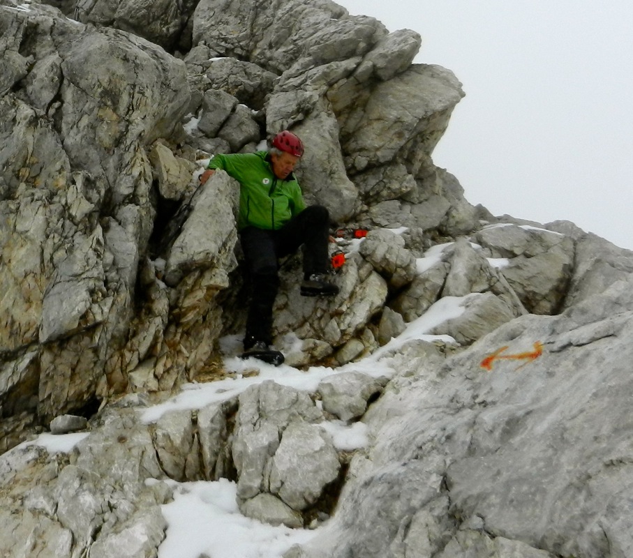
The route will lead to a small notch between section 1 and section 2. Here, the easy downclimb
is on the right side while the route seems to be marked slightly on the left. On the opposite
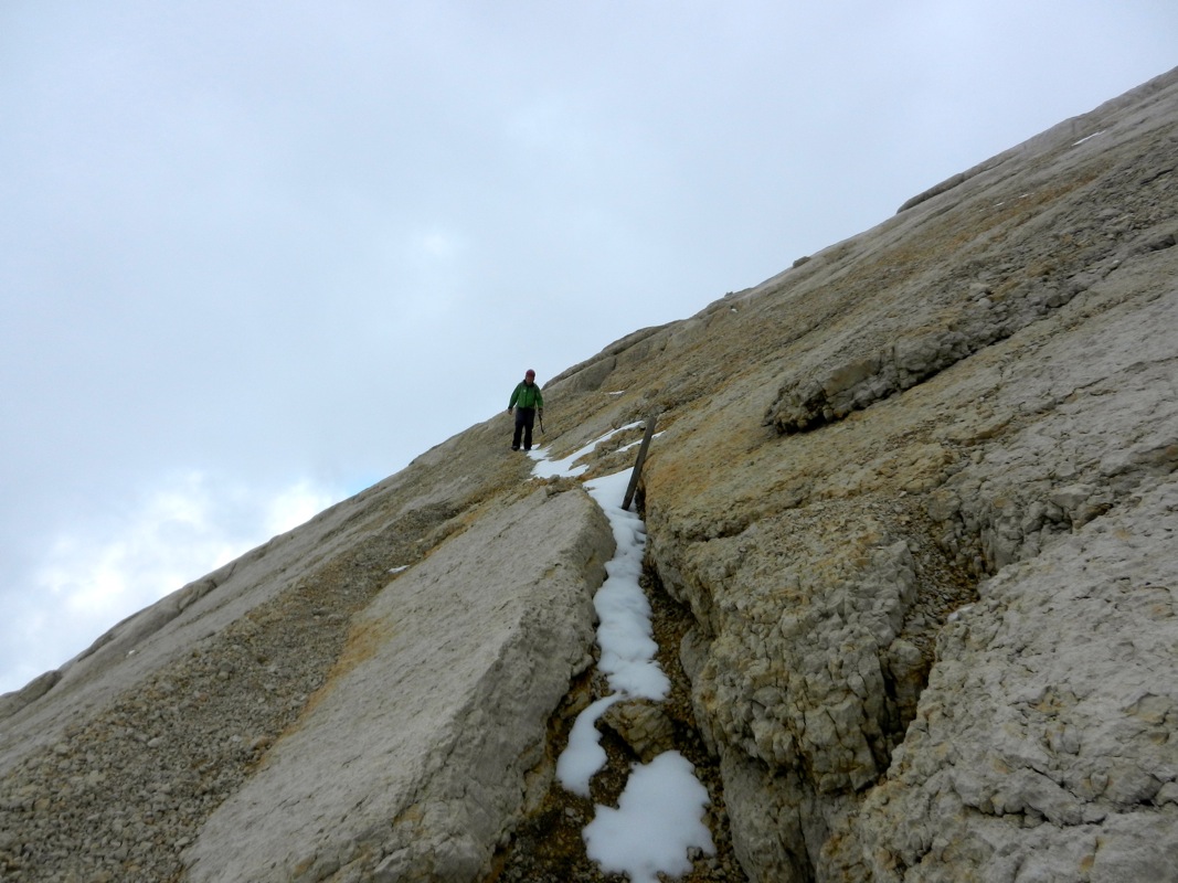
side, climb a narrow crack to get onto section 2. Section 2 continues uphill and you will
see a cliff band higher
up that blocks access to section 3. Continue up to the cliffs, then
along on the right hand side. You will soon find a crack going left that nicely connects
you to section 3. Section 3 is a bit more narrow and the route follows
the left side with a
steep drop on the left. Higher up, there is a short
section of climbing (picture from descending) before the easiest
route continues slightly on the left side of the highest ridge. You are now below the final
summit block and the route will run right and follow a short exposed ledge to a crack
that climbs left in two steps. This is the crux of the climb.
When we were there a fixed
rope came down to this ledge. Climb the two steps, perhaps 5 meter in total and reach easier
ground. From here, the route zig-zags, crosses a few tilted slabs of rock and then easily
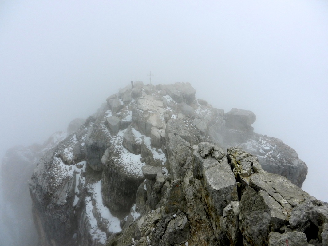
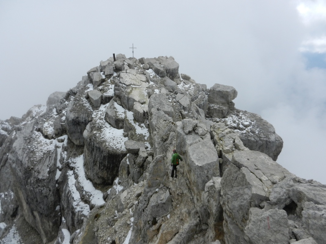
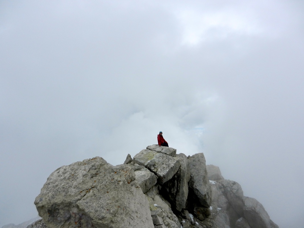
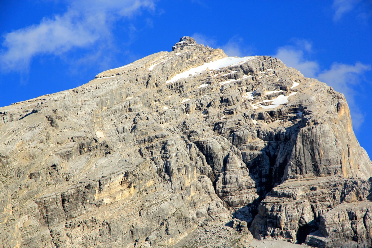
gains the top of the mountain. As it turns out, this summit is not quite the highest one.
A short, but easy summit ridge connects to
the summit with the cross. However, it is
pretty certain that the highest point of Antelao is located slightly further ahead.
Bypass a large boulder on its left side, then reach a tilted rock that marks the highest
point.
This route is long and (extra) attention is needed for long periods. Most of the
climbing is (YDS) class 3 and the three sections of slanted rock are really class 2
under favorable conditions. The staff at Rifugio San Marco informed us that on average
2 people fall to their death on this route every year. Wet rock, not to mention verglas
(ice coating) ofr snow can make this route quite difficult. There are a few class 4 moves and
the overall exposure and effort certainly earns this climb a (YDS) class 4 and a French
alpine rating of PD.
Comments:
I did this climb together with my friend Åke Dahlen. We flew from Oslo to
Milan, picked up a rental car and drove to San Vito di Cadore, arriving there shortly
before 1800. We reorganized gear and changed into mountain clothing in order to drive
uphill at 1830. Parking at the trailhead, we completed the short hike and arrived
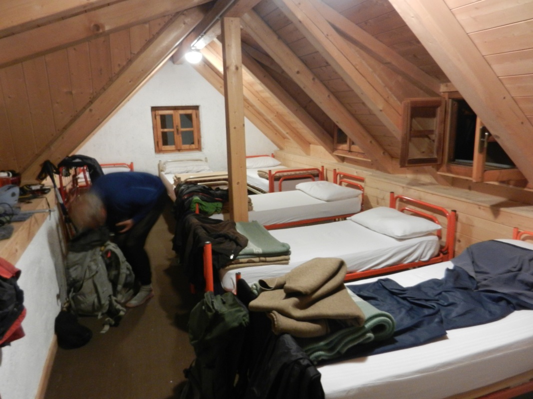
at Rifugio San Marco around 1900, just in time for an excellent dinner.
After breakfast at 0630, we left around 0715
and walked the nice trail to the main
col (direction Galassi) about one hour later.
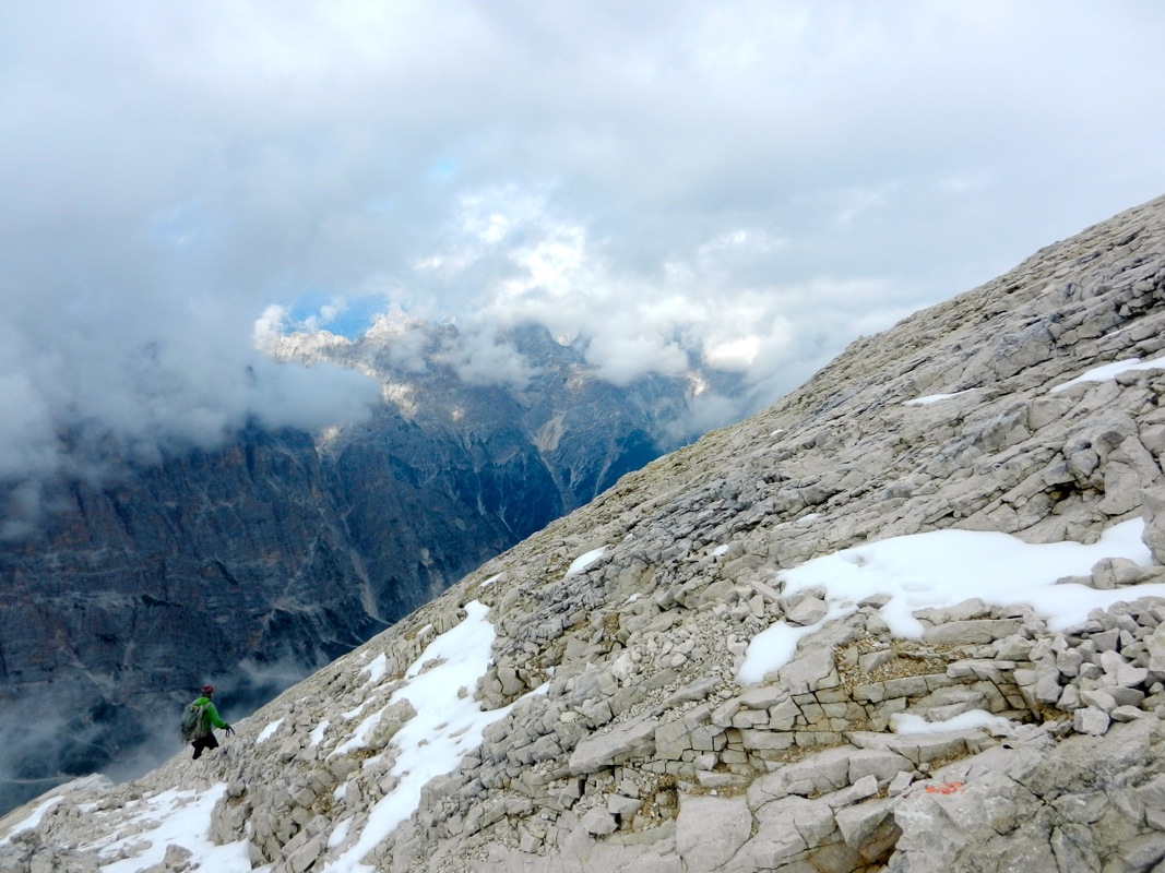
We took the trail up into the basin
and finished the loose scree to
arrive at the smooth rock that signaled the beginning of the climbing
part. 800 vertical meter was still ahead, no doubt that this would be quite
a long day. The first section, up to the main ridge, is quite nice, not
technically difficult, but quite exposed. The sloping ledges are the first
part of a route that certainly should be avoided when wet or icy.
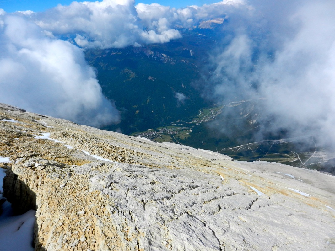
Up on the main crest with its large, sloping rockface, the terrain became easier,
but one is often reminded that sliding off is never an option.
I wasted some time trying to descend to the first notch on the left side, the route
was marked here and I did not realize that a much easier route went on the right
hand side. Finally, I did listen to the suggestion from Åke and we quickly
continued our ascent. Higher up, we got another delay as I, without paying enough
attention, pulled ahead of Åke. I got above the crux before understanding that
I needed to descend back down in order for the team to stay together as a team must.
We then advanced up to what we believed to be the summit before seeing that the
summit was a bit further across a final, short ridge.
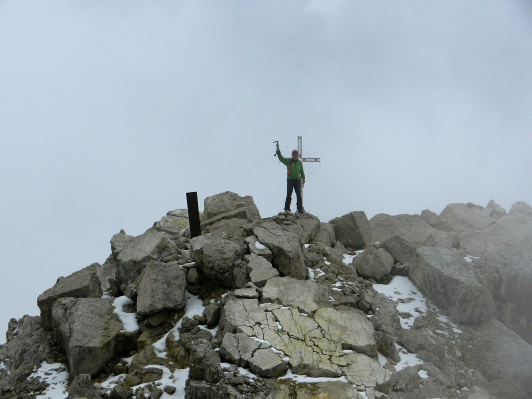
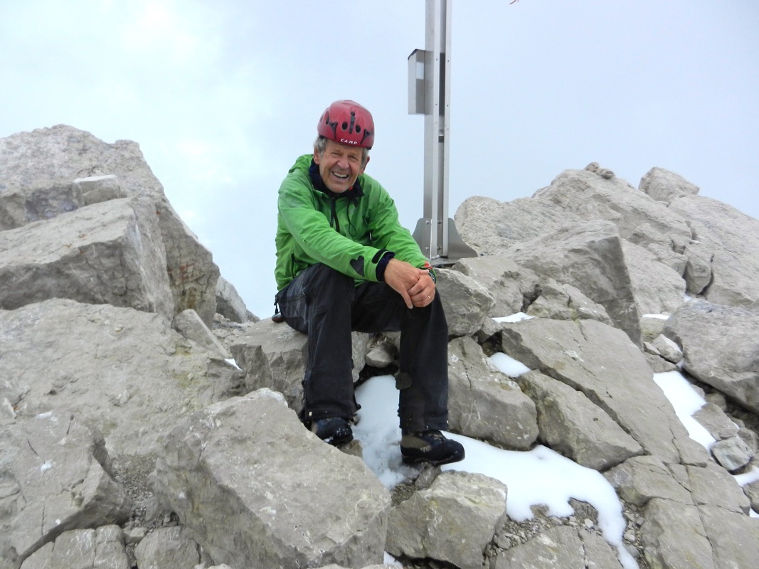
We arrived at the summit
at 1345, the climb had taken a bit more than 5 hours, this includes a few delays
that one normally would not encounter.
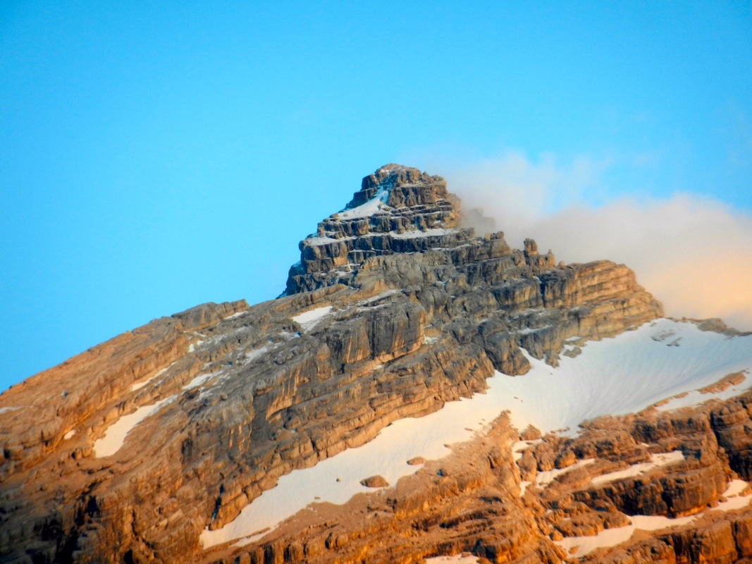
Interestingly, the highest point was
located a bit beyond the summit cross, but the
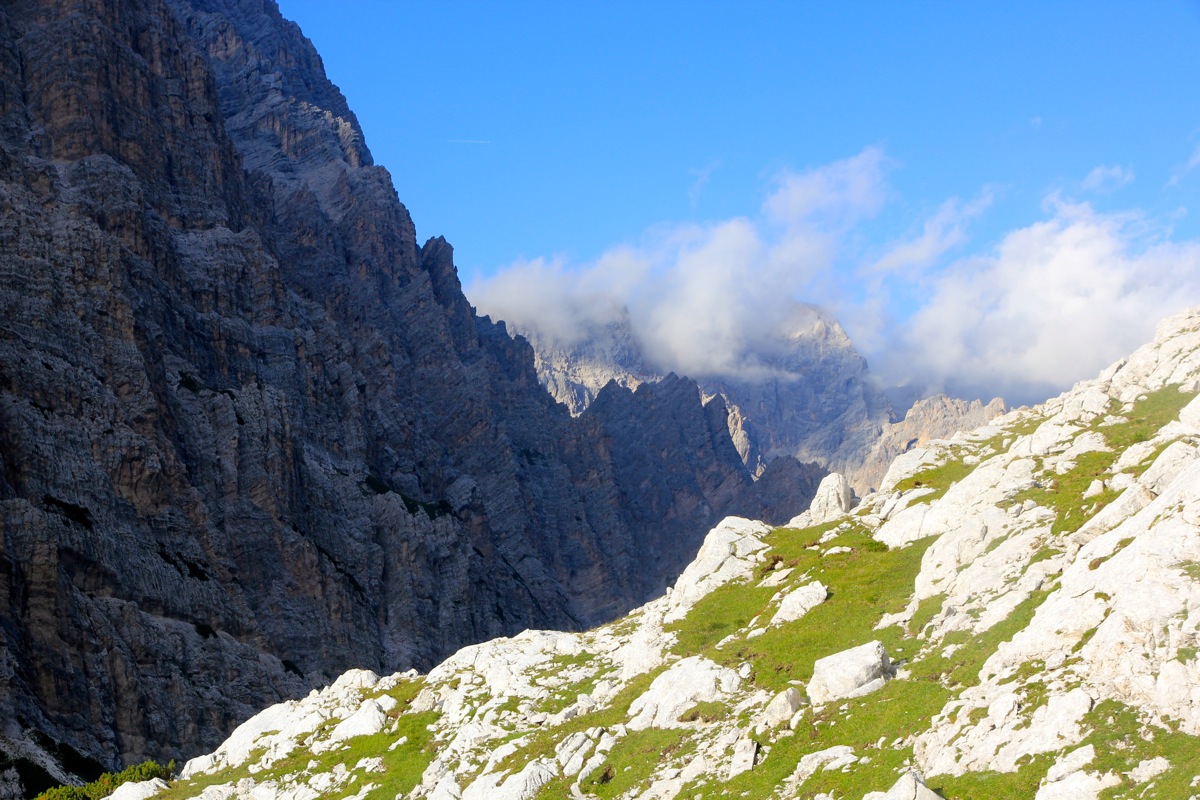
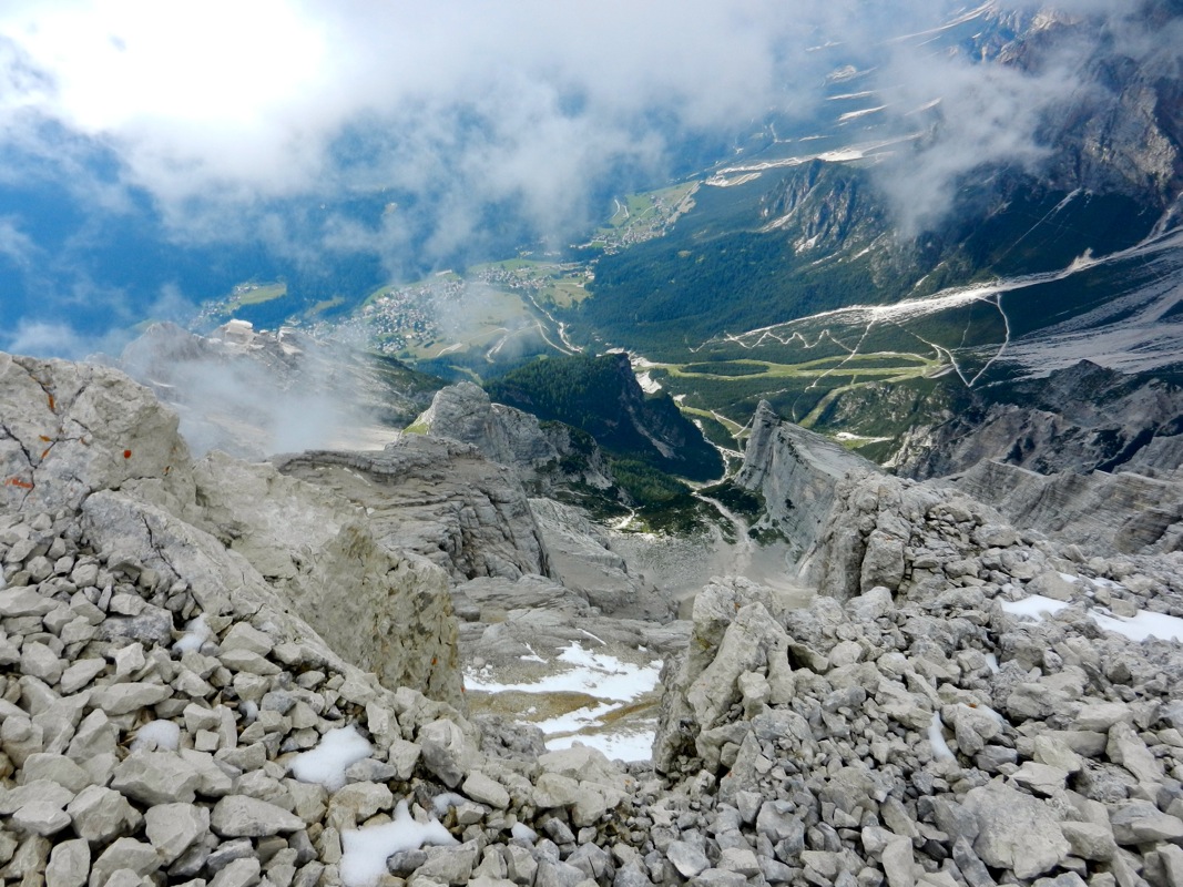
path to this rock was easy. We were part time in a cloud, but got intermittent views
down to the valleys around. I signed the summit register and we stayed at the summit
area about 30 minutes.
However, we knew that we needed to descend a long way and that we needed to stay alert
the entire way. Nothing particularly difficult, but just a very long route where no mistake
is permitted. We moved down one section at a time, finally the narrow, exposed ledge before
coming down to the climbers trail descending the scree.
Certainly nice to see the remaining part with easier terrain.
We had taken longer than anticipated, but the climb had been great.
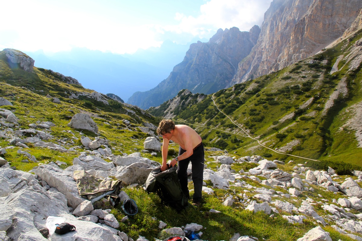
We had left a few items at the beginning of the climb,
now we had time to rest and
admire the landscape
before completing our hike.
We decided to hike back to the
nice rifugio San Marco and stay another night. The dinner, a couple of cold beers and another
good night sleep all seemed completely right.
We were back at 1835, two beers were served before we even entered the hut. The hosting lady told
that her husband had kept an eye on our ascent through his strong binocular.