Location: South 39.42098, West 071.94011 (GPS on the summit)
Difficulty: YDS class 2
Climbed January 22. 2015.
Information:
How to get there:
A good point of reference is the city of Pucon on the shore of
Lago Villarrica. From Pucon, drive west towards the town of Villarrica.
As you leave town, you drive through a traffic circle, shortly after
this, a well signed road forks left. Take this road and follow signs for
the Villarrica ski area / Volcan Villarrica. The road will climb with many
turns and end at a large parking area at the base of the ski area. Thia
location is S39.39173, E071.96008, elevation about 1430 meter.
This is a quick summary and reference to climbs made on this trip.
Red Tape::
You need a permit to climb this peak. The permit is obtained from the local Conaf
office, located on the right hand side of the road immediately after the pavement
ends. The official policy states that you must be a member of an Alpine club and you must
show the Conaf people that you have the required equipment to climb the peak.
In practice, the equipment you must be able to show are crampons, ice axe and a climbing helmet.
When all is found to be in good order, you pay 4000 peso per person. The Conaf has established
a check point near the top of the ski lift, they will check your permit and equipment
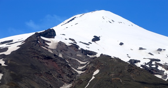
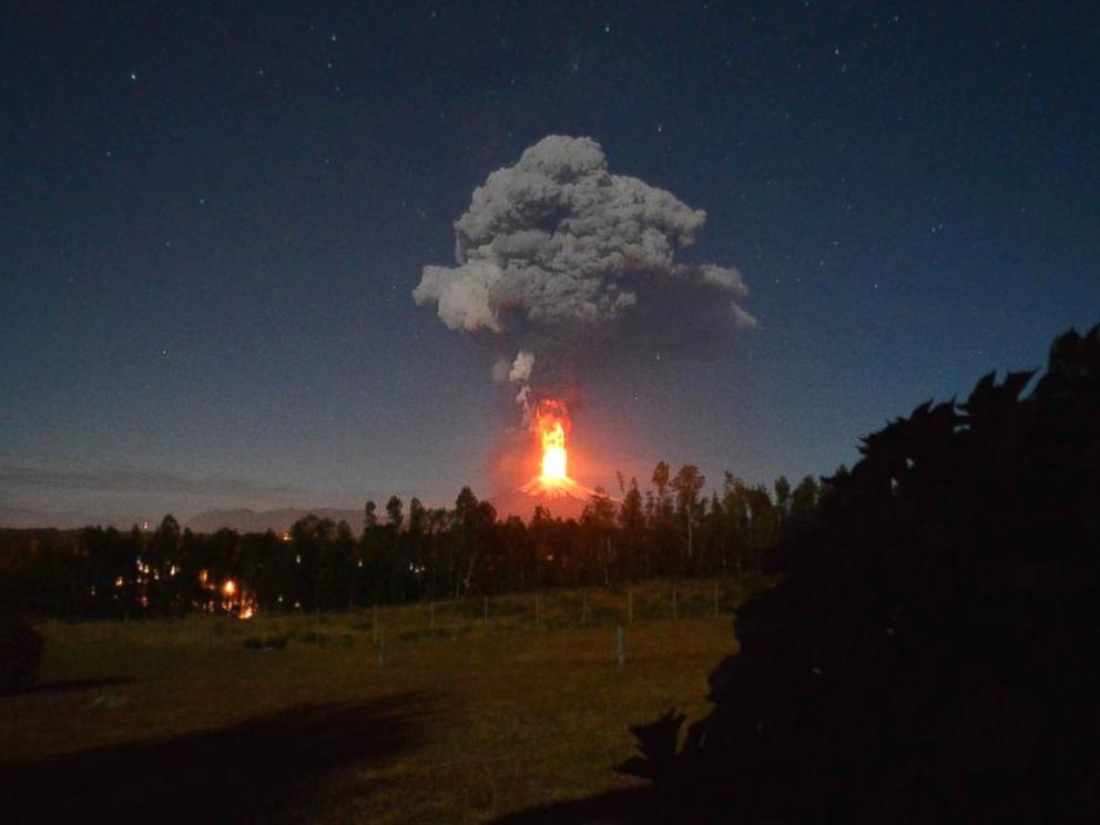
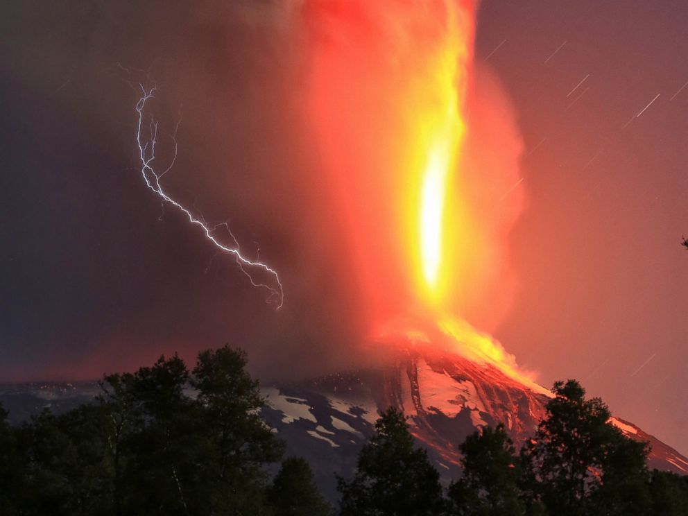
once more. Note: On March 3rd. 2015, about 5 weeks after my ascent, Villarrica started
a violent and spectacular eruption.
This event may substantially affect the description below. Currently, this volcano is obviously impossible to climb.
Route description:
From the ski area parking, head left (when facing uphill), across to the skilift that starts out
from a small hill across from a small ravine. One may take the lift (operates every morning), or hike
uphill, basically along the top of a moraine, to the top station of this lift.
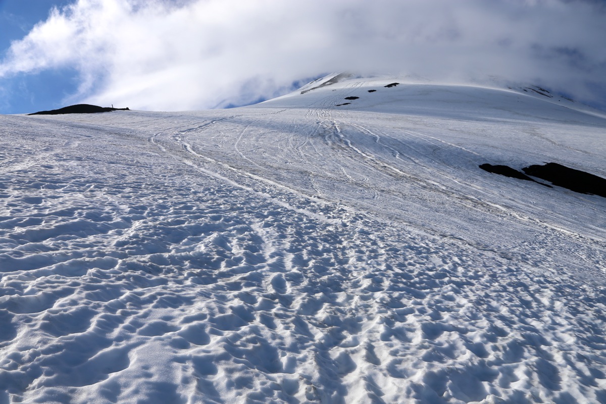
From the top station, the route traverses left, then one can get onto snow and ascend uphill.
The snow slope is moderate, one will see a somewhat steeper section higher up. This is not as steep
as it looks, normally a clear track traverses up and across this short section. Next, a slightly
more gentle slope connects to the final slope.
The final ascent consists of two somewhat steeper
slopes with a short, more gentle slope in between. Overall, the slope is mostly between 30 and 35
degrees.
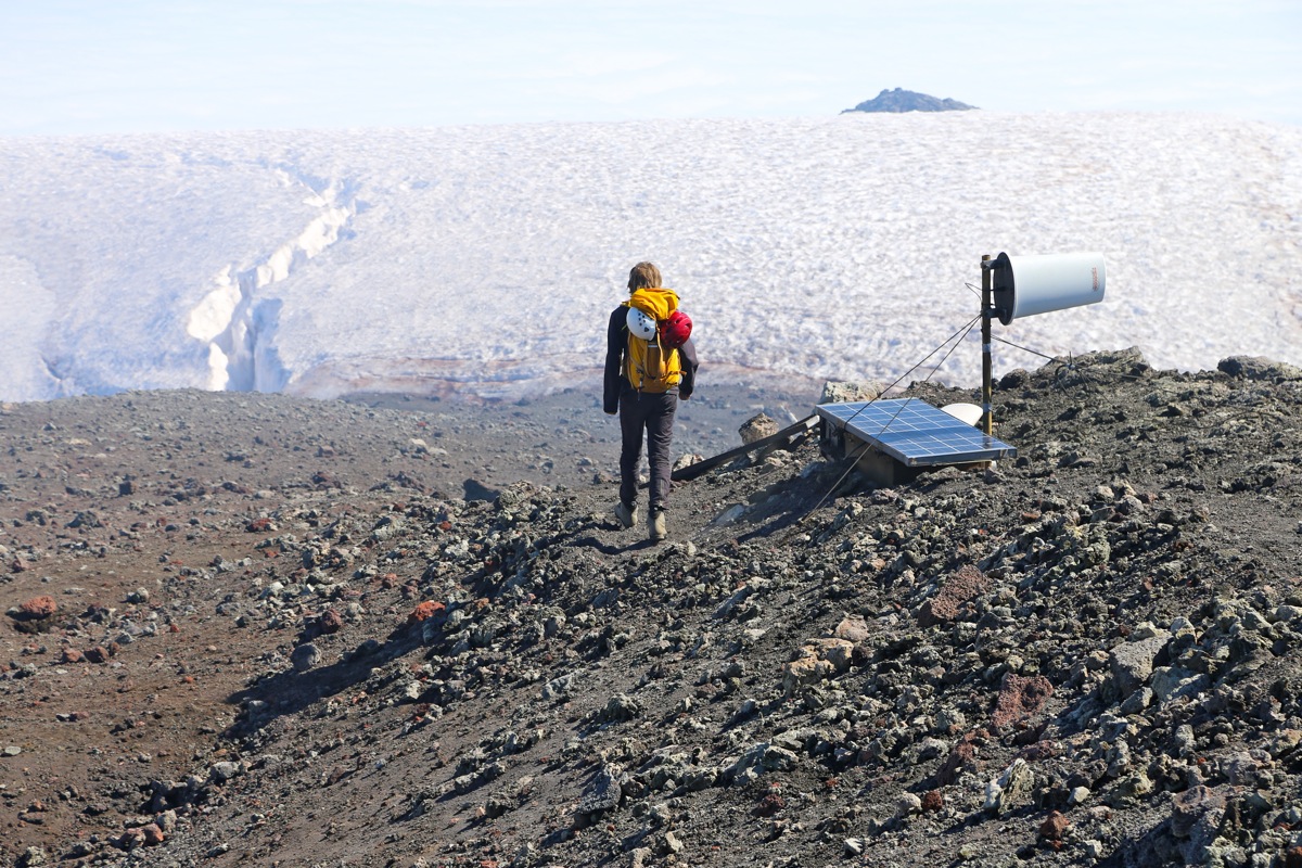
Higher up, the route stays on snow, but rocks are visible nearby as the route angles a bit left.
The slope eases as you reach the crater rim, consisting of snow in this area. You immediately see
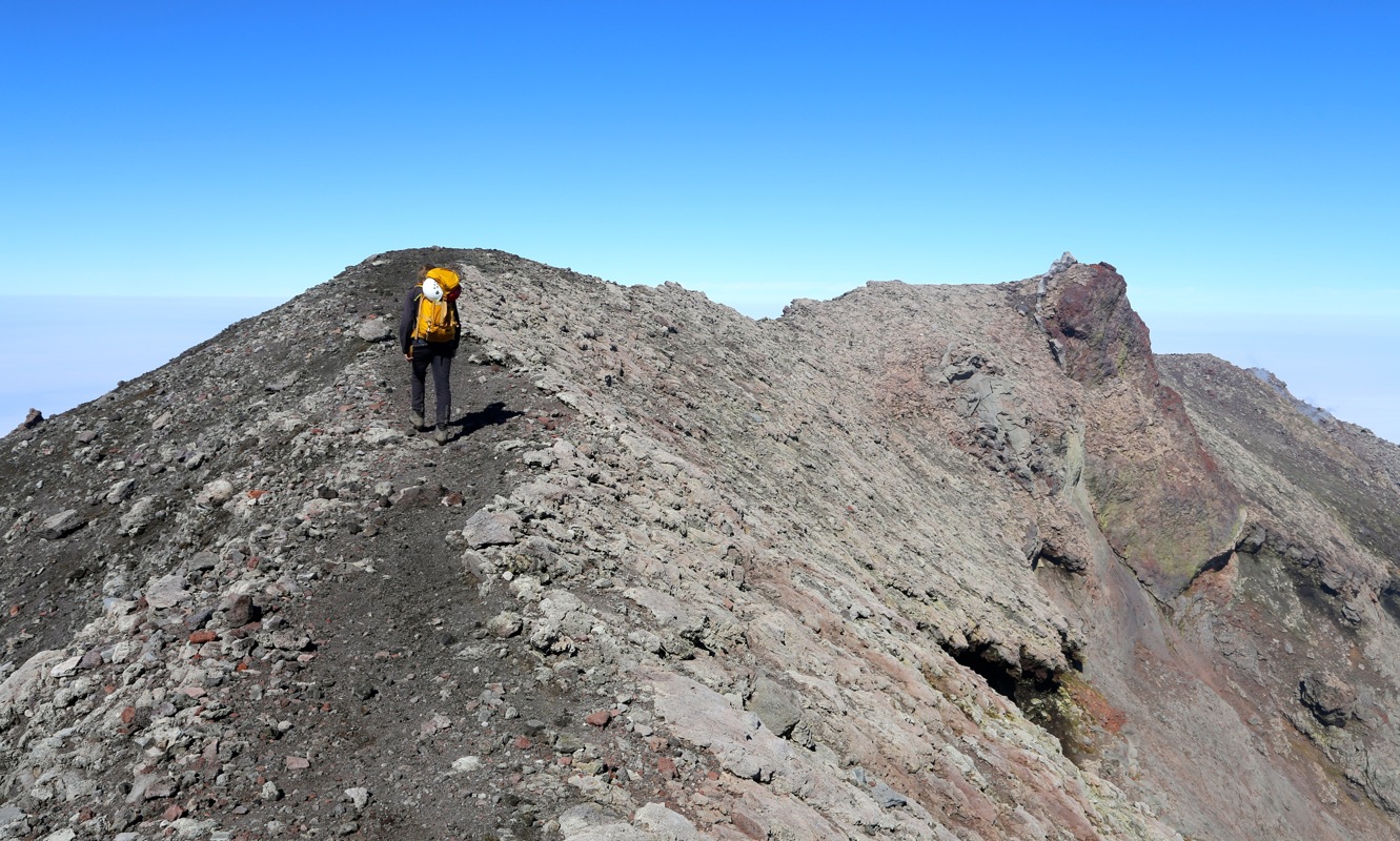
the highest point more or less across the crater. Turn left and follow the snow until it ends.
From here, a pretty obvious route, following the crater rim which is easy to follow, leads to a fairly
distinct rocky highest point. Comments:
I woke up to light rain outside my hotel room window. Looking out, a grey sky
everywhere and a bit of rain. This did not look good, but I had a vague feeling that
this weather was a result of the previous very hot days and that the clouds might be
pretty low. We decided to drive up to the Conaf office and at least secure our climbing
permit for the next day, unless conditions would allow an ascent already today.
As it turned out, the report frpm the ski-center was indeed positive. The clouds were
lower than the base of the center, blue sky and good weather on Villarrica.
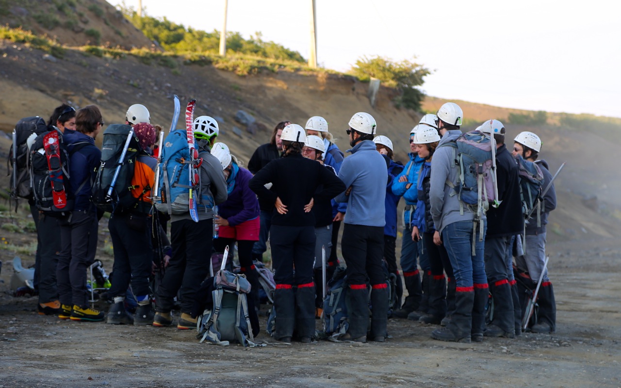
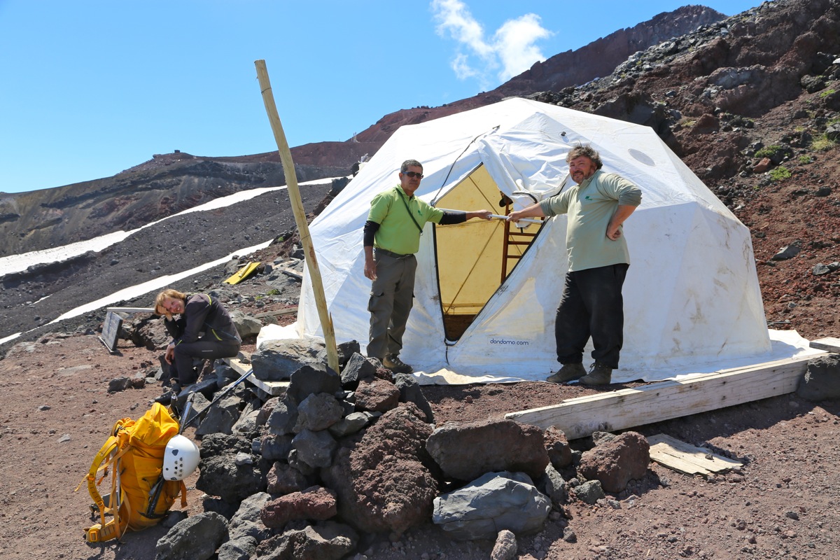
Next followed a session with the Conaf people. They wanted to see our alpine club membership
cards, we showed them our DNT cards and they were happy. Next, a look at equipment, the
crampons, ice axe and helmet seem to be the key points to check off. We paid 4000 each for
the permits and continued uphill to the ski center.
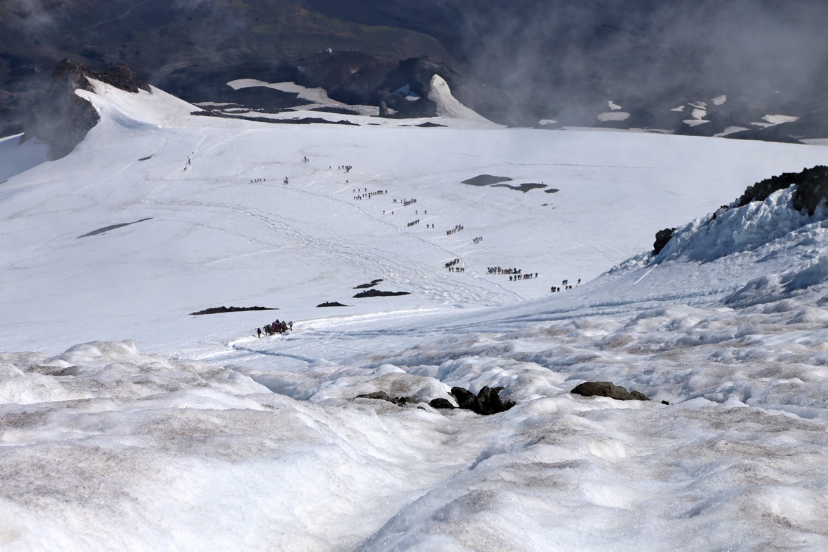
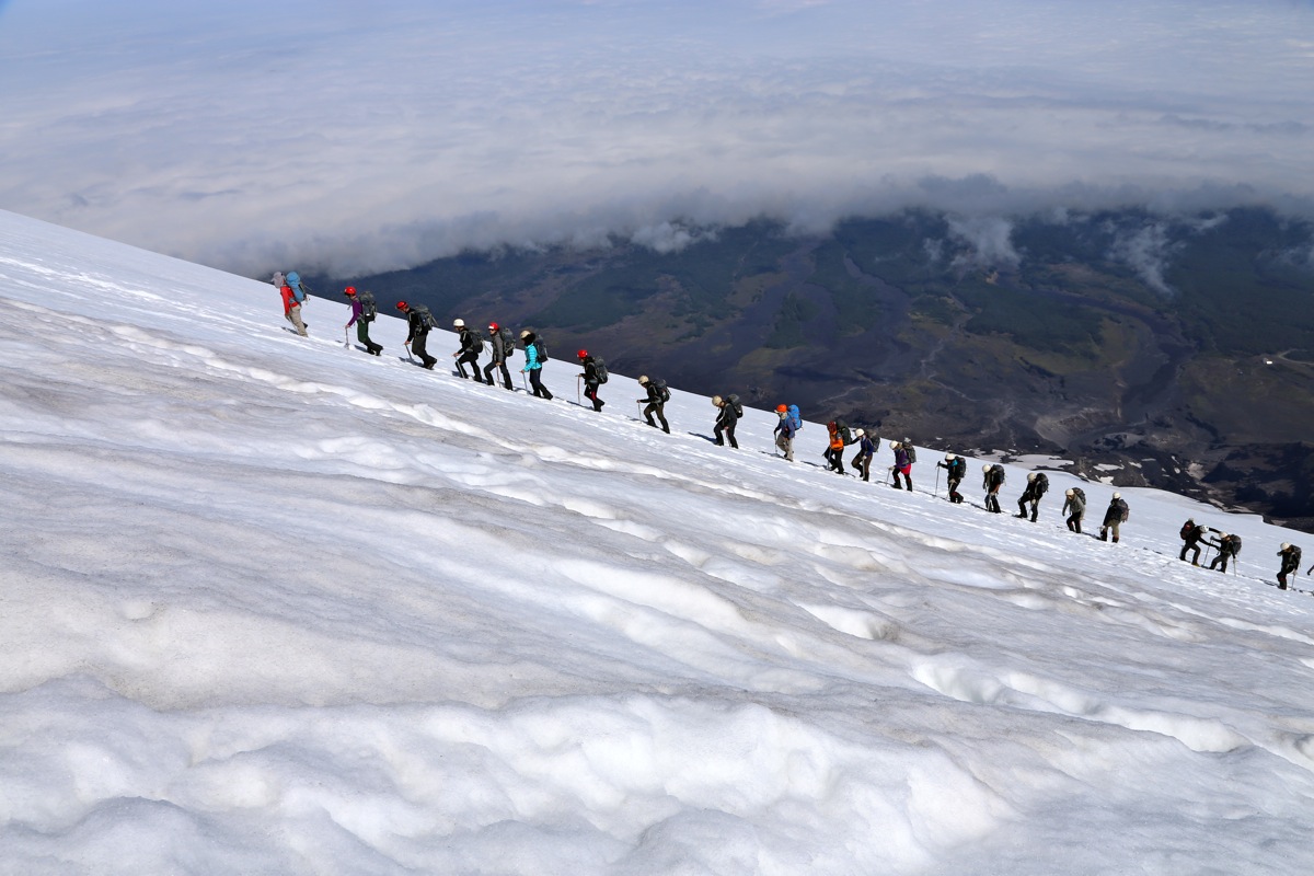
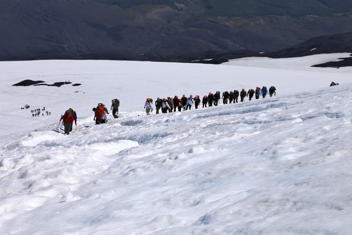
Big activity! Several large groups with
guides were preparing for departure. All dressed up
in fancy mountain gear, all wearing colorful climbing helmets. We let our helmets remain
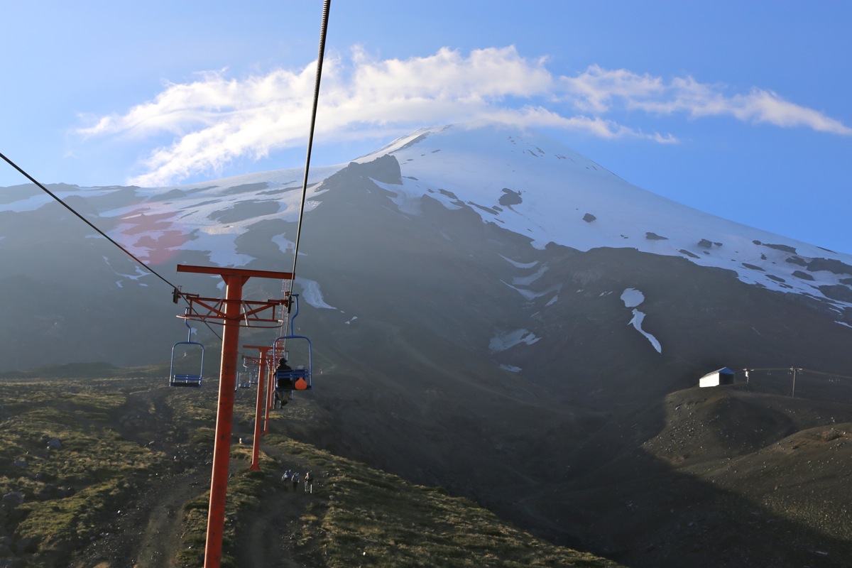
in the backpack, then headed over to the chairlift.
An easy ride up to the top station where
more Conaf people had established a "high-camp", for final equipment check.
We started walking from the top station of the lift at 0840.
Pål Jørgen had already observed that one could stay on snow for the entire ascent,
thus we put on crampons and (unlike all other parties) did this climb as a pure snow-ascent.
We were off at 0840, quickly passing several guided groups. At the higher slopes, only a group
of 4 Germans were ahead. They rested at the crater rim as we passed, then walked the short
crater rim towards our left, in order to reach the highest point.
We arrived on top at 1040, so 2 hours from the starting location.
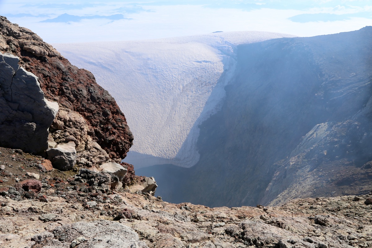
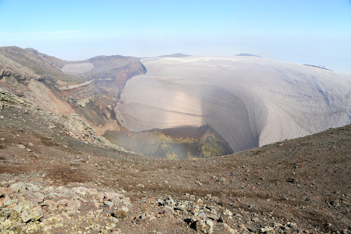
Good views, the crater is
quite deep and one can see and smell the sulphur gas
that comes out at a fairly steady pace.
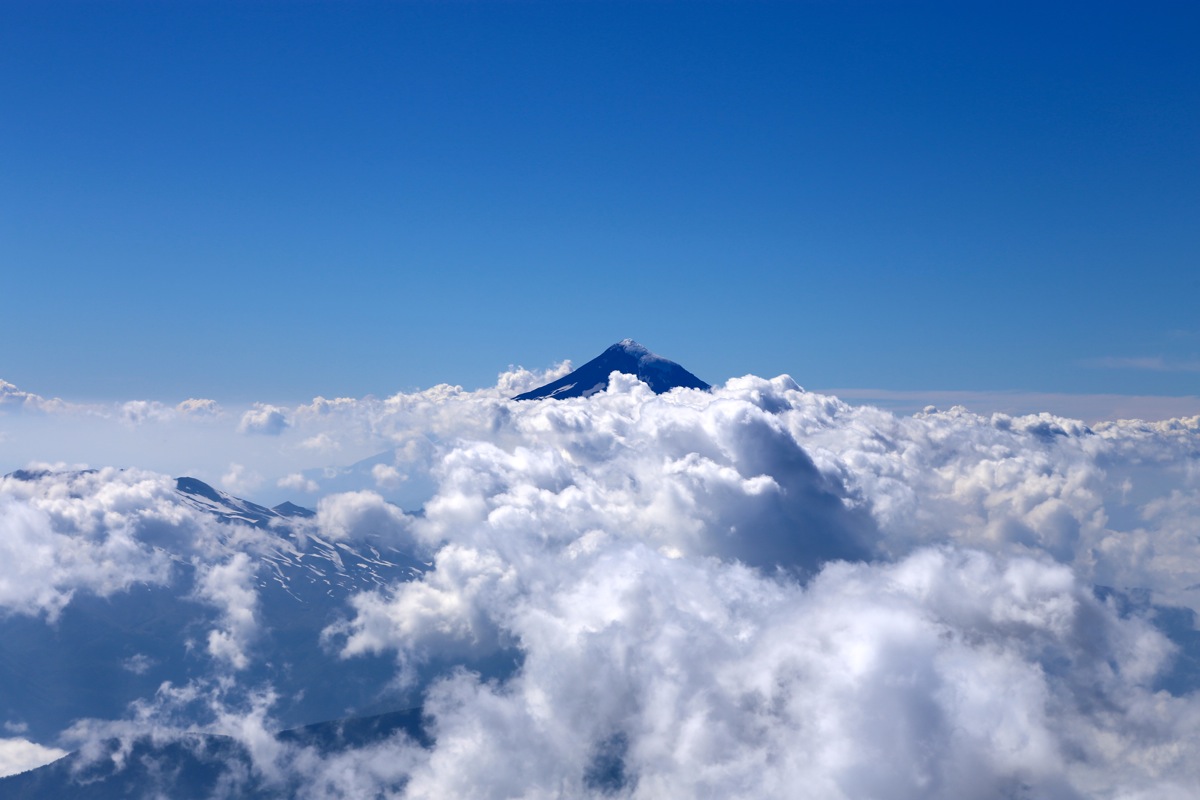
Since clouds covered the land, the views and impressions
were different. The feeling of being quite high up is perhaps stronger when you look
down on a complete blanket of clouds, while the sun and blue sky is all around and above you.
We stayed at the summit until 1100,
then started our descent. As it looked, we were the first
party to reach the summit today.
A very large number of guided parties could be seen
below. We estimated that at least 200 people would climb this peak today.
Our descent was quite easy, we basically walked directly downslope avoiding all the
teams that were slowly moving uphill.
We were back by the Conaf tent in one hour, a 15 minute break
while putting away the crampons and preparing for warmer conditions.
Next, we continued along the trail
going down the moraine to the parking.
This last part of the descent took 25 minutes.
We organized our gear in the car and decided to drive back to the town
of Villarrica for lunch.
Subsequently, we continued to the small town of Panguipulli in order to attempt
the volcan El Mocho the next morning.