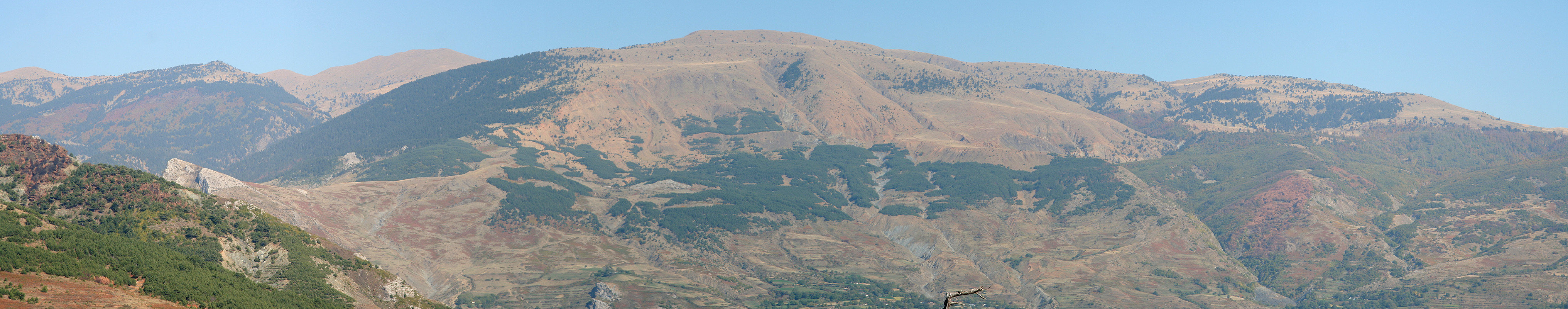
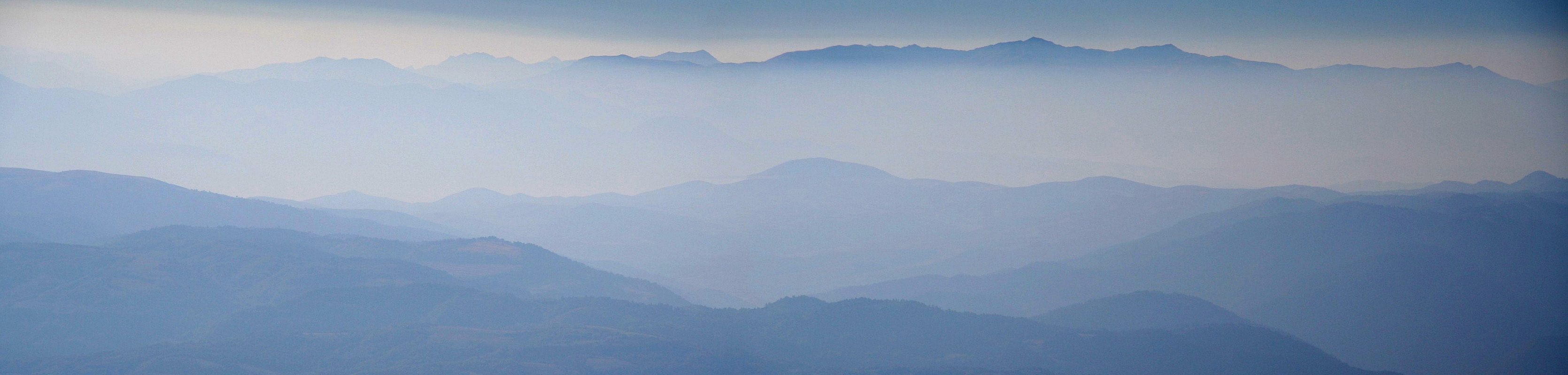
Valamara
- Valamara
- 2373 m.
- Primary factor: 1526 m.
- Location: Central Albania
- Location: North 40:47:646, East 020:27.911 (GPS at the summit)
- Difficulty: YDS class 1.
- Climbed October 4. 2007
Valamara
|
|
How to get there:
From Tirana, the capital of Albania, go southeast to Elbasan, this is about 40 kilometer.
In Elbasan, locate the road that heads south to the village Gramsh, this is about 42 kilometer.
Drive through Gramsh, locate a pink mosque with a minaret tower on your left hand side. Measure from
here.
The following description giving both kilometer and approximate driving
times should be helpful when navigating to the trailhead.
| Km | Time | Action | |
| 0.0 | 0:00 | Pink mosque and minaret in the village Gramsh. | |
| 2.6 | 0:07 | Go left. | |
| 5.4 | 0:11 | Paved road ends (2007). | |
| 14.2 | 0:28 | Keep right (bridge). | |
| 16.7 | 0:32 | Go left. | |
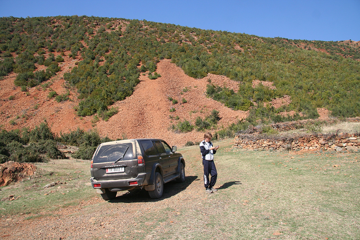
| 23.3 | 0:50 | Go straight. The small road (4WD) that goes right connects with location N40:46:325, E020:18.679, 562 m, on the main road. | |
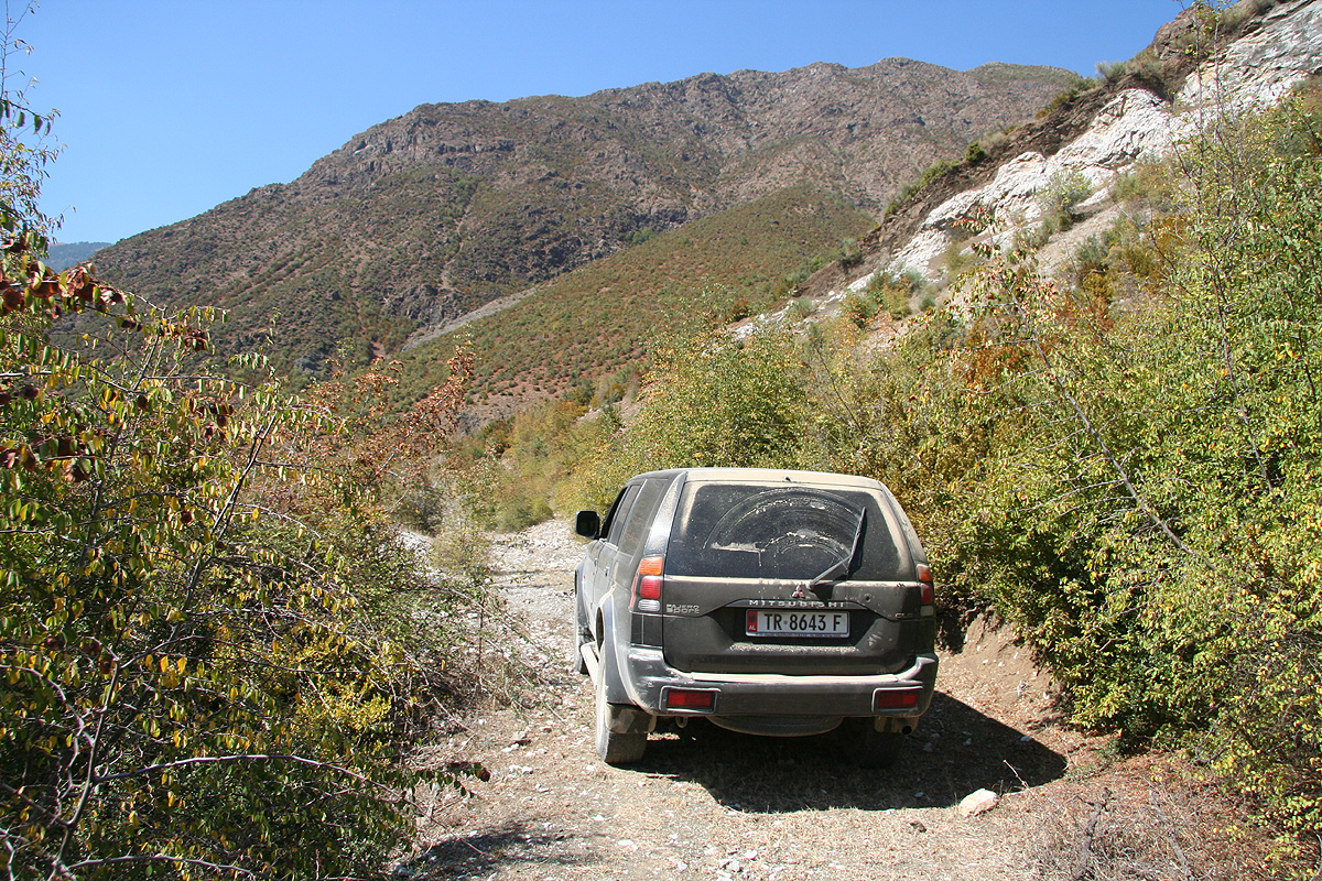
| 31.8 | 1:10 | Go left, the road will become a 4WD. | |
| 37.1 | 1:42 | Keep right on a distinct hilltop. | |
| 39.0 | 1:54 | Turn left around a building, road narrows. | |
| 39.6 | 2:00 | Park in front of lodge. This is the trailhead, your location is: N40:47:612, E020:24.897, 1367 m. | |
Route description:
From the hotel, follow the good trail that heads in the valley along the left side
of the river.
There are at least two locations where one
can enjoy cold water that come out from the slope above.
Pay attention when the trail crosses the first creek that comes down from
your left side. Take a look in the direction of this creek and verify that this is indeed
the first valley coming down on your left side. Cross this creek and follow the trail as it
climbs more steeply on the hillside ahead. Eventually, this trail emerges in a small, but distinct
valley that continues ahead. The trail now cuts back and up on your left, as soon as you reach about
1900 meter (in the small valley), you may head straight up to your left and you will intersect
the trail partway up the slope. This trail climbs and gains the much more gentle grass slope that
sweeps down from the summit ridge. From here, head directly for the summit, the terrain is
very easy.
For completeness, we provide GPS coordinates and approximate hiking times for
the route we followed in the table below:
| GPS coordinates and elevation | Time | Location | |
| N40:47:636, E020:24.894, 1362 m. | 0:00 | The trailhead, Hotel Grabova. | |
| N40:47:349, E020:26.926, 1901 m. | 0:50 | Small valley, turn left here. | |
| N40:47:541, E020:27.836, 2367 m. | 1:30 | Summit ridge (beginning). | |
| N40:47:646, E020:27.911, 2373 m. | 1:35 | Summit (opposite end of ridge). | |
Comments/Trip Report
October 3. Travel day.
What a day this has been. First, we saved about 5-6 hours of driving by
getting south via Macedonia. This cost us Euro 52, 50 to Macedonia (essentially
to pay for liability insurance), then 2 to Albania in order to re-enter the
country. Quite a bit of procedure, two sets of border controls when leaving and
two sets when we re-entered. Many new stamps in our passports, while most of
the time was spent waiting for different officials to look at the car documents.
Despite this huge saving in distance, the road we drove was still about 200 kilometer
and required essentially a full day of driving.
The road in Macedonia was fine and we quickly got south to the big lake Ohrid.
We continued through Pogradec and located the small village of Maliq. From here, our
map indicated a "yellow road" connecting to Gramsh, our access road should fork from this road.
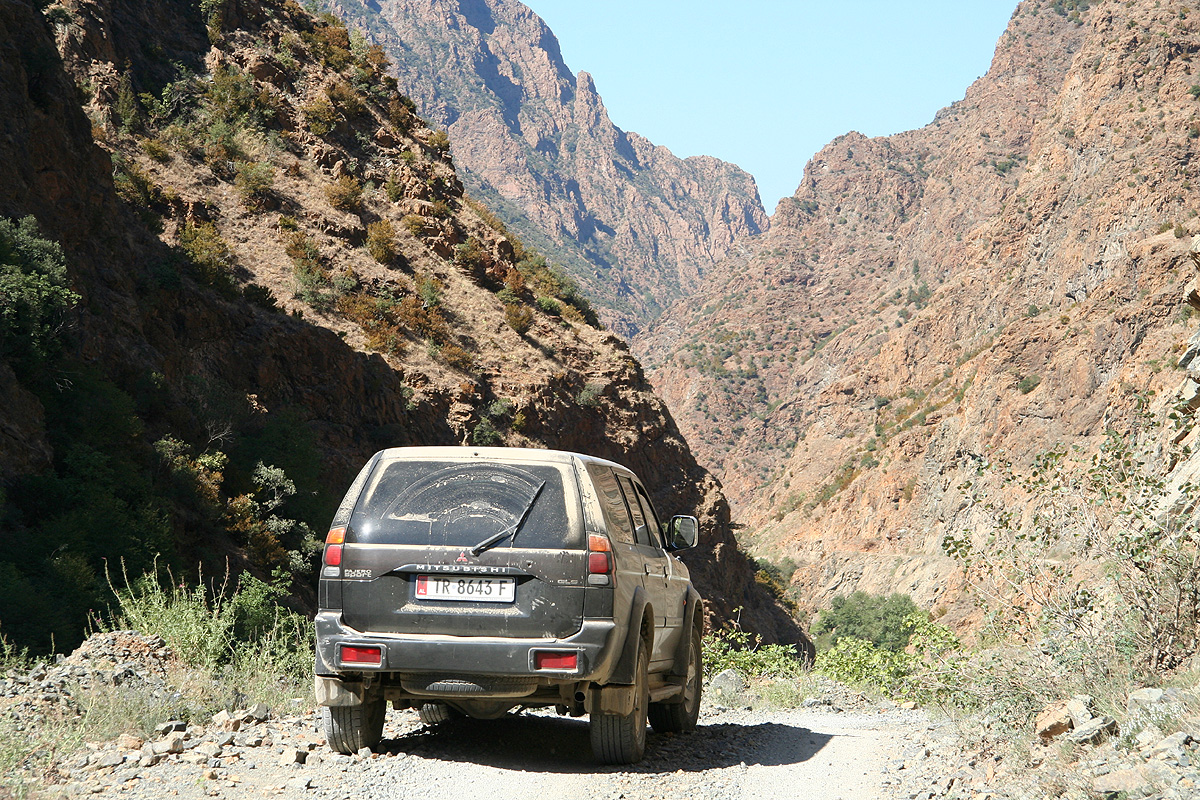
The road and the map were in total disagreement. Very soon, the
road became dirt, then very rough. It took us
into a deep and steep canyon, at
times very spectacular. A narrow, winding road glued to vertical rock faces, dirt,
no guarding between you and the river deep, deep down in the gorge. In the first
village where the map indicated a side road, there was none. The local people,
first confirming that we were indeed in the right village, had little idea about
how to find our destination. Partly, they disagreed sharply on where one
should go in order to find the village we were looking for. Discouraging.
We continued towards Bulcar and asked two locals there. This time, we got a somewhat
more optimistic reply, they not only indicated that they knew about this place,
they also indicated that we should make a right turn a little bit further
down the road.
Encouraged by this, we continued driving while looking carefully for any
possible side road. We spotted a very weak "trace" of a road, decided that it
could not possibly be right and continued driving. We found no more right turns despite
looking for another 5 kilometer. Eventually, we decided to turn back and try the
only "desperate" possibility that we had seen.
This turn-off was located
at coordinates N40:46:325, E020:18.679, elevation 562 meter along the
primary road.
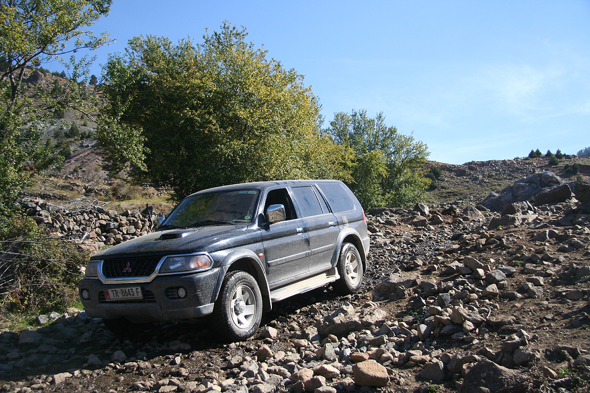
It was pretty rough, we needed to shift
into low. As we crawled up, the "road' stayed about the same, we climbed and turned.
The driving was possible, but tricky. We came up to a farm where the road made a hairpin
turn right, then continued into the hills.
A few more "rock-steps", but just the right
size, then a very sharp curve around a corner followed by the biggest surprise of the
day - a cross road. This road was obviously of better quality, but where the h... did it
come from? We decided not to worry about such questions, turned right and shifted back
up into more normal driving. Life got a lot easier
as we drove on and eventually arrived
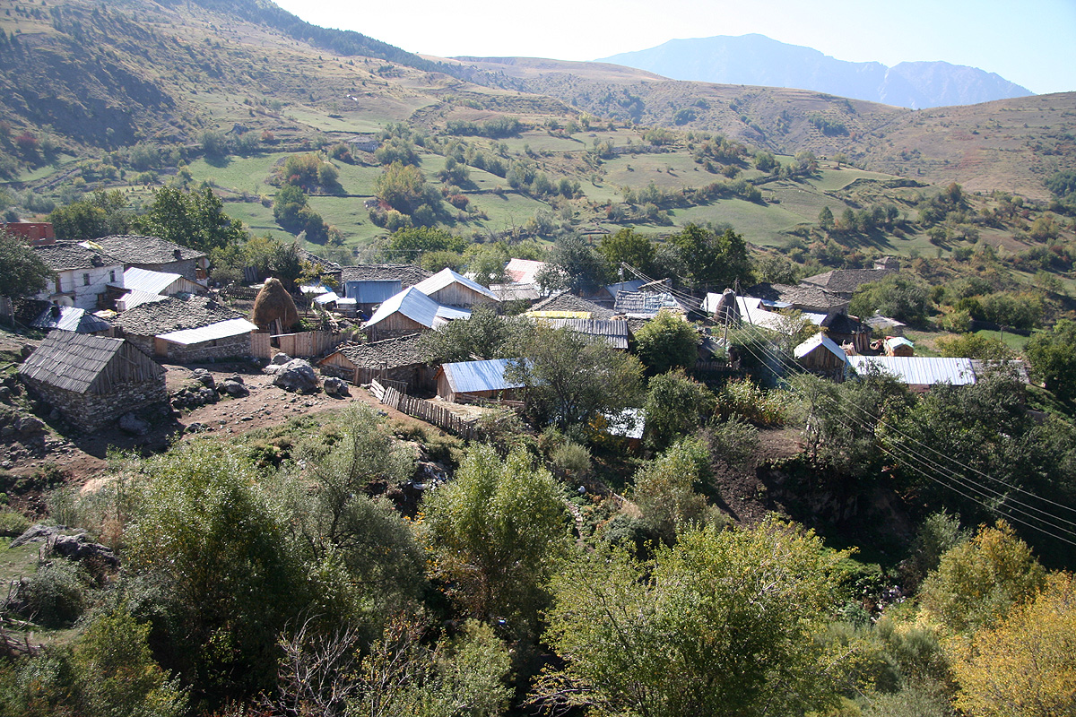
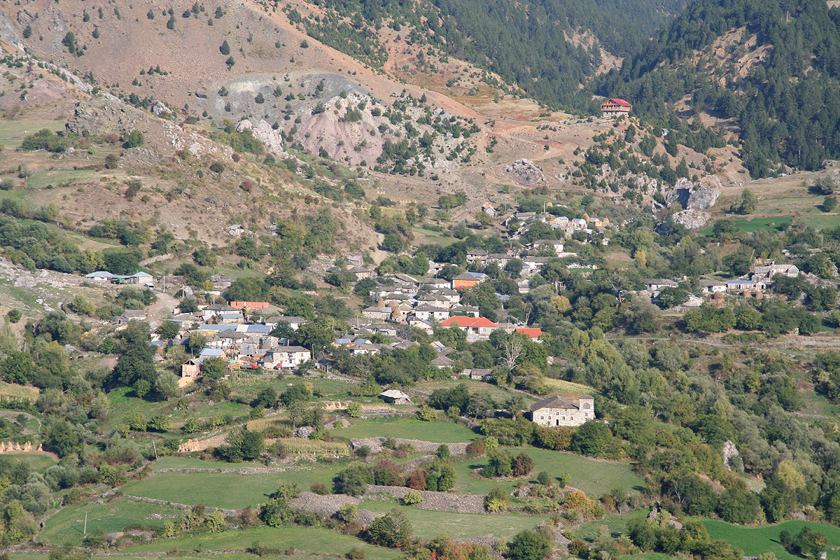
at a village that had to be the one we were looking for.
We asked about a suitable starting point for Valamera and
was told that we should drive to the village of Grabova.
This village was not on our map,
but it was pretty clear which side road to take.
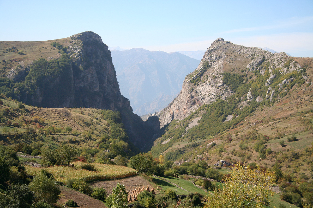
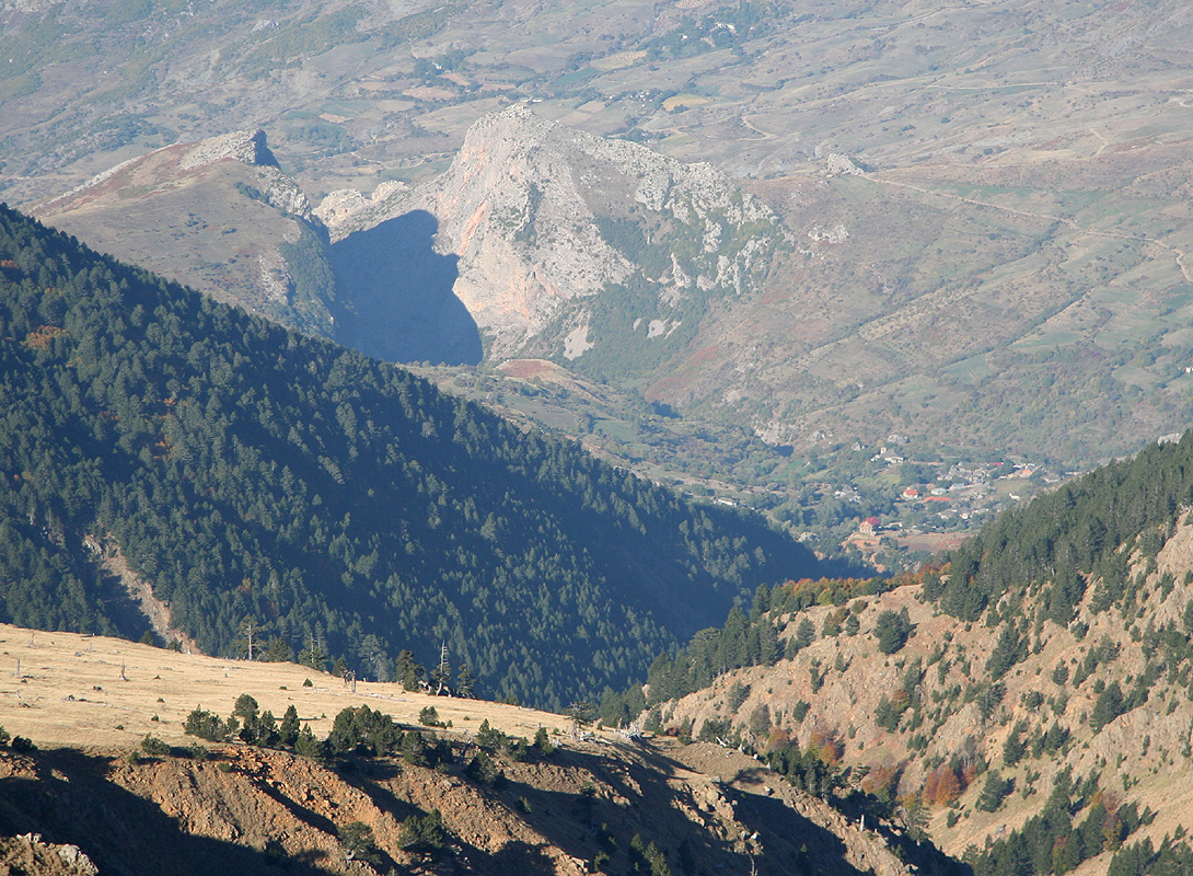
We were facinated by a deep cut straight
through the mountain above us, it seemed that Grabova
was located on the other side of this mountain. We had driven by a left forking road that most
likely would get us there.
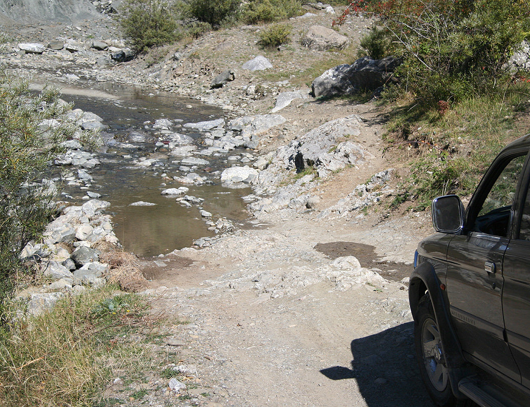
This road quickly got worse as it climbed the hillside. We needed to go back into low, this was
not even a road for Mercedes. With care, we slowly advanced uphill, then across and took a right
fork at a hilltop that overlooked what had to be Grabova. The next section involved a river that
the road not only crossed, but actually
followed a short stretch. Finally, we arrived in
Grabova. We stopped and looked around, found some people and tried to explain that we were
looking for a suitable place to stay until tomorrow (our own tent if needed) and possibly some
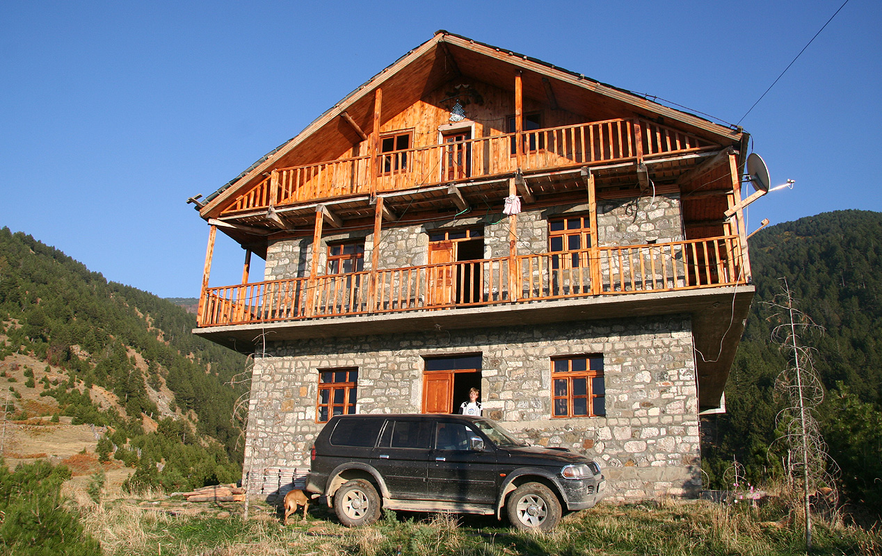
food. Nobody spoke English, but pretty soon somebody pointed to a pretty fancy looking house
overlooking the small village. The
word "hotel" was unmistakeable, but still unbelievable.
A hotel here up in the roadless small village of Grabova? Yes, indeed the local told us to
drive up to the "Grabova Hotel", WOW! A hotel here absolutely "road-less" and extremely hidden away.
The last section of our access was steep and rocky, but not terrible, I got the Pajero all the
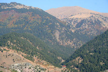
way up to the doorstep of the building. The building was locked and I told Pål Jørgen
that if necessary we would just camp here. Very nice views, the Valamara peak up the valley and
the very interesting rock portal further
down. We took a piece of bread each and sat down on a big rock.
I said that half the village below had clearly seen us arriving, if somebody in the village had
any responsibility for this hotel, then they would surely show up. Exactly as predicted, within 10
minutes a young woman and a somewhat older man came walking up the hill. Sure enough, here they
opened the hotel for us.
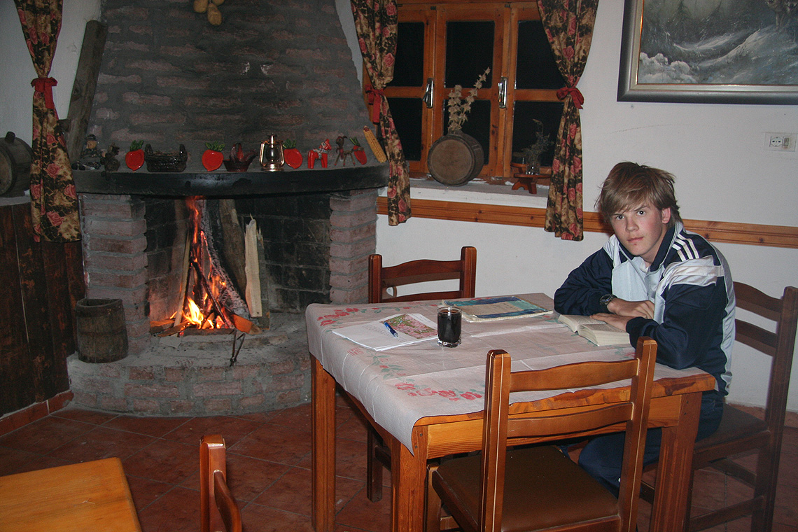
A large downstairs room with tables,
a big fireplace and a bar. Several bedrooms
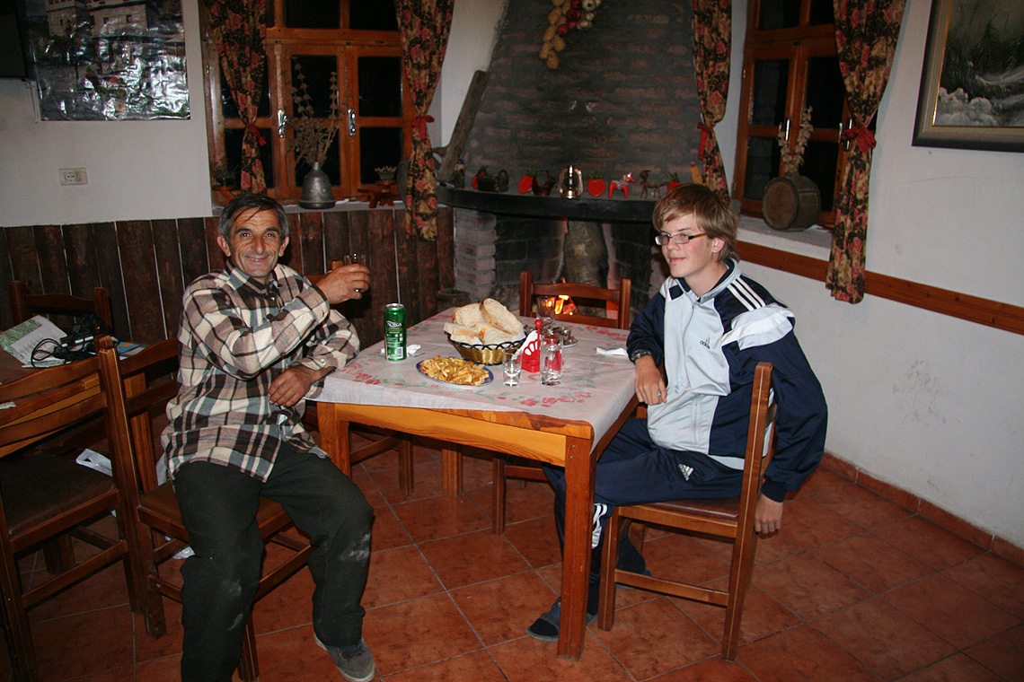
were located upstairs. The girl immediately started to ready a corner room upstairs for us. The man
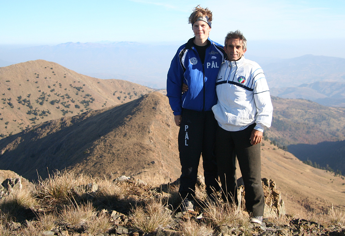
took a beer with me and we sort of communicated. We will stay here til tomorrow, then climb Valamara.
A perfect trailhead, sort of a miracle place. I would say that chances of finding something like
this after such a long and complex 4WD access is essentially zero. If I understand our kind host
correctly, there are two trails from here to Valamara. One starts out along the river here, it should be a 2
hour quick walk. The other climbs slightly further left in the nearby hill. The man indicated that
this alternative should take about 2.5 hours. My GPS says that we are 4.25 kilometer from the summit
and 1010 meter below it.
Later in the evening, we were served delicious meat of (local) lamb, then had another beer while
sitting next to the huge fireplace.
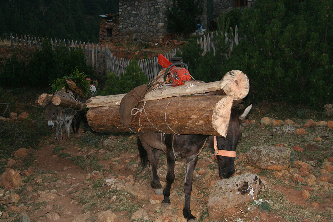
Outside, the people from the village that had been working in the forest
returned with new building material.
The sun set behind a nearby mountain and left the
characteristic mountain cut behind.
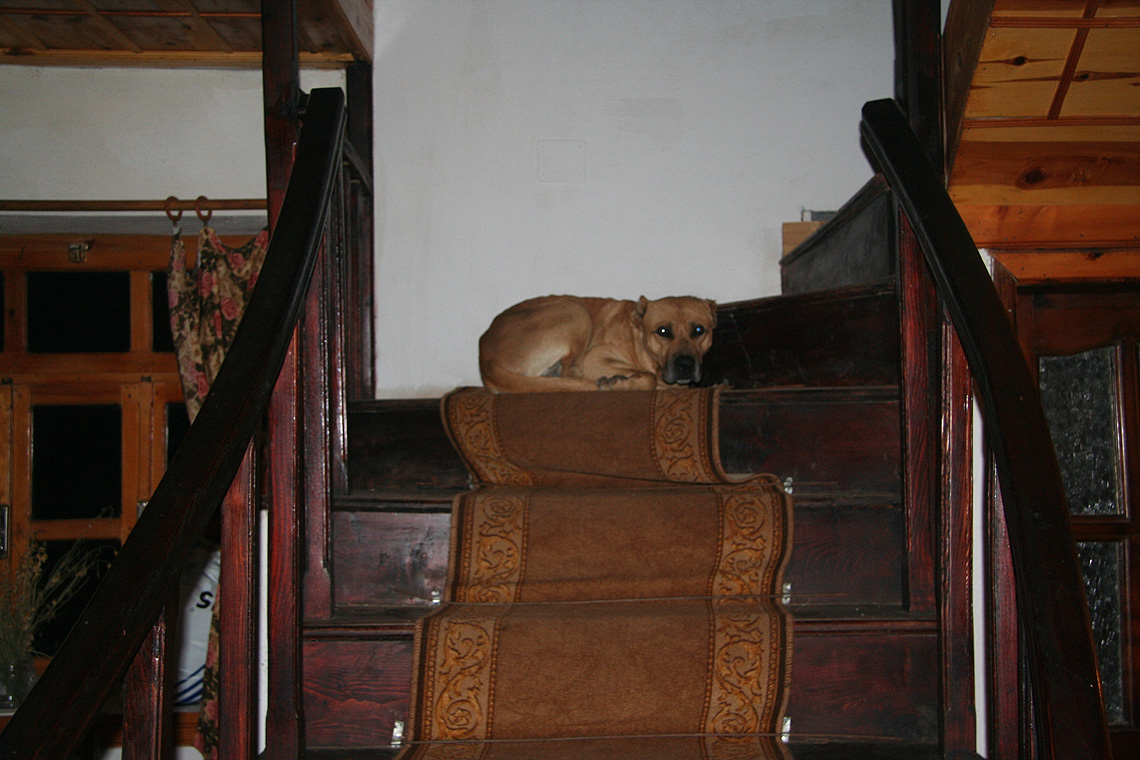
Inside, it was already warm and cozy, the house dog found
his favorite place halfway up the stairs.
I had a look in a guest book and noticed that on two consequtive
years there had been Swedish visitors, clearly some kind of organized tour. They had climbed Valamara, but
obviously, did not know they climbed an ultra prominent mountain. The guest book was first dated May 26. 2004,
so I assume that the lodge is only 3 years old.
Another appropriate quote (dated June 2005) from the guest book read: "I have
travelled in many parts of Albania, but never was it more difficult to reach a village than yesterday coming
to Grabova. But to find our wonderful Hotel Grabova at the end of the trip was more than worth the
difficulty of getting here." This guest book entry went on to say: "I am sure I will see Grabova with
a road someday, pipes for water and phone service." The only reference to a possible owner of this lodge
was a Mr. Todi and his (incredible) Toyota 4WD truck.
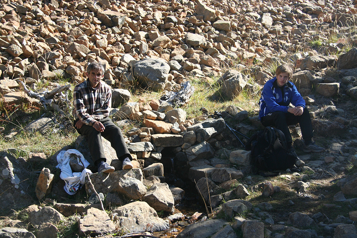
October 4. Summit day, then travel.
The next morning, we had breakfast and tried to indicate (in a polite way) that our host
should not feel obliged to climb Valamara with us. However, it was quite obvious that he had
made up his mind and that our hiking party would be a team of three. We set out around 0700 and kept
a good pace along the trail. Higher up, we met the local people working in the forest. Our friend exchanged a few
words before we headed somewhat more steeply uphill. This trail soon emerged in a small, but distinct valley that
continued further uphill, but fairly gently so. Our local "guide" indicated that leaving the trail and heading
straight uphill to our left would be the right thing to do. Soon, we hit a clear trail that ascended from the
valley as it traversed more left. Following this, we came up onto open grass land that sloped upwards towards
the peak, it all looked and indeed turned out to be very easy.
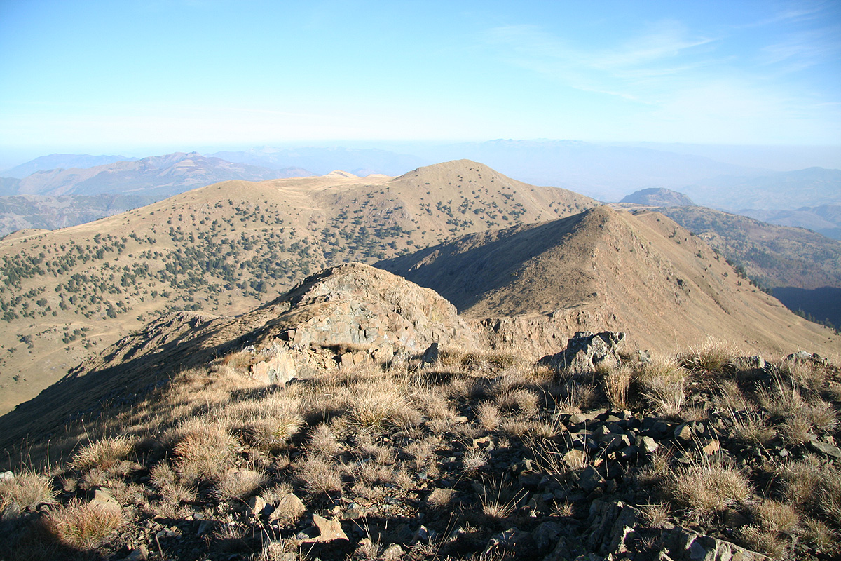
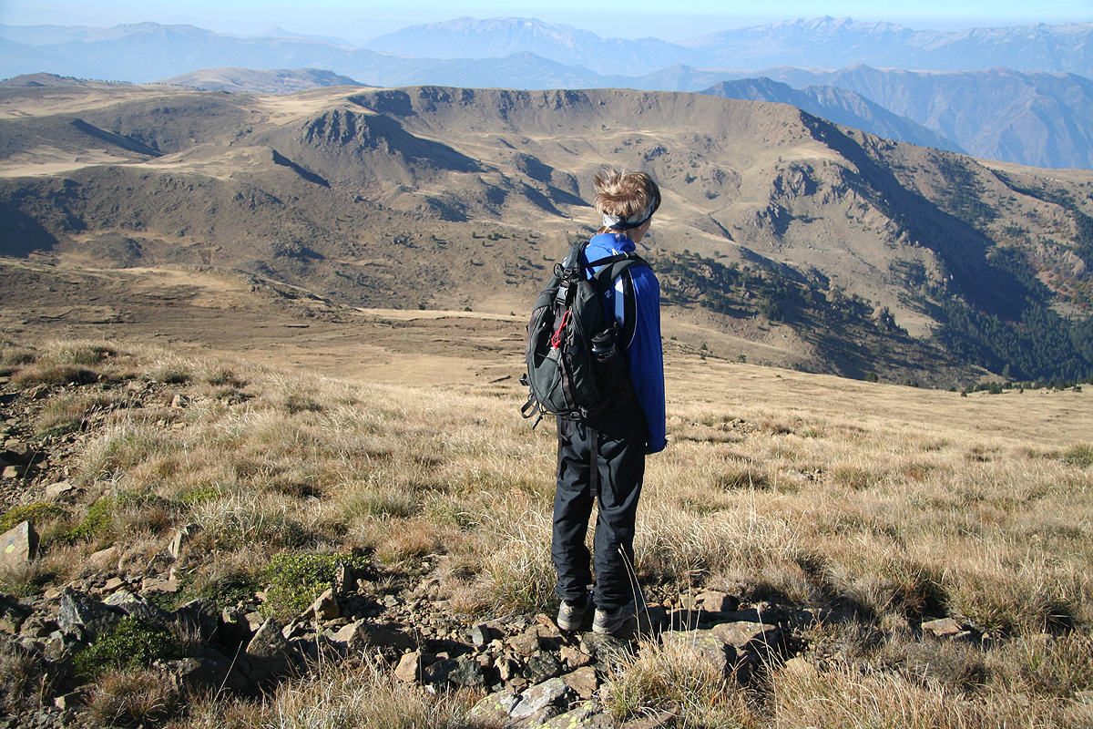
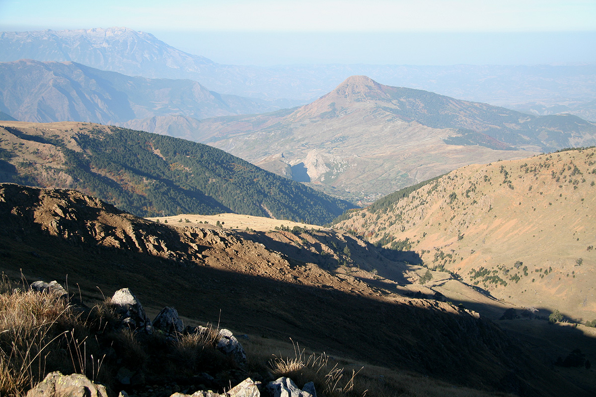
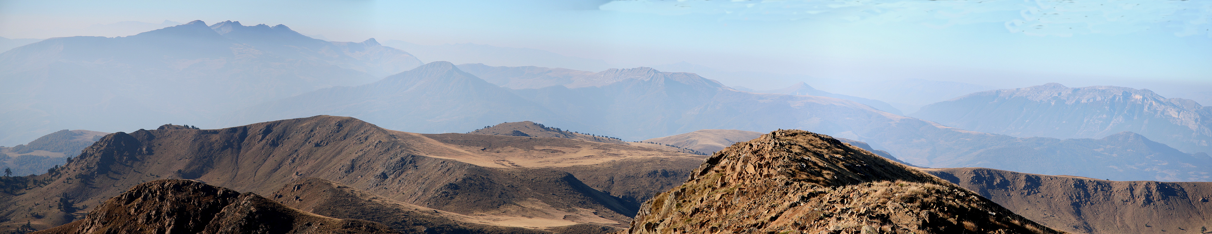
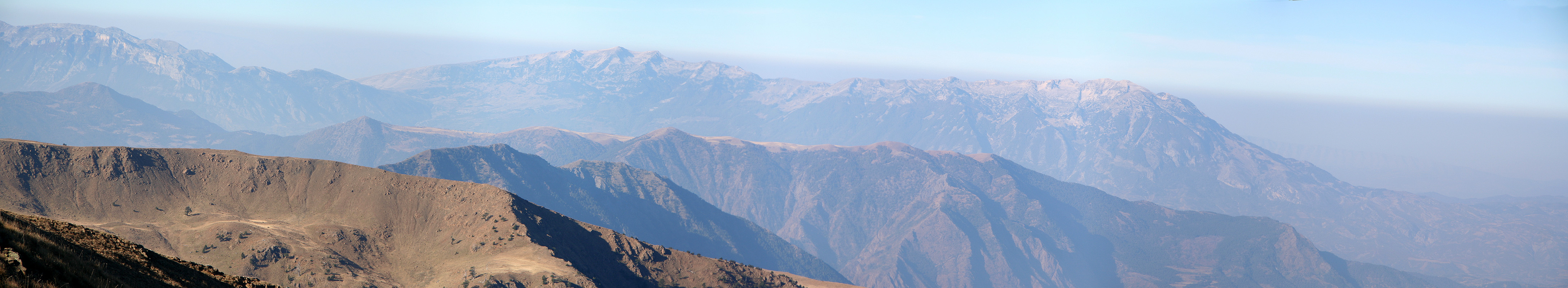
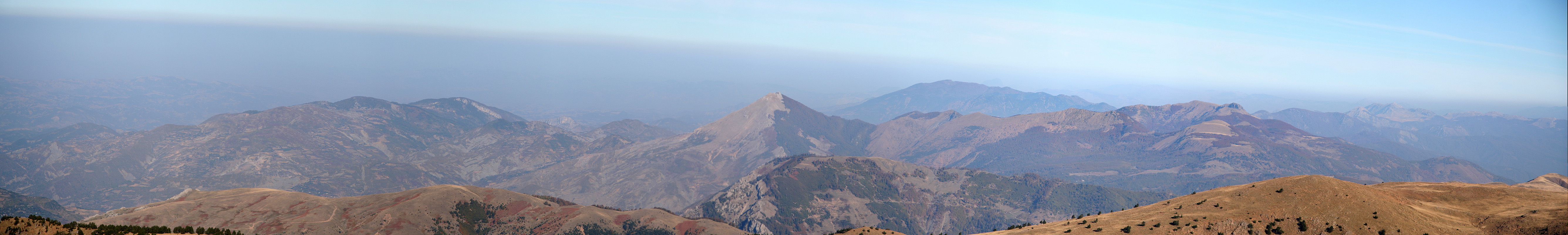
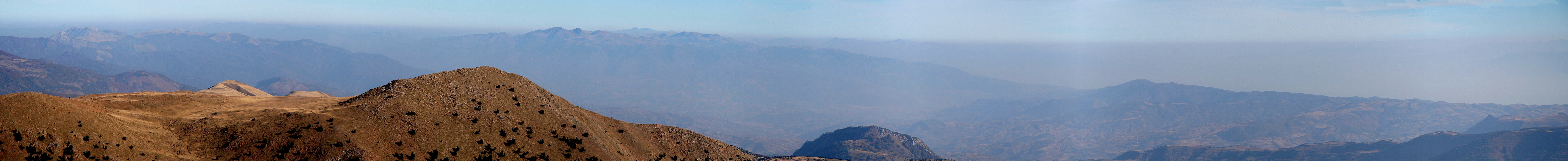
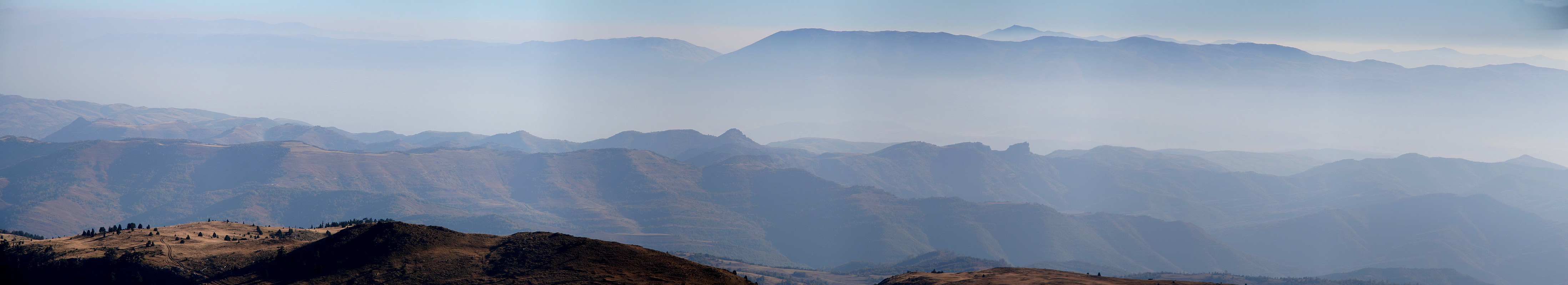
We arrived at the top ridge already 0835, just
slightly more than 1.5 hours. The view was quite good and our local friend
pointed to other peaks in
all directions, giving their names and other characteristics, unfortunately, all this in Albanian.
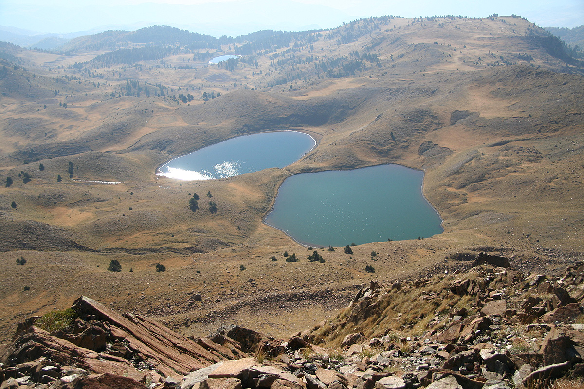
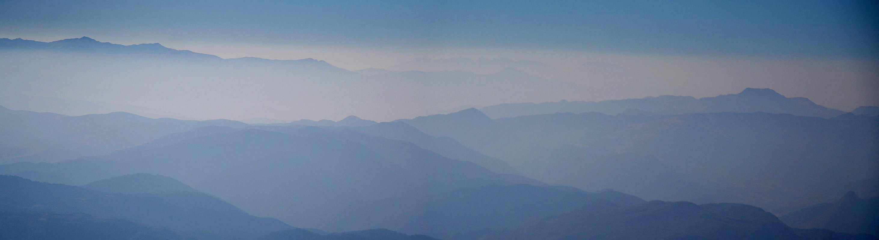
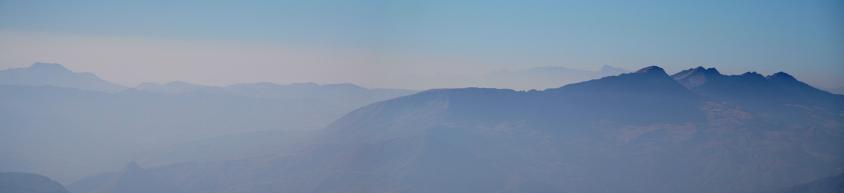
Just below the peak, there were several small lakes in the otherwise quite dry landscape.
The characteristic "cut mountain" and the village of Grabova could be seen below us.
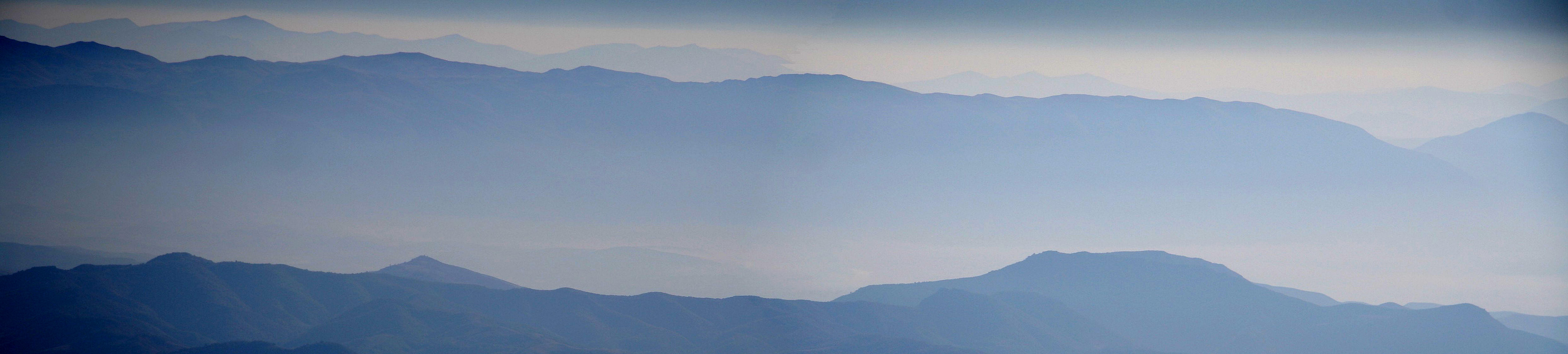
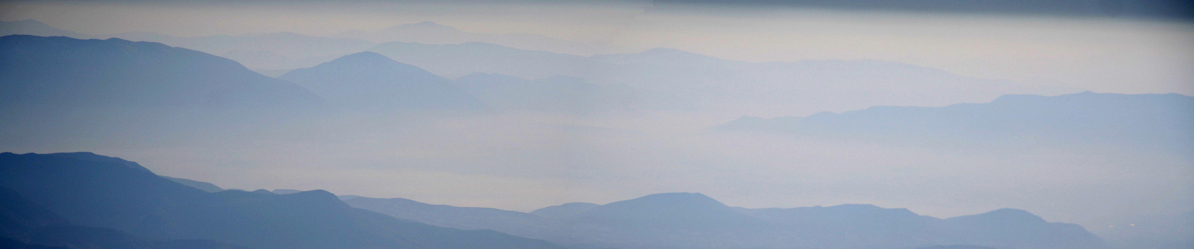
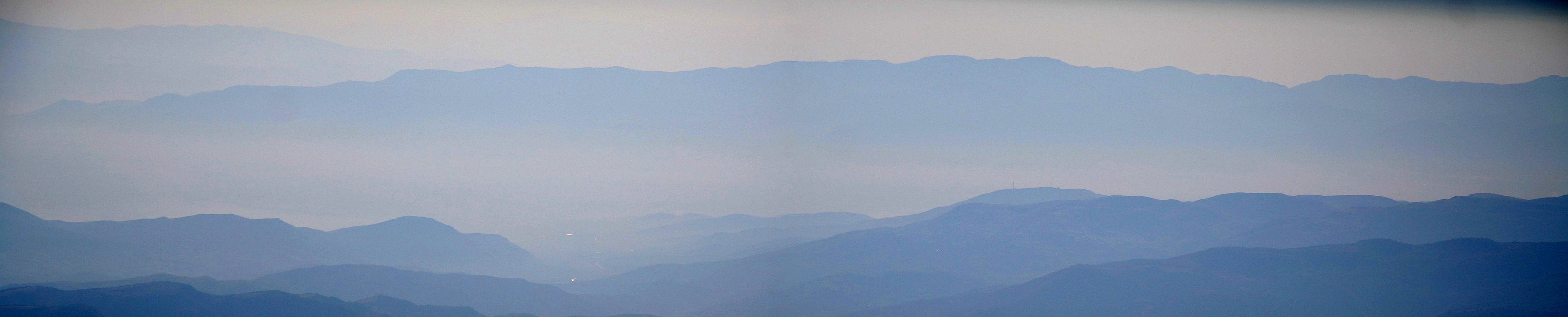
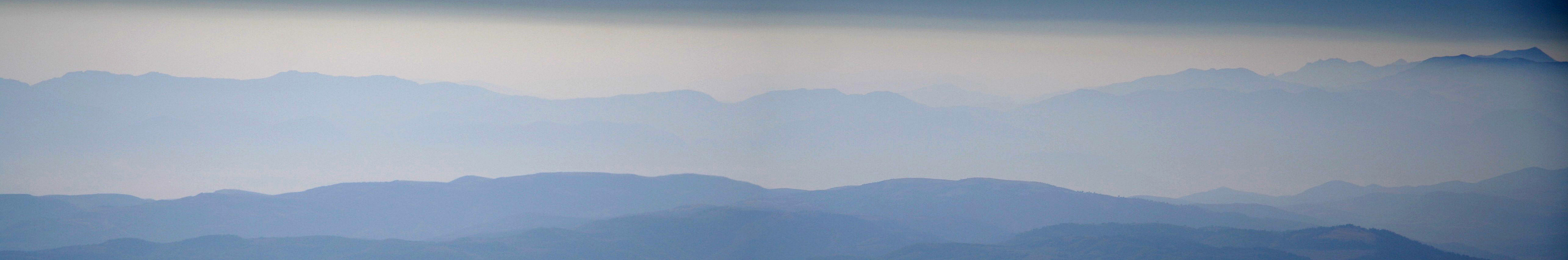
We generally had a very good time on this summit, however, the horizon was still not crisp clear, limiting
long distance views. We eventually descended, while
I showed our local friend the secrets of a GPS unit. It seemed
like he had never seen such a device before. Still, he realized that it could take him exactly back to the
point where we had left the trail when ascending.
We came back down in exactly
the same time as our ascent, packed up the gear, paid for our excellent stay, including
a generous tip, then waved goodbye and started the rather bumpy drive
down the rough path that some call a road
connecting the village of Grabova to the rest of Albania.
Our next goal was to get to the base of Kendervices, if at all possible also learn how to find a suitable trailhead.
We drove north to Gramsh, then west to the main north-south highway in Albania. For the first time on this trip
we even had a short stretch of road where one could (safely) drive at 90 kilometer per hour. The village that
looked best as a base for Kendervices was Tepelene. One could drive to the town of Fier, then directly to
Tepelene, or one could continue to the town of Vlorë, then take a yellow road closer to the mountain down to
Tepelene. This last option seemed most attractive, as it might give us more insights into promising trailheads
already today. Thus, we drove to Vlorë, then tried to locate the road across to Tepelene. This was easier said than
done, we quickly got slightly lost on terrible dirt roads and wasted considerable time.
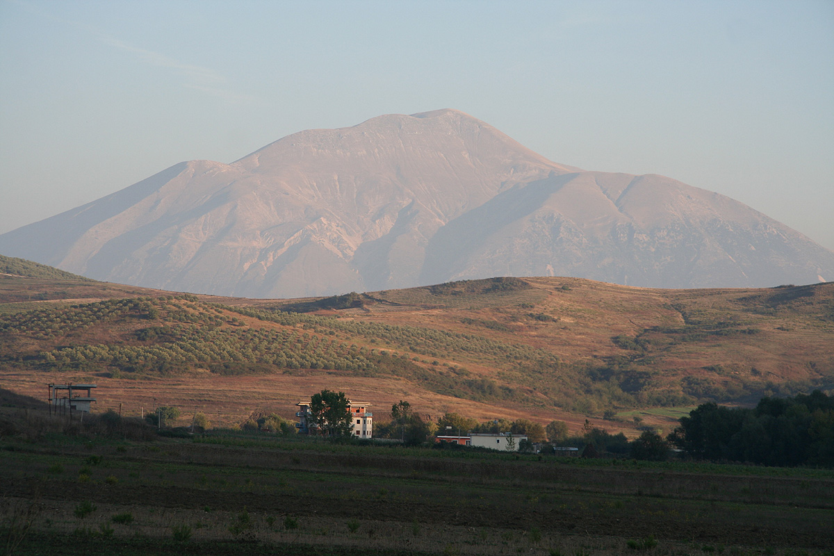
We saw the north side of the general mountain
area, the peak glowing nicely in the evening sun.
Finally, as it got dark, we believed
we were on the right track and planned on reaching Tepelene before it got very late. However, this was not to be,
the road quickly degraded from paved to dirt to 4WD. Our progress slowed as we crawled along the base of the mountain
on its north side. Our GPS indicated that we were about 12-14 kilometer from the summit, measured as the crow flies.
After considerable time, our road finally descended into an area with a few houses. Good news, hopefully we would soon
arrive in Tepelene. At this point we came up to a T-shaped road intersection, again without a single sign indicating
directions. Again, no such intersection could be seen on our roadmap. We discussed which way to go and came up
with the following plan. We would make a right turn. If this road led to Tepelene, we would find a hotel and resume
our hunt for a trailhead the next morning. If it should turn out that this road got us closer to the summit, then
we would just find a place to sleep (we still had our tent and sleeping bags), then hike the mountain early tomorrow before
a lunch in Tepelene. OK, we continued driving and after a while it looked like this choice would lead us to the mountain.
The distance (from our GPS) to the summit decreased nicely, 9-8-7-6 kilometer, while our elevation increased, 600-700-800
meter. Good news, even though it was completely dark, it seemed like we had discovered a road that would take us
within hiking distance of the mountain. However, what we could see of the terrain looked less promising. We arrived
at an area with some old tunnels, it seemed like this road might have been an old mining road. The mountain was too steep
to be hiked right where we were and the road ended here. I told Pål Jørgen that we should turn around
and at least drive partially back. After all, we now knew how close this road could take us. He agreed, but just as I had
turned the truck, an unexpected thing happened. Out of the dark came an army dressed person with a flashlight and
an army rifle. He did not look pleased. We talked briefly, of course nothing but Albanian on his side. I told him that
we had obviously taken the wrong way, and said politely goodbye, before taking the car down the road. He actually replied
with his own goodbye. However, more trouble ahead. The guy obviously had alerted more of the Albanian army lower down
the slope about this intruder, and they had called out a bigger force to stop us. I tried to explain again that we were
on our way to Tepelene, that we were tourists from Norway and that we were sorry if we had disturbed them. Not much
sympathy. One of the guys was clearly in command and he made several calls reporting this incident. We showed them our
passports as well as the vehicle papers, proving that we legally rented this truck from Tirana. No avail, this was
most likely the most exciting event that had happened to the Albanian army in this desolate mountain slope for ages.
A civilian appeared that spoke selective English, he clearly only wanted to understand what he decided. I pointed out that
they should at least have posted a sign if they did not want visits. It is normal practice at other military areas to
post signs or even have a gate to keep people out. No, this civilian wanted a free ride to Tepelene in return for
helping out. The military seemed reluctant to let us proceed. General harassment, seemed to be their main agenda.
I suggested that they call the local police, but they did not want police interference. I then made a call on my cell phone
to the guy in charge of the rental car back in Tirana, explained the trouble and asked that he talk to the
officer in command. They talked for a while, but obviously, they were still not happy. I told the English speaking
civilian, that he should explain that this behavior would be bad for Albania trying to attract tourism. The military
should really not harass peaceful tourists. That we should conduct espionage seemed unlikely, driving up this road
with high beam lights and a quite noisy truck. To explain that we really were looking for a trailhead to climb
this mountain seemed far too complex, so we stayed with our explanation that we had turned right down at the T-intersection,
while we obviously should have gone left in order to find Tepelene. Just the idea of putting up some signs one way
or the other seemed like an incredibly good idea. An hour passed an we had little progress. Finally, we sort of agreed
to drive the commanding officer, another military and this stupid civilian three kilometer to achieve an objective that
we failed to understand. There, we met another uniformed guy and they all tried to explain the situation. He seemed
completely uninterested, but likely had some influence. We drove the two military back, then drove off to Tepelene
with the stupid civilian, he earned himself a very undeserved free ride to town. Heck, what a delay in the middle
of some dark and unknown mountain side.
We got rid of the civilian, booked us a hotel room, decided that the north side of this mountain was the wrong
place to find a trailhead and subsequently fell asleep.
This trip continued the next morning with Kendervices.