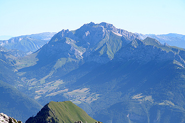
La Tournette
- La Tournette
- 2351 m.
- Primary factor 1514 m
- Location: North 45:49.627, East 006:17.166 (GPS on the summit)
- Location: Near Faverges / Lac Annecy
- Difficulty: YDS class 3 (easy)
- Climbed: July 14. 2007
La Tournette
|
|
How to get there:
This description starts at the main intersection in the middle of
the village Faverges. Drive north, in the direction of Annecy. After
2.2 km go straight in a traffic circle, from here on the road is called Hwy. N-508.
At kilometer 3.6, turn right onto Hwy. D-42 towards Vesonne. Continue straight
at km 4.0, then turn left in the middle of the small village Vesonne at km 4.3.
Follow Hwy. D-42 uphill passing through the village of
Montmin then continue until kilometer 10.9 in the small village of Le Villard, where
you leave Hwy. D-42 by forking right.
At kilometer 12.6 there is a parking area and the paved road ends. However, one may continue
on a somewhat rough road (OK for ordinary cars) until kilometer 14.7 where there is a large
parking area. Park here, this is the trailhead, location N45:49.921, E006:15.824, elevation
approximately 1430 meter.
Route description:
From the trailhead, head directly uphill on a good trail that zig-zags and
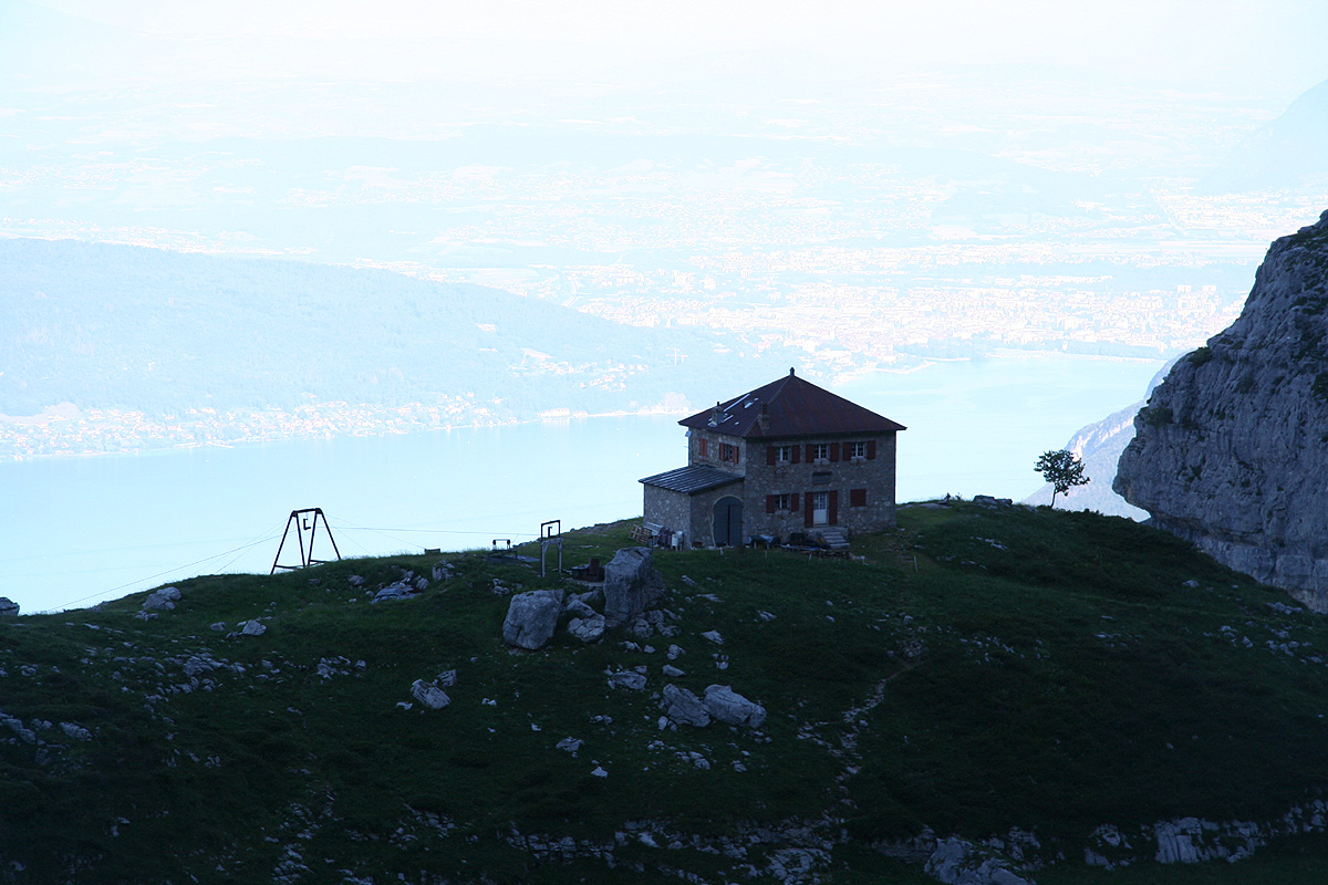
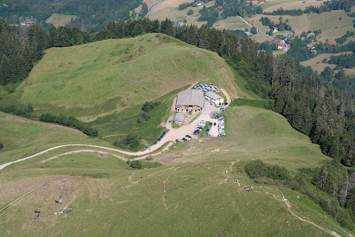
climbs to an area where a few rocks emerge from the grass. Here, the trail traverses right
and reaches the Refuge de la Tournette.
There is a bypass trail on the left. The trail continues
to climb and makes a big bend left (180 degrees), climbing more grassy hills, but now going north.
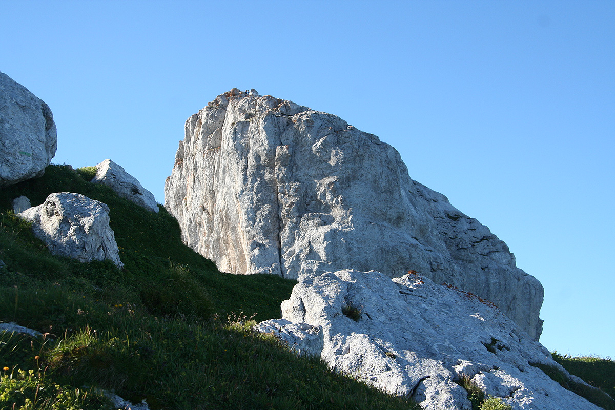
At elevation approximately 2151 meter, one gains the ridge and the trail turns more east. The objective
is now to gain the summit ridge. The trail winds its way and finds a nice path uphill. There are a few
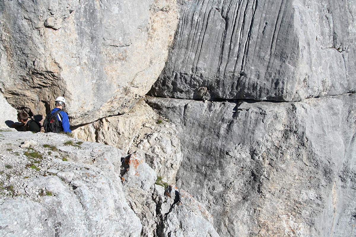
sections of easy (YDS) class 3 scrambling, all protected by chains. The limestone is polished and
somewhat slippery (worse when wet!), but the chains are really not needed under normal, dry
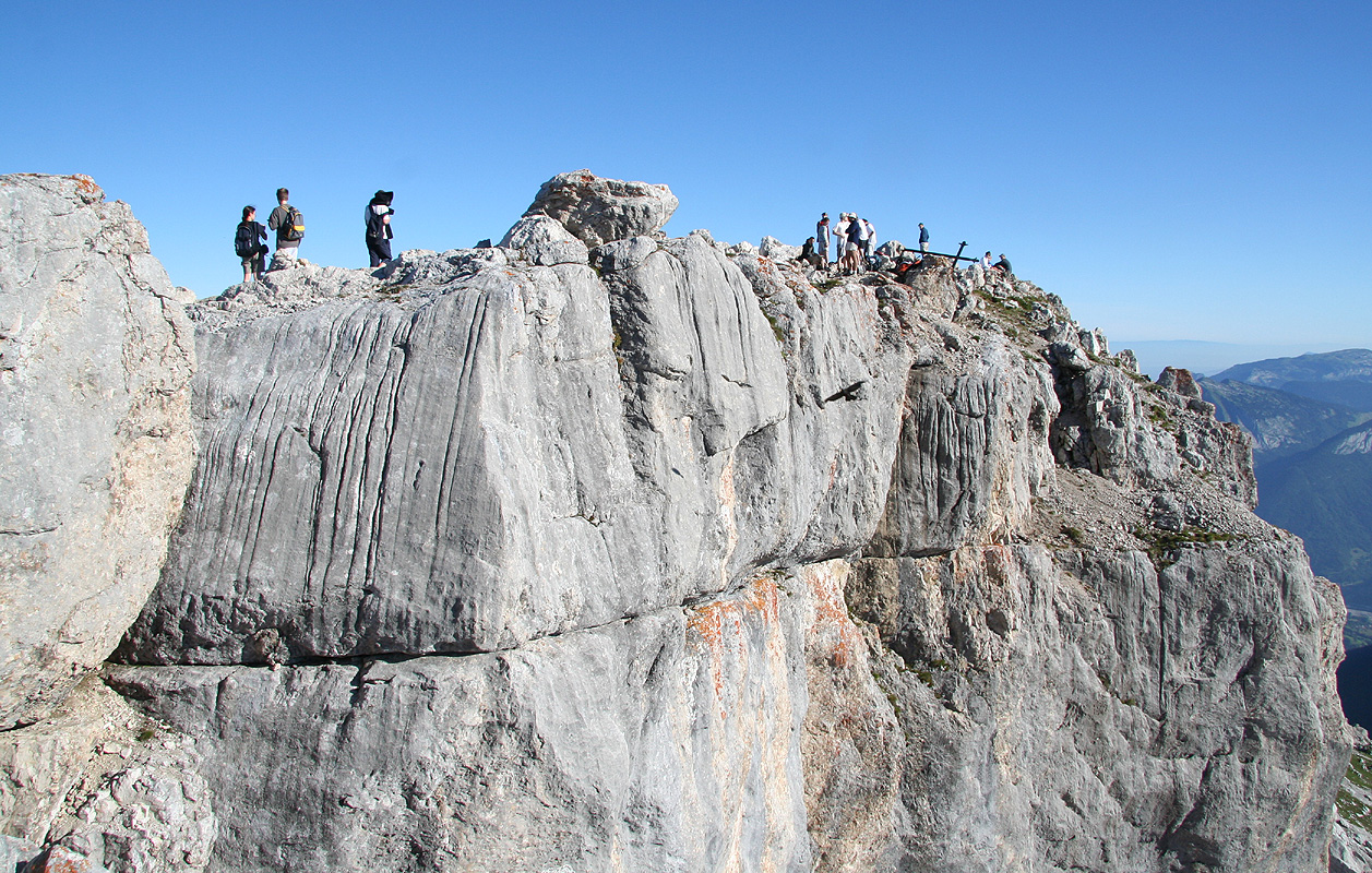
conditions. After gaining the summit ridge, one readily sees the pretty huge summit block straight ahead, south.
Follow the easy trail along its east side and arrive at the last scrambling section. A nice crack leads uphill
to a notch between the higher (north) summit block
and a slightly lower (south) summit block.
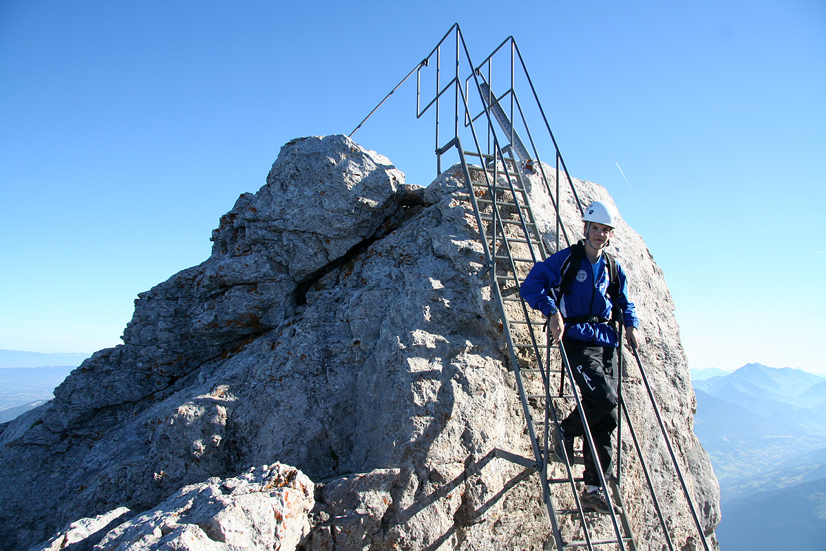
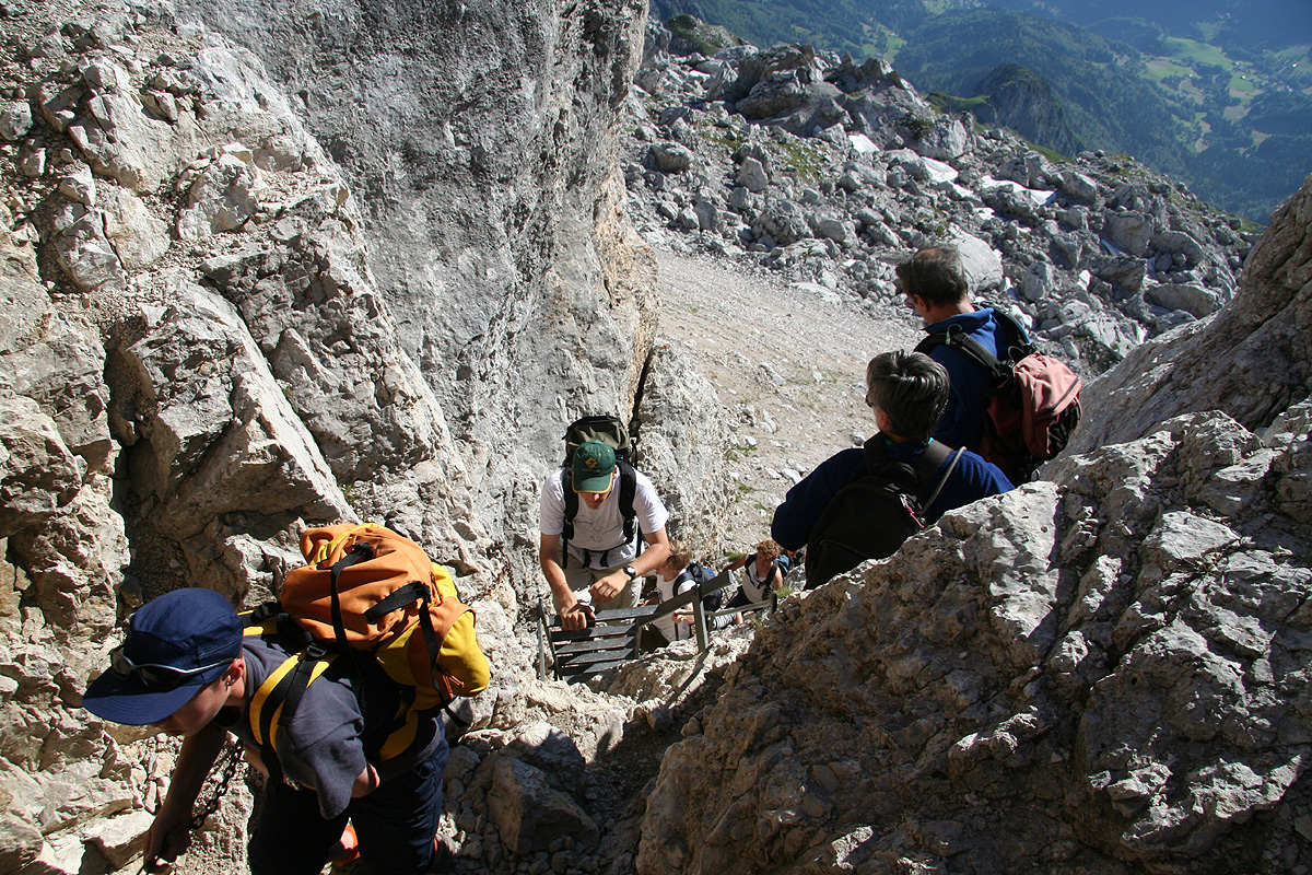
There are some man made steps in the rock to facilitate the climbing (again not really needed). The very
last section ascending the summit block, is equipped with a
solid steel stairway with handrails. Without it,
one would have to climb just left of this stairway, fairly straightforward, but with significant
exposure, this would have been a (YDS) class 4 move in order to gain the summit without permanent human made
structures.
Comments:
I did this climb with my son Pål Jørgen, age 18. We left the trailhead
at 0640, and arrived at the summit after 1:30, at 0810. The weather was just perfect and
we rested and had "early lunch" for about 30 minutes. Leaving
at 0840, we were back at
the car already at 0950.
This mountain is quite popular, we saw more than 100 hikers including
a full school-class this
morning. As a very popular climb, this route has been equipped with chains and steps in order to
make it easily accessible for anybody reasonably fit and with a normal tolerance for heights.
Our next goal before going to a conference in Zürich was
Pointe Percée. We had decided to
move a bit closer to its trailhead and Le Grand Bonard seemed like
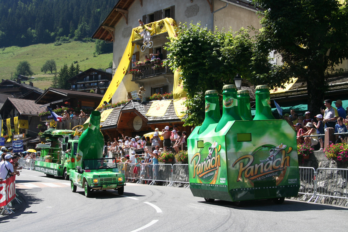
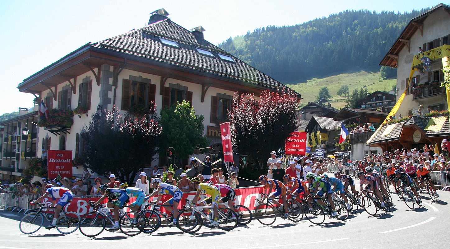
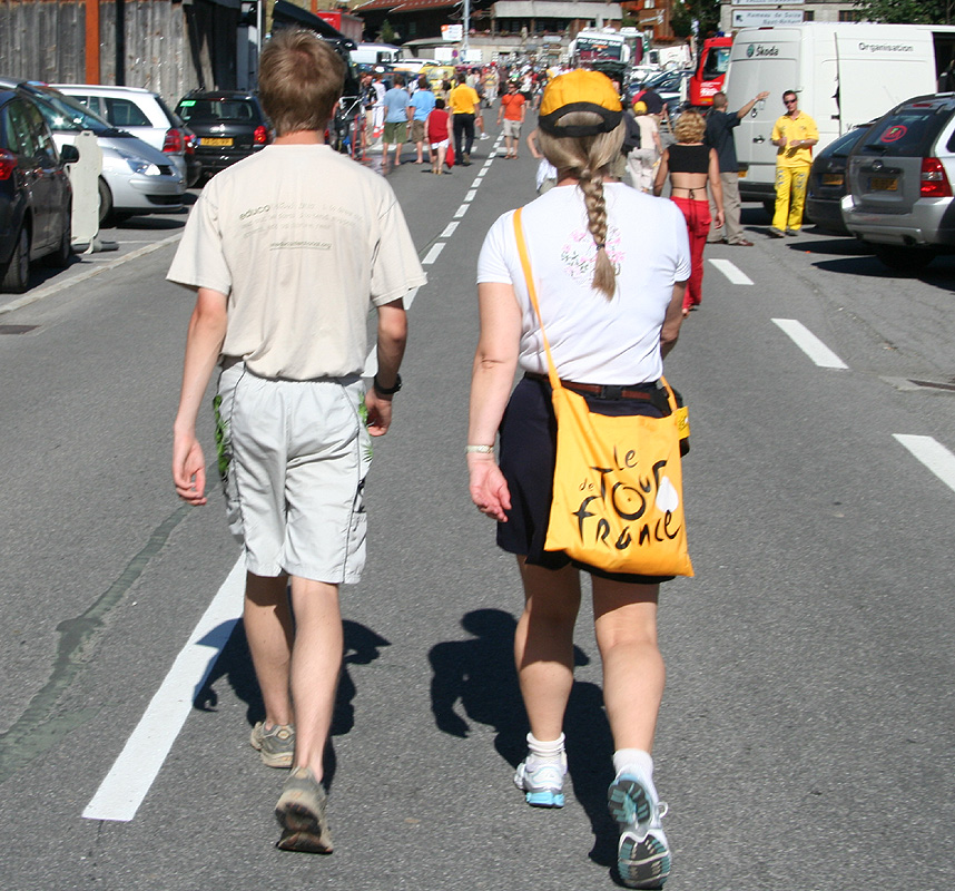
a good place. However, this turned out to be a mistake. Just as we
arrived in town, it became clear that Tour the France
also had the
same destination that afternoon. As they closed all roads in the area
we got stuck up on a dead end road behind town, actually the very road
to the trailhead. The bicyclists finally arrived
between 1700 and 1730, but
the resulting traffic jam afterwards was monumental. Not until around 2100
did we manage to get back through town and to the neighbor village of
La Clusaz where we had called and booked accommodation.
Very unplanned, but I guess fairly ok to have experienced
this circus live one time, in this
sense the afternoon and early evening was well spent.