Location: South 39.29610, East 174.06383 (GPS on the summit)
Difficulty: YDS class 2
Climbed December 29. 2014.
Information:
How to get there:
This mountain is located south of the city New Plymouth, west on the North island on New Zealand.
The access road is signed and runs south from Hwy. 3, just west of the town Inglewood.
Drive this road to find good parking at the North Egmont visitor center.
This location is S39.27065, E174.09506, with an elevation near 960 meter.
This is a quick summary and reference to climbs made on this trip.
Route description:
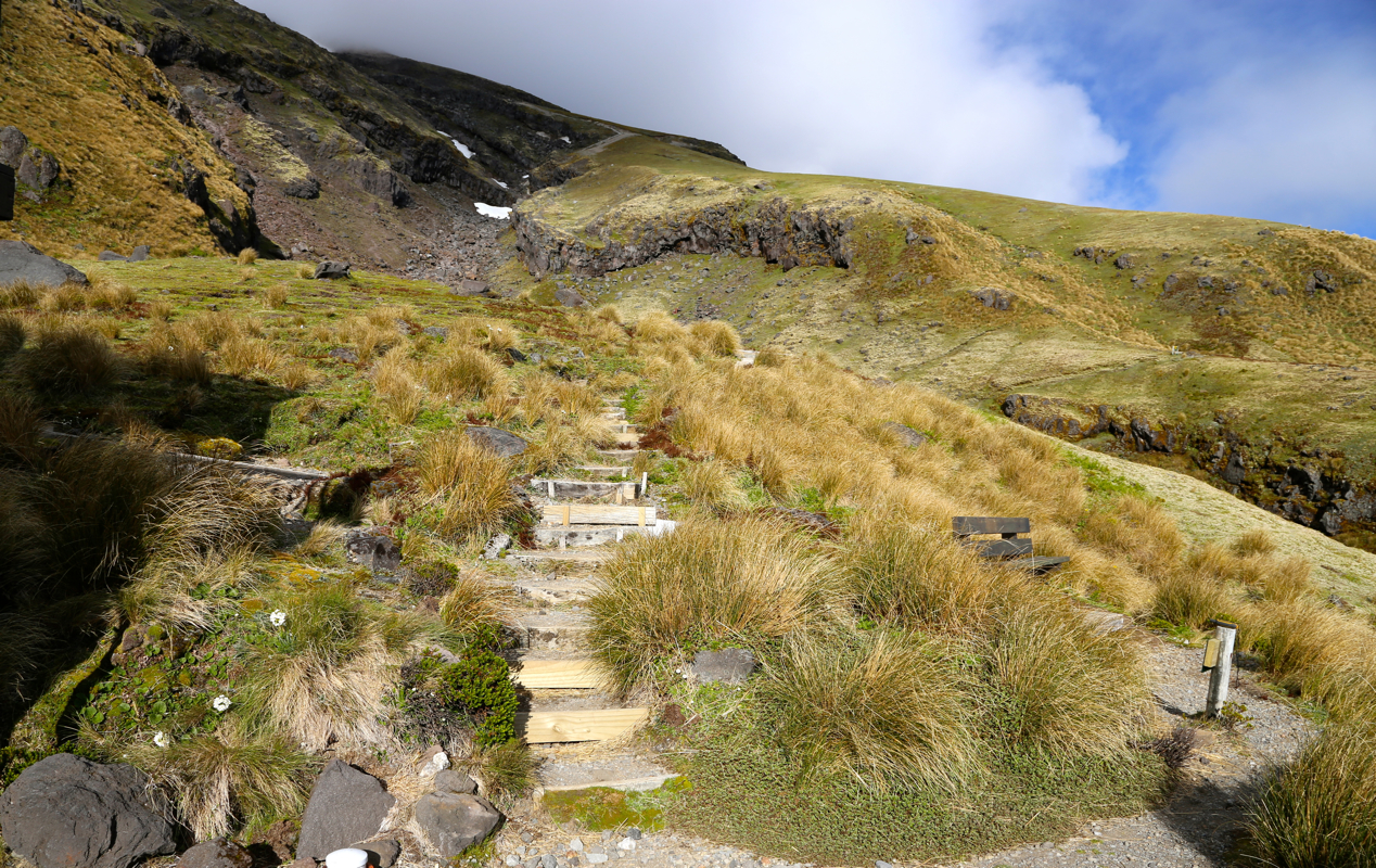
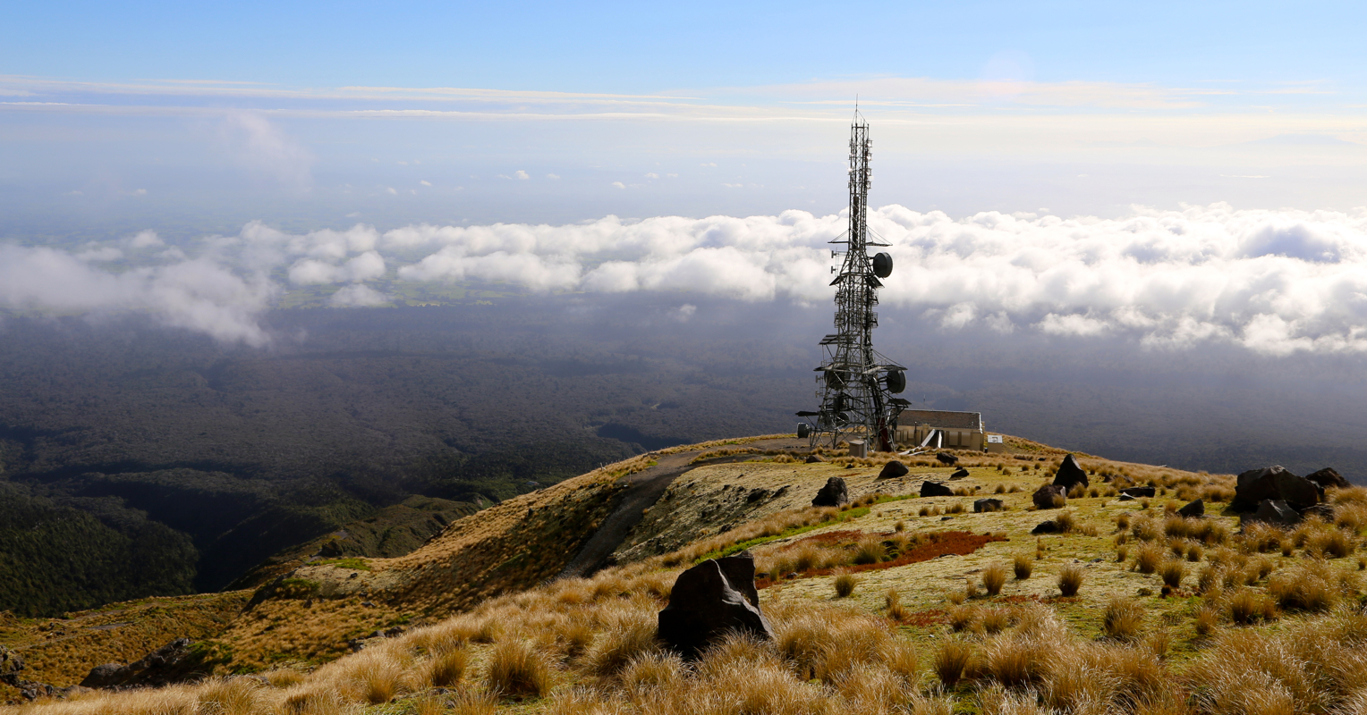
Follow the signs for "Summit Route", this runs on a 4Wheel drive road up to a big, visible
antenna located on a spur at about 1500 meter of elevation. There is also a mountain hut at
this location, S39.28921, E174.08252.
From here, the route continues on a good, well marked trail.
The trail heads up and into a large gully, as this gets steeper, the trail becomes a
well made staircase. Thus, a large number of steps provide a very convenient and easy
access to the slope higher up. The route traverses a bit right, then continues uphill
on very loose, volcanic scree. This section is clearly the hardest going up and correspondingly
easier down, since the boots tend to slide downslope.
Higher up, the trail gets onto a more rocky rib, there are several local variants of easy
scrambling and the footing is now good. Near the top, the marked route enters a nice ledge
that overcomes what looked like a difficult section, then enters the snow filled crater.
Continue into and uphill on the crater snow, as the route slowly makes an arc towards your right
in order to end at the easier base of the final climb. Depending on the snow conditions this
may be rock or snow. Crampons and an ice axe may absolutely be recommended here. Ascend on easy
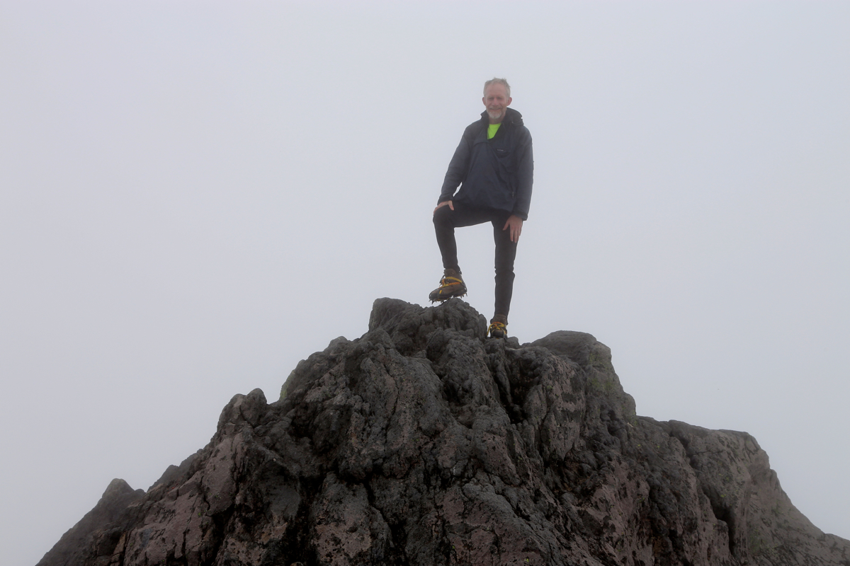
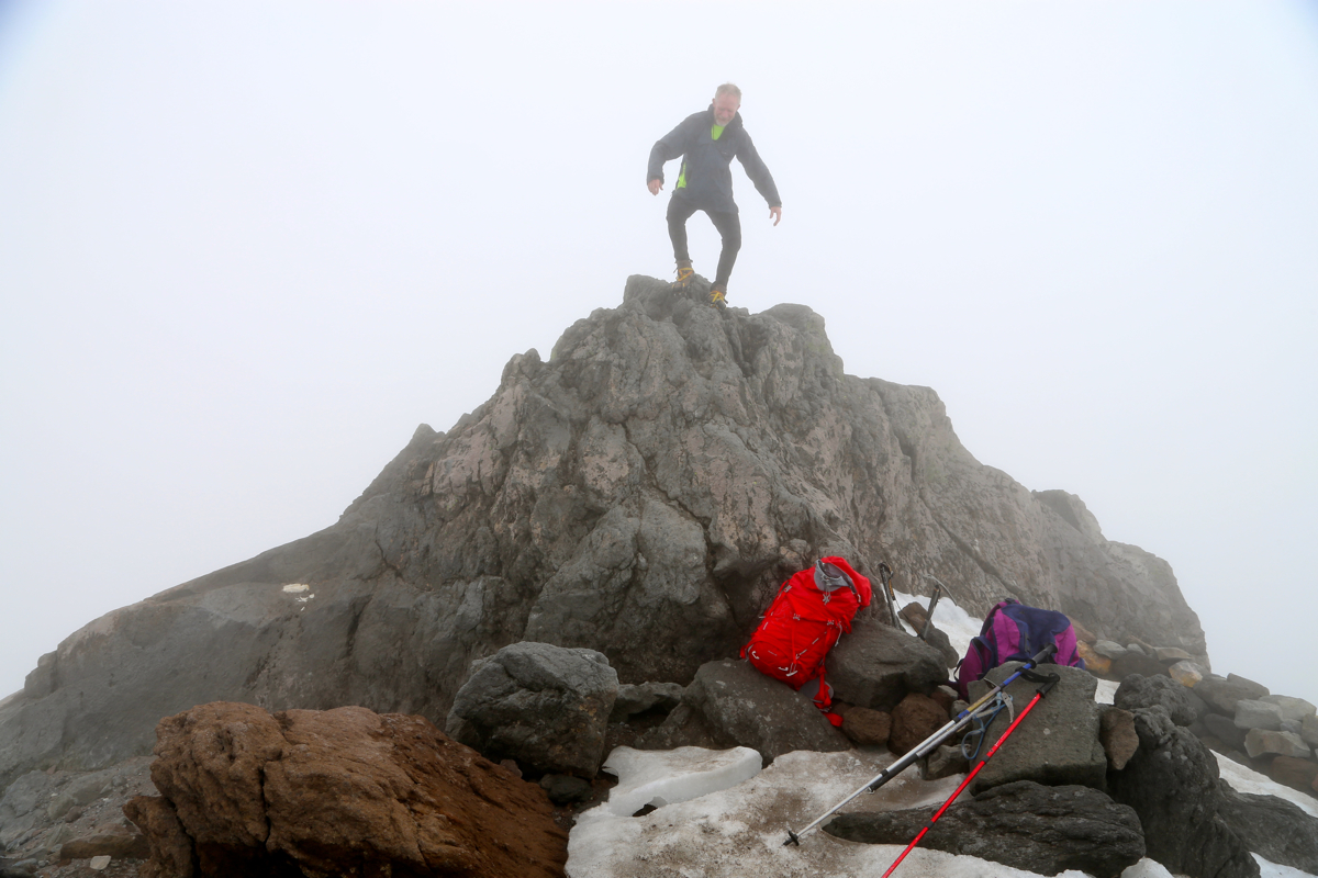
slopes to reach the final, highest summit ridge.
There are two local points on this ridge that
compete for being the highest. Climb both of them (trivial).
Comments:
Pål Jørgen and I left Bergen on December 26 for a long flight via Copenhagen,
Shanghai, Auckland to Wellington. We lost our connecting flight fro Auckland, due to
incredibly bad immigration service in New Zealand. What about service and trying to behave
as a modern country? Anyway, and more serious, in the ensuing turmoil, we also lost our
North Face bag with climbing gear.
Adrian Rayner and Rob Woodall arrived from Australia and we all drove (in 2 cars!) from Wellington
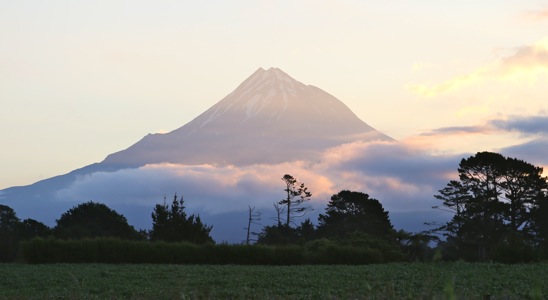
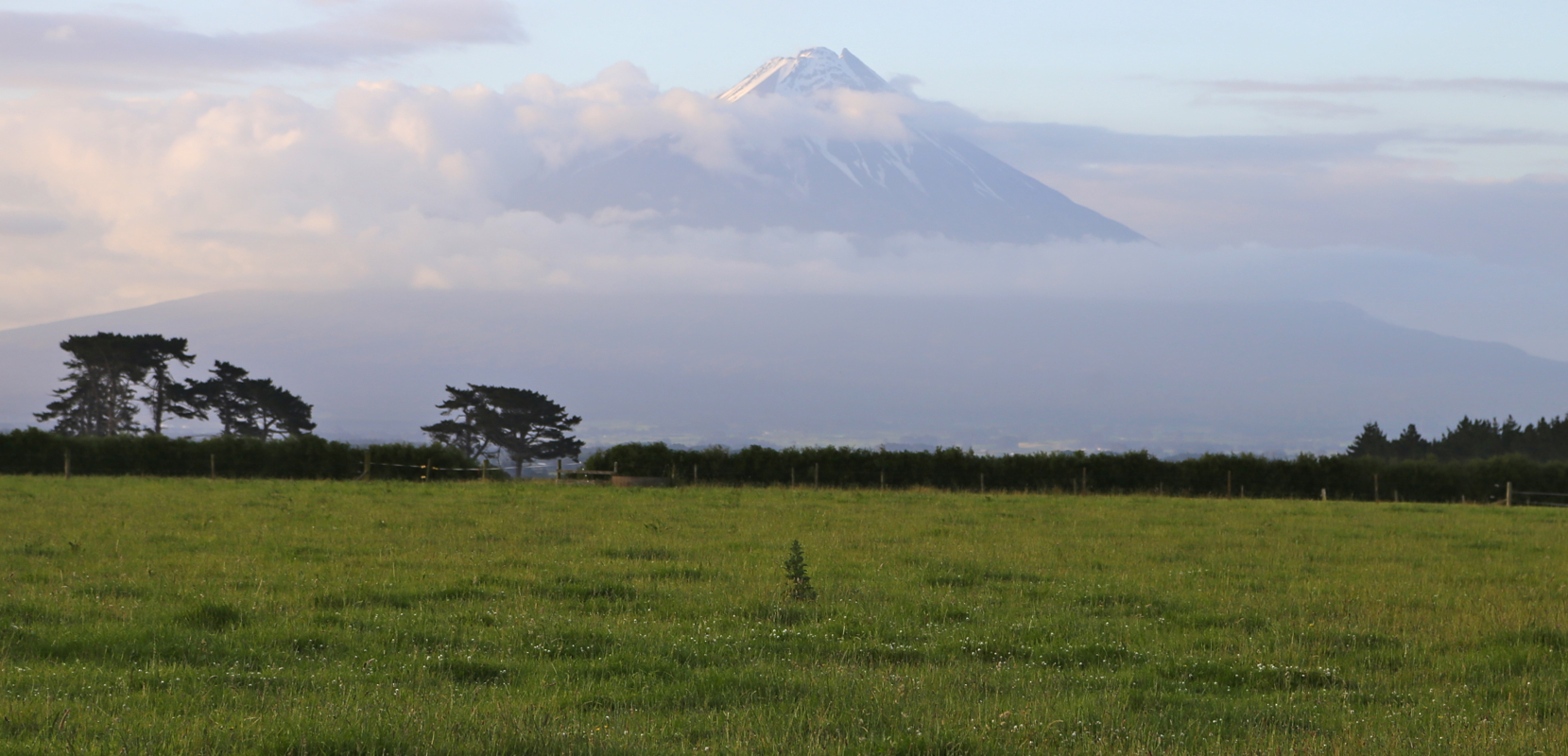
to Inglewood on December 28. Taranaki was
visible in evening light above the clouds.
Dinner in new Plymouth and all set for our first New Zealand climb.
We started walking at 0705, after one hour we made a brief stop at the mountain hut near the
large antenna mast.
The higher climb went straight into the clouds. We arrived at the summit
at 1050, so 3:45 to the summit. We caught up with a sole climber from Germany, otherwise we
were the only team on the top. We stayed around on the summit for 30 minutes, but no
sign of a break in the clouds. The descent was pretty easy and we were back down in 2:30.
We had a couple of very brief bursts of rain, but too short/little to get wet. A very good
start to our extensive New Zealand climbing trip.
We next went back to New Plymouth in order
to retrieve our lost bag. It contained crampons that would be needed for the climb of
Ruapehu.
The plan was to get the bag shipped from Wellington to New Plymouth, however, the bag never
made it to Wellington. New Zealand air turned out to be absolutely incompetent in handling
lost luggage. Their approach was far from service, in fact, they all claimed that the bag
was stuck in customs, a claim that turned out to be completely false. Finally, after several
phone calls, I got hold of a person in Auckland that identified the bag and sent it onwards to
New Plymouth.
With all climbing gear and mountain clothing under control,
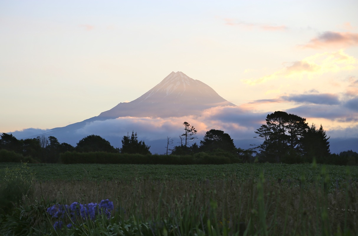
we drove to Whanganui, our mountain
now finally free of clouds.