Mount Stuart
- Mount Stuart
- 2870 m
- Primary factor 1626 m
- Washington, USA
- Location: North 47:28.509, West 120:54.149 (GPS at the summit)
- Difficulty: YDS class 3.
- Climbed August 27. 2010
|
|
Information:
How to get there:
From Seattle, drive east on Interstate 90 to Cle Elum. Just after Cle Elum, take
exit 85, in the direction of Cle Elum, but turn right onto Hwy. 970 and measure
from here. Follow Hwy. 970 for 6.3 miles, note that it forks left where Hwy. 10 continues
straight. At mile 6.3, turn left onto Tenaway Road. Stay on this paved road until it
ends just after milepost 13, at mile 19.3. At this point, stay right as you enter
road 9737. (Beware of the road 9738, that forks right just before. At mile
20.6, keep left (road 9703 forks right), continue on the main road. The road passes
several trailheads, camps and turnoffs, stay on the main road until it ends in a parking
area at mile 28.9. You must have a Forest Pass to park here (US dollar 5 per day, dollar
30 for an annual pass, 2010). This is the trailhead, location N47:26.211, W120:56.227,
elevation about 1300 meter.
Route description:
The trail begins on the right hand side of the parking area. Follow the trail
uphill, soon the wide trail narrows and arrives at a fork. Go right here (there
may be a sign for Longs Pass). Higher up, after about 3 kilometer, there is a new
trail fork where you should go right again. From here, the trail climbs somewhat
more steeply in switchback fashion to reach the remains of an old mining road.
A final traverse going left followed by a few zig-zags among trees will get you
to the well defined Longs Pass.
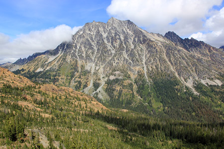
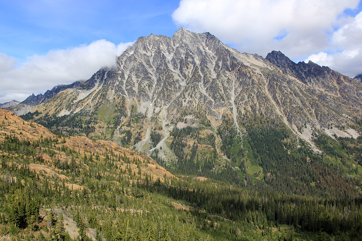
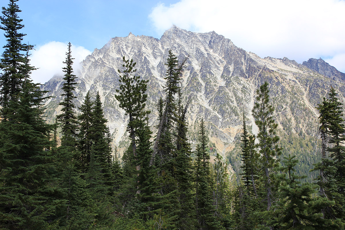
From this pass you see Mount Stuart for
the first time. Ingalls valley lies between
Longs Pass and Mount Stuart
and the route now needs to descend to Ingalls Creek. Slightly right, there is a cairn
that marks the beginning of this descent. This trail is slightly rougher than the
trail leading up to Longs Pass, but easy to follow. It reaches the creek and merges with
Ingalls Trail. Take this trail right (downstream) less than one kilometer to an area
where you see campgrounds on your right and you may spot a small cairn right next to
the trail that marks the beginning of the Cascades Couloir route to Mount Stuart.
The campground is at location N47:27.275, W120:54.302, elevation 1465 meter.
From here, there are two alternative routes up the lower part of the mountain, the two
routes meet higher up and the last part is the same.
Variant I:
From the campground location, cross the trailnext to the small cairn and follow a climbers
trail uphill crossing vegetation and bushes. The trail has several local variations and may
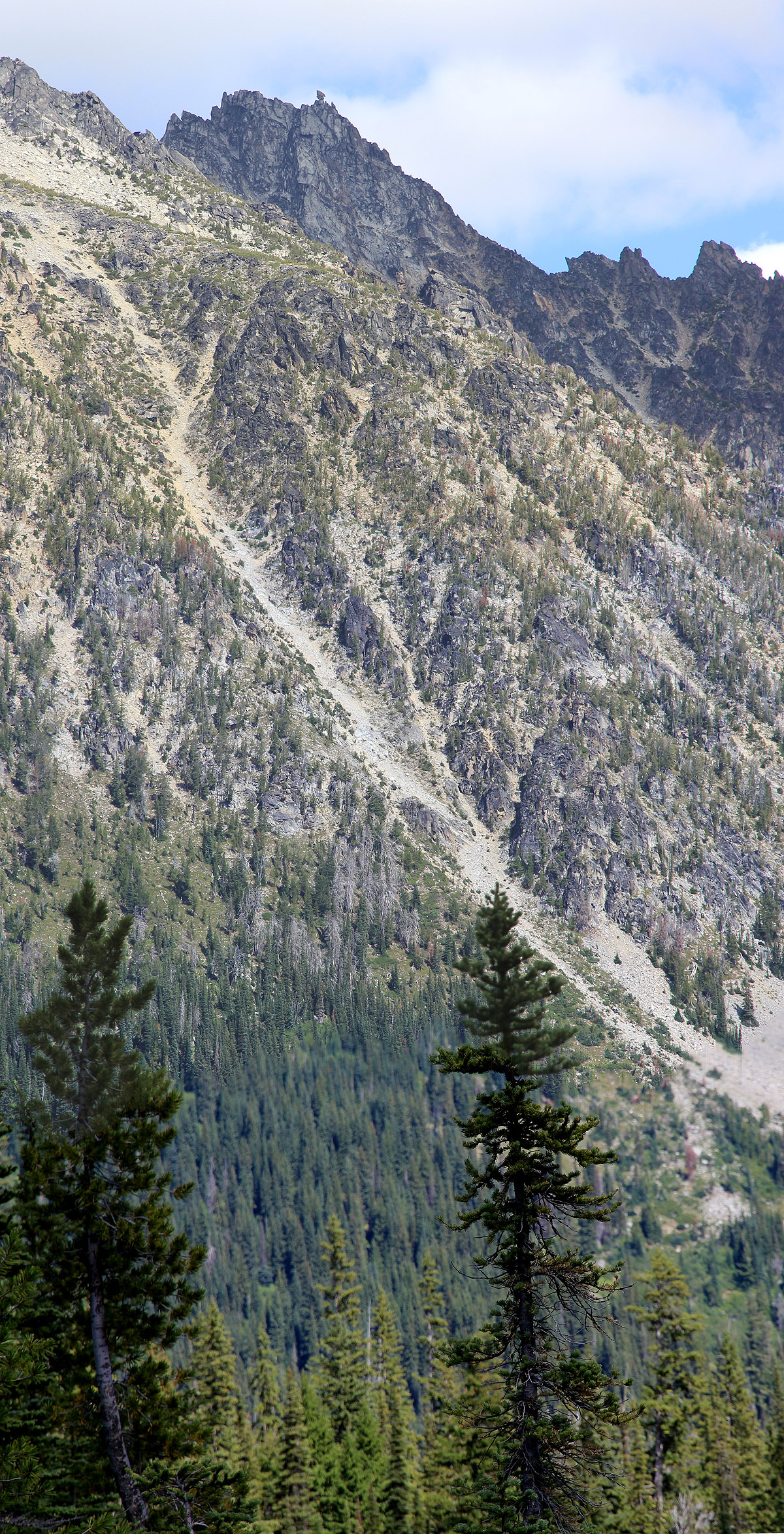
be a bit hard to follow with poor light. The general direction is obvious in order to enter
the couloir that is visible higher up and slightly left. Continue on climbers
trail up the couloir.
The entire hike is class 2. Higher up, as you exit the couloir, cross boulders and
some broken rocks that are easy to see. Higher up, the route curves slightly left as you see the
patch of snow above you. Looking back, you can see the other couloir that merges while coming
up further right.
Variant II:
From the campground, get back on the trail, turn right and continue along the trail
to location N47:27.262, W120:53.808, elevation 1478 meter. This is just near the beginning
of a large open area. Take the smaller trail that forks left (uphill) here. This trail
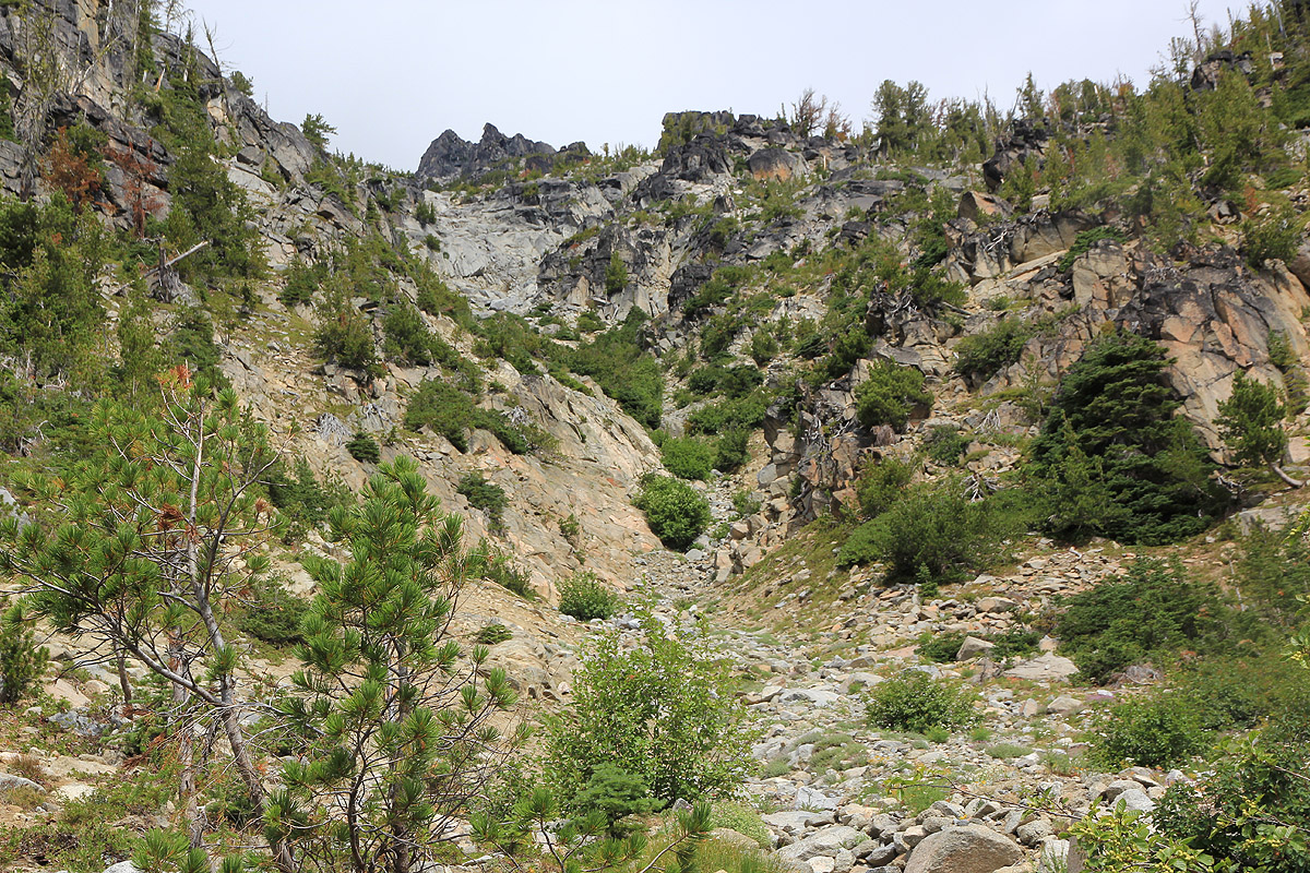
will lead you uphill through the vegetation, then across and
into a distinct gully. Follow
the trail, marked by cairns as it enters a steeper section. Some easy scrambling will get
you up this section and into the proper couloir higher up. The trail is very clear as it
zig-zags uphill and eventually enters the same area as described above under Varant I.
Final summit climb:
Locate the pretty steep patch of snow above you. The route, marked by small cairns,
runs up on the left side of the snow. The summit above is
not the highest point and
the route will bypass this (false) summit on the left. Near the top, move left and climb a short
pitch to reach the rock shoulder (class 3). From this shoulder, you may see the summit,
it is not up to your right, but rather across on the left side of the high ridge
that runs on your right. The route has cairns all the way, they may be hard to see, so
look carefully. The
route now descends (quite a bit), and passes through a narrow crack,
large climbers must circumvent this passage. Next, the route climbs uphill in fairly
rough terrain, one
can easily loose the class 3 rock and enter class 4 terrain here.
Reaching the main crest, move left and find a short picth of steeper class 3 terrain.
Next, the route takes you to the right side as you turn a small corner with great
exposure on your right side. No fall here! Finally, you enter the last section, a large
sloping piece of rock with big cracks that can be followed to the very summit.
Comments:
After a very nice climb of Mount Olympus, we returned to HQ in
Seattle were I received the shocking news that Daniel H. Schreiber, age 24, was dead. From beginning to
the end of our last climb, Mount Stuart, my thoughts stayed with the Schreiber family.
We left Seattle at 1200 and after an uneventful drive, we located the proper trailhead without
any difficulties, arriving there at 1430. A few cars were parked there, obviously this is a fairly popular trailhead.
We started hiking at 1445 and by 1500 we were already quite a bit uphill. At this point I realized that my
camera was missing. Had I left it behind in Seattle or in the car? Unfortunately, I had no idea, but decided to
hike back down while Rob got a pretty long break. The camera was in the car and by 1530 I was back up the
hill where Rob was waiting. My camera ran out of battery on the very summit of Olympus and I had spent the
morning driving to a camera store buying a spare battery as well as a charger. How typical then, to leave
the camera behind!
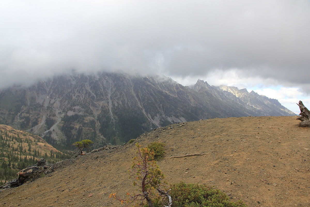
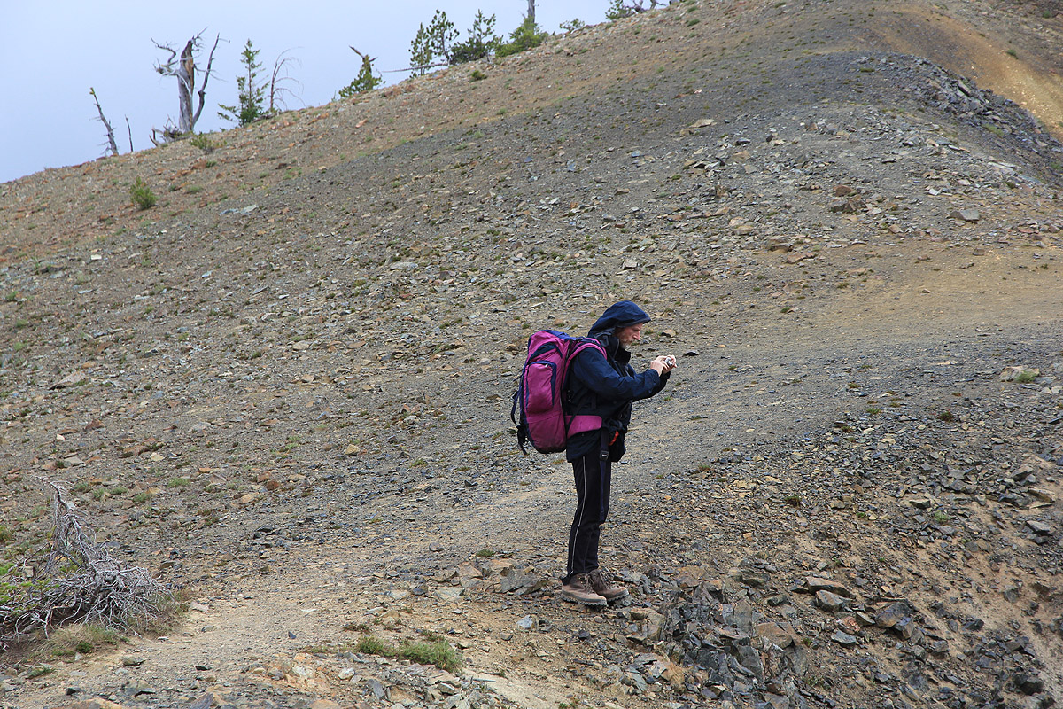
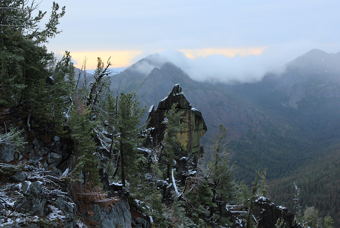
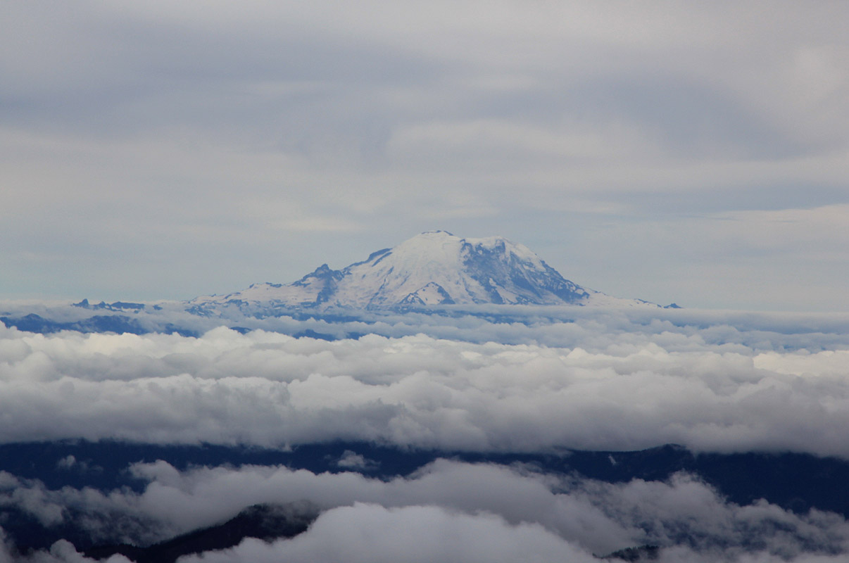
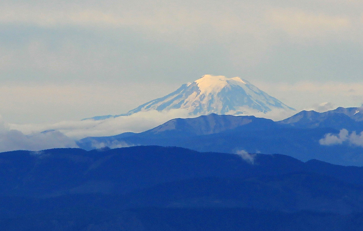
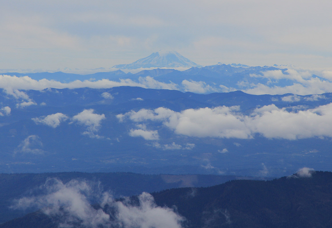
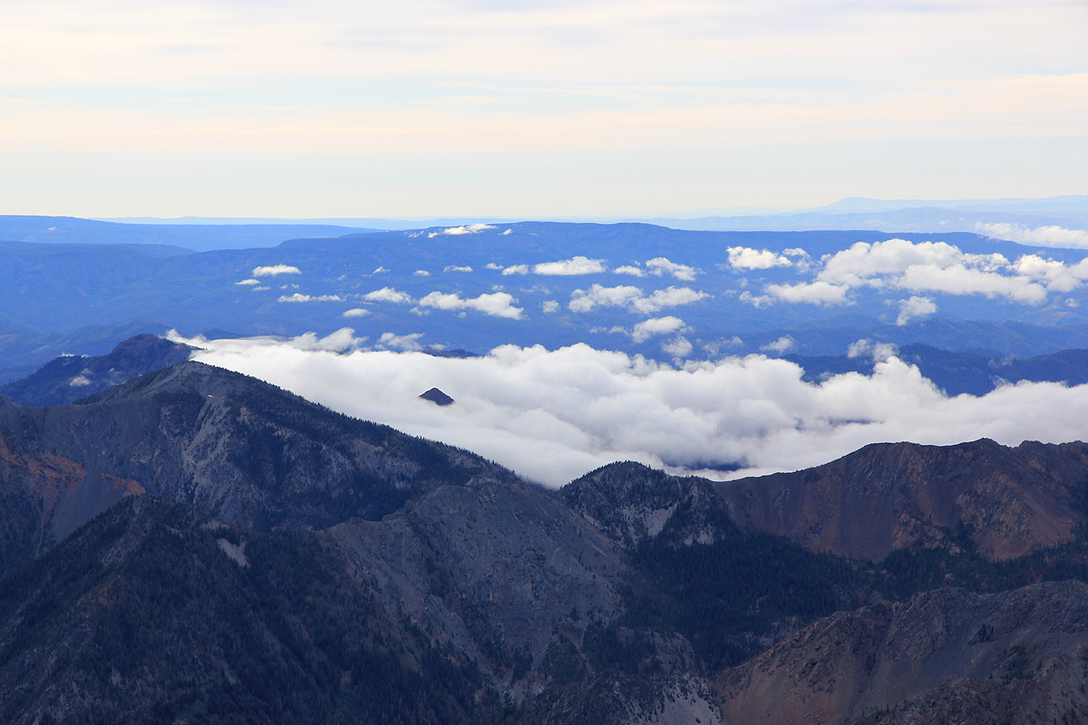
The weather was gray with a drizzle of rain, my thoughts were
wandering, even Mount Stuart was hiding in thick
clouds as we reached Longs pass at 1615.
From here, the trail went downhill, loosing most of the elevation
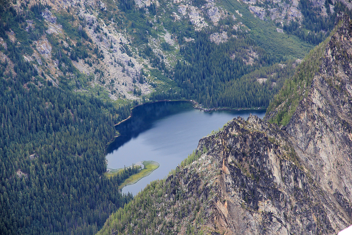
we had gained. Ingalls valley is kind of hidden away, an interesting place before getting to the base of
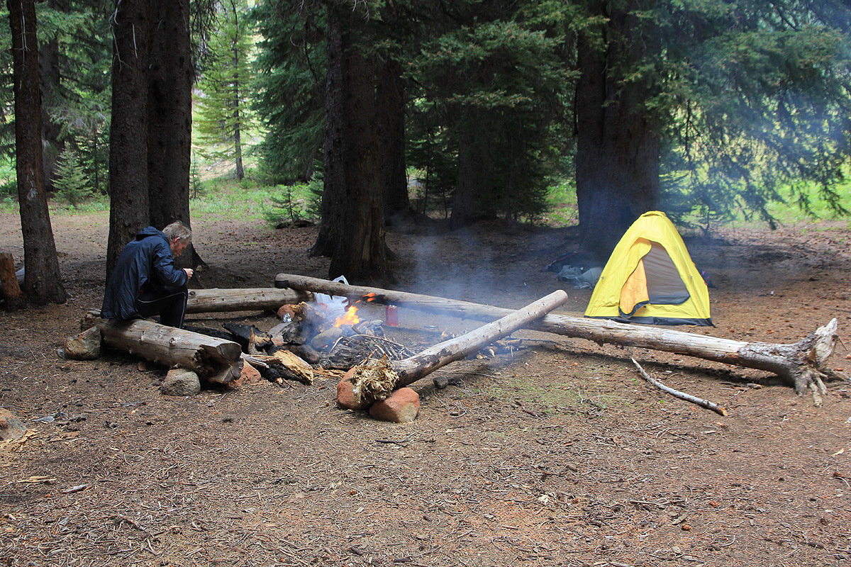
Stuart. We arrived at a good camp site by 1715, good timing for making dinner and collecting some
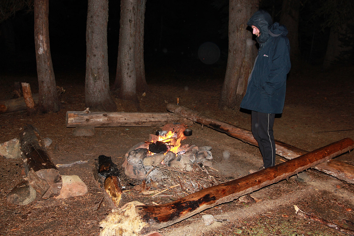
firewood before it got dark. It kept raining, but not very hard.
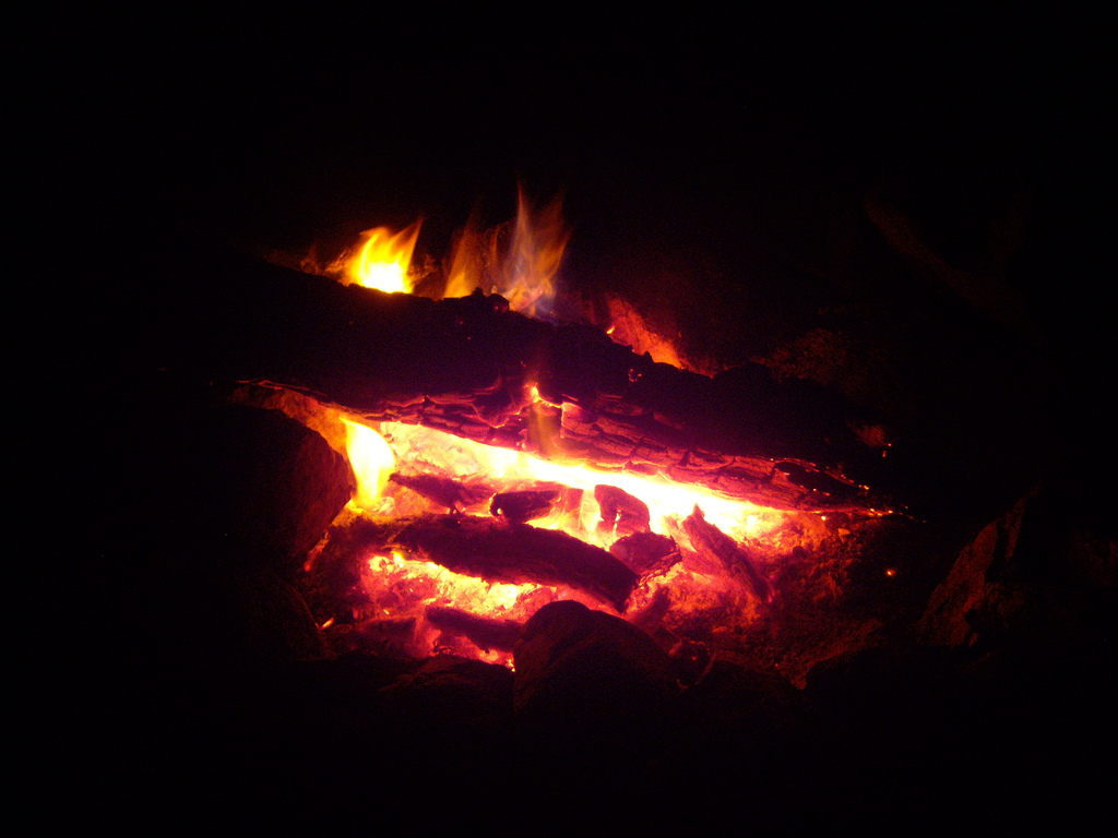
We made a nice fire and as the sky turned
dark, the flames reflected
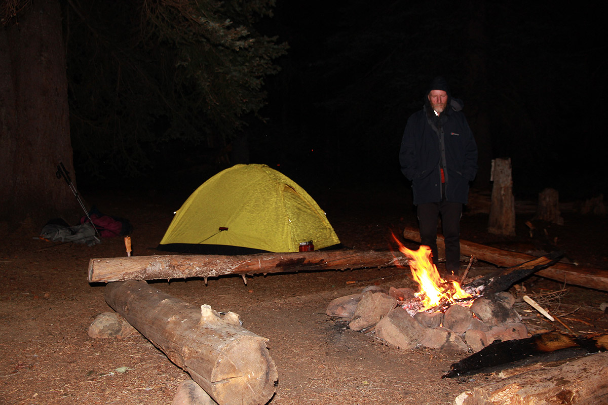
a magic light among the big trees that surrounded us. Sitting by a fire, we were
now at the last tent night on our last mountain. I completely forgot
the rain, looking at the red glow
made my mind wander again. Humans have been sitting just like this for thousands of years,
with a fire
that provides warmth and safety, it triggers feelings that seem like they may have been passed down by
generations. However modern and full of technology our society is, as human beings we still carry many
traits that do not differ much from what we needed in stone age time. There is so much we do not
understand, what affects our inner feelings, how and why does our brain sometimes direct us into
actions that cannot be explained?
The next morning came, grey and cloudy with rain still lingering. We had a good breakfast, then left by
0515. Morning light is slightly sooner here than at Olympus further west. The trail was not very
visible, but we entered the Cascadian couloir and
moved steadily uphill.
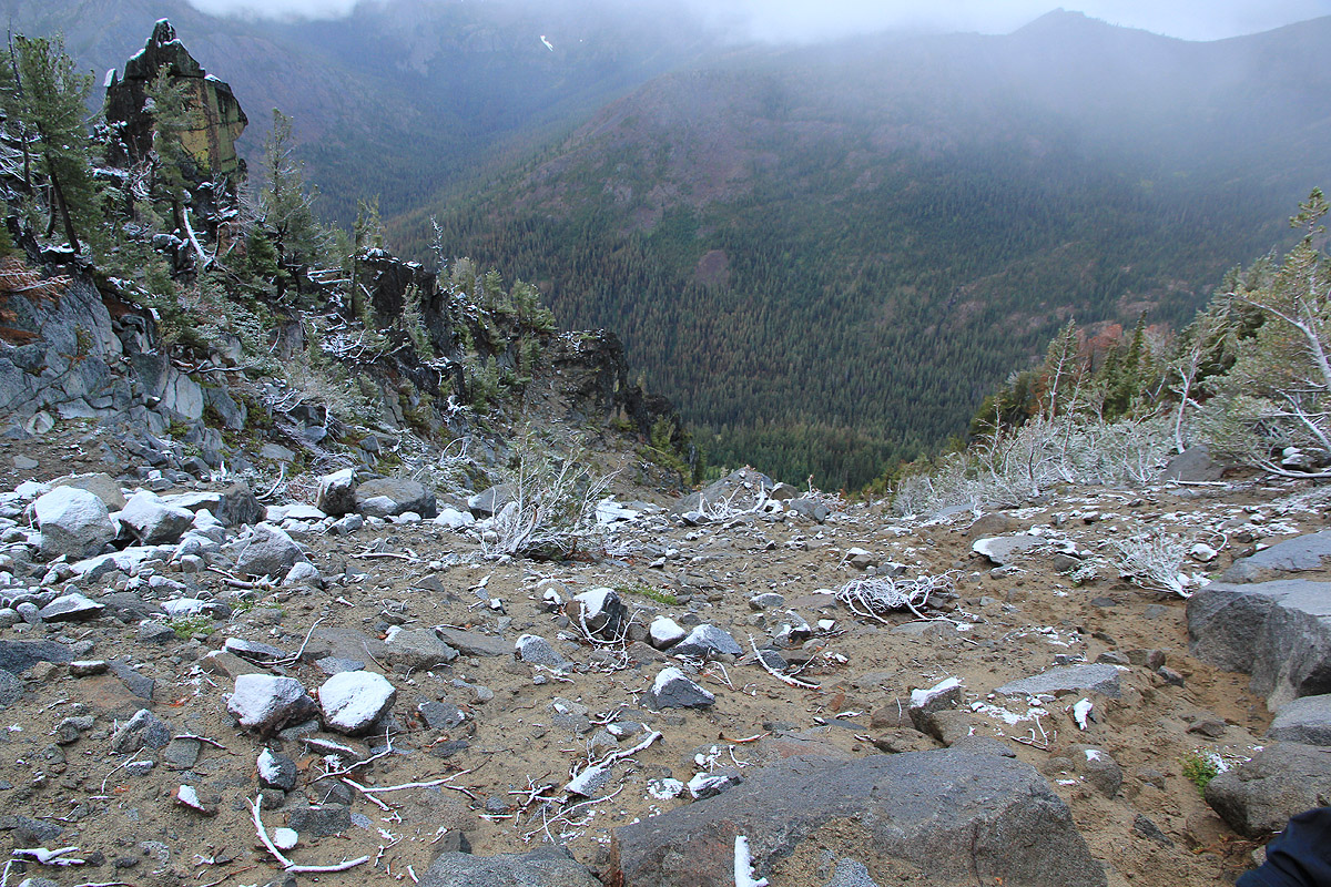
The trail was never very steep,
but somewhat loose in places. Looking down, we
had certainly made progress, but
looking further uphill, we agreed that this is indeed a long couloir.
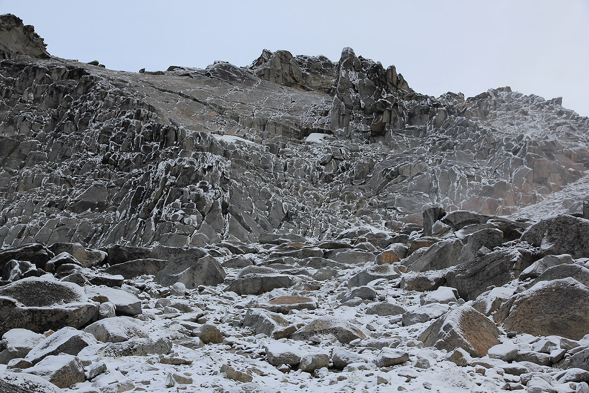
We noticed new snow, what rained at our camp had turned to snow higher up.
In fact, it was clear that we would run into snow higher up and that the entire upper part of the mountain
would be covered by snow.
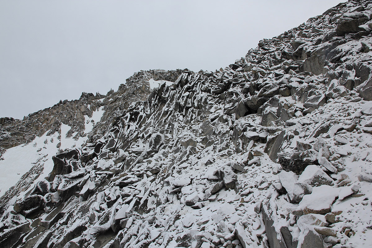
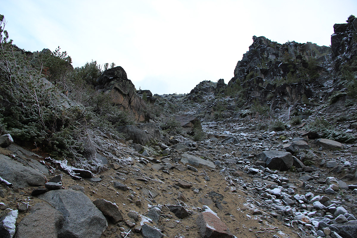
Higher up, we exited the couloir and entered a wider area
with slippery rocks due to the snow.
Quite surprisingly, we met a couple coming downhill. It is rather unclear where they spent the night.
We followed their tracks as we climbed more steeply on
the left side of the upper patch of snow.
The route took us up
on a shoulder then descending
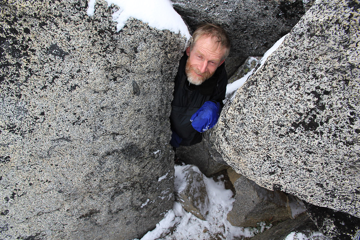
to an interesting crack between the rocks. This
passage is definitely not for big people, I was barely able to squeze through. Soon thereafter,
the footprints we had been following ended. We did not pay too much attention and quickly ended
up off-route. Trying to climb more or
less directly uphill caused us to run into some (YDS) class
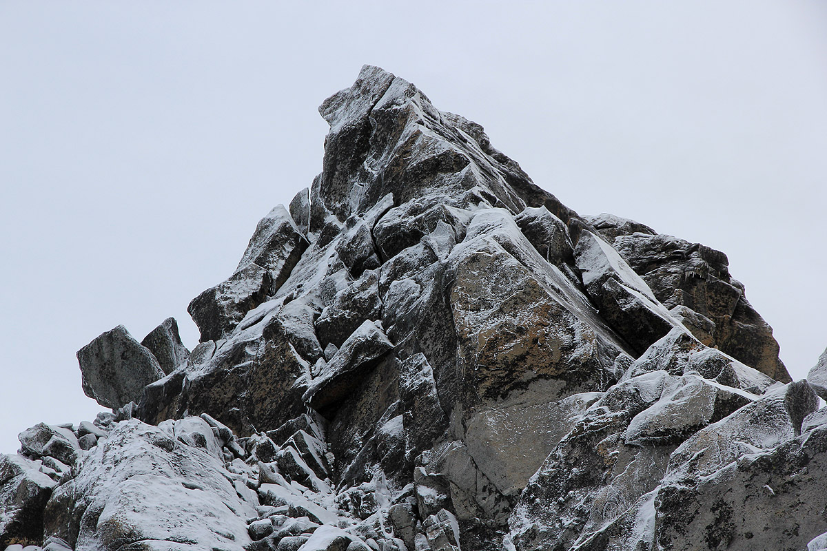
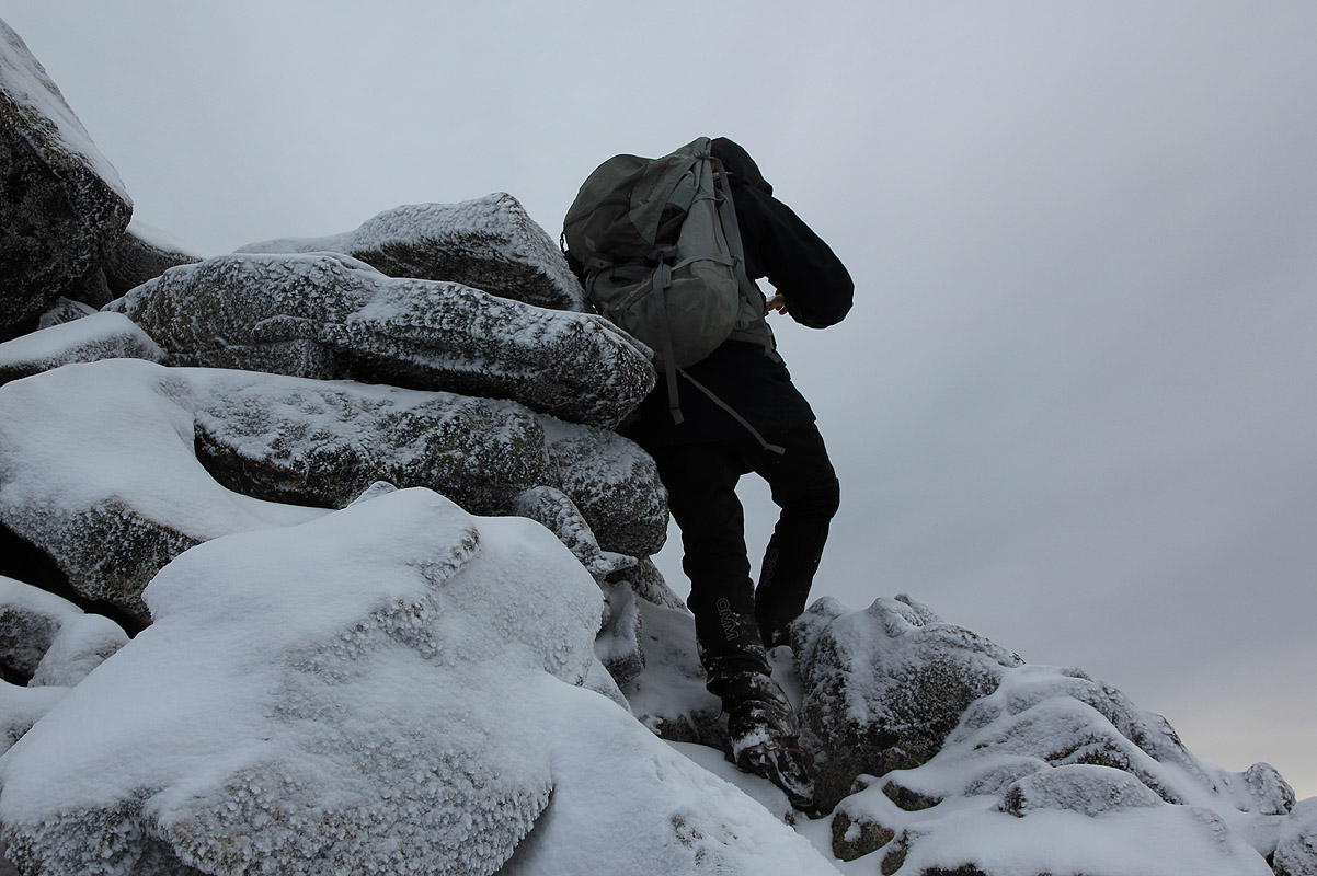
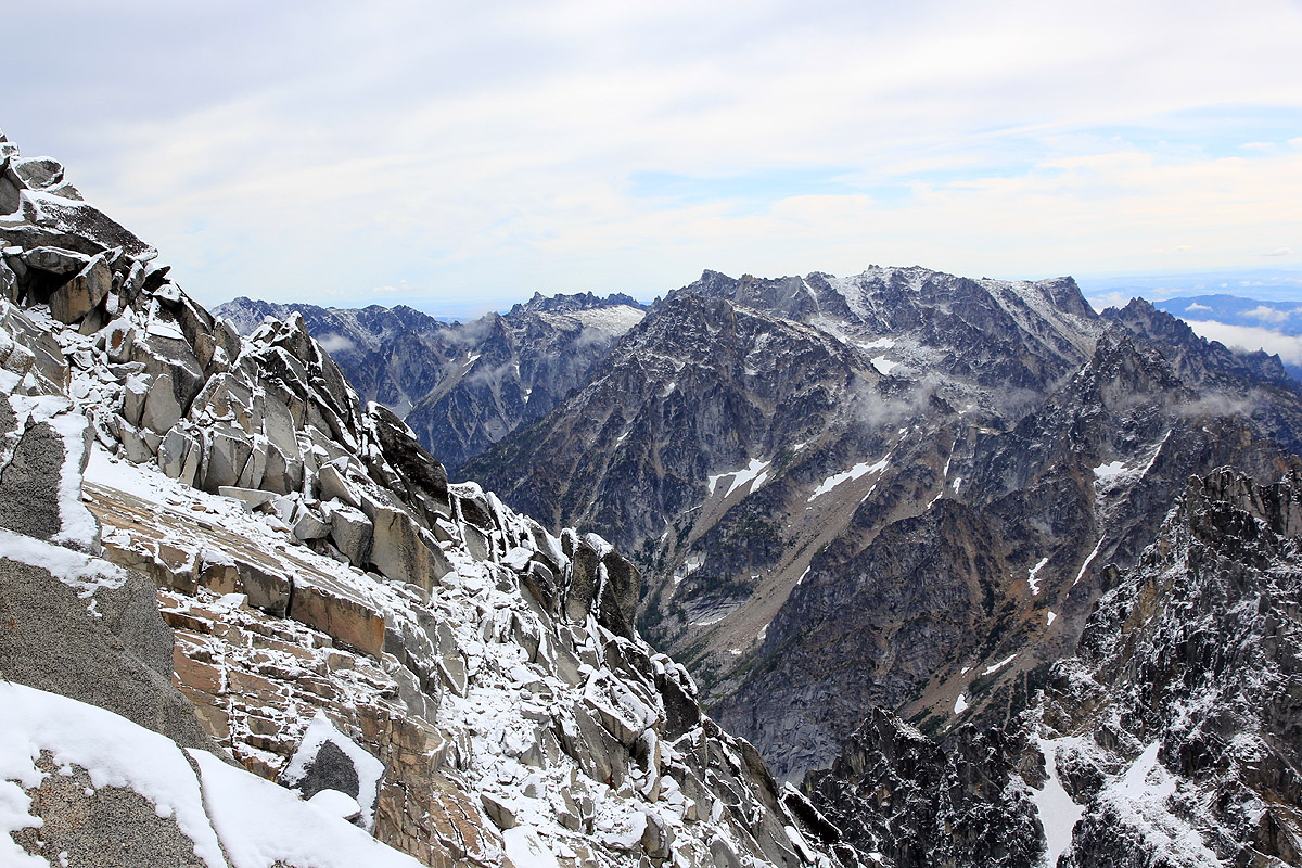
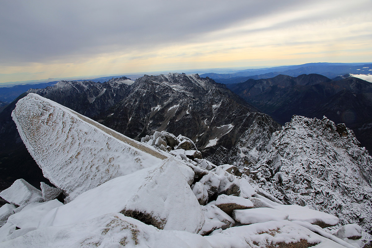
4 terrain, tricky with the snow covering all rocks. Reaching the very top ridge, we wondered how
hard it might be to follow. The summit was in clear view, but no cairns showing the route.
It turned out quite well, a steeper section in a well protected spot, then a pretty exposed move
around a corner with the steep cliff on our right directly below, followed by easy scrambling along
some big cracks in the final rock leading to the summit.
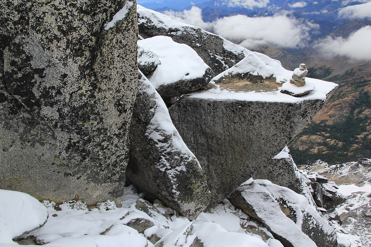
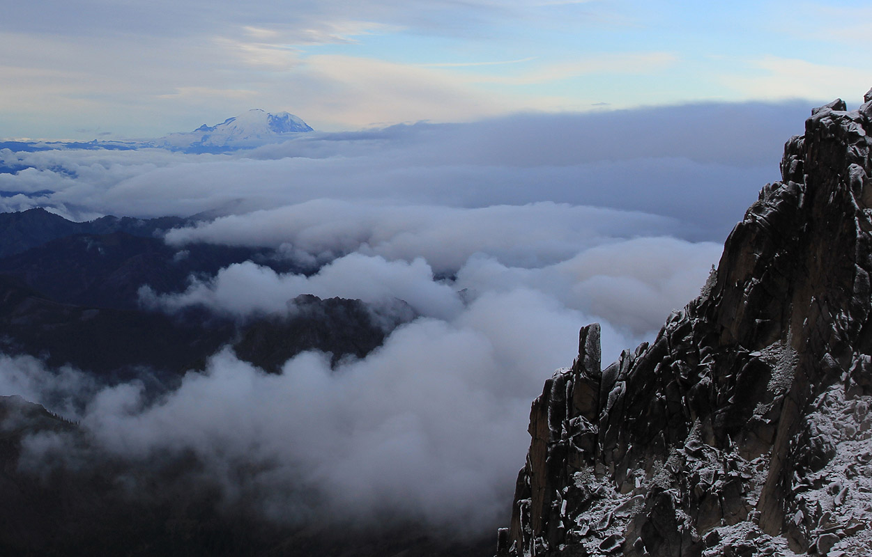
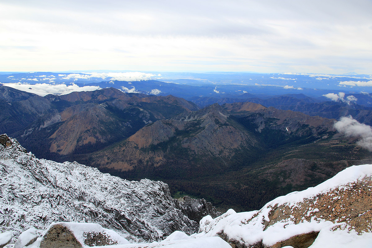
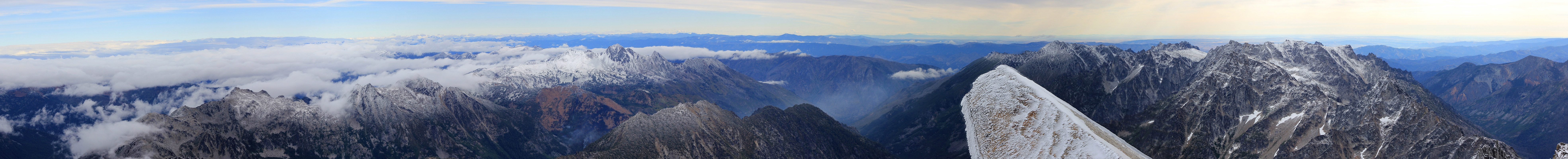
We arrived at the summit at 0915, and became aware that the weather had improved greatly. We had been
focused on the climb and the slippery rocks, but now was time for rest, for looking around at the
vast wilderness, and for reflection. A very fine summit indeed, very limited space and pretty steep
cliffs in all directions but where we came from.
We searched around for the summit register, but did not find any. This was unfortunate, as
I had planned to write a short message in memory of Dan. However, his memory is now buried
in my mind with my memories of this trip, a trip that started grey and then grew into a great
experience.
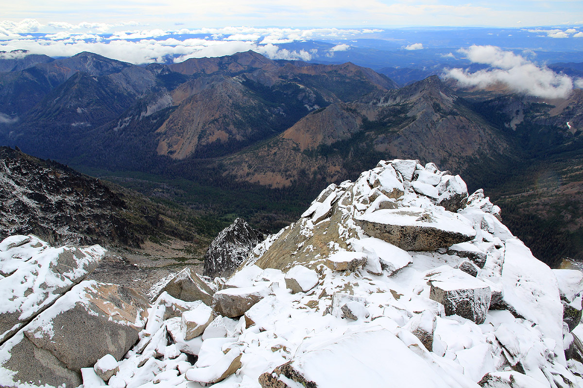
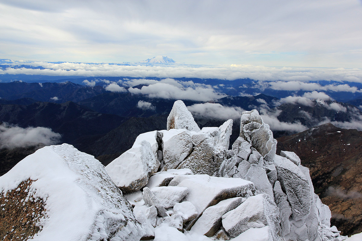
This concluding trip put everything together in a good way, the
very nice view and the pure, white snow that covered the rocks.
The sun was about to break the high clouds, and ours were the only footprints to the very summit.
The climb had turned into a very
nice scramble, much better than the rain and an ugly couloir had promised in the morning.
Time for more thinking about how wonderful it is to just be breathing
the fresh air, to absorb
the seemingly endless landscape, to
have this strong feeling of being alive, very much so.
We most likely had different thoughts, but none of us spoke. There was no wind and the mountain
was quiet, covered by a new, fresh blanket of white snow.
We both admired the landscape in silence, before I said:
"I dedicate this climb and this moment to the
memory of Daniel H. Schreiber, a very fine boy.
My thoughts and warm feelings go to the
Schreiber family, his parents and siblings."
We left the summit at 0945, carefully downclimbing on the slippery snow. Motivated
to find an easier way down, we kept a close eye on the small cairns and they did indeed
lead down along a simpler route than what we ascended. Further down, we stayed left and
explored the route that is called Variant II,
in the description above.
We were back down at camp by 1230 and ready to continue at 1315. One hour back up to Longs Pass and
another hour to the car, arriving there at 1415. We had a nice drive back to our
Seattle HQ, arriving by 1800.
See also the nice picture story posted by Rob.
This concluded our ultra trip to the NW USA, 2010. We enjoyed the second half of lasagne masterly
prepared for us by Loyce, then burned the garlic bread, causing the smoke detector to sound an
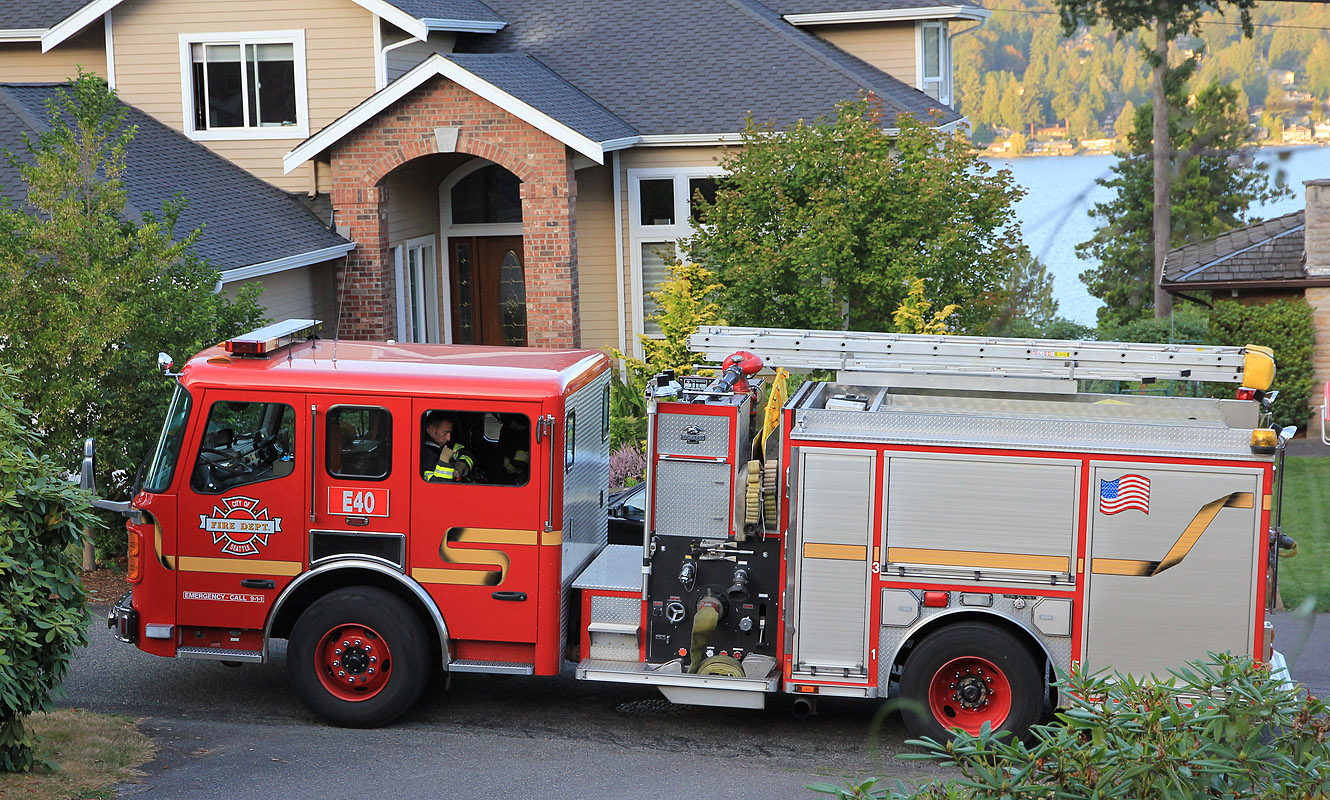
alarm. We quickly got the smoke/smell out the terasse door, but were unable to prevent the
local fire department from
checking on us. Many thanks are due to Loyce and Randy for their
great hospitality!
Resources: