Location: North 48.22280, West 115.68859 (GPS at the summit)
Montana, USA
Difficulty: YDS class 4
Climbed: August 8, 2012
Information:
How to get there:
The starting point for visiting this mountain, is the town of Libby in north-west Montana. Libby is located on
Hwy. 2 connecting Kalispell (MT) and Spokane (WA), about 32 miles from the state line to Idaho.
From the intersection with US37 in central Libby, drive 8 miles south on US Hwy. 2, and locate Bear Creek Rd. going right.
Drive this road to location N48.24956, W115.53515, turn right on Cherry Creek Rd. here. Continue to location
N48.22206, W115.60472 where a fork going right is signposted Leigh Creek Trail. The final 3.5 miles will get you to the
trailhead. This final section is rough, a high clearance car is likely necessary. The trailhead is located at
N48.22463, W115.64079, elevation about 1250 meter. There is parking for several cars here.
Here is a quick reference and summary of all
peaks visited on my 2012 summertrip to the USA.
Route description:
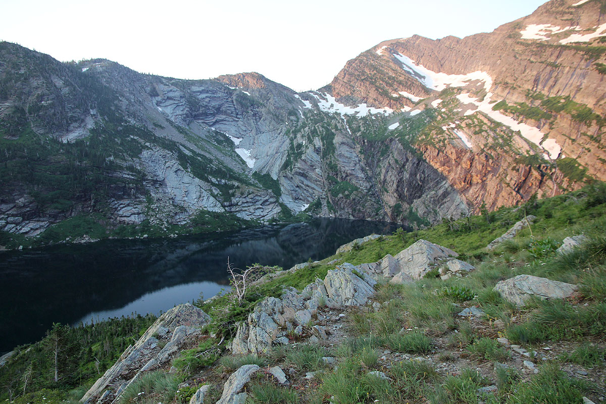
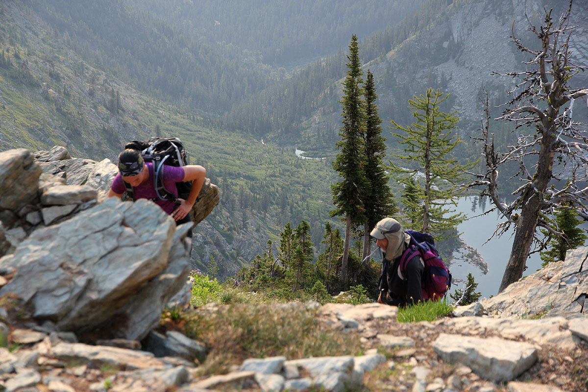
The trail to Leigh Lake starts directly from the parking area.
Follow the trail, sometimes pretty steeply, uphill on the right side
of the creek, to Leigh Lake. Continue fairly close to the shore, along the
right side of the lake until there is a pretty rocky gully going uphill to your
right. Ascend up along the right side. You will locate a trail, soon the trail
crosses to the left hand side. The route now ascends between this gully and the next
gully further left, then crosses this second gully below some rock bands.
The grass on this slope is very slippery, even when it is dry. It therefore pays to stay
on rocks and avoid the grass as much as possible. The route traverses further left to a third gully.
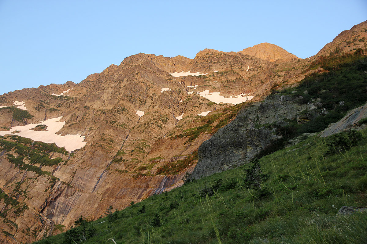
This gully extends all the way up to the main crest and is the way to ascend in order to get onto the
ridge. We ran into a snow slope at the lower section, but this caused no complications. The gully is moderately
steep, with some (YDS) class 3 scrambling, mostly class 2.
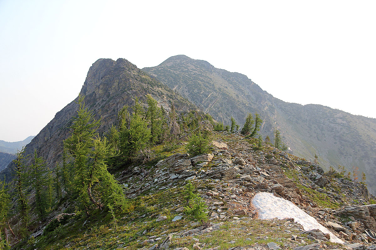
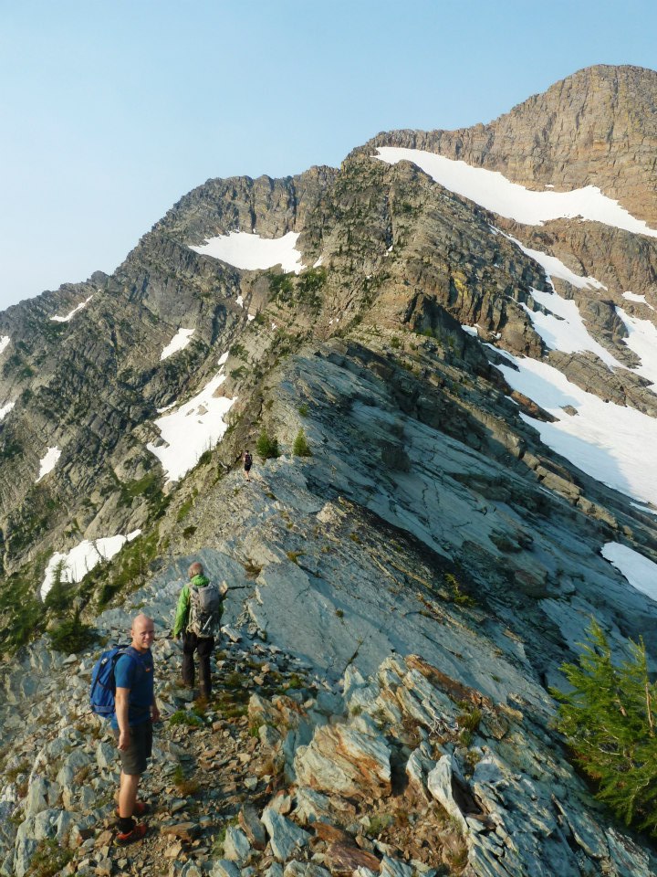
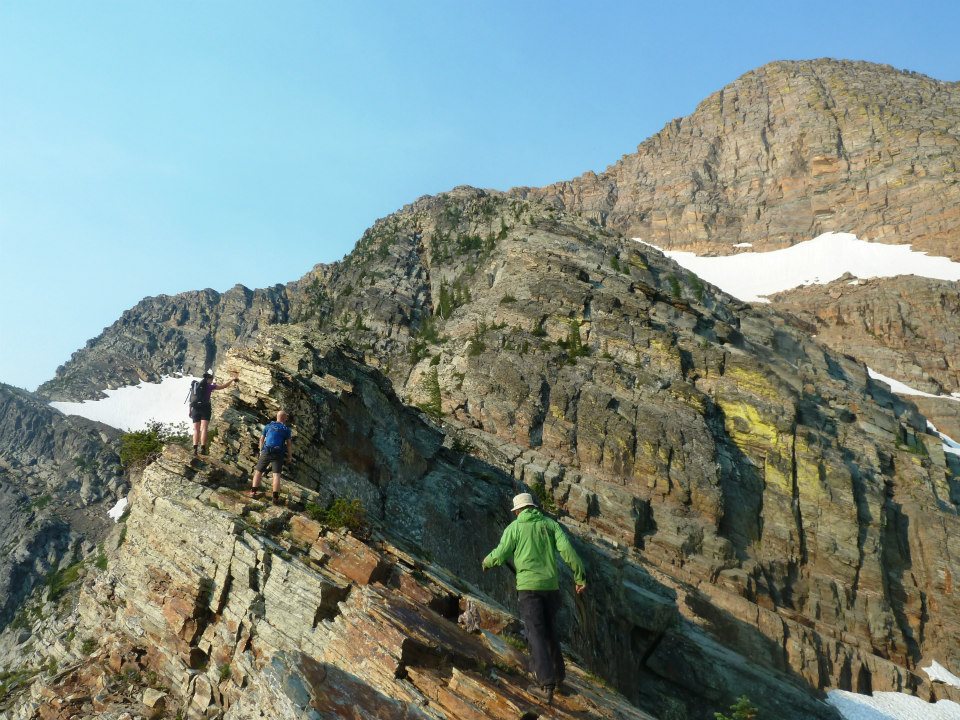
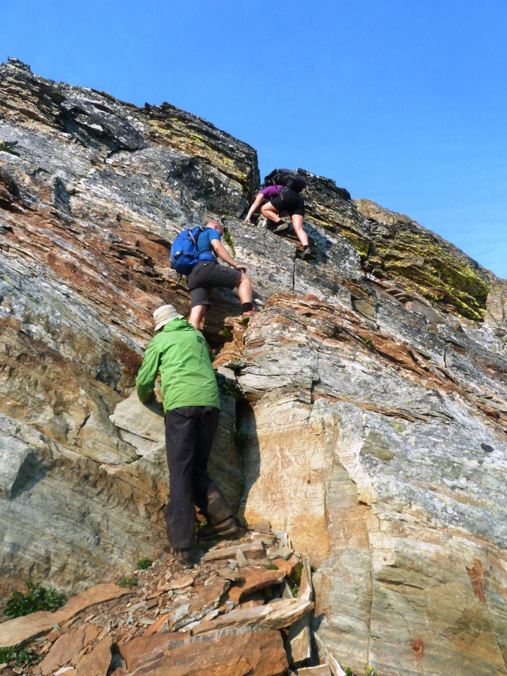
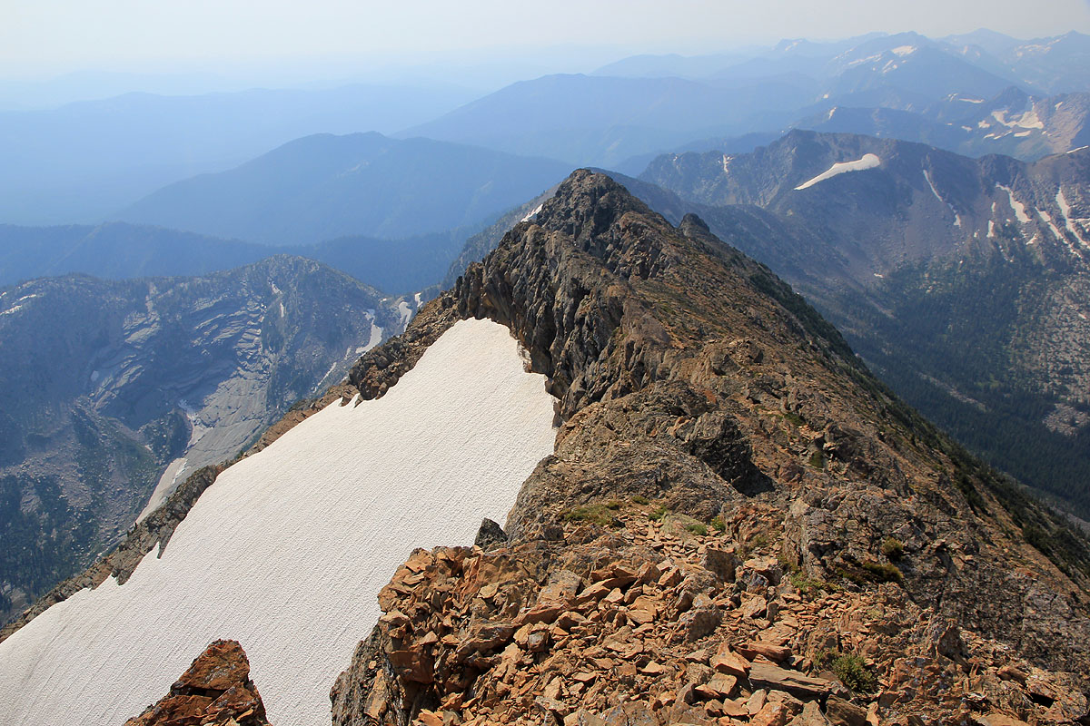
As soon as one reaches the ridge, the route becomes much more interesting.
In the beginning, the ridge is quite
narrow, but technically easy. Subsequently, the ridge rises more steeply. It is generally best to stay on the very
top of the ridge as much
as possible. A small bypass on the left side may be needed in one instance.
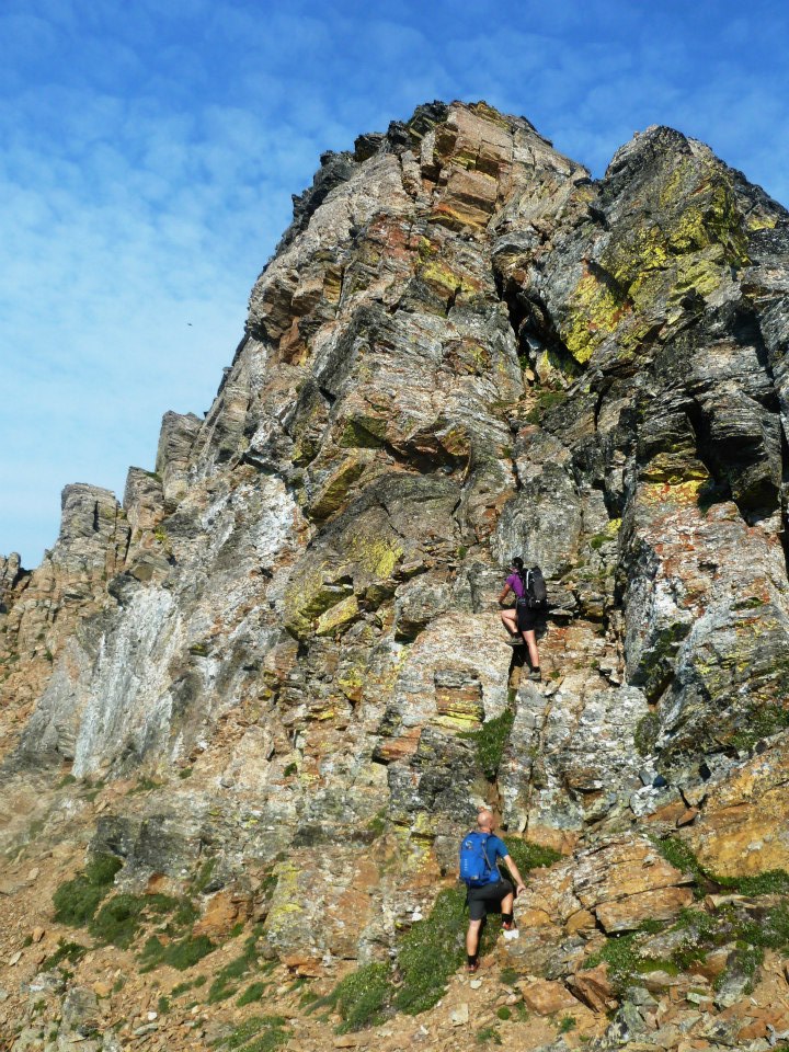
The climbing looks harder than it is, the easiest route is really mostly (YDS) class 3. Higher up, there is a pretty
steep rock wall blocking the way. This can be climbed sort of right on, hard YDS class 4, or bypassed
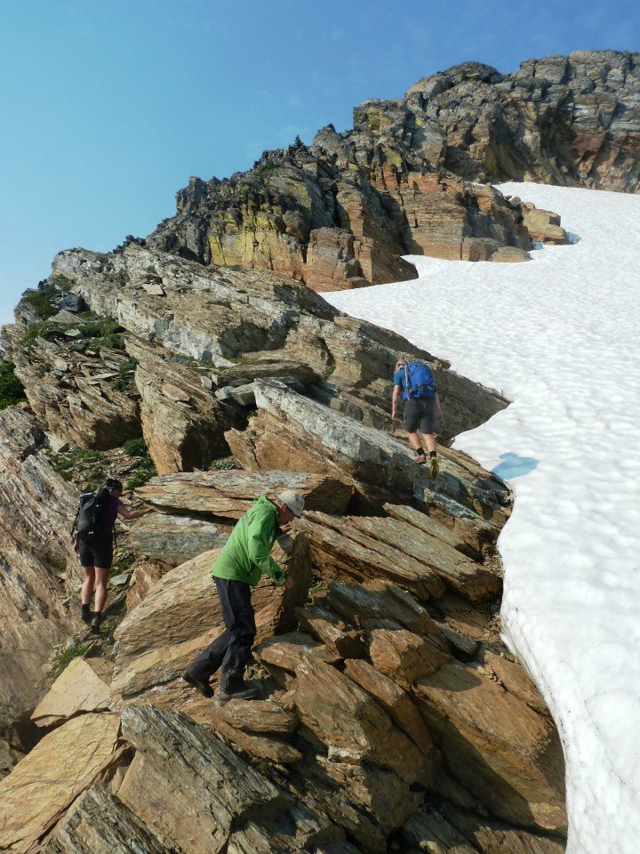
on pretty easy snow on the right hand side.
This bypass is best and safest if one has crampons and an ice axe. After this, the
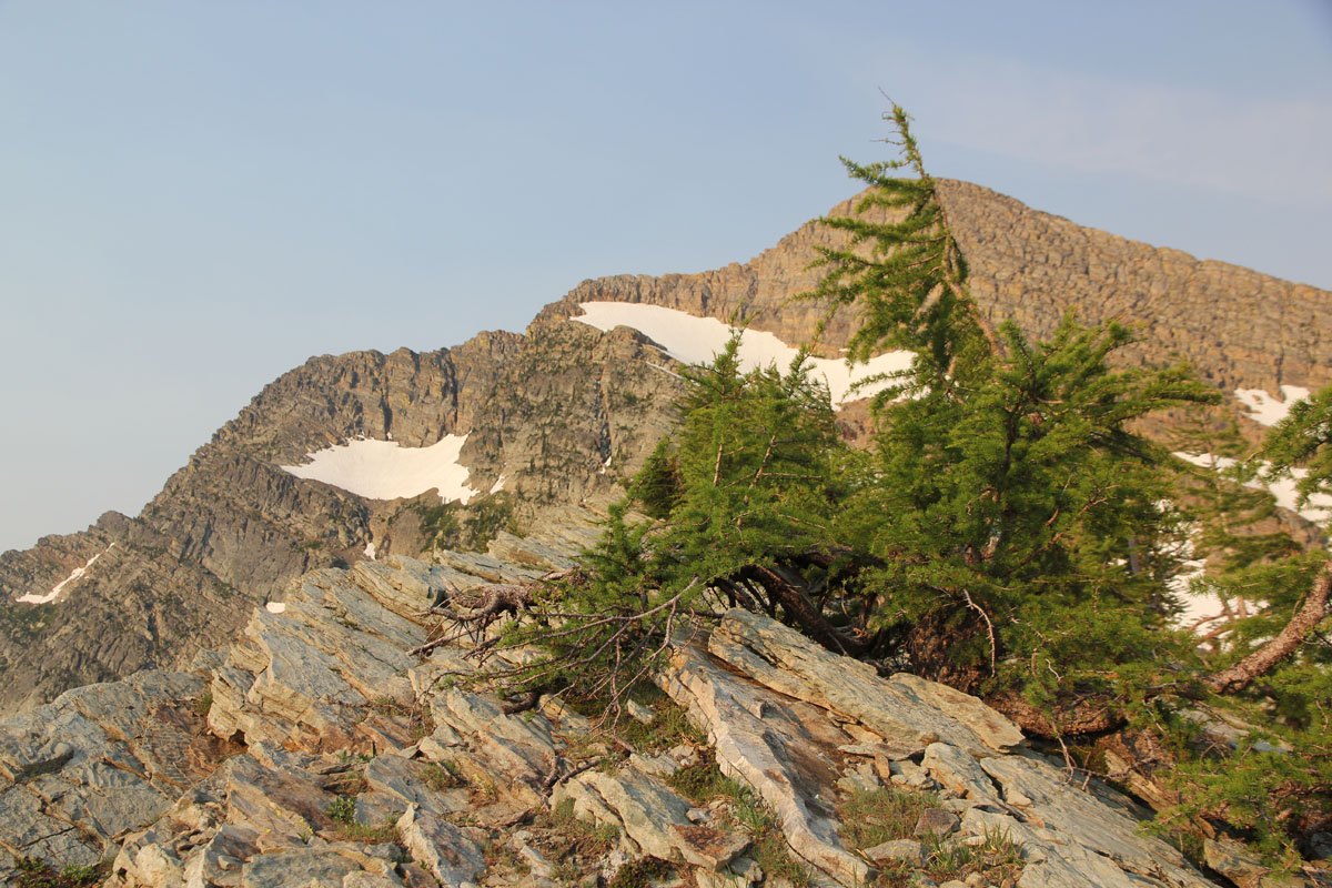
ridge turns right. There is a climbers trail that crosses on the left side
across to a col, then continues on the left side
of the summit ridge. The trick here is to stay pretty low, then climb right closer to the summit.
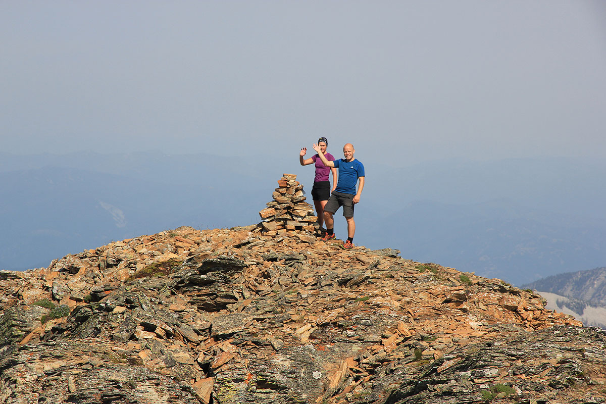
There are two summits, perhaps 50 meter apart. It seems like the first one is slightly higher,
but the cairn and summit register
is located at the second summit.
This part of the
route is mostly (YDS) class 2, but with a few sections of class 3 terrain.
Comments/Trip report:
We had agreed to drive across to Crazy Peak after climbing Snowshoe Peak. In this way we would catch up with
the schedule despite the need for a rest day yesterday. This drive is stipulated to 9 hours, an early start
for this climb was therefore very important. We were hiking at 0525, it was still dark, but everyone carried a good
torch light. Daylight came just as we ascended a steeper section of the trail right next to a waterfall.
We more or less followed some vague trails uphill and
avoided the extremely slippery grass.
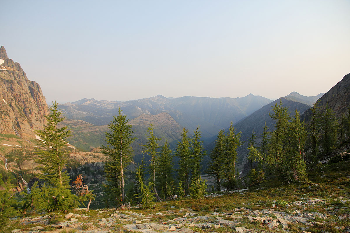
The weather is perfect and
the landscape likewise.
Another cause
of trouble was exceedingly agressive mosquitos. I climbed the lower slopes with several hundred of them in constant
circulation around me. The scrambling up to the main crest went well and the
climbing along the ridge was just
a lot of fun. The climbing seemed
easier than class 4 most of the way.
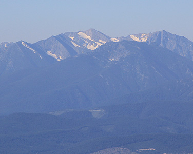
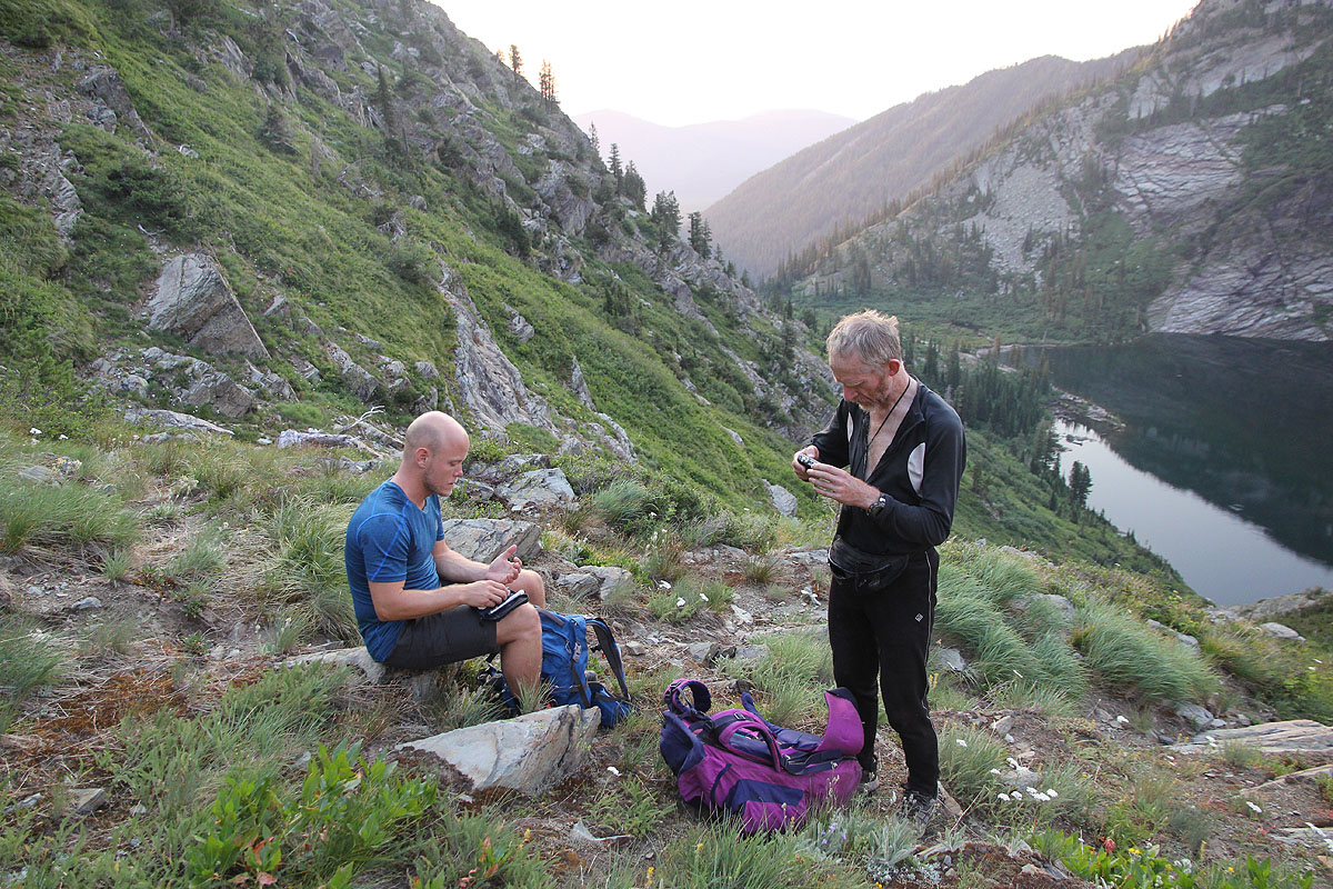
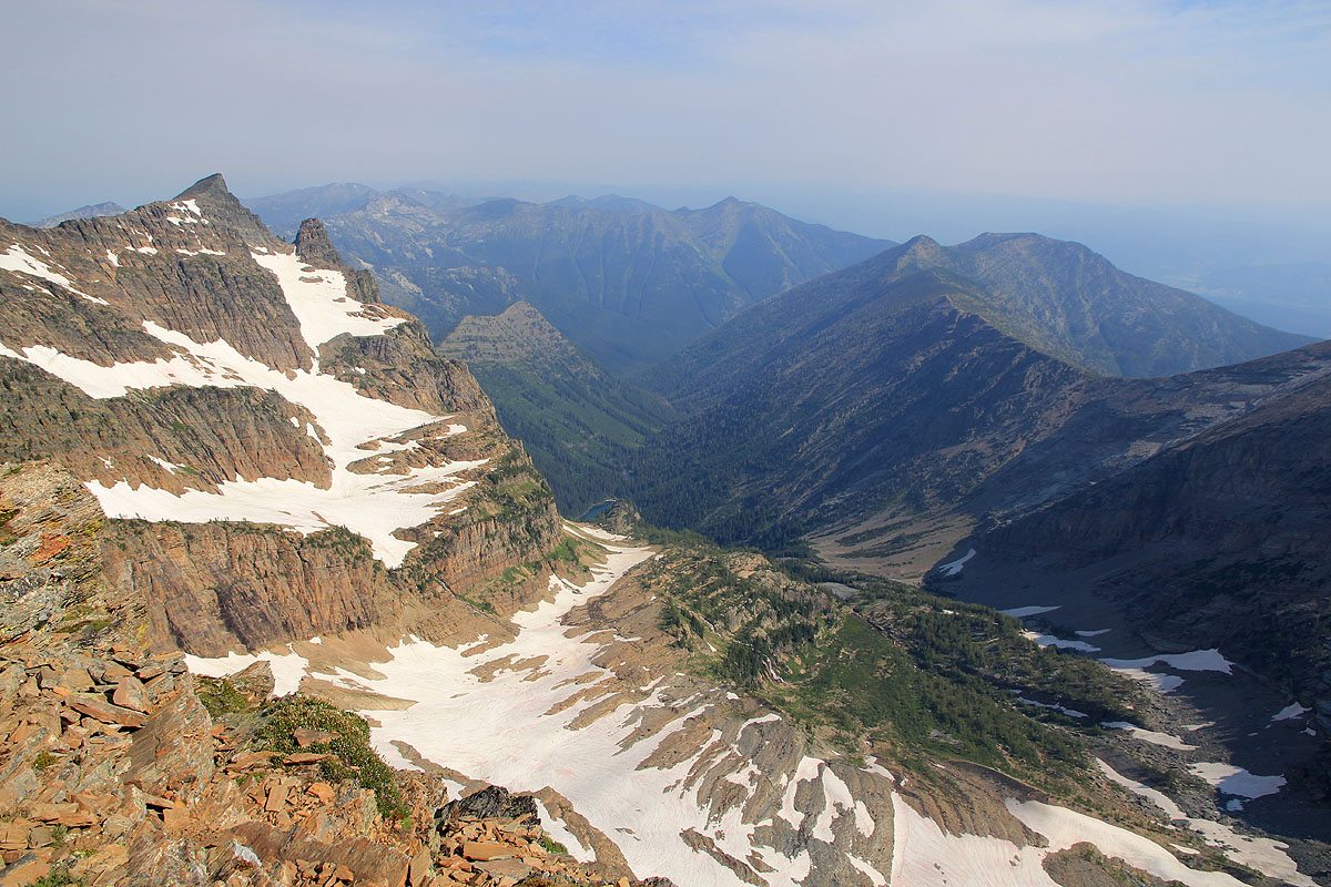
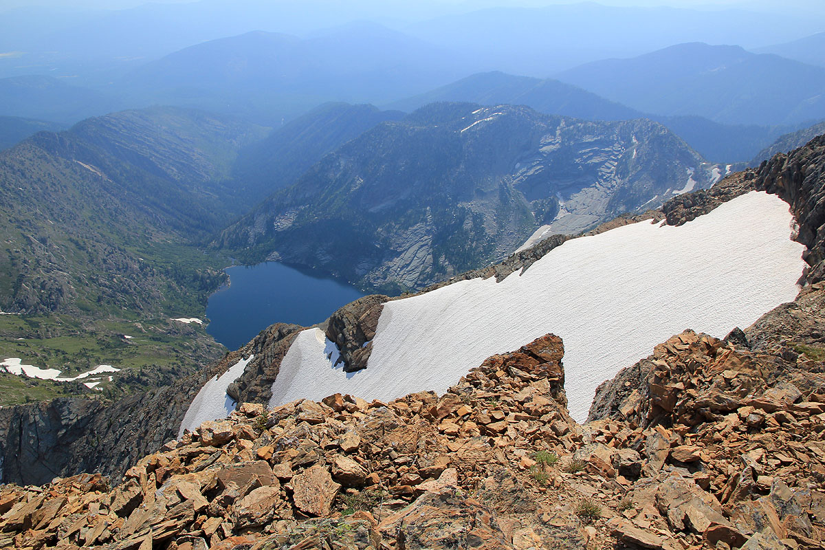
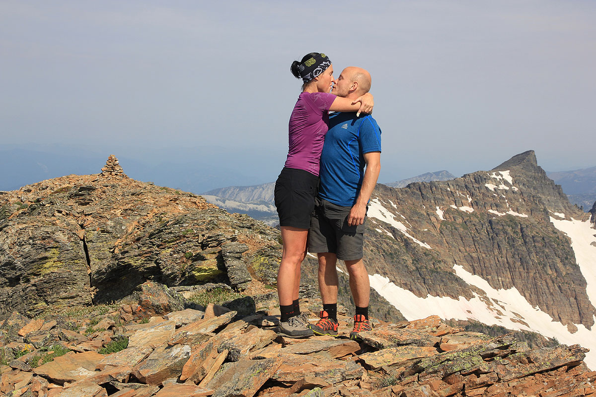
We arrived at the summit at 1030, beautiful weather and a very nice view across
to more rugged terrain.
Suddenly, Leigh Lake seemed quite some way below us.
Eirik and Melanie climbed
along the top ridge all
the way and arrived about 20 minutes later.
They seemed quite happy with the trip,
fun climbing at about the right level (no rope!) on good rock.
We spent 30 minutes at the top before descending along the same route that I had used on ascent.
We are back at the car by 1525, a 10 hour trip. Next follows a 9 hour drive in order to sleep at the
Crazy Peak trailhead tonight. Has anybody been sufficiently crazy to climb Snowshoe Peak and Crazy Peak
on consecutive days?