Location: North 47:14.963, East 009:20.601 (GPS at the summit)
Location: North-west of Lichtenstein in Switzerland
Difficulty: YDS class 2+
Climbed: September 1, 2008
Information:
How to get there:
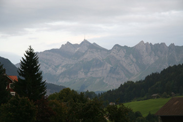
This mountain is located north-west of the small country of Lichtenstein. There is a gondola
cable way serving the very
summit. The base of the mountain (north side) is
called Schwägalp.
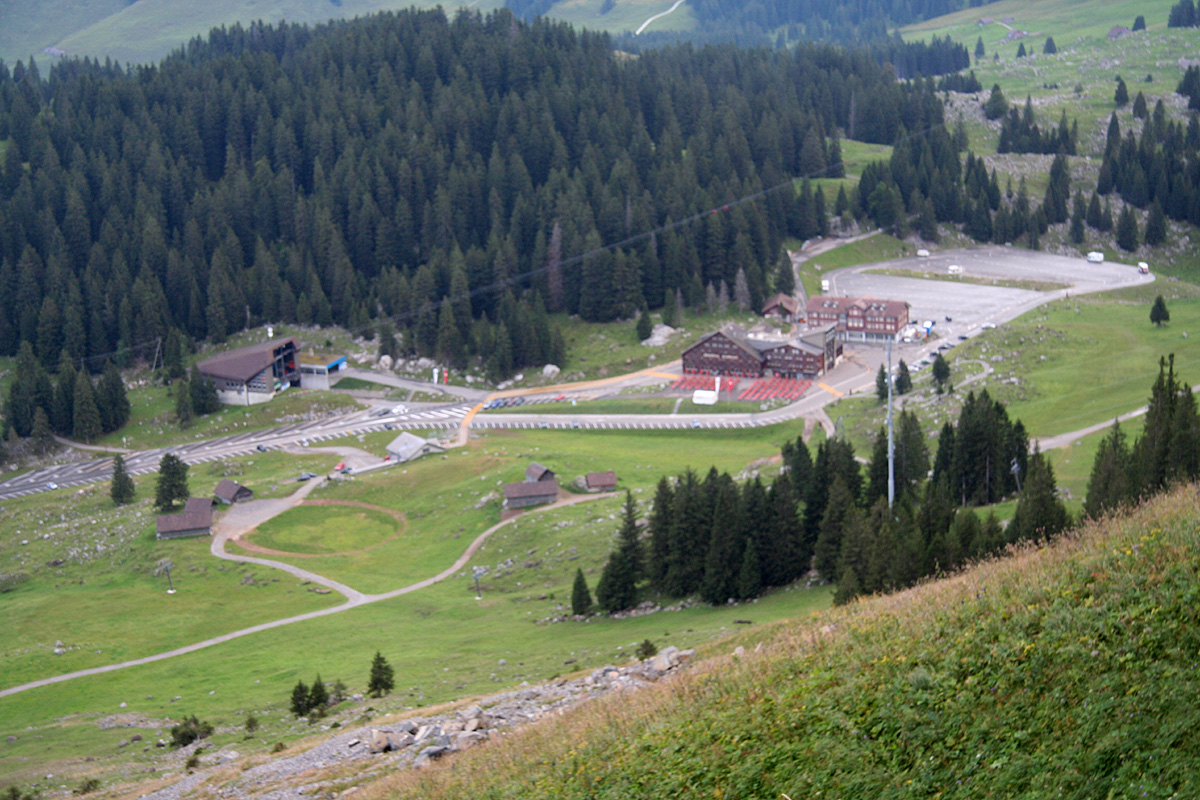
The Berghotel Schwägalp is located right there, the accommodation is reasonable and there is
free parking.
Schwägalp can be reached from Zürich by going south to Rapperswil, then continue on Hwy. 8
to Wattwil. Turn south (right) onto Hwy. 16 in Wattwil and drive to the small village called
Neu St. Johann. Here, make a left turn on a road with signs for St. Gallen. Drive about 10 kilometer,
you will see Säntis on your right hand side, a very clear paved road forks right and serves the
Schwägalp hotel as well as the gondola. Park here, this is the trailhead, location
N47:15.366, E009:19.222, elevation 1355 meter.
From the south, say the city of Chur, go north to Lichtenstein, then west to Hwy. 16 via Buchs. Continue
to Neu St. Johann and follow the directions above.
Route description:
This route is marked with the standard red and white paint on rocks.
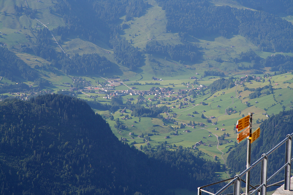
From the trailhead/parking by Berghotel Schwäbalp, follow the direction
of the sign, that is go right as you face the mountain. The correct way crosses some grass,
then runs right next to a couple of smaller buildings. The route then follows a small (walking) road
in the same direction until near another building where there is a new pole with clear signs.
The sign for Säntis as well as Tierwies points uphill at this point.
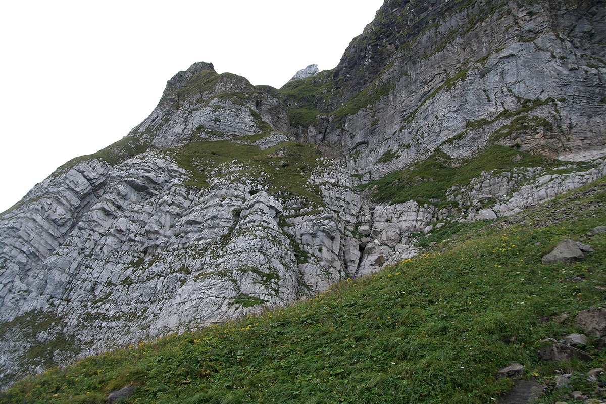
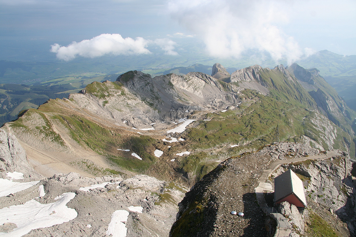
Follow the trail as it zig-zags uphill in order to approach the cliffs above you. Higher up, the
trail turns left and climbs the left ridge coming
down next to a ravine. The trail is quite steep
for a short section, with some exposure. Above this, the trail continues to gain elevation until
reaching a new cliff band. The route then runs horizontally to the left, immediately below the
vertical cliffs, until reaching a new big gully that comes down from above. Here, the trail again
climbs the right side of this gully then zig-zags left and climbs a
final ramp to reach the hut called Tierwies.
This hut is situated at a col
in the main ridge with a view both north and south.
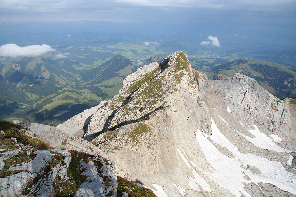
From this hut, the route runs more east across and between limestone cliffs to a place quite near one
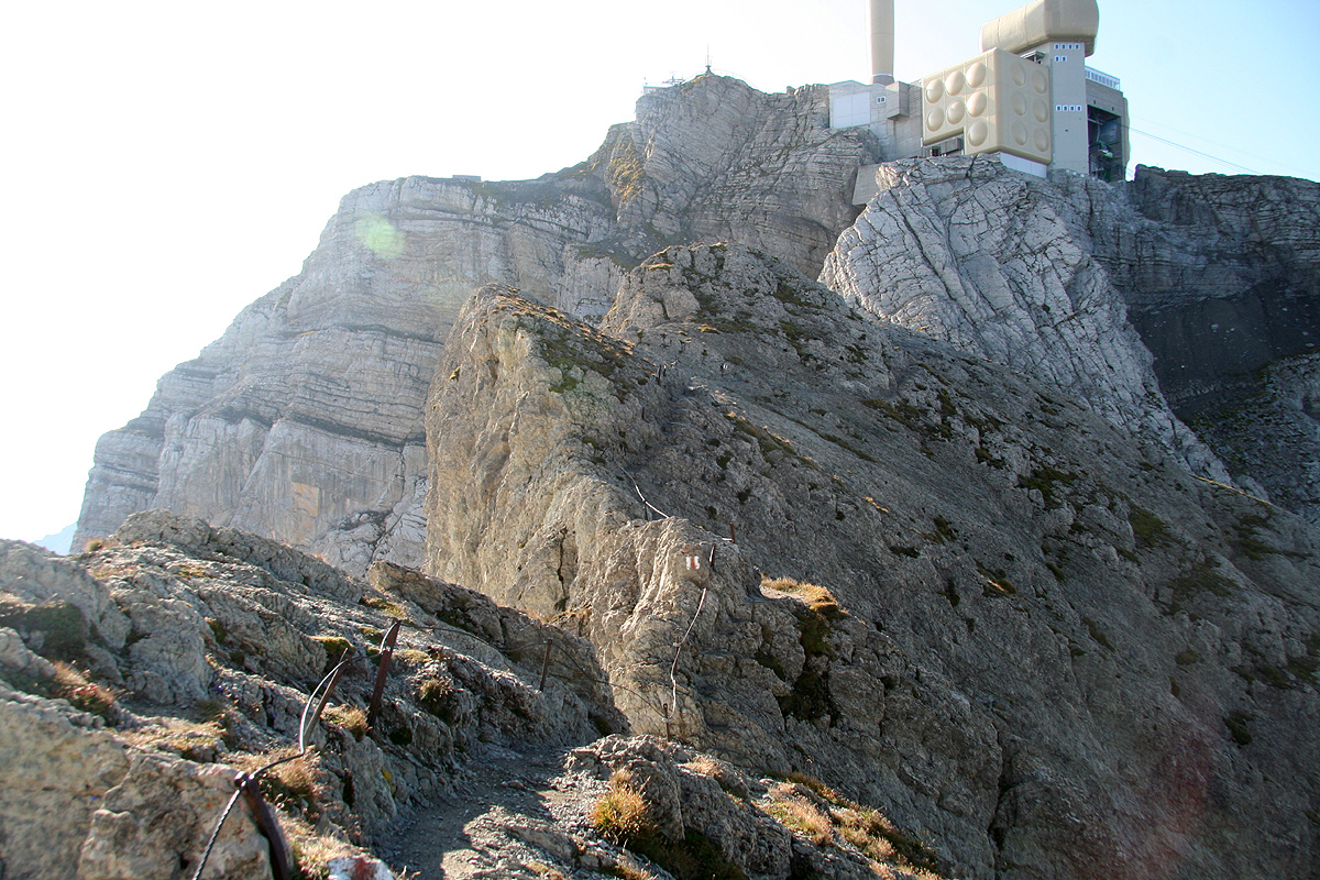
of the supporting towers for the gondola. The mountain is now steeply up on your right. The trail climbs
the slope in front of you in order to reach the (north) ridge coming down from Säntis. From here,
the trail is supported
by a cable most of the way as it follows the ridge, descends to a small notch, then
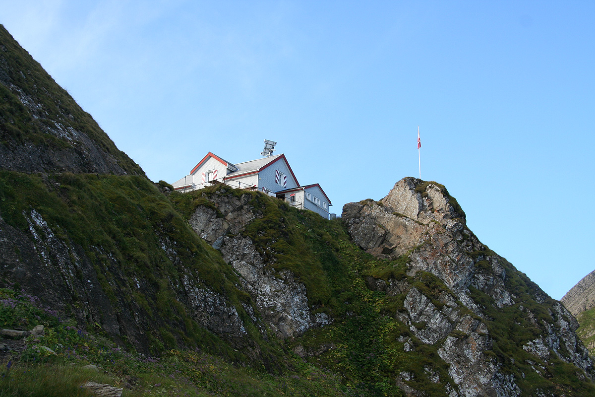
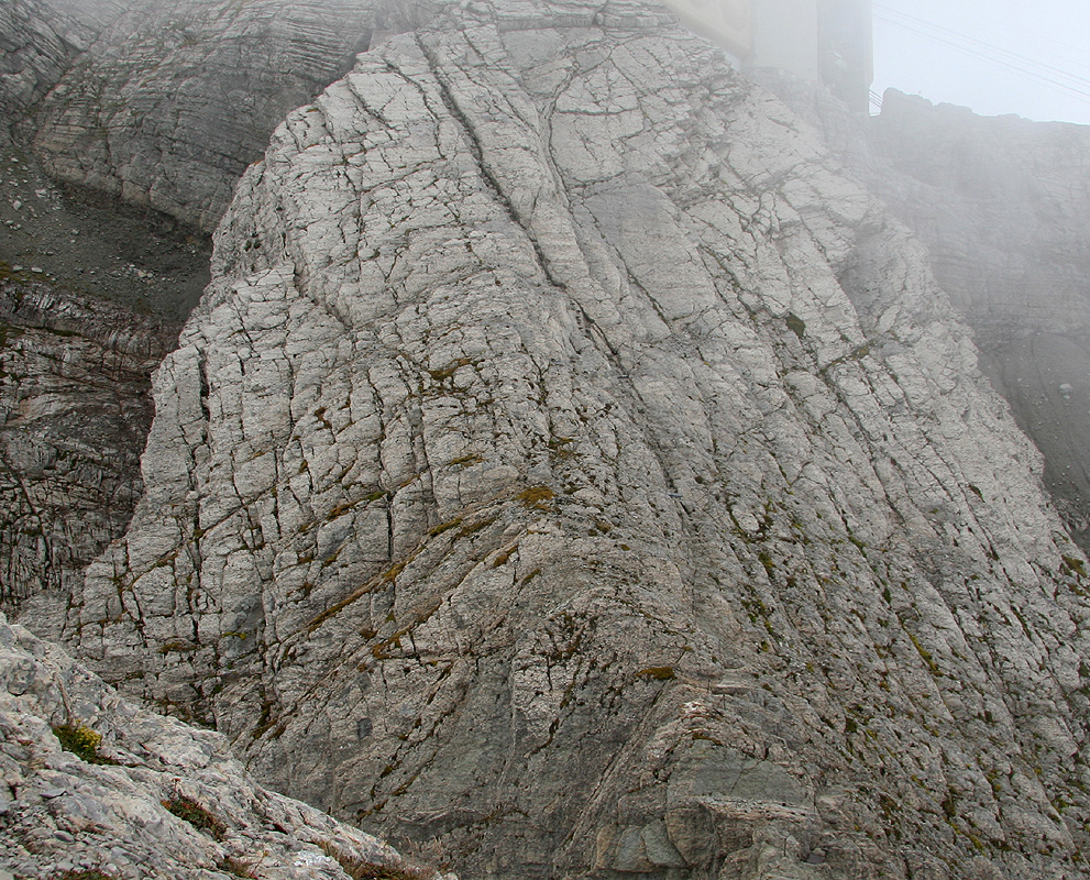
ascends more steeply up along a very distinct crack
in order to reach the concrete structure that
has been built on the summit.
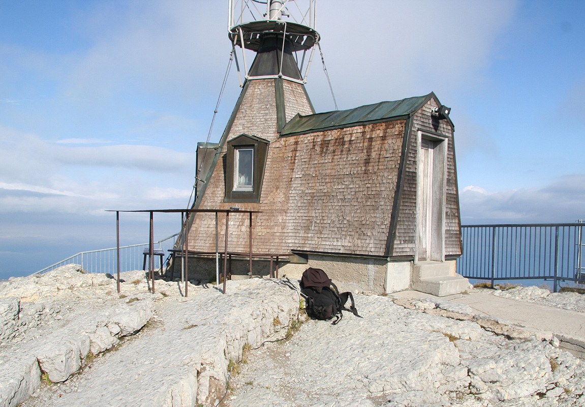
In fact, you enter a small tunnel at the very base of the building and the next part of the climb
involves navigating through doors and up stairs in order to locate the summit.
The summit rock is (fortunately)
visible near the very highest viewing platform.
Comments:
Having said goodbye to Andy and Rob after the nice climb of
Piz Kesch, I arrived at Schwäbalp well ahead of
dinner. The next morning, I had breakfast at 0715 and started hiking around 0730. The forecast
called for rain, however the sky looked pretty ok and I hoped to do at least part of the climb before
any bad weather.
I started up the hill and must admit that the terrain above looked pretty steep
for a trail. However, the path climbed a small ridge in quite a clever way, then proceeded
to wind its way ever higher. Soon, I arrived at the hut Tierwies, the time was 0845 and I had
already gained about 700 vertical meter. The weather was still very acceptable and a short break
was called for. Two guys with shotguns came out from the hut and descended along a trail to
the south. Today was September 1., perhaps some local hunting season just started? I continued along
the trail and before long reached the (last) mast supporting the gondola before its top station at
the mountain. The terrain looked steep, but obviously my trail would continue east, then access the
peak via its north ridge. As I reached this ridge,
I observed that the very last stretch followed
a narrow crack in rather steep terrain. This section was protected by a cable running from top
to bottom. Three guys just started descending. They had obviously taken the gondola up and wanted
to hike back down. These were the first people I saw on the hike. I quickly gained the top of
the ridge and entered into a small tunnel. A rather strange and unusual way to finish a summit climb,
navigating through tunnels, doors and steel spiraling stairs in order to find the summit.
I located the highest rock near a top viewing platform. the time was 0945 and there was still a bit
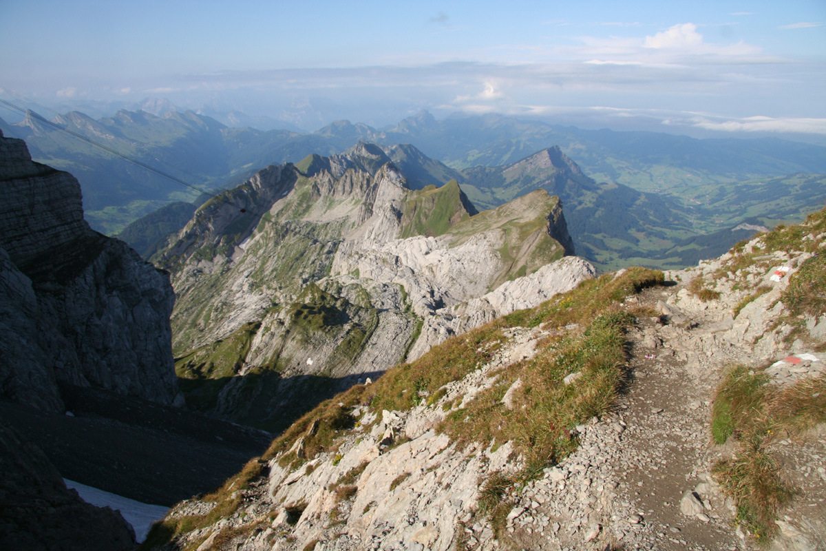
of sunshine mixed with clouds. I rested and walked around to view
the various valleys and ridges that
spread out below.
The long distance view from this peak is supposed to be famous, but there were way too
many clouds and only a short range view.
Leaving around 1000, I descended back down the same way. Before even reaching the horizontal part
of the north ridge, the summit was engulfed in clouds and hardly visible. Thus, my timing had been near
perfect. I realized that it might start raining any moment as I continued downhill. I was back at the
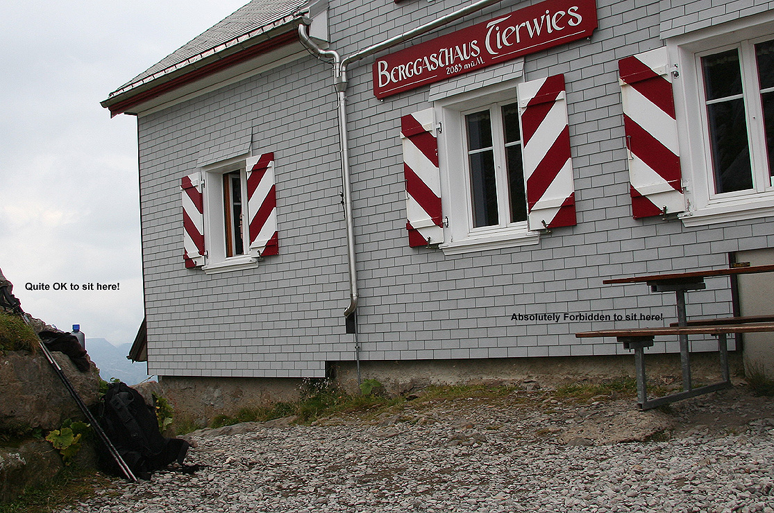
hut Tierwies by 1100 and decided to eat my two slices of bread. There were still nobody around on the
good sized terrasse that probabely could easily seat 40 people. I sat down at the end of one bench and
pulled out my food from my pocket. Immediately, the hut keeper came rushing and pointing, telling
me in a rather unfriendly voice that it was highly illegal to sit at the bench without buying food and
drink from the hut. Rather surprised by this interuption of a very peaceful day, I pointed to a nearby
rock only a few feet away and asked if it was ok to sit there instead. That, appearently, was totally ok.
I finished my small lunch while reflecting on the nature of human beings. No wonder that we do have
conflicts n the world if just sitting down at
an outside bench, completely alone, could stir such hostile emotions.
I left the hut at 1115 and completed the descent back down to my car by 1200. Just as I unlocked the car,
the first few drops of rain started falling. This was the end of a very nice three day trip to the
alps, all that remained was going back to Zürich and catch a flight back home.