Location: North 45:14.704, West 117:17.580 (GPS at the summit)
Difficulty: YDS class 2.
Climbed August 16. 2010
Information:
How to get there:
This mountain is named in honor of a Shoshone woman that travelled with the
Lewis and Clark expedition from South Dakota to the Pacific (and back). She
acted as an interpreter and guide and has become quite famous as part of early
American history.
Starting from Portland, Oregon, travel 260 miles east on Interstate 84 to the city
of La Grande. Exit in La Grande and take Hwy. 82 64 miles (north then east) to the
city of Enterprise.
Follow Hwy. 82 into Enterprise and make a right (still on 82) as you drive through
town. As you are about to leave town, Hwy. 82 curves left and in this curve you will
locate Hurricane Creek Road forking off to the right. Take this road and measure
from here. Continue tomile 5.1 where you fork right as the road changes to dirt. This
road is fine for ordinary cars. Continue to follow the road until it ends at mile 8.8.
There is a large parking here, this location is N45:18.700, W117:18.438, elevation
about 1535 meter.
Route description:
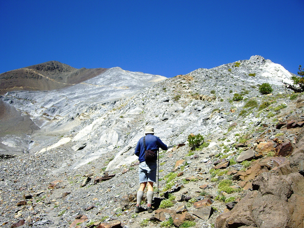
The trail heads out from the corner of the parking area going south along the west side
of the Hurricane Creek. Soon, you will
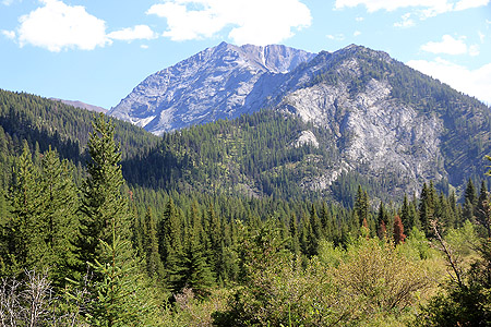
see the Sacajawea up in front,its highest summit
located slightly right on what appears to be the highest ridge. Your focus should now be
to find the trail that branches left from this main trail. Proceed about 2.7 kilometer
along the main trail. You cross a large open area, before the trail again enters a forest
section. At location N45:17.192, W117:18.423 there is a false trail heading left, ignore
this one. Proceed to location N45:17.145, W117:18.430, at this point a fairly small trail
forks left across a small grassy area. This is the Thorp Creek Trail, it is essential that
you locate this trail. The trail first takes you a bit closer to the river, then runs
parallel (upstream) with the river at some distance from the creek. Subsequently, the
trail hits the creek at a location where two logs
provide an easy crossing. On the other
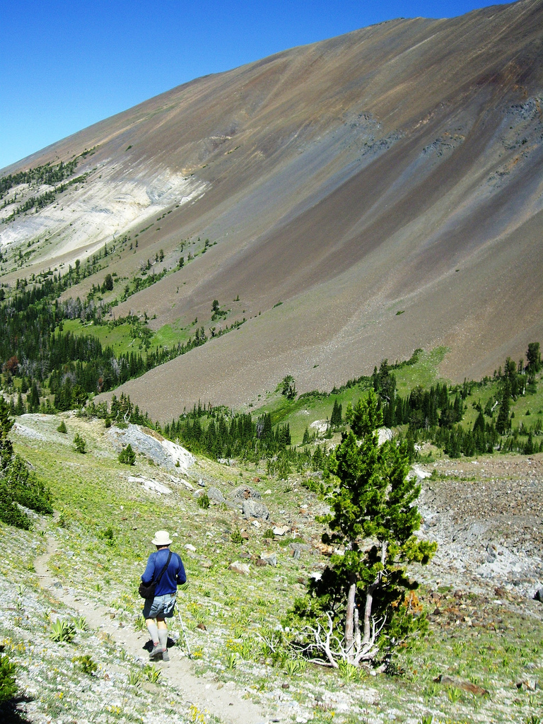
side of Hurricane Creek, the trail soon enters a meadow area where it gradually fades out.
Cross a small (possibly dry) creekbed, then head sort of diagonally uphill (it is fairly flat
here) and aim for location N45:17.010, W117:18.295 where the trail again is clear and easy
to follow. (If you do not recover the trail on the far side of this
meadow area, then do use your GPS, it is important to find this trail.)
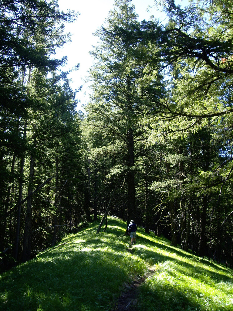
The trail will take you to a new (smaller) creek, Twin Creek, cross it and recover the trail at the
opposite side, typically a bit further upstream. Soon thereafter, the trail will climb steeply up
a ridge and eventually gain its top. Continue a short
stretch on the very top ridge with nice grass,
then follow the trail as it ventures back onto the right (west) side of the main ridge line.
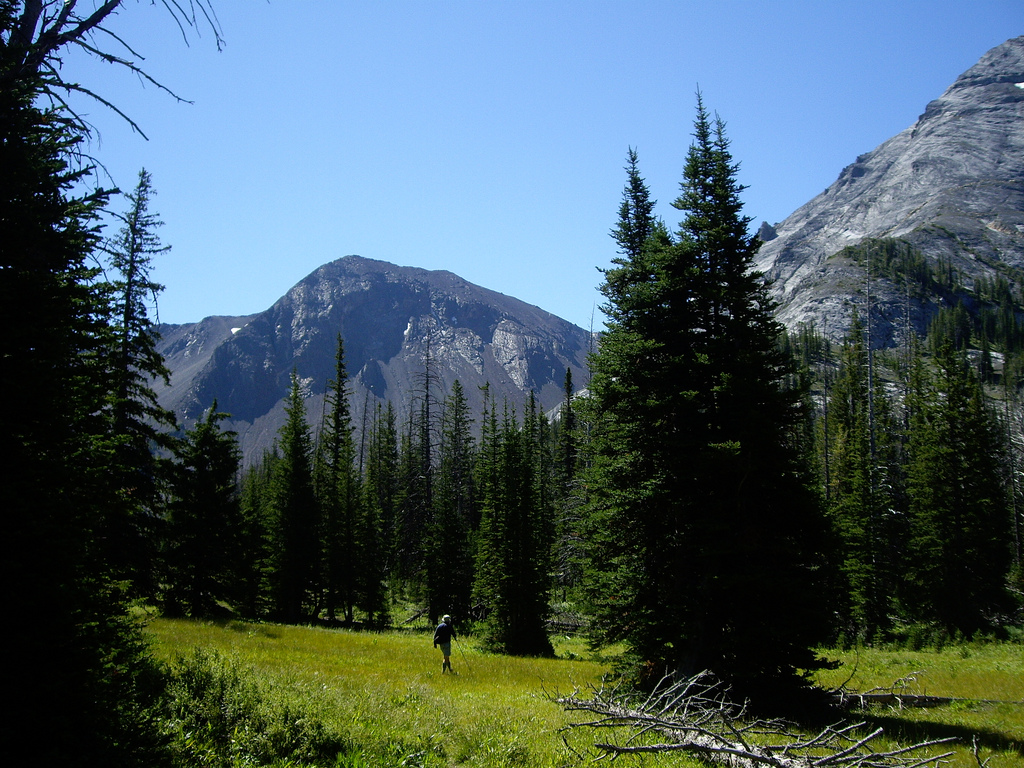
You keep on climbing as the trail traverses before leveling off and descends (very slightly) into
a very nice alpine valley
having a flat valley floor carpeted
with grass and alpine flowers.
Keep heading into this valley aiming for its upper end.
You hike parallel to the small creek before
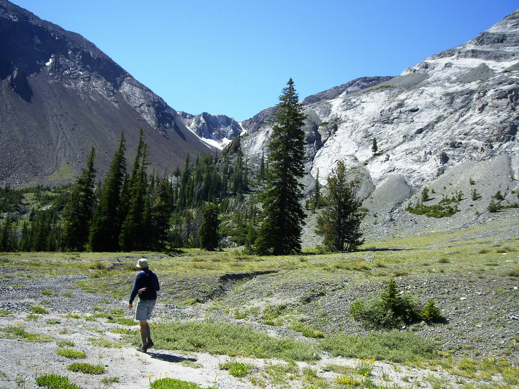
eventually crossing it at around 2300 meter. Finally, ascend a short, loose slope to gain a small,
local ridge at location N45:14.890, W117:16.626, elevation about 2325 meter. From here, turn more
uphill (right), then further into the narrow valley between Sacajawea and the slope going up on the
east side. You should pick up a pretty clear trail again that will lead you into the more narrow
section and partially around the rocks that constitute the very lower base of the ridge coming down
from Sacajawea.
Just as you turn the corner, a wider alpine bowl opens up in front of you and the climbers trail
turns further right and climbs the rocky ridge. From here, the trail
follows the ridge upwards, climbing
more steeply. The trail may be hard to see in a few places, but generally, it is easy to follow, staying
mainly a bit on the left side of the ridge crest. Gradually, this trail gains a pretty distinct subpeak
that forms what is the end of a summit ridge. Turn more left and follow this top ridge towards the
summit. There is a small dip in one place, then a final uphill in order to gain the highest summit point.
Comments:
After a great trip to the Devils, we drove south and planned to get across
Hell's canyon, cross the Snake river and get directly to Enterprise via the small village named Joseph.
However, where we needed to turn right and leave Hwy. 86, a barrier had been put across the road with big
signs saying "Road Closed". This was an unforseen complication and led to a considerable detour following
Hwy. 86 all the way to Baker where it hits Interstate 84. We drove to La Grande and checked into
the local Travellodge for two nights. Our Ford Explorer had started asking "Oil Change Soon",
I decided to ask the motel to make a reservation at the local Ford dealer for an oil change in the morning
when we planned to check out.
Driving to Enterprise, we discussed how long time this hike could possibly take. We believed that this
was rather long climb to be done in one day. Rob had carefully measured the trip to exceed 20 miles
(32 kilometer). However, as we arrived at the trailhead, we discovered a discrepancy between the
distance on the map to the Thorp creek trail fork and the distance described in a trip report that we
had read. A closer inspection of the map revealed that the distance between map lines was one
kilometer, not one mile as previously assumed. Consequently, our hike shrunk from about 32 kilometer
to only 20 kilometer!
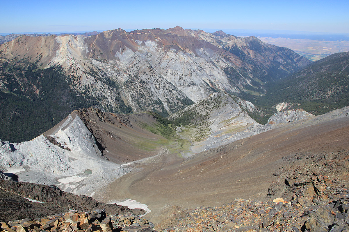
We left around 0900, it was a very nice hike with changing scenery. As we reached the upper
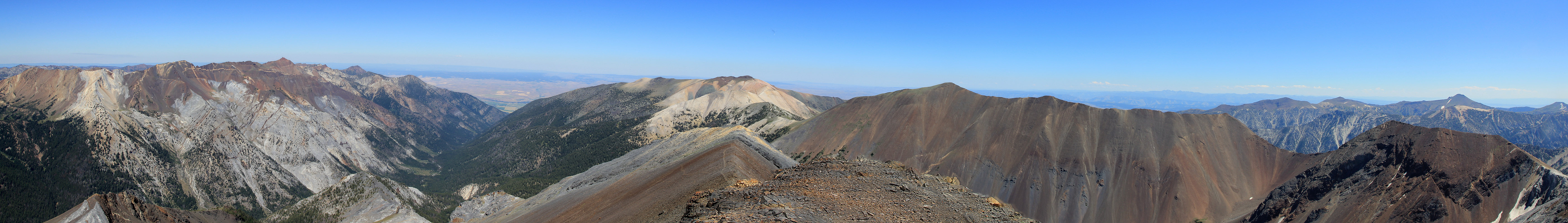
alpine valley the landscape took on exceptional qualities, alpine flowers and a green carpet with
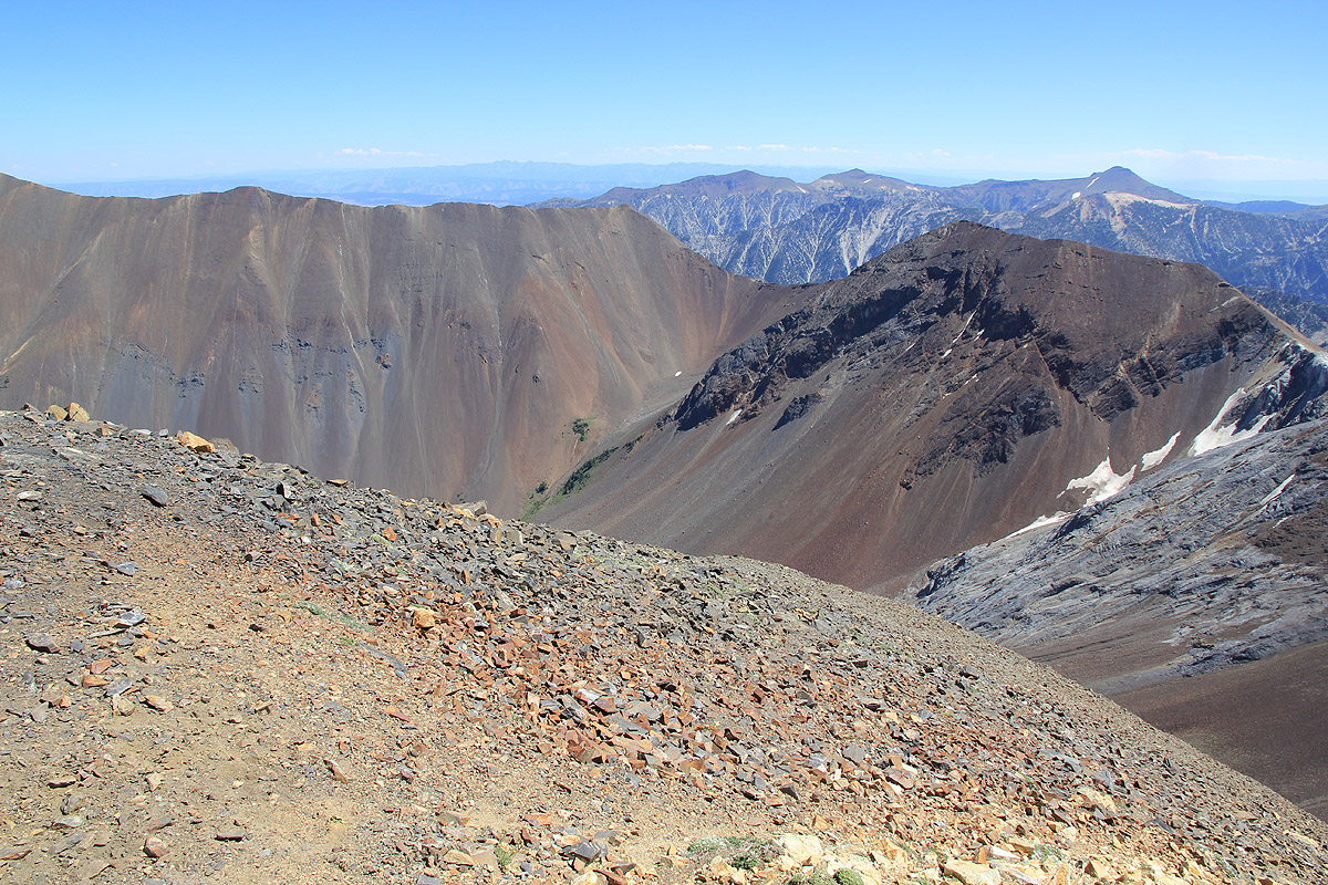
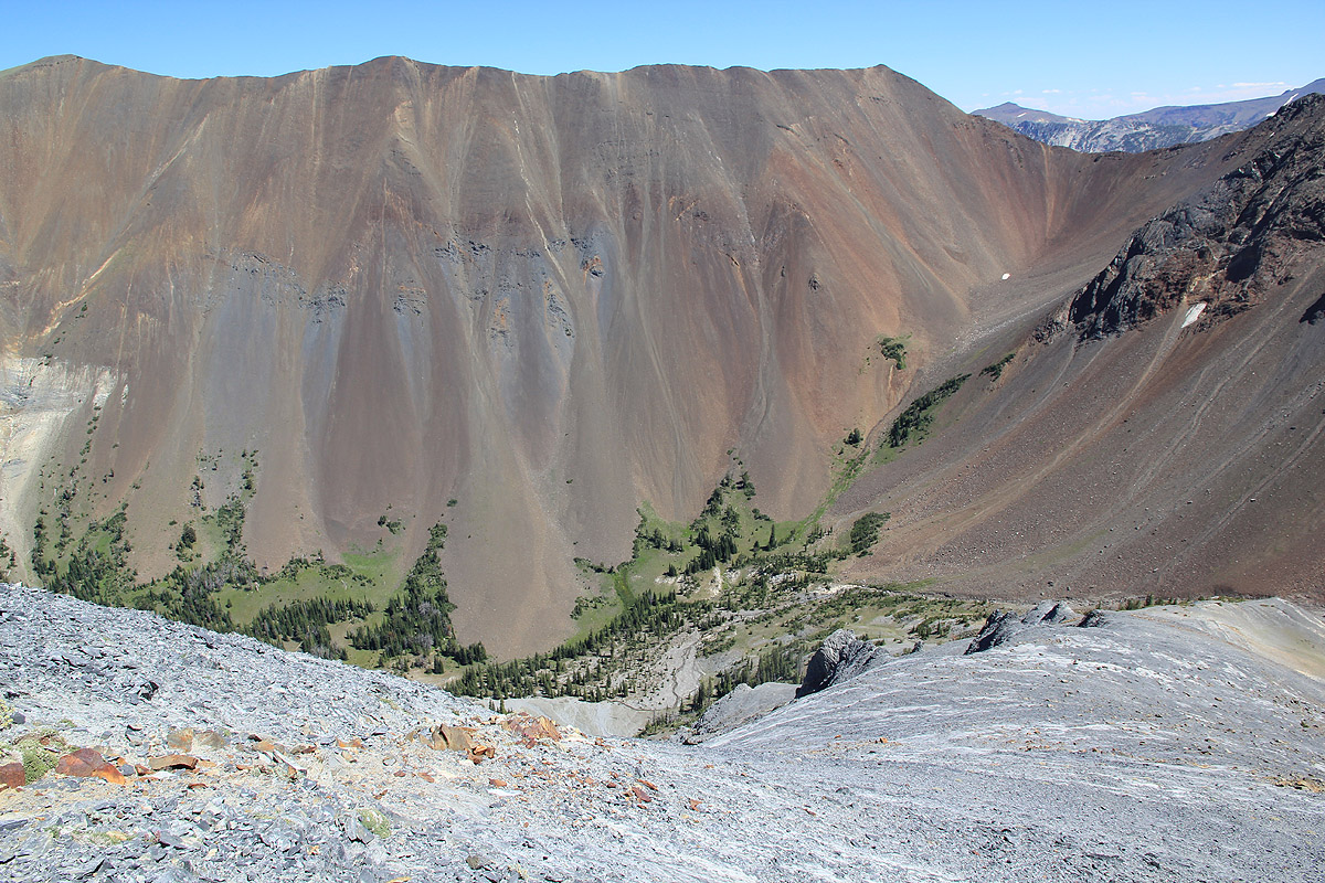
a the small creek running through it. The mountain slope (on our right) having almost no
vegetation and a bright grey color. On the opposite side, steep slopes in a bright red color.
We took a brief rest at the very end of the valley, the time was 1115 and the summit seemed close,
a bit less than 700 vertical meter above us.
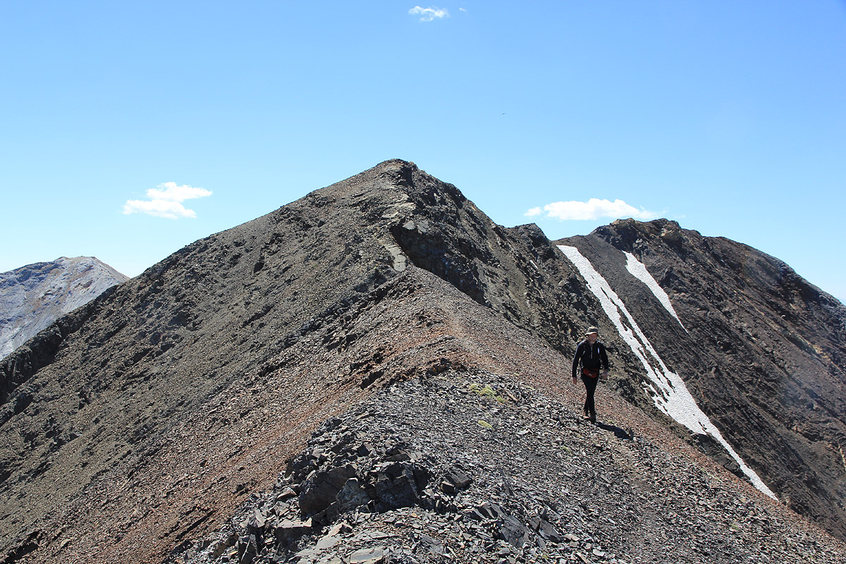
Somewhat to our surprise, we discovered the small, but pretty nice trail that continued up the
ridge and essentially all the way to the summit. One has to look carefully in a few spots, but
overall this trail is certainly helpful and makes the ascent rather pleasant. Arriving at the
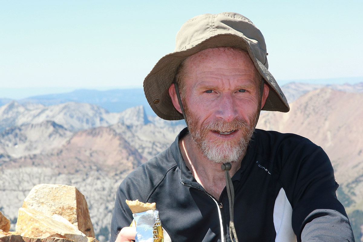
summit by 1230, we knew that this peak was easily doable as a single day hike. The weather was
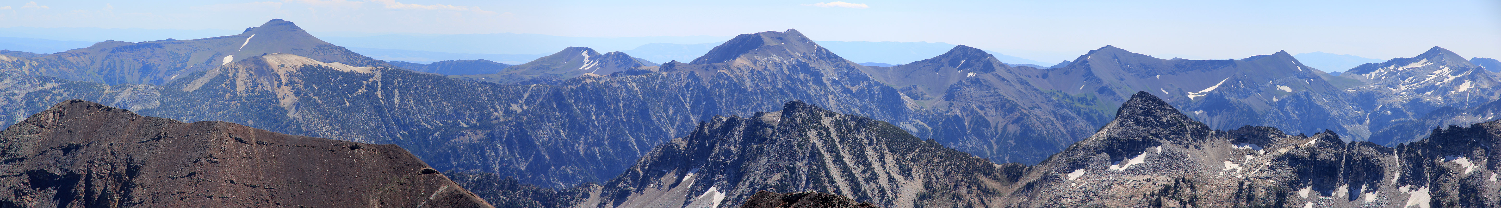
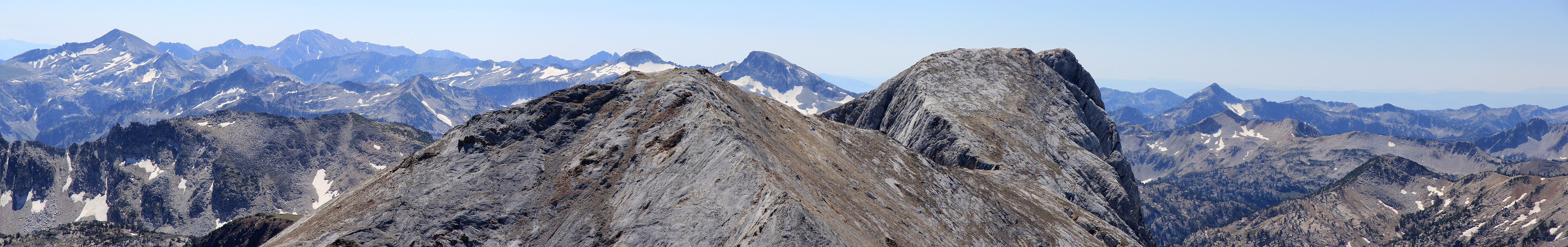
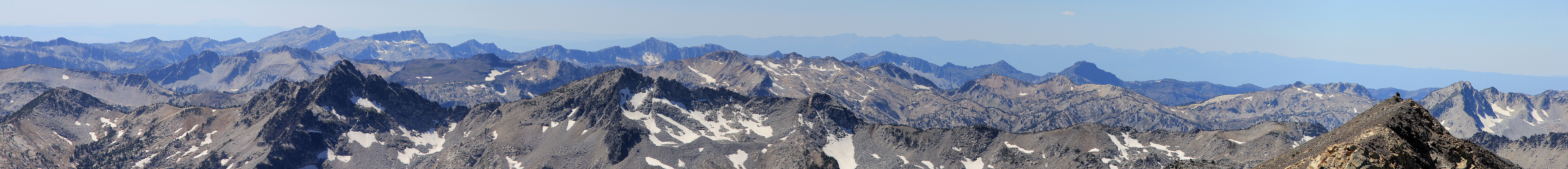
just gorgeous and the sunshine felt warm. We gave the continuation of the ridge across to
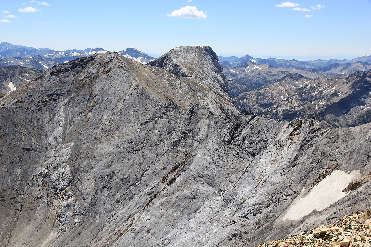
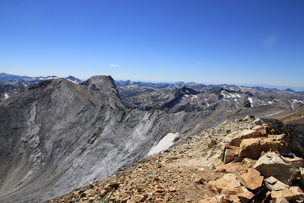
Matterhorn a careful look, no particular difficulties as far as we could judge it from here.
The red slopes across our alpine meadow continued to set its trademark on the views. Far east,
we could see the HE/She Devils from yesterday, they looked distant from here. We signed the
summit register and noted that quite a few people had been here recently. Heading down at
1300, we knew
that the return hike would be pretty easy.
Back at the car by 1530, then
a pretty drive back to La Grande where a delicious (and inexpensive!) Mexican dinner concluded
a very memorable day to a fine peak that seemed more isolated than the time it took to
climb it. A peak and a landscape characterized by a superb display of chocolate colors, all shades of
red, gray and brown.
The next day, we changed oil on the truck (amazingly good service, safety check, tire rotation,
full car wash, and a total cost of US dollar 30.-), then headed west towards
South Sister.
See also the nice picture story posted by Rob (some of his pictures are also in this report).
Resources:
Images
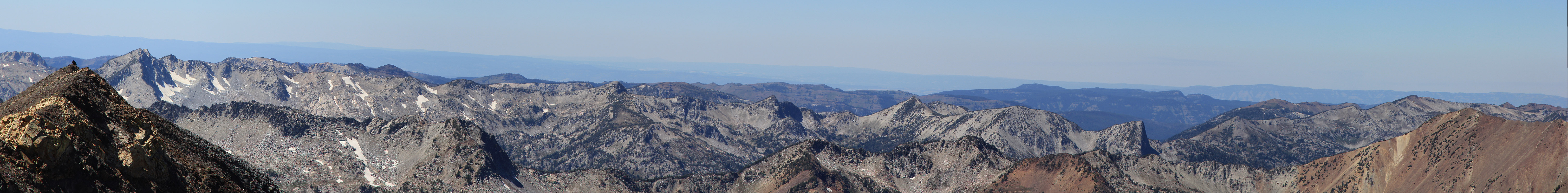
Summit view, we look all the way back towards the trailhead.