Location: North 46:41.143, East 013:08.801 (GPS at the summit)
Difficulty: YDS class 3
Climbed September 23. 2007
Information:
How to get there:
This mountain is located west of the city Villach in Austria, near the
Italian border. More precisely, the mountain is the highest in the area
south of Drautal and north of Gailtal, when staying east of Hwy. 110.
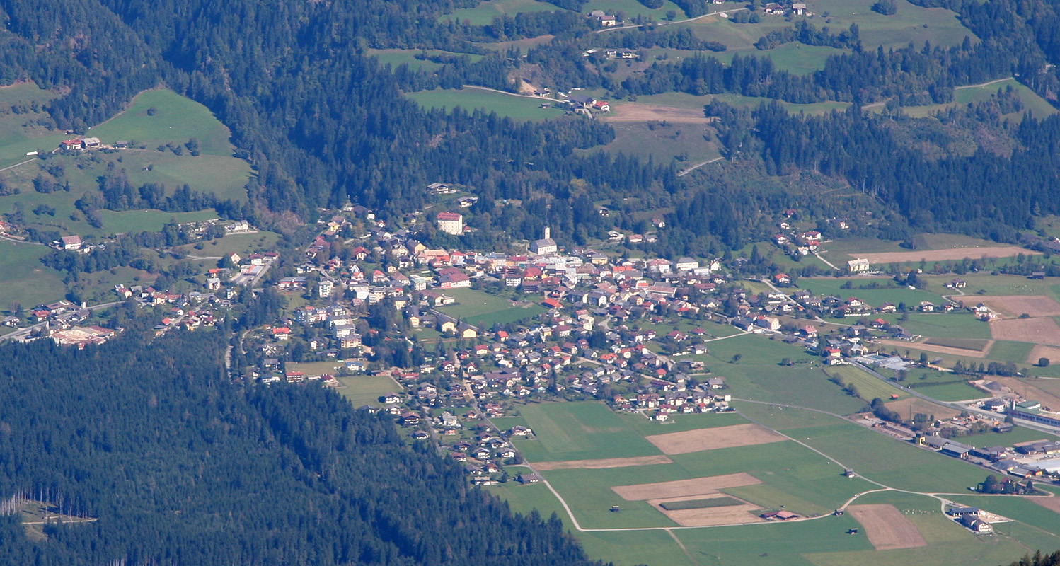
The local village is Grafendorf.
I stayed at the nice hotel Lenz in the next village Gundersheim.
(Landhof Lenz Hotel, 9634 Gundersheim 38, phone +43-(0)4718-3370.)
Coming to Kötschach, where Hwy. 111 and Hwy 110 intersect, go east
along Hwy. 111 9.1 kilometer. You have then passed through Dellach, and
entered the small village of Grafendorf. Pay attention to the church in Graftendorf,
just as you pass the small road (going left) that serves the church, your left turn
will be the next possible road. The turn (left) is just before Hwy. 111 crosses a small
bridge. Look for a sign on this road saying Reisskofelbad. If you arrive from the east on
Hwy. 111, then note when you pass through the village of Gundersheim, again pay attention
to the next church and turn right on the road immediately after crossing a small bridge.
There is a sign saying Reisskofelbad. Measure from this turnoff.
The road is pretty straight in the beginning. At kilometer 0.4, continue straight ahead.
At kilometer 0.7, stay right. At kilometer 2.2, turn right. There is another sign saying
Reisskofelbad here. At kilometer 3.2, make a sharp left at a T-junction. At kilometer 3.3,
the paved road ends, but a quite nice dirt road continues. At kilometer 4.1, go right across
a riverbed (hopefully almost dry!), and continue to kilometer 5.3 where you keep right.
At kilometer 8.2, there is a cattleguard and a small (flexible) barrier, drive slowly past it and
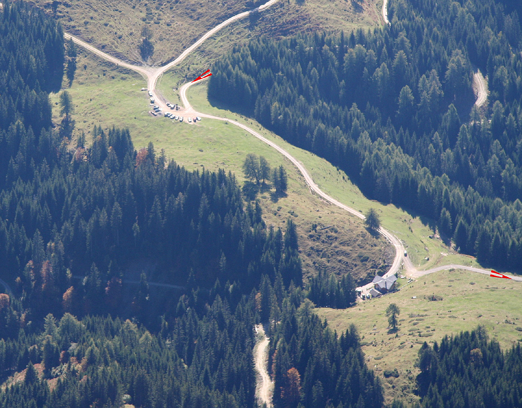
it will swing aside. At kilometer 8.7, you arrive at a saddle and roadfork. There is parking right
there. This is the trailhead, park your car.
This location is N46:40.321, E013:09.492, elevation 1511 meter.
Note: This road was not marked on my (brand new!) map (WK-223).
Rather, a road starting in
the village of Reisach seemed to be the road one needed. I explored this the day before, but
was eventually informed that this road was blocked by timber and could not be used. The lady then
told me about the "Reisskofelbad road" and the fact that it would deliver you exactly to
the proper starting point.
Route description:
From the trailhead, head slightly downhill along the road that comes up from the left, relative to
where you came driving.
There are signs for route 235, Reisskofel. Shortly, you arrive at the small
hut called Gregorihütte, continue along the road, now gently uphill. Relatively soon, just as the
road makes its first clear curve to the right, the trail goes off left into the forest. There is
also a yellow sign here saying route 235, Reisskofel.
The trail immediately heads steeply uphill among the big trees. It follows a ridge that naturally
climbs high on the mountain from the general trailhead area. After about 30 minutes, the forest opens
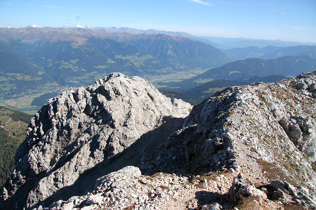
up somewhat and you can see the slopes uphill and to your right. The trail shall gain the main east
ridge of Reisskofel just west of Kleine Reisskofel, however, in order to achieve this, it must first go
as high as possible. There is a marked variation of
the route that climbs more directly to the
main summit ridge, however, this is likely a bit steeper. The normal route traverses
to Kleine Reisskofel, and this is described here.
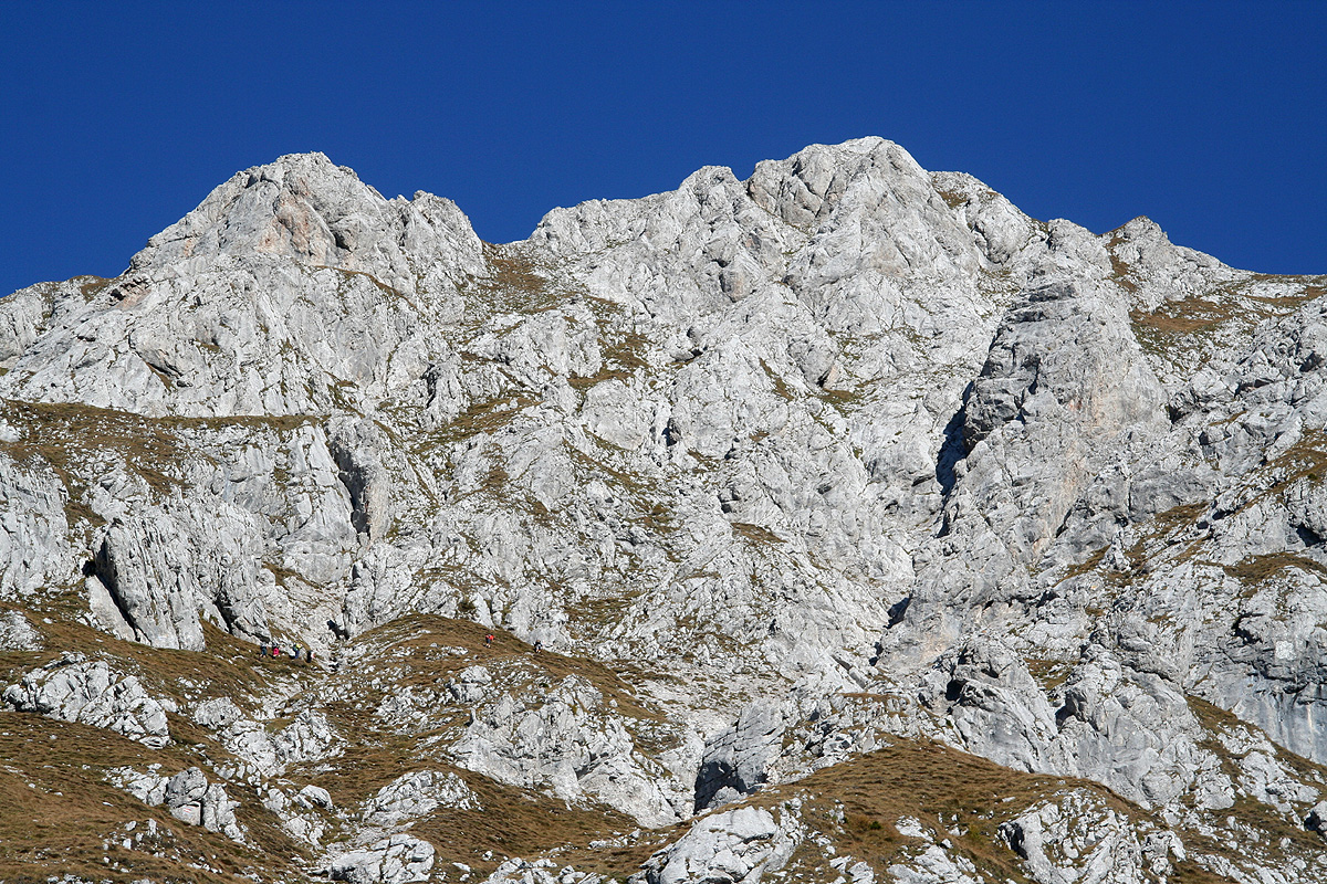
Eventually, the trail tops out, there is a very ugly ravine on your left. Traversing right, the trail
crosses the upper end of several gullies that would be harder to cross further down. The trail runs a bit
up and down, but mainly horizontally to the right. It seems like there is only one possible "easy" path
and that is exactly where the trail goes.
There are a couple of scrambling sections (YDS class 2+), some of
which are equipped with bolted cables. Under good conditions, these are really not needed. Finally, you
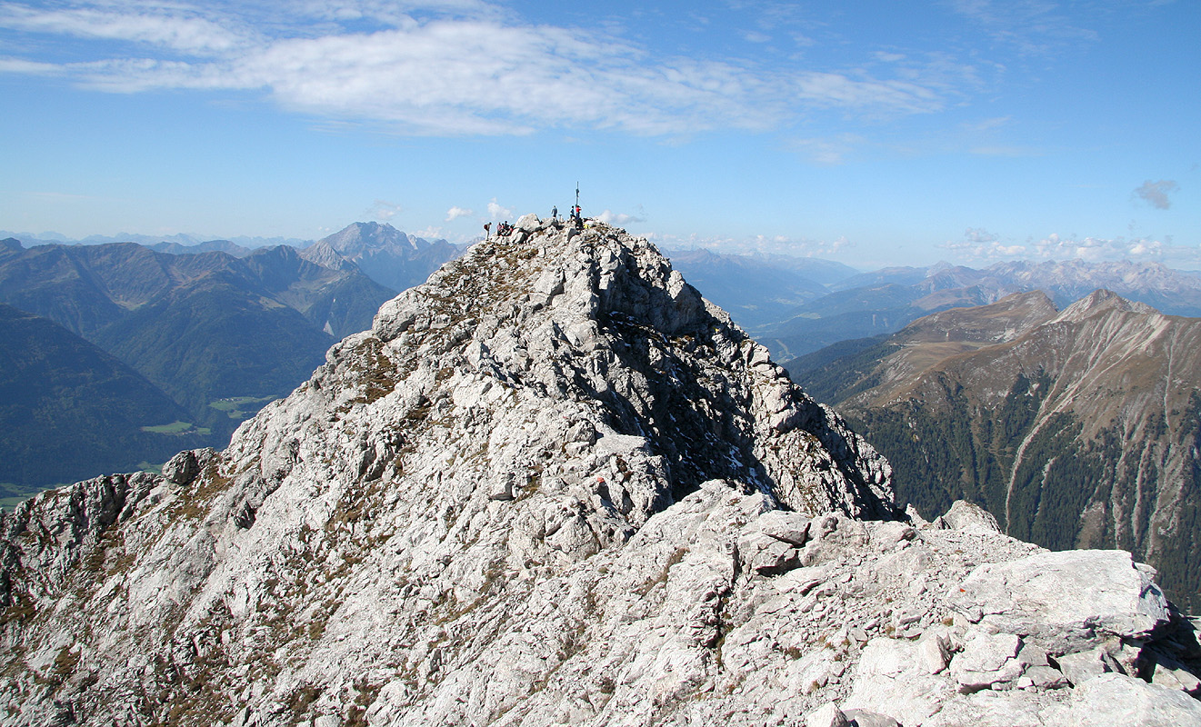
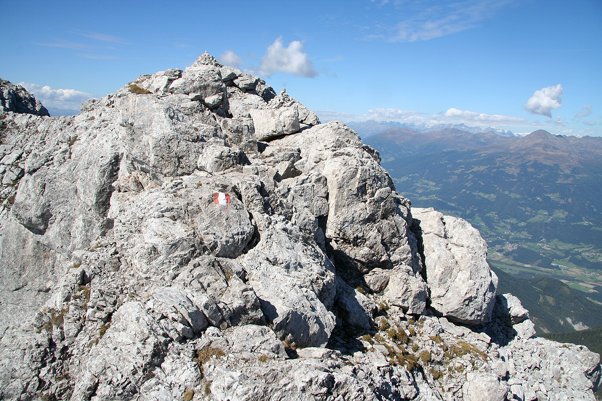
will see the last traverse up to the col, just below Kleiner Reisskofel. This small top has its own
summit cross. Arriving at this col, you notice that it is only one meter wide. There are trail signs with several
routes here.
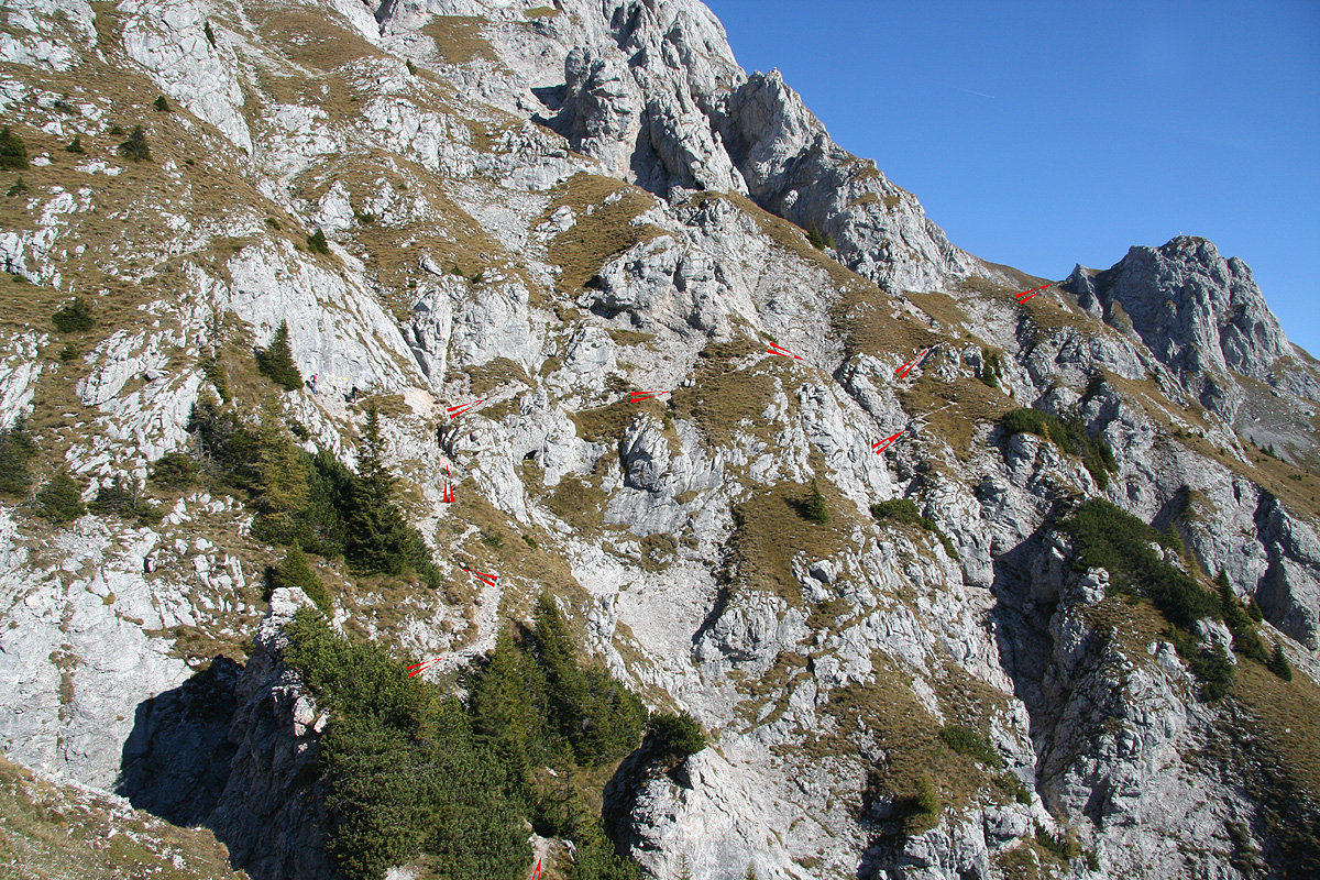
Continue left, first along the ridge, then into the left side. The trail now climbs partly in a couple of
gullies to a new and higher col on the main east ridge of Reisskofel. Be careful in order to avoid releasing
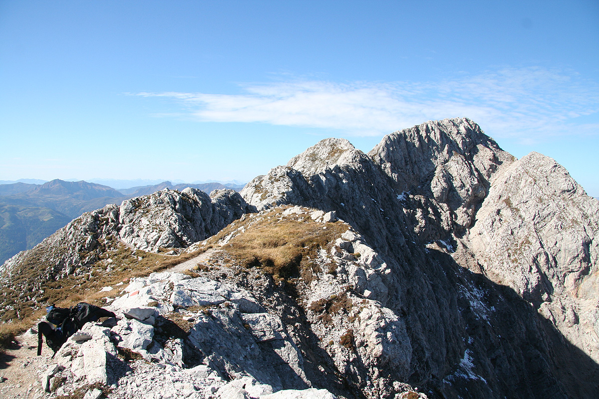
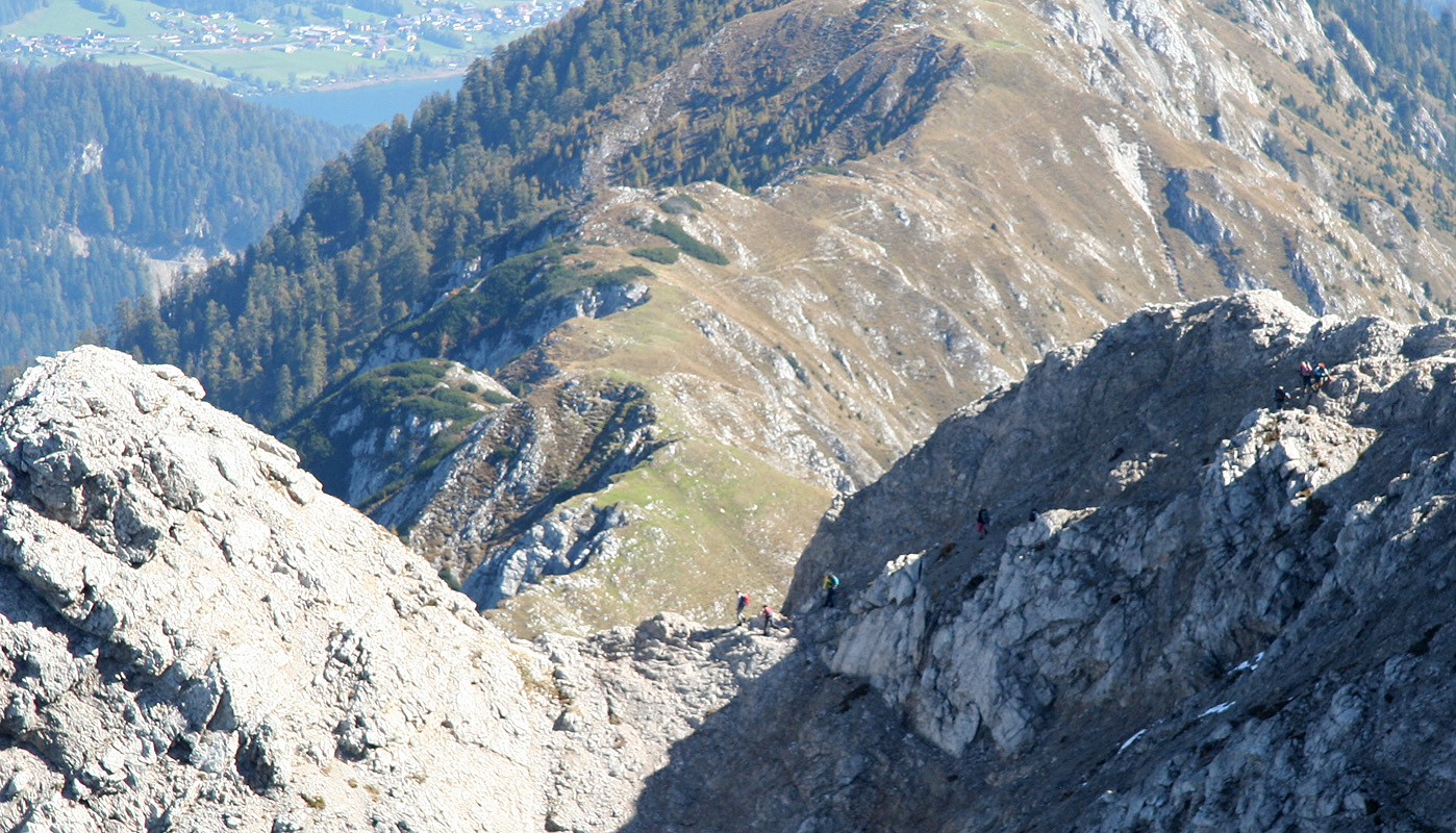
rocks that might roll to climbers below you. This scramble is quite easy, low (YDS) class 3 terrain.
From this col, you first traverse left along a pretty sharp ridge. It is best to walk below this
ridge and hold onto rocks near the top. The route is well marked and continues on
an ascending traverse
until it regains the top of the main east ridge. (The small col can be seen where the sun and shaddow meet.
From this point, the route runs more or less
along the very top of the east ridge. This section is
delightful! Excellent views, the exposure is significant to your right side, but also the left slope
is sometimes quite steep. The ridge is pretty flat on the top,
often only about one meter wide.
The route will take you across a few small tops as well as descend a bit into one lower col. You can see
the main summit along most of this way.
Finally, you arrive at the last pitch. The trail here contours around
on the right side before ascending the last few meter.
Comments:
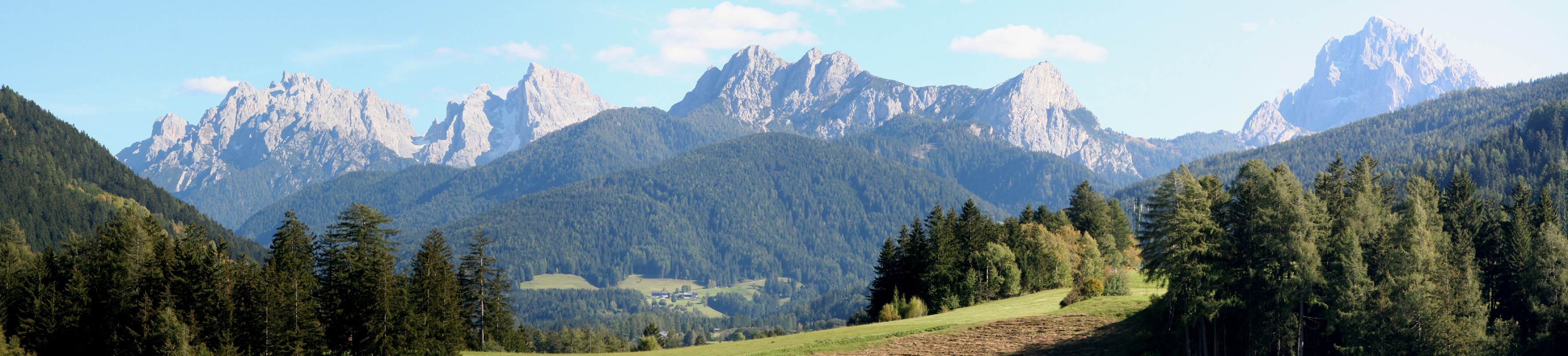
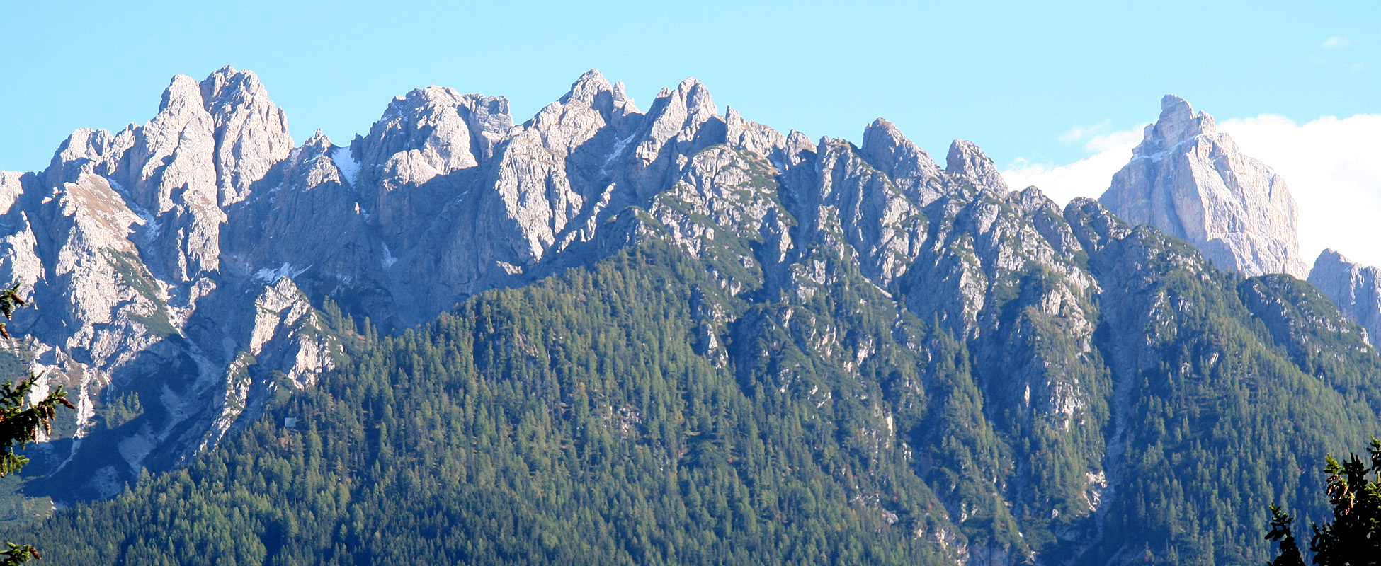
The day before I had climbed Cornetto near Trento, then I drove
to Gailtal, stopping several times near the border crossing in order
to enjoy the famous Sexten's Dolomites. The views of
these mountains came
as an extra bonus after a very nice morning hike.
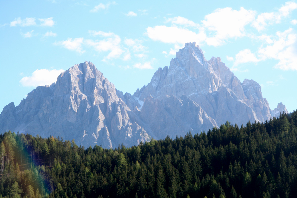
As I continued driving east in Gailtal along a very winding road,
a very shapely peak caught
my attention. I knew immediately that this would be my goal for Sunday morning.
I had a very nice dinner the night before and took an easy morning. Started breakfast
around 0815. The drive was short and uneventful and by 0900, I had arrived at the trailhead in
brilliant sunshine. I started out at 0910 and quickly found myself "puffing" on the rather
steep trail among the big trees. I met a few hikers that were already descending, truly impressive
how early some people start.
After about 30 minutes, I started to emerge from the forest and could see the mountain more clearly.
I knew that the route should traverse right, however, it was not easy to see a connecting route to
the saddle next to Kleine Reisskofel. The route turned out to be quite impressive, by climbing
quite high, one finds essentially the only easy path traversing right. I caught up with a couple
of hikers and decided to rest when reaching the main ridge. I was there around 1030, having gained
about 600 vertical meter from the trailhead. Yet another very nice day, I could now see the next section
of the route and a surprisingly large number of climbers. I left this col around 1045 and quickly gained
the next (much smaller) col higher up on the main ridge.
The next traverse had a
slight trace
of ice and snow, most likely since the shaddow keeps the sun away most of the day. Within a few more
minutes, I reached the main ridge again, not a col, but the main ridge stretching its way towards the
summit that now came into view for the first time. A very nice walk with some easy scrambling, but with
quite some exposure. The north side dropped away
more or less next to your boots, while the south side
was steep, but still seemed a bit more friendly. I could see more people on the summit and about
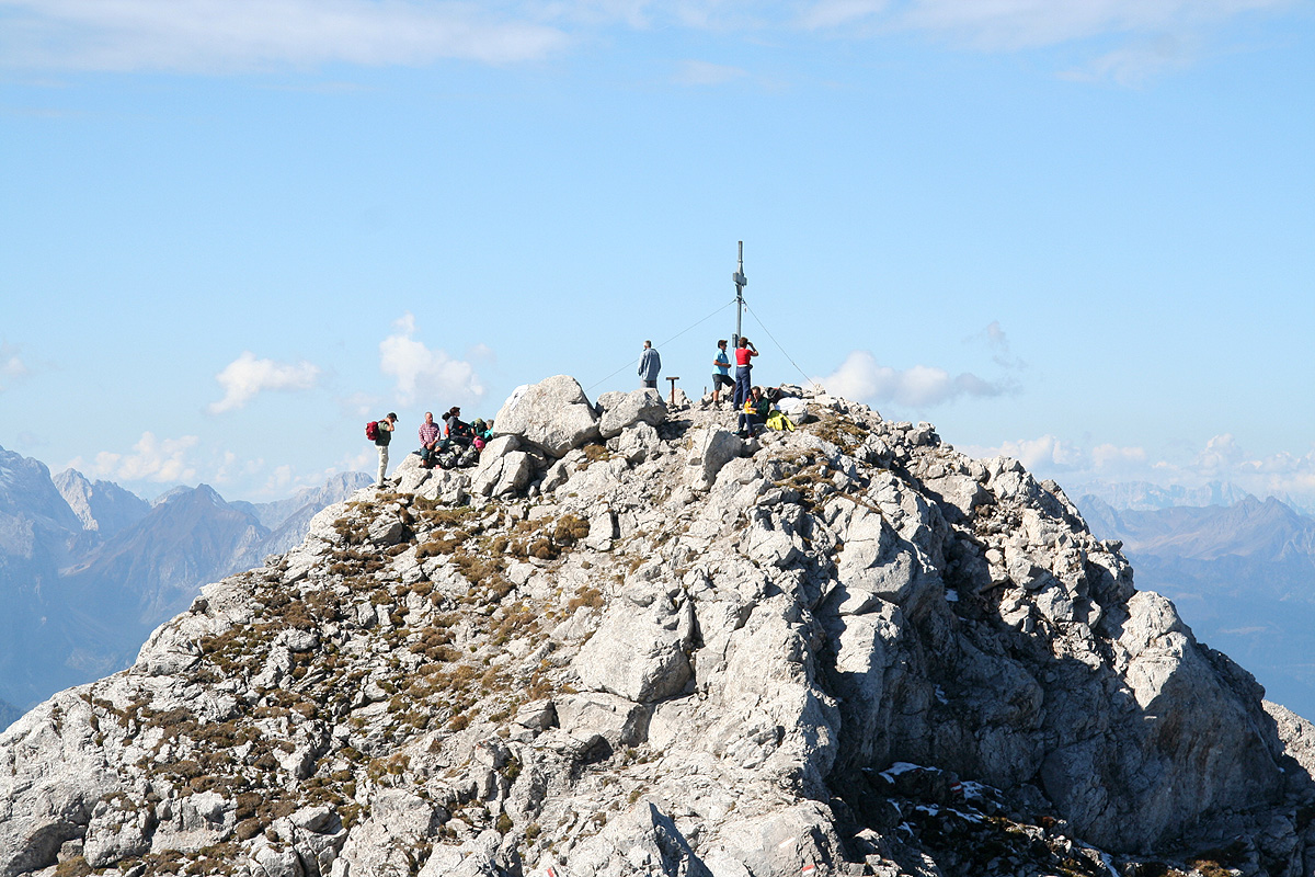
45 minutes after leaving the col below Kleine Reisskofel, I arrived at the summit. I talked briefly to
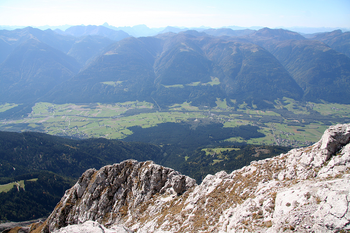
some of the other climbers, signed the summit register and took photos. Very impressive views, the two
valleys
on the south, Gailtal, and
on the north, Drautal, side are
about 600 meter,
so the vertical drop (left and right!) of the summit ridge is close to 2000 meter.
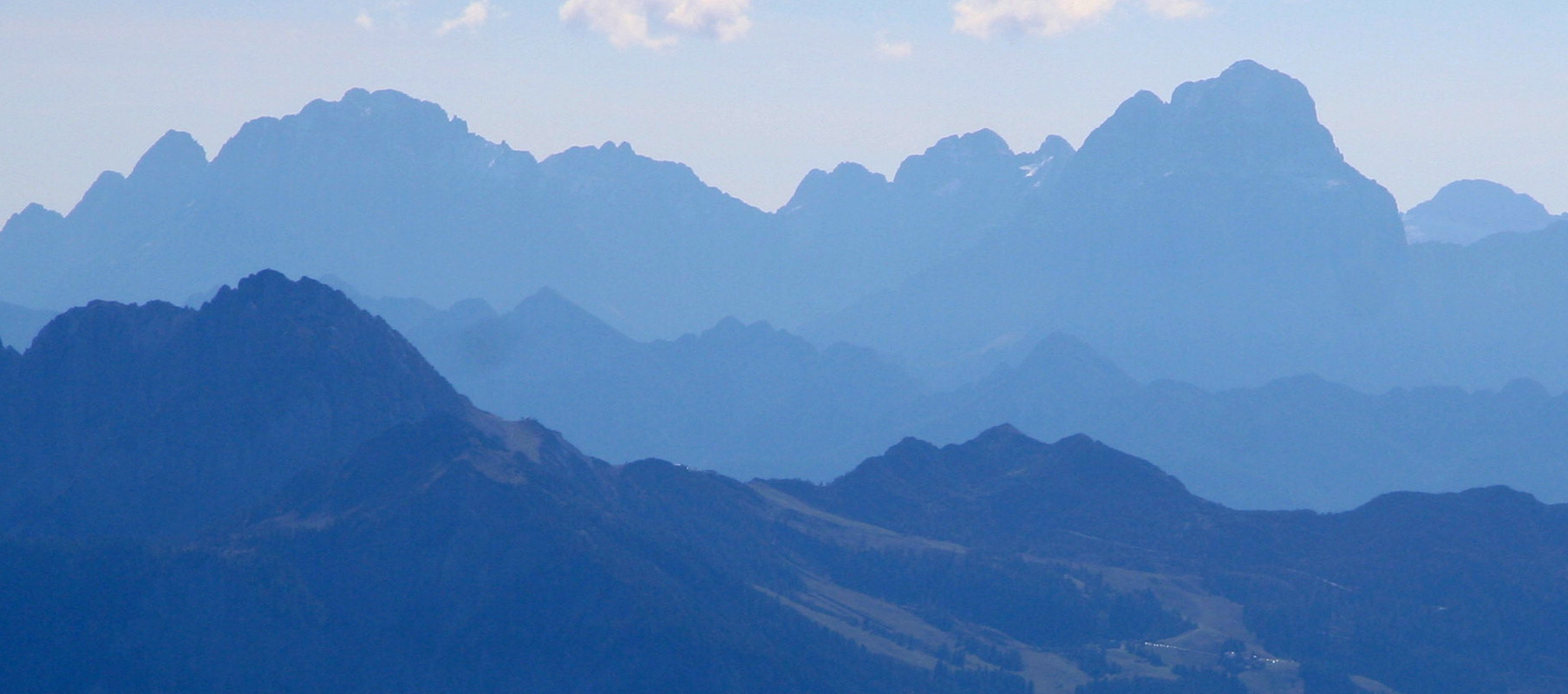
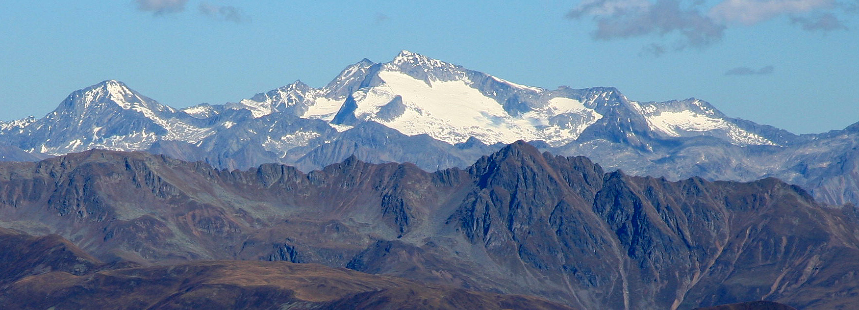
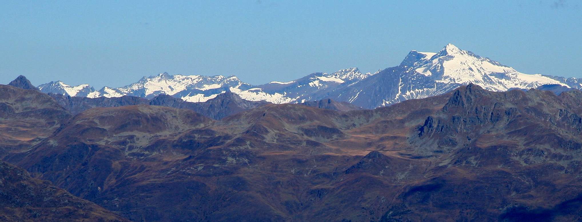
Looking more across, one can see several nice mountains, the Dolomites
a bit in the haze further
south, while peaks with glaciers
are visible to the north.
I started the descent at 1200 and arrived back at my car at 1345, very happy about my descision to
climb Reisskofel.
Resources:
Images
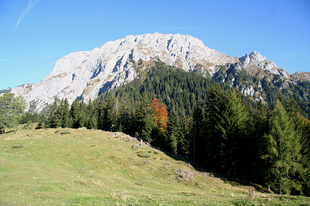
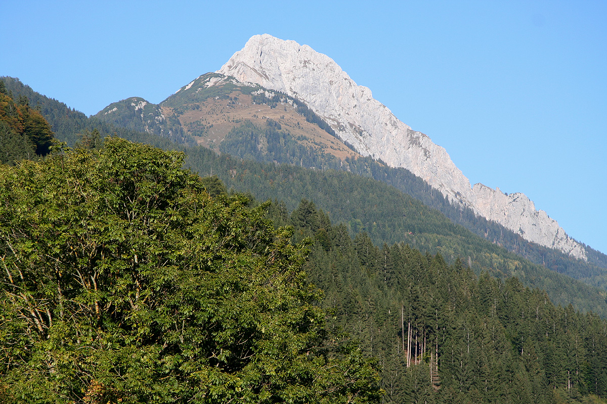
Reisskofel, as seen from Gundersheim, the vertical rise is 1900 meter.
Reisskofel, as seen from Drautal, the vertical rise is 1900 meter.
